

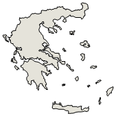
Administrative Region : North Aegean
Regional unit : Mykonos
Ktapodia (Κταπόδια) Mykonos
Ktapodia or Stapodia is a cluster of three islets southeast of Mykonos. They are 5 nautical miles from Mykonos and 20 from Ikaria and administratively belong to the Municipal Unit of Ano Mera, which is part of the Municipality of Mykonos.
The islets are rocky and uninhabited. The largest of them is called Stapodi or Kalamapodi.[1] The area is protected and included in the Natura 2000 network[2], as the Mediterranean monk seal nests there.
The islets are identified with the Melantio reefs of the ancient Greeks[3]. In the past, the nearby Tragonisi was used as pasture by the monks of the Tourliani monastery of Mykonos, who did not prefer Ktapodia as they had no drinking water.[4]
References
Toponymy of Mykonos (1930), S. Menardos, p. 243
Islands of Mykonos: Rhineia, Octopus, Tragonisi and the sea area at votaniki.gr
| Municipal Community Ano Mera |
|---|
| Ano Mera (Άνω Μερά Μυκόνου, η) |
| Kalafati (Καλαφάτη Μυκόνου, η) |
| Ktapodia (Κταπόδια Μυκόνου, τα (νησίδα)) |
| Tragonisi (Τραγονήσιο Μυκόνου, το (νησίδα)) |
See also: Mykonos (island)
Greece :
A - B - C - D - E - F - G - H - I - J - K - L - M -
N - O - P - Q - R - S - T - U - V - W - X - Y - Z
Retrieved from "http://en.wikipedia.org/"
All text is available under the terms of the GNU Free Documentation License
| Ancient Greece
Science, Technology , Medicine , Warfare, , Biographies , Life , Cities/Places/Maps , Arts , Literature , Philosophy ,Olympics, Mythology , History , Images Medieval Greece / Byzantine Empire Science, Technology, Arts, , Warfare , Literature, Biographies, Icons, History Modern Greece Cities, Islands, Regions, Fauna/Flora ,Biographies , History , Warfare, Science/Technology, Literature, Music , Arts , Film/Actors , Sport , Fashion --- |

