

.
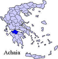
Periphery:West Greece
Prefecture : Achaea
|
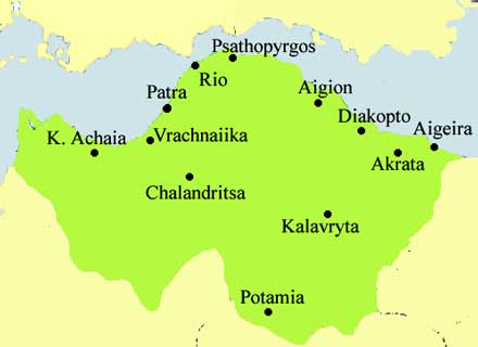 |
Kastritsi (Greek, Modern: Καστρίτσι, Ancient/Katharevousa: -on) older forms: Kastritsio and Kastritsion are two communities that are divided into Ano Kastritsi and Kato Kastritsi that is located 4 km from downtown Rio and is part of this municipality in the prefecture of Achaia. The distance between the two communities are approximately 4 to 5 km apart. Ano Kastritsi is connected 3 km SE ofGR-8 linking Patras and Corinth. The nearest interchange for the GR-8A superhighway is nearly 3 km W. It is located about 10 km NE of Patras, 6 and 7 km SE of the Rio-Antirio Bridge, 107 km NE of Pyrgos and 212 km W of Athens via two interchanges. Distance from these places to Kato Kastritsi are approximately 4 to 5 km further.
Nearest places
- Rodini, N
- Panachaiko, east
- Patras, SW and south (and the neighborhood of Sychaina)
- Rio, W
- Platania, NW
Geography
Location:
Ano Kastritsi:
- Longitude: 21.829 (21°49'48') E
- Latitude: 38.268 (38°16'15) N
Kato Kastritsi:
- Longitude: 21.785 (21°47'12') E
- Latitude: 38.285 (38°17'6') N
Postal code: 265 00
Elevation:
- lowest: about 50 m
- Ano Kastritsi: 460 m
- Kato Kastritsi: 96 m
- highest: about 1,185 m
Dialing code: +11+30-2610 (030-2610)-99x xxx
Historical population
| Year | Ano Kastritsi population | Kato Kastritsi population |
|---|---|---|
| 1981 | 691 | 518 |
| 1991 | 764 | 380 |
| 2001 | 931 | 514 |
Kastritsi has two school, two churches, a lyceum, a secondary school a small port and two squares (plateies). The two communities also has a Roma population.
Ano Kastritsi lies on a slope of a mountain which elevates up to about 200 m and lies next to the creek on a local road. The University of Patras lies to the northwest.
The area aroung Kastritsi are mountainous are part of the Panachaiko mountain ranges. The mountaintops lie to the north and another to the south. The river lies to the south which is also the municipal boundary. Pine forests are situated to the east, grasslands to the west in areas lower than about 300 to 400 m. Barren lands are in higher elevations in the east with a mountaintop of about 1,100 m.
The Panachaiko can partially seen, the mountains of southeastern part of Acarnania including Nafpaktia with Nafpaktos and the southern part of Phokida is to the west and the Rio-Antirio bridge can be seen in higher elevations but not in the valleys.
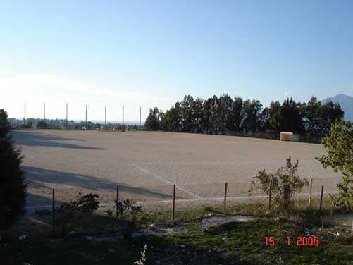
Ano Kastritsi Stadium
Persons
Charikleia Kastritsi, a Greek weightlifter
| Ancient Greece
Science, Technology , Medicine , Warfare, , Biographies , Life , Cities/Places/Maps , Arts , Literature , Philosophy ,Olympics, Mythology , History , Images Medieval Greece / Byzantine Empire Science, Technology, Arts, , Warfare , Literature, Biographies, Icons, History Modern Greece Cities, Islands, Regions, Fauna/Flora ,Biographies , History , Warfare, Science/Technology, Literature, Music , Arts , Film/Actors , Sport , Fashion --- |
Retrieved from "http://en.wikipedia.org/"
All text is available under the terms of the GNU Free Documentation License
