
.
FINDEN'S VIEWS
OF THE
PORTS, HARBOURS & WATERING PLACES
OF
GREAT BRITAIN,
Continued by
W. H. BARTLETT.
THE
PORTS, HARBOURS, WATERING-PLACES,
And Picturesque Scenery
OF
GREAT BRITAIN.
ILLUSTRATED BY VIEWS TAKEN ON THE SPOT,
BY
W. H. BARTLETT, J. D. HARDING, T. CRESWICK,
AND OTHERS.
WITH DESCRIPTIONS, HISTORICAL AND TOPOGRAPHICAL.
VOL. I.
VIRTUE AND CO., LIMITED, CITY ROAD AND IVY LANE, LONDON.
LIST OF PLATES.
☞The arrangement adopted in this List is that of starting from the metropolis, and following the line of the Eastern coast of Great Britain as far northward as Banff, and then returning westward to the River Thames. But as the description of each plate is complete in a single leaf, and there is not any series of folios, the order can be varied at the taste of the purchaser, if directions to that effect be given to the binder.
VOLUME I.
Frontispiece—London, Southwark, and Blackfriars Bridges.
Vignette—Tynemouth Priory and Lighthouse, with Life-boat.
———— with the Quay and Shipping.
Flamborough-Head, with the Lighthouse.
Scarborough, with the Harbour, Castle, &c.
Sunderland, with the Lighthouse, South Pier.
————— the Bridge from the West.
Shields, Entrance to the Harbour.
Newcastle-upon-Tyne, Town and Harbour.
Tynemouth Castle, with Vessel on the Rocks.
Dunstanborough Castle, from the East.
Bamborough Castle, from the South-East.
————————— from the North-West.
Castle of Holy Island and Abbey of Lindisfarn.
Leith, with the Docks, and Edinburgh in the Distance.
Newhaven, with the Piers, Edinburgh.
——— from the Fife Side of the Tay.
Montrose, with the Harbour and Chain-Bridge.
Dunnottar Castle, near Stonehaven.
Stonehaven, with the Town and Harbour.
Aberdeen, Entrance to the Harbour.
———— from above the Chain-Bridge.
Slaines Castle, Seat of the Earl of Erroll.
Peterhead, Town, Harbour, and Lighthouse.
Port-Glasgow, with the Pier and Docks.
Greenock, with the Custom-house.
Broomielaw, with the New Bridge, Glasgow.
The Solway, View across the Frith.
Allonby, Watering-Place, with Fishing-Boats.
Maryport, Town and Harbour, English Coast.
St. Bees' College, with the Village.
THE
PORTS AND HARBOURS
OF
GREAT BRITAIN.
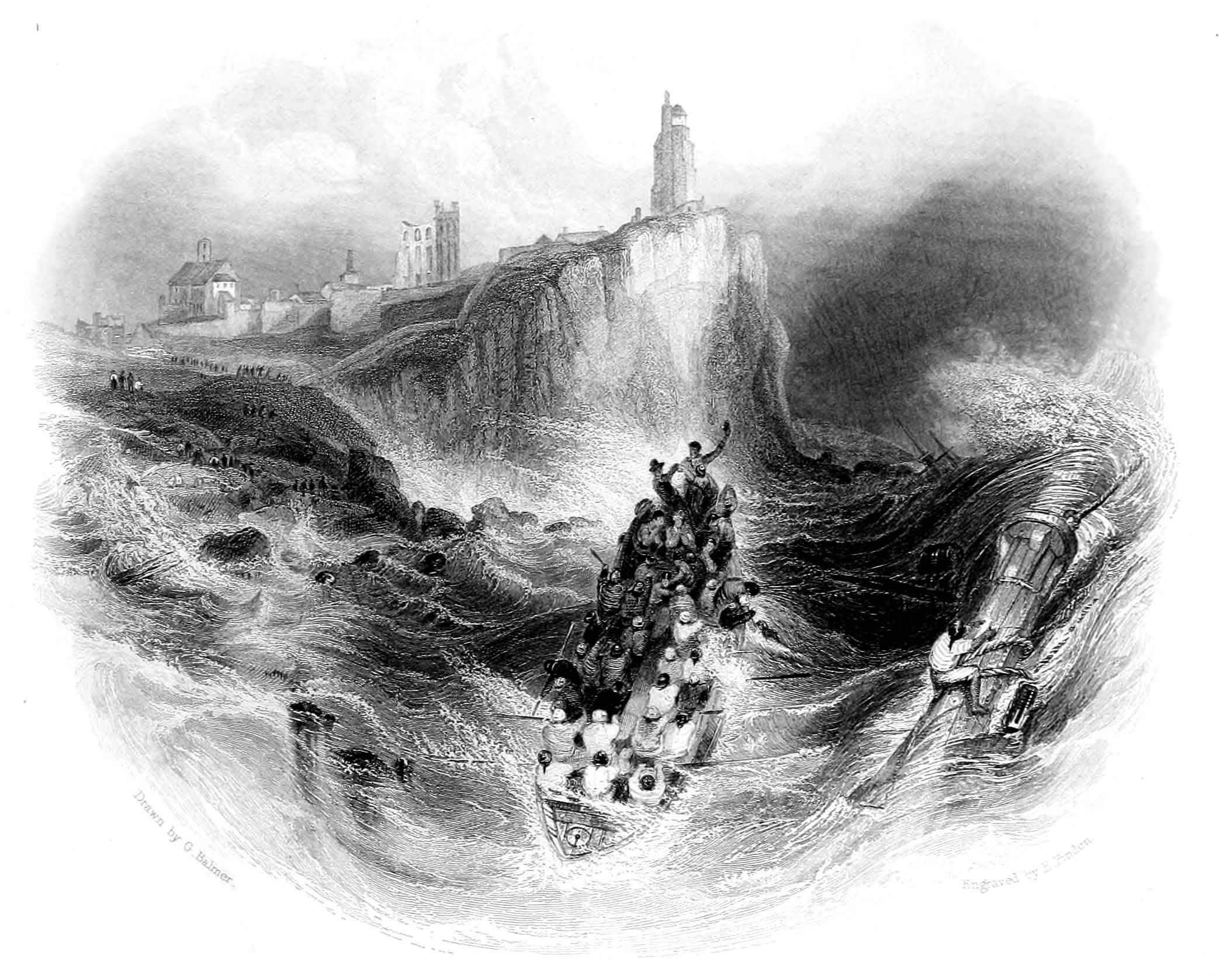
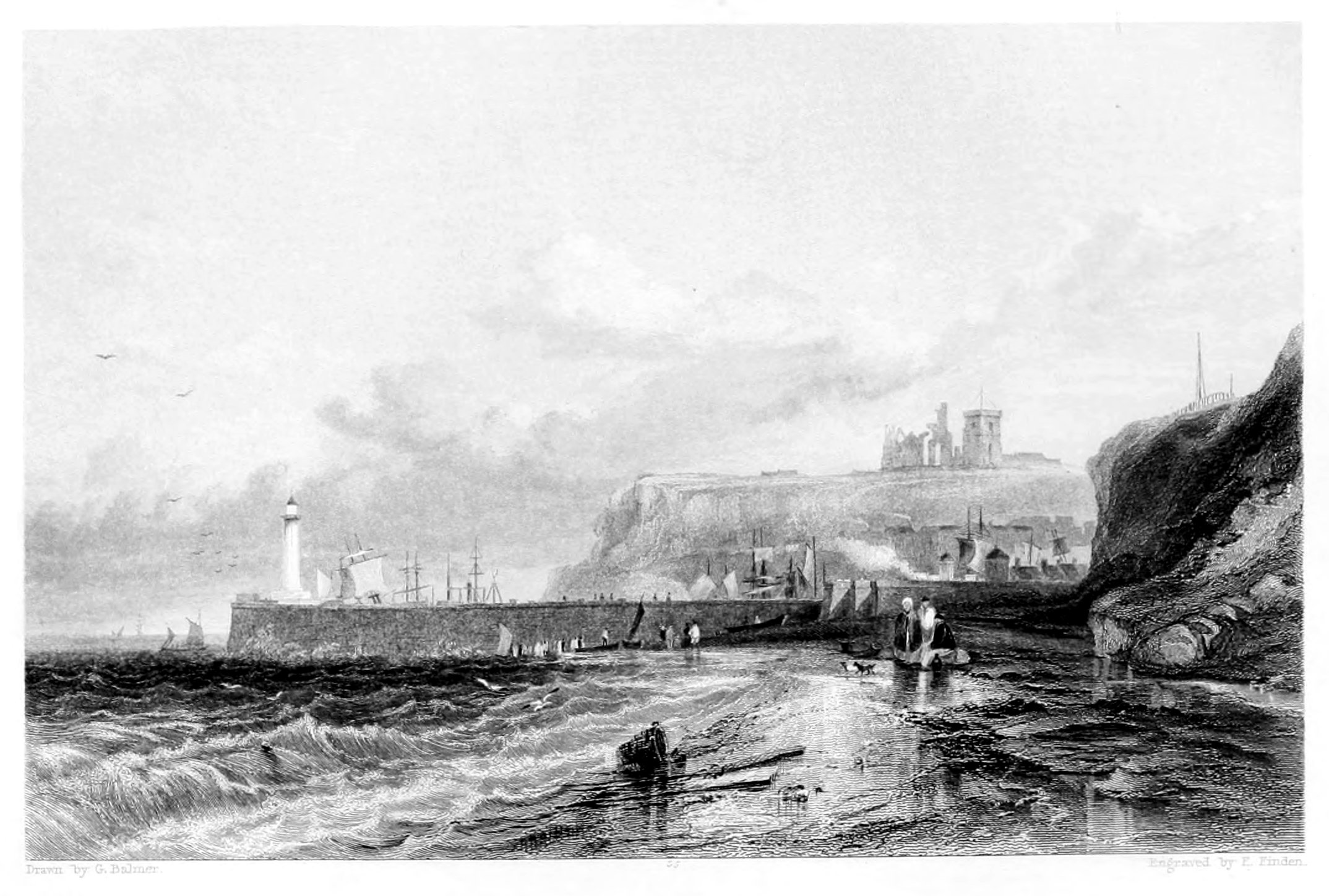
TYNEMOUTH LIGHTHOUSE AND PRIORY.
Our present engraving is a view of Tynemouth Lighthouse and Priory, with the life-boat in the act of saving the crew of a vessel, which has struck upon the rocks at the foot of the cliff on which the lighthouse is built. This incident, so effectively and appropriately introduced by the artist, Balmer, who has frequently witnessed the scene which he has depicted, is peculiarly characteristic of the neighbourhood of Tynemouth; for, in consequence of the danger of the entrance to Shields Harbour in stormy weather, with the wind from the eastward, more vessels are there lost than at the entrance of any other harbour in Great Britain; and in no part of the kingdom has the value of the life-boat been more frequently experienced.
The view is taken from the entrance to Shields Harbour, about half a mile to the south-west of the lighthouse, which is seen rising from behind the extremity of the cliff which overlooks the entrance to Prior's Haven. Towards the centre of the land view are the ruins of Tynemouth Priory; while farther to the left, in the same distance, is seen the castle, now modernised and occupied as a garrison. The fore-ground to the left is the bank which forms the south-western boundary of Prior's Haven; and the rocks which are seen at its foot are a portion of the formidable Black Middens, which lie on the north side of the entrance to the harbour.
The principal feature of the engraving under observation is the view of the life-boat, which is introduced with a thorough knowledge of the subject, and with a feeling and a character of truth which mere imagination can never inspire. The downward plunge of a boat's bows among broken water, while her stern is at the same time elevated by a slanting wave, was never more happily represented. A person who has been at sea, may almost fancy that he hears the resounding dash of the water against the curved bow, and the seething of the angry wave as it rises on each side. The idea of motion is admirably conveyed in the representation of the wave lashing over the floating mast, which is tossed about like a light spar by the violence of the sea; and the continued inward roll of the water, from the side and bow of the boat towards the shore, is no less naturally expressed.
Part of the life-boat's crew, with most of the oars double-manned, are seen "giving way," with strenuous efforts, through the breakers, while others are endeavouring to save the shipwrecked seamen; and one of the men at the steer-oar appears to be encouraging the sailor who clings to the floating mast. The position of the boat, with her stem towards the harbour, and the shipwrecked men seated towards her stern, indicate that she is returning from the vessel, the top of whose masts are seen, and that she is now endeavouring to save such men as were washed overboard when the vessel sunk. The flying of the spray declares the loudness of the wind; and though a cheering glimpse of sunshine appears to illumine the land, yet the dark cloud, which seems to rest upon the waters to the right, sufficiently informs us of the gloominess of the prospect when looking towards the sea.
In consequence of a bar of sand, which stretches across the mouth of the Tyne, where the outward current of the river at ebb tide is met by the inward roll of the sea; and from the Herd Sand on the south, and the Black Middens on the north, the entrance to Shields Harbour is attended with great danger when the wind is blowing hard from the eastward and a heavy sea running. In crossing the bar, at such a time, a loaden ship, with rather a heavy draught of water, will sometimes strike, and unship her rudder; and a light one, in consequence of being struck by a heavy sea will sometimes broach to. A vessel thus rendered unmanageable, is almost certain, with the wind from the north-east and a flood tide, to be driven on the Herd Sand; and, should the wind be blowing strong from the south-east, she is extremely liable to be thrown either on the Black Middens or on the rocks at the foot of Tynemouth Castle; more especially in attempting to gain the harbour after the tide has begun to ebb. In the latter case, when vessels have been too late to save tide and are land-locked, and when it may seem less hazardous to attempt to pass the bar than to bring up, with evening approaching, on a lee shore, the danger of being wrecked on the rocks to the northward is more especially imminent.
LONDON:
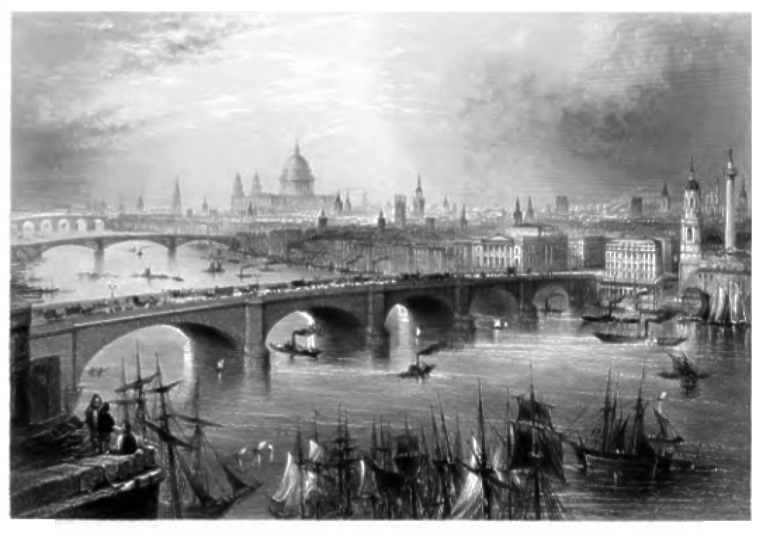
THE BRIDGES OF LONDON, SOUTHWARK, AND BLACKFRIARS, FROM THE SURREY SIDE.
Denham.
The New London Bridge, which forms so striking a feature in this View, is justly considered the finest specimen of bridge-building in Europe. It is alike the admiration of strangers and natives, and unites in the highest degree the useful and ornamental—elegance of design with solidity of structure. The first pile of this superb structure was driven on the 15th of March, 1824; and on the 27th of April, the following year, the first stone was laid by his Royal Highness the Duke of York, attended by the Lord Mayor, a distinguished party of noblemen, gentlemen, and citizens, and a great concourse of strangers, who had assembled to witness the imposing ceremony. The contracts amounted to five hundred and six thousand pounds, but the total expenditure more than trebled that sum. The clear water-way is six hundred and ninety feet out of seven hundred and eighty-two—the actual width. The carriage-way is thirty-five feet wide, and the foot-paths nine feet each. The central arch, of the five of which it consists, is one hundred and fifty-two feet in span—one of the largest ever known—it is twenty-nine feet and a half in height; and there is no weir, or fall, as in the Old London Bridge. We are thus particular in the measurements that the reader may more readily comprehend the magnificent scale upon which this great national structure has been finished; and it may be an additional facility to this purpose to state, that of granite alone one hundred and twenty thousand tons were consumed in the building.
After six years of incessant labour, it was happily brought to a successful termination under the direction of the late John Rennie, Esq., of whose genius as an architect it is a splendid monument. The opening of the bridge took place on the 1st of August, 1831, and gave occasion to a magnificent festival, which was honoured with the presence of his late Majesty William the Fourth and Queen Adelaide, the Lord Mayor, and all most remarkable for rank and station who were at that time in London. The ceremony was of the most gorgeous and gratifying description; and the water-pageant which accompanied it was the finest ever remembered on the Thames. The bridge was lined with tents and marquees, from which proudly floated the national standard, with numerous flags of societies and corporations, which gave the whole a strikingly gala-like effect. Under these a superb déjeûner, consisting of all the luxuries of the season, was served to the numerous assembly; and, to give additional novelty to the scene, Mr. C. Green, the celebrated aëronaut, ascended from the bridge in his balloon, much to the gratification of the spectators.
Immediately adjoining the Bridge, on the right, is the Steam-packet Wharf, which, from the constant landing and embarkation of passengers to and from all parts of the river, is a scene of uninterrupted stir and animation. On the left are the Bridges of Southwark and Blackfriars, with the magnificent Cathedral of St. Paul's in the centre of the picture.
The Monument (a conspicuous object on the right hand of the engraving) is a magnificent pillar, erected to commemorate the great fire of the city of London, in 1666, on the spot where it first began. It is of the fluted Doric order, and the material employed in its erection is Portland-stone of the best quality. It is one of the boldest specimens of the kind ever attempted, being two hundred and two feet in height, and fifteen in diameter, and stands on a pedestal forty feet high and twenty-one feet square; and within the shaft is a spiral staircase, consisting of three hundred and forty-five steps, formed of black marble. It was begun in 1671, but not completed till seven years after, as the great demand for stone in the restoration of London and the Cathedral of St. Paul's absorbed nearly all that the Portland quarries could furnish. Mr. Elmes, in his Life of Sir Christopher Wren, informs us that the Monument was at first used by the members of the Royal Society for astronomical experiments; but was abandoned on account of its vibrations being too great for the nicety required in their observations. This occasioned a report—extensively circulated at one time—that it was unsafe; but its sound foundation and scientific construction may bid defiance to all attacks, but those of earthquakes, for centuries to come.
This View of the Metropolis, from Southwark, is exceedingly grand and impressive, and presents a faithful picture of the every-day scenes which are here passing before the eyes of the spectator—dazzling his eye, and filling his mind with those images of unbounded wealth, power, and magnificence, of which there is no precedent in ancient or modern history.
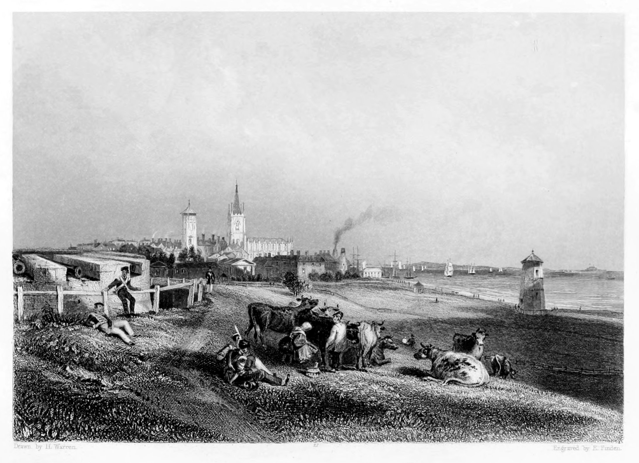
HARWICH.
Harwich is in the county of Essex, and lies on the south side of the estuary formed by the confluence of the Stour and the Orwell, about sixty-two miles to the north-eastward of London. The view in the engraving is taken from the southward, and comprises three of the most conspicuous objects in the town—the church, which is of modern erection, and the upper and the lower light-houses. In the distance, to the right, is perceived Landguard Fort, which lies on the Suffolk shore, on the opposite side of the channel.
In 1318, Harwich was incorporated by Edward II., at the request of his brother, Thomas de Brotherton, Earl of Norfolk. In 1347, the town supplied 14 ships and 183 mariners to the grand fleet of Edward III.; and in the 17th and 18th years of that king's reign, Harwich returned two members to Parliament; but the exercise of this privilege was discontinued till 1616, when it was restored by James I.
The trade of Harwich never appears to have been extensive; and its prosperity seems to have greatly depended on the Post-office packets, which formerly used to sail from the place with passengers and letters for the northern parts of Europe. The introduction of steam-packets has, however, rendered Harwich a place of no further importance as a packet-station, and for several years past the town has been in a declining state. The fishery, which formerly contributed to the prosperity of the place, has greatly diminished since the commencement of the present century. Harwich is the only harbour between Yarmouth Roads and the mouth of the Thames that is capable of affording refuge, in gales of wind from the eastward, to vessels navigating the eastern coast. During the prevalence of strong north-east winds, sometimes from 200 to 300 light colliers, and other vessels proceeding northward, are to be seen anchored in the harbour.
On the south of the town a cliff divides Orwell Haven from the bay, that extends to Walton-on-Naze. This cliff is observed to be constantly giving way to the action of the sea, which, it is expected, will at some future period force a passage to the opposite shore, and insulate Harwich and its vicinity. The cliff contains many acres of land, and its greatest height is about fifty feet. At the bottom, a bed of clay, of a bluish colour, about one foot thick, is succeeded by a bed of stone of nearly the same colour and thickness. Within the latter, shells and petrifactions, of various descriptions, have been found embedded. Above the stone are several beds of clay similar to that under the stone, rising to more than twenty feet. This clay, on exposure to the air, hardens into stone, and the streets of Harwich are paved with it. The town walls were formed of this material, as were also the castles of Orford and Framlingham.
During the fashionable season the town is visited for sea-bathing, and excellent accommodations are now provided, bathing-machines having been introduced, and the private baths rendered most convenient. They stand in a large reservoir of sea water, which is changed at every tide, and supplied with fresh water every hour, by a contrivance on the principle of a natural syphon. In some of these baths, the water is made hot for invalids, who, if they have neither strength nor courage to plunge themselves into the water, are assisted with a chair. There are also vapour baths, and machinery to throw the sea water, either hot or cold, on any part of the body.
There is a delightful walk, called "the Lawn," much frequented in fine weather as a promenade; and not far distant from it is the Beacon Cliff, on which were formerly the signal-house and telegraph, which were, some time ago, destroyed by the encroachments of the sea. This eminence commands a grand, interesting, and extensive prospect. Parties are also frequently made by the visitors for sailing or steaming up the Orwell and Stour, and making excursions on the bosom of the ocean. The scenery of the Orwell possesses peculiar interest, the banks being studded with elegant villas and pleasure grounds.
YARMOUTH.
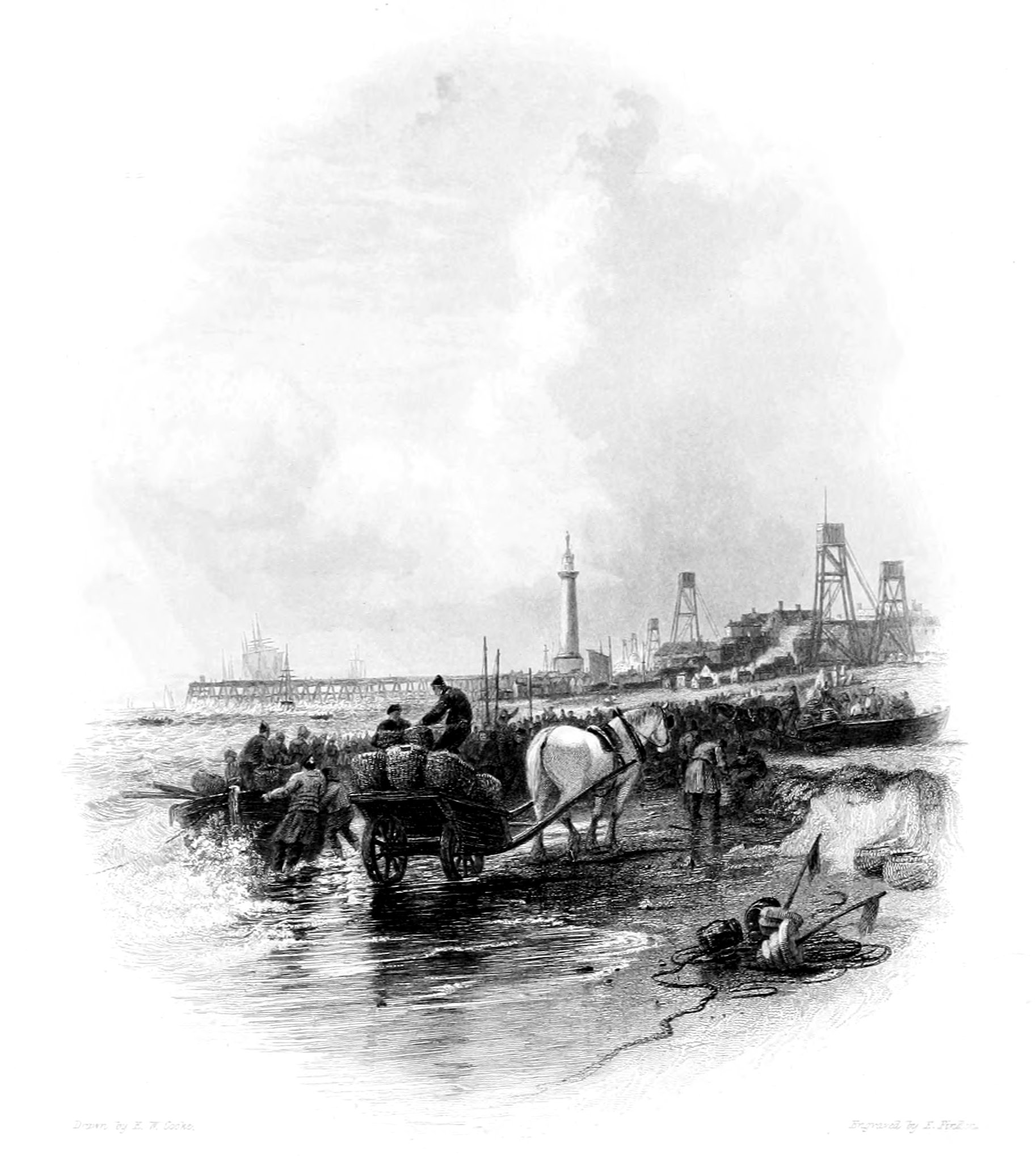
Yarmouth, in the county of Norfolk, sometimes called Great Yarmouth, to distinguish it from Yarmouth in the Isle of Wight, lies about 123 miles north-east of London, and about twenty-four to the eastward of Norwich. In the Vignette Engraving, from a beautiful painting by E. W. Cooke, the view is taken from the shore a little to the northward of the Jetty, which is seen extending into the sea. Nearly in the centre of the engraving is seen the column erected by the county of Norfolk to the memory of Nelson; and to the right are perceived several look-outs, like so many elevated scaffolds, from which, as the shore is very low, the pilots are enabled to take a wider survey when looking out for ships which may require their assistance.
The name of Yarmouth obviously alludes to the situation of the town near the mouth of the river Yare; the word Yare, according to Druery, in his Historical Notices of Great Yarmouth, is derived from the Celtic Iar, dark, supposed to have been given to this river from the dark colour of its waters. According to Sir Henry Spelman, the ground on which Yarmouth stands became firm and habitable in the year 1008, from the recession of the sea, and the accumulation of the sands. If this account be correct, it would appear that the town began to be built almost immediately afterwards; for in the Domesday-book, which was compiled between 1080 and 1086, the place is mentioned, with the usual carelessness of the Norman scribes, by the name of Cernemude; and the entry further records that the place had been held by King Edward [the Confessor], and that it "always had seventy burgesses."
In 1208, Yarmouth received a charter of incorporation from King John; and the privileges of the town were confirmed and enlarged by several succeeding kings. In 1228, in the reign of Henry III., Yarmouth had become a considerable port, both for the importation and exportation of merchandize; and in a charter of Edward I., granted in 1306, it is especially mentioned as a place where fishing-vessels, from an early period, had been accustomed to land the herrings which they caught during the season of the fishery. In 1347, Yarmouth supplied 43 ships and 1,095 mariners to the grand fleet of Edward III. and in 1349, the town was visited by a dreadful plague, which carried off seven thousand of the inhabitants. In the 31st of Edward III., an act was passed regulating the annual herring fair at Yarmouth, and appointing it to be governed by the barons of the Cinque Ports, according to the composition made between them and the inhabitants of the town in the reign of Edward I., the king's grandfather. One William Beukelem, of Biervliet, in Flanders, who died in 1397, according to Anderson, in his History of Commerce, is said to have been the inventor of the method of pickling herrings: but this cannot be correct; for though he may have introduced some improvements in the mode of cleaning and barrelling the fish, the inhabitants of Yarmouth and other places on the eastern coast were accustomed both to pickle and smoke herrings long previous to the time when the practice is said to have been introduced by Beukelem. Yarmouth is still the principal place of resort on the eastern coast of England for vessels engaged in the herring fishery, which there commences about the 21st September, and concludes about the 14th December. Most of the Yorkshire five-man boats come to Yarmouth in the herring season, and make their fishery from that place, disposing of all the herrings which they catch to curers who live in the town.
The quay at Yarmouth is one of the longest and most spacious of any in the kingdom; but from the shallowness of the entrance of the harbour, there being only fourteen feet of water on the bar at spring tides, the trade of the place is chiefly carried on in small vessels. It is high water in Yarmouth Roads at forty minutes past eight, and at Yarmouth Sands at thirty minutes past ten, on the full and change of the moon.
The column erected to the memory of Nelson stands on the low sandy flat, called the Denes, to the south of the town. Its total height, including the basement and the figure of Britannia at the top, is 144 feet, and it is ascended by a staircase consisting of 217 steps. It forms a conspicuous object when seen from the sea; and to the crews of vessels passing through Yarmouth Roads it is a proud memento of Nelson's fame and the naval glory of their country.
YARMOUTH QUAY.
The subject of the annexed View, representing the Quay at Yarmouth, conveys a faithful idea of that interesting and important locality. It is considered by competent judges as the finest quay in England, and in point of length exceeds every other in the United Kingdom. It is one hundred and fifty yards in breadth, contains in its centre a delightful promenade—planted on each side with trees, protected from the east wind by a row of handsome and well-built houses—and presents in all its aspects a striking combination of commercial activity and ornamental beauty. To the elegant Town Hall, which occupies the centre of this space, and to other public buildings, we have briefly alluded elsewhere. As a grand panorama of commercial life, it would be difficult to point out a finer scene than what is every day presented on the Quay at Yarmouth. Its principal foreign connexion is with the Baltic; and its trade in coal, corn, and other merchandise, coastwise, is very extensive. By means of the navigable rivers Yare, Waveny, and Bure, it possesses great facilities of intercourse with the interior of the county.
In Yarmouth Roads—so renowned for the safe riding they afford to shipping—the anchorage is extensive, and there is room for any number of ships. The Roadstead, however, is better calculated for summer than winter, for to large vessels it is only accessible in the daytime with safety.
The trade for which Yarmouth is peculiarly noted is its fisheries, which are an unfailing source of wealth and employment to the inhabitants, and have proved an invaluable nursery for those hardy and gallant seamen who have so often fought and conquered in the battles of their country. The mackarel[1] fishery begins in the end of April, and ends in the beginning of July. The herring[2] fishery commences at Michaelmas, and continues till the end of November; during that interval, it affords constant employment to sixteen hundred fishermen, besides six or seven hundred men and women who are engaged in the curing-houses.[3] In addition to all these, many others are occupied in the various manufactures connected with the fishery—in the preparation of nets, rope, twine, baskets, coopering, &c.
The number of registered vessels belonging to the Port of Yarmouth is about six hundred, exclusive of fishing-smacks and other small craft. Ship-building is carried on to a great extent; and the artificers in the various departments of the building-yards are considered eminently skilful. There are several private bonding-warehouses, besides that on the South Denes belonging to the Custom-house. On the North Denes are the silk-mills of Messrs. Grout and Co.; and on Cobham Island are considerable salt-works for the use of the town and fisheries. At South Town, or Little Yarmouth, the banks of the Yare—besides the handsome houses by which they are lined on the south—are occupied by docks, timber-wharfs, and shipbuilding-yards, in which a large proportion of the vessels belonging to Yarmouth are constructed and fitted out for sea.
YARMOUTH, WITH NELSON'S PILLAR,
(FROM THE LOWESTOFT ROAD).
Yarmouth Pillar.
Yarmouth, as a market-town and sea-port, enjoys many natural advantages; and, aided by the public spirit of its inhabitants and a train of successful enterprise, has long enjoyed a well-merited distinction in the chart of the British Empire. It is a borough, both corporate and parliamentary, situated at the eastern extremity of the county, near the mouth of the river Yare, from which it derives its name, and which is navigable as far as Norwich. Joined by its tributaries, the Waveney and Bure, a short distance to the west of the town, in a fine sheet of water called the Breydon, it proceeds in a copious stream to the sea. The Waveney and the Bure are both navigable rivers—the former as far as Bungay, and the latter to Aylsham.
The town, extending upwards of a mile along the river, from north to south, occupies an area of at least a hundred and thirty acres. On the western side it is bounded by the river, over which there is a handsome drawbridge, communicating with South Town or Little Yarmouth, one of its populous suburbs, where extensive business is carried on. The principal streets, running north and south—Regent-street and South-street excepted—are all indicative of the stir and animation which pervade every place of trade, and evince in their construction both taste and comfort, with an occasional air of the picturesque. The market-place of Yarmouth is extensive, covering an area of nearly three acres, and inclosed on the west side with a range of handsome and well-furnished shops.
Among the public edifices of Yarmouth, which merit especial notice, is the Town Hall, which stands near the centre of the quay. It is an elegant modern structure, with a portico admirably proportioned, and supported by pillars of the Tuscan order. The interior consists of a noble room, finely designed and ornamented, with a richly embossed ceiling in stucco, from which are suspended three massive and superbly cut lustres, containing seventy-six lights, which are used on festive nights, when, with permission from the mayor, public assemblies are held within its walls. Over the chimney-piece is a full-length portrait of George III., in which is preserved a faithful resemblance of that sovereign. The theatre, erected about sixty years ago, and the bathing-establishment, with a spacious public room adjoining, where the company are supplied with refreshments, are among the other places of public resort. A jetty, twenty-four feet wide, secured by a strong railing, and extending four hundred and fifty-six feet into the sea, on piles of wood, forms a delightful promenade, where health of body and exhilaration of mind may be greatly promoted by the salubrious sea breezes by which it is constantly visited. Near this, and commanding a magnificent view over the German Ocean, the stranger is particularly struck with the appearance of a marine villa, which harmonises admirably with the scene.
At a short distance from the pier is a noble pile of buildings, belonging to the barrack department and erected on a portion of the South Denes. In the centre of the latter rises the triumphal Pillar, which forms so striking a feature in the landscape, and awakens so many proud and heroic associations in the heart of the spectator. This monument, raised to commemorate in his native county the services of the immortal Nelson, is worthy of the virtue and valour it was designed to celebrate. It was erected in 1817, by W. Wilkins, Esq. Both in the design and execution great solicitude was evinced by the public that a monument, bearing the name of the greatest of our Naval Heroes, should present everything that classical taste and national gratitude could suggest—and in this respect his countrymen have been fully gratified. It is of the Doric order, fluted and ornamented with appropriate decorations and title-inscriptions—illustrating the Hero's most celebrated battles—and surmounted with a ball and an exquisitely cast figure of Britannia, supporting her trident and laurel wreath. The ascent is by an easy flight of two hundred and seventeen steps, and the whole is built of white Scottish marble. Its height from the ground is one hundred and forty-four feet; the diameter of the column or shaft is twelve feet six inches; and the pedestal is twenty-three feet square by twenty-seven feet in height.
CROMER.
Cromer is a fishing village, situated near the north-eastern extremity of the county of Norfolk. It lies about 129 miles north-north-east of London, and about 22 miles nearly due north of Norwich. The view in the engraving is taken from the sands, looking to the westward. Some years ago, part of the cliff, with two or three houses beyond those which are now seen standing on its extremity, fell down in consequence of the encroachments of the sea. At that time a subscription was entered into by the inhabitants of the place, and by several of the neighbouring gentry, for the purpose of forming a breakwater; for without some such protection it was apprehended that at no very distant period many more houses, with the fine old church, would fall a prey to the violence of the sea.
It is supposed that Cromer was formerly a place of much greater importance than it is at present; and that at the time of the Domesday survey it was included in the town of Shipden, which, with its church, is supposed to have been destroyed by the sea in the reign of Henry IV. At low water many large portions of wall are to be seen, which have evidently formed part of the houses of the old town of Shipden. "The set of the great tidal current of the German Ocean," says Mr. R. C. Taylor, in his Geology of East Norfolk, "is from the north-west, along the eastern shores of this island. In their progress southward, the tides meet with an extensive obstruction in the projecting county of Norfolk. About twenty miles of its coast has been subjected, from time immemorial, to the abrasive action of ocean currents. The ancient villages of Shipden, Wimpwell, and Eccles, have disappeared; several manors, and large portions of neighbouring parishes, have, piece after piece, been swallowed up by the encroaching waves; and their site, some fathoms deep, now forms a part of the bed of the German Ocean."
The sea in this neighbourhood, and on the whole of the Norfolk coast, is particularly dangerous. Between Flamborough and Spurn Heads, and Winterton Ness, the most easterly points of land on this side of the island (excepting the North Foreland), the land retreats inward, forming a large bay. If vessels leaving Flamborough Head proceed southward and meet with a hard gale from any point between north-east and south-east, or of leaving Yarmouth Roads, proceeding northwards, they are retarded by the wind blowing hard from the north-east; so that as they cannot weather Winterton Ness, they become embayed, and the only chance of safety is to run for Lynn Deeps, in attempting which they are in danger of foundering on the rocks near this town or stranding upon the flat shores between Cromer and Wells.
Cromer is much frequented in summer by visitors for the sake of sea-bathing, for which the fine sandy beach to the eastward affords great convenience. It is a place of very little trade, and is chiefly dependent on the fishery. Cromer light-house stands on an eminence, about three-quarters of a mile to the eastward of the village. It is a revolving light, and is visible, in clear weather, at a distance of five or six leagues. It appears in its brightest state once in every minute, and then gradually becomes eclipsed.
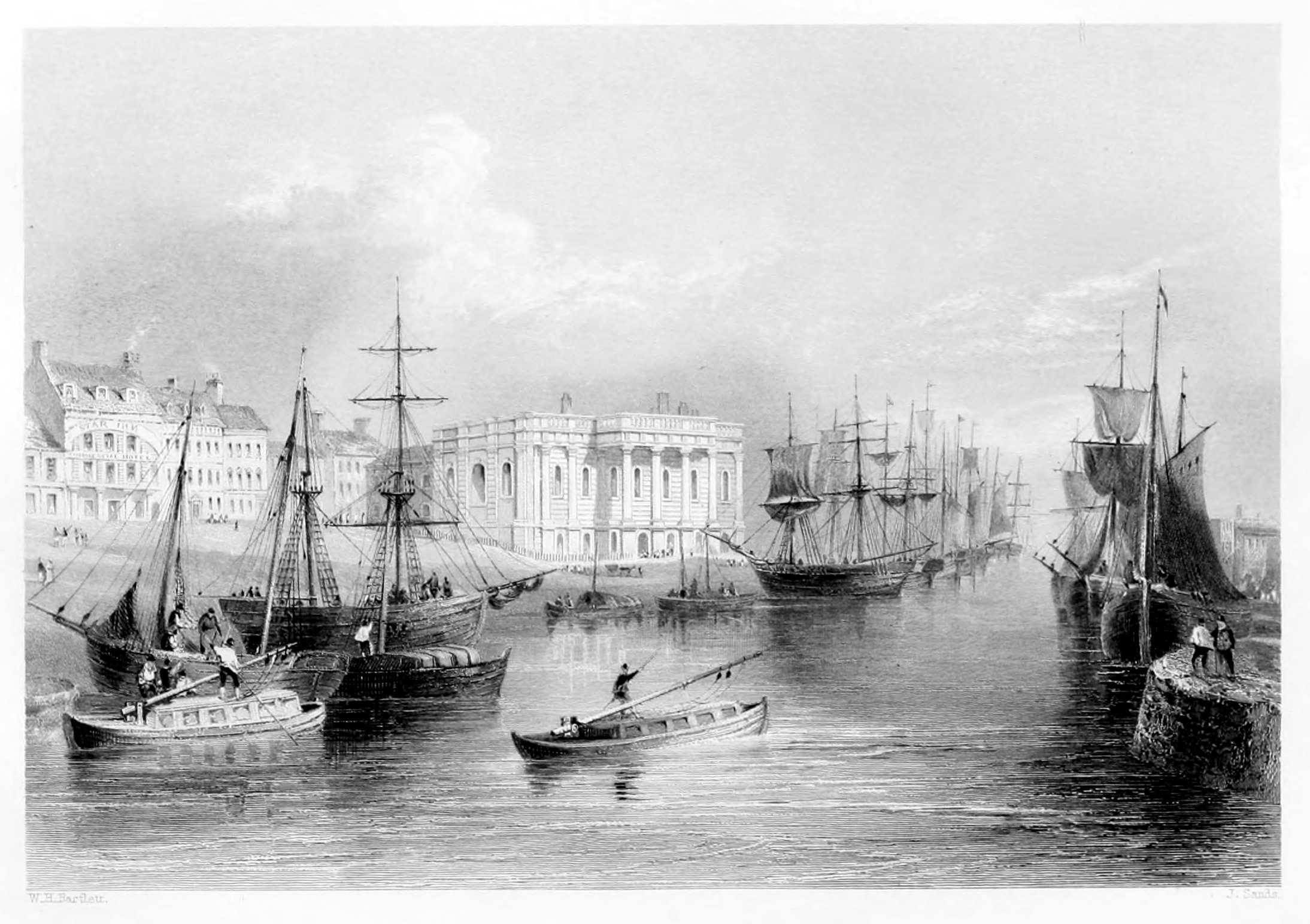
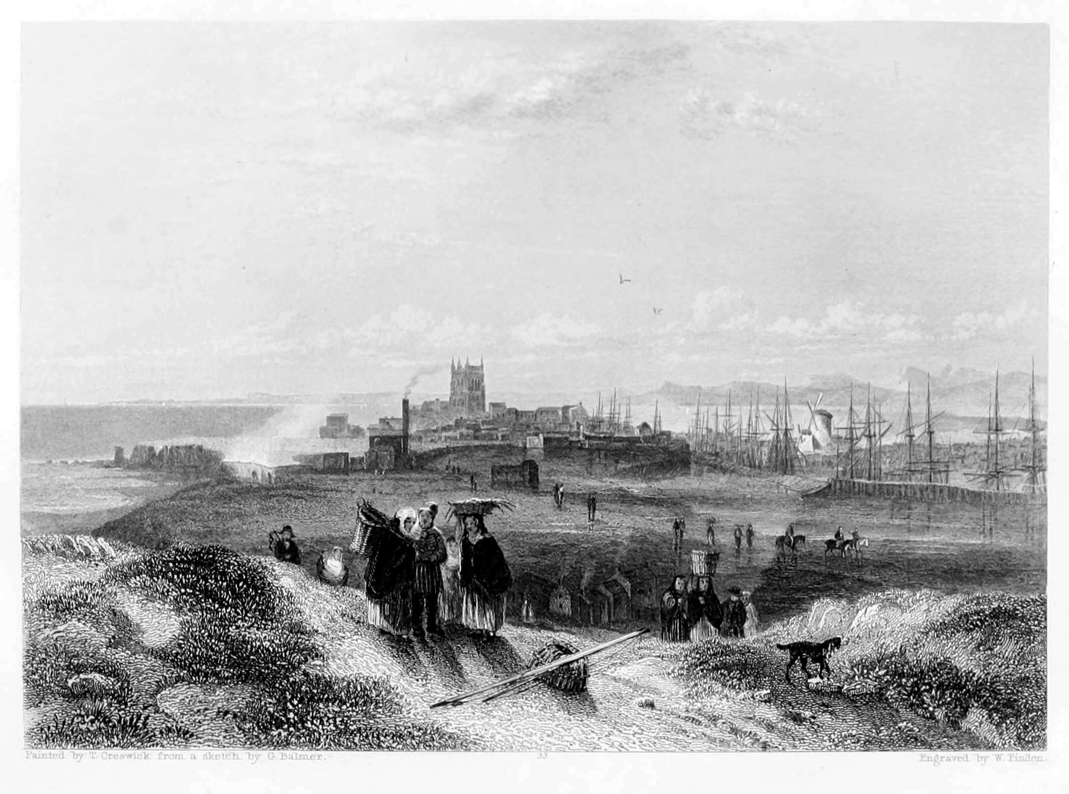
KINGSTON-ON-HULL.
Hull, though one of the most considerable ports of the kingdom, is also one of the least picturesque. From its low situation, little more of the town can be seen than the modern houses near the banks of the Humber; and though jetties, dock-gates, and pier-heads, are sometimes useful as accessories in a picture, yet where such occupy almost the entire line of the foreground, with a row of brick buildings behind them, the painter must manage his subject as he best can, and be content with giving correctly that which his art cannot improve:—"Res ipsa negat ornari." The view of Hull, from a painting by Balmer, is taken from the Humber, looking towards the north. Beyond the river-craft, which are seen in front, is the entrance to the Humber dock; and the jetty to the right, which appears crowded with people, is a favourite promenade with the inhabitants of Hull, who sometimes assemble there in crowds to watch the sailing and arrival of the steam-packets. The most distant building to the right is the citadel, at the entrance of the river Hull, which then discharges itself into the Humber. Towards the middle of the engraving is seen the tower of Trinity Church, the only object which, at the distance of a mile, commands the attention of the stranger, and gives an individual character to the river.
The town of Hull, or, as it is sometimes called, Kingston-upon-Hull, is in the East Riding of Yorkshire, and lies about one hundred and seventy miles northward of London, and about thirty-nine to the south-east of York. On the south it is bounded by the Humber, and on the eastward by the small river Hull. The old town, which was formerly protected on the north and west by a wall running from the Hull to the Humber, is now wholly insular, as a line of wet-docks occupies the site of the old fortifications. The suburbs, of Sculcoates on the north, and Drypool on the east, may be considered as forming, with the old borough of Hull, but one large town.
The Hull, which is but a small river, has its source near the village of Lissett, about five miles from Burlington, and after running about twenty-six miles, in a southern direction, discharges itself into the Humber, on the east side of the town to which it gives name. It is navigable for small craft as far as Elmotlands about sixteen miles from its mouth. It contains many fish, such as roach, perch gudgeon, eels, and pike; and Driffield Beck, one of its tributaries, is famed for the size and excellence of its trout.
The Humber, which opposite to Hull, is nearly three miles broad, and about six fathoms deep in mid-channel, is formed by the junction of the Trent and the Ouse, about sixteen miles above Hull, and it discharges itself into the sea about twenty-four miles below that town. From the rapidity of the current, which at spring tides runs at the rate of five miles an hour, and from the numerous sand-banks which are in the river, the navigation of the Humber is both intricate and dangerous; for should a vessel get aground on one of the sands, she is extremely liable to be overset by the force of the tide. Such accidents are, indeed, by no means uncommon, for almost every year affords instances of vessels, both ships and river-craft, being lost in the Humber in this manner. In the upper part of the Humber, in the Trent, and in the Ouse between Trent-falls and Selby, the flood tide, more especially in a strong easterly wind, frequently rushes up the river like a wave, considerably raised above the water which it meets. This tidal wave is called by the people of Hull and its vicinity the "Ager,"—the g being pronounced hard; and from the murmuring sound which it makes, as it rolls onward and dashes against the shore, it has been supposed that the river was called the "Humber." Drayton, in his Poly-Olbion, thus notices the "Ager," or as he spells it, the "Higre," in his description of the Humber:—
Taylor, the water-poet, observed this tidal wave in the estuary of the Wash below Boston:—
Dryden, who had noticed it in the river Trent, calls it the "Eagre."
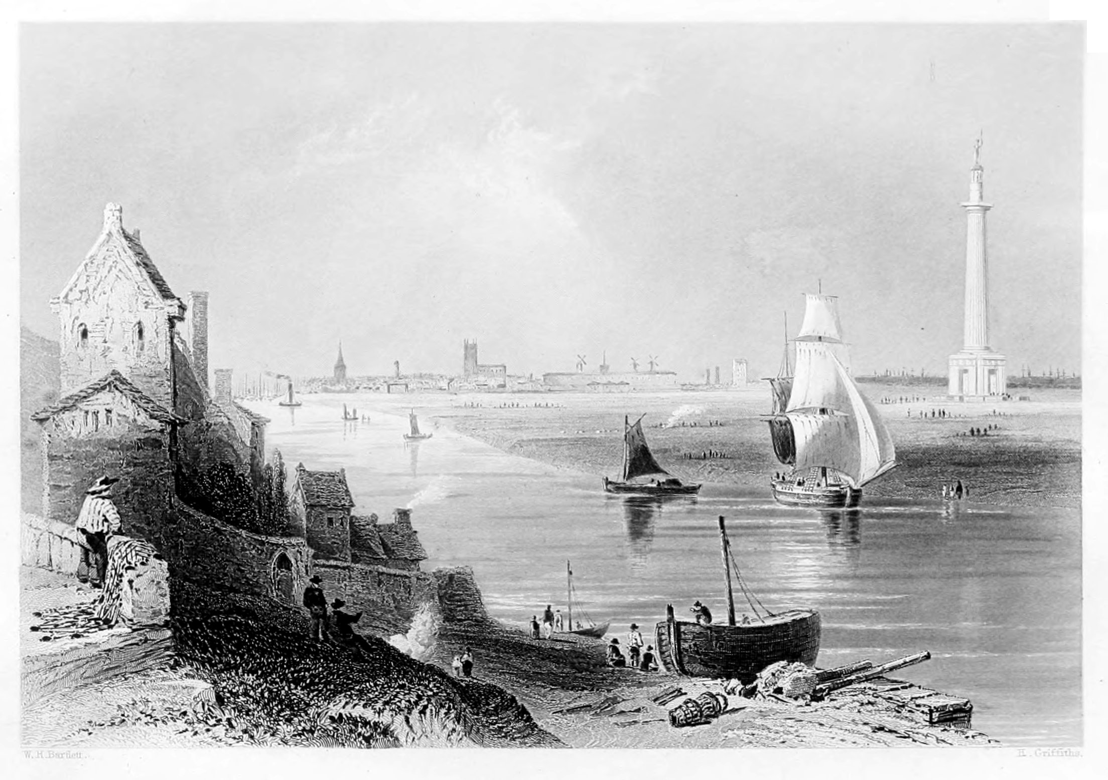
BURLINGTON QUAY.
The Engraving of Burlington Quay, from a painting by Balmer, presents a view of the entrance to the Harbour from the eastward. To the right is seen the inner part of the Old Pier, as it appeared after the great storm of 17th and 18th February, 1836. In front are the houses at the end of Quay Street, and to the left is the South Pier; between this and the shore two ships are perceived aground at the entrance of the inner harbour, which is nearly dry at low water. In the storm above alluded to, great injury was done to the old North Pier, and part of one of the houses to the right was washed down by the violence of the sea.
Burlington Quay lies about a mile to the north-east of the market-town of Burlington, and at the bottom of a bay of the same name. It is in the East Riding of Yorkshire, and is about two hundred and eight miles from London, forty from York, and twenty from Scarborough. The earliest mention of it as a harbour occurs in a mandate of King Stephen, addressed to the Sheriff of Yorkshire, commanding him to allow the Prior of Burlington to hold it on the same terms as Walter de Gaunt, and Gilbert, his ancestor, had held the same. During the time that it was in the possession of the Priors of Burlington, it seems to have been an inconsiderable place; but subsequently, as the coal trade between London and the northern parts of the kingdom increased, it began to be of greater importance as a harbour, in consequence of its affording shelter in stormy weather to vessels engaged in that trade. In 1546, an act was passed imposing a duty for erecting the piers and keeping them in repair; and, in 1614, a second act was passed, upon a petition from the merchants and ship-owners of the eastern coast, imposing a duty, for the same purposes, on all coals shipped at Newcastle. Since 1614, several other acts have been obtained, authorising the levy of duties and tolls for the purpose of improving the harbour and repairing the piers; and since 1816, the sum thus collected has averaged about £1,750 per annum.
The harbour at Burlington Quay is almost entirely the work of art, as the small stream which there runs into the sea is scarcely sufficient to turn a mill. Its locality seems to render it one of the most appropriate stations for a harbour of refuge between the Frith of Forth and Yarmouth Roads, more especially in gales of wind from the north-eastward; but unfortunately it can only be entered by comparatively small vessels, as the depth of water at the entrance is only from ten to twelve feet at neap-tides, and from fourteen to sixteen feet at springs. The harbour is also so small, that fifty sail of colliers taking shelter there would render it extremely crowded.
The history of Burlington Quay, considering it as a separate place from the town of Burlington, is extremely meagre. The most remarkable event which its annals record is the landing there of Henrietta Maria, Queen of Charles I., on her return, in 1643, from Holland, whither she had been to conduct her newly-married daughter to her husband, the Prince of Orange, and where she pledged part of the crown jewels in order to obtain money to purchase arms for the Royalists. The Queen, who was attended by a convoy of Dutch men-of-war, under the command of Admiral Van Tromp, landed at Burlington Quay, on the 22nd of February. The Parliamentary admiral, Batten, who had been cruising, with four ships, for the purpose of intercepting her, having received intelligence of her arrival, sailed into the bay and began to cannonade the town. Several of the shot struck the house in which the Queen was lodged, so that she was obliged to leave it, and take shelter in a ditch in a neighbouring field. A serjeant was killed near her, and the Parliamentary admiral continued his fire until the reflux of the tide and the threats of Van Tromp compelled him to desist.
Burlington Quay is much frequented in summer as a bathing-place; and many persons prefer its quiet and retirement to the greater gaiety of Scarborough. The beach, to the northward of the quay, affords excellent opportunities for bathing, and the walks and rides in the vicinity are extremely pleasant. A visit to Flamborough Head, which is only about five miles distant, forms a highly interesting excursion either by land or water.
The market-town of Burlington, or, as it is frequently spelled, Bridlington, is situated about a mile to the north-westward of the quay.
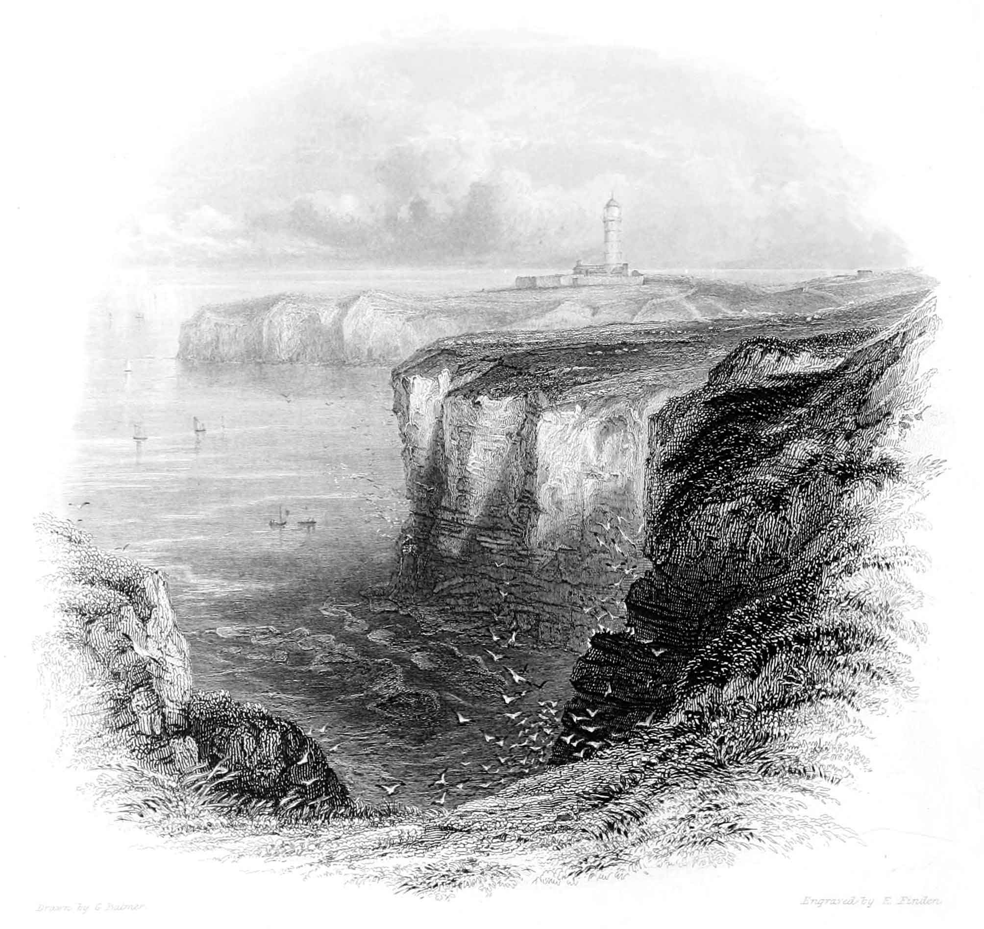
FLAMBOROUGH HEAD.
The view of Flamborough Head, drawn by Balmer, is taken from the cliffs to the north-west. To the left is the promontory properly called "The Head," at a short distance from which stands the lighthouse. Between the Head and the nearer cliffs is a small haven, which is used as a landing place by the fishermen of the village of Flamborough, which lies about a mile to the south-west of the lighthouse.
Flamborough Head, which lies about eighteen miles southward of Scarborough, and four and a half miles northward of Burlington, is one of the most remarkable promontories on the eastern coast. It projects about five miles into the sea, from a line drawn between Burlington Quay and Filey; and its southern side forms the northern boundary of Burlington Bay. The cliffs, which are of limestone rock, are from three hundred to four hundred feet high, and their crumbling sides form the haunt and the breeding place of innumerable flocks of sea-birds: among which are cormorants, puffins, razor-bills, and guillemots, with gulls and terns of several species. Guillemots, which are here extremely numerous, are known to the seamen of Shields and Newcastle by the name of "Flamborough-head pilots," as their presence in considerable numbers is almost a certain indication of the ship being "off the Head." Great numbers of those feathered denizens of the cliff are killed every year by "parties of pleasure," from Burlington, Scarborough, and other places, who visit the "Head" for the sake of indulging in the heartless sport, which requires neither skill nor courage, of killing birds by wholesale. At the foot of the cliff, which to the north-west is much indented, there are several caverns and large insulated masses of rock. The largest of those caverns, called Robert Lyth's Hole, has two openings, the one communicating with the land and the other exposed to the sea. The roof, though low at the landward entrance, is in some places fifty feet high; and the view, looking through the rocky vault towards the sea, is extremely grand.
Flamborough Head, which is a most important land-mark for vessels navigating the eastern coast, lies in 54° 8' north latitude; longitude 2' 30" west. A revolving light is displayed from the lighthouse from sunset to sunrise, and presents, first the appearance of two lights on the same tower, and next a brilliant red light. Each of those lights appears at intervals of two minutes; and after gradually attaining their greatest lustre, they in the same manner decline and become eclipsed.
Between Flamborough Head and Burlington Quay, is situated Burlington Bay, a secure roadstead in north-east gales; and, during the prevalence of such winds, it is not unusual for three hundred ships to be riding there at the same time, sheltered from the violence of the wind and sea by the lofty promontory. On the south-east, the Bay is partially sheltered from the violence of the sea by the Smithwick Sands, which run nearly in a line with the coast, from Burlington Quay to Flamborough Head. At each extremity of those sands there is a channel leading into the Bay; that towards the Head is called the North Sea; and the other, towards Burlington, the South Sea. Though the Smithwick Sands effectually break the violence of the sea at low water, yet at high water, when they are covered to a considerable depth, the protection which they afford, in gales of wind from the south-eastward, is not to be depended on. Vessels, therefore, leave the Bay as soon as the wind changes to east or south-east, as it no longer affords them sufficient security; the protection of the Smithwick Sands not being equivalent to the risk of the lee-shore, to which they would be exposed in a gale from the south-east. Were the harbour of Burlington, which is situated to the westward of the Bay, enlarged and deepened, its importance, as a place of refuge for vessels compelled to leave the Bay from the wind changing to the eastward, would be very greatly increased. Could it be so enlarged as to admit one hundred vessels, of from 200 to 300 tons each, it would, with the Bay, afford a place of refuge in all storms from north-east to south-east, which are generally the most destructive on the eastern coast.
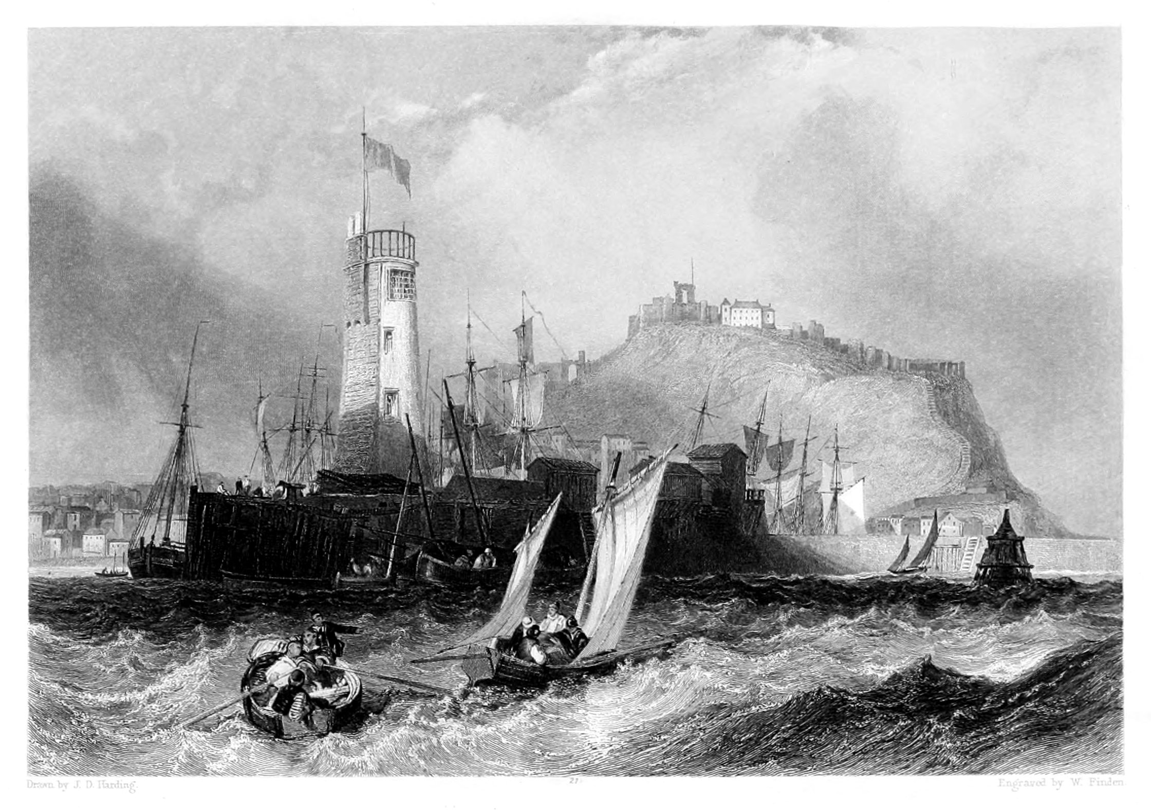
SCARBOROUGH.
In this view of Scarborough, by Harding, which is taken from the southward, the most conspicuous object is the Lighthouse on the Old Pier, or, as it is sometimes called, Vincent's Pier, from the name of the engineer, by whom the outer portion was erected about the year 1750. Beyond the pier are seen the masts of vessels lying in the harbour; to the left are the houses, which are built near the shore between West Sand-gate and Bland's Cliff; and on the height are the barracks, with the ruins of the old castle, a little further distant, to the left.
Though the name of Scarborough appears to be of Saxon origin, yet as the place is not mentioned in any author who wrote before the Conquest, nor in the Domesday-book, we cannot reasonably suppose it to have been of much importance, either during the Saxon period, or at the time when the Conqueror's survey was made. The castle of Scarborough was built about 1163, by William le Gros, Earl of Albemarle and Holderness; and from that period the authentic history of the town commences. The castle is situated to the north-eastward of the town, and is built on the isthmus of a peninsula, which comprises an area of about sixteen acres, and is bounded on the north, east, and south by inaccessible cliffs, whose summits are about 300 feet above the level of the sea. The western boundary, overlooking the town, is also formed by an elevated rock; and the only means of approach to the castle is by a steep path near the edge of the cliff forming the north side of the isthmus. On passing through a gateway, and over a draw-bridge, we arrive at the castle, which, previous to the introduction of cannon, must have been almost impregnable. The keep or principal tower is ninety-seven feet high, and though greatly dilapidated, is yet a striking object, more especially when viewed from the sea, at about two miles' distance from the north cliff.
There is no river at Scarborough; and the harbour, which is formed by the piers, is only accessible towards high water. It is high water at Scarborough at forty-five minutes past three o'clock at the full and change of the moon; and at spring tides there is about twenty-two feet water at the end of the pier. At night a light is shown from the lighthouse as long as there is twelve feet water at the entrance to the harbour; and during the same period a flag is hoisted by day.
About 1620 the sanative virtues of the Spa-well were discovered by Mrs. Anne Farrow, who "sometimes walked along the shore, and observing the stones over which the water passed to have received a russet colour, and finding it to have an acid taste different from the common springs, and to receive a purple tincture from galls, thought it probably might have a medical property." The lady having tried the water herself, and persuaded others to do the same, it was in a short time pronounced an all-heal, and the people of the place took it as their usual physic. Before 1670 these waters had become celebrated, and many persons resorted to Scarborough for the sake of drinking them. Medical men, however, disagreed both as to their composition and effects; and the opinions of Dr. Witty, a resident physician, who recommended them in every case, were controverted by Mr. Simpson and Dr. George Tonstall. The latter says of the Spa-water, "The essence is fit for the cup of a prince; the caput mortuum, which is sand and clay, is fit for nothing but the bricklayer's trowel. Hence it doth follow that those who are weak in their digestive faculties, and strong in their distributive, may find good by drinking this water; but those who are weak in both will experience the contrary." From the following anecdote related by the doctor, we may infer that the spa-drinkers of that period were accustomed to indulge in rather copious draughts. "Mr. Westro came to us at Scarborough only to visit his friends, and the two or three days he drank the waters (not above two quarts at a time), did so far put him out of tune, that he made his complaint to me he could neither eat nor sleep; and it took me a week's time before I could reduce him to the state of health which he had before he meddled with the waters." He would have been a person of strong constitution indeed not to have been "put out of tune" by such drenching; and it is no small proof of Dr. Tonstall's skill that he should have been able to restore Mr. Westro the blessings of sound sleep and a good appetite in so short a time as a week. From the double advantage which Scarborough presents to visitors, of drinking the waters and enjoying the benefit of sea bathing, it is much frequented during the summer season; and a more agreeable place is not to be found on the coast betwixt the Humber and the Tyne.
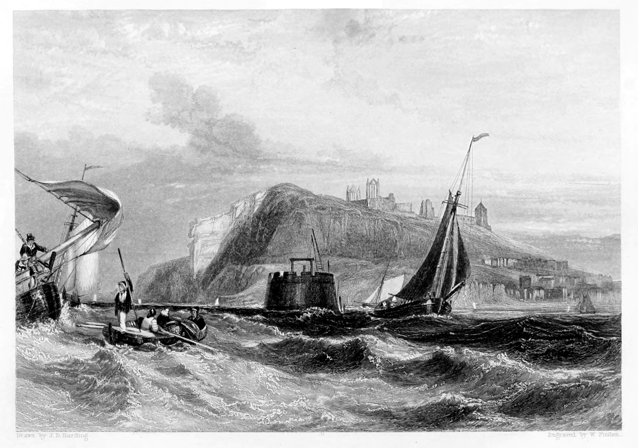
WHITBY.
This engraving of Whitby, from a drawing by Harding, presents a view of the entrance to the harbour, as seen from the northward. Towards the middle of the plate is seen the end of the east pier; on the top of the cliff are the ruins of the abbey and the parish church; while, farther to the right, part of the town is perceived.
Whitby is in the North Riding of Yorkshire, and lies about 246 miles north of London, 22 north-north-west of Scarborough, and 47 north-east of York. It is chiefly built on the sloping banks of the river Esk, by which it is divided into two parts; that on the west side being the most populous. The opposite parts of the town are connected by means of a bridge, the middle of which is moveable for the purpose of allowing ships to pass through. In the old bridge, which has been pulled down, the opening in the middle was upon the principle of a drawbridge, in which the roadway is raised and lowered by means of beams and chains. At high-water the river above the bridge expands into a spacious harbour, where ships can lie in perfect security; but at ebb tide, except in the mid-channel, the harbour is nearly dry. In the outer harbour, as it is called, below the bridge, vessels cannot ride with safety in gales of wind upon the land.
The piers at the entrance to Whitby harbour are not built and maintained at the sole expense of the place, but by a duty on coals shipped at Newcastle, Sunderland, Blyth, and their dependencies—Yarmouth vessels only being exempt—and the sum thus raised amounts to upwards of £2,000 per annum. It is doubtless a great advantage to the people of Whitby to have their piers built and kept in repair at the expense of other ports; but it is equally certain that the same sum might be employed more to the advantage of those by whom it is paid in improving other places—Scarborough and Burlington, for instance—as harbours of refuge on the eastern coast. In a gale of wind from the eastward, Whitby is perhaps one of the most dangerous harbours that a vessel can attempt to take between Yarmouth roads and the Frith of Forth, and captains of coasting vessels cannot be too frequently warned to avoid it. As the flood tide sets strong to the southward across the entrance to the harbour, vessels in attempting to enter with a gale of wind from the north-east are extremely liable to be driven on the rocks and wrecked at the foot of the cliff beyond the east pier.
A singular customary duty, called "making the penny-stake hedge," is annually performed at Whitby, by certain tenants of the Lord of the Manor. It consists in driving a certain number of stakes, which, according to the ancient prescribed form, were to be cut with a knife of the value of one penny, on the shore of the south side of the Esk, at low-water mark, at nine o'clock on the morning of the day before Ascension-day, while a man with a horn blows, "Out on you! Out on you!" to the shame of the persons whose duty it is to drive the stakes. When it shall be full sea or high-water at nine o'clock on the day of performing this service, it was to cease; but as Ascension-day is regulated by the change of the moon this can never happen. This custom is of great antiquity, as the horngarth, the enclosure formed by the stakes, is mentioned about 1315 in the registers of the Abbey, in an account of certain disputes between the abbot, Thomas de Malton, and Alexander de Percy, of Sneaton. Tradition reports that this custom was imposed as a penance on three persons of the families of Percy, Bruce, and Allatson, who held lands of the Abbey, for having killed a hermit in the chapel of Eskdale-side, when hunting a wild boar which had there taken refuge. The penance imposed was the tenure by which they and their successors were to hold the Abbey lands.
Leland, who visited Whitby a few years before the suppression of the monastery, describes it as a "great fisher town;" and he mentions that when he was there a new quay and pier were in course of erection. Until the establishment of the alum works in its neighbourhood, towards the latter end of the reign of Queen Elizabeth, Whitby appears to have been a place of little trade. As this new branch of commerce extended, the trade and population of Whitby steadily increased until it has attained its present importance.
WHITBY,
FROM THE NORTH-WEST.
The view of Whitby from the north-west, by Balmer, is taken from the sands near Upgang, between Whitby and the village of Sandsend. From this point nearly the whole of the west pier is seen, extending directly from the shore, and having a light-house near its outer extremity. Beyond the pier, and on the other side of the river, are seen the houses built on the sloping side of the cliff, and on its top the ruins of Whitby abbey, which
The first authentic notice that we have of Whitby, is contained in Bede's Ecclesiastical History. In the time of the venerable historian it was called in the Anglo-Saxon language Streoneshalh, a name which he interprets in Latin by the words Sinus Fari; that is, in English, "Light-house bay." Subsequently it received from the Danes its present name of Whitby, a word which is probably derived from hvit or whit, white; and by, a dwelling, or in its more extended sense, a village or town. It has been supposed that this name might be given to the village in consequence of its being built chiefly with stone taken from the ruins of the monastic buildings; but the supposition is untenable, unless we at the same time presume that the stones, which were taken from buildings which had been destroyed by fire, were rendered white by being burnt. In Domesday Book the place appears to be called Prestebi—Priestby—as well as Witeby—Whitby. The name Priestby, which soon became obsolete, probably denoted that part of the village which lay on the east side of the Esk, and was more immediately dependent on the monastery.
The abbey of Whitby, founded by St. Hilda in 658, acquired considerable importance as the residence of this saint, of whose miracles certain marvellous traditions are still current in this vicinity. At the dissolution, under Henry VIII., Richard Cholmley, Esq., obtained a lease for twenty-one years of the site of the abbey and several parcels of its lands. In 1550 those lands were sold by the crown to John, earl of Warwick, who again sold them to Sir John Yorke, of whom they were purchased by the original lessee, then Sir Richard Cholmley, in 1555. Since that time the property has continued in the family of Cholmley, who enjoy many valuable rights and privileges as lords of the manor of Whitby. On the dissolution of the monastery, the abbey was stripped of every thing that was valuable. The bells were taken down, and the church was unroofed for the sake of the timber and lead. The walls only were spared, as the cost of taking them down would probably have been greater than the value of the stones. Though time has destroyed much of Whitby Abbey, yet the ruins still form a conspicuous and interesting object when viewed from the sea. The tower, which for several preceding years had been in a tottering state, fell down 25th June, 1830. The parish church, a plain structure, probably founded about the beginning of the twelfth century, stands at a short distance to the north-westward of the abbey. The direct foot-way to the church-yard from the town is by a steep ascent of one hundred and ninety steps.
It is worthy of remark that the number of ships registered at Whitby by no means affords a criterion of the trade of the place, for the greatest part of them are freighted to and from other ports. Perhaps no port in the kingdom presents so great a difference as Whitby between the number of ships registered at the port, and the number annually entered and cleared. This discrepancy between the trade and the tonnage of the port arises from the circumstance of many wealthy persons who live there having their ships built and registered at Whitby, but chiefly employed, on freight, in the trade of other places. When speaking of the shipping of Whitby, it would be unpardonable not to mention that Captain James Cook one of the most distinguished of British circumnavigators, served an apprenticeship in a vessel belonging to that port.
The principal trades carried on at Whitby are ship-building, and the manufacture of sail-cloth. Its chief imports are coals from Newcastle and Sunderland, and timber, hemp, flax, tar, iron, and tallow, from the Baltic. Alum manufactured in the neighbourhood is shipped at Whitby, but the principal article of export is at present stones for building, of which great quantities are sent to London.
From the light-house, on the western pier, a tide-light is displayed at night time, as long as there is eight feet water on the bar. The light is stationary, and is visible at the distance of two leagues in clear weather. During the same period of tide, in the day, a flag is hoisted on the west cliff. It is high water at Whitby pier at forty minutes past three o'clock at the full and change of the moon.
ROBIN HOOD'S BAY.
The above is the name of a fine bay on the Yorkshire coast, between Whitby and Scarborough, and also of the fishing village, situated towards its northern extremity. In the view, which is taken from the north, several of the houses are seen standing upon the very edge of the cliff. The promontory to the left is called Ravenhill, and forms the south-eastern extremity of the bay. From an inscription dug up at Ravenhill in 1774, it appears that there had formerly been a Roman camp there.
The ancient name of the bay was Fyling, and from what reason or at what period it first received the name of Robin Hood's Bay is uncertain. That it ever was the resort of the famed outlaw of that name is extremely questionable; although two or three tumuli on the moor, about two miles to the southward of the village, are said to be the butts, in shooting at which he exercised his men in archery. Near Whitby Lathes, about five miles to the north-west of Robin Hood's Bay, are two upright stones, which are said to mark the spots where the arrows of the bold robber of Sherwood Forest, and his man Little John, fell, when, in a trial of strength, they discharged them from the top of Whitby Abbey in the presence of the abbot. As the distance from these stones to the abbey is rather more than a mile and a half, it is evident that a long bow must have been drawn by some one, if not by Robin Hood. It has been supposed that the place was originally called Robin Wood's Bay, from a fisherman of that name, who formerly resided there; but this conjecture rests on no better ground than the fact of two or three fishermen of the name of Wood having lived there in modern times. A family of fishermen of the name of Wood, with whom "Zebedee" appears to have been a favourite "fore-name," have resided at Runswick, a fishing village, about seven miles northward of Whitby, for several generations.
Leland, in his Itinerary, written about three hundred years ago, calls the village by its present name, Robin Hood's Bay, and describes it as "a fisher townlet of twenty boats." It is still, as in his time, almost entirely inhabited by fishermen. The houses forming the principal street are built on each side of a steep road, leading down to the shore; while others, as may be seen in the view, are built upon the very extremity of the cliff. The approach to the village is by a steep descent, which is extremely inconvenient for carriages. It is about fourteen miles north-west of Scarborough, and seven south-east of Whitby; and the population is about a thousand.
Robin Hood's Bay, Filey, Runswick, and Staithes, are the principal fishing villages on the Yorkshire coast. Filey is about eight miles south of Scarborough; Runswick, as has been previously observed, is about seven miles northward of Whitby; and Staithes is about three miles northward of Runswick. At each of those places the fishery is carried on both by cobles and by five-man boats. At most of the other fishing stations on the Yorkshire coast cobles only are employed. A description of the last named species will be found in our notice of Bambrough from the South-east; and of the five-man boats, we propose to say a few words on the present occasion.
The vessels now called five-man boats are about forty-six feet long, sixteen feet eight inches broad, and six feet three inches deep. They are clinker-built, sharp at the bows, and have a deck with a large hatchway in midships, and a cabin towards the stern for the men. They have three masts, on each of which they carry a lug sail. Their other sails are a jib, and, in fine weather, a top-sail set on a shifting topmast, above the main-mast. As the sails are all tanned, a five-man boat forms a picturesque object at sea, more especially when viewed in contrast with a square-rigged vessel with white sails. The crew of each five-man boat consists of seven persons, five of whom, called shares-men have equal shares of the proceeds of the voyage, or the season, after the boat's share is paid. The sixth person is often a young man who receives half a share, and is a kind of apprentice to the captain or owner of the boat. The seventh is generally hired at a certain sum per week, and not sharing in the profits of the fishery.
To each five-man boat there are two cobles, which in proceeding to the fishing ground are generally hauled up on the deck. On arriving at the place where it is intended to fish, the boat is anchored, and the cobles being launched, three men proceed in each to shoot their lines, while one remains on board. The lines used for this more distant fishery are called haavres. They are about the same length as those used in the coble fishery nearer the shore, though thicker, and having the hooks placed at greater intervals. As the six men who fish have each two sets of lines, they are thus enabled to shoot one set immediately after they have hauled the other. In the five-man-boat fishery the hooks are always baited at sea.
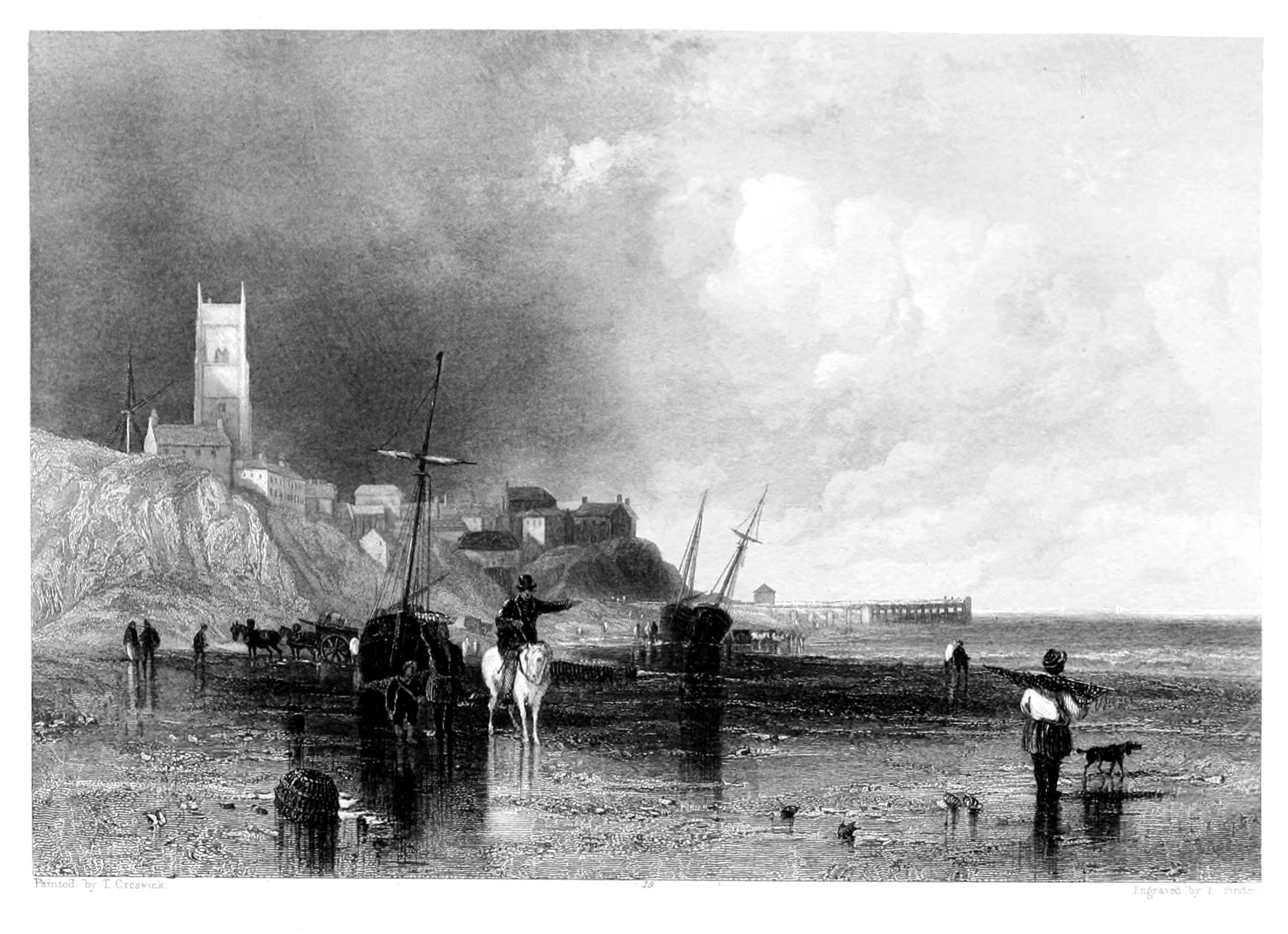
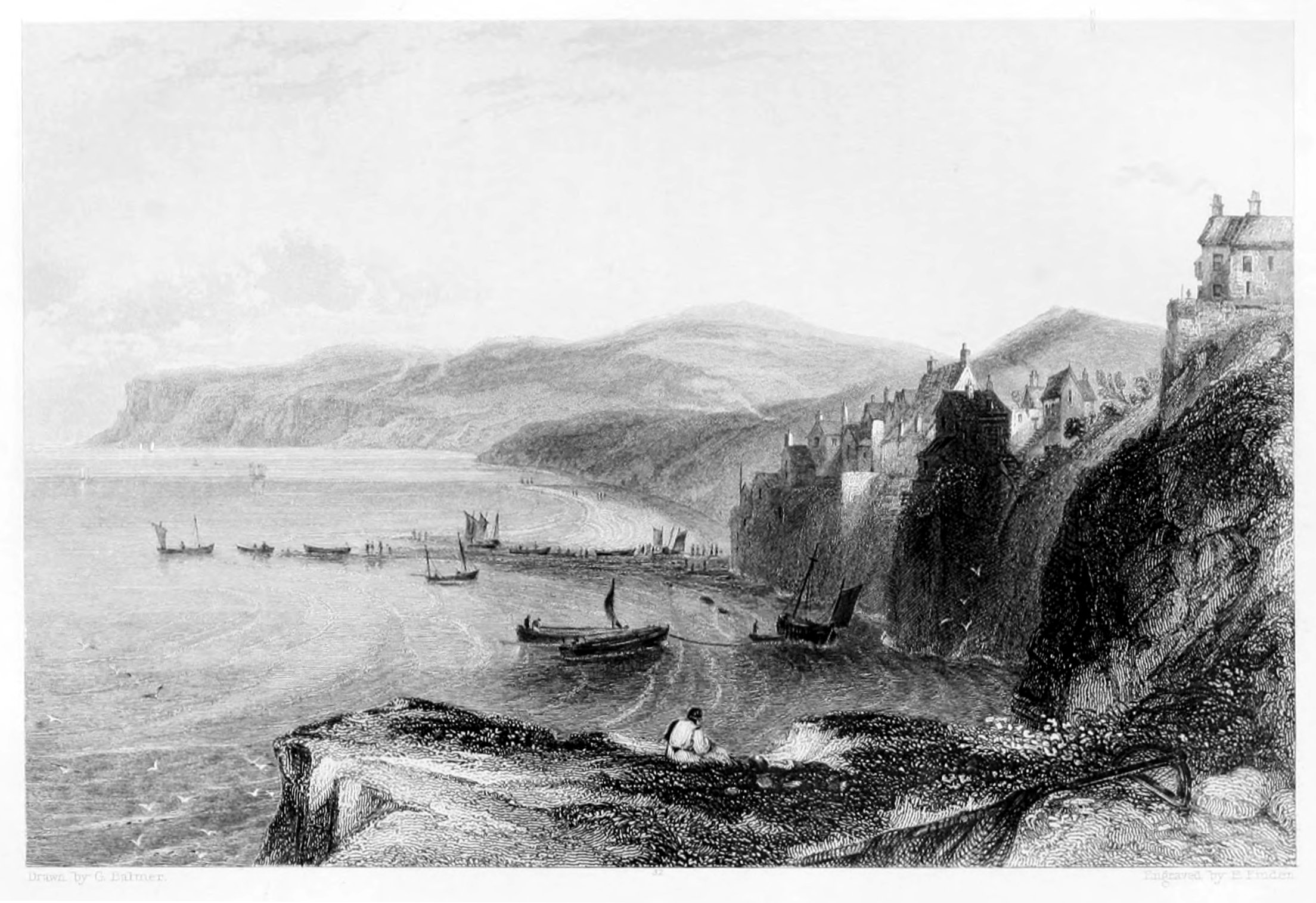
HARTLEPOOL.
The view of Hartlepool, painted by T. Creswick, from a drawing by G. Balmer, is taken from the northward. To the right, between the foreground and the town, are seen the sands of what is called the "Slake;" to the left are the cliffs, at the foot of which are the excavations called "Fairy Coves;" and beyond the town part of the southern coast of Durham is perceived, which extends from Hartlepool southward to the mouth of the Tees. The figures in the foreground are characteristic of the place; for there is no obtaining a view of Hartlepool from the land-side without seeing a group of fishwomen.
The town of Hartlepool stands on a small peninsula on the southern coast of Durham, and is about nine miles north-east of Stockton-upon-Tees. From the "Slake," or Pool, which is between the town and the mainland to the west, it probably received the appellation of "Le Poole," to distinguish it from the village of Hart, which is about four miles and a half to the north-west. The word Hart, according to Ducange, signified, in Teutonic, a forest; and, if the name of the parish of Hart be of the same origin, the reason why the place should have been so called is obvious. The old town-seal of Hartlepool contains a rebus of the name—a hart up to his knees in a pool—which assigns to the first part of it a different etymology. Previous to receiving the name of Hartlepool the place was called Heortu, and sometimes Heortness; the terminating u is perhaps an abbreviation of eau, water; and the name Heortu synonymous with Hart-le-pool. The termination ness is expressive of the place being built on a point of land which projects into the sea. "At or near this place," says Bishop Tanner, in the Notitia Monastica, "was the ancient monastery called Heorthu, founded upon the first conversion of the Northumbrians to Christianity, about A.D. 640, by a religious woman named Hieu, or, as some have it, St. Bega, whereof St. Hilda was some time abbess." This ancient convent was destroyed by the Danes about 800, and its site is now unknown, though it is supposed to have stood on the spot which was subsequently occupied by a Franciscan monastery, founded by one of the Bruce family about 1250, and suppressed by Henry VIII. Of this monastery or its church there is at present no part remaining, though some old houses, called the Friary, probably built out of the ruins, still indicate its situation. The church of Hartlepool, which is dedicated to St. Hilda, is a large building, and, from the various styles of its architecture, has evidently been built at different periods.
About the time of the Conquest, the manors of Hart and Hartness belonged to Fulk de Panell; and, upon the marriage of his daughter Agnes with Robert de Brus, one of the Norman followers of William I., they came, with other rich manors in Yorkshire and in Durham, into the possession of that family. Upon Robert Bruce, a descendant of the above-named Robert de Brus, succeeding to the crown of Scotland in 1306, all his English estates were confiscated by Edward I., who granted the manor of Hart and the borough of Hartlepool to Robert de Clifford, "saving the rights of the Bishops of Durham," under whom, since 1189, the property had been held.
In 1201, King John granted a charter to Hartlepool, conferring upon the burgesses the same privileges as those of Newcastle-upon-Tyne; and in 1230, Richard le Poor, Bishop of Durham, granted another charter, appointing a mayor and other officers for the government of the town. In 1593, Queen Elizabeth granted a new charter, under which the affairs of the borough have been since regulated.
From the reign of King John to that of James I., Hartlepool was the most considerable port in the county of Durham; but from the latter period till about seven years ago, its importance as a place of trade appears to have greatly declined: and from 1730 to 1832, its condition was that of a small fishing town, scarcely visited by any ships, except colliers belonging to Sunderland and Newcastle, which occasionally sought refuge in its harbour during a storm. In 1832, a bill was obtained for the purpose of improving the harbour and forming a dock at Hartlepool; and since that period a considerable portion of the projected works have been finished. A railway has since been formed, by which coals are brought to the town; and a considerable quantity are now shipped there for the London and other markets; and from the advantageous situation of the harbour, and the facility with which vessels can be loaded, there seems great probability of Hartlepool becoming, in a few years, one of the principal ports for the shipment of coals in the county of Durham.
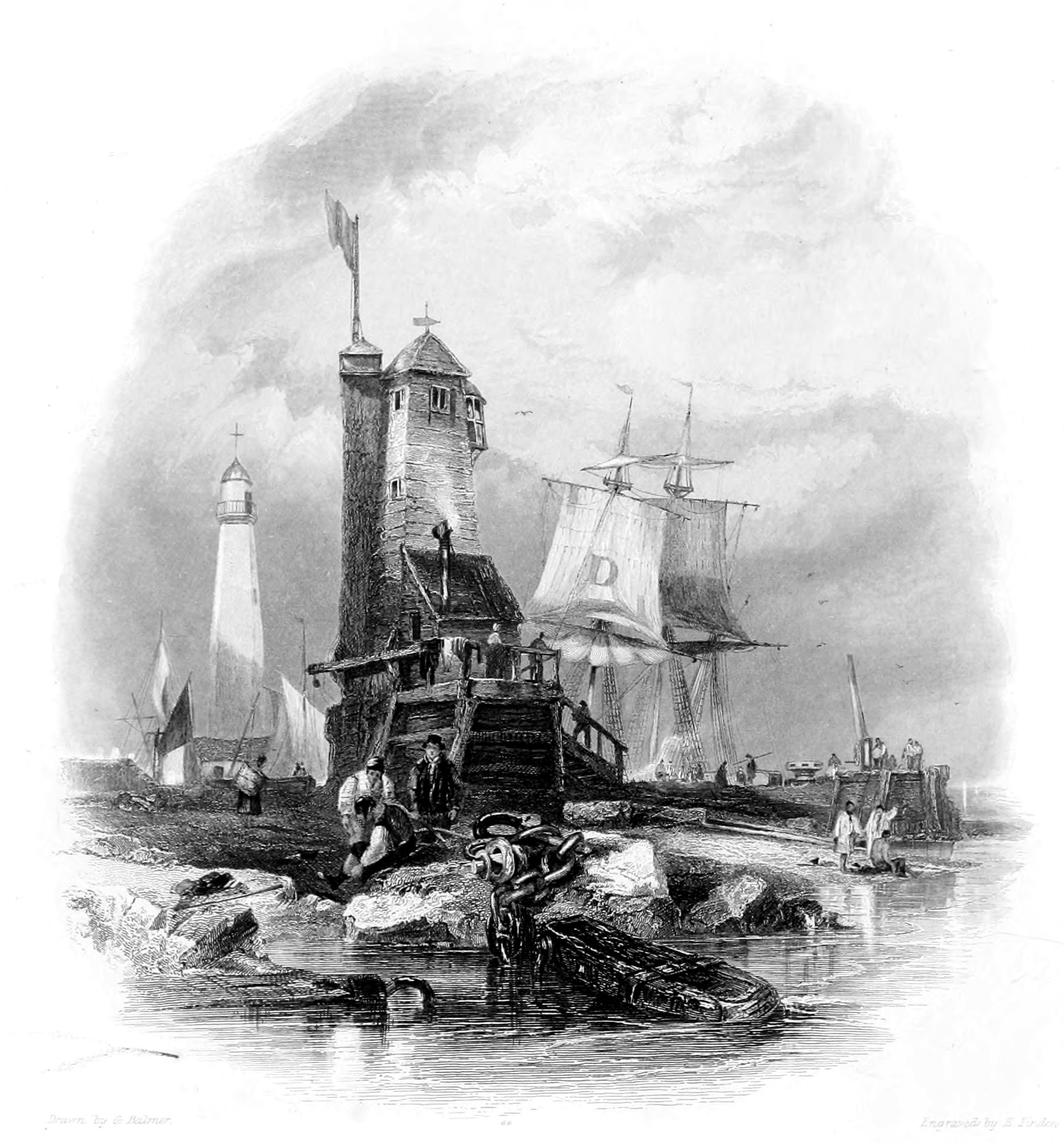
SUNDERLAND,
THE LIGHTHOUSE ON THE SOUTH PIER.
The view of the Lighthouse on Sunderland South Pier is taken from the south-east. The entrance to the harbour lies beyond the pier-head, to the right, on which a crane, and a capstan used in warping out ships, are perceived. The large D on the fore-topsail of the collier lying within the pier is a distinguishing mark adopted by the owner that his vessels may be more readily known. To the left is seen the higher lighthouse, of stone, which stands on the north pier, on the opposite side of the river.
The erection of a pier on each side of the entrance to Sunderland harbour has been rendered necessary in consequence of the constant tendency of the bar of sand at its mouth to accumulate. The piers, by contracting the channel of the river, have deepened the water, and increased the velocity of the current at ebb tide, which thus scours the entrance to the harbour, and prevents the accumulation of sand upon the bar.
In 1669, Charles II. granted letters patent to Edward Andrew, Esq., empowering him to build a pier, erect lighthouses, and cleanse the harbour at Sunderland, and also to raise funds for these purposes by a tonnage-duty on ships. At a subsequent period, commissioners were appointed for the same purposes by an act of parliament; and under their authority three hundred and thirty-three yards of the north pier were built, between 1716 and 1746. From a report of the commissioners made in 1765, it appears that £50,000 had been expended on the south pier up to that time, and it was estimated that to finish it would cost as much more. It is now extended to the length of six hundred and twenty-five yards. The north pier, which is entirely of stone, was commenced about 1785, but additions have been recently made to its eastern extremity.
The lighthouse on the north pier was erected in 1803. The light, which is stationary, is exhibited from sunset to sunrise, and is visible in clear weather at the distance of twelve miles. The light on the south pier is a tide light, and is only shown when there is sufficient depth of water on the bar for ships to enter. This light is of a red colour. By day a flag is hoisted during tide-time.
Since the year 1200—and probably from a much earlier period—the harbour at the mouth of the Wear appears to have been generally known as that of Sunderland, the present name of the port and of the parliamentary borough. "Various conjectures," says Mr. Surtees, "have been formed as to the derivation of this name; the simplest and most obvious seems to be, that it marked the original situation of the place on a point of land almost insulated by the Wear and by the sea, which has probably flowed much higher than at present up some of the deep gullies on the coast, particularly Hendon-Dene, which, it seems, contained, as late as 1350, water sufficient for vessels to ride at anchor in the bay."
In 1719 an express distinction was made by an act of parliament, which constituted Sunderland a separate parish from that of Bishop-Wearmouth, in which it had formerly been included. This act was passed on the petition of the inhabitants of Sunderland, who, between 1712 and 1719, had built a new church. The old church of Bishop-Wearmouth—which was pulled down and rebuilt in 1808—was probably founded shortly after the date of Athelstan's grant. The rectory of Sunderland is but slenderly endowed; that of Bishop-Wearmouth is one of the richest in the kingdom, and was at one period held by the Rev. Dr. Wellesley, a brother of the Duke of Wellington. Dr. Paley—whose "pigeon illustration," in his Moral Philosophy, of the basis of political authority, is said to have kept him out of a bishopric—was rewarded by Dr. Barrington, bishop of Durham, with the rectory of Bishop-Wearmouth, where he died in 1805.
SUNDERLAND.
THE BRIDGE FROM THE WESTWARD.
Under the general name of Sunderland, the three townships of Monk-Wearmouth, Bishop-Wearmouth, and Sunderland are usually comprised. Monk-Wearmouth is situated on the north side of the river Wear, at a short distance from its mouth. Sunderland and Bishop-Wearmouth, which form one continuous town, lie on the south side of the river; Sunderland, properly so called, extending from the line of junction of the two parishes, eastward to the sea; and Bishop-Wearmouth extending towards the west. Sunderland—which has given its name to the port and to the borough—is 269 miles distant from London; fourteen from Durham; and thirteen from Newcastle-on-Tyne.
The great boast of Sunderland is the beautiful iron bridge, of a single arch, which connects it with Monk-Wearmouth. This noble structure, which is at once highly ornamental and useful, was projected by Rowland Burdon, Esq., of Castle Eden, who in 1792, he being then M.P. for the county of Durham, obtained an act of parliament empowering him to raise money for its erection; the sums advanced to be secured on the tolls, with five per cent. interest, and all further accumulation to go in discharge of the capital. The abutments, from which the arch springs, are nearly solid masses of masonry, twenty-four feet thick, forty-two feet broad at bottom, and thirty-seven feet broad at top. That on the south side is founded on a solid rock, which rises above the level of the Wear; the foundation of that on the north side, owing to the unfavourable nature of the ground, was obliged to be laid ten feet below the level of the river. The arch, which is a segment of a large circle, is of 236 feet span, and its centre is ninety-four feet above the level of the river at low water. From the height of the arch and its comparative flatness—its versed sine, or perpendicular height from its centre to a line joining its extremities, being only thirty-four feet—ships of 300 tons burden can pass underneath not only directly below the centre, but also to the extent of fifty feet on each side. The navigation of the river thus remains unobstructed—for many vessels proceed to the staiths above the bridge for the purpose of taking in their coals—while the inhabitants on each side enjoy all the advantages of facilitated intercourse. The breadth of the bridge at the top is thirty-two feet including the footpaths on each side; and the carriage-way is formed of lime, marl, and gravel, above a flooring of timber, which is laid across the iron ribs of the arch. The iron ribs and blocks were cast and prepared at the foundry of Messrs. Walker, at Rotherham, near Sheffield. The whole weight of the iron is 260 tons; of which 46 tons are malleable, and 214 cast. The foundation-stone[4] was laid on the 24th September, 1793, and the bridge opened to the public on the 9th August, 1796, having been completed under the superintendence of Mr. Thomas Wilson, of Bishop-Wearmouth, in less than three years. The total expense was £26,000, of which sum £22,000 was subscribed by Mr. Burdon.[5]
Although many ships are loaded direct from such staiths as are at a short distance above the bridge, yet the greater part of the coals are brought down in keels from staiths situated higher up the river. The keels of the Wear, though of the same tonnage as those of the Tyne, are somewhat differently built, being flatter in the bottom, and of a lighter draught of water. The Sunderland keels are managed by only one man, who usually has a boy to assist him. In the Wear the coals when in bulk are cast from the keel into the ship by men called coal-casters; while on the Tyne, where the crew of each keel consists of three men and a boy, the coals are always cast by the keelmen. Within the last few years, a considerable quantity of coals, in order to prevent the breakage occasioned by discharging them into the keels from the spout, and then casting them into the ship, have been put on board the keels in tubs, which are afterwards raised by machinery to the vessel's deck, and then discharged into the hold. These tubs are exactly like coal waggons without their wheels, and contain the same quantity—one Newcastle chalder, or fifty-three cwt.[6] Each keel carries eight of these tubs. The number of keels employed on the Wear is above 500.
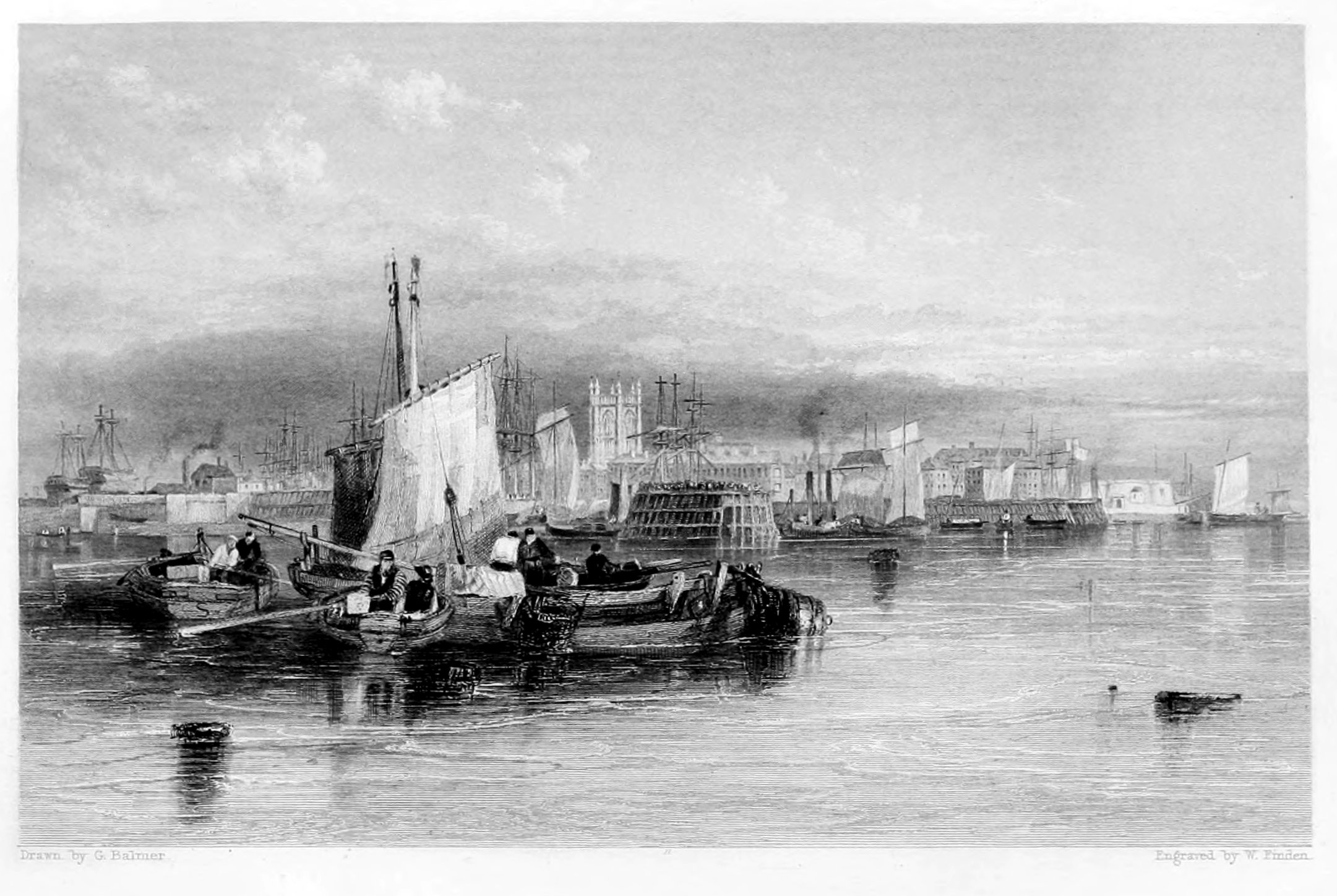
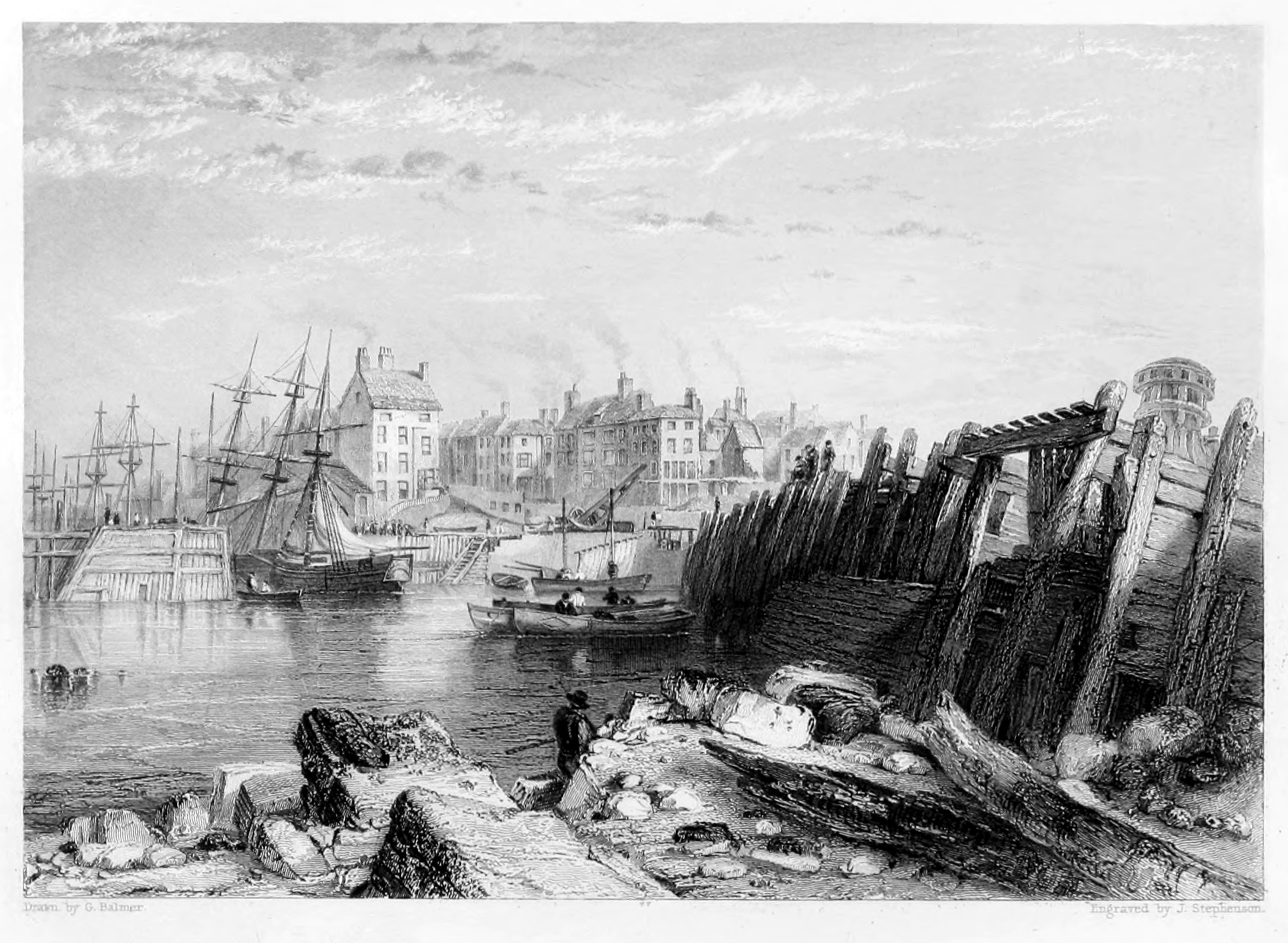
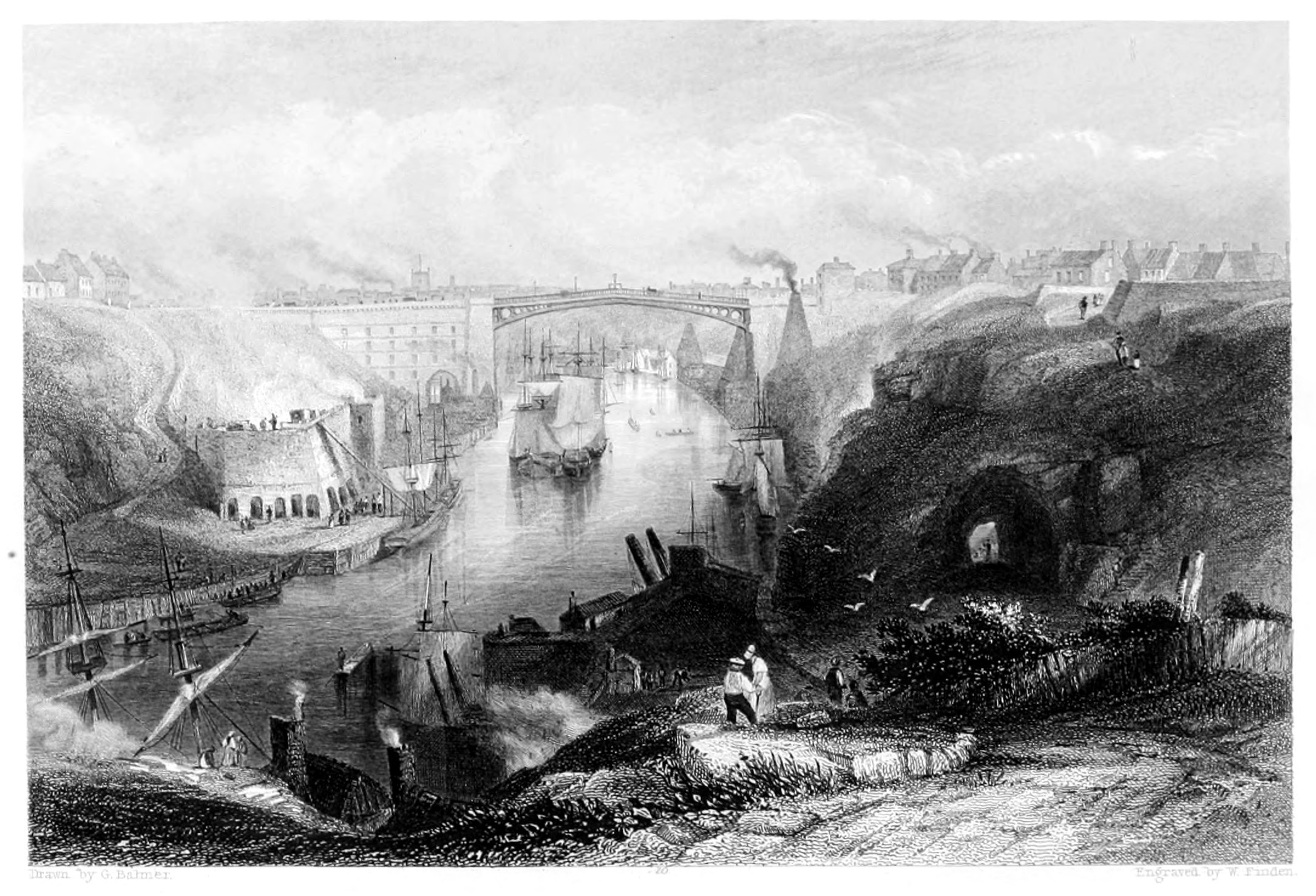
SHIELDS.
ENTRANCE TO THE HARBOUR.
The view of the entrance to Shields Harbour is taken from the bank a little below the Spanish Battery, on the north side of the Tyne, and about a quarter of a mile to the south-westward of Tynemouth lighthouse. To the left, a part of South Shields is seen, with a vessel "dropping up" the Narrows, just before entering the harbour. Towards the middle of the Engraving are the two lighthouses at North Shields—distinguished by their flag-staffs—which, when taken in a line, are a guide for vessels in passing the bar. To the right of the low lighthouse is Clifford's Fort, enclosed by the line of embrasures, and commanding the entrance to the harbour. To the right are the banks, of clay, which extend from the Spanish Battery to the Low Lights, and upon which the sea is every year gradually making encroachments. The present Engraving, independent of its beauty as a work of art, possesses the merit of containing the only correct view of the entrance to Shields Harbour which has hitherto appeared.
That portion of the river Tyne which may be considered as Shields Harbour is about a mile and a half in length, supposing it to commence at the Low Lights, on the north side, and to terminate at the lower end of Jarrow Slake, at the head of South Shields; its direction is from east by north to west by south; and the towns of North and South Shields are built on the banks and by the shore on each side of it. As the Low Lights are about a mile within the bar, the swell of the sea is not felt within the harbour.
The river is of unequal width, being in some places not more than 400 yards broad, while in others, when the sands are covered with the tide, its width is upwards of 600. From the shoals and varying width of the river, the velocity of the current differs with the breadth of the harbour. Opposite to the New Quay at North Shields, the average velocity in the middle of the tide-way is, at half flood, about three miles an hour; and, at half ebb, about three miles and three quarters an hour. As the easterly wind blows directly into the harbour, vessels formerly were often hindered from getting out to sea, even in fine weather, when the wind was in that quarter, more especially if they were of considerable draught of water; for frequently before such a vessel could drop down with the ebbing tide as far as the bar, there was not sufficient depth of water on it to allow her to proceed to sea. The general introduction, however, of steam-boats for the purpose of towing vessels, when the wind is shy or contrary, has, in a great measure, remedied this inconvenience, and vessels now proceed to sea at any time, in favourable weather, when there is a sufficient depth of water on the bar.
The town of South Shields is very irregularly built; and the principal street for business extends from the market-place to the lower end of the town. The market-place, in the centre of which stands the town hall, is spacious, but the market is very indifferently supplied with every thing except fish. Westoe, anciently Wivestoe, is a pleasant village about a mile southward of South Shields, where several ship-owners and persons of property reside. Jarrow, so famous in days of yore for its monastery, is about a mile and a half to the westward of Westoe; and in the vestry an old chair is still preserved, which is said to have been the seat of the venerable Bede.
The town of North Shields lies on the north side of the river Tyne, and is in the county of Northumberland. The principal street for business, and which may be considered as forming the greater part of the old town, is the Low-street, running nearly parallel with, and at a short distance from, the river, and extending from the New Quay to the Low Lights. The greater part of the town, which is built on the bank top, extending in regular streets towards the north, has been erected within the last fifty years.
At the New Quay there is a commodious wharf, with warehouses at each end, where trading vessels load and unload, and where steam-boats leave for Newcastle. A little above the New Quay is the landing for the steam ferry-boat, which plies between North and South Shields, and leaves each place four times an hour, from seven in the morning till dusk, carrying passengers across the river at the charge of a penny each. This ferry, which was only established in 1829, is a great accommodation to both the towns. Previous to its establishment, the conveyance of sheep, cattle, and horses across the Tyne, in an awkward flat-bottomed boat, managed by a single man, was attended with great inconvenience. The barge steam ferry-boats now employed are surrounded with a strong railing; and sheep, cattle, and horses can be driven on board with little trouble, and conveyed across the river without risk.
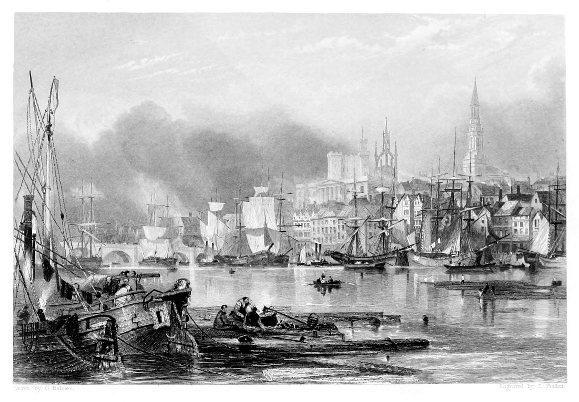
NEWCASTLE UPON TYNE.
The view of Newcastle is taken from the Gateshead shore, on the south side of the river Tyne, about a quarter of a mile below the bridge. From the point chosen by the artist, a better and more characteristic view of the town is obtained than from any other station. The line of vessels, extending from the right of the engraving to the bridge, indicates the quay—the longest in England, except that of Yarmouth—and which, on a Saturday, when the country people come in to market, is one of the most crowded thoroughfares in the kingdom. The steeple that rises above the houses to the right is that of All Saints. Between All Saints and the Castle—which is distinguished by its modern turrets and battlements—is the famed steeple of St. Nicholas; this the Rev. Dr. Carlyle, vicar of Newcastle, in 1804, declared to be, in his opinion, "the most beautiful fabric existing in the world: surpassing the Cathedral of St. Sophia, at Constantinople; the Mosque of Sultan Saladin, at Jerusalem; the Church of St. Peter, at Rome; and even the Temple of Minerva, at Athens." The modern building, with a Grecian portico, in front of the Castle, is the County Court, where the assizes for the county of Northumberland are held. The Exchange is hidden by the sails of the large vessel, towards the middle of the engraving; and the bridge excludes a view of the Mansion House, which stands in friendly neighbourhood with a glass-house and a soapery, in a narrow street, with a most expressive name—the "Close."
The town of Newcastle, though its present name is not older than the reign of William the Conqueror, claims to be a place of great antiquity. The Roman Wall—which extended from Wallsend, about four miles eastward of Newcastle, to Bowness on the Sands, in Cumberland—crossed the site of the present town; and it is certain that there was a Roman station here, the southern wall of which probably ran along the high ground overlooking the river in front of the old castle. In the list of stations, with their garrisons, on the line of the wall, as given in the Notitia, Pons Ælii occurs as the next station to Segedunum; and our best informed antiquaries appear to agree in assigning the latter name to the station at Wallsend, and the former to the station at Newcastle. The name Pons Ælii, however, occurs in no other ancient work as the name of a station on the line of the wall, and no inscription has been discovered which might confirm the opinion of its being the name of the station at Newcastle. Different writers also have interpreted the list of stations in the Notitia from different ends, and at the present time the situation of several places remains undecided.
The Tyne is navigable as high up as Newcastle, about ten miles from its mouth, for vessels of 250 tons burden, though in some places between Newcastle and Shields, even in the middle of the stream, its depth does not exceed four feet at low water. A little below Hebburn quay, about half-way between Newcastle and Shields, it is not unusual to see three or four small steam-boats, which do not draw more than three feet water, lying aground in the very mid-channel at the last quarter ebb, and waiting for the flood tide to set them afloat. A few years ago, the corporation of Newcastle, as conservators of the river Tyne, employed a steam-boat to scratch away the sand in shallow places, by means of a kind of harrow, which she towed after her. Since the accession of the present corporation to office, a dredging machine has been employed, and if they proceed in their plans for the improvement of the river as they have begun, they will merit the thanks of every person interested in the trade of the town.
But, however praiseworthy may be their efforts for the deepening and cleansing the bed of the Tyne, the present year (1853) has exhibited melancholy testimony that the streets, lanes, and alleys of Newcastle call aloud for the expenditure of the municipal funds—if the lives of the inhabitants are not of less value than the commerce of the port. The ill-drained and badly-ventilated dwellings of some of the more densely-peopled portions of the town have suffered more from the attacks of cholera than any other place in the kingdom.
The chief exports from Newcastle, besides coals, are pig and sheet lead; anchors, and chain cables, with other articles of wrought iron; bottles, plate and crown glass; brown and white paper; common leather gloves, manufactured at Hexham; leather; hams and butter; grindstones, obtained on Gateshead Fell; fire-bricks; alkalies; soap; and Epsom salts. This list comprises the principal articles which constitute the cargo of a Newcastle trading vessel proceeding to London.
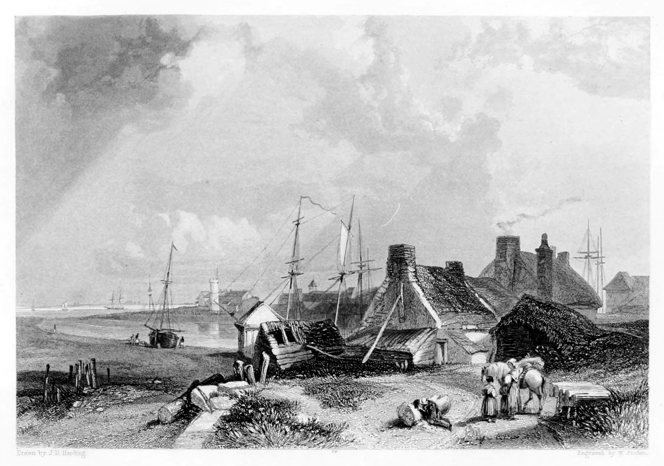
BLYTH.
The view of Blyth, or more properly of the entrance to the harbour, is taken from the north side of the river, and looking towards the south-east. The cottages seen in the foreground are in North Blyth, which consists only of a few houses, chiefly occupied by fishermen and pilots. On the opposite side of the river are seen the lighthouse of stone, and the "basket light" to the left of it, in which lights are exhibited at night when there is eight feet water on the bar.
Blyth, which is a small seaport town on the coast of Northumberland, and about thirteen miles north-east of Newcastle, derives its name from the river Blyth, on the south side of which it is built. The principal trade of Blyth is in coals, of which more than 120,000 tons are now annually exported. The earliest notice of Blyth as a harbour occurs in Bishop Hatfield's Survey in 1346, from which it appears that the Bishop of Durham claimed fourpence for every ship which anchored there, and that the sum received for that year was 3s. 4d. At what time the coal-trade was first established there is uncertain, but so early as 1610 a complaint appears to have been made to Parliament on account of a late imposition of a shilling a chalder levied on coals shipped at Blyth and Sunderland, "not by virtue of any contract or grant, as in the coals of Newcastle, but under the mere pretext of his majesty's royal prerogative." In 1624, Blyth is again mentioned in a proclamation, as a place exporting sea-coals; and in 1643 an order of Parliament prohibits ships from bringing coals or salt from Newcastle or Blyth, as those places were then in the hands of the Royalists.
Within the last forty years the trade of Blyth has much increased in consequence of the opening of new collieries in the neighbourhood. A commodious dry dock was formed in 1811; and there are several slips for the building and repairing of ships. A considerable quantity of articles of cast and malleable iron, manufactured at Bedlington, about three miles up the river, are shipped at Blyth.
Blyth is a member of the port of Newcastle; and a number of vessels belonging to persons residing there are registered at the latter port. Nearly the whole of Blyth is the property of Sir M. Ridley, Bart. At spring tides there is about fourteen feet water on the bar, and about twelve at neaps; but at low water the bar is nearly dry.
It may be interesting to contemplate a few facts and figures in connexion with that trade which forms the principal occupation of Blyth and its neighbouring ports. From the evidence of an experienced coal-engineer,[7] given a few years since before a Parliamentary Committee, we learn, "that the number of persons employed under-ground on the Tyne are—men, 4,937; boys, 3,554; together, 8,491: above-ground—men, 2,745; boys, 718; making 3,463: making the total employed in the mines above and below ground, 11,954, which in round numbers I call 12,000, because I am pretty sure there were some omissions in the returns. On the river Wear, I conceive there are 9,000 employed; making 21,000 employed in digging the coal, and delivering it to the ships on the two rivers. From the best calculations I have been able to make, it would appear that, averaging the coasting-vessels that carry coals at the size of 220 London chaldrons each vessel, there would be 1,400 vessels employed, which would require 15,000 seamen and boys. I have made a summary. There are, seamen, 15,000; pitmen and above-ground people employed at the collieries, 21,000; keel-men, coal-boatmen, casters, and trimmers, 2,000: making the total number employed in what I call the Northern Coal Trade, 38,000. In London, whippers, lightermen, and so forth, 5,000; factors, agents, &c., on the Coal Exchange, 2,500;-7,500 in all, in London. Making the grand total in the North country and London departments of the trade, 45,500. This does not, of course, include the persons employed at the outports in discharging the ships there."
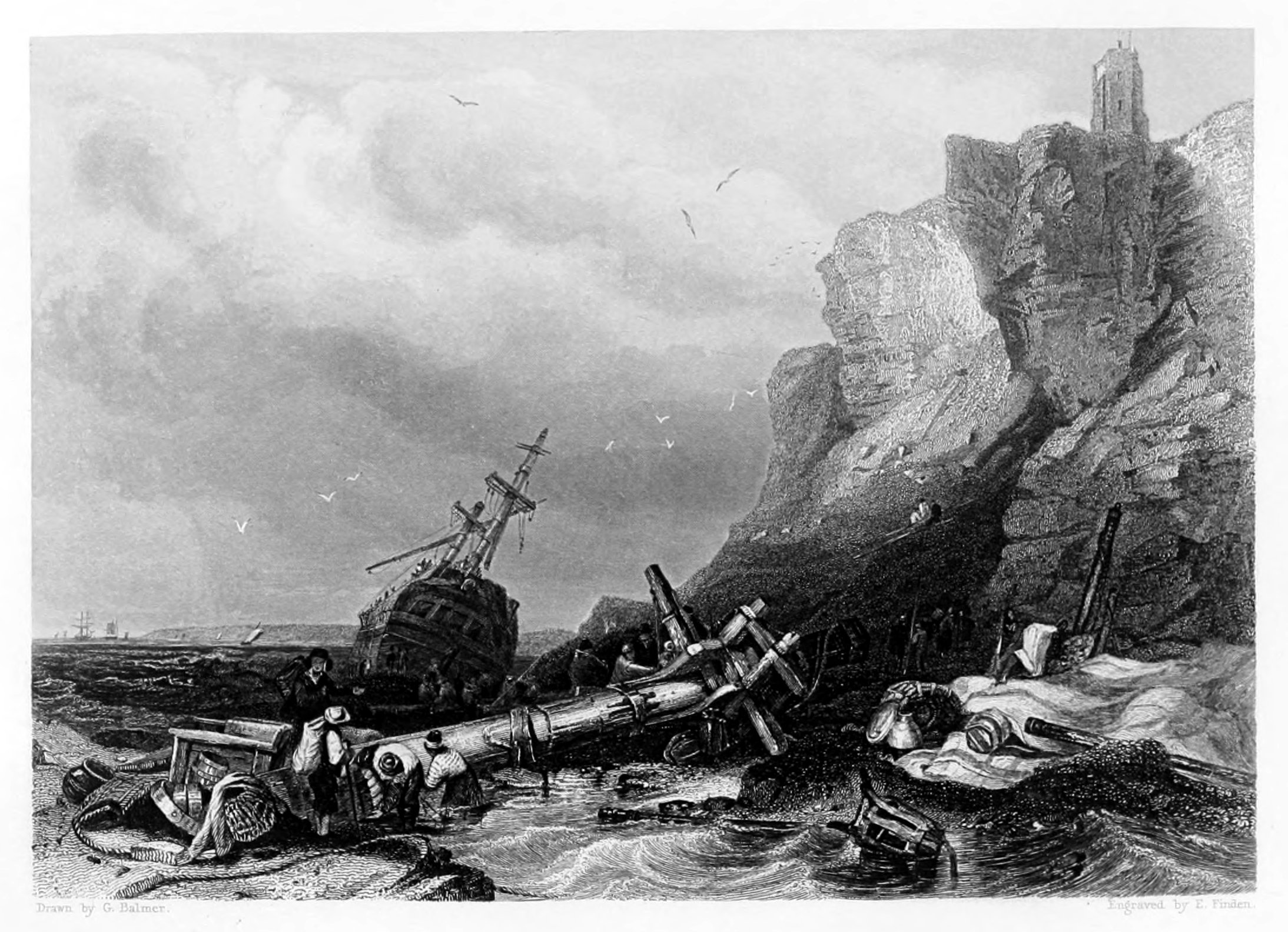
TYNEMOUTH.
VESSEL ON THE ROCKS.
The engraving presents a view of a vessel on the rocks, at the foot of the cliff, to the north-east of Tynemouth castle, as seen from the Ox-fall, in coming from Cullercoat Sands. On the top of the cliff is the lighthouse; in the foreground are various indications of a wreck; towards the middle of the engraving is the vessel "high and dry" upon the rocks; and in the distance, on the left hand, is seen Souter Point, in the county of Durham, about four miles distant from Tynemouth.
The village of Tynemouth, which gives name to an extensive and populous parish, is situated near the mouth of the river Tyne, at the southern extremity of the county of Northumberland. It is a short mile distant from North Shields, about nine miles to the eastward of Newcastle, and two hundred and seventy-six from London. It consists chiefly of one wide street, which runs nearly east and west, with one or two smaller streets to the northward, nearly in the same direction.
The ruins of Tynemouth priory, which, with the adjacent lighthouse, form one of the most conspicuous landmarks on the eastern coast of England, lie to the eastward of the village. The priory is built on a small rocky peninsula, which is bound, from south-west to north-east, by a steep and lofty cliff; and the entrance to this enclosure, which is of about six acres area, is through the gateway underneath the castle. The whole of the enclosed space is fortified according to the rules of modern defensive warfare, and a party of artillery are always stationed at the castle. There is a public walk round the whole of the castle-yard; and the view of the coast, looking either to the north or south, is extremely interesting. From the top of the lighthouse, which stands at a short distance to the north-east of the priory, the Cheviot Hills, on the borders of Scotland, can be plainly seen; and, looking southward, the view extends across the Durham coast as far as Huntcliffe Fort, in Yorkshire; and, in very clear weather, Flamborough Head, which is about seventy-two miles distant, may be perceived.
Although the present castle of Tynemouth, the appearance of which has been considerably altered within the last thirty years, may not be of very great antiquity, yet it is certain that Robert de Mowbray, in 1095, when he entered into a conspiracy to dethrone William Rufus, had a castle at Tynemouth, and that he converted the peninsular area on which it was built into a place of great strength. After a siege of two months, the castle was taken by the king, and the earl escaped to Bamborough. Mowbray, subsequently, being pursued by the king's party, when endeavouring to gain admission into the castle of Newcastle, took sanctuary in Tynemouth church, from which, however, he was dragged by his enemies, and made prisoner.
In 1090, Malcolm III., King of Scotland, and his son Edward, having been slain when besieging Alnwick, were interred at Tynemouth. In 1298, Edward I. visited Tynemouth, and offered a clasp of gold at the shrine of St. Oswald; and, in 1303, his queen resided there while he proceeded into Scotland. In 1381, some monks of St. Albans, who had been engaged in Wat Tyler's insurrection, fled to Tynemouth for refuge on the death of their leader. On the suppression of Tynemouth priory, by Henry VIII., in 1539, the monks were possessed of twenty-seven manors in the county of Northumberland, with various advowsons, impropriations, and other property, both in that county and in Durham. Their annual revenue was valued by Speed at £511 4s. 1½d.; and by Dugdale at £397 10s. 5½d.
The church of Tynemouth priory continued to be used for divine service till about 1659, when, in consequence of its dilapidated state, the foundation of a new church was laid, near to North Shields, on the Newcastle-road. In the reign of Charles II., the lead was stripped off the roof of the old church, by Colonel Edward Villiers, then governor of Tynemouth castle, who also pulled down part of the priory, in order to obtain stones for the erection of a lighthouse and other buildings.
By a grant from Charles II., dated 30th June, 1677, Colonel Villiers, in consideration of building the lighthouse and providing a light, was authorised to demand one shilling from each British, and sixpence from each foreign, vessel entering the Tyne. Since the time of Colonel Villiers, the lighthouse has undergone considerable alterations, and it has also been greatly elevated. Its correct geographical situation is—north latitude, 55° 0' 55"; west longitude, 1° 24' 31". The light, which is a revolving one, is displayed from sunset to sunrise, and may be seen, in clear weather, at the distance of five or six leagues. The light appears in its greatest lustre, like a star of the first magnitude, once a minute; its brilliancy then begins to decline, and at length it becomes totally obscured.
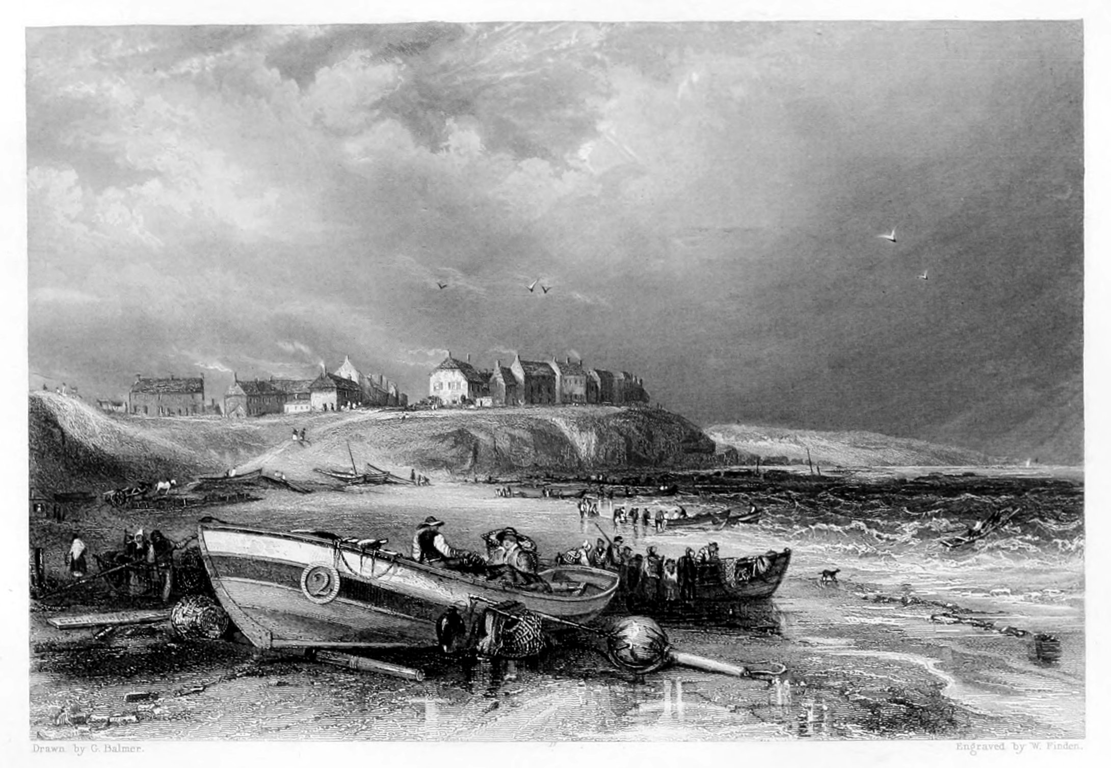
CULLERCOATS.
In the Engraving is given a view of Cullercoats, as seen from the southward. On the sand, in the foreground, is a coble, a light kind of boat, generally employed by the fishermen on the coast of Northumberland; near the coble, to the right, is a dand or buoy, used by the fishermen to mark the place where they have cast their lines or nets. It is formed of an inflated bag of tanned skin, through which a light pole passes, and to which pole the ends forming the openings of the bag are tightly tied with cord. The lower end of the pole is sometimes rendered heavy by lead, so that the dand may float upright, and it has also a loop, or a ring, to which the rope connecting it with the nets or lines is fastened; and a piece of bunting, or coloured cloth, is attached, as a small flag, to the upper end, in order that it may be more perceptible at a distance.
The village of Cullercoats, which lies about a mile to the northward of Tynemouth, is mostly inhabited by fishermen. The duties performed by the wives and daughters of the Cullercoats fishermen are very laborious. They search for the bait—sometimes digging sand-worms in the muddy sand at the mouth of the Coble-dean, at the head of North Shields; gathering muscles on the Scalp, near Clifford's Fort; or seeking limpets and dog-crabs among the rocks near Tynemouth;—and they also assist in baiting the hooks. They carry the fish which are caught in North Shields in large wicker baskets, called creels, and they also sit in the market there to sell them. When fish are scarce, they not unfrequently carry a load on their shoulders, weighing between three or four stone, to Newcastle, which is about ten miles distant from Cullercoats, in the hope of meeting with a better market. The fish principally caught by the fishermen of Cullercoats are codlings, cod, ling, (Gadus molva), halibut, usually called turbot in Northumberland, haddocks, and whitings. Herrings are also taken in the season; and the colesay (Gadus carbonarius), is occasionally caught, but it is a fish which is hardly worth the bait, as it is scarcely saleable at any price. The most valuable sea-fish caught by the fishermen of Cullercoats, is the bret, or turbot of the London market. But this fish, when caught by them, is mostly sold to the bret smacks, by which it is conveyed to London. Gentlemen residing at Cullercoats or Tynemouth during the bathing season, may often obtain excellent sport in fishing for whitings, in fine weather, off the north-eastern end of the Herd Sand. The best time is in the evening, towards high-water; and the best bait is sprats cut into small pieces; it is no extraordinary feat for a party of three, with half a dozen lines, to take twelve or fifteen dozen of whitings in three hours, on a summer's evening.
For the amateur sea-fisher, in the neighbourhood of Tynemouth, there is no bait generally so good when fishing within six or eight miles of the shore, as the small dog-crab, called in the neighbourhood of Shields a pillan. It is known from the common dog-crab by the facility with which its shell may be stripped off; for instance, in breaking the shell round one of its claws, the broken portion may be withdrawn from the member as a glove from the hand; and the shell of the back may also be stripped off in the same manner. From this facility of peeling, it is probable that the crab derives its local name of pillan. Pillan, however, are not plentiful; and when such are not to be got, then sand-worms, muscles, and common dog-crabs are the most likely bait. Codlings and rock-codlings are plentiful a little to the eastward of Tynemouth; but, haddocks and cod, the staple of the Cullercoats fishermen, are not often caught in any great quantity within seven miles of the shore. The young of the colesay, called a hallan, a beautiful little fish, is frequently caught with a rod, from the rocks in the neighbourhood of Tynemouth. The weaver, (Trachinus draco,) or stinging-fish as it is called at Shields, is often caught when fishing off Tynemouth Bar; and strangers, who are unacquainted with the formidable character of this little fish, are sometimes pricked by it when taking it off the hook. The men who are employed in the salmon fishery, at the end of the Herd Sand, have sometimes their bare feet stung by it when hauling their nets. The average length of this fish, as caught at the mouth of the Tyne, is about five inches; though some are occasionally caught there three or four inches longer. The dangerous spines are those of the first dorsal fin; and the best remedy for the wound is to rub it well with sweet oil.
Cullercoats is a kind of land-mark for vessels leaving Shields Harbour; for as soon as the man at the helm can see the village opening behind Tynemouth Cliff, the ship is over the bar.
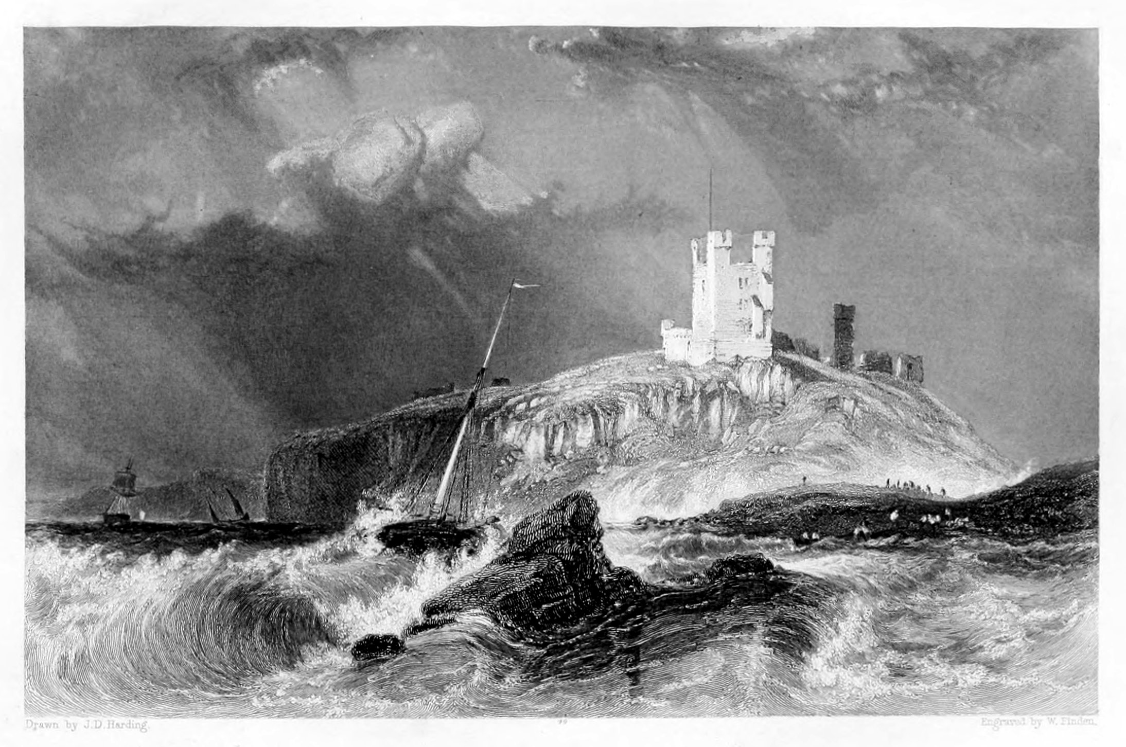
DUNSTANBROUGH CASTLE,
FROM THE EASTWARD.
Dunstanbrough Castle, in the county of Northumberland, is situated about seven miles north-east of Alnwick, and about two miles north by east of Howick, the seat of Earl Grey. Of the keep there are no vestiges remaining; and it is even questionable if it was ever completed. Thomas, Earl of Lancaster, who is generally considered to have been the founder of the present castle, only obtained the king's licence to crenelate, or fortify, his house at Dunstanbrough in 1316: and as he was beheaded at Pontefract in 1321, and in the intermediate years had been much engaged, in the south, in rebellion against Edward II., it is not unlikely that the keep might be unfinished at his decease, and never afterwards finished. Of Dunstanbrough Castle history records little that is interesting. In 1464 it was held, after the battle of Hexham, for Henry VI., by Sir Peter de Bressy, and a party of Frenchmen; but was taken, after a vigorous defence, by Ralph Lord Ogle, Edmund and Richard de Craster, John Manners, and Gilbert de Errington, all Northumbrians, and partisans of Edward IV. From this period the castle, which was dismantled by the victors, is never mentioned in the history of the county as the scene of any memorable event. It was in the possession of the crown in the 10th of Elizabeth, but was granted by James I. to Sir William Grey, afterwards Lord Grey of Wark. It is now the property of the Earl of Tankerville, whose ancestor, Charles Lord Ossulston, became possessed of it in 1701, through his marriage with the daughter and heiress of Lord Grey, Earl of Tankerville, son of Lord Grey of Wark.
In the present engraving a view is presented of the principal remaining tower of Dunstanbrough Castle, as seen from the sea at the distance of about a mile; and whoever has seen it at that distance in a blustering day, towards the latter end of October, will immediately acknowledge the fidelity of the artist's delineation. Though the Abbess of Whitby and her nuns, in their fabled voyage to Holy Island, passed the place in summer, and in fine weather, yet they seem to have been near enough to be sensible of the danger of too close an approach to its "wave-worn steep;" for Sir Walter Scott, in Marmion, Canto II., relates that,—
The contemplation of Dunstanbrough Castle, like that of many similar edifices, the ruins of which still frown upon the promontories and headlands of our coast, cannot but awaken feelings little favourable to what are frequently called the "good old times." If we may compare what our ancestors have left with what the present generation is exerting itself to accomplish, antiquity has little to boast of. Our forefathers crowned the cliffs of the land with strongholds, bristling with lofty towers and warlike battlements, nominally for their own defence from the incursions of foreign foes, but too often diverted into engines of tyranny and oppression to their fellow-citizens. The shipwrecked mariner of those days had often more to dread than to hope for in the approach to such beacons as Dunstanbrough; and if unhappily thrown upon the mercy of its owners, they were only too ready to seize upon what the waves had spared, and deem that in permitting him to depart unharmed, they had done all that could be expected from them. In our days, we no longer erect castles on our coasts; we rather stud them with lighthouses, and thus mark out the track of safety, not only for the ships of our own nation, but confer equal benefits upon those of every other maritime power. We no longer pour down upon the distressed seamen with armed bands, whose only aim is plunder; but we rush to the beach, and with life-boats constructed in the best manner, and manned by the bravest and most skilful of our countrymen, we hasten to succour and to save those whom the elements are threatening to destroy. Of a truth, the ruins of these fortresses of old might instil a spirit of thankfulness in the minds of many of those who profess to admire the days which are gone, and render them grateful that their lot has been cast in happier times.
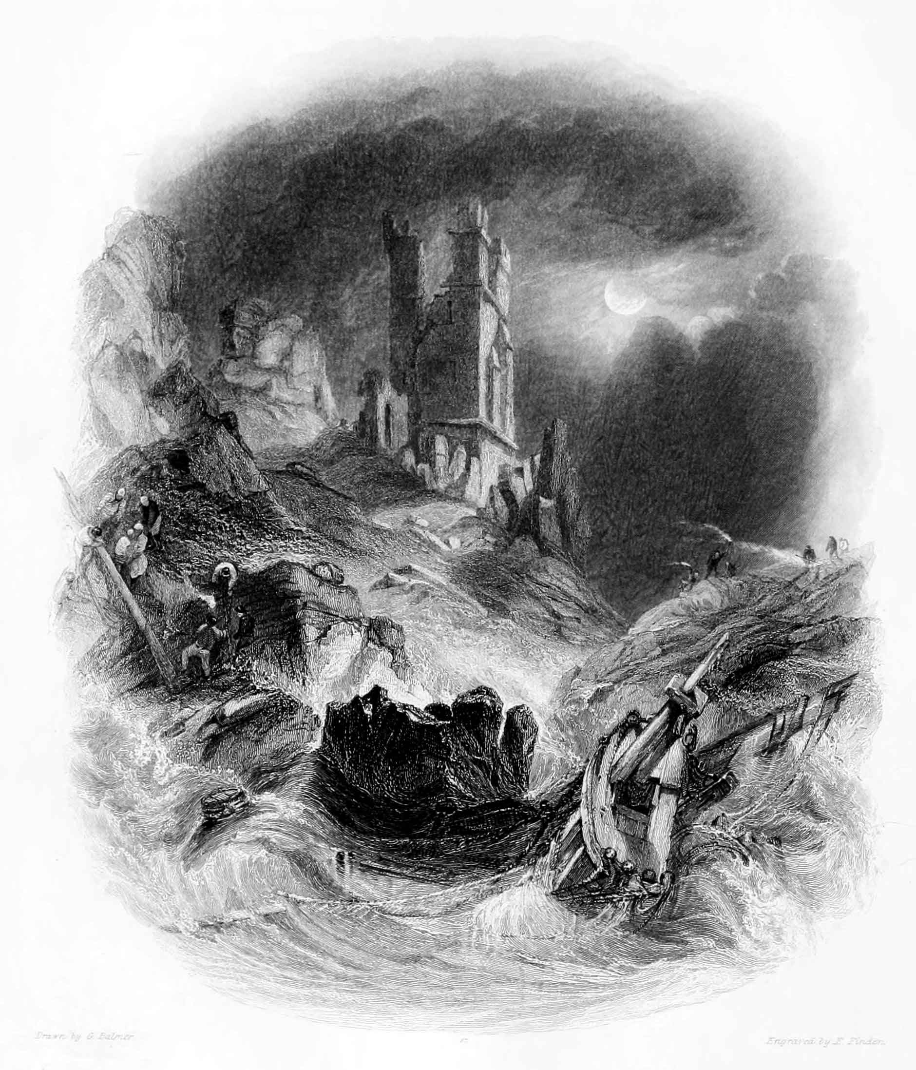
DUNSTANBROUGH CASTLE.
MOONLIGHT.
In the vignette engraving of Dunstanbrough by moonlight, the incident of a wreck coming ashore among the rocks at the foot of the castle is introduced with striking effect. The masts of the vessel are seen dashing against the rocks. To the left are fishermen assisting such of the crew as have escaped to ascend the cliff; while to the right are seen people with torches from the adjacent country hastening towards the scene of destruction. The moon appears as if "wading"[8] through the clouds, and the old tower—itself the wreck of time—appropriately occupies the centre of the view.
"On the brink of the cliff, to the sea," says a writer, describing Dunstanbrough Castle, "appear the remains of a very strong wall; indeed it is probable the whole area was originally so enclosed. The heavy seas which break upon the rocks of the north-west point have torn them much, and it appears as if the area had been originally of greater extent than at present, many separate columns of rock standing near the cliffs, which, some ages ago, may have been joined to the mainland.... Immediately below this tower" [that which is seen in the engraving] "is a gully or passage, of perpendicular sides, formed in the rocks, about sixty yards in length, and forty feet deep, where the sea makes a dreadful inset, breaking into foam with a tremendous noise: the spray occasioned thereby is driven within the Castle walls. This place is called by the country people the Rumble Churn[9]." It is to this chasm that Sir Walter Scott alludes when he speaks of "Dunstanbrough's caverned shore," in the popular poem of Marmion.
In the neighbourhood of Dunstanbrough there is a legendary tale yet current, though no longer at its ancient value, of a knight who, many centuries ago, discovered a place of enchantment in the vaults of the castle, but who, failing to break the spell, through inattention to certain mysterious instructions given to him, was doomed to seek for ever amid the ruins for the entrance to the enchanted apartment. Mr. G. Lewis, in the Tales of Wonder, has versified this story under the title of "Sir Guy, the Seeker," adding to it certain embellishments of his own, and among other matters, introducing a description of the Rumble Churn.
The principal parts of Dunstanbrough Castle at present standing are the outer walls to the south and west, with the tower overlooking the sea, and a gateway towards the south, defended by two circular towers. The area inclosed by the walls and the cliff is about nine acres. It is under cultivation; and in the additions to Camden, it is said to have produced in one year two hundred and forty bushels of corn, besides several loads of hay.
Howick House, the seat of Earl Grey, is situated in the vicinity of Dunstanbrough. It is a noble mansion, built in 1787 from designs by Paine; and is surrounded by a beautiful park, watered by two streams which unite in the grounds. Near the eastern side of the park are the remains of a Roman encampment, where numerous coins and antiquities have been found. The family of Grey is ancient in Northumberland; and first obtained the peerage in the reign of Edward IV. It is observable that the Greys of this district bear the same heraldic distinction as the Grey family in Scotland, and are both probably descended from the same stock,—one of the martial followers of the Norman conqueror.
Alnwick Castle, about seven miles from Dunstanbrough, is the residence of the Duke of Northumberland: it is an immense pile covering nearly five acres of ground; and built upon an elevated spot on the southern side of the river Aln.
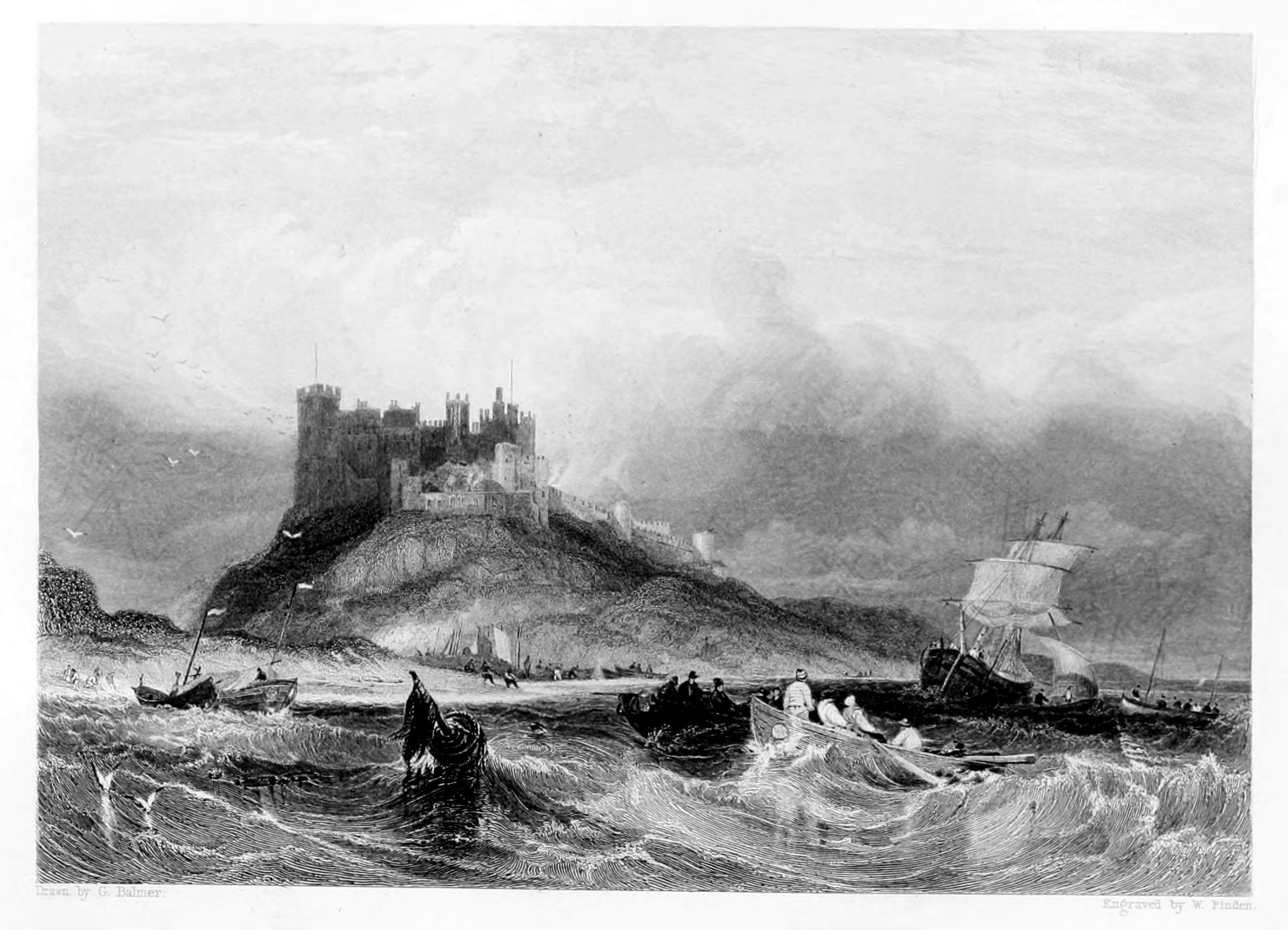
BAMBROUGH CASTLE.
FROM THE SOUTH-EAST.
Sir Walter Scott, in his description of the voyage of the abbess of Whitby and her nuns to Holy Island, in the second canto of Marmion, thus speaks of them as noticing Bambrough Castle:
The view which Balmer, with his usual effect, has given of Bambrough Castle from the south-east, is that which the reverend mother and her five fair nuns might be supposed to contemplate on entering the channel between the Great Farn Island and the mainland, and when about half a mile from the shore. The stranded vessel, however, must not be supposed to be of the age of Henry VIII., when the abbess made her voyage; for she is evidently a light collier of the present day, whose captain, probably, in running for Skate Roads in a strong south-east gale, had stood too close in shore in passing through the Fareway, and laid her snugly up on Bambrough Sands. The Holy Island fishing-boats that are seen—for no fishermen dwell at the village of Bambrough—would seem to indicate that their owners expect a job in assisting to get her off.
These hardy and industrious men follow an occupation in which the hazards and dangers are but poorly recompensed by their gains; and the sums they occasionally obtain from the owners of colliers and other coasting vessels, form rich prizes in the humble lottery of their life. Having in our remarks on "Bambrough, from the north-west," described the principal features of this sea-girt fortress, we cannot better employ the present page than in a notice of the fishery which is carried on in its vicinity. The boats principally used for this purpose are called cobles, and their fishing ground is from eight to sixteen miles from the shore. In winter, however, they do not venture so far out as in summer, but usually shoot their lines between six and ten miles from the shore. There are usually three men to a coble. When the wind is not favourable and they cannot set their sail, they use their oars; the two men seated nearest the head of the boat row each a single large oar, while the man on the thwart nearest the stern rows a pair of smaller size. The fish are not caught, as on some parts of the south-western coast of England, by hand-lines, which are suspended over the side of the boat, and pulled up when the fisherman feels that he has a bite. The mode of proceeding is to make fast a number of lines together, and shoot them across the tide; and after they have lain extended at the bottom of the sea for several hours—usually during the time of a tide's ebbing or flowing, that is about six hours—they are hauled in. While the lines are shot, one man keeps a look-out, and the other two usually wrap themselves in the sail, and go to sleep in the bottom of the coble. Each man has three lines, and each line is from 200 to 240 fathoms long. The hooks, of which there are from 240 to 300 to each line, are tied, or whipped, as the fishermen term it, to lengths of twisted horse-hair called snoods; each snood is about two feet and a half long, and they are fastened to the line at about five feet apart. Each man's lines, when baited, are regularly coiled upon an oval piece of wicker work, something like the bottom of a clothes-basket, called by the Yorkshire fishermen a skep, at Hartlepool, in the county of Durham, the same thing is called a rip. In this mode of fishing the hooks are all baited, generally by the fishermen's wives and children, before the coble proceeds to sea. The lines when shot are all fastened together; and when each is 240 fathoms long, the length of the whole is nearly two miles and a half. There is an anchor and a buoy at the first end of the line, and the same at the end of each man's set of lines. There are thus four anchors and four buoys to each coble's entire line. The buoys at the extremities of the line are usually formed of tanned dog-skin, inflated in the manner of a bladder, and having a slight pole, like the handle of a mop, passing through them, to the top of which a small flag is attached to render them more conspicuous. The intermediate buoys are generally made of cork. The anchors for sinking and holding the lines are mostly large stones; as an iron anchor, with arms like a ship's, is liable to get fast among the rocks at the bottom of the sea, and be lost in consequence of the buoy rope being too weak to force it loose.
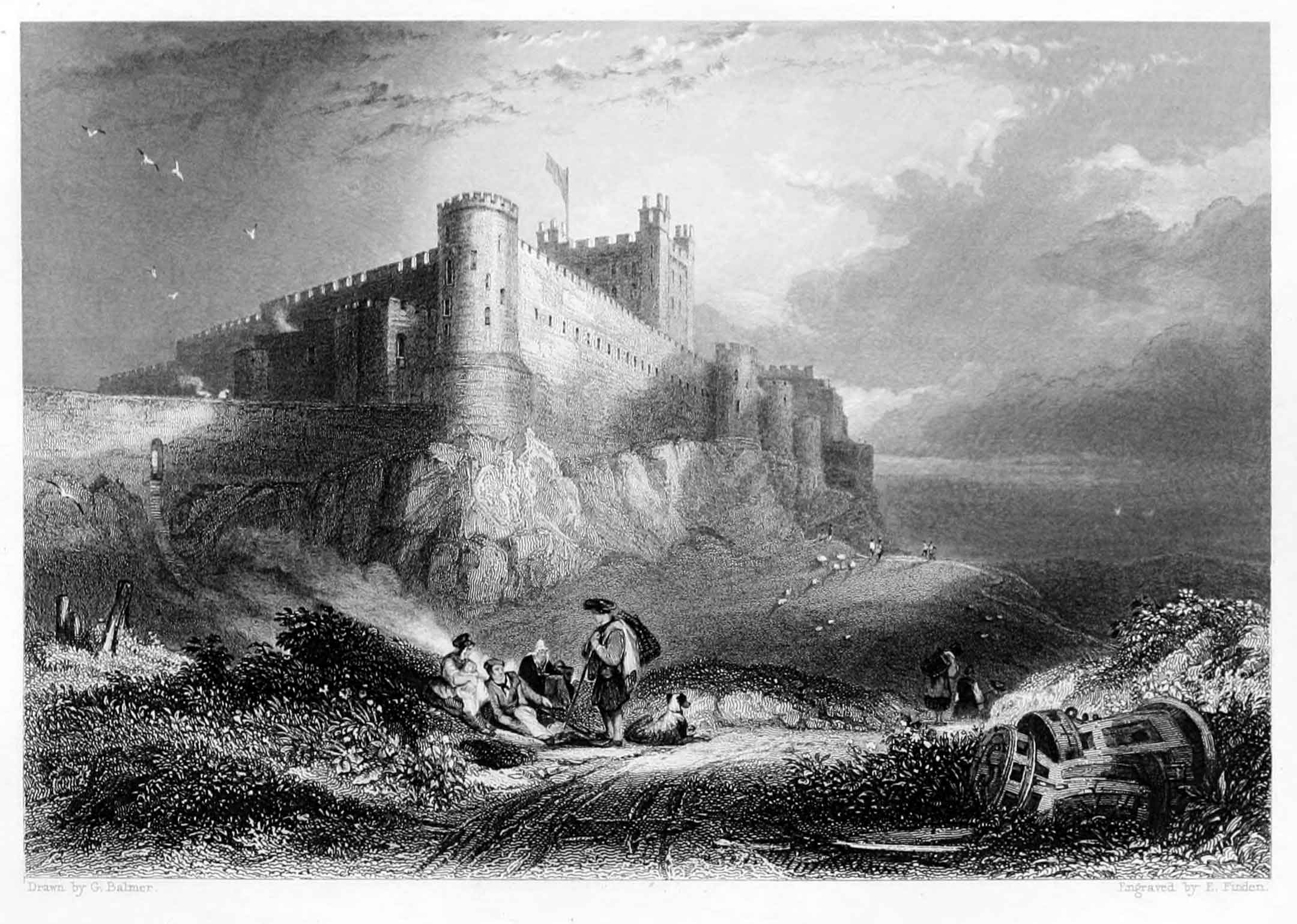
BAMBROUGH CASTLE.
Bambrough, which is now a small village, was a place of considerable importance during the Saxon period. King Ida, who ascended the throne of Bernicia in 559, first built a castle there, which he is said to have named Bebban-burgh in honour of his queen Bebba. It has been conjectured by Wallis in his History of Northumberland, that the Keep or great tower, is of Roman origin; but Grose, with greater probability, considers it to have been built by the Normans. In 1095 Robert Mowbray, Earl of Northumberland, having rebelled against William Rufus, retired to Bambrough Castle, whither he was followed by Henry, the King's brother, and closely besieged. After the siege had continued some time, Mowbray left the castle in the charge of his kinsman Morel, who continued to defend it with great bravery. The Earl being afterwards seized at Tynemouth, where he had taken sanctuary, Henry caused him to be brought to Bambrough, and there showing him before the walls of the castle, he threatened to put out his eyes if it were not immediately delivered up—a proceeding which caused Morel to surrender the place forthwith.
From the reign of William Rufus till about the middle of the fifteenth century, Bambrough Castle, as if it were a place too important to be in the hands of a subject, appears to have continued in the possession of the crown, by whom a governor was appointed. In the frequent contests between the houses of York and Lancaster, it sustained great damage; and as it was not repaired either by Henry VII. or his successor, it ceased about the beginning of the sixteenth century to be a fortress of importance. In 1575 Sir John Foster, warden of the Middle Marches was governor of Bambrough Castle; and one of his descendants received a grant of the old building from James I. It continued in the possession of this family till the commencement of the reign of George I., when it was forfeited through the treason of Thomas Foster, Esq., M.P. for Northumberland, better known as General Foster, who in 1715 took up arms in favour of the Pretender.
The Manor and Castle of Bambrough were afterwards purchased of the crown, by Nathaniel, Lord Crewe, Bishop of Durham, who was married to Foster's aunt. Lord Crewe, at his decease in 1720, left the above property, with other valuable estates, to trustees to be applied to charitable uses. In compliance with the intentions of the testator, a noble charity is established at Bambrough for the succour of shipwrecked seamen, the education of children, and the relief of indigent persons. In 1757 part of the Keep being ready to fall down, the Rev. Thomas Sharp, Archdeacon of Northumberland, and one of Lord Crewe's trustees, caused it to be repaired, "merely because it had been a sea-mark for ages, and as such beneficial to the public." The Rev. Thomas Sharp being succeeded in the trusteeship, as well as in the archdeaconry, by his son, the Rev. John Sharp, D.D., the latter, who was also perpetual curate of Bambrough, continued to make further repairs; and he also caused an immense quantity of sand, which he had accumulated in the castle-yard, to be cleared away. To this gentleman, who was a brother of the amiable Granville Sharp, the present arrangements of the charity are chiefly owing. At the castle, blocks and tackles, anchors, cables, warps, and other articles are kept for the use of stranded vessels. In stormy weather, two men patrol the coast for eight miles, day and night, in order to look out for vessels in distress, and during a fog a bell is rung at intervals from the castle, and a gun fired every quarter of an hour, as a warning to such ships as may be near the coast. Flour and groceries are sold to poor families at a reduced rate, and twenty poor girls are boarded and educated within the castle.
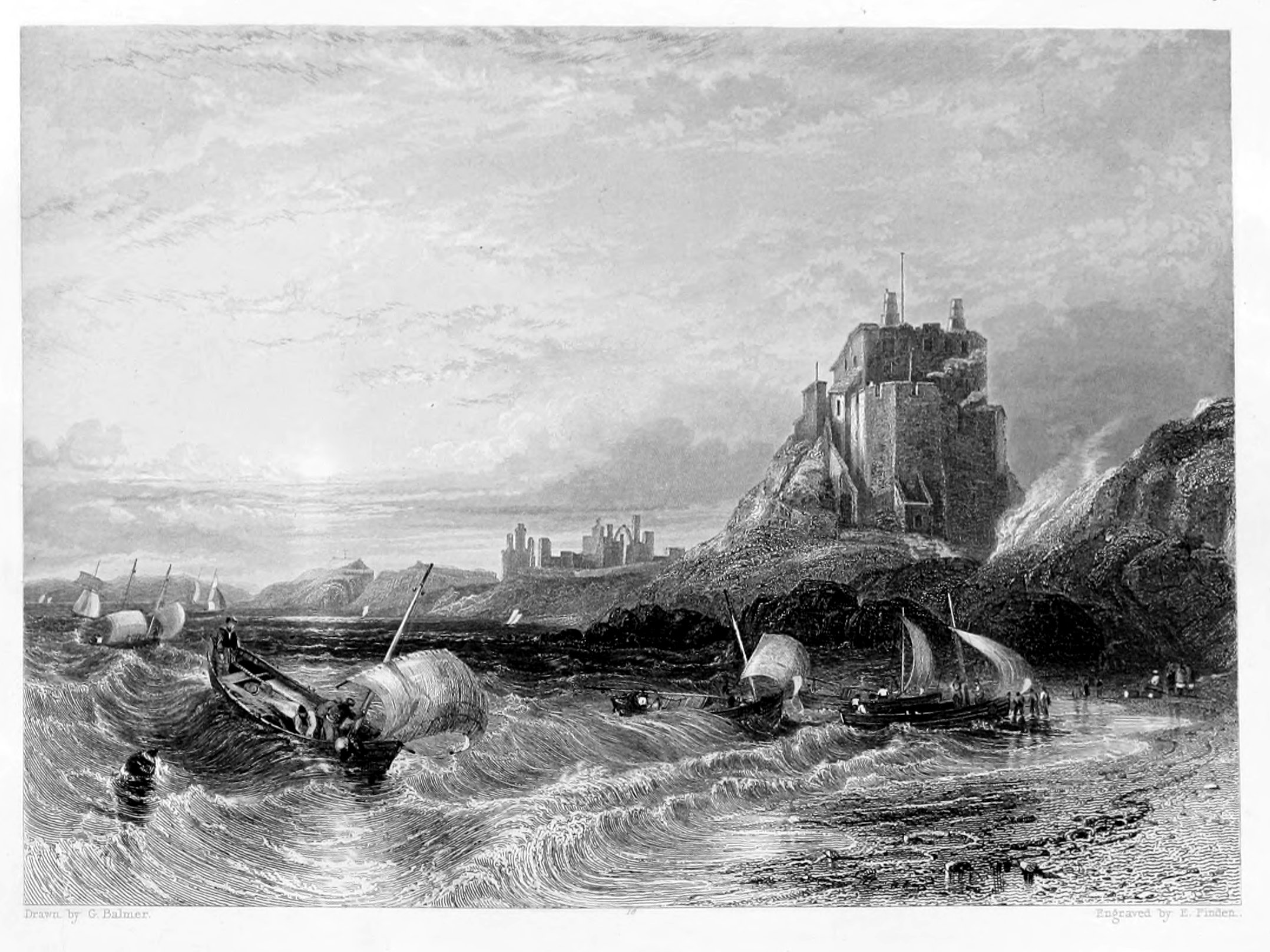
CASTLE OF HOLY ISLAND, AND LINDISFARN ABBEY
In the present engraving the view is taken from the eastward on entering the harbour. To the right is the castle; beyond which, towards the centre of the view, are seen the ruins of the abbey. The setting sun sheds a warm, yet mellow light, over land and sea; and as evening is approaching, and the breeze freshening with the flood tide—for it is evident from the inward swell that the tide is flowing—the fishermen are seen making for the shore. The boats bound merrily before the wind, and
The painter when he made his sketch must have thoroughly felt the beauty of the scene, and been touched with the influence of the hour:—
and inspirest poets to sing, and artists to paint the charms of eve's sweet hour in words and colours that never die—for once felt and communicated, they become impressed on the heart and soul of man, and live and bloom there for ever.
Holy Island, which is about two miles and a half long, and about two miles broad, lies off the Northumberland coast. On the south it is separated from the mainland by a deep channel about a mile broad. To the north-west it is connected with the mainland by a sand, which is dry at low water, and by which carts and passengers can pass to and from the island. Speed says that the Britons named it "Inis Medicante, for that, in manner of an island, it twice every day suffreth an extraordinarie inundation and overflowing of the ocean, which, returning unto her watery habitation, twice likewise makes it continent to the land, and laies the shoare bare againe, as before." It was called Lindisfarn by the Saxons; and in after times, from the celebrity of its monastery, and the holy men who had lived there, it acquired the name of Holy Island.
About 635, a church, of wood and thatched with reeds, was first built in Lindisfarn, by Aidan, a Scottish monk from the Isle of Iona, who exercised the office of bishop in Northumberland. It was afterwards built of stone, and gave title to a bishop, until the see was removed to Durham in 995. The monastery continued as a cell, dependent on Durham, till it was suppressed by Henry VIII. A considerable part of the old church, with circular arches in what is termed the Saxon style, is yet standing, and forms, with the adjacent ruins, a most picturesque object. The village, or as it is usually called "the town," lies at a short distance to the northward of the ruins of the monastery, and is chiefly inhabited by fishermen, about two-thirds of whom are also licensed by the Trinity-house at Newcastle to act as pilots for their own harbour and the adjacent coast.
The fishery for cod, ling, and haddock is usually carried on in cobles. These boats are very generally employed in the coast fishery from the Tweed to the Humber. They are sharp and wedge-shaped at the bow, but flat-bottomed towards the stern. They have only one mast, stepped close forward, on which a lug sail is set. They are excellent sea boats, and, for their size, carry a large sail. The usual length of a Holy Island coble is from twenty-five to twenty-seven feet, of which there are about sixty belonging to the island. A great quantity of the fish thus caught is sent to London in smacks, employed by fishmongers or salesmen there, who annually contract with the fishermen to pay them so much per score for all the fish sent during the season. From December to April many lobsters are caught off Holy Island, nearly the whole of which are sent to London.
For the herring-fishery, boats of a larger size are employed. They are from thirty to thirty-six feet long, about eleven feet broad, and from four and a half to five feet deep. They carry two lug sails, and have no deck. The herring-fishery commences off Holy Island about the 20th of July, and usually terminates early in September. Many herrings are caught in the Fare-way, between the Farn islands and the main-land; but the principal fishery for them is generally a little to the southward of the Staples, a cluster of small islands which lie from two to three miles to the eastward of the Farns. Most of the herrings caught by the Holy Island fishermen are taken to Berwick to be cured, and are thence chiefly exported to London, Hull, and Newcastle.
On the beach to the westward of the island, the fossils called St. Cuthbert's beads—the entrochi of naturalists—are found. They are also to be observed in the cliff to the north-east. A rock which lies at a short distance from the south-west point of the island is called St. Cuthbert's rock, where in former times superstition feigned that the saint was wont to sit and
This article of popular credulity has, however, been long exploded, and the fisherman when he hears the stones rattle on the beach from the force of the waves, no longer imagines that the sound proceeds from the saint's hammer.
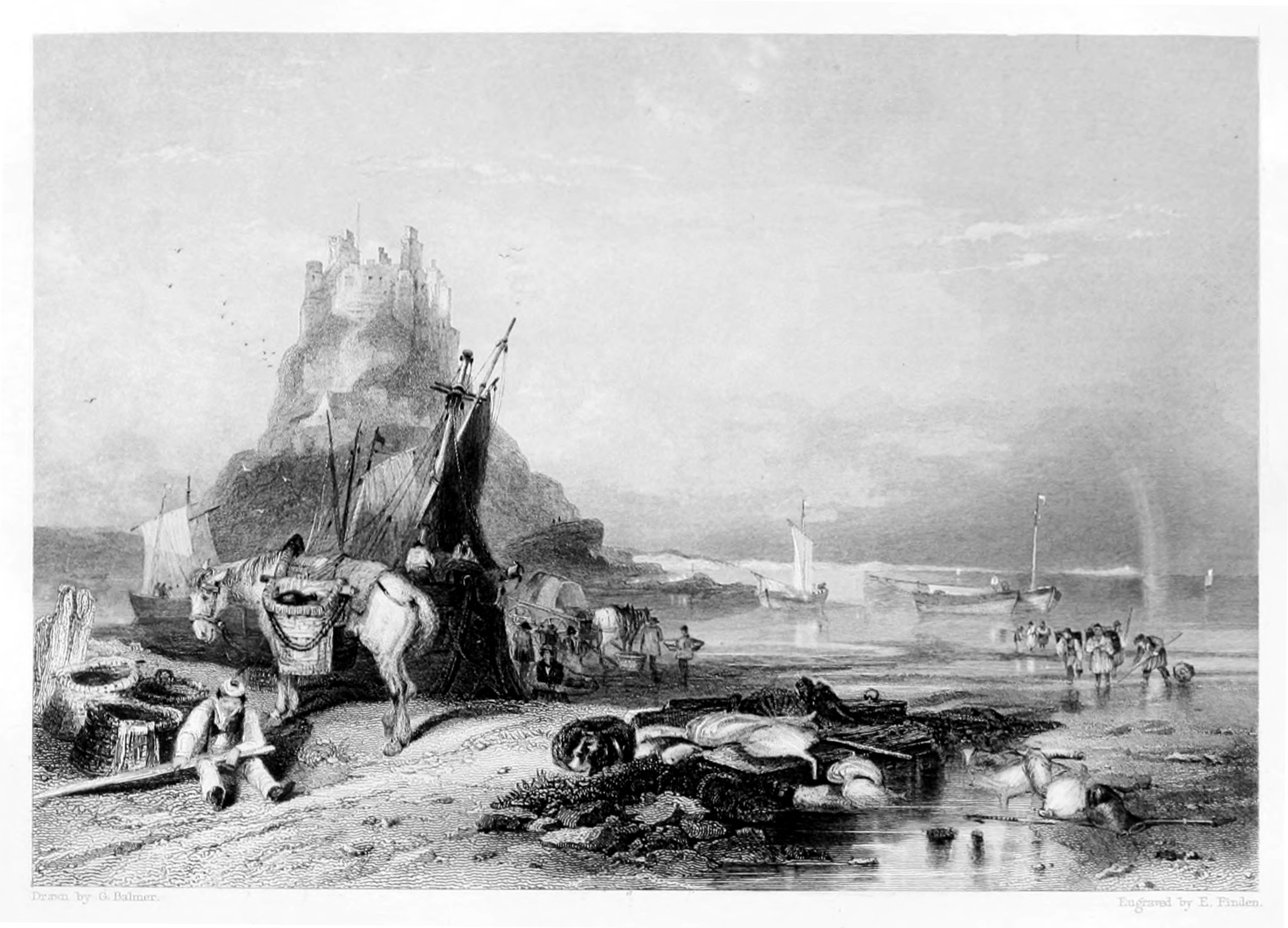
CASTLE OF HOLY ISLAND.
FROM THE WESTWARD.
The Castle of Holy Island stands on a steep rock, about half a mile to the eastward of the Abbey. It is wholly inaccessible, except by a winding pass cut through the rock on the south side. The date of its foundation is unknown; but it is supposed to have been first built by the monks, as a place of refuge against the piratical attacks of the Danes, who frequently annoyed them, and twice burnt their abbey. The most memorable event in the meagre history of this castle is its capture for the Pretender, by two men, Launcelot Errington, and his nephew Mark, in 1715. The garrison at that time consisted of a sergeant, a corporal, and ten or twelve men. Errington, who was master of a little vessel then lying in the harbour, invited the sergeant, and such of his men as were not on duty, to drink with him on board of his ship. The invitation being accepted, he plied them so well with brandy as to render them incapable of opposition. Framing an excuse for going ashore, he proceeded to the castle with his nephew, and succeeded in turning out the old gunner, the corporal, and two soldiers, being all that were on duty. He then shut the gates, and hoisted the Pretender's colours, but being disappointed in the succour which he expected, and a party of the king's troops arriving from Berwick, he and his nephew made their escape over the castle walls, and endeavoured to conceal themselves among the rocks and sea-weed, to the south-eastward of the castle till it was dark, when they intended to swim to the mainland. In consequence of the rising of the tide, they were obliged to swim while it was yet light, and, being perceived by the soldiers, they were taken, and conveyed to Berwick gaol, from which, however, they broke out before they were brought to trial, and escaped to France. On the suppression of the rebellion they took the benefit of the general pardon, and returned to England.
Holy Island is of an irregular form. Its greatest length, including a low sandy point, which stretches out towards the west-north-west, is about two and a half miles. Its mean breadth does not exceed a mile and a half.
Holy Island harbour is a small bay or haven on the south side of the island, between the castle and the ruins of the monastery. On the bar, which is about a mile distant from the town, there is about nine feet at low water at spring-tides. The flood then sets with a strong current in the channel between the island and the mainland; and at high-water there is twenty-four feet on the bar. There is no lighthouse on Holy Island, but there is a beacon on the "Heugh"—a hill between the town and the harbour—on which, in bad weather, when pilots cannot get off, a flag is hoisted during the time of tide that ships may safely enter. In gales of wind from the eastward, coasting vessels sometimes seek shelter in Holy Island harbour, and find good anchorage before the town in three fathoms at low-water.
The Staples and Farn islands, with the rocks and shoals between them and Holy Island, render the in-shore navigation of the coast of Northumberland, from North Sunderland point to the mouth of the Tweed, extremely intricate and hazardous; and the corporation of the Trinity House, London, caution all masters of ships, and especially strangers to the coast, not to attempt sailing within those islands and shoals; more particularly on account of the various settings of the rapid tide which runs in the different sounds between the islands.
A visit to the Farn and Staple islands, from Bambrough or Holy Island, forms a pleasant excursion in fine weather, more especially when the eider ducks are sitting, which is from about the middle of May to the latter end of July. These birds, which are seldom seen, and do not breed to the southward of the Farn islands, are also known in the neighbourhood by the name of St. Cuthbert's ducks. Their eggs, and the fine down with which they line their nests, are collected and sold by the person who rents the islands, which are also the haunt of several other species of water-fowl, such as the sheldrake, the cormorant, and the shag, with auks, guillemots, terns, and gulls. Solan geese also visit the Farn islands, but do not breed there, commonly making their appearance early in spring, and departing before May.
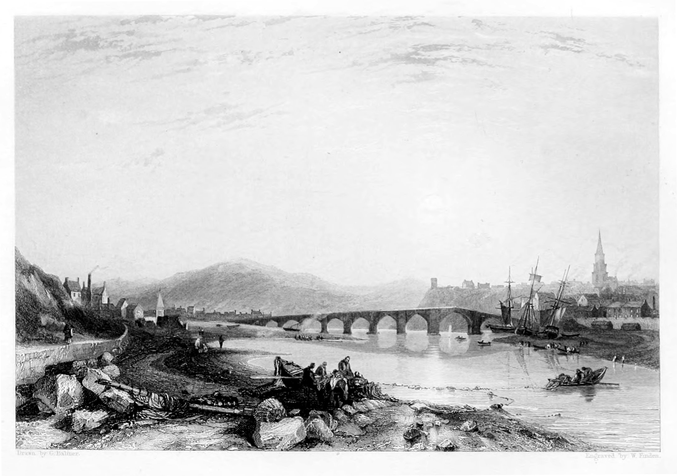
BERWICK.
FROM THE SOUTH-EAST.
The view of Berwick from the south-east is taken from the Tweedmouth shore, at low-water, about a quarter of a mile below the bridge. In the foreground is a group of salmon-fishers on the shore examining the produce of their last haul, while two others in a coble are shooting the net. To the left are seen the chapel and some of the houses of Tweedmouth; to the right a few ships are perceived lying on the shore near Berwick quay, where the smacks usually take in, and discharge, their cargoes. The spire which towers above the houses, like the steeple of a church, is that of the town-hall. As Berwick church, which stands towards the north side of the town, is without a steeple, it would seem that the inhabitants had determined to make amends for the deficiency by giving their town-hall a steeple like a church.
The town of Berwick stands on the north side of the Tweed, by which it is separated from the county of Northumberland, and about half a mile from the mouth of that river. It is 336 miles north by west from London, and 54 south by east from Edinburgh. As a great part of the town is built on a declivity, which slopes down towards the river, and as most of the houses are covered with red tiles, the view that is first obtained of it, in approaching from the south, on a clear bright day, is very striking, though not very grand. It is almost the only town on the Scottish side of the Tweed in which the houses are so covered; in all the others the houses being, for the most part, roofed with slate.
Chalmers, in his Caledonia, vol. ii, p. 217, speaking of Berwick, says, "this place, lying at the mouth of the Tweed, on a dubious frontier, has an origin obscure, undignified, and recent." That its origin, like the origin of most other towns in Great Britain, is obscure, may be admitted; but the term "recent" can scarcely be applied with propriety to a town which was of such consequence in the reign of David I. as to be appointed one of the "Four Boroughs,"[10] which, by their Commissioners, met annually at Haddington, where, under the presidency of the King's Chamberlain, they formed a Court of Appeal from the jurisdiction of other boroughs, and exercised an authority in commercial affairs. As nothing is positively known respecting the origin of Berwick, it is impossible that an uninspired antiquary should be able to decide whether it was "undignified" or not. Its first "kirk and mill"—the primary conditions of a town—were more likely to be founded by a noble than by a serf.
In 1174, Berwick, with the castles of Jedburgh, Roxburgh, Stirling, and Edinburgh, was delivered up to Henry II. as security for payment of the ransom of William the Lion, King of Scotland, who had been taken prisoner when besieging Alnwick; and it remained in the possession of England until 1189, when Richard I. restored it with the other castles to William for the sum of 10,000 marks. In 1216, Berwick was plundered and burnt by King John, but in a short time was rebuilt by the Scots, in whose uninterrupted possession it continued until 1296, when it was taken by Edward I. at the commencement of the Scottish war of independence, which was first waged by Wallace, and afterwards by Bruce, against Edward and his successor; who, laying claim to the sovereignty of Scotland, endeavoured to reduce that country to a state of vassalage, and to compel her kings to do homage to England for their crown. From this war may be dated that jealous and hostile feeling with which the two countries continued to regard each other for nearly three centuries afterwards, and was only modified in the reign of Elizabeth—when there was a prospect of a Scottish king succeeding to the English throne, and when open warfare was succeeded by political intrigue—but which was not wholly extinct at the Union of the two kingdoms in 1707.
In 1484, it was agreed on, by commissioners appointed by the two kingdoms, that the debatable ground in the neighbourhood of Berwick should remain without culture, buildings, or inhabitants; and by a treaty, concluded at Norham, 10th June, 1551, between Edward VI. and Mary Queen of Scots, Berwick was declared to be a free town, independent of both kingdoms. Notwithstanding this declaration, Berwick continued subject to English authority, and, during the reigns of Mary and Elizabeth, was garrisoned with English soldiers. At the Union of the two kingdoms in 1707, Berwick, as a salvo to national pride, was considered as a separate and independent territory; and it is to this cause that, in Public Acts and Forms of Prayer, the "Town of Berwick-upon-Tweed" is especially mentioned.
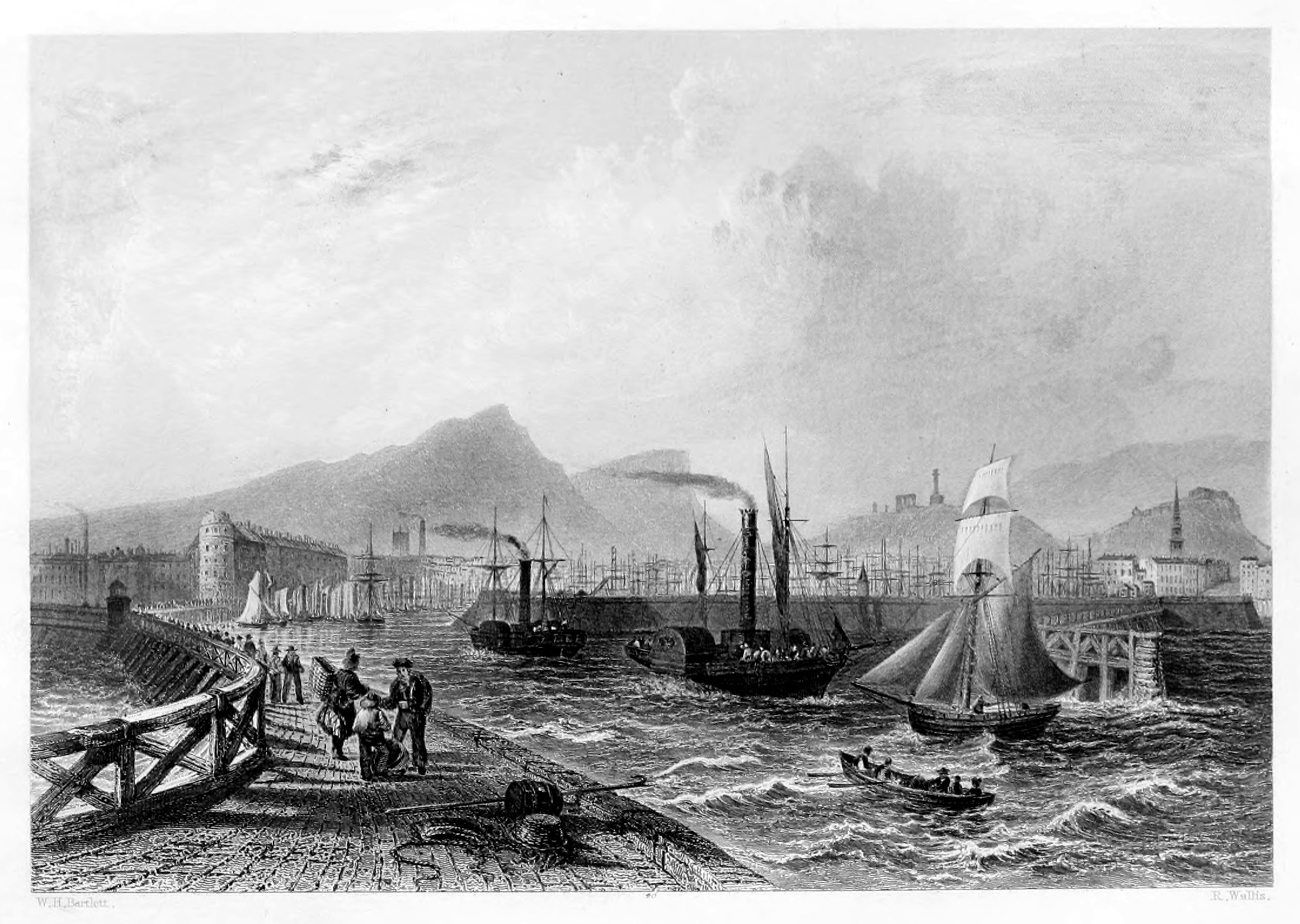
LEITH.
This view is taken from the pier, with Edinburgh, the Castle, the Calton-hill, Salisbury-crags, and Arthur's-seat in the background.
Leith, which performs nearly the same important services to the "Modern Athens" as the "Piræus" did to the Ancient, has long served as the port and harbour of Edinburgh, to the prosperity of which, as well as to that of the whole country, it has greatly contributed. As early as the beginning of the fourteenth century the citizens of Edinburgh received from King Robert I. a grant of the harbour of Leith; but, owing to the resistance of a powerful family, to whose interests it was prejudicial, the royal grant was of little or no value to the city. As soon, however, as the difference was adjusted, and the corporation of Edinburgh had obtained undisturbed possession of the harbour, symptoms of mercantile prosperity became visible. But as this prosperity was confined to the corporation, the inhabitants of Leith were naturally incensed at the monopoly; they felt themselves debarred from the natural advantages, profits, and employments of their maritime position, and daily beheld the wealth which flowed into their port transferred to the hands of those who were neither resident nor proprietors in the place. In 1555 a strong effort was made by the inhabitants of Leith to throw off their humiliating dependence. With this object in view they petitioned the Queen Regent of Scotland, Mary of Lorraine, for the royal sanction and assistance; and succeeded as far as to get Leith erected into a burgh of barony, a preparatory step to its being raised to the independence of a burgh royal. From this epoch, however, having obtained letters patent, empowering the inhabitants to elect magistrates, and charters for erecting divers of their trades and arts into corporations, Leith acquired the name and distinction of a town. By these charters the people were divided into four classes, each of which became an incorporated body, known as the shipmasters, the traffickers or merchants, the maltmen, and the trades' companions; the last of which possesses exclusive privileges.
The port and harbour of Leith have always been an object of paramount interest to the country at large, and, from time to time, various plans for their improvement and extension have been carried into effect. There are now two dry-docks for building and repairing vessels—a branch of the craft which is here brought into extensive operation—and two wet-docks, each three hundred feet wide by upwards of seven hundred feet long, and occupying, with their appurtenances, a space of about three hundred acres. On these important works upwards of two hundred and fifty thousand pounds have been expended. The basins are enclosed by well-constructed quays and capacious warehouses for the reception of merchandise. The Custom-house, the Exchange, the Trinity-house, the Bank, the Court-house, the Baths, the Grammar-school, &c., are all elegant buildings, designed with classic taste, and of modern erection.
Leith enjoys an extensive commerce with the Baltic, the northern parts of Europe, Holland, France, Spain, Portugal, the Mediterranean, North America, and the West Indies; besides a widely ramified coasting-trade, and a share in the whale and herring-fisheries. The Leith smacks have been famous for their safety and swift-sailing properties; and the powerful steam-ships, which now maintain an almost daily intercourse with London, are proverbial for their speed and accommodation.
The growing prosperity of Leith is fully evinced by the number of trading vessels in its port, the mercantile business carried on in every street, the crowded warehouses and ships, its rope-works, canvas manufactories, sugar-refining-houses, breweries, distilleries, soap-works, iron-foundries, glass-works, and other establishments of local industry. But the tide of prosperity, it is said, is prevented from reaching its height by the corporation of Edinburgh, who, by increasing the rate and number of the port-dues of Leith, have caused various branches of commerce to seek encouragement in Kirkcaldy, Dundee, Aberdeen, and other places.
The depth of water in the harbour of Leith is stated at only sixteen feet at spring-tides, and ten feet at neap-tides; so that very large vessels cannot enter the port; but at a mile from the mouth of the harbour there is excellent anchorage in what is called Leith Roads. The fort, garrisoned by the royal artillery, is a place of great strength.
The municipal government of Leith is vested in a provost, four baillies, a treasurer, and ten common-councillors, and, in connexion with Portobello and Musselburgh, returns one member to Parliament.
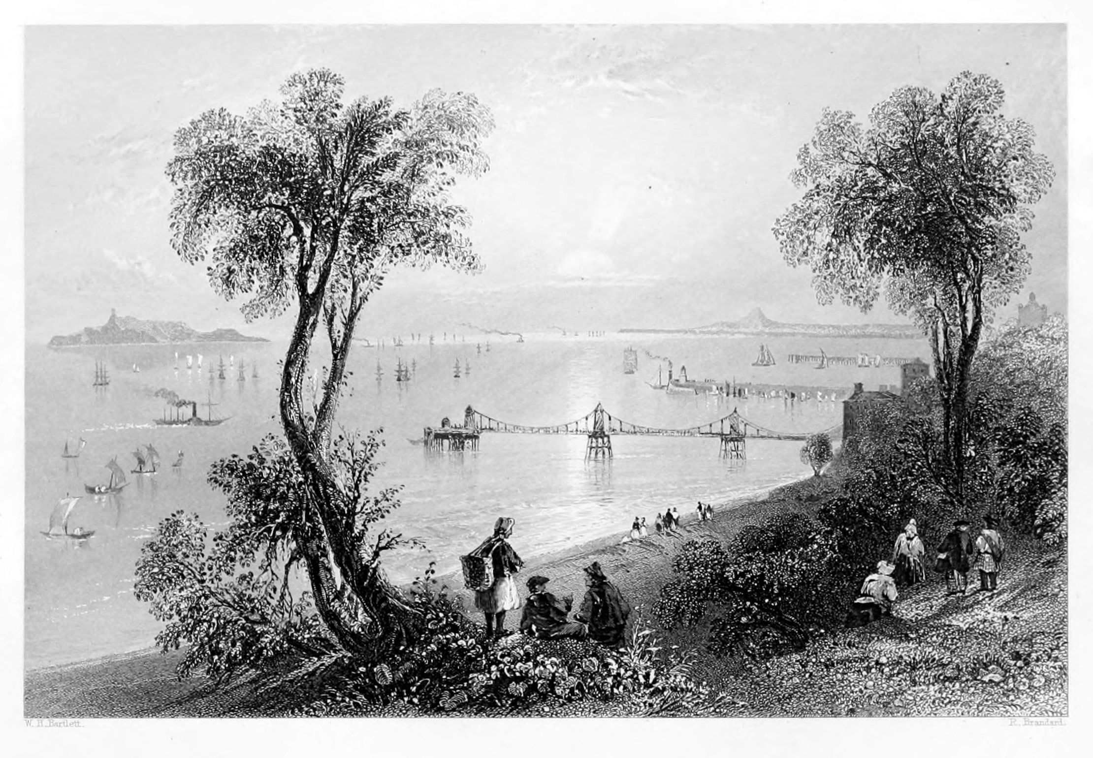
NEWHAVEN.
Newhaven derives its name and origin from James the Fourth, the most accomplished monarch of his day: here he created a yard for shipbuilding, a harbour for the reception of vessels, and a chapel dedicated to the Virgin Mary and Saint James. The superior advantages which the new harbour possessed in depth of water was sufficient to give it a decided superiority over Leith, from which it is only a mile distant; but, as this result was easily foreseen, measures were promptly adopted for its prevention, and the people of Edinburgh—to whom the prosperity of Leith was of vital importance—succeeded in purchasing the town and harbour, with all rights and privileges thereto belonging. Thus the rising importance of Newhaven was completely checked, and its rival trade restored to Leith.
The great natural advantages of Newhaven as a harbour, however, were not lost sight of; and in recent times the subject was once more revived by the city of Edinburgh, and arrangements for its improvement unanimously agreed to. A pier and harbour have been erected, beautiful in design and substantial in execution, affording abundant accommodation and shelter for the large steam-vessels and other craft frequenting this part of the coast, and to which the depth of water affords for the most part, an easy entrance or exit, at all states of the tide.
To the westward of Newhaven is the elegant chain-pier, erected for the special accommodation of steam-vessels; and along the coast, and the intervening space between that and the city, numerous villas, cottages, and gardens, contribute great beauty and animation to the scenery, which is here peculiarly rich and variegated. On the opposite shore of Fife is seen the picturesque village of Aberdour, with its feudal keep and richly-wooded declivities. Half-way across the frith stands the venerable ruins of Inchcomb, the ancient Æmonia, one of the earliest monastic establishments in the kingdom, and the subject of many a pious and monastic legend. On the south the bulwarks of Edinburgh Castle, the blending structures of the "new city and the old," the Calton-hill, with its Acropolis-like finish of monumental splendour, Salisbury Crags and Arthur's Seat, refresh the eye and fill the mind with such striking combinations of nature and art, as are nowhere to be met with but in the precincts of the Scottish "Athens."
Although the establishment of a harbour has operated greatly to the advantage of Newhaven, by giving additional value to every rood of ground in its vicinity, it has not materially interfered with the internal economy of the village, which retains most of those ancient characteristics which for ages has given its inhabitants an isolated position in the community. A stranger cannot enter it without being struck by the singularity of everything around him—men, women, children, the fish-"creel" and the fishy cabin make their appeal to his senses in a manner not to be misunderstood. The remotest village in the Alps has not been left by the "march of improvement" more decidedly in the back-ground than that of the fish-dealing denizens of Newhaven.
These fish-wives of Newhaven dress themselves in a manner which, however coarse or homely in appearance, is not uncostly. They are unable to wear any head-dress except a napkin, on account of the necessity of supporting their burden by a broad belt which crosses the forehead, and must be slipt over the head every time they take off their merchandise. They usually wear, however, a voluminous and truly Flemish quantity of petticoats, and several fine napkins enclosing the neck and bosom. Their numerous petticoats are of different qualities and colours, as in the Netherlands; and it is customary, while two or three of these are allowed to hang down to the ancles, to have as many more bundled up over the haunches, so as to give a singularly bulky and sturdy appearance to the wearer. Thirty years ago, the poissardes of Newhaven wore neither shoes nor stockings; but in this particular they have at last yielded to the force of example, and clothed their nethermost extremities in comfortable worsted stockings and neat's-hide. Along with the fishermen occupying the village of Fisherrow, those of Newhaven supply the fresh fish consumed in Edinburgh and Leith; while their wives, sisters, and daughters carry them to market, or hawk them about the streets in baskets. They generally ask, like their sisters in the Courgain of Calais, three times the value, but their customers, aware of this propensity, have little difficulty in reducing the "upset price" to the estimate of the buyer.
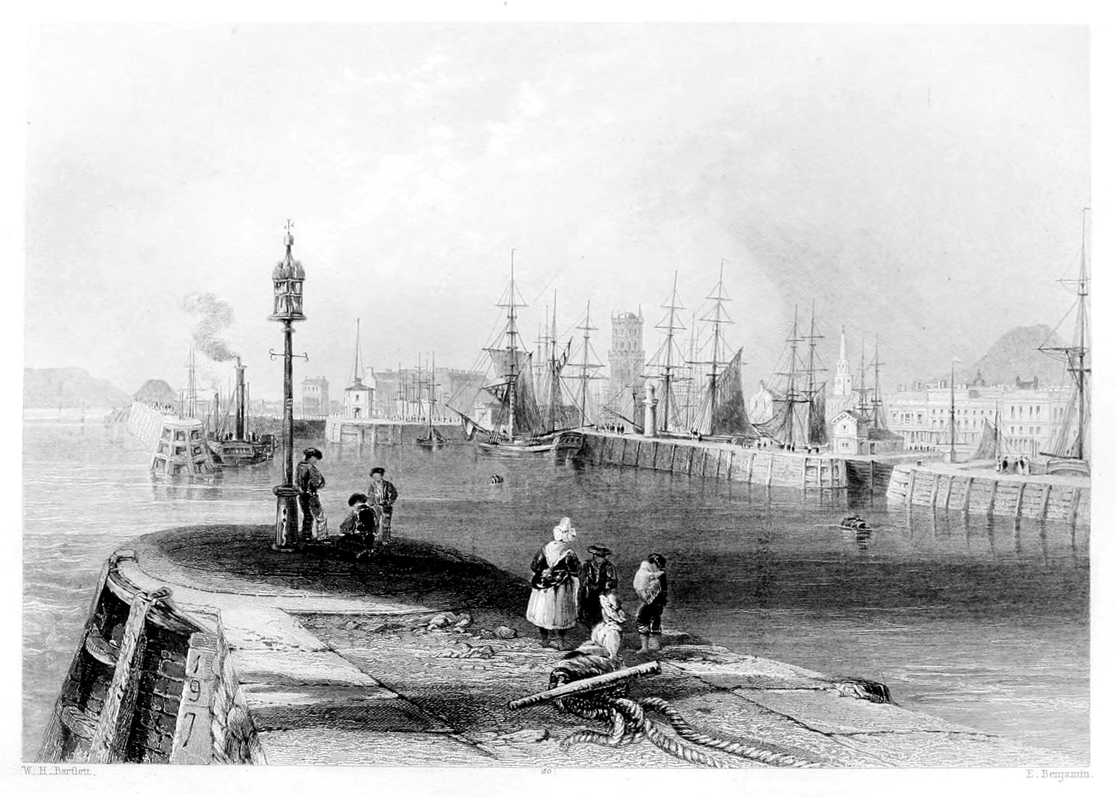
DUNDEE.
ENTRANCE TO THE PORT.
Highly favoured by nature in point of situation, Dundee has enjoyed, from the remotest period of our national history, many facilities for the encouragement of trade. But it is only in more recent times that she has risen to that eminence which now places her among the first-rate commercial towns of the empire. That laudable spirit of enterprise which has encircled the whole island with new or improved ports and harbours, has operated most beneficially for those of Dundee; where, within the last twenty or thirty years, almost every improvement which either science could suggest or wealth accomplish has been carried into effect.
On the return of peace in 1815, the first great impulse was given to the manufactures and commerce of Dundee, by the renovation and extension of the harbour. Prior to that epoch, the accommodation provided for shipping was adapted to the most limited commerce only. One small pier and two or three clumsy erections in a state of dilapidation, and which it required a boat to reach, constituted the sole protection afforded to the shipping, and the only convenience for discharging or loading. Although the spirit of enlightened enterprise had been at work for several years, it was only at this late period that application was made to Parliament, and a bill obtained for separating the harbour from the other branches of the common good, and for investing the management of it for a term of years in district commissioners, who were selected partly from the magistrates, and partly from the public bodies of the town. Great pains were taken to procure the best plans; and after all preliminaries had been settled, the work was begun and carried on with such extraordinary activity, that, although everything was finished in the most substantial manner, all was accomplished within the time specified. The plan comprised the new harbour, consisting of a wet-dock of about six acres; a tide-harbour of much greater extent; a graving-dock, capable of containing three of the largest merchant-vessels frequenting the Tay; extensive carpenters' and other yards for ship-building; wide and capacious quays, affording berthage for about thirty vessels to load or discharge at the same time. From the first moment that measures were taken to ensure this superior accommodation, the number and tonnage of the ships were increased by their owners, and the trade and commerce of the port most materially improved. The expenditure incurred by these great public works, though amounting, from 1815 to 1833, to £242,000, or upwards, was judiciously (says our Statistical authority) applied, and with great advantage both to the private trust and to the public at large.
When the plan for the new harbour was adopted in 1815, it was considered to be so extensive, especially when compared with what preceded it, that it was generally believed that the accommodation it promised would exceed the necessities of the trade of Dundee for many years; but this was so far from the fact, that some years ago the want of sufficient berthage became so much a subject of complaint, that measures were taken as soon as possible to remedy the evil. A new harbour-bill was applied for, and obtained, vesting the shore-dues permanently in a board of trustees. A plan was adopted for extending the tide-harbour, and for converting the greater part of it into a wet-dock, and for other improvements, rendered necessary by the rapidly increasing trade and commerce of the town, all of which have been completed.
In population, trade, and manufactures, as above stated, Dundee has advanced faster perhaps than any town so situated in the United Kingdom. There are men now living who remember when its population was less than one-fifth of what it now is; and when its harbour was a crooked wall, affording shelter to only a few fishing or smuggling-craft; when its spinning-mills were things unknown and unthought of; and when its trade was hardly deserving of the name.[11]
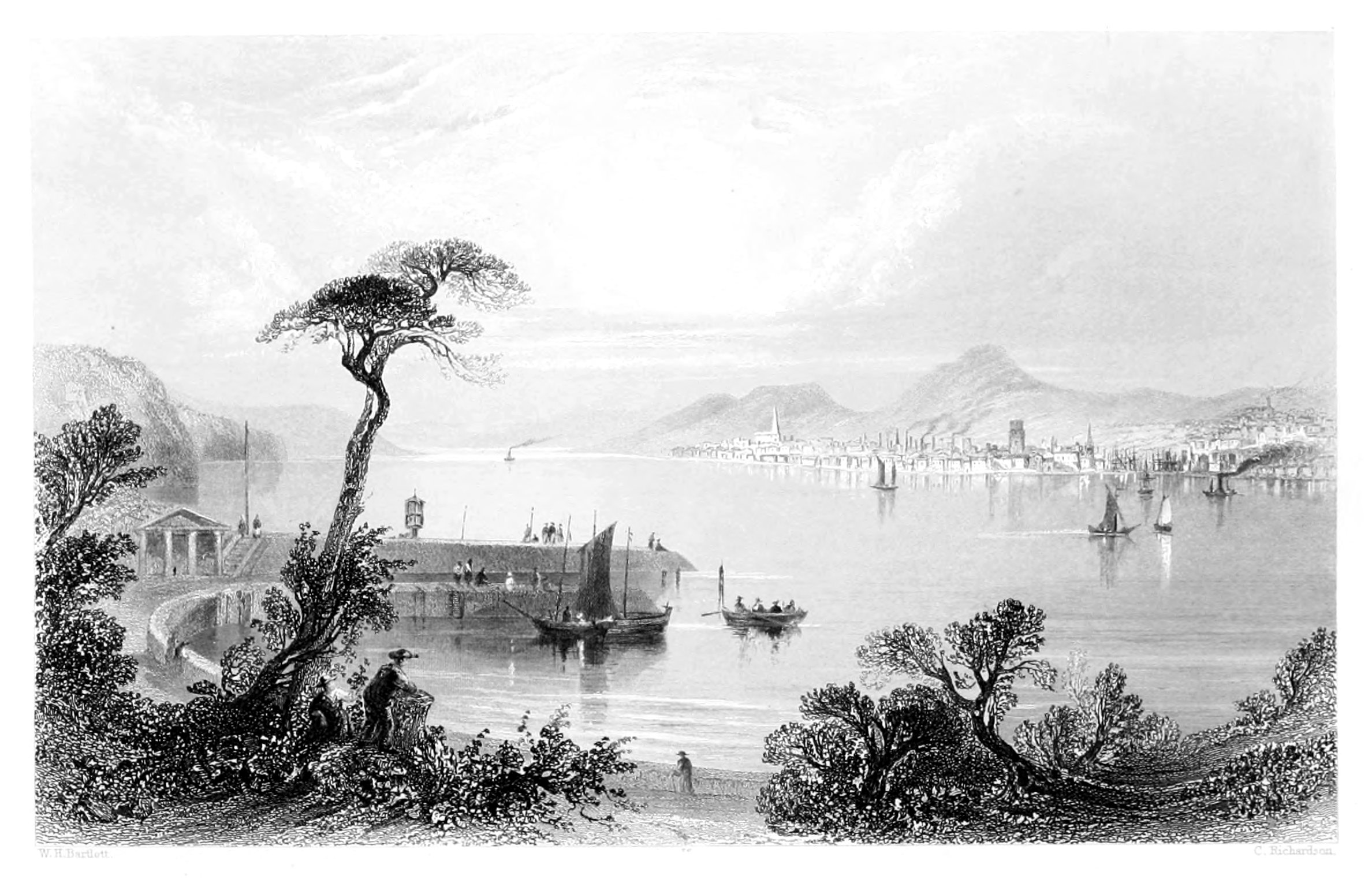
DUNDEE.
FROM THE OPPOSITE SIDE OF THE TAY.
Our present engraving depicts a scene of great natural beauty, and a faithful picture of one of the most thriving of the Scottish seaports. Few towns in the United Kingdom have advanced so rapidly in commercial importance. The manufactures of Dundee have become of great interest not only to the town, but to the nation at large. The proportion which they bear to the general produce of the industry of the state is very high; and their rapid and continued progress holds out the most encouraging prospect of still greater accessions in every department of trade. Of these manufactures, the linen trade holds the first place; it employs the greatest number of hands and the greatest capital, and gives a stimulus to all other branches of trade and commerce. The materials for this branch of manufacture are imported from Russia, Prussia, Holland, and Brabant, and thus employ a great number of ships and seamen. Up to the beginning of the present century, all the linen yarns manufactured here were hand-spun; and in 1811 there were only four spinning-mills driven by steam: at the present time there are upwards of 100 flax spinning-mills, employing more than 8,000 hands, of whom nearly one half are females. The following figures exhibit the progressive increase of this trade:—The importation of flax in 1790 was 2,700 tons; in 1850, 55,000 tons. The export of linen in 1790 was 8 millions of yards; in 1850, 85 millions of yards. The yarns thus manufactured are generally sent from the mills direct to the bleach-fields, or to the wash-mill, where they are scoured or whitened, and prepared for the loom. In weaving sail-cloth, and other heavy goods, men only are employed; but, in the lighter fabrics, women perform the work as well as the men. Formerly, the women were employed in spinning only; but here, as everywhere else, where steam is employed, the introduction of machinery has wholly superseded the use of the domestic wheel and distaff, and compelled the females to earn a scanty subsistence in a much less appropriate labour.
Within the last thirty years the population of Dundee has been more than doubled; its charitable contributions have risen from under £2,000 to nearly £12,000 per annum; its shipping has increased fourfold; while its linen trade has been called almost entirely into existence. But the reverse of the picture must not be concealed—the assessment of the poor has advanced tenfold; in 1791, it was £400, it is now upwards of £10,000. This is an evil, it has been said, inseparable from prosperous communities, for the poor generally flock to, or are increased in them; and where multitudes are gathered together at various employments, example does not always favour economy, industry, and virtue. Nor is it easy, amidst the spirit of enterprise which is now abroad, to suggest any improvement for the town which the resident authorities have not already in contemplation.
Full tide in the estuary of the Tay is generally said to occur, on the days of the new and full moon, at a quarter past two o'clock, but in the harbour of Dundee it flows till about half-past two. The average height of the spring-tides, as measured by an index at the entrance to King William's Dock, is about seventeen feet, while that of the neap-tides is about eleven feet. The water opposite the town, though saline, is not wholly marine, but considerably diluted by the fresh water flowing down the river; and this is the reason, probably, why sea-water insects never attack the piles, buoys, or beacons about the harbour. Opposite the town, the river Tay is very nearly two miles broad. The channel across is much interrupted by a sand-bank, which, though formed within the last forty years, has now at full spring-tides only about ten feet water over its surface, and at neap-tides scarcely more than four. Its position is not far from midway across; its form is spindle-shaped; its length, as seen at low water, upwards of a mile; and its course parallel with that of the river. At present, its lower or eastern extremity is stretching down in the form of a curve, concave towards the harbour of Dundee; but it is so constantly altering its features, that no further remark need be made upon it than this, that it is always accumulating, and slowly moving down the river. This sand-bank, in reference to the navigation of the Tay, is naturally an object of no small interest and solicitude.
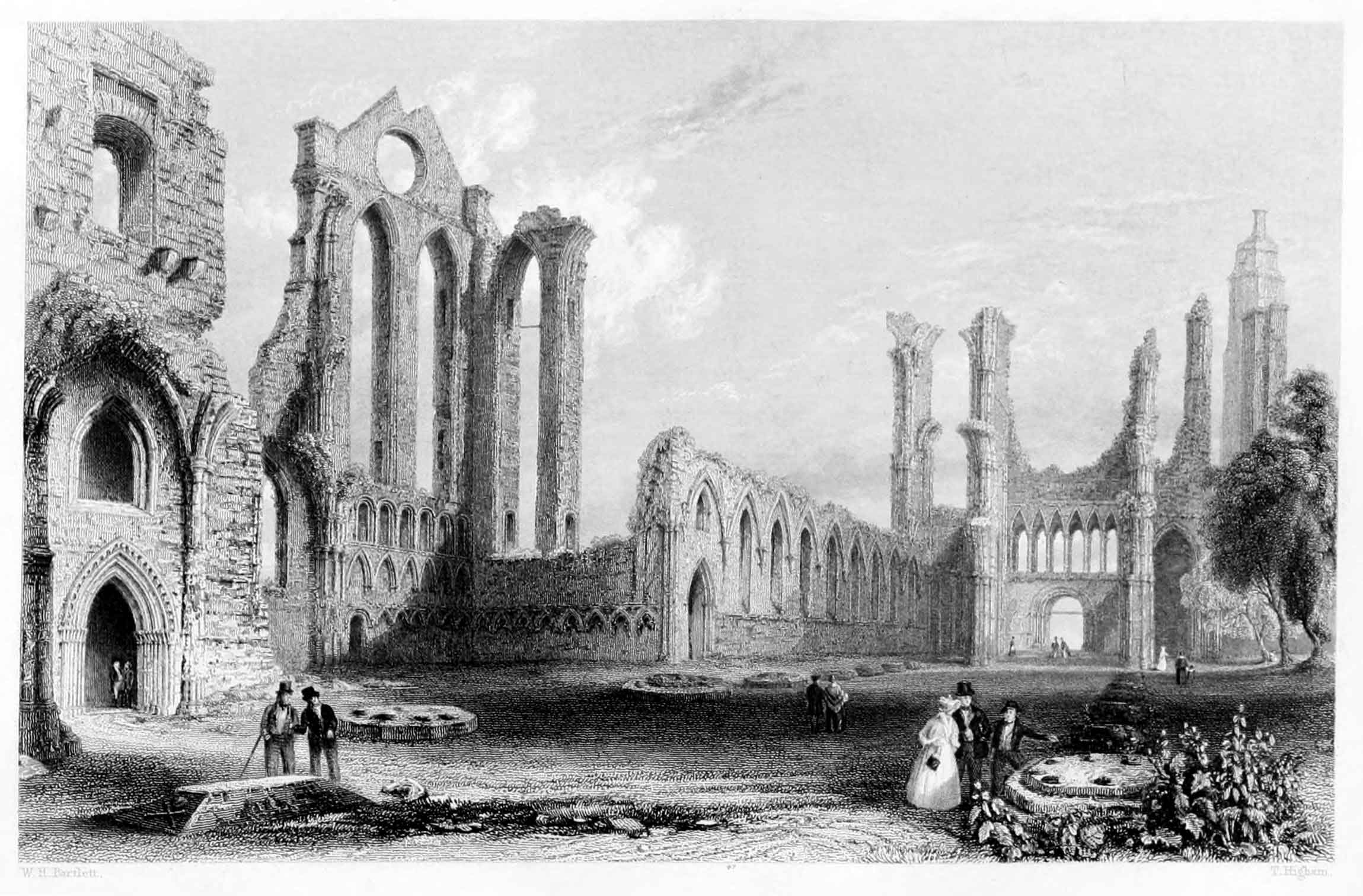
THE ABBEY OF ARBROATH.
The Harbour, which was originally at the end of the East Causeway, was formed about the remote period of 1194; but being ill-constructed for the craft and increasing traffic of more modern times, a brief or bill was obtained for building a new pier in 1725, and which is situated a little to the westward of the old one. It is strongly built of stone, and, though not capacious, is sufficiently commodious to admit of vessels lying close to any part of it, either to receive or discharge their cargoes. During spring-tides there is a depth of from fifteen to sixteen feet of water at the entrance, and at neap-tides of from nine to ten feet; but it is dry at low water. Here, as in most of the other ports of this coast, there is a considerable foreign trade carried on with Russia, Norway, and Sweden, as well as a home-trade in lime, coals, and agricultural produce. The trade at this port is now so rapidly increasing, that great improvements in the harbour are contemplated. It counts seventy-seven vessels of its own, registering 6700 tons.
Near the south side of the harbour of Arbroath is a handsome signal-tower fifty feet high, which is used for communicating with the keepers of the Bell Rock Lighthouse. On a clear day this gigantic column may be seen rising from the sea at the distance of about twelve miles. The Bell Rock, so long known and celebrated in history, tradition, and poetry as the "Inchcape," is thus described by an ancient chronicler: "By east the Castle of May twelve miles from all land, in the German Sea, lies a great hidden rock called Inchcape, very dangerous for navigators, because it is overflowed every tide. It is reported that in old times, upon the said rock, there was a bell fixed upon a tree or timber, which rang continually, being moved by the sea, and thus gave notice to sailors of their danger. This bell, or cloche, was put thus, and maintained by the pious Abbot of Arbroath, and being taken down by a sea-pirate a year thereafter, he perished upon the same rock, with ship and cargo, in the righteous judgment of God."[12]
But the glory of Arbroath, as every reader knows, is its Abbey, which, as seen in the accompanying view, presents one of the most imposing monastic ruins in existence. It was founded in 1178, by King William the Lion, who was buried here, and dedicated to St. Thomas à Becket, of Canterbury. The monks, to whose ministry this sumptuous temple was consigned, were of the Benedictine or Tyronensian order, and brought from the Abbey of Kelso, the abbot of which declared them, on their first instalment, free from his jurisdiction. The monastery, thus tenanted, soon obtained those great and peculiar privileges which it long continued to enjoy. Its abbots were frequently the first churchmen of the kingdom; and a charter from King John of England, under the great seal, is still extant, by which the monastery and the citizens of Aberbrothock are exempted a teloniis et consuetudine, in every part of England, except London and Oxford.
It was inferior, perhaps, in architectural elegance to Melrose, Elgin, and some others; but, with the exception of Holyrood, it was probably the most wealthy monastic establishment in Scotland. The monks did not exceed twenty-five in number; and some idea may be formed of the abbot's charity and hospitality from this fact, that one of the orders issued for the yearly provision of the abbey is thus particularized:—eight hundred wedder sheep, one hundred and eighty oxen, eleven barrels of salmon, twelve hundred and five dried cod-fish, eighty-two chalders of malt, thirty chalders of wheat, and forty chalders of meal; these supplies, it is to be observed, were in addition to the rents paid in kind by the abbot's tenants.
The Abbey of Arbroath appears to have been demolished some time previously to the general destruction of the religious houses at the Reformation. Tradition ascribes its early fate to a quarrel between the monks and Ochterlony, Laird of Kelly, at whose instigation a lawless mob attacked and set fire to the abbey, till the neighbouring streets, it is said, "were deluged with the melted lead that streamed from its roof."
After the destruction and spoliation of the abbey, Arbroath lost all its importance as a royal burgh, and continued in a very depressed state till the building of the new pier, when commerce began to repair the loss and recover some portion of its ancient prosperity. The population is about 7000, or upwards.
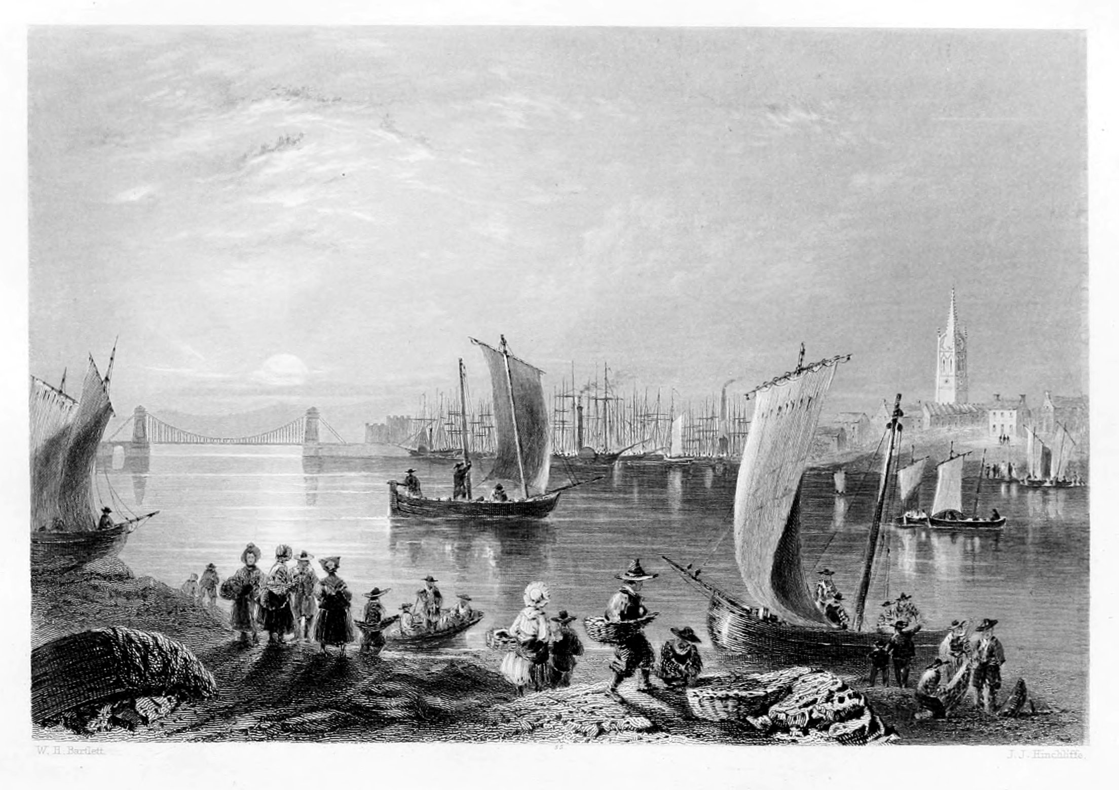
MONTROSE.
"Montrose—a beauty that lies concealed, as it were, in the bosom of Scotland; most delicately dressed up, and adorned with excellent buildings, whose foundations are laid with polished stone, and her ports all washed with silver streams that trickle down from the famous Ask."—Richard Frank, A.D. 1658.
Montrose, a royal burgh and sea-port town of Forfarshire, is agreeably situated on a level plain, or peninsula, bounded on the north-east by the German Ocean, on the south by the river South Esk, and on the west by a large expanse of this river, called the Basin of Montrose. The erection of this town into a royal burgh has generally been referred to the year 1352, being the twenty-third of the reign of David II.; but it appears to have been a place of some note long before it acquired this dignity, and is connected with many important events in the history of Scotland. It is mentioned by Froissart, as the port from which the gallant Sir James Douglas embarked in 1330, for the Holy Land, attended by a numerous and splendid retinue, and carrying with him the heart of King Robert Bruce. This, as the reader knows, was in execution of the last charge committed to him by his royal master, namely, to carry the heart of the deceased monarch to Jerusalem, and there deposit it in the holy sepulchre. The disastrous failure of this pious enterprise is too well known to require further notice in this place.
The principal manufactures carried on in Montrose are the spinning and weaving of flax. For this purpose there are several steam-mills for spinning, and one on the North Esk driven by water. These steam-mills produce annually upwards of 800,000 spindles. There are also in the town soap, starch, rope, and sail manufactories; and others for making steam-machinery. Ship-building is carried on to a considerable extent, and there is a patent slip, introduced for repairing ships. There are also in addition various breweries, tan-works, candle-works, a foundry, and a steam-mill for grinding meal and flour.
Montrose is the port of the Custom-house, and, as such, comprehends within its bounds all that district between the lights of Tay on the south, and the Todhead on the north, thereby including Arbroath, and other places of less importance.
The principal foreign imports into Montrose consist of flax, hemp, tallow, whale-fins and oil, fir-timber, oak and oak-planks, deal and deal-ends. But as the goods manufactured here are sent coastwise to London, Glasgow, Dundee, and other towns, there are few or no exports to foreign places from Montrose. Owing, however, to the bonded system having been extended to this port, nearly all the foreign wines and spirits consumed in the district, are brought coastwise to the bonded warehouses, and pay duty at the Custom-house when taken out for consumption.
The exports from this district by the coasting-trade consist of wheat, oats, barley, rye, peas, beans, and potatoes; salmon, codfish, and pork, the latter chiefly for the London market: great coal, culm, parret, lime, blue slate, iron, tallow, rosin, barilla, kelp, salt, and herrings from the Moray Frith, chiefly smoked and sent to the Hull and London markets. The principal import from the English coast is coal; but various other articles are imported and exported by regular traders to London, Glasgow, and Leith.
Montrose contains several public edifices, all designed with considerable taste and substantially executed. Among these are the church, with a fine gothic tower, St. John's church, St. Peter's episcopal chapel, the Town-hall, the Academy, the Lunatic Asylum, and the Jail. The finest object, however, and which combines ornament with utility, is the new Chain-bridge, erected, like many others in the United Kingdom, after a plan by Captain James Brown, of the Royal Navy. The foundation-stone of this admirable structure was laid on the 18th of September, 1828, and the whole was completed before the close of the following year. The distance between the towers at the two extremities of the bridge, measured from the centre, is four hundred and thirty-two feet. The height of each tower is seventy-one feet, namely, twenty-three and a half from the foundation to the roadway; forty-four from the roadway to the top of the cornice; and three feet and a half forming the cornice. It spans the river, South Esk, and is justly considered the finest specimen of the kind in Scotland. The whole cost is stated at twenty thousand pounds.
The population of Montrose continues rapidly to increase. The society is very superior to that of most country towns, and includes amongst its members men who have distinguished themselves in every department of the state. It was formerly represented in Parliament by Joseph Hume, Esq., a native of the place, and so well known as a leading member in the House of Commons.
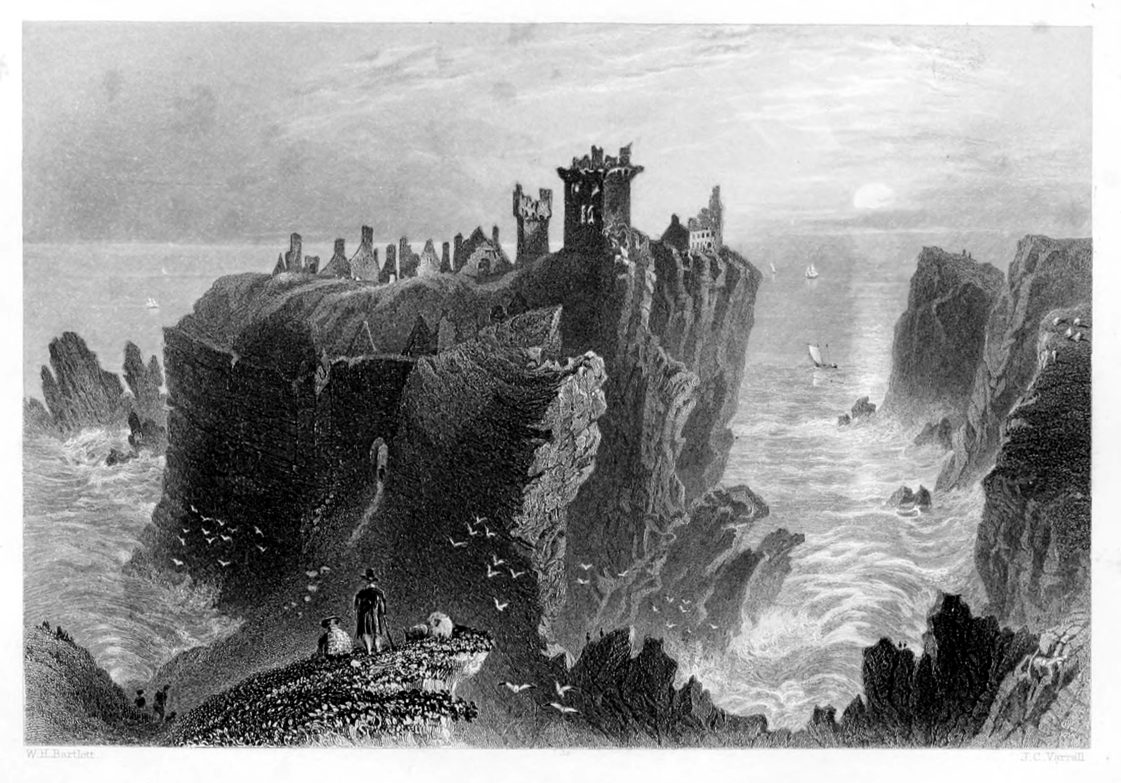
DUNNOTTAR CASTLE.
"Dunnottar Castle," by Mrs. Carnegie, 1796.
The view of Dunnottar Castle, which so happily illustrates this portion of the work, represents one of the most remarkable features that are anywhere to be met with on the coasts of the British empire. The drawing was taken on the spot, and shows with admirable effect and precision those striking combinations of nature and art which, during a long series of ages, rendered the fortress of Dunnottar impregnable. But those rocky foundations from which it once rose in all the strength and grandeur of feudal architecture are fast yielding to the encroachments of the sea; its crested summits, once brilliant with arms and bristling with cannon, seem ready to drop from their precipice. Unroofed, unlatticed, untenanted, with not an ember left on its once capacious hearth, desolation and ruin are vividly pictured in its dreary solitude. The floors are covered with crumbling fragments of varied and costly decorations in sculpture, painting, and fretwork. Once a palace—commanding all that could minister to the security and luxury of its almost royal possessors, its battlements gay with standards, crowded with retainers, mailed guests in the hall, and minstrels in the court—it is now dark as a sepulchre;—banners, retainers, guests, minstrels, and the master of the feast himself—all are gone! The hoarse dash of the waves, the shrill scream of the stormy petrel, the crash of some disjointed and falling rock, or the whistling of the coming tempest, are almost the only sounds that now alternate among these embattled heights, where the curious stranger retraces with melancholy interest the days and deeds of antiquity. To him who is familiar with its history, Dunnottar speaks with an audible voice; every cave has a record—every turret a tongue; his ear is struck with "wandering voices," and words that never die seem at every step to arrest his attention.
The Castle of Dunnottar—now the stately and magnificent ruin thus feebly sketched—stands on an isolated rock two hundred feet perpendicular, washed on three sides by the sea, and on the other separated from the adjacent land by a wide and deep chasm, from which by a gate in the wall, nearly forty feet high, there is an entrance to the fortress. Leading upwards from this gate there is a long steep passage, partly arched over, and formerly secured by two drawbridges, the grooves for which are still visible. At the inner end of this passage is another gate, opening into the castle area, which is enclosed by a wall, and occupied by buildings of various epochs. But of all the buildings on this rock the chapel is the most ancient, and there is reason to believe that it originally served as the parish church of Dunnottar. The Castle, or the peninsular rock on which it stands, makes its first appearance in Scottish history during the wars of Bruce and Baliol, when, it is alleged by some modern authorities, the castle was erected by Sir William Keith as a place of safety for himself and friends. According to Blind Harry and Hector Boece, Dunnottar was surprised and taken by Sir William Wallace in 1297, and the Blind Historian relates that Dunnottar was occupied by four thousand English troops, who had fled before the victorious arms of the Liberator; and that when Wallace made the onslaught, as many of them as the church would contain took shelter there, in the hope that consecrated ground would not be violated by their slaughter; but, says the bard,—
In the year 1336 Dunnottar was fortified and garrisoned by Edward III.; but immediately after his departure for England it was attacked and carried by the gallant Sir Andrew Moray, who destroyed the fortifications of the Castle, so that it might not again afford ready protection to an enemy.
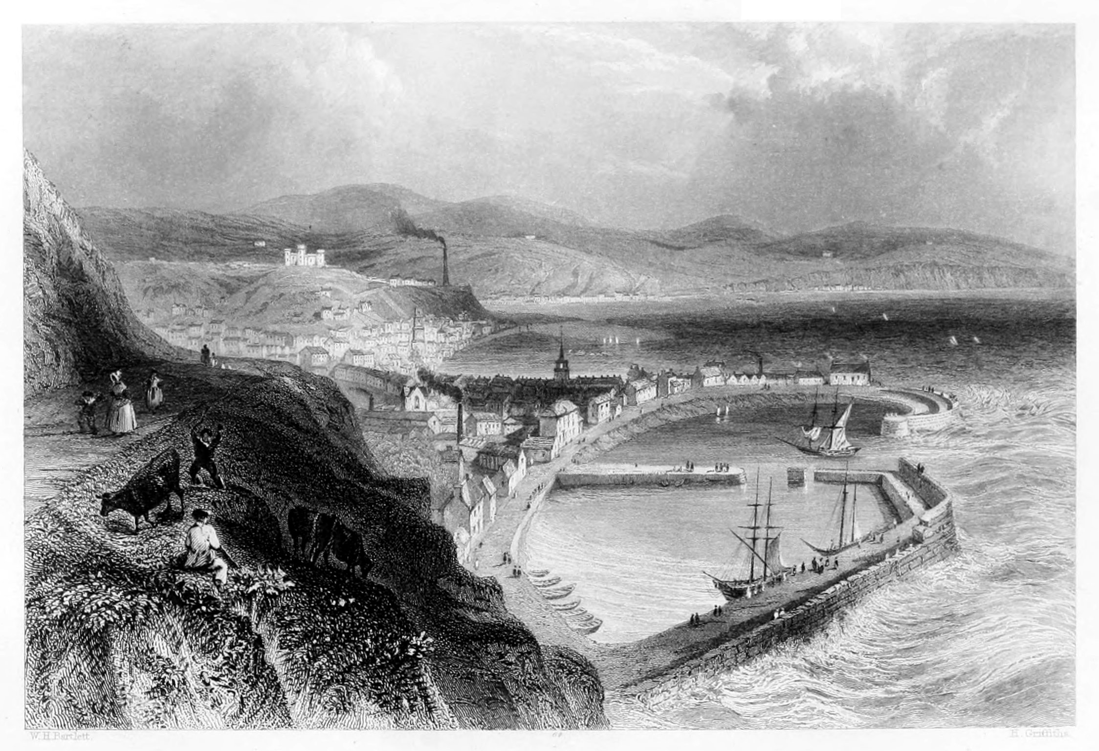
STONEHAVEN.
Stonehaven, like Aberdeen, has its old town and its new; but "with this distinction, that of the latter, the new town is the older of the two." The old town of Stonehaven, or Steenhive as it was formerly written, was built on feus granted by the "Earls Marischal," by one of whom it was erected into a burg of barony. The new town, or "Links of Arduthie," is separated from the old town by a brook, called the water of Carron, and is built upon the estate of the patriotic Mr. Barclay Allardyce, of Ury. It is the county-town; and hither, in 1660, the sheriff-court was removed from Kincardine by Act of Parliament.
On the south-west of a bare rocky promontory, called Garron-point, at the entrance of Stonehaven Bay, are seen the ruins of Cowie Chapel, which is said to have been dedicated to the Blessed Virgin. From this point on the north, called Garron, to that of Downie on the south, is what is termed the Bay of Stonehaven. The town stretches from the bridge over the Cowie river, on the north, to the above-mentioned headland, Downie Point, on the south; but it is divided, as already stated, into two parts by the "Carron;" the north part being the new, and the south the old, or sea-town; close to which last, and to Downie Point, which is a protection to it from south-east gales, stands the Harbour, erected, like most others on the east coast, sea-ward. It is a capacious basin, and would contain a great number of vessels, but until lately, when two cross-jetties were built, it was very insecure, or afforded little protection to vessels during north-east and east gales, to which it is much exposed, the entrance being to the east. It is now, however, comparatively secure; and gas-lights being erected, the one bearing on the other, vessels bound southward in winter find it a very agreeable retreat, and about thirty so situated have been seen in it at one time.
The exports consist of grain, timber, herrings, and other fish; the imports are principally coals and lime, of which a great quantity is required for agricultural purposes.
The Harbour, in spring-tides, will admit vessels drawing fourteen feet water, sometimes upwards; but in ordinary tides the depth can hardly be reckoned at more than from ten to eleven feet.
The trade of curing fish by smoke-drying, in imitation of the Finnan haddies, is carried on with much spirit: several large houses have been fitted up for this purpose and for red-herrings; and a stranger would scarcely believe the extent done in this business, the haddocks thus cured being sent to London, Edinburgh, and other markets in the south, by all conveyances.
The other trade of the place is principally in manufacturing woollen, linen, and cotton cloths, a branch of native industry in which great numbers of people are employed. The Glenury distillery is a large concern, and close to the town, from which a great quantity of whiskey is constantly shipped off.
Among the disasters which, in its day, Stonehaven has had to deplore, we may cite the following, as characteristic of those unhappy times when the country was torn by the violence of faction, and fire and sword laid waste this ill-fated district. On the 20th of March, 1645, the Marquis of Montrose, then quartered at Stonehaven, addressed a letter to Earl Marischal, at his castle of Dunnottar, about two miles from this, exhorting him to espouse the royal cause; but receiving no answer, he proceeded to wreak his vengeance on the earl's lands and dependants. "Thereafter," says the historian Spalding, "he fires the Tolbooth, a prison of Stonehaven, wherein there was store of grain, and the whole town, with all the barnyards, houses, and other buildings, except those of James Clark, wherein Montrose himself was quartered. They plundered a ship lying in the harbour, then set fire to her, as well as to all the fishing-boats then in the harbour. They burnt up the whole town of Cowie, houses, buildings, corn, and corn-yards; and in like manner plundered the whole goods, gear, horses, oxen, sheep, which they could get; plundered the parson of Dunnottar's house and set it on fire. The people of Stonehaven and Cowie, it is said, came out, men, women, and children at their feet and children in their arms, crying, howling, and weeping, praying the earl, for God's sake, to save them from this fire as soon as it was kindled; but these poor people got no answer, nor knew they where to go with their children. How lamentable to behold!"
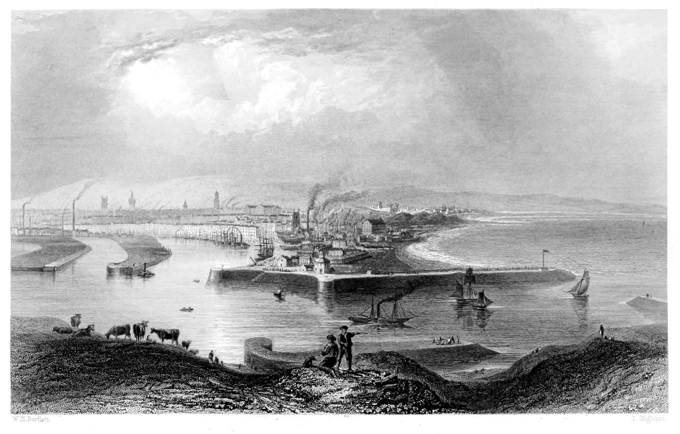
ABERDEEN.
GENERAL VIEW.
The city of Aberdeen, the seat of two celebrated universities, is divided into the old and the new towns, at an interval of about a mile. Of these, the former—now reduced almost to a village—appears to have been a town of some note as early as the ninth century, but gradually fell into decay after the great epoch of the Reformation. The Cathedral of St. Machar was founded at the remote era of 1164, and repaired in the beginning of the fourteenth century. But a new building of more elegant design was founded by Bishop Kinnimond, the second prelate of that family, and finished by Bishop Leighton. The Reformation, however, suspended all further operations, and left the pile a monument of premature decay. Of King's College, founded at the close of the fifteenth century, the learned Hector Boethius was the first principal.
New Aberdeen, though irregularly built, is a handsome city, and beautifully situated on three gentle eminences at the mouth of the Dee. The streets are spacious, and many of the public buildings of elegant design. In ancient times, several religious establishments flourished here, belonging to the different orders of Dominicans, Carmelites, and Grey Friars, with an hospital, or maison-Dieu. Marischal College, so named from its liberal founder, George, Earl Marischal of Scotland, has, like its predecessor, been long celebrated as a seat of the muses. Its professors and lecturers—twenty-seven in number—have shone conspicuous in every department of human learning, and are continually sending forth in their pupils the living proofs of that zeal and assiduity with which their important functions are discharged. With the fame of this university, the names of Campbell and Beattie are more especially associated, as the champions of religion and the ornaments of our native literature.
The environs of this ancient city exhibit many pleasing indications of commercial improvements, which are daily acquiring fresh impulse, adding new embellishments to the landscape, and evincing an increase of comfort and independence among the inhabitants, who amount to about fifty thousand.
There are few springs of any consequence in Aberdeen or the neighbourhood, and although a supply of water can be had in most places, by digging to a depth of from ten to thirty feet, it is generally so hard as to be of comparatively little value. Close by the boundary of the parish, on the west side, are two springs, quite contiguous, which have been long known as the "Well of Spa." Both these springs, but especially the least copious one, are impregnated with carbonate of iron, and on that account have been long noticed as medicinal. Early in the seventeenth century an account of the properties and powers of these springs was published by Dr. Barclay, under the title of Callirhöe, commonly called the Well of Spa, or the Nymph of Aberdene. A building, which at that time protected the spring, having fallen into decay, was repaired by the celebrated painter George Jamieson, but was not long afterwards demolished by a flood of the Den-burn, which runs close beside it. In 1670, another building was erected over the spring, which still remains, consisting of a stone enclosure, with steps or benches, and an entablature bearing these inscriptions:—
Within the last two centuries both these springs have repeatedly disappeared and been recovered, and always retaining their chalybeate qualities till of late. Within the last few years, however, while digging upon the adjacent eminence for the foundations of the west wing of the new infirmary, it would seem as if the course of the water had been disturbed, or some other change produced, the consequence of which is, that now the larger spring appears to possess hardly any chalybeate impregnation, whilst the smaller one is much weaker than formerly.
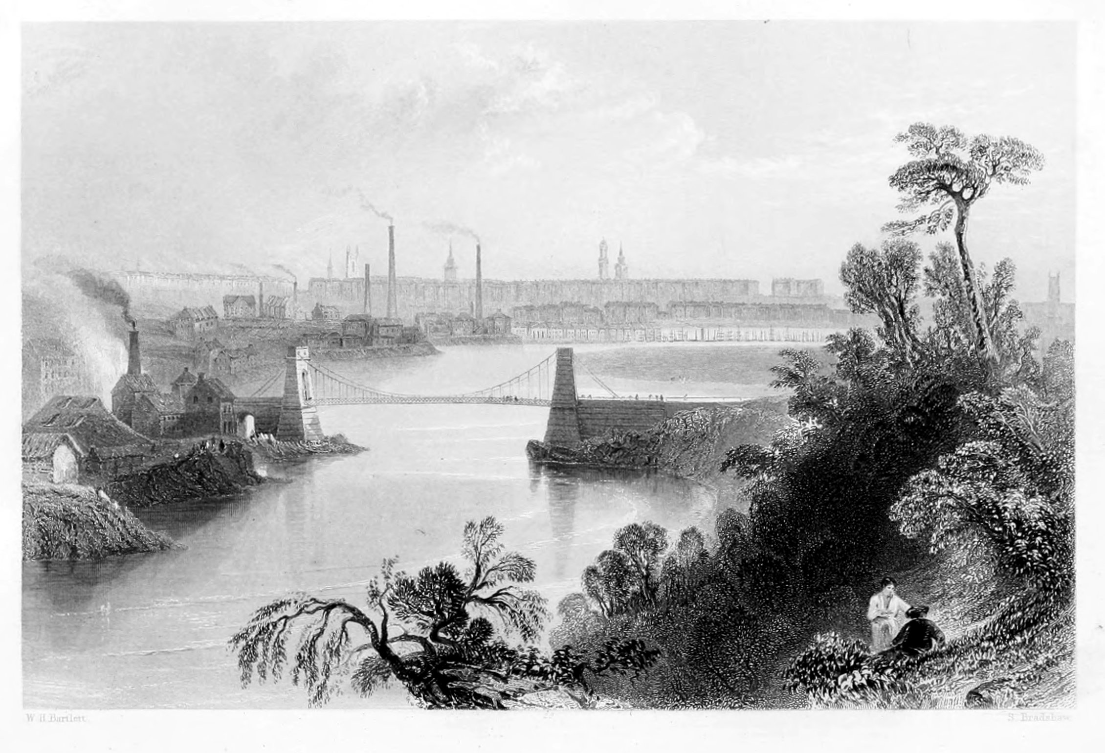
ABERDEEN,
FROM ABOVE THE CHAIN BRIDGE.
The Port of Aberdeen is now universally known among seafaring men as one of the safest and most commodious in Scotland. The skill and practical efforts of both Smeaton and Telford were successively employed upon it; and after an arduous and extensive enterprise, the grand object has been fully obtained. To those who are only acquainted with the harbour under its present aspect it will be difficult to convey a correct notion of its appearance in ancient times. There is reason to suppose that at a period beyond the reach of history, the river Dee must have discharged its waters into the sea at the Craiglug—where the Chain Bridge is seen in the engraving—and that by their alluvial deposits, and the effects of the north-east winds, in accumulating the sands in the neighbourhood, the ground now occupied by the village of Footdee, the shorelands and Sandilands, the Links and the islands in the estuary were gradually raised above the level of the sea. At a less remote period it is believed that the river Don poured its floods into the frith of the Dee: and the conjecture derives strength from the notices of Roman geographers. The occurrence of great changes is attested by various remains which have been disinterred at different periods. Thirteen feet under low-water mark in spring-tides, and twenty-eight feet below the general surface of the Inches, were discovered two human skulls, a large piece of flint, and great quantities of shells and other marine deposits; and in excavating the canal, at a considerable distance from the shore, anchors and other articles of shipwreck were found deeply imbedded in the earth.
The entrance to the harbour of Aberdeen is naturally bad, owing to a bar at the mouth of the river, where, at ebb-tide, the depth of water was often not more than two feet. To remedy this evil was, from a very early period, the ardent desire of the citizens, and to some of their first efforts in this direction we have alluded in our notice of Aberdeen Light-house. But it is since the commencement of the seventeenth century that the most effective improvements have been made, amongst which we may name the erection of a bulwark on the south side of the entrance, and the removal of a great stone, called "Knock-Maitland," which lay nearly in the middle of the river, both of which were accomplished in succession; the first in 1608, and the latter in 1618. Between 1623 and 1658, the quay was extended eastward, towards Futtie; by which means a considerable portion of ground was redeemed below the Castle-hill, and is now covered with buildings. In 1755 an additional quay was built a good way further down, opposite the village of Torrie. In 1770, further improvements were projected; and, on a report from Mr. Smeaton, recommending the erection of a pier on the north side of the entrance, so that the influx of sand from the north might be prevented, and the removal of the bar effected, by confining the waters of the river Dee within narrower bounds, the work was commenced in 1775, and finished in less than six years. The length of this pier was twelve hundred feet, and it terminated in a round head of sixty feet in diameter. Owing, however, to a departure from Mr. Smeaton's plan, by which the pier was founded too far to the north, it was found that a heavy swell entered the harbour; and to obviate this formidable inconvenience, a bulwark was projected from the pier, to about one-third across the channel.
By these means considerable improvements were effected; but as the trade of the city increased, inconvenience was still felt from a deficiency of water on the bar; and Mr. Telford, having been consulted in 1810, on the means of remedying this evil, recommended that the pier should be extended, and that wet-docks should be formed in the harbour. These works were commenced forthwith, and the pier, carried on to the extent of nine hundred feet beyond the head of Smeaton's pier, and again finished with a round head, was completed in 1816. In the course of the following winter, however, this head was destroyed by the storms; but being rebuilt with a slope towards the sea, it has since stood without very material damage. A breakwater, extending to the length of eight hundred feet, was also built on the south side, by which the mouth of the channel was narrowed, and the entrance protected from the storms of the south-east. Wharfs were built along the south-west side of Futtie; the pier opposite Torrie was enlarged; and, latterly, the quay has been extended westward from the old quay-head; and by raising embankments on the Inches, a considerable range of quay-room has been gained there, which is connected with the town by a swivel-bridge, opposite Marischal-street. By all these combined measures, quay-room has been provided to the extent of about four thousand feet; a tide-harbour has been formed, in which, at spring-tides, the depth of water is about eleven feet at the west-end, gradually increasing to fifteen feet, where it joins the course of the river; while the depth of the water on the bar has been increased to about nineteen feet.
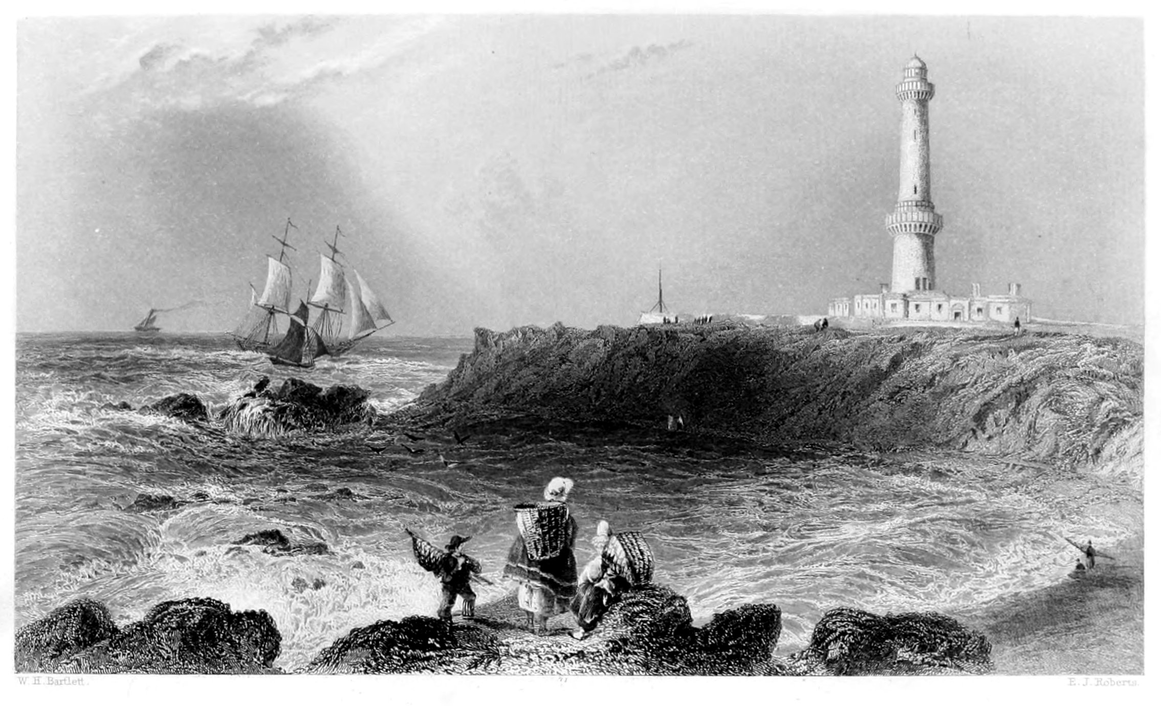
ABERDEEN LIGHTHOUSE.
Immediately to the south of the small bay of Greyhope stands the Girdleness Lighthouse; an erection by which the trade of Aberdeen has been greatly benefitted. The Girdleness, from which it takes its name, is a conspicuous promontory of which the Commissioners of the Northern Lights took advantage to erect this monitory beacon: it was lighted up for the first time on the night of the 15th of October, 1833, and is a lofty, circular tower, built of granite, and crowned with two copper domes, one within the other, in order to prevent the effects which would follow from the condensation of vapour from the heated air of the lamps. The dwelling-houses of the keepers are at the bottom of the tower; and a field of considerable extent has been walled in and cultivated for their accommodation. It is on the larboard, or left-hand side, as we enter the port, and is known to mariners as a double-light, a distinction produced by placing two lights in the same tower, the one above the other. Of these, the lower light is visible in clear weather at the distance of thirteen, and the higher at that of sixteen miles. They are under the charge of two keepers, one of whom mounts guard at sunset, and in case of emergency can summon assistance by means of an alarm-bell, placed in the sleeping apartments, which may be rung from the light-room, by means of an air-blast, through tubes laid for that purpose. This edifice, of incalculable benefit to the cause of humanity, was erected after the design of Robert Stevenson, Esq., and does great honour to his talents. The bay of Greyhope, above-named, is memorable as the scene of many a disastrous shipwreck, particularly that of the Oscar, in which, out of a crew of forty men, only two were saved. This occurred on the 1st of April 1813.
For many centuries after the foundation of Aberdeen, the harbour was nothing more than an open expanse of water, washing the base of the Castle-hill on the north, the rising grounds of Torrie on the south, and communicating with the sea by the narrow and shallow mouth of the river. Of this basin the greater part was left dry at ebb of tide; while several large, but low islands, were never wholly overflowed. The most ancient, and during many years the only erection within the port, was a bulwark extending from the Ship-row southwards, and now known as the Shore-area. Its extremity was called the Quay-head, a name afterwards applied to the wharfs extending from the vicinity of the Trinity Kirk eastward, beyond the present weigh-house. At what time it was built is altogether unknown; but it was in existence in the fourteenth century, and was probably constructed in the preceding age. In 1484, having become ruinous, it was either repaired or rebuilt; and about the same time, beacons for the guidance of ships were erected, and the wreck of a Spanish galley on the southern shore, which had long obstructed the channel, was removed. In 1512, the quay was again repaired; and in 1526, still further operations became necessary, and a great portion of the wharfs was reconstructed. In 1549, repairs being once more required, a stair was added; and in 1582 a crane was erected. In 1621, two corn-mills were built within flood-mark; and about thirteen years later, a weigh-house, which served also for a custom-house, was erected. In the course of the same century, various other additions were made to the wharf, and several municipal statutes introduced for the better regulation of the port. In 1566, a lighthouse, containing "three great flaming lights, to burn from daylight to daylight, between the first day of September and the last day of March," was erected on St Ninian's Chapel, on the Castle-hill.
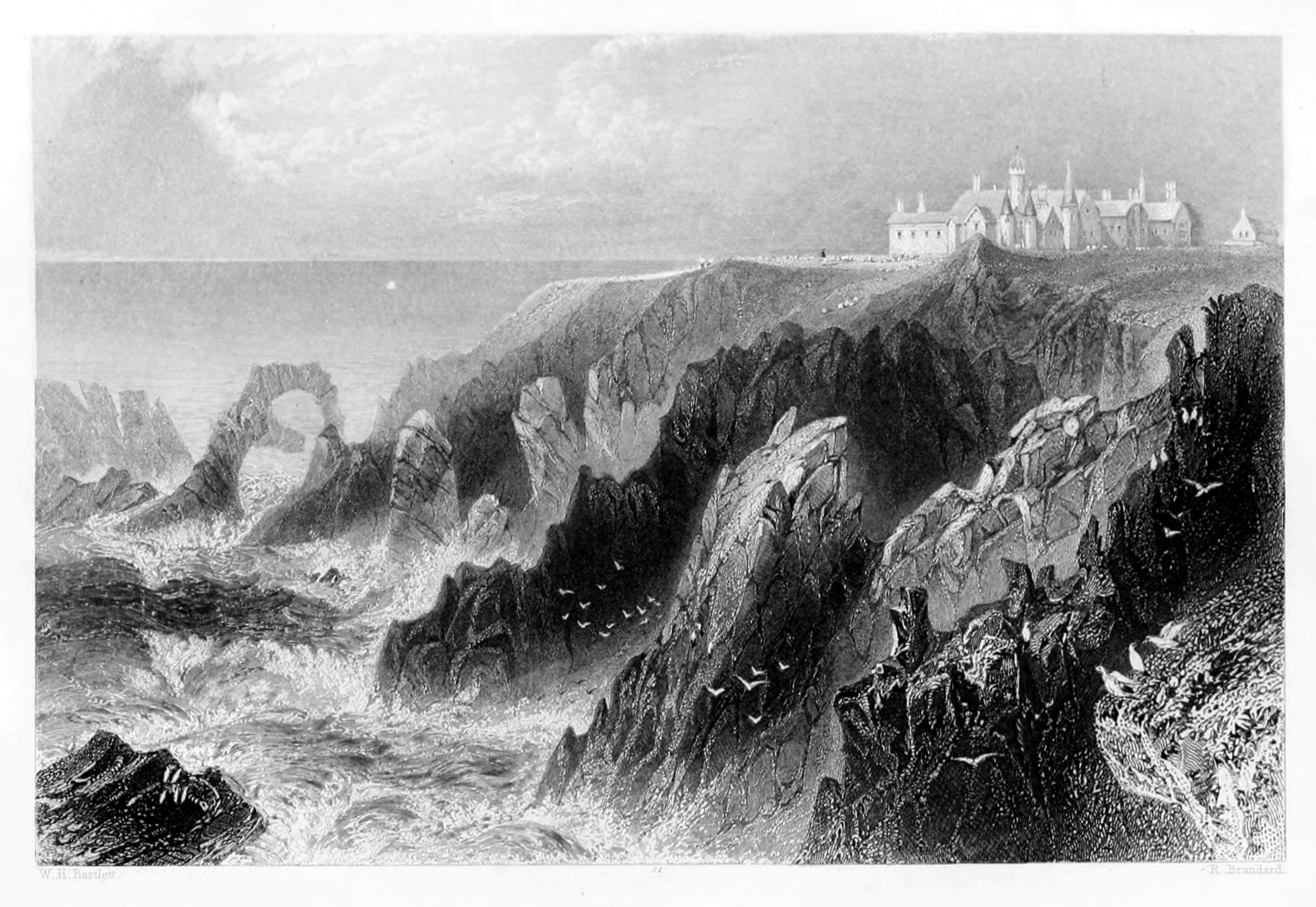
SLAINES CASTLE.
Slaines Castle, the feudal residence of the Hays of Erroll, covers a peninsular rock, boldly projecting into the German Ocean and forming an abrupt and imposing landmark on this iron-bound coast. Its position is remarkable: the huge precipice over which it projects on one side, and of which it seems an integral part, descends perpendicularly to the sea, where the water is so deep that vessels of large burden may float within a yard of the rock. It is said, indeed, that a tankard of wine may be lowered down from the Castle window to the yard-arm of a man-of-war under sail. Whether this experiment has been tried we know not; but this we can readily admit, that much good wine has taken the opposite direction.
The situation of this family fortress is rather bleak and cheerless, presenting no leafy bowers, no clumps of trees, few masses of verdure or vegetation, to refresh the eye or flatter the imagination.
The prospect, however, which is bounded only by the horizon seaward, is grand and imposing, and fills the mind with corresponding ideas. For a Trappist convent, with Baron Geramb at its head, nothing finer could be imagined; for their nearest neighbour in one direction is the "King of the Norse;" and the hills, on the other hand, are wild and solitary enough to shut out the world and its vanities.
The following is the traditional origin of the Hays of Erroll:—In the year 980, and reign of Kenneth III., the Danes having invaded the country, gave battle to the Scots at Loncarty, near Perth. The latter, being worsted in the fight, gave way; but, while passing a defile in their flight, were stopped by a countryman and his two sons, who encouraged the fugitives to rally and renew the struggle. The example, resistance, and reproaches of these three brave men, armed only with the implements snatched hastily from their ploughs, inspired the routed Scots with new life. They rushed back upon their pursuers, encountered the Danes afresh, defeated them at every point, and delivered their country from servitude. The victory being complete, the father, afterwards known by the name of Hay, was ennobled by the king, and rewarded with the best part of the enemy's baggage, and a grant of land in the rich Carse of Gowry, containing as much as "a falcon flew over without alighting." The march stones, being about seven miles apart, are to this day called the "Falcon Stones."
The first of this ancient family who did honour to the Scottish peerage was created Earl of Erroll by James II., in 1452, in recompense of his faithful services, and died at this castle in 1470.
The baronial fortress of Slaines was afterwards demolished by order of James VI., on the rebellion of the Earl of Huntly, and long continued in ruins.
Dr. Johnson thus records his visit and reception within these walls:—"We came in the afternoon to Slaines Castle, built upon the margin of the sea, so that the walls of one of the towers seem only a continuation of a perpendicular rock, the foot of which is beaten by the waves. To walk round the house seemed impracticable; from the windows, the eye wanders over the sea that separates Scotland from Norway, and when the winds beat with violence, it must enjoy all the terrific grandeur of the tempestuous ocean. I would not for my amusement wish for a storm, but as storms, whether wished for or not, will sometimes happen, I may say, without violation of humanity, that I should willingly look out upon them from Slaines Castle."
The caves and grottoes along this coast are numerous and interesting. The Dropping, or White Cave of Slaines, extends about 200 feet underground; and through a natural vault the water oozes forth, and forms fantastic pyramids of incrustations or stalactites. The cave, by this natural process, would soon be filled up, were not the petrified substance frequently cut away and burnt for lime. In this, as in many other caves along the shore, the ancient inhabitants of the district are supposed to have taken refuge when repeatedly harassed by the sudden descent of Danish marauders; and in later times it may have often served as a secure retreat for smugglers, who formerly abounded in this neighbourhood, and carried on their illegal traffic in comparative safety.
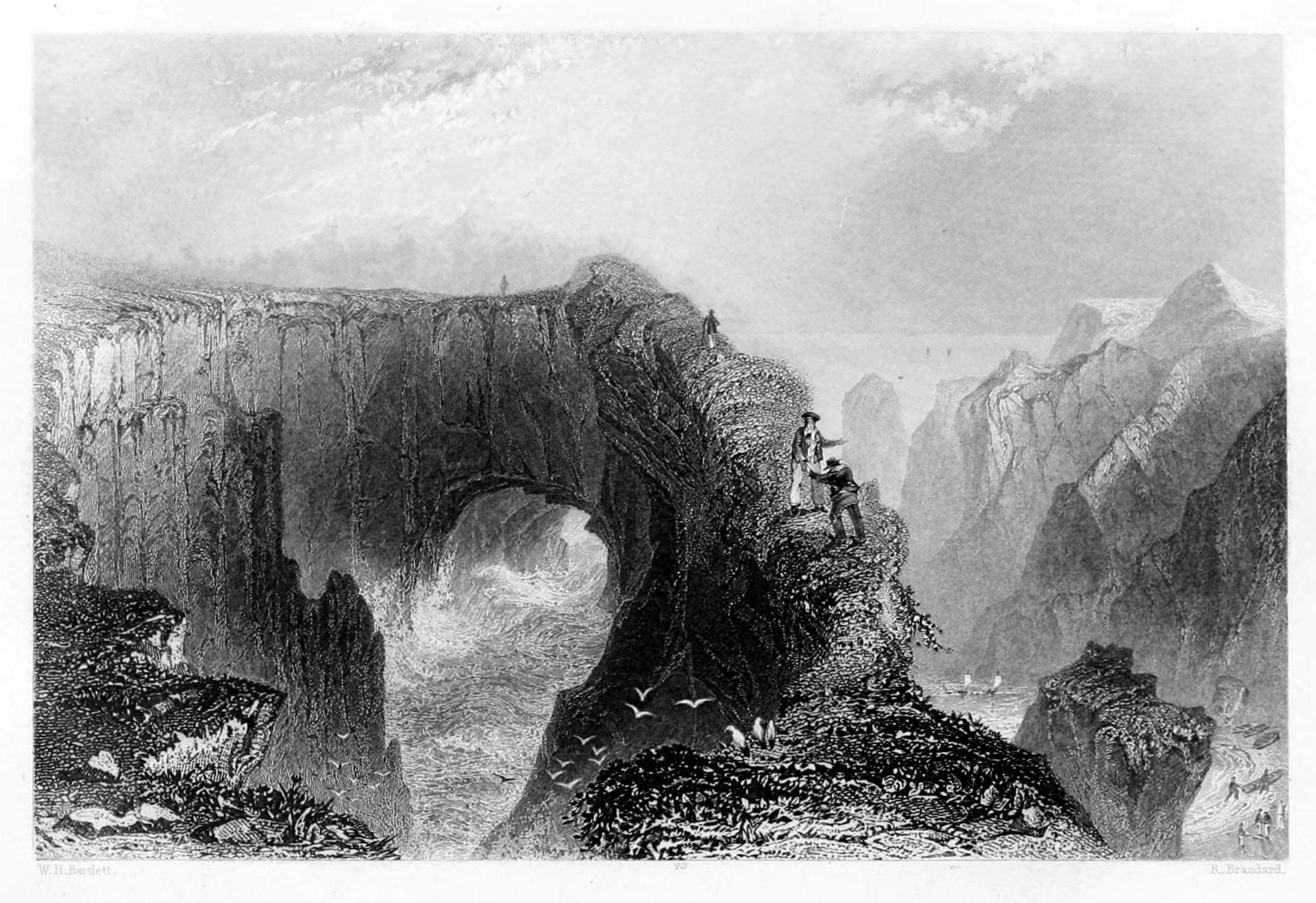
THE BULLER OF BUCHAN.
"If I had any malice against a walking spirit, instead of laying him in the Red Sea, I would condemn him to reside in the Buller of Buchan."—Samuel Johnson.
The Buller of Buchan, one of the most remarkable natural curiosities in Scotland, is about six miles south from Peterhead. It is a vast hollow in a rock projecting into the sea, open at the top, and communicating with the water by means of a natural arched passage, about fifty yards high. The basin within is nearly circular, about thirty yards in diameter; and around the extreme edge of the chasm is a narrow footpath, from which to the water in the abyss below, measures about thirty fathoms,[13] more or less, according to the state of the tide. It is a scene upon which all travellers dwell with feelings of mixed awe and admiration. Even Dr. Johnson, the learned philologist from whom we take our motto, visited and retired from the spot with amazement. "We soon turned our eyes," he observes, "to the Buller, or Bouilloir, of Buchan, which no man can see with indifference, who has either sense of danger or delight in rarity. It is a rock perpendicularly tubulated, united on one side with a high shore, and on the other rising steep to a great height above the main sea. The top is open, from which may be seen a dark gulf of water, which flows into the cavity through a breach made in the lower part of the enclosing rock. It has the appearance of a vast well, bordered with a wall. The edge of the Buller is not wide, and to those who walk round appears very narrow. He that ventures to look downward sees that, if his foot should slip, he must fall from his dreadful elevation upon stones on one side, or into water on the other. We, however, went round, and were glad when the circuit was completed. When we came down to the sea, we saw some boats and rowers, and resolved to explore the Buller at the bottom. We entered the arch which the water had made, and found ourselves in a place which, although we could not think ourselves in danger, we could scarcely survey without some recoil of the mind. The basin in which we floated was nearly circular, perhaps thirty yards in diameter. We were enclosed by a natural wall, rising steep on every side, to a height which produced the idea of insurmountable confinement. The interception of all lateral light caused a dismal gloom. Round us was a perpendicular rock; above us, the distant sky, and below, an unknown profundity of water."[14]
To the above description, written in the autumn of 1773, little needs to be added: the wild features of the scene, and the effect produced upon the minds of travellers, continue to present nearly the same aspect and to awaken the same impressions as in the days of the great lexicographer. The scene of horror, however, is often enlivened by pic-nic parties from Peterhead, during the fine season, and is deservedly considered as one of the great "lions" on this coast, a title to which its continual "roar" gives it a more especial title.
The geological features of this locality are very interesting. The rocks are of primitive granite, and appear to have been upheaved to the surface by some internal expansive force, and have an inclination from east to west of 25 degrees. Reposing upon the granite, is a bed of diluvial clay, of from ten to fifteen feet deep, containing numerous small water-worn stones, of different species of the secondary formation; besides large quantities of flint, originally imbedded in limestone, which must have been rolled from a great distance, as there are no beds of limestone on this coast, or in any of the neighbouring districts. From atmospheric action and other causes the rocks are rapidly disintegrating; and great quantities of débris are annually accumulating at the bottom of the precipices, where wild grasses and lichens springing up produce, by their decomposition, a vegetable mould which is gradually increasing.
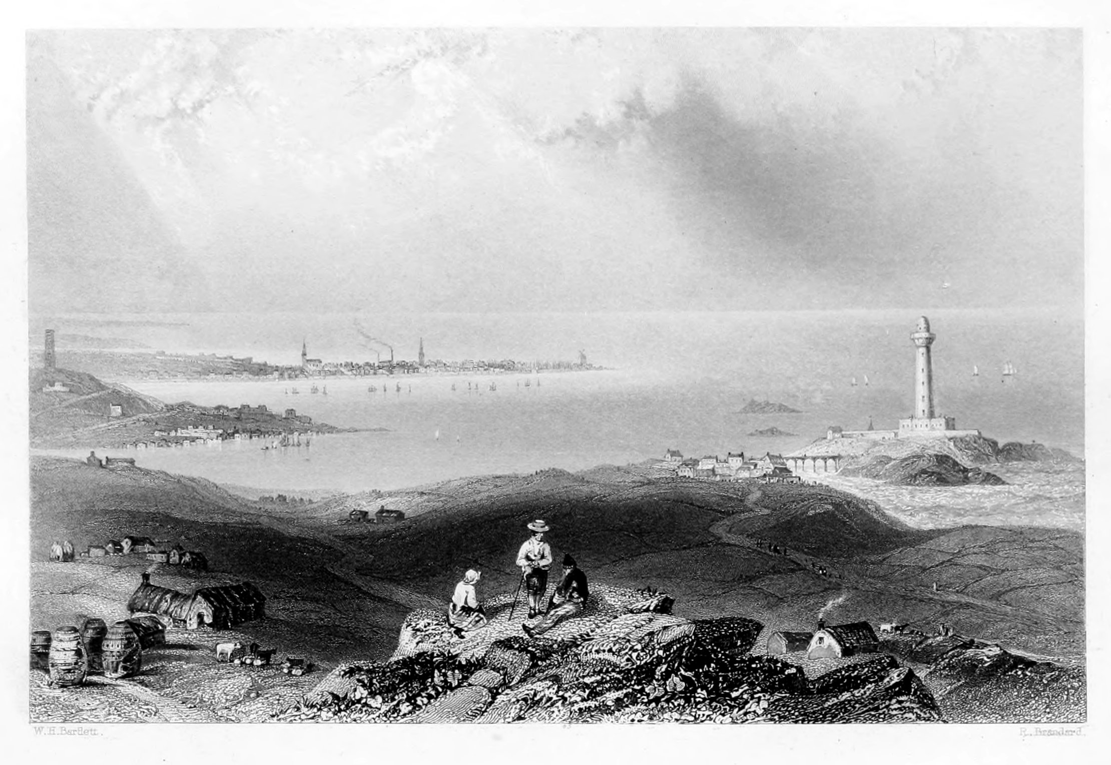
PETERHEAD.
The Heliotrope.
Peterhead, like the neighbouring ports already noticed, has rapidly increased, within the last twenty years, in all those means which facilitate and secure the advantages of trade and commerce. Though long and deservedly resorted to as a delightful watering-place, remarkable for the salubrity of its air, and the beauty of its situation, the activity of trade was still unknown to its inhabitants. Its only harbour, a small basin dug out of the rock, was rarely enlivened by anything that could aspire to the title of shipping; for in Cromwell's time, about twenty tons of boat-freight was all that its diminutive port could lay claim to. The spirit of its inhabitants, however, with an accurate perception of the natural advantages of the Port, and aided by government in the preparation for a new era in commercial enterprise, has achieved wonders. An air of prosperity animates the whole town: the harbour is filled with goodly traders; imports and exports cover the quays: industry has received a stimulus which communicates its happy influence to everything around; and Peterhead now holds an enviable station among the Ports and Harbours of Great Britain.
The point of land on which the town is built, is the most easterly of the mainland of Scotland. It forms the north-east side of a bay, and is connected with the country, on the north-west, by an isthmus eight hundred yards in breadth. On Keith-Inch, so called from the Earl Marischal, are many elegant and substantially-built houses; and on its south-side is an old Castle, erected in the sixteenth century, by George, Earl Marischal, after the model of one which he had seen in Denmark. Down to the close of the sixteenth century, Peterhead was only a small fishing-village, and the stranger who now passes through its populous streets, and busy harbours, will readily perceive how much has been accomplished in the interval.
The Harbours are both handsome and commodious; and, having two entrances from the south and north, and being equidistant from the Forth and Moray Friths, are much resorted to by vessels frequenting the east coast of Scotland. The annual revenue is under the management of commissioners incorporated by Act of Parliament. The South Harbour has a depth of between twelve and fourteen feet water at medium springs, and from eight to ten at neap-tides; but the North Harbour, during spring-tides, has full eighteen feet water, and at no tide less than fourteen. The Quay extends to 3350 feet in length; and connected with the harbour is an excellent graving dock. The shipping belonging to the port amounts to about 12,000 tons; and the number of vessels that annually take shelter in these harbours, may be estimated at two hundred and forty. The leading articles of export are grain, meal, eggs, butter, cattle, fish, and the produce of the fisheries: the imports are groceries, clothing, flour, salt, iron, timber, coal, lime, and bone-manure. Shipbuilding has long been carried on to a considerable extent; and in the present day no port of the kingdom sends out vessels more remarkable for fine proportion and elegant combination of strength and beauty. During the last half century, Peterhead has carried on an extensive trade with Greenland, and Davis' Straits; and takes rank next to Hull in the whale fishery.
The lighthouse, which stands on the Buchan Ness, at the extremity of the south bay, is of the utmost importance, both as regards the interest of the general trade of the port, and the prosecution of the herring fishery, which is carried on with great success.
The neighbourhood of Peterhead is renowned for its granite, which is of a reddish colour and closely resembles that on the west bank of the Lago Maggiore in Italy. The beautiful pillars in the British Museum, and the Duke of York's column in Waterloo-Place, are specimens of it; and materials for many of our public buildings, such as the docks at Sheerness, have also been furnished from the quarries of Peterhead.
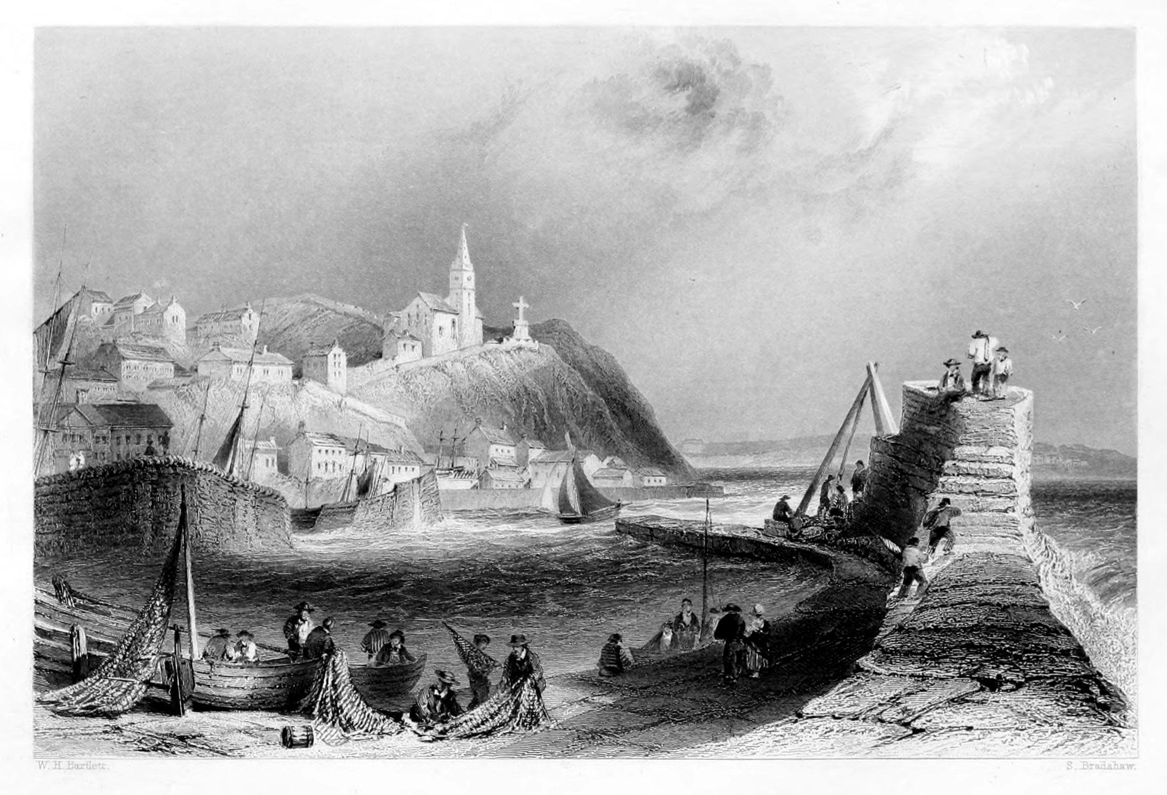
MACDUFF.
Macduff, which in the course of a century has emerged from its humble origin of a few fishermen's huts into a town and harbour of no little importance on this coast, is now an object of increasing interest to all who delight in tracing the gradual rise and progress of national prosperity, in the ramifications of our trade and commerce. The town is situated about a mile and a half to the east of Banff; and in the grouping of its buildings presents an aspect sufficiently romantic to arrest the attention of every stranger who has a taste for the picturesque. The Earl of Fife, on whose property it is built, has greatly contributed to its advancement in all that regards the comfort of the inhabitants, and the improvement of its harbour, which is now considered one of the best in the Moray Frith. At the instance of this patriotic nobleman, Macduff was created a burgh of barony by his Majesty George III.; and from that time large sums of money have been annually expended in improving the town, encouraging industry, and extending the harbour. The import and export traffic of this port continues on the increase, and employs numerous vessels that carry on a regular trade with London and the ports of the Baltic. The exports consist chiefly of corn, salmon, cod-fish, and granite, for which the quarries of this coast have been so long known and appreciated. It is also a favourite fishing-station, and possesses a numerous fleet of boats engaged in the herring-fishery, which is here prosecuted during the season with great activity and success; an occupation that has been the means of training up a larger number of hardy seamen, and thus contributing to the naval supremacy of our country in a greater degree than any other branch of the coasting-trade. It has at the same time been instrumental in providing an important portion of the subsistence of the peasantry in the district, as well as furnishing a supply for transmission to the metropolis and the southern part of the Kingdom, and successfully vieing with the far-famed staple of Yarmouth. The herring-fishery on the coast of Scotland was long confined, almost exclusively, to the coasts of Caithness and Sutherland; but owing to the encouragement afforded by government at the termination of the war, the fishing of herrings was commenced on the Aberdeen, Banff, Moray, and Rossshire coasts; and it was soon discovered that the herrings were both as good in quality and as abundant on the south side of the Moray Frith as on the north. This trade, from a small beginning, has now become flourishing and extensive; and although the government bounties have been withdrawn, it is still carried on with great spirit and activity. The quantity cured within the district amounts in favourable years to about thirty thousand barrels.
The town contains a thriving and industrious population of nearly two thousand: it has a grammar-school, a town-hall, and a jail. The church, which forms so prominent a feature in the picture, occupies a conspicuous situation on the eminence, and owes much to the taste and munificence of Lord Fife, who has erected a fine massy cross in its immediate precincts, and thereby contributed an ornament which, by its peculiar elevation, gives additional interest and effect to the whole scene.
The bridge across the Devon, by which Macduff communicates with Banff and the surrounding scenery, is described in our notice of the latter town and harbour. Owing to the acknowledged excellence of its accommodation for shipping, Macduff is gradually acquiring fresh testimony in its favour as a seaport, and promises to insure to its inhabitants, at no remote period, their full proportion of maritime prosperity. So be it; and in this wish and prospect every one, who is acquainted with the place or the people, will cordially sympathize; and from their known energy and perseverance, there is no reason to doubt of their securing that commercial success which they labour so strenuously to obtain, and to which their natural position so much entitles them.
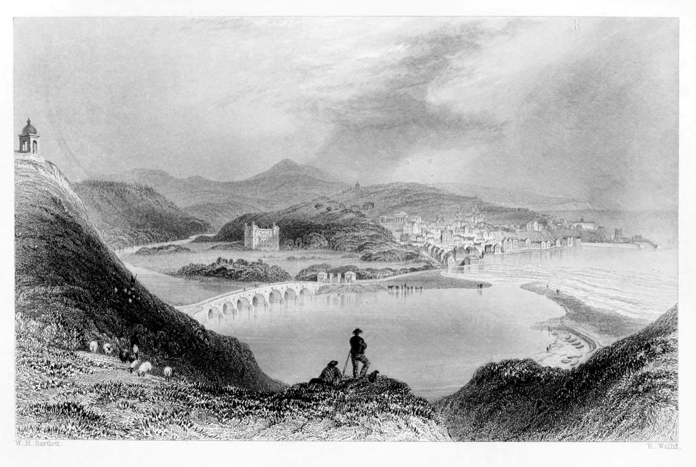
BANFF.
The ancient town of Banff consists of two distinct parts, the first of which, called the body of the town, lies partly on the lower extremity of the plain, skirting the river, and partly on the declivity. The second portion, called the sea-town, stands on an elevated level which terminates abruptly within a short distance of the sea, by which it is bounded. When viewed from the low ground beyond the river, the sea-town appears to stand on a long elevated ridge, as seen in the engraving, and having the battery on its northern extremity. On a piece of table-land, projecting midway between the town proper, and sea-town, and nearly opposite the mouth of the river, stands the Castle, a plain, modern edifice, but commanding an extensive and varied prospect of the sea, the town, the hill of Macduff, the sweep of the river, and the beautiful slope opposite, surmounted by the woods of Mount Coffer.
The streets of Banff, though composed of houses varying much in size, are generally straight and of a convenient width. The High-street, Castle-road, and a street in the sea-town, terminating in the battery, form a continuous line from south to north, of about half a mile in length. In the progress of recent improvements, many of the old houses have been pulled down and replaced by others, so that now scarcely a feature of primitive architecture is left to remind the spectator of the olden time—the characteristic dwellings of our forefathers—
About twenty years ago the comfort and convenience of the inhabitants were greatly promoted by the addition of an excellent market-place, laid out in a central part of the town and furnished with every necessary accommodation. Public baths have also been erected by a joint-stock company, and the town is lighted with gas.
In the southern approach to Banff, the road is carried over the Doveran by means of an elegant and substantial stone bridge, consisting of seven semicircular arches, with a clear water-way of one hundred and forty-two yards. This handsome structure was finished at the expense of government in 1779, and is highly ornamental to the town and neighbourhood. From this point the view of Duff House, in the centre of a beautiful park, is seen to great advantage. In proof of this, the reader has only to cast his eye over the engraving, which, to those who have not seen the original, conveys a faithful and striking resemblance to Banff and its vicinity. Seen so near as to render its elaborately carved ornaments visible, the appearance of Duff House is particularly rich, graceful, and majestic. It contains a fine gallery of paintings, many of them by the first masters of the art. This baronial mansion, was built nearly a century ago, after a design by Adams, in the Roman style, but has never been finished in its original detail. The body of the house is an oblong, consisting of four lofty stories; the first of which is a rustic basement, over which rise two stories, adorned with fluted pilasters, and an entablature in imitation of that on the temple of Jupiter Stator, in the Campo Vaccino at Rome. Over this entablature, which surrounds the whole structure, is an attic story, surmounted by a balustrade. The four corners of the building have projections resembling towers, which break and vary the outline, overtop the attic story, and are adorned at the angles by an upper range of pilasters with an entablature of the Composite order, and crowned by dome-like roofs, on which are placed octagonal pedestal-chimneys.
The town of Banff has much to recommend it as a residence. It possesses both coast and inland scenery of a superior description, and is particularly healthy. It has excellent schools, classical and commercial; various places of public worship, as observed by the established Presbyterian, the Episcopalian, the Seceder, and others. It has abundant markets, frequent and regular mails, public baths, literary, scientific, and benevolent institutions; boarding-schools, and society equal at least to what is generally met with in a remote provincial town.
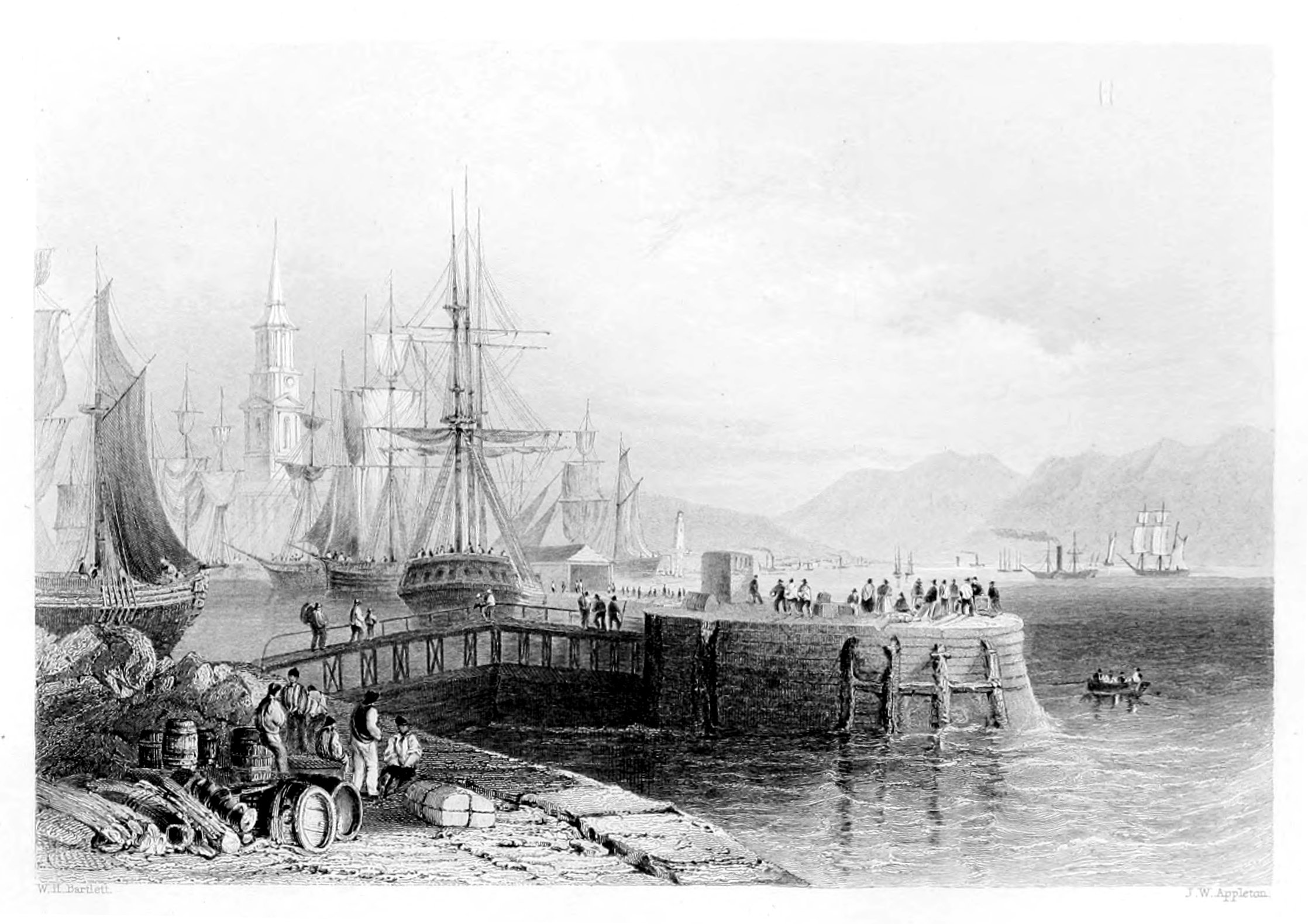
PORT GLASGOW.
The ground on which this town has been erected belonged originally to the estate of Newark, and was purchased by the magistrates of Glasgow, in 1668, in order to provide a convenient harbour for the merchant-vessels belonging to that city—hence the name of Port Glasgow. In 1775, a charter was obtained from parliament, conferring on the town the privilege of a burgh of barony, and granting a constitution, which vested the management of its municipal affairs in a council of thirteen, including two baillies. By the Burgh-Reform Act, the number was reduced to nine, consisting of a provost, two baillies, and six councillors. The Reform Bill elevated it to the rank of a parliamentary burgh; and, in connexion with Kilmarnock, Rutherglen, Dumbarton, and Renfrew, it sends one member to parliament.
In its general appearance, Port Glasgow presents an air of much neatness and regularity. The streets are straight, and for the most part cross each other at right angles; while the houses, nearly uniform in size, and generally whitewashed, give to the whole a light and regular appearance. Among the modern buildings the town-house, and parish-church are chiefly deserving of notice. The town-hall, of plain but substantial workmanship, is ornamented in front with a portico, resting on four massy fluted pillars, and surmounted with a handsome spire, which rises from the centre. Of this edifice, the ground-floor has been laid out chiefly in shops; but the upper story, in addition to the chambers of the council and town-clerk, contains a large and commodious reading-room, with several apartments occupied as mercantile counting-rooms. The church was finished seventeen years ago, and affords accommodation for about twelve hundred persons. It is square in form, and plain in its exterior; but is much and deservedly admired for the simplicity and elegance of its internal arrangement. The wealthy inhabitants of the place did themselves great honor, and at the same time set a valuable example to others, by gratuitously contributing a sum of fifteen hundred pounds to assist in the expenses of its erection.
Attached to this Port are two capacious harbours, substantially built, and so completely sheltered from storms, that the vessels moored within them have rarely been found to suffer injury even in the severest weather. These harbours are furnished with ample quay and shed-room, and also with a commodious graving-dock—the oldest in Scotland. The largest vessels that trade to the Clyde are found at this port; such is the facility of access to this harbour, that vessels which draw twenty-one feet of water are towed up and down the channel with the greatest ease and safety.
A very important addition to the harbour accommodations of Port Glasgow was obtained a few years back in the erection of wet-docks. The then existing harbours having been found much too small for the increasing number of ships belonging to the port, the inhabitants of the town resolved to avail themselves of their local advantages, by converting the Bay of Newark, naturally adapted to the purpose, into a spacious dock, where vessels of the largest class might lie securely afloat in every state of the tide. The trustees of the harbours obtained an act of parliament, investing them with the necessary powers for carrying this desirable object into effect; and funds having been secured, they were enabled to commence the work, which was soon in rapid progress, and completed about twelve years ago. This dock, having spacious quays, with a twenty-five feet depth of water alongside, holds out special advantages to the trade, both in point of safety and convenience.
The charges levied at this port are on the most moderate scale, and considerably below the rates imposed at the neighbouring ports. To merchants engaged in trade with the Clyde, Port Glasgow thus presents the double advantage of low charges and very superior accommodation; while, at the same time, the privileges of the warehousing system are on a footing equal to those of any other port in the kingdom. Warehouse-room is provided on a very extensive scale, and is open for the general accommodation of the trade, on very moderate terms. In addition to the regular bonded warehouses, there is a large area for receiving wood into bond, and an excellent warehouse for crushing refined sugars, in which large quantities of that article are prepared for exportation to the Mediterranean markets.
Shipbuilding is also carried on at this port to a considerable extent: of late years the builders have been chiefly employed in the construction of steamboats, of which they have produced a great number, some of them of the largest class, and all of very superior workmanship. From the nature of the trade, the rope-work and canvas factory are here in a state of constant activity, and give employment to a great number of hands. The vast improvements effected within the last few years, by deepening the river, and extending the harbours and docks as already mentioned, give Port Glasgow just cause to anticipate all the advantages arising from a prosperous and extending commerce.
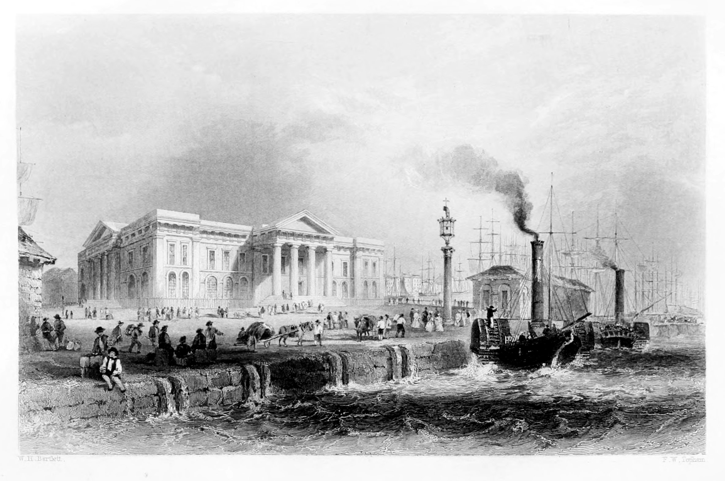
GREENOCK.
"The Clyde, always spacious, and always covered with its shipping, offers a scene of life and brilliancy unparalleled on any of our sea-shores; and enhanced by a majestic screen of mountains to the north, for ever varying under the change of a restless atmosphere, but under all these changes, for ever magnificent!"
Among the principal sea-ports of the United Empire, Greenock is justly entitled to a distinguished place. Although of comparatively modern date, it has left many of its ancient predecessors and modern rivals in the background, and at this moment continues to advance rapidly in commercial enterprise and prosperity.
The recent formation of quays and docks of corresponding dimensions, affords to this harbour every facility for vessels of heavy burthen. The town possesses several handsome buildings, the principal of which are the church, the Tontine, or great hotel, and the Custom-house. Of the latter, with the immediate scene of commercial activity and forest of masts by which it is surrounded, the engraving opposite presents a vivid and faithful representation. It is a structure of great elegance, and, as an illustration of the chastest style of Grecian architecture, it would be difficult to point out a finer specimen either at home or abroad. The quality of the materials too is every way worthy of so fine a monument of national prosperity; and a fair estimate may be formed of the superiority of the workmanship, when we state that a sum of not less than twenty thousand pounds was expended in its erection; a fact which evinces at the same time the high importance attached to Greenock as a depot of the national revenue. The river Clyde is here about three miles broad; but, as also at Port-Glasgow, the navigable channel is little more than three hundred yards across. The bay is formed by an expansion of the Clyde, into which several bold points of land project from the northern bank, over which the mountains of Argyll, gradually receding till their summits are lost in the sky, present a landscape of almost Alpine beauty and magnificence.
In conjunction with the native grandeur of the scenery, the spirit of commercial enterprise, which is everywhere visible on the banks, as well as on the bosom of the water—transforming the one into a garden, and the other into a "high road" to prosperity,—impresses every spectator with the strongest evidence of its magical influence. Industry and activity pervade and animate everything around, and extend their influence into the remotest parts of the country. For several years past, Greenock has been the principal port in immediate connexion with America, to which the annual tide of emigration from the Highlands still flows, though with abated force, and a divided stream, since the golden hills of Australia have offered to thousands the vision of wealth to be acquired in a few months, and an independence to be realized in a single year. Here, grouped on the quay, sauntering along the streets, or viewing the distant mountains to which they are soon to bid adieu, the voice and features of the Gaël awaken a lively interest and attention on the part of every stranger. They have left their humble dwellings in those mountains, which still look invitingly in the distance, and which through innumerable generations had afforded shelter and sustenance to their ancestors, but whence they are driven at last, not by choice, but imperious necessity.
When tired or satisfied with the tumultuous scene on the quays, the traveller may ascend in half an hour the heights above the port, and there behold one of the finest views in Scotland. The gigantic screen of Argyllshire mountains, rising peak over peak till they vanish in the sky, forms a magnificent distance to the picture; while the middle ground is occupied by the broad expanse of the Clyde, gay and studded with shipping in every direction. Still nearer, the port of Greenock itself, crowded with masts and sails, and steam chimneys and buildings, forms an appropriate foreground to a panorama as variegated as it is picturesque.
That generous spirit of enterprise which characterises the merchants of Greenock has given birth to one of the most remarkable efforts of science and art which have been accomplished in modern times. This is the admiration of every stranger, and well known to the public under the name of Shaw's Water-works. By a singular combination of ingenuity and skill, a small stream of water is made to travel along the faces of mountains, and across ravines, for the space of six miles and a half, till it reaches the brow of a hill about a mile above Greenock, at an elevation of more than five hundred feet above the level of the sea. Here it is received into a small reservoir, and managed in such a manner as to produce, by this stupendous fall, a two-thousand-horse power, greater, says Mr. Brown, than that produced by all the united steam-engines in Glasgow. This splendid scheme was designed and completed under the personal superintendence of Mr. Thom, of Rothesay, to whose scientific and inventive genius it is a noble and lasting monument. The immense power thus provided is rendered more secure and certain than that of steam, because there exists no doubt whatever that a full supply of water commensurate with the power, can be had at all times and seasons.
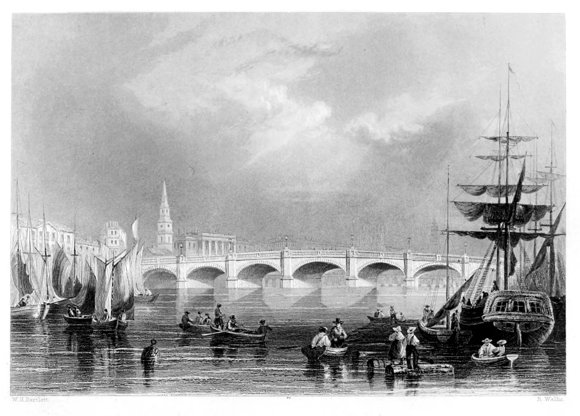
THE BROOMIELAW, GLASGOW.
The river Clyde, in a commercial point of view, is of the greatest importance, not only to the city of Glasgow, but to the whole western district of Scotland. Till the beginning of the sixteenth century, however, the channel of this noble river was so incommoded by fords and shoals, as to be hardly navigable even for the small craft of that day. Sensible of this great evil, and aware that it admitted of a remedy, the inhabitants of Glasgow, Renfrew, and Dumbarton entered into an agreement to excavate the channel of the river, and, by working six weeks alternately, succeeded in their enterprise. The principal ford and several others of less importance were removed, so that by the middle of the sixteenth century, flat-bottomed lighters could be floated with ease and safety to the landing-shore at the Broomielaw, which, in the process of time and events, has become the great commercial port of Glasgow.
A few years ago, the harbour of Broomielaw was only seven hundred and thirty feet long on one side; it is now 3340 feet long on the north side of the river, and 1260 on the south. Till of late years there were only a few punts and ploughs for dredging the river; there are now four dredging-machines, with powerful steam-apparatus and two diving-bells. The shed accommodation on both sides of the river is most ample; and one of the cranes made by Messrs. Claud, Girdwood, and Co., for shipping steam-boat boilers, is capable of sustaining a weight of thirty tons, and may, for the union of power with elegance of construction, challenge all the ports in the kingdom. For the space of seven miles below the city the river is confined within narrow bounds, and the sloping banks, formed of whinstone, in imitation of ashlar, are unequalled as a work of beauty and utility.
From the Broomielaw, till it begins to expand into an estuary, the Clyde is everywhere overlooked, at short intervals, by the rising hulls and finished decks of steam-boats and other craft preparing for the launch. Compared with the bulk of its waters, and the breadth of its stream, this river is unequalled for the amount and stir of its navigation. Here it is seen bearing along ships of heavy burden and deep draught of water; there plentifully dotted with yawls and wherries, and kept in a constant state of foaming agitation by large steam-ships, freighted with heavy cargoes from the shores of England and Ireland—by numerous coasting steam-vessels, careering over its surface with thousands of human beings, and by steam tug-boats, dragging behind them trains of sailing craft, too unwieldy to pilot their own way within its narrow channel. First in the practical working of steam-ship architecture, the Clyde may be safely said to maintain its pre-eminence over every other river in the world.
The Broomielaw Bridge, which forms so prominent a feature in the engraving, was begun after a design by Mr. Telford, the late celebrated engineer, and built by Messrs. Gibb and Son. It is faced with Aberdeen granite, and has a very gentle acclivity. It is 560 feet in length over the newals, and sixty feet in width over the parapets: it has seven arches, and is wider than any river-bridge in the kingdom.
Tides.—The tide at Greenock is two hours earlier than at Glasgow. At places situated near the ocean, the tide flows nearly as long as it ebbs. At Greenock it flows generally about six hours, but at Glasgow it flows only for five hours and ebbs in about seven; this, however, is modified by the winds. High winds in the Clyde affect the time and elevation of high-water; and by considering the form and course of the Frith of Clyde, it is obvious that a gale from a northerly quarter, by opposing the flow of the tide, will cause the time of high-water to be earlier, and the height of the water to be less, than would otherwise be the case; while a gale from an opposite direction, acting in concert with the flowing tide, will produce a contrary effect.
The merchants and citizens of Glasgow have ever been characterised as a loyal, patriotic, and generous people. When the country was suffering under civil war, they raised an armed force in defence of their civil and religious liberties, and when menaced by the enemies of their country they stood nobly forward in its defence. In times of local distress their liberality knows no bounds; and their support of religious and benevolent institutions has never been surpassed in any community. That the citizens of Glasgow have done honour to departed worth is abundantly proved by the monuments and statues erected in the city; and that their gratitude is not confined to the dead is daily evinced by their respect and admiration of living merit. Such is the testimony borne to them by one of their fellow-citizens. Such they are known to be in their intercourse with strangers; and none, we will venture to say, have ever spent a week in the precincts of the Broomielaw, and shared in its hospitalities, without a cordial assent to the city motto—Let Glasgow flourish!
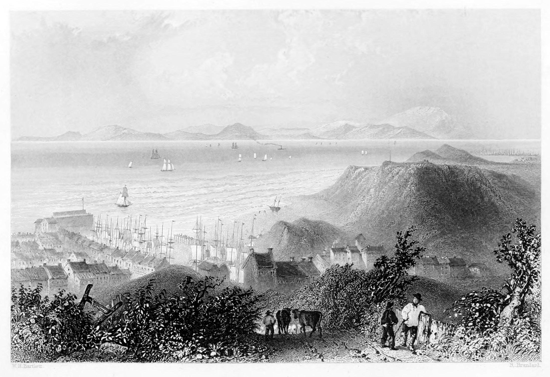
THE SOLWAY FRITH,
FROM HARRINGTON PIER.
Harrington is a small maritime village, about two miles from Workington, with a commodious harbour opening on St. George's Channel, which is a prolific source of industry to this portion of the coast. The outward trade consists chiefly of coal and lime, in both of which the immediate district abounds. The limekilns of Dissington, and the coal-mines of Workington are the sources from which these exports are obtained in excellent quality, and which employ a great number of hands in the several departments of mining, burning, carting, and exportation to the opposite coasts of Scotland, Ireland, and the Isle of Man, where the cargoes are readily disposed of, and such articles selected for importation as the season, or the peculiar state of the markets at home, appear to recommend. In this manner a degree of local prosperity is insured, and another efficient nursery of seamen kept up by the spirited ship-owners in their regular intercourse with the neighbouring coasts. It is by the combined influence of such nurseries that the maritime power of England first acquired, and still maintains, her supremacy at sea; and to the thousand harbours by which she is encircled she is indebted for those naval victories which, under Providence, have preserved her integrity and independence amidst the shock of surrounding nations. The humblest fisherman on the waters of the Solway, if thoroughly skilled in the management of his trim-built craft, is not without his importance in the scale of national utility; for the same qualifications which give him superiority among the comrades of his hardy calling, would procure him distinction on the deck of a seventy-four. No effort should be spared to encourage nautical science wherever men and ships are to be found on our coasts. "Britannia rules the waves" only by those "hearts of oak" which have been so long and devotedly at her command, and her real strength and security consist, not in the number of her ships or their weight of metal, but in the education and discipline of her native seamen, whose uncompromising gallantry has long passed into a proverb. But from this digression we return to the subject more particularly under notice.
Harrington, it appears, was the hereditary domain of the ancient and baronial family of that name, the title of which became extinct in 1457. It was proposed to carry the railway, alluded to in our notice of Maryport, across the upper part of Harrington, by means of a bridge or viaduct; but the objections to such a measure, so far as it would affect the maritime interests of this place are insurmountable. The report of the committee appointed by the Lords of the Treasury to examine this subject on the spot is as follows: "The whole extent of this harbour is only seven hundred and sixty-two feet in length, and two hundred and twenty in breadth, and as it is used as well for a port of refuge as for lading, and there is an insufficiency of space for vessels to anchor and swing in, an artificial beach has been formed at the eastern or upper end, on which they are enabled to bring up. The proposed viaduct would cut off about a third of the harbour. This would not only be objectionable on account of its diminishing the capacity of the port, but also by its depriving the shipping of the artificial beach to which we have just alluded. The objection to curtailing the size of the harbour will be apparent, when we state that the harbour-master supplied us with a return, verified by the Custom-house officer, by which we find that in the course of the year, 1839, no fewer than five hundred and ten vessels used this port; and that during the gales of wind it was frequently so full that they were in actual contact from side to side. After well considering this part of the subject, we are of opinion that, whatever expense or other inconvenience it might cause, it would be necessary to adopt some other mode of carrying the railway past Harrington than that proposed."
The population of this port is gradually increasing. The number of shipping is also increased; and altogether Harrington may be pronounced as in a flourishing condition. The light now at the pier-head was first used in 1797, and is always exhibited when there is a depth of eight feet water in the harbour. It is a fixed light, hoisted upon a mast forty-four feet above high water, and in clear weather may be seen at the distance of ten miles at sea.
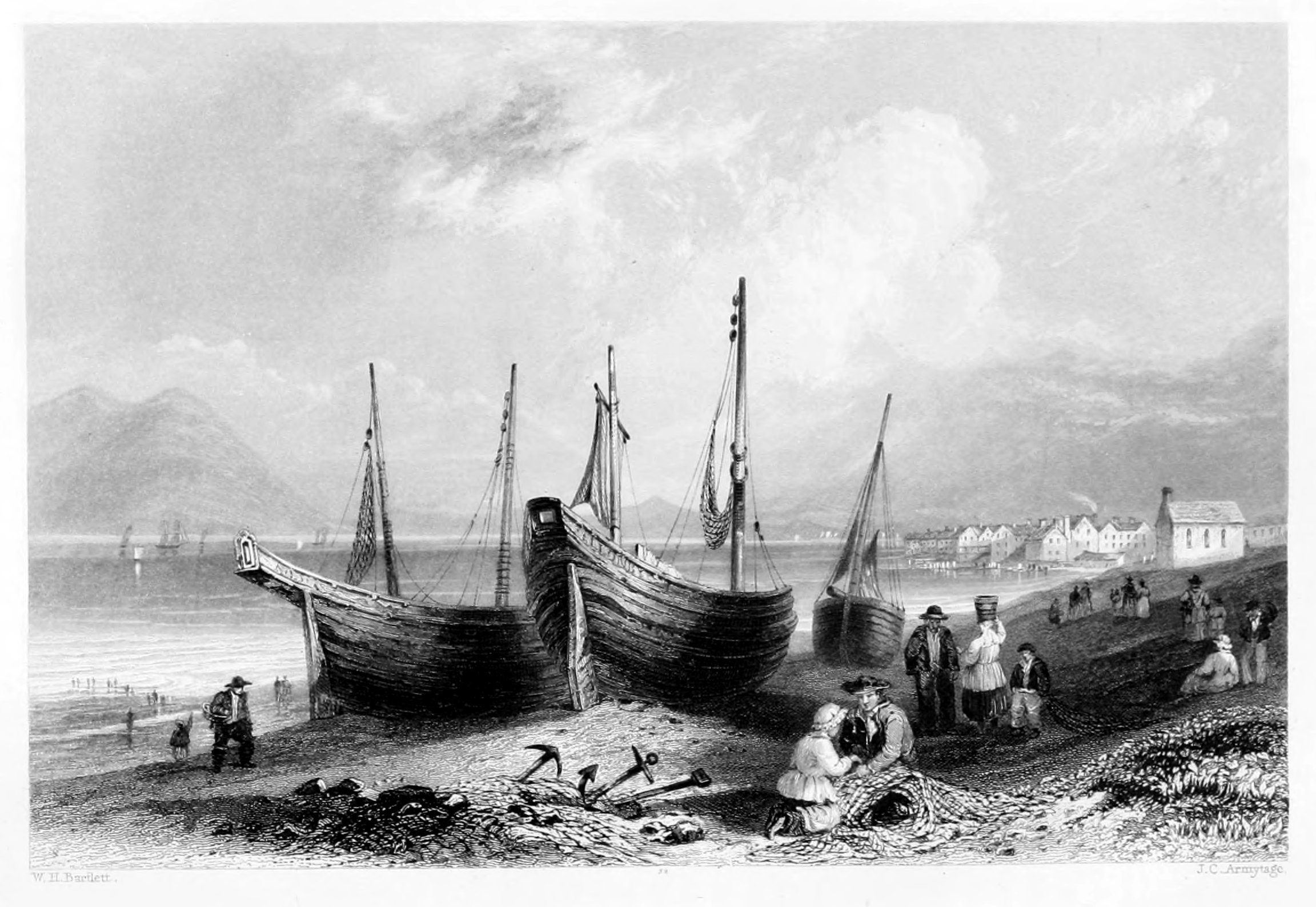
ALLONBY.
CUMBERLAND.
The banks of the Solway are much frequented during the summer months by families from the interior, who resort thither for the benefit of sea-bathing, to which great importance is attached as a preventive, no less than a curative, process in the economy of health. Among the various localities selected for this enjoyment, Allonby bears a long-established reputation, and is annually resorted to by many families of distinction and respectability, from both sides of the Channel, who seek, in the invigorating air of the sea, the pleasures of social intercourse, and in the delicious walks and drives with which the coast abounds, the restoration of health or temporary relaxation from business. Several of the distinguished public characters of the day have here spent the recesses of Parliament, and found in the tranquillising atmosphere of Allonby a safe remedy for the enervating influence of the capital, and the cares and irritations of public life. It was long a favourite resort of the Scottish gentry, and still maintains a degree of pre-eminence as an attractive watering-place. The accommodation at the hotels is excellent, and they are furnished with every convenience for hot-baths.
Allonby is only five miles from Maryport, and ten from Wigton, and is flanked by a fine undulating country, celebrated as a field for rural sports, and industriously cultivated by a numerous and thriving population. The village itself is small, its permanent inhabitants being considerably under a thousand, most of whom depend upon the annual visitors, and a share in the herring-fishery, for the means of life. The latter, however, has become much less productive than formerly; the herrings are very capricious in their visits, and, according to Hutchinson, after continuing the same annual track for ten years, change their route, and only resume their visit after an interval of ten years. In this respect, says our authority, they are as regular as the tides or the vicissitudes of the seasons: but, as annual "customers" for the net, these savoury visitors are not to be depended upon; and although, like Owen Glendower, the anxious fisherman may call up "spirits from the vasty deep," the question is, will they come?
Allonby has the benefit of good assembly-rooms, a reading-room, a free school, and two other daily schools; and here too that exemplary body of men—the Quakers—who are numerous and influential in this county, have a meeting-house. The character of these dissenters from the Established Church is generally praiseworthy; and in this part of Cumberland, where they have long been established, their reputation as a moral, peaceable, and industrious community, is established by the daily evidence of facts and the testimony of all who have enjoyed their intimate and personal intercourse. The Society of Friends—such as they are in this district—bear a closer resemblance to those primitive Christians secluded among the Alps of Piedmont than to any other religious body with which we are acquainted.
Allonby enjoys the honour of having given birth, in 1741, to Captain Joseph Huddart, of the Royal Society, a man of great scientific acquirements, and eminent as a naval engineer and hydrographer. The patronage of the chapel founded here by the Rev. Dr. Thomlinson, and consecrated in the eventful year 1745, is vested in the representatives of that distinguished churchman. The Gill, a seat of the Reay family; West Newton, the ancient residence of the Musgraves; Langrigg Hall, the fortalice of the Barwis family, are among the domestic relics of the "olden time," which give an interesting character to this district. But, with the fall of that despotism from which they rose, these feudal mansions have been left to decay, except in a few instances where the progress of dilapidation has been arrested by the taste of the proprietor, and the Border tower of his ancestors preserved as a landmark to indicate the vast progress which has been effected since then in all the departments of civilised life. Crookdake Hall, celebrated as the residence of "the worthy warrior, Adam of Crookdake," is now a farm-house; and in the very court, probably, where the knight and his retainers once donned their mail for the onslaught, or displayed their booty after a successful raid across the "marches," the spectator sees only the homely instruments of domestic husbandry, where the sword is literally "converted to a ploughshare, and the spear to a pruning-hook."
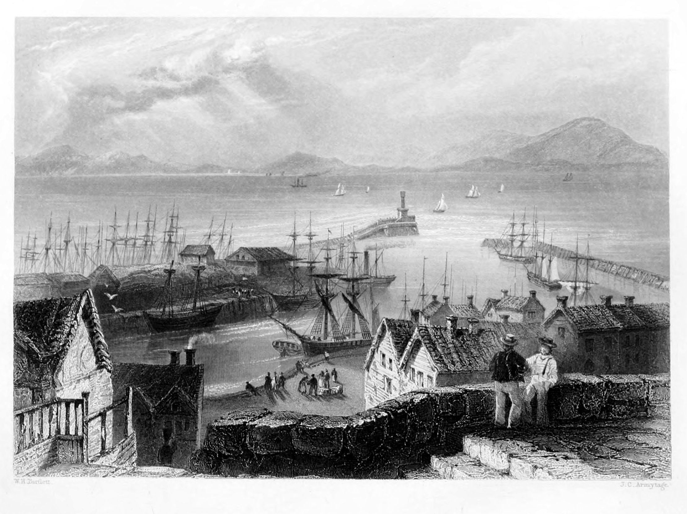
MARYPORT,
CUMBERLAND.
Maryport derives its name from that of a patriotic lady in the neighbourhood, the wife of Mr. Humphry Senhouse, of Netherhall,[15] who, in 1750, took a lively interest in the place, and, with the assistance of her family connexion and the spirited inhabitants of the place, succeeded in raising it to the distinction of a port town; a title to which it has added many additional claims within the last ten years. The original name was Ellenfoot, so called from its situation at the embouchure of the river Elne with the Solway. It is a chapelry of Cross Canonby, or Crosby—a parochial village about three miles distant; in the church, dedicated to St. John, are several ancient monuments of the Senhouse family, already mentioned, one of whom, Richard Senhouse, was bishop of Carlisle in 1624.
The commerce of Maryport, according to the last report, is decidedly on the increase; and the many advantages it possesses for ship-building and refitting are more and more appreciated by all trading-vessels frequenting this coast. The exports consist principally of coal for Scotland and Ireland, which is furnished in great abundance by collieries in this district, and affords the means of comfortable subsistence to a hardy race of seamen, who, in the hour of danger, have often "done the state some service." The importations consist of timber, flax, and iron, from the Baltic, and various articles of domestic utility from the opposite coasts. The herring-fishery has hitherto been prosecuted with great success; upwards of twenty boats were lately engaged in this enterprise. In winter, the boat-crews are employed in the taking of cod-fish, which is here caught in great abundance, and finds a ready sale on the market-days of Tuesday and Friday. The river Ellen, or Elne, affords no inconsiderable supply of salmon-trout during the season; and as the daily steam-vessels running between Carlisle, the Scottish coast, and Liverpool, generally touch at Maryport for the convenience of passengers, there is a constant air of bustle and activity about the pier that renders the place very agreeable as a sojourn in the summer months. The view across the Frith is one of the finest on the coast, and the inland scenery is proverbially beautiful. It is only six miles from Cockermouth; and is further enlivened by the continual traffic along the great coast-road which connects it with Carlisle on the east, and with Workington and Whitehaven on the west.
The county of Cumberland abounds in vestiges of Roman domination, and to the eye of the antiquary presents a fertile field of investigation. Of all these, however, the Roman wall is the most remarkable. It was built by the Emperor Adrian early in the second century, as a barrier against the Caledonians, and extended across the whole island from sea to sea. Its length was one hundred miles, and its breadth six feet, by twelve in height. In its course it had twenty-five strong castles, planted at regular distances; the foundations of which, as well as of the wall itself, can still be traced, and in some places present a solid mass of several feet above the ground. Besides these there are also Roman, Danish, or Saxon encampments, in various parts of the county, as well as ancient Roman and British causeways, and several remains of Druidical circles.
The great store of antiquarian treasure lies, however, at a short walk from Maryport, where the Romans have left abundant proofs of their long sojourn on the banks of the Solway. The character of the present work, however, does not permit our enlarging on this subject; but to all those who visit Allonby or Maryport during the summer, and have a taste for antiquarian lore, the scene thus briefly adverted to will furnish a source of many classical reminiscences.
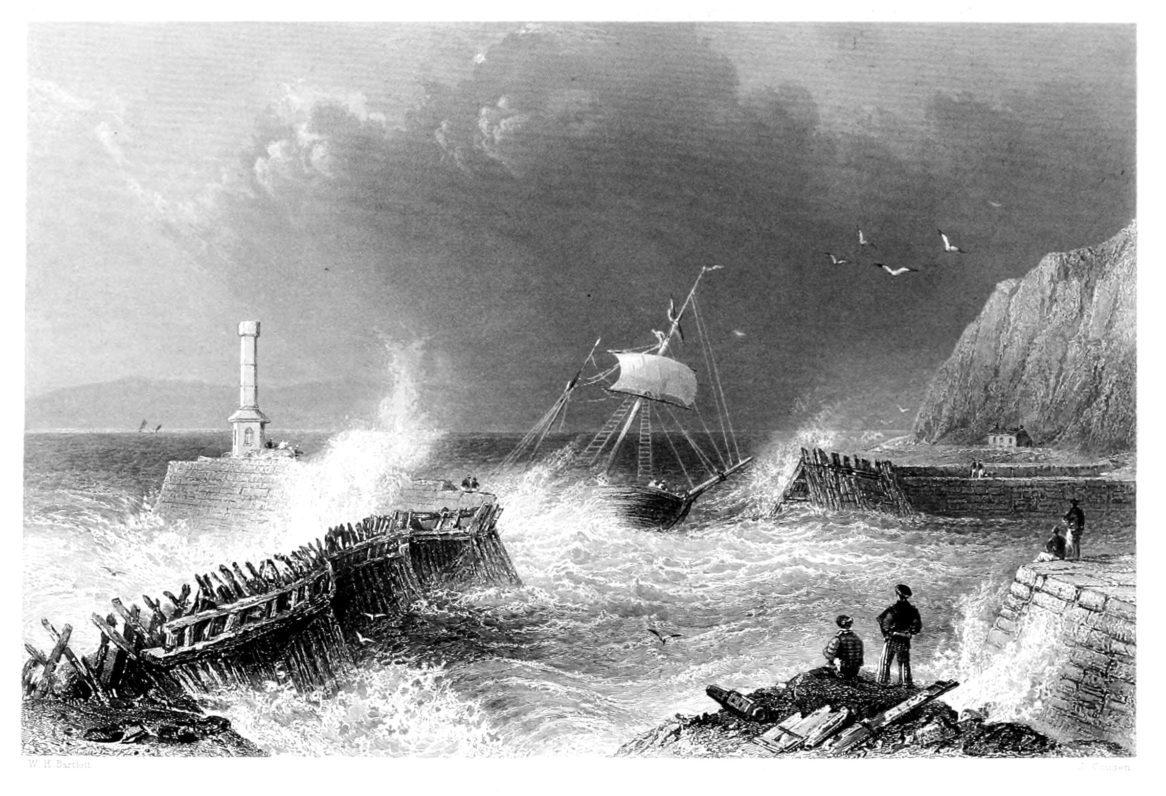
MARYPORT PIER.
The subject of our engraving is a scene but too often visible on our coasts, and by no means peculiar to Maryport. The storm is evidently exhausting its fury upon the Pier and Lighthouse in vain, they are destined to sustain the shock of many such rude assaults, and to afford that shelter and warning to mariners so requisite in the hour of Ocean's rage. The coast of Cumberland is at all times of the year rough and inhospitable to the sailor; but at the equinoxes, especially the autumnal one, its dangers are more imminent; and the trading vessels in the Solway Frith and Irish Channel, are exposed to serious risk. Owing to the numerous shoals and sand-banks lying at various points, the navigation is at all times intricate; and even to those best acquainted with its peculiarities, the passage from Ireland is frequently attended with greater hazard than many longer voyages.
The Town of Maryport is the subject of another view, and in the notice accompanying it will be found such particulars as we could glean in connection with this small but bustling port. The Pier itself, though well adapted for the purposes of illustration, is not a subject upon which we can profitably occupy the reader's attention; we shall, therefore, avail ourselves of the opportunity thus afforded us to say a few words upon one of the finest of the English lakes, situated within a few miles of Maryport, and a visit to which is a favourite excursion with its inhabitants and visitors. It is to the far-famed Derwent Water that we allude. It occupies a beautiful valley, surrounded by romantic mountains; its shores and islands, covered with luxurious wood, and towards Keswick its northern extremity opening to a spacious and fertile plain. The mountains on the eastern side of the lake are finely broken, in some places presenting precipices mingled with copse-wood and verdure; the chasms of the rocks discharging a great many streams in beautiful falls. The mountains on the western side of Derwent Water are more regular in their forms, generally verdant, and adorned with a profusion of wood near the water's edge. At the southern extremity of the lake, three miles from the town, is Lowdore waterfall, the height of which is said to be not less than 200 feet. It is a very considerable stream, rushing through an immense chasm, and bounding over huge blocks of stone, with which the channel is filled. Near the fall is Gowdar Crag and Shepherd's Crag, constituting one of the finest scenes amongst the lakes.
The manor of Derwentwater belonged to a family which derived their name from it. In the reign of Henry VI., the heiress of Sir John de Derwentwater married Sir Nicholas Radcliffe, of Dilston, in Northumberland, whose descendant, Sir Francis Radcliffe, was created by King James II. Earl of Derwentwater, &c. James, the second earl, having been engaged in the rebellion of 1715, was beheaded on Tower-hill; and the Derwentwater estates, becoming forfeited to the Crown, were granted to Greenwich Hospital, by Act of Parliament. Lords' Island, in the lake, was the residence of the earls.
The beautiful scenery of Derwent Water, said to be about ten miles in circumference, has often been described. St. Herbert's Island is named from a hermitage dedicated to that saint. Vicar's Island formerly belonged to Fountain's Abbey. Rampsholm, a small island, is covered with wood. The fish in greatest estimation in the lake is a sort of salmon trout. The celebrated mountain Skiddaw, in this vicinity, said to be about 3036 feet in height, extends to several townships; that part which is in Crossthwaite parish is within the townships of Under Skiddaw and Crossthwaite, and comprises the manor of Brundholm. The mountain is easy of access; and, standing in some measure detached, the view from the summit, particularly to the north and west, is not intercepted by other mountains: it comprehends the principal part of the county, including the coast from St. Bees Head to the head of Solway Frith, with its several bays and promontories, the Isle of Man, and a considerable portion of the southern part of Scotland. The summit of Ingleborough-hill, in Yorkshire, may be seen over the range of hills bounding the head of Ullswater; and a glimpse of the sea near Lancaster is obtained through the gap of Dunmel Raise. Derwent Water and Bassenthwaite lake are the only lakes seen, and but one of these from the summit. The views from the neighbouring mountains may exceed in grandeur the view from the summit of this, but in no other ascent are the prospects equalled, which unfold themselves when overlooking the lake and vale of Keswick, with Borrowdale and Newlands mountains.
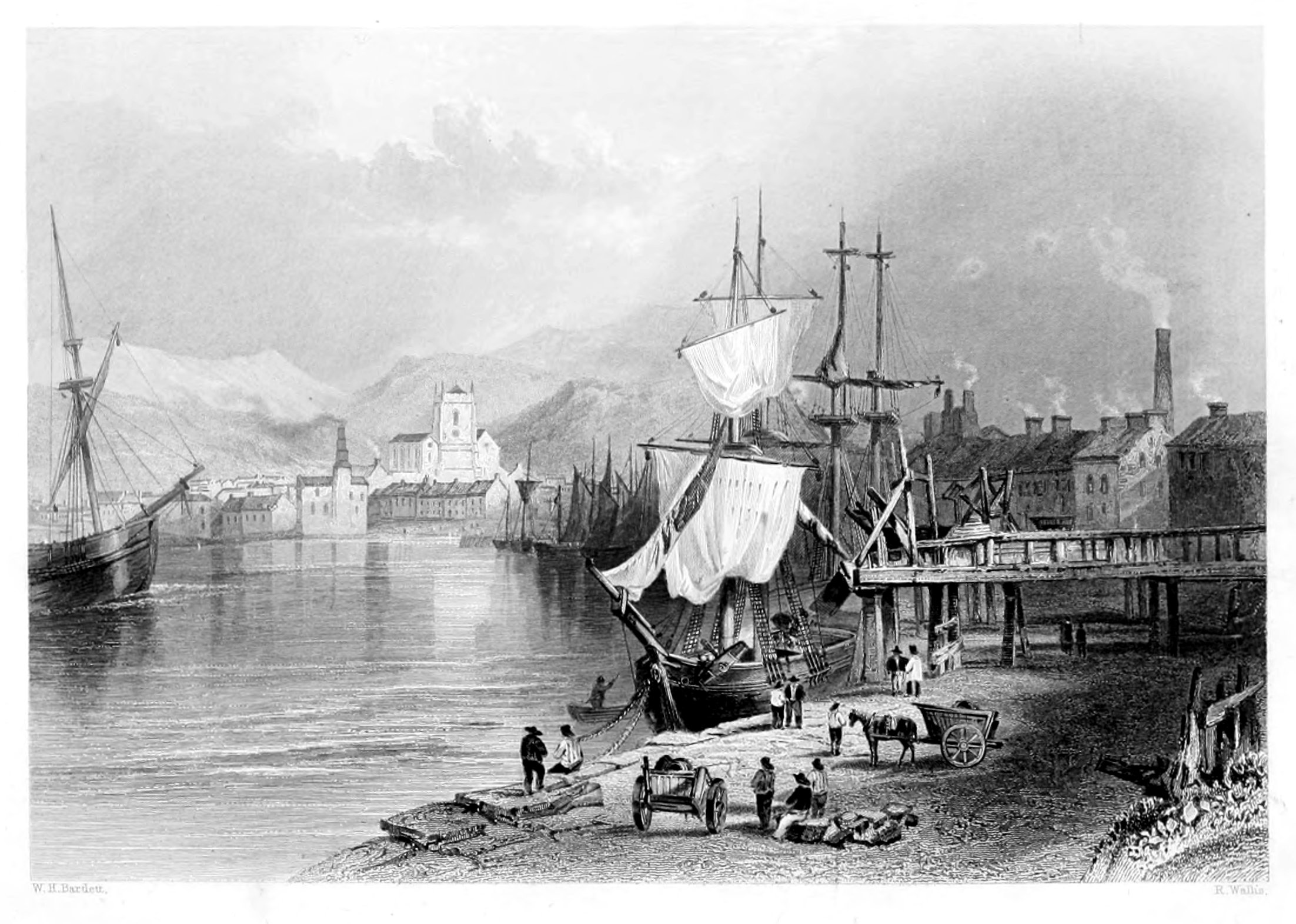
WORKINGTON,
CUMBERLAND.
The town and harbour of Workington is situated on the south bank of the Derwent, near its entrance to the Irish sea; it is about seven miles north of Whitehaven, and thirty-four south of Carlisle. It is divided into the upper and lower towns. Leland, in his venerable Itinerary, describes "Wyrkenton" as "a lytle prety fyssher-town;" and in his day, indeed, most of the maritime stations on this coast, which have subsequently risen into importance, were nothing more than "pretty little fisher-towns." It is also noticed by Camden as distinguished for its salmon-fishery, owing to its favourable position at the mouth of the river Derwent, whose scenery holds so distinguished a place in the poetry of the Lakes.
The public buildings of Workington are chiefly of modern date, and the houses disposed into two clusters in that called the Upper town. In the area of the new square is the corn-market, and at a short distance are the assembly rooms and theatre, both of which, though small, are by no means destitute of taste and elegance. It has a weekly market on Wednesday for corn, and on Wednesday and Saturday for butchers' meat. The church of St. Michael, forming a prominent object in the centre of the Engraving, is a rectory in the patronage of the Curwen family, and contains a monument of Sir Patrick Curwen, Bart., who died in 1661. The chief source of industry here, as at Whitehaven and other towns of the coast, is the coal-mines, which, in the vicinity of Workington, amount to sixteen or upwards, with a depth of from forty to ninety fathoms. The coal lies in bands or seams, divided from each other by intermediate strata. Of these the uppermost is generally three feet thick, the second four, and the third, or lowest, from ten to twelve feet. The extraneous matter that separates the former varies considerably; but the covering of the main coal is of the finest white freestone, about twenty yards thick. When the "new seam," as it was then called, was first discovered at Chapel-bank, the event was celebrated by the late proprietor, Mr. Curwen, by a splendid festival, and a vast concourse of the inhabitants and neighbours assembled to drink success to the "black diamond."
The quantity of coal shipped from this port, per week, amounted latterly to two thousand tons or upwards, and the raising of which, with the aid of several steam-engines, afford employment to between six and seven hundred workmen. The agricultural society of Workington has contributed much to the improvement of the county, and owes its origin to the spirited and indefatigable example of the late proprietor of these mines. A staith or loading stage for collier vessels is seen on the right hand of the illustration. It is an object more valuable for its utility than for any beauty in an artistic point of view; but it is a distinguishing characteristic of all the ports engaged in the coal-trade, and, wherever it can be rendered available, reduces the expenses of the coal-owner, by obviating the necessity for keels or lighters.
The mansion of the Curwen family—or hall, as it is more generally designated—was formerly a castle of great strength; and, notwithstanding the numerous alterations it has undergone since the feudal epoch, still presents a noble and imposing feature in the landscape. In this hospitable fortalice Queen Mary was received and entertained by its generous owner, the ancestor of the present Mr. Curwen, till the royal pleasure of Elizabeth could be ascertained as to her future disposal. The chamber in which she slept is still a recording testimony of the fact, and retains the name of the "Queen's chamber," where we may well believe—
The mountains of Cumberland—some of which form the background in the present view—are exceedingly numerous, lofty, and of striking conformation. Around the lakes they are often finely grouped, generally clothed with copse-wood: here pastoral, and dotted with flocks; and there rugged, precipitous, and hewn into deep ravines by those thundering torrents which convey their foaming tribute to the lakes. Every mountain in Cumberland has its name celebrated in poetry—every lake has been the subject of some inspired lyric; and such was the favour in which the charming scenery of this county was held by several of the master-spirits of the age, that the lakes of Cumberland and the adjoining county were adopted as their residence, and from their banks the strains of Wordsworth and Southey were welcomed as the genuine emanations of inspired minds.
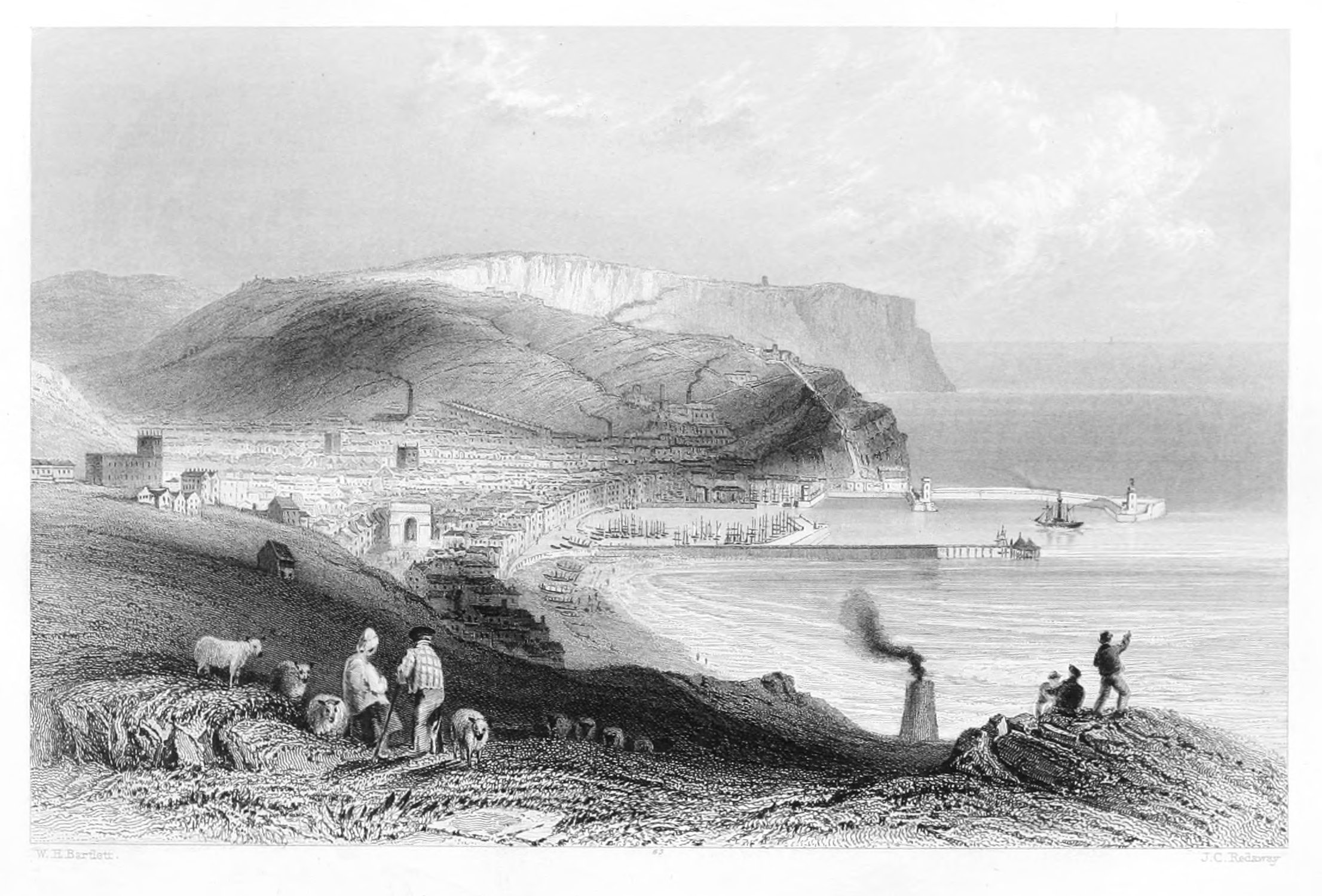
WHITEHAVEN,
CUMBERLAND.
The town of Whitehaven may be considered as a national monument to the creative influence of trade. Favoured by the geological character of its soil, and fostered by native industry, it has risen in the comparatively brief interval of a hundred and eighty years, to a position of eminence among the minor ports and harbours of Great Britain. What in the middle of the seventeenth century consisted, according to written testimony, of only six fishermen's huts and one small bark, is now a flourishing town, enlivened by trade and commerce, with a commodious harbour, extensive shipping, and enterprising merchants.
The bay on which the town of Whitehaven is erected is so deeply seated, that the adjacent shore, rising like the grades of a magnificent amphitheatre, appears to enclose it on every side. In approaching it from the north, the stranger is uniformly struck with its sheltered position, and from the heights looks down upon it as on a map spread at his feet. From the south the view is particularly beautiful. The town is well built, the streets wide and enlivened with well-furnished shops, and inhabited by a cheerful and thriving population. Like Longtown, on the Border, Whitehaven is built after a correct plan; the streets cross each other at right angles, presenting much architectural regularity, and combining with the air of internal comfort the outward signs of taste and elegance. The public improvements continue to advance in proportion to the extent of commercial intercourse, and to this, apparently, every succeeding year throws open some new channel. The introduction of steam-navigation between all the adjacent as well as opposite coasts, has powerfully contributed to stimulate the native industry of the place, by increasing the demand for coal—its staple produce—to which we shall more particularly advert in our notice of the harbour.
The situation of Whitehaven in a narrow valley, extending to the village of St. Bees—a distance of several miles—unites with the appearance of seclusion much of that picturesque beauty for which the inland districts of the county are so justly celebrated. St. Bees'-head is a bold and striking feature, and contrasts admirably with the softer scenes from which it projects, as the most imposing landmark on this part of the Channel.
The population of Whitehaven has greatly increased within the last ten years. The neighbouring villages, farms, and pastures, all indicate progressive advancement in the several branches of domestic industry. The land is highly cultivated, and in many instances fertile and productive; while the orchards and gardens, by the nature and abundance of their produce, bear friendly testimony to the mildness of the climate.
To the Lowther family, who have a handsome castle here, Whitehaven owes its foundation as a borough, and much of its prosperity as a trading port. To the munificence of its patrons—and especially to the Earl of Lonsdale, who has spared neither personal expense nor political influence to facilitate every object which held out the promise of permanent advantage to the inhabitants, it is eminently indebted. And in return, it may be justly observed, that whatever the patron has expended in improving the town and harbour, the people have repaid by increased attachment to the interests of their benefactor. The inhabitants of Whitehaven are noted for their public spirit, honourable conduct in trade, and for that indefatigable attention to business which has so happily distinguished them through a long series of years. It has several schools, two weekly papers, and the study of literature and science is much cultivated and encouraged by the families of affluence and respectability who reside in the town and vicinity. Social and hospitable intercourse, with balls, assemblies, and public fetes, render the stranger's residence at Whitehaven extremely agreeable. It offers, in general, all the luxuries of a country town, with few or none of its disadvantages; and presents at all times the means of prompt intercourse with the great commercial emporium of Liverpool, the coasts of Scotland, Ireland, Wales, and the Isle of Man. Independently of its immediate vicinity to the Lakes, it would be difficult to point out any situation in the northern counties which enjoys so many attractions in regard to situation, scenery, and society, as the picturesque and prosperous town of Whitehaven.
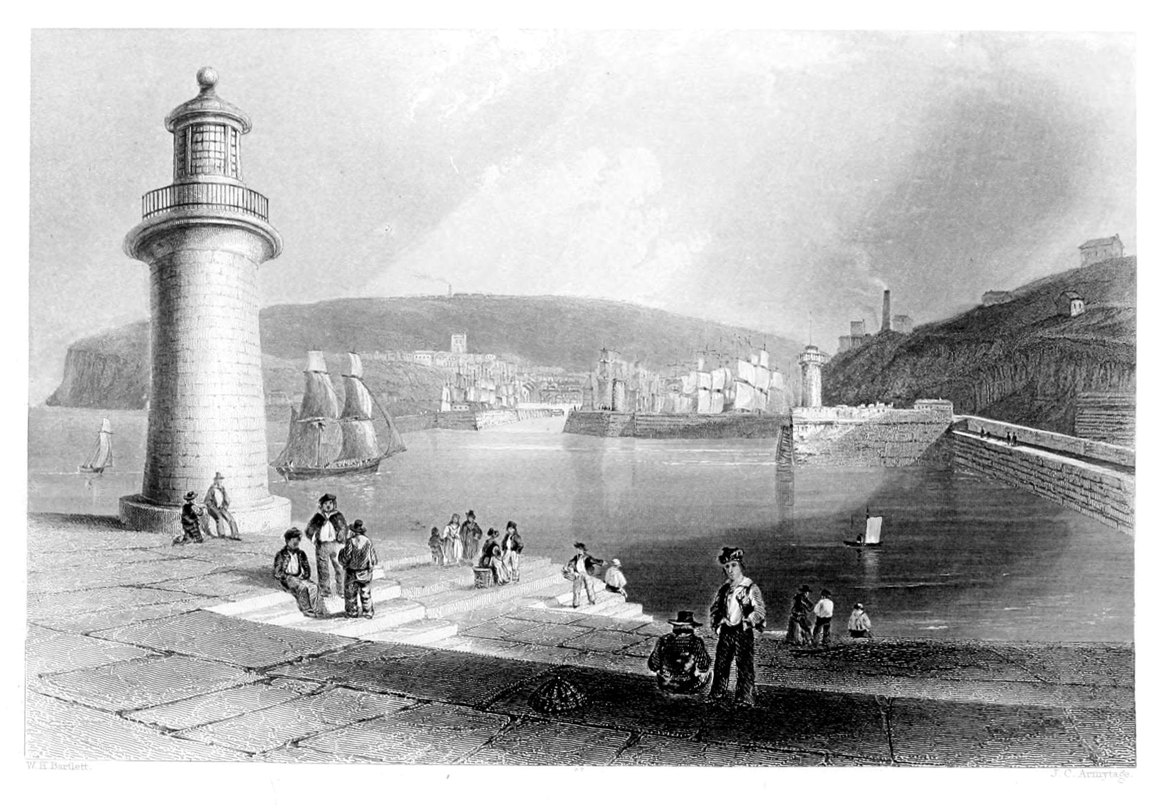
WHITEHAVEN HARBOUR.
In another article we have given some descriptive particulars of the town of Whitehaven and its vicinity, and have therefore in the present instance to confine our attention to the harbour, an excellent view of which forms the subject of our engraving.
We have previously stated that Whitehaven is mainly indebted to the Lowther family for its rise and progress as a trading port. By Sir John Lowther, an ancestor of this house, the lands of the dissolved monastery of St. Bees were purchased for his second son, Sir Christopher, early in the reign of Charles the First; and, as the use of coals first became general at this period, the new proprietor determined on improving his estate by opening a colliery. In this, however, little progress was made till after the Restoration, when Sir John Lowther, his successor, formed a plan for working the mines on a very extensive scale, and with this view obtained considerable grants of unappropriated land in the district, which was secured to him in 1666. Two years later he obtained a further accession of property, including a parliamentary gift of the whole sea-coast for two miles northward, between high and low water-mark. He next turned his attention to the port, which was neither large nor convenient, and by his judicious schemes laid the foundation of the present haven. Since that important epoch it has been greatly and gradually improved, particularly since an act of parliament was obtained to finish the original plan, and to keep it in repair, by a moderate tonnage on shipping. In its present form it is protected and strengthened by several piers, or moles, of compact stonework, three of which project in parallel lines from the land; a fourth, bending in the form of a crescent, has a watchhouse and battery, with a handsome lighthouse at its extremity. At low water, the port is nearly dry, so that the shipping within the moles lie as if in dry docks.
Adjoining the harbour, on the west side of the town, is the coal-staith, or magazine, where coal for exportation is deposited to the amount of several thousand waggon-loads. Eight or ten, and occasionally twelve, vessels, each carrying a hundred tons and upwards, are commonly loaded at one tide, at an expense of only ten shillings each, so great are the facilities contrived for this purpose. The method is this: the greatest part of the road from the pit runs along an inclined plain, on which are railways communicating with covered galleries, which terminate in large flues, or hurries, placed sloping over the quay. When loaded, the waggons run by their own weight from the pit to the magazine, where, their bottoms being struck out, the coals are dropped into the hurries, and thence with a noise like thunder descend into the holds of the vessels.
Whitehaven forms one of a chain of ports on the north-western coast of England, which owe their commercial importance to the demand for coals. This branch of trade has long been famous as a nursery of hardy and intelligent seamen, and the naval service of the country has, in times of war, been chiefly indebted to the numerous body of men who have, either voluntarily or by compulsion, exchanged their services from the humble collier to a more distinguished, though less lucrative, position on the deck of a line-of-battle ship. Years have now passed since there has been any occasion to disturb the arrangements of our commercial marine for this purpose; and it is to be fervently hoped that the advancing civilisation of the age will preclude the re-enactment of such scenes of misery and crime as must ever accompany the system of impressment and forced service.
Most of the coal exported from this haven is conveyed to Ireland; and the annual quantity raised, on an average of twenty years, was formerly under 100,000 chaldrons; but of late years the export trade in this department is understood to have greatly increased. In the Whitehaven coal-mines there have happened from time to time lamentable catastrophes by the explosion of foul air, attended by great sacrifice of life. It is painful to reflect, that, with all the means which, in this scientific and inventive age, have been recommended and adopted, no effectual plan has hitherto been devised for the prevention of these sad and appalling accidents.
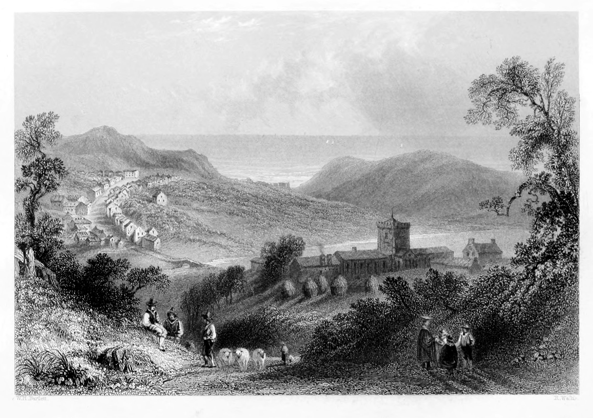
ST. BEES' COLLEGE.
Delille.
The village of St. Bees is a place of great antiquity, and holds a distinguished place among the theological seminaries of the kingdom, owing to the high reputation of the late Dr. Ainger, and his able and distinguished successor, the Rev. W. Buddicom, principal of the college. The chapel, which is built of freestone, is part of an ancient church belonging to a monastery, founded here by St. Bega, a holy woman of the seventh century. The form of the building is that of a cross. The western portion, or nave, is now fitted up as the parish church, the great door of which is ornamented with grotesque heads, chevron mouldings, and other ornamental work in the ancient ecclesiastical style. It formerly contained a large wooden statue of Anthony, the last Lord Lucy of Egremont.
The original building having been destroyed by the Danes, William, son of Ralph de Meschines, Earl of Cumberland, undertook its restoration in the reign of Henry the First, and made it a cell for the prior and six Benedictine monks to the Abbey of St. Mary, at York. It was endowed, at the dissolution of monasteries and religious houses, with a hundred and fifty pounds, and granted by Edward the Sixth, along with the manor, rectory, and other estates, to Sir Thomas Challoner; but afterwards revoked, and given by Queen Mary to the Bishop of Chester and his successors.
The eastern part of the abbey, built in the thirteenth century, was fitted up about twenty-four years ago as a college, containing a public hall and lecture-room for the students, the end of the ancient cross-aisle being converted into a library, with an excellent collection of approved works on divinity. This valuable institution was commenced under the auspices of the late Bishop of Chester, Dr. Law. Its object is to afford such young men of the northern provinces as have not the opportunity of prosecuting their studies at Oxford or Cambridge, the means of fitting themselves for entering into holy orders; and the success which has already attended this pious and patriotic measure has been highly gratifying. Previous to admission, it is expected that every candidate shall furnish evidence of his having received a classical school-education, with testimonials of moral character; and, after two years' study, he is entitled to be received on trial for ordination. A gentleman who lately studied here, and who is now a most efficient and zealous minister of the Church, speaks in very favourable terms of the judicious arrangement which has latterly marked the theological course at St. Bees; and improvements still more decided, it appears, are in contemplation under its present administration.
Edmund Grindall, Archbishop of Canterbury, was a native of Hensingham, in this parish; and, in 1583, obtained letters-patent for the foundation of a free grammar-school at St. Bees, in which gratuitous instruction in the classics was provided for a hundred boys. This institution is under the management of a corporation of seven governors, two of whom are the provost of Queen's College, Oxford, and the rector of Egremont.
It has produced several learned characters, among whom was the pious Dr. Hall,[16] bishop of Norwich, whose eventful life is familiar to every reader of ecclesiastical history. Much of the prosperity of the village of St. Bees depends on the lodgings which it supplies to the students during term.
The parish of St. Bees is of great extent; and, judging from the ruins still observable, must have been fortified by the Romans at all the convenient landing-places along the shore, which here, and particularly to the northward, presents many vestiges of their military occupation. The village stands on the margin of the bay formed by the southern promontory of St. Bees'-head.
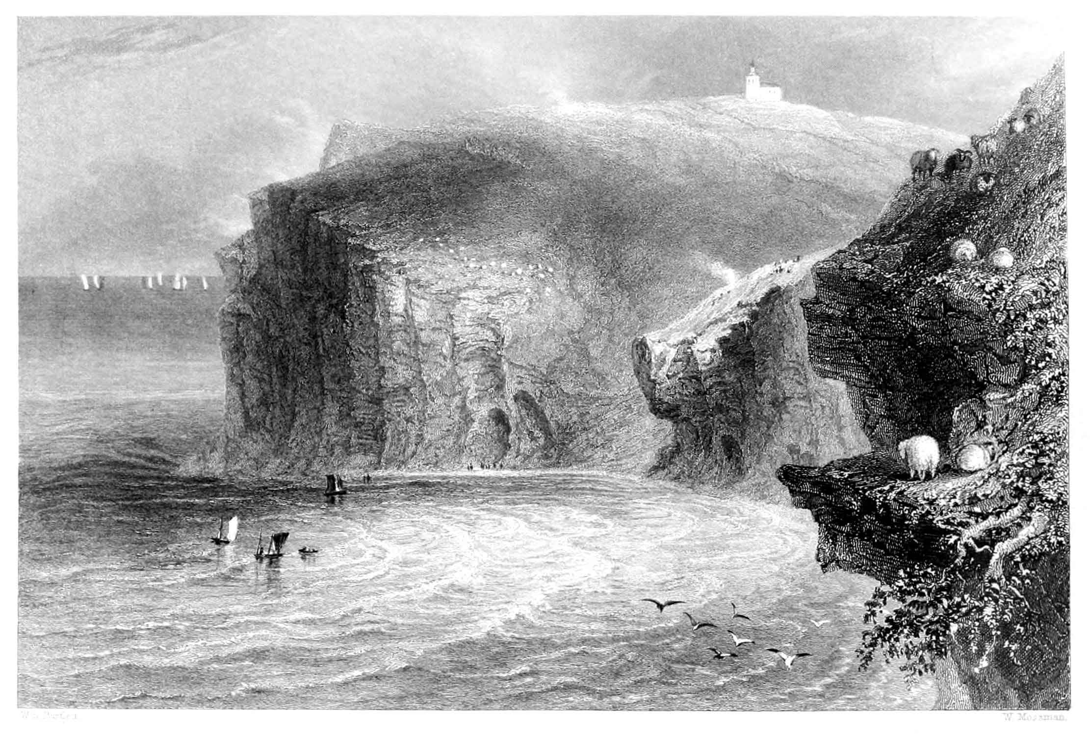
ST. BEES'-HEAD.
This lofty headland, anciently known as the "Cliff of Barath," is a conspicuous object to vessels in the north-east part of the Irish channel—bold, abrupt, and precipitous towards the sea; but presenting, as it slopes inland, a fine undulating and pastoral mass of verdure, through which, at intervals, projecting fragments of rock discover its geological character. The succession of deeply indented and rugged precipices which it presents seaward, is singularly wild and picturesque; and during gales from the southward the scene is one of the most sublime that can be conceived.
The lighthouse which occupies the summit, was first erected in 1718, with a fixed light at an elevation of three hundred and thirty-three feet above high water, which in clear weather is visible at a distance of twenty miles. But in January, 1823, a new light, consisting of nine reflectors, was first exhibited, which has doubtless been the means of rescuing from destruction many lives and much valuable property.
The view from the summit of this cliff is particularly striking—embracing all the bolder features of the Scottish shore—the Isle of Man, and an expanse of sea which, however the wind may blow, is always enlivened with shipping. Besides the exportation of coal, which is immense, there are several vessels employed in the exportation of lime, freestone, alabaster, and grain, and in the importation of West Indian, American, and Baltic produce, flax and linen from Ireland, and pig-iron from Wales.
The parish of St. Bees, is very extensive, and includes some picturesque mountain scenery, among which may be enumerated the views from those peculiarly named hills Hard-knot, Wry-nose, and Scafell. The highest point of this range, Scafell, is three thousand one hundred and sixty feet above the level of the sea, at this height very little vegetation is met with; huge masses of stone piled one upon the other, in alternations of different strata, give to the whole a ridged or furrowed appearance of a singular character. The visitors to "the Lakes" may here gratify their taste for the romantic by visiting the beautiful valley of Buttermere, situated about midway between St. Bees and Keswick. This lake or mere, so widely known and so highly praised, is about a mile and a quarter in length, and nearly half a mile in breadth; it is connected by a little stream with Crummock lake, which has three or four small islands, but these are placed too near the shore to add much to its beauty. The best general views of the lake are from the Hause, a rocky point on the eastern side, and from the road between Scale-hill and Lowes-water. Both lakes are well stocked with trout and char. Scale Force, near Buttermere, has a fall of more than one hundred and fifty feet, and is very nearly perpendicular, besides uniting its waters with a small fall below: it is said to be the deepest in the lake district. The water is precipitated into a tremendous chasm between two mural rocks of sienite, beautifully overhung with trees, which have their roots in the crevices, and the sides are clad with a profusion of plants which glitter in the spray of the fall. At Buttermere is situated the Sour Milk Gill, a waterfall so termed from the frothy whiteness of its surface, which has been supposed to resemble butter-milk fresh from the churn. The temptation to indulge in reminiscences of the innumerable views of interest with which this vicinity abounds, has led us to ramble far from the description of the promontory which forms our subject; but this is less to be regretted as it has afforded us an opportunity of calling the reader's attention to a country that yields to none in the United Kingdom in point of natural beauties, and which is every succeeding year becoming a more fashionable resort.
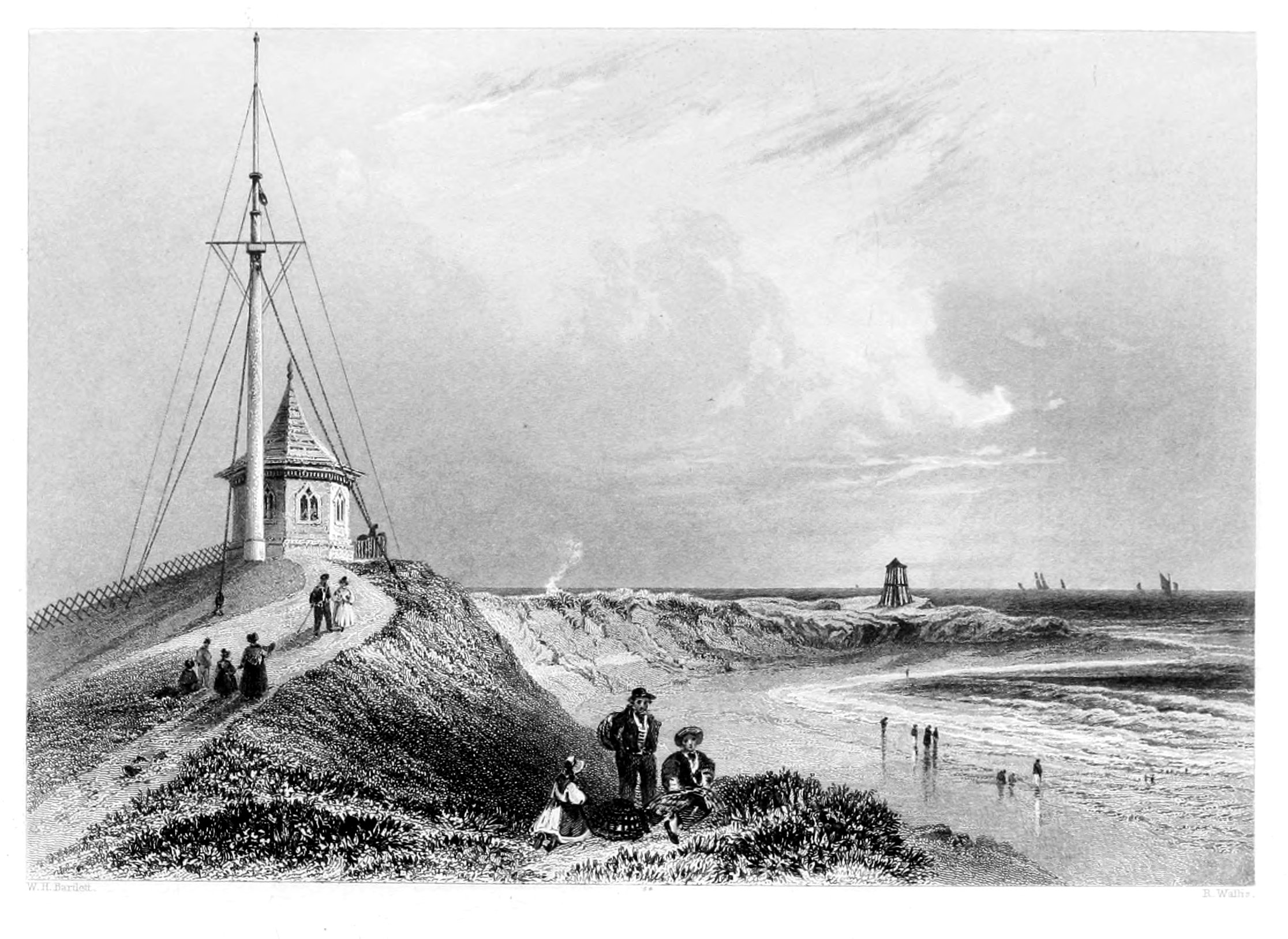
FLEETWOOD-ON-WYRE,
LANCASHIRE.
Fleetwood: A Poem.
The name of Fleetwood is associated, prospectively, with the first commercial ports of the kingdom. The illustration prefixed sufficiently indicates the use to which it is applied; but the rapidly increasing importance of this new maritime station is entitled to a more particular notice than the detached "scene" would appear to demand. Situated at the entrance to Morecombe Bay, on the river Wyre, the great natural advantages which it presents are hardly to be surpassed; and from the liberal spirit with which the operations are carried on, Fleetwood must shortly become one of the most frequented sea-ports on the British coast; combining, at the same time, all the recommendations of a commercial town, and a delightful watering-place. With Preston, from which it is distant only eighteen miles, it is connected by means of the railway through Poulton and Kirkham.
The limits of the Port of Fleetwood, as determined by the Commissioners from the Court of Exchequer, are to "commence at a run of water called the Hundred-End, about two miles to the west of Hesketh-Bank, continuing up to Preston; thence along the coast, on the north side of the river, to Lytham; round the coast to Blackpool, and on to Fleetwood; thence to the river Broadfleet, four miles from Sea-Dyke, including both sides of the Wyre, and the river Broadfleet."
The Commissioners appointed by Government to investigate the most eligible routes by railway, to facilitate communication between London, Ireland, and Scotland, reported that the harbour at Fleetwood—which by the Preston and Wyre Railway is put in communication with London—appears to them likely to form a good point of departure for the north of Ireland and the west of Scotland. Since this report was published, experiment has fully justified the opinion thus expressed. The capabilities of Fleetwood as a commercial port are of the first order; and the plans to render it such can be executed at a comparatively small expense. Its fine spacious harbour, extensive dock, cheap port-dues and dock-charges, cannot fail to attract a large share of the American cotton, timber, and other foreign trade; while the great recommendation of low charges induce the regular Belfast and Glasgow steam-vessels to frequent the port. There is a custom-house, with bonded warehouses for all ordinary merchandise, except East India goods and tobacco—unless removed coastwise for home use and ship's stores. In a very advantageous situation seaward, a very elegant and finely contrived light-house has been erected; and, in pursuance of the comprehensive schemes of Sir Hesketh Fleetwood, Bart., M.P., proprietor of the harbour, numerous buildings have sprung up in all directions, and upon ground which recently consisted of only a warren for rabbits. Among these buildings are a handsome church, and a large and beautiful hotel, the centre of which has seventy feet of frontage, besides two spacious wings of ninety feet each; the whole forming one splendid edifice of two hundred and ninety feet in length, and commanding an extent of marine scenery not to be surpassed in any part of the kingdom.
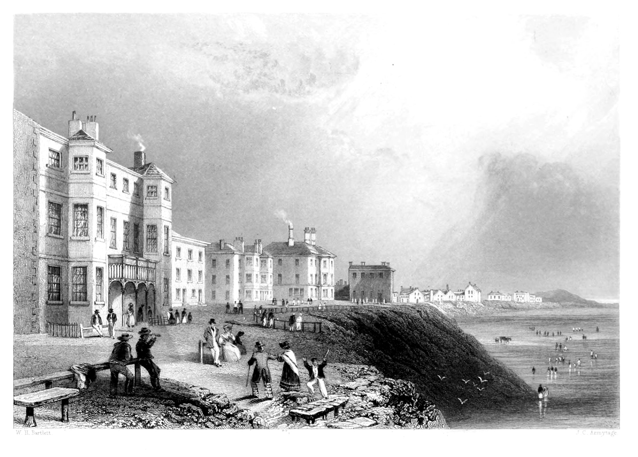
BLACKPOOL.
In referring to this watering-place for a second time we feel some difficulty; not that we have said all that can be put forth in connexion with its claims to the patronage of the health-seeking and pleasure-loving population of Lancashire and the surrounding counties, but because our desire has been to introduce, wherever possible, some historical notice of the places which form the subject of our artist's pencil, especially where, as in the present instance, more than one illustration has been given of the same town or port. We must, however, confess, that of Blackpool, historically considered, we have nothing to record. Its chronicles, if ever it possessed any, have been swallowed up by the encroaching waves, which have taken a large portion of what was once dry land to augment their liquid domains.
About half-a-mile from the beach, the stranger's attention is directed to a small rock in the sea, called the "Pennystone," which, according to local tradition, marks the place where a public-house once stood on dry land. In this stone, it is added, were fixed iron hooks, to which travellers usually fastened their horses' bridles while they alighted to refresh themselves with "penny pots of beer,"—a circumstance perpetuated in the name which it still retains.
At the south end of the town is the now dilapidated building called Vauxhall, where, in 1715, the Chevalier St. George lay for some time concealed, while the secret measures were concocting by his adherents for a general insurrection. This house belonged to the family of the Tyldesleys, who at that time, and long previously, had considerable possessions in this country; but being faithful adherents of the House of Stuart, they embraced the desperate cause of the royal exile with undissembled zeal. Sir Thomas Tyldesley, the head of the family at that moment, prepared this house for the reception of the royal adventurer; but this open declaration of his attachment proved ruinous to himself and his descendants. The last male heir joined the standard of the Chevalier in 1745. One of his ancestors was slain at the battle of Wigan Lane, in that county, while marching to the assistance of Charles II.; a monument to his memory was erected by one of his officers in 1679. It is still in tolerable preservation, and bears an appropriate inscription.
East of Blackpool are situated the townships of Great and Little Marton, where a subterraneous forest has been discovered, by digging out the timber from which many of the peasantry obtain considerable sums. Some of the trees are sound enough to make agricultural instruments, barn roofs and fences, and even articles of ornamental furniture. Much of the land in this neighbourhood has been reclaimed from a state of marsh; and there are still remaining, within a few miles, a Moss comprising several thousand acres—so extensive, indeed, as to have passed into a local aphorism, "As inexhaustible as Pilling Moss," being an ordinary mode of expressing anything that is supposed to be without limit. This moss is reported to have, as lately as 1745, altered considerably in its level, and, by a movement to the south, to have destroyed one hundred acres of improved land. It affords a large supply of fuel for the district, and seems likely to continue to do so for generations to come.
The little watering-place, from which we have thus wandered away, owes its name to a pool of water of more than ordinary darkness of colour, caused by the decaying vegetation of the marshes. It has now, however, disappeared under the hand of modern improvement, and given place to a supply of water more than usually pure, and which is not to be often found in such close proximity to the coast.
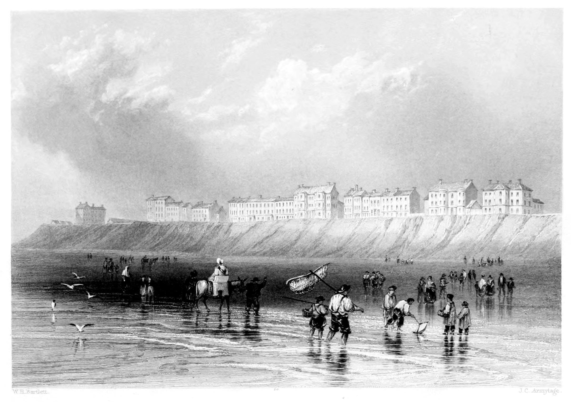
BLACKPOOL.
THE SANDS.
Blackpool is a favourable instance of that spirit of enterprise which is at work on almost every point of the British coast, and under the creative influence of which so many obscure or little-frequented localities have suddenly risen into provincial, and even national importance. Wherever nature had thrown out any encouraging hint, it has been eagerly taken advantage of by the hand of art, and, under the guidance of taste and liberality, been turned into a source of public emolument. It is, comparatively, only a few years ago since Blackpool exhibited in its appearance nothing superior to that of an inconsiderable hamlet, with few visitors, less trade, and little opportunity of extending the sources of native industry. It is now a fashionable and well-frequented watering-place, deriving a certain annual revenue from its visitors, and enjoying a considerable share of trade, with every reasonable prospect of a progressive increase. These are gratifying facts which abundantly prove the healthful vigour with which the country is animated, and the boundless resources which are everywhere thrown open to native industry and talent.
The line of coast at Blackpool runs in a nearly straight direction for several miles; and the cliffs which form the sea boundary, mostly clay, rise to various heights—the greatest elevation above high-water mark being about twenty yards. The sea-bank is lined with houses at considerable intervals to the extent of a mile or more; not grouped together as in villages, but each occupying a position independent of its neighbour. Most of those houses intended for the accommodation of visitors have an aspect due west, so as to command an uninterrupted marine view, which at this point presents a field of interest of which the mind and the eye are never weary. The land, gradually rising as it recedes from the beach, acquires a degree of elevation which excludes the eastern landscape; but for this defect the other points of the compass make ample amends, and present landscapes so varied and extensive as can be rarely met with on the coast of Great Britain. To the southward, at the distance of fifty miles or more, and gradually stretching forward till lost in the horizon, the "Cambrian Alps" present a grand and imposing feature, connected with glimpses of Cheshire, Flint, Caernarvon, and the Isle of Anglesea. On the north, the promontory of Furness, the mountainous features of Westmoreland, Cumberland, and the craggy summits of Lancashire, give a bold transition to the picture; while in front the dimly-visioned Mona finishes the panorama, and conjures up many a slumbering image and recollection of the past.
The sea on this point of the coast retreats nearly half a mile at ebb-tide, so that an ample space of nearly twenty miles, on a bed of hard sand, is left for the enjoyment of pedestrian, horse, and carriage exercise. These, indeed, are the principal out-door resources during the fine season, and, with the additional luxury of a salubrious and bracing atmosphere, produce a highly invigorating effect upon the constitution of invalids,—particularly dyspeptics, who derive great and almost uniform benefit from this new and salutary mode of life. The air of Blackpool is proverbial for its salubrious quality; the best evidence of which is afforded by the patriarchal age of many of its inhabitants.
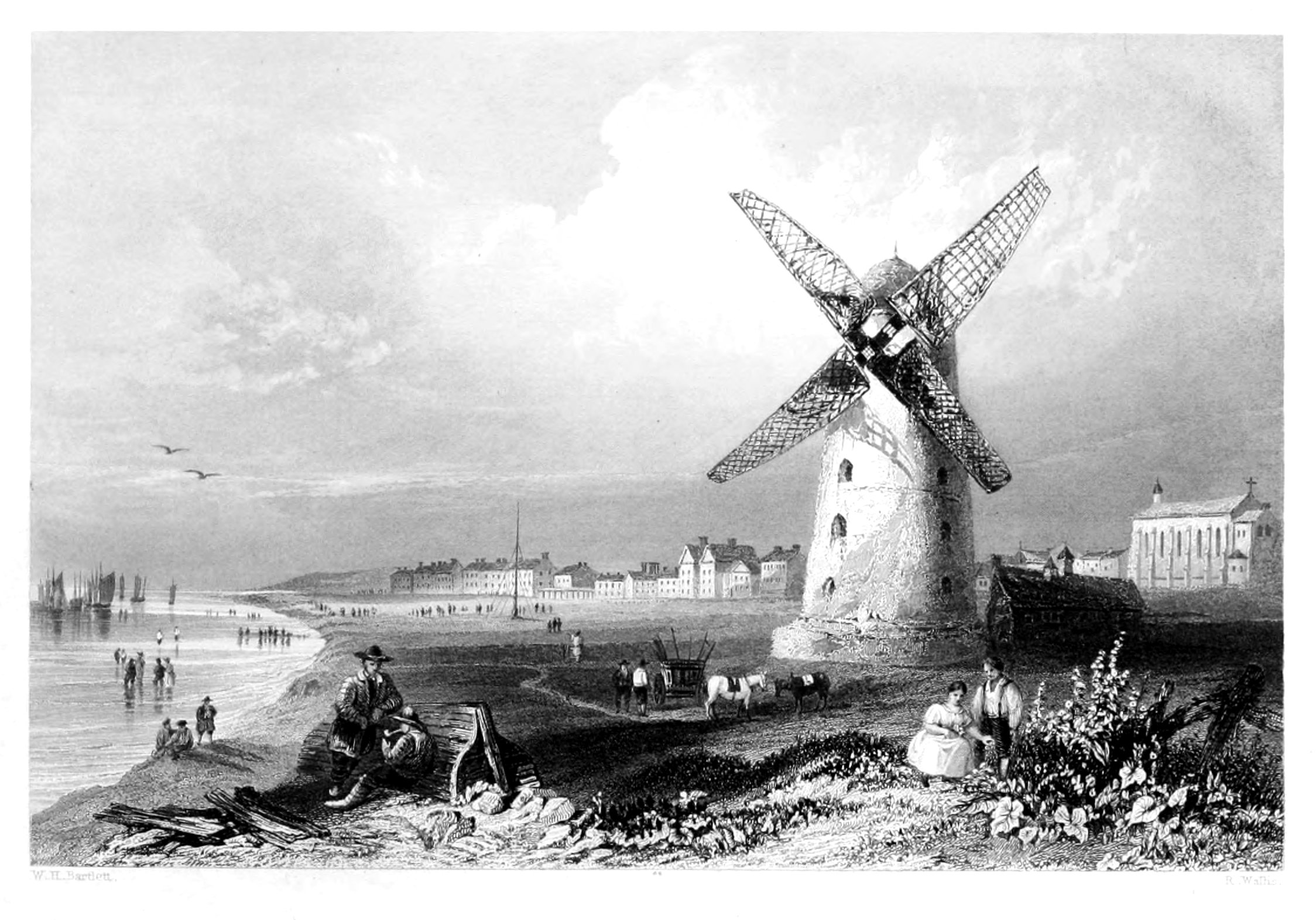
LYTHAM.
Shakespeare.
Lytham is another of those delightful watering-places to which, in our brief survey of the Lancashire coast, we have so often had occasion to refer. There is not a bay, indeed, along the whole line of sand which forms our ocean frontier on the west, but offers some pleasing summer retreat, where the invalid may repair his constitution, and return with renovated strength to the active duties of life.
Lytham is about twelve miles west from Preston, and offers every accommodation to visitors which is either usual or desirable in sea-bathing quarters. The town is cheerful, well-built, containing about fifteen hundred inhabitants, and is a place of considerable antiquity. It was here, that in the reign of Richard the First, Baron Fitz-Roger founded, in honour of the Virgin Mary and St. Cuthbert, a cell of Benedictine monks; the annual revenues of which, at the dissolution of religious houses, amounted to fifty-four pounds—equal in the present day to at least three hundred and twenty pounds. The site of this ancient cell was shortly after granted by Parliament to Sir Thomas Holcroft. Lytham Hall, the seat of John Clifton, Esq., is an object of considerable interest in the neighbourhood, and familiar to all who have ever listened to the "Lass of Lytham Hall."[17]
The country around Lytham abounds in fine drives; and, independently of the minor points, which cannot fail to engage the attention of visitors, the ancient town of Preston will offer a full day's entertainment to all who are curious in historical sites. The lordship of Preston was granted by Richard the First to Theobald Walter, seneschal of Ireland, ancestor of the dukes of Ormond, and sheriff of Lancashire; and by Edward the Third it was constituted the chief seat of the duchy and palatinate courts. King James the First honoured it with a visit in his progress to Scotland, in 1617; and on Ribbleton Moor, on the east side of the town, the Scottish forces, under the Duke of Hamilton, sustained a serious defeat in 1648—the last operation of the civil war in this country. In 1715 the Chevalier de St. George was proclaimed at the Market-cross, by the title of James the Third; and in 1745 the troops, under Prince Charles Edward, marched through the town to the Jacobin air of "The king shall have his sin again." This lively tune, however, as the reader knows, was changed into a melancholy dirge on his return through Preston—only a fortnight afterwards. The celebrated Preston Guild, which is held once in twenty years, is considered to be one of the most splendid provincial festivals in England. The institution of this ancient and unique pageant is five centuries old, the first having taken place in the reign of Edward III. It commences on the Monday after the day set apart by the Church in commemoration of the beheading of St. John the Baptist (the 29th August), and continues about a fortnight. By the charter which renders the celebration necessary twenty-eight days are allowed to all who are disposed to renew their freedom. On the first day the different trades muster in number, form processions, and attend the mayor and corporation to church; the following day the ladies of Preston, with the mayoress, are escorted in the like manner, and various festivities are encouraged during the time. On Wednesday the races commence; the race ground is about two miles distant, on Falwood Moor, anciently a part of the royal forest of the same name. Preston Guild was celebrated three times during the reign of George III., an event that never occurred in the reign of any other king of England.
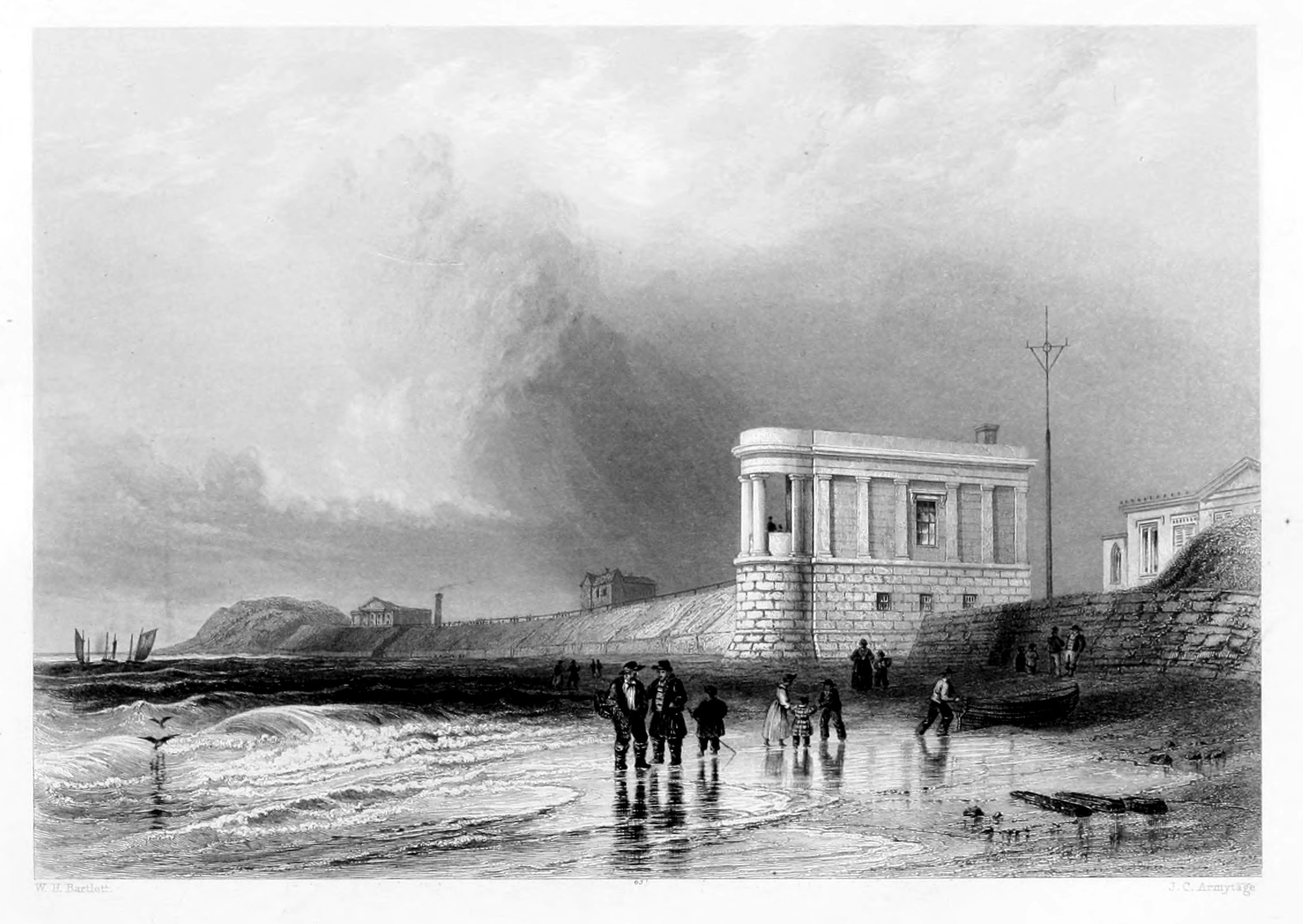
SOUTHPORT SANDS.
LANCASHIRE.
Southport—formerly South Hawes—is about two miles to the southward of North Meols, near the estuary of the Ribble, and opens upon a magnificent bay. Its situation among the dry sand-hills, or meols, contributes much to the salubrity of the place, and it appears to gain in popularity as it becomes more generally known.
This popular watering-place is of modern erection, as in the year 1809 it contained only eighty-eight houses, but it no sooner obtained the patronage of the wealthy and active merchants of Lancashire, than it sprung up with rapid strides, and those numerous appliances of luxury which its patrons know so well how to appreciate were produced in abundance, while the low, barren sand-hills of this part of the coast were soon covered with spacious hotels, boarding-houses, baths, and all the essentials of a fashionable sea-bathing town. There is no doubt but that at some period the sea must have covered much of what is now dry land, as in the churchyard of North Meols, sea shells, in considerable numbers, are frequently found when the ground is opened for graves, to the depth of five or six feet.
In the vicinity of Southport, and forming part of the same parish, is Martin (or more properly Merton) Meer, once an extensive morass. In Leland's time, it was four miles long and two broad, and emptied itself into the sea. About 1692, Mr. Fleetwood, of Bank Hall, commenced draining this meer by a sluice, shutting and opening with the tide, and died with the idea that he had completed the work. When the water was drained off, eight canoes were found, scooped out of the trunks of trees, in the same mode as they are made among the Indians of the Pacific at this day; one of them had plates of iron fixed upon it, and all were constructed probably before the Roman possession of Britain. In 1755, the Meer was again inundated by a very high tide, owing to the insufficiency of the sluice-gates, and Mr. Eccleston, of Scarisbrick, made a second attempt to drain it, and succeeded until 1789, when a partial inundation from the river Douglas did some mischief, but more extensive injury was prevented by the action of some floodgates, which had been erected to guard against such accidents. In 1813, the sea-gates were again swept away, but the land was protected by the stop-gates as before. Since that time a great improvement has taken place in the Meer, and much of it is now good land.
The practice of sea-bathing—if we may judge by the much improved accommodations at Southport and along the coast—appears to be on the increase. There are many, indeed, who a few years ago would hardly have been persuaded to dip their fingers in salt-water; but, having once become converts to that salutary habit, they would now suffer many privations rather than forego their annual visits to the cheerful "sands" and sea-breezes of their native coast. After an indulgence of this nature, the man of business returns fresh-braced to his counting-house, the student to his books, each with renewed strength and resolution to perform their several duties in the great drama of active life. We are in hopes that those of our compatriots who have really the means of such enjoyment at their command, will at length do justice to the beauty of their own shores. The millions that are squandered in perambulating foreign lands, under the specious pretext of recovering health, or in pursuit of amusement, if spent in England would secure for their owners at least something like an equivalent for their money, and testify in their own persons and in everything around them, not only proofs of good judgment, but praise for their patriotism. This mania, which for so many years has deprived our native watering-places of their legitimate revenue, is certainly on the decline; and we speak from much experience in foreign travel, when we state that, to a well regulated mind, England alone presents, in the greatest proportion, the true requisites for health and rational enjoyment. In no other country of the world is the word "comfort" so well understood; and in no other climate—"damp and dripping" as it has been pronounced by certain morbid peripatetics—can we promise ourselves so much out-door luxury and enjoyment as at "home." But to him who still entertains a doubt on this point, and prefers, with Lucullus, to change his quarters, we recommend Southport by way of experiment, and have no doubt that he will soon make a voluntary surrender of his prejudices.
FOOTNOTES
[1] Mackarel is found in large shoals, especially on the French and English coasts. This fish enters the English Channel in April, and, as the summer advances, is found on the coasts of Cornwall, Sussex, Normandy, Picardy, &c., where the fishing is most considerable.
[2] Herrings are also remarkable as appearing in immense shoals—many miles in extent, and several fathoms in depth. Their presence is easily discovered by the flights of sea-fowl which accompany them, by the unctuous matter with which the water is covered, and in the night by the brilliant phosphoric light which they emit. They are very plentiful about the Orkney Isles in June and July, in the German Ocean in September and October, and in the English Channel in November and December.
[3] The London fishmongers are said to prefer the Lowestoff herrings to those cured at Yarmouth, although they are generally retailed under the name of "Yarmouth Herrings."
[4] The inscription on the foundation-stone contains a bad pun: "Quo tempore civium Gallicorum ardor vesanus prava jubentium gentes turbavit Europeas ferreo bello, Rolandus Burdon armiger, meliora colens, Vedræ ripas, scopulis præruptis, ponte conjungere ferreo statuit."
[5] Surtees's Hist. of Durham, vol. 1, p. 226.
[6] Evidence of Sir Cuthbert Sharp before the Lords' Committee on the Coal Trade, 1829, p. 23.
[7] Mr. Buddle, of Wallsend, whose statistics of the coal-trade have been quoted by McCulloch and other writers on the subject.
[8] The moon is said to "wade" when she seems as if toilfully making her way through a succession of clouds, which flit rapidly past her.
[9] History of Northumberland, vol. i. p. 594. Edit. 1810.
[10] The other three were Roxburgh, Stirling, and Edinburgh.
[11] For many of the preceding facts we are indebted to the New Statistics of the Town and Port of Dundee, a work indispensable to all who desire correct information on the subject.
[12] Monipennie's Scots Chronicles. London, 1612.
[13] Two hundred and fifty feet, according to more recent admeasurement.
[14] The accompanying view has been justly pronounced as by far the best that has ever appeared of this remarkable scene, and is taken at the same point from which it was contemplated by Dr. Johnson, after his walk from Slaines Castle, about two miles distant. Sir Walter Scott, when on his excursion to the Shetland Isles, and while becalmed off this coast, paid a visit to the Buller; and we are of opinion (says Mr. Mackie), that in his description of the Cavern of Staffa, we can discover some of the general features of the scene described, shadowed forth in the Lord of the Isles. It is proper to mention, that although now generally written Buller, it is uniformly known in the district as the Bullers—Les Bouilloirs, or boiling caldrons.
[15] Netherhall, the seat of Humphry Senhouse, Esq., contains a fine collection of Roman antiquities, found at Ellenborough. It was visited, so far back as 1599, by Sir Robert Cotton and his friend Camden.
[16] Dr. Hall was born in 1574, and, in 1624, refused the see of Gloucester; but three years afterwards accepted that of Exeter, from which he was translated, in 1641, to that of Norwich. A few years subsequent to this event he was sent to the tower, with twelve other prelates, for protesting against any laws passed in Parliament during their forced absence from the House. In June of the following year he obtained his release; but shortly after suffered much persecution from the Puritans, who plundered his house and despoiled the cathedral. His private estate was also sequestered; and thus in his old age he was reduced to poverty, which he bore with great fortitude, and continued to preach as long as his health permitted. He was author of the well-known Meditations, was a poet of considerable genius, and with great wit and learning united a spirit of true meekness and piety. His works have gained for him the appellation of "the Christian Seneca." He died in 1656.
The Ports, Harbours, Watering-places and Picturesque Scenery of Great Britain. Vol. 1, Vol. 2, William Finden
