
.
HIGHWAYS
AND
HIGHWAY TRANSPORTATION
© Major Hamilton Maxwell
© Underwood and Underwood
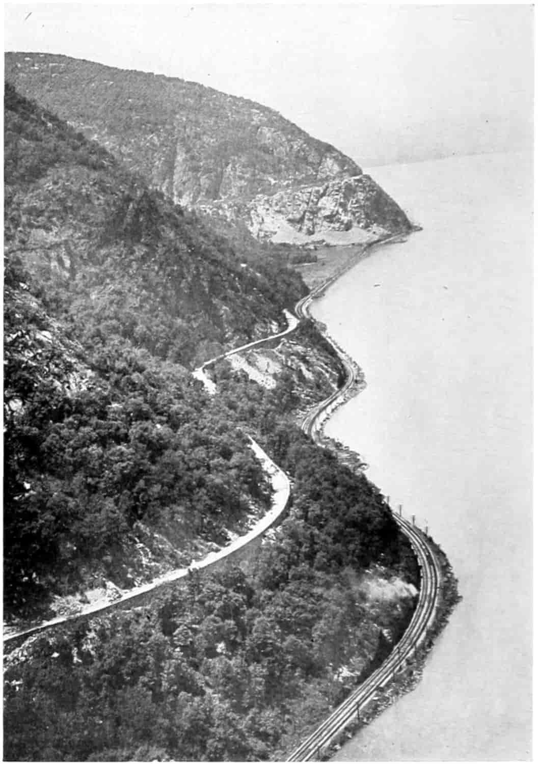
STORM KING HIGHWAY
A Great Engineering Project Along the Hudson between Cornwall and West Point, N. Y.
HIGHWAYS
AND
HIGHWAY TRANSPORTATION
BY
GEORGE R. CHATBURN, A.M., C.E.
Professor of Applied Mechanics and Machine Design
Lecturer on Highway Engineering
The University of Nebraska
NEW YORK
THOMAS Y. CROWELL COMPANY
PUBLISHERS
Copyright 1923, by
THOMAS Y. CROWELL COMPANY
Printed in the United States of America
[v]
PREFACE
The following pages on Highways and Highway Transportation do not pretend to be an exhaustive treatise on the subject, but rather a glimpse of the vast development of the humble road and its office as an agency for transportation. Possibly the grandeur of the mountains is best appreciated by one who lives among them, who climbs their acclivitous heights, who daily experiences their power and majesty, and measures their magnitude by grim muscular exertion. But, even so, it would be foolish to contend that he who gets his information from the seat of a Pullman car receives no benefit from the hasty glimpse, or, that his imagination is not quickened and cultured by the experience. In writing this book, then, I have had constantly in mind the myriads of people who have not the time, and possibly not the facilities, to search the pages of the literature of the past for the origin and development, or to work out their present importance, of our amplification of roads and of road uses. It is felt that many of these people laudably desire a conversational knowledge of the origin, evolution and present status of highway transportation, even though it be glimpsed by a very rapid passage through a very large subject.
The primary objects have therefore been, to sketch briefly and simply the development of the transportation systems of the United States, to indicate their importance and mutual relations, to present some practical methods used in the operation of highway transport and to make occasional suggestions for the betterment of the road as a usable machine for the benefit and pleasure of mankind.
Any observations made or conclusions drawn are purely personal. I entered into and have carried on the work entirely unbiased. I am not financially or otherwise, except academically, interested in any firm or company whose[vi] business has to do with transportation either directly as a carrier, or indirectly as a manufacturer of the instruments or accessories to transportation, nor does any of my living come from societies or foundations organized as propagandists for any particular forms of transportation, or transportation materials or equipment. I have no admiration for the man who hopes to see the steam and electric railways put out of business or even caused to run at a loss by the automobile, motor express or motor bus. Neither have I any plaudits for the man who would arrest the growth of the new forms of transportation by drastic legal enactments and excessive taxation in order to preserve the old. I believe there is room and need in the United States for all forms of transportation, and that each can thrive in its respective field just as do wheat and corn but none will thrive if they attempt to occupy the same field at the same time.
The text is naturally divided into two parts—the development of highways and their use. The first part treats of the relation of transportation to civilization generally, explaining briefly how the two have grown together like children at school, how each has helped the other, and how the meter of one is the measure of the other.
Leaving the old world there is sketched all too briefly the development in the United States of transportation facilities from the coastal and natural waterways, from the pack and trail, used by the aborigine and early settlers, through the treks of the pioneers, the periods of canal digging, the toll road competition, and the railway frenzy, to the advent of the modern road with the coming of the bicycle and automobile and their wonderful accelerative impulse.
The effects of State and Federal aid upon the road conditions of the country are fully treated as is also the planning of highway systems.
Automotive transportation for business and pleasure including rural motor express and bus lines, and their effect on production and marketing are described and discussed.
[vii]
In the chapters on highway accidents and highway aids to traffic, attention is called to many types of accidents, including railway crossing accidents, with suggestions for their mitigation. Here also are given the most recent practical rules for the regulation of traffic in both city and country.
A chapter is devoted to the esthetics of the highway, a subject just coming to the attention of road men who have heretofore been mostly concerned with distances, grades, widths and surfaces, which, by the way, are frequently mentioned in the text. As in all building construction the first appeal was made to material things and their relation to the pocket-book, while the last and most enduring appeal is spiritualistic and is made to the pleasures of the imagination.
The same idea of making the road a means of catering to the preservative and pleasure instincts of man is considered in the final chapter on aids and attractions to traffic and travel. Safety and warning devices are discussed as such, while comforts and conveniences are means for luring the average citizen to the highway, to the camps and parks, for the broadening effect upon his character, the health of his body, and the enlightenment of his soul.
Thus we close a most hurried journey from the very beginning of roads to their modern far superior yet very imperfect attainments. The main thought throughout has been the road as a usable agency in the economic and entertaining phases of life. Each equally important to the wealth, health, and happiness of our people. The mind easily travels ahead to a time when separate roads will be devoted to the two great ends of business and pleasure. Then the flight of fancy passes on to still another period of time and sees the highways made inoperative and superfluous, overgrown by weeds and grass, for the argosies of business and pleasure have taken to the air.
George Richard Chatburn.
Lincoln, Nebraska
March 9, 1923.
[ix]
CONTENTS
| CHAPTER I | |
| PAGE | |
| Transportation a Measure of Civilization | 1 |
| Stages of Civilization: Direct Appropriation; Pastoral; Agricultural — Manorial and Feudal Systems; Handicraft — Merchant Guilds, Effect upon Trade, Domestic System, Government Control, Agriculture; Industrial — Building of Canals, Smelting Iron, Invention of Steam Engine, Railways Developed. Some Historical Roads and their Influence: Early Highways — Asiatic, Greek, Roman, Pre-Historic American. | |
| CHAPTER II | |
| Transportation Development in the United States: Early Trails and Roads | 34 |
| First Settlements near Coast. Birch Bark Canoe, Meagerness of Roads. Settlement follows Waterways. Portages. Lines of Travel — Through Alleghanies, from the North, Boone’s Trace or the Wilderness Road, Calk’s Diary. Explorations — Marquette, Lewis and Clark, Fur Companies. Western Trails — Oregon, Salt Lake, Later California, Santa Fé, Gila and Spanish. Turnpike Roads, Wagon Road Neglect, National Participation — Cumberland Road. Early Inns. | |
| CHAPTER III | |
| Waterways and Canals | 70 |
| Coastal, Inlets, Rivers, Creeks. Canals — Europe, New York, Pennsylvania, Ohio, Other States; Passenger Traffic on; Prosperity and Desuetude. Ship Canals: Sault Ste. Marie, Cape Cod, Panama — Inducements for, Early Schemes, Routes — Tehauntepec, Nicaragua, Others; French Participation — DeLesseps’ Grant, Company Organized; Other Promotion Schemes; Indignation in the[x] United States against Foreign Building Canal; DeLesseps begins Work; Clayton-Bulwer Treaty; Hay and Pauncefote Treaty; Commission Reports Favorably on Nicaraguan Route; French Company Bankrupt; Colombian Congress Refuses to Sell to the United States Control of the Canal Strip; Panamanian Revolution — Roosevelt’s Part in Revolution; United States Secures Control of Canal Strip, Colombia Protests; Construction of Canal Begun; Description of Canal, Canal Traffic. River Transportation: Small Boats, Pole Boats, Large Boats, Rafts. Steamboat: Construction, Mississippi River Traffic, New Orleans Levee, Mississippi Steamboats and Steamboating; Steamboat Fares. Government Attitude toward River Improvement. John Fitch Granted a Right in New Jersey; Calhoun’s Activities, Monroe’s Attitude. National Aid for Internal Improvements. | |
| CHAPTER IV | |
| Railroads | 99 |
| Origin and Early Development. Optimism of Promoters. Early Locomotives. First Chartered Railroad — Charleston and Hamburg, First Passenger Car on Baltimore and Ohio, New York Central, Camden and Amboy, New England Roads, West of Alleghanies, in the South. Rapid Growth in Railway Mileage. Call for Government Aid. Land Grants. Pacific Roads — Congressional Discussion, Compromise Bills, Construction of Pacific Roads, Crédit Mobilier. Era of Railway Consolidation — Typical Consolidations, Methods of Consolidating. Mechanical Development: Rails, Freight Cars, Locomotives, Gauge, Telegraph, Signals. The Evolution of the Sleeping Car. Street Car Service. Electric Traction — Origin, Development. | |
| CHAPTER V | |
| The Modern Wagon Road | 126 |
| Neglect and Desuetude of Wagon Roads, 1830-1890. Laying out and Working Roads, Statutory Width of Roads. Influence of Bicycle for Better Roads: Origin of Bicycle, Development, Ordinary, Safety, Cycling Boom, Organization of Wheel Clubs, Propaganda for Good Roads, Prevalence of Poor Roads, Comments by Writers. Good[xi] Roads Associations; League of American Wheelmen, National Highway Commission, Col. Pope’s Propaganda, Bills Introduced in Congress. Office of Public Roads Inquiry: Duties and Limitations, Cooperation with Good Roads Organizations, National Good Roads Association — Good Roads Trains, Object Lesson Roads, Policy Discontinued, Duties and Scope of Office of Public Roads Widened and Name Changed — Educational Work, Research, Administration of Federal Aid. Rural Free Delivery of Mail: Origin, Development, Advantages. State Aid: Origin — New Jersey, Salient Features, Difficulties of Getting it Enacted; Massachusetts; Other States; State Bonds for State Aid. Federal Aid; Enactment of Law, Provisions, Appropriation, Administration, Additional Appropriations. | |
| CHAPTER VI | |
| Interrelation between Highway and Other Kinds of Transportation | 159 |
| Classification of Transportation. Railroads have not always Acted Honorably. Quantity Production and Division of Labor Applied to Railway Transportation, to Motor Transport. Automobiles Cutting into Railway Earnings, Babson’s Prediction. Effect of Motor Competition on Interurban Trolley Lines, on Street Car Lines, Taxicabs and Jitneys, Buses, Trackless Trolleys. Guaranteeing Earnings of Street Car Companies, Legitimate Fields of Transportation Agencies. Length of Haul for Economic Trucking. Reduction of Rates and Expenses. Carving out New Fields. Still Room for all Kinds of Transportation. | |
| CHAPTER VII | |
| Automotive Transportation | 181 |
| Defined, Radical Changes to be Expected. Business Passenger Traffic: Jitney and Taxicab, Motor Bus — Qualifications, Fares, Competition with Street Cars, Cross-country Service, Carriers of School Children, Transfer between Depots. Pleasure Passenger Traffic: An Influence in the Purchase of Automobiles, Pleasurable Effect of Automobile Riding, Recreational and Pathological Benefits of Motoring, Cost of Motoring. Freight Traffic: Cost and[xii] Time Factors, Motor Trucks and Congested Districts, Time Devoted to Loading and Unloading, Depots, Warehouses, Devices, Removable Bodies, Sectional Containers, Store to Door Delivery, Mass Loading. Devices Connected with the Truck. Devices Separate, Special Types of Bodies. Traffic between Towns: Economic Distance, Licenses and Insurance, State Regulation without Competition, Development of State Regulation. Motor Bus Traffic: Buses, Rates, Future of Motor Bus and Other Types of Transportation. To and from the Farm: Importance of Farm Trucking, Arguments in Favor of, Cost of Trucking, Diversified Farming, Intensive Farming, Live Stock. Trucking, Benefits to the Farmer, Economy of Farm Trucking, Parcel Post Service and the Farm, Rural Express, Milk Trucks, Convenience to the Farmer, Purchasing a Truck. Terminal Facilities: Advantages. Social Aspect of Motor Transportation: Effect on Merchandising, Housing, Unification of Society, Standard of Living, Size of Farms, Salesmen, Hotels, City and Country Stores. Consolidated Rural Schools: The Public School and Patriotism, Peace, Changing Concepts of Public Schools. Rural Mail Delivery. Automobile and Health: As a Form of Exercise, Effect on Styles; Medical Science; Sanitary Effects — Mosquitoes, Flies. The Automobile and Crime: Bootlegging, Robbery, Vandalism. Types of Automobile Transportation. | |
| CHAPTER VIII | |
| Planning Highway Systems: Selection of Road Types | 222 |
| Object of a Road. Road Classification: Agricultural. Recreational, Commercial, Military. Problem of the Road Planner: Economy, Accommodation, Utilizing Existing Roads. Essentials to be Considered: Ruling Points, Branch Lines and Detours, Alternate Routes, Existing Highways and City Streets, Vested Rights, Widening Roads and Streets, Railroads, Trolley Lines, etc., Bridges, Culverts, Drainage, etc., Ruling Grades, Esthetics. Motor Transport Efficiency Outline, Highway System Unit: Arguments in Favor of National System — Eliminates Sectional Differences, Gives Continuous Roads, Military Roads, Benefits of Example. State Systems — Benefits. Procedure of Laying out a Road System: Commission, Determining Factors, Maps, Tentative System, Reconnaisance Survey — What Shown, How[xiii] Taken, Instruments; Hearings — Object; Final Location — Considerations, Traffic Census Advisable. Financial Considerations: First Cost, Upkeep, Traffic Census: Affects Location, Type of Road, Grades, Width, Foundations. Making a Traffic Census: Variation of Traffic — Number of Counting Days, Hours Each Day, Weights, Observer’s Cards, Both Way Count, Weather, Stations — Location of. Classification of Traffic: Object, Maximum Loads, Effect of Heavy Loads, Influence Units of Traffic — British, French, Other Countries, Maryland, Massachusetts, Borough of Brooklyn; Suggested Form of Traffic Sheet — New Jersey. Destructive Factors: Density of Traffic, Weight of Vehicles, Impact, Speed, Wrinkling, Sprung and Unsprung Weight, Tires, Pleasure Cars and Light Traffic to be Considered. Other Methods of Estimating the Amount of Traffic: Area Served, Tonnage Arising. Distribution of Traffic over Township Roads. Selection of a Suitable Type of Road. Taxpayers Allowed to Assist in Selection, Engineers to Suggest. Ideal Road: Qualities of — Low First Cost, Durability — Materials and Design, Resistance to Traction and Tractive Force — Horse, Truck, Speed, Temperature, Roughness, Width of Tire, Diameter of Wheel, Table of Resistances; Resistance Due to Grade — Formulas, Coefficient, Available Engine Effort; Slipperiness — Type of Pavement, Climatic Conditions; Sanitariness — Definition, Effect of Type of Road; Noisiness; Acceptability. Some Types of Roads and their Qualities: Earth, Sand-clay, Gravel, Macadam, Bituminous Macadam, Bituminous Concrete, Brick, Concrete, Creosoted Wood Block, Asphalt Block, Sheet Asphalt, Other Types. Comparison of Roads — Specimen Tables. | |
| CHAPTER IX | |
| Effect of Ease and Cost of Transportation on Production and Marketing | 273 |
| Production Defined, Productive Activities — Change of Form, Change of Place, Change of Time. Nature and Labor. Capital — Stored up Labor. Marketing — Wholesaling and Retailing. Grain Exchanges; Defined, Object, Commission Merchant, Dealing in Futures — Hedging. Cooperative Marketing: Advantages. Local Grain Merchant — Financing Movement of Crops. Elements Entering into the Cost of Marketing. Transportation from[xiv] Farm to Local Market. Cost of Production, Effect of Good Roads upon, Intensive Farming, Fruit Farming, Long Haul Transportation. Stock Marketing: Changing Character of Stock Raising, Distance of Economic Hauling by Team and by Truck, Effect of Truck Hauling on Number of Hogs Marketed. Seasonal Effect. Stock Merchant — Local, Shrinkage, Dairying. Poultry. Forestry: Logging and Lumbering, Forest Management, Use of Truck and Trailer, At Saw Mill, Log Loader, in Lumber Yards, Mining. Factory Products. From Factory to Retailer. Terminal Charges Eliminated. Construction. | |
| CHAPTER X | |
| Financing Highways and Highway Transportation Lines | 306 |
| Origin and Reasons for Road Work. Working out Road Tax Abolished. Private Financing, Public Financing. Taxation: Tax Defined, Classified. Direct Taxes — Levied Uniformly. Indirect Taxes: Defined, Classes of, Special Taxes, How Levied, Benefits Decrease with Distance, Petitioning Influence — Curve of, Concrete Illustration. Zone Weights: How Determined, Plots and Tables. Frontage: Defined, Calculation, Illustrative Example. Unequal Zones and Irregular Lots — Concrete Illustration. Another Method of Apportioning Assessments. Rule for Assessment. Miscellaneous Sources of Revenue: Public Service Corporations, Bus and Truck Lines, Municipal Sale of Water, Gas, Electricity, Ice, Coal. Public Ownership of Transportation and other Necessary Utilities. Bonds: Sinking Fund, Serial, Annuity, Comparison of Costs. Term of Bonds. Stocks and Bonds. National and State Aid. Present Status of Federal Aid. Matching Federal Aid Dollars. Financing Highway Transportation: Individual, Partnership, Corporation. Public Ownership — When Advisable. | |
| CHAPTER XI | |
| Highway Accidents and their Mitigation | 351 |
| Accidents Result of Disorder, Codes to Prevent, Automobile Accidents Lead in Number. Causes: The Driver — Mentally or Physically Unfit, Ignorant, Indifferent, Reckless; Driving and Operating: Recklessness, Speeding, Around Sharp Turns, Passing Cars. Horns. Stopping Cars on[xv] Grades, in Streets, etc., Backing. Other Forms of Carelessness. The Car: Skidding, Brakes, Flexibility, Steering and Turning Ability, Lights, Unlighted Vehicles, Speedometer. Bad Roads: Slipperiness — High Crowns, Embankments and Guard Rails, Super-elevation — Rule for, Clear Vision, Curves, Bridges and Culverts. Railway Crossing Accidents: Prevalency, Elimination of Crossings — Cost, Automobile Drivers Careless — Observations, Methods of Mitigation; Bridge Clearance. Pedestrians — Jay-walkers, Obstacles that Obscure Vision, Pedestrians on Country Roads, Slow Going Vehicles, Bicycles. Road and Traffic Regulations: Development of, Council of National Defense Code, Education Necessary. | |
| CHAPTER XII | |
| Highway Esthetics | 382 |
| Indispensable Elements of Architecture — Stability, Utility, Beauty. Esthetic Sense — Applied to Roads, to Landscape Gardening. Styles — Natural and Formal. Application to Roads. Varieties of Road and Street Trees — List; Shrubs — List; Climbers — List. Semi-formal Style. Telephone and other Poles, the Ideal Section, Legislation Necessary. Local Conditions Determine Planting. | |
| CHAPTER XIII | |
| Aids and Attractions to Traffic and Travel | 418 |
| Pleasure Riding — Extent, Advantages to a Community to Have Tourists Pass through, Ranking and Parking, Parking Spaces a Convenience to Motorists — Space for and Angle of Parking, Location of Parking Spaces, One Way and Rotary Traffic, Opera House Traffic, Public Garages — Several Story Garages. Terminal Stations — Omaha, Poughkeepsie, Elsewhere. Gas, Air and Water Stations, Named and Numbered Roads; Marks, Signs and Guides — Distance and Direction Signs, Letters and Colors, Warning Signs, Map Signs, Detour Signs, Location of Detour Markers, Dummy Cop, Semaphores, Signal Lights and Colors, Road and Street Lighting, City Traffic Lighting, Traffic Officer, Semaphore and Towers. Touring: Prevalency and Pleasures of, Camping — Grounds, Caravans, and Equipment. Camp Sites, Hotels, Parks, Information Bureaus and Agencies. | |
| Index | 465 |
[xvii]
LIST OF INSERTS
| 1. | Storm King Highway | Frontispiece | ||
| A Great Engineering Project Along the Hudson between Cornwall and West Point, N. Y. | ||||
| PAGE | ||||
| 2. | The Appian Way | 22 | ||
| Showing the original Paving Stones laid 300 B.C. | ||||
| 3. | Map of Italy | 24 | ||
| Showing Some of the Twenty or More Roads that Radiated from Rome. | ||||
| 4. | Map of Roman Roads in England | 26 | ||
| (After Jackman: “Development of Transportation in Modern England.”) | ||||
| 5. | Map of the North-Eastern Portion of the United States | 36 | ||
| Showing the Location of Well-known Portages. There Were Other Portages Wherever Two Water Courses Came Near to Each Other. (See Farrand: “American Nation,” Vol. I, and Thwaites, Ib. Vol. VII.) | ||||
| 6. | Map | 42 | ||
| Showing Main Highways and Waterways in the United States about 1830. When the Railroads Entered the Industrial Arena, the Country Was Being Covered With a Net Work of Highways. (Based on Tanner’s Map of 1825 and Turner in “American Nation,” Vol. XIV.) | ||||
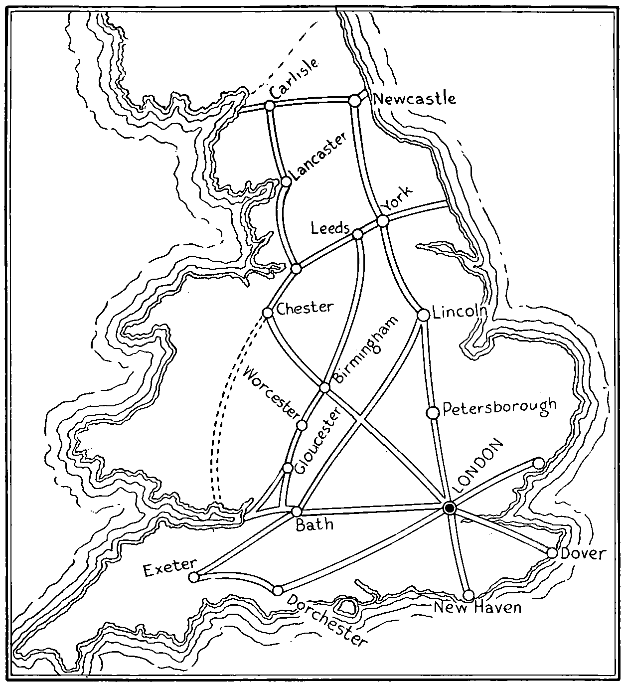
| 7. | Map | 54 | ||
| Showing Transcontinental Trails in the United States. | ||||
| 8. | Way Bill | 66 | ||
| Used on the Slaymaker Stage Line from Lancaster to Philadelphia, 1815. (Courtesy of Prof. P. K. Slaymaker, Lincoln, Nebr.) | ||||
| 9. | The Sault Ste. Marie Canal | 76 | ||
| 10. | The Evolution of the Railway Train[xviii] | 102 | ||
|
||||
| 11. | Modern Locomotives | 120 | ||
|
||||
| 12. | Transportation Across Death Valley | 126 | ||
| A Picturesque Method of Earlier Days. | ||||
| 13. | Good Roads Day in Jackson County, Mo. | 132 | ||
| 14. | Chart of the Organization of the U. S. Bureau of Public Roads and Rural Engineering, 1917 | 142 | ||
| 15. | Hard Surface Highway in Oregon | 146 | ||
| 16. | A Farmer’s Wife Meeting the Postal Truck | 146 | ||
| 17. | Trackless Trolley Operated on Staten Island, N. Y. | 166 | ||
| 18. | Motor or Rail-Car | 166 | ||
| Showing the Gasoline Locomotive and Trailer, Operated by the Chicago & Great Western R. R. | ||||
| 19. | The Evolution of the Steam Automobile | 182 | ||
|
||||
| 20. | A Modern Rural Passenger Bus | 184 | ||
| 21. | A New York City “Stepless” Bus[xix] | 184 | ||
| It Has an Emergency Door, with Wire Window Guards, and will Seat 30 Persons. | ||||
| 22. | The Evolution of the Gasoline Motor Car | 188 | ||
|
||||
| 23. | Hauling Beans by Motor Truck and Trailer | 200 | ||
| Sacramento Valley, Calif. | ||||
| 24. | Hauling Sugar Beets to Market in a Motor Truck | 200 | ||
| 25. | Traffic on Fifth Avenue, New York City | 234 | ||
| 26. | Giving a Macadam Road an Application of Tarvia Binder | 254 | ||
| This is Followed by a Coat of Screenings and then the Road is Rolled Again. | ||||
| 27. | A Road of Mixed Asphalt and Concrete Being Tested Out | 254 | ||
| 28. | Crowning a Dirt Road in California with Tractor Drawn Grader | 263 | ||
| 29. | A Milk Truck Equipped with both Cans and Tank | 296 | ||
| 30. | A Lumber Log Truck Used in the Northwest | 296 | ||
| 31. | A National Highway in the Mountains of Maryland | 332 | ||
| 32. | A Dangerous Curve Made Safe by an Artistic Concrete Wall | 364 | ||
| The Tennessee State Highway at Lookout Mountain, Built of Cemented Concrete. | ||||
| 33. | Pin Oak Street Trees | 388 | ||
| About 15 Years Old on Land that Was Once Considered to be a part of the “Great American Desert.” | ||||
| 34. | A Cottonwood Wind Break | 388 | ||
| Formerly very Common in the Prairie Region. | ||||
| 35. | Warning and Direction Signs Used in the State of Illinois | 434 | ||
| 36. | Traffic Guides[xx] | 442 | ||
| (From Eno’s “The Science of Highway Traffic Regulation.”) | ||||
| 37. | New York City Traffic Guides | 444 | ||
| “In November, 1903, one hundred blue and white enameled signs, directing slow-moving vehicles to keep near the right-hand curb, were put in use in New York. These were probably the first traffic regulation signs ever used.” (From Eno’s “The Science of Highway Traffic Regulation.”) | ||||
| 38. | Traffic Tower on Fifth Avenue, New York City | 446 | ||
| 39. | Camping Ground and Caravan | 458 | ||
| 40. | A Gipsying Touring Caravan | 458 | ||
[1]
HIGHWAYS AND HIGHWAY TRANSPORTATION
CHAPTER I
TRANSPORTATION A MEASURE OF CIVILIZATION
As the several peoples inhabiting the earth have progressed from barbarism through the different stages of civilization, the transportation occasioned by their wants and desires has kept a close pace. By a study of the transportation—travel, movement of goods and commodities—and the means and facilities for its accomplishment, the relative civilization of any people, their rank and position may be accurately surveyed, graduated, and estimated. The highways of a nation, whether they be of the land or sea, or both, are most vital elements in its progress and could almost as well as transportation be considered the measuring rod of civilization.
Stages in Civilization.
—Sociologists differ as to what constitute the several stages of civilization. One might trace the development of man through literature, another through art, another through government; others consider his economic activities the more fundamental factors. The most widely used economic classification, according to Ely,[1] is based upon the increasing power of man over nature and consists of (1) Direct Appropriation,[2] (2) The Pastoral Stage, (3) The Agricultural Stage, (4) The Handicraft Stage, and (5) The Industrial Stage. These stages are well illustrated in English history. The stage of direct appropriation corresponding to the prehistoric period and up to 54 B.C., when the Romans overran the island of Britain; the Pastoral stage from this time to the invasion by William the Conqueror, 1066; the Agricultural up to about the discovery of America, when a great impetus was given to travel and discovery; the stage of Handicraft, from 1500 to the invention of the steam engine and its application to manufacture at the beginning of the eighteenth century; the Industrial stage, to the present time. While these stages necessarily overlap each other considerably, it will be seen that as one declines the next is ushered in with some radical change in government or in economic or industrial condition. The present day—immediately following as it does the Great World War, out of which have issued many scientific discoveries and inventions, notably those advancing the theory and practice of air navigation, with many potential possibilities in new lines of transportation; and the setting forth of an idea which is capable of leading to a better understanding or even a confederation of nations and altering all forms of national government—may be the beginning of a new stage of civilization.
Stage of Direct Appropriation.
—This stage covers the whole course of prehistoric man from the time the first ape stood erect some 500,000 years ago[2] through the stone, bronze, and iron ages to the age of literature and art. During these long years civilization traveled far, for the least cultured savages observed have advanced not only away beyond the highest of the lower animals but also beyond the lowest intellectual estate of which human beings may be supposed capable of subsisting. And from the lowest to the highest of these tribes are shown traits varying as greatly in degree as from one stage in the above classification to another. The Indians at the time of the[3] discovery of America and the three centuries following, and many of the tribes of Africa during the explorations of Livingstone and Stanley, were and still are in this stage and hence have been subjected to scientific study and investigation. Their governments while variable are of the primitive types. Ordinarily a chief autocratically rules because of hereditary influence. Little is manufactured, planting is scarcely known; by hunting, fishing, and collecting nature’s products of wild seeds and roots is a subsistence obtained often with long, arduous, and dangerous labor. Efficiency, as we understand that term to-day, is very low, and the number of persons that a given area can support is few. No one can predict but what to-morrow he may have to go hungry or suffer cold from the inclemency of the weather, for his store of food is nil or small, his shelter rudimentary and clothing scanty. Note the hardships of the party of Henry M. Stanley during his expedition across the African wilderness in quest of Emin Pasha.[3] Notwithstanding Stanley’s men were possessed of firearms and edged tools and carried some provisions with them, and were traversing a country teeming with vegetable and animal life, many times they were on the verge of starvation. The number of the natives in these wildernesses are no doubt kept low because of the extreme difficulties of procuring the necessities of life.
The barbarian requires less, of course, than the civilized man; he is satisfied with mere subsistence. He is improvident and relies upon picking up his needs from day to day as a robin picks worms from the grass. Cannibalism often exists, for the sacredness of human life has not yet been established, although magic and crude religious rites are seldom missing. While private personal property is recognized and retained by personal prowess, the ownership of land is absent. Coöperation of the crudest sort only is found; division of labor consists largely in having the females perform the work of planting, cultivating, carrying[4] burdens—when these are attempted at all—cooking and caring for the children in the crudest fashion, leaving to the men the work of hunting, fishing, and fighting. Each tribe is self-sufficient and consists of a chief with a few followers bound together loosely for the purposes of protection from other tribes. Exchange, barter, and trade is at its lowest ebb; consequently transportation is practically unnecessary, and roadways except mere trails do not exist.
The Pastoral Stage.
—In the process of evolution certain animals undoubtedly were domesticated and used for food. Whether or not this domestication preceded or followed primitive agriculture or “hoe culture,” is not important, as the pastoral stage of culture evidently lies between the hunting and the farming stages. The written history of mankind indicates that this stage largely prevailed among the earlier Hebrew, Greek, and Teutonic races. A private ownership in cattle and herds was recognized, but the necessity of moving about with the flocks precluded fixed habitations, although large areas were claimed and held or endeavored to be held from trespass thereon by neighboring tribes. A given area would thus support a much larger number of people than in the preceding stage. A small amount of trading or bartering was carried on and consequently some transportation was required, but road building as such was little known. Rivers and coast waters for canoes and dugouts were no doubt early taken advantage of by the aborigines of bordering territories. But since there is so little division of labor, so little of barter and exchange, commerce was not developed much during this stage.
The Agricultural Stage.
—The growing and storage of crops, increased by the use of animal power, greatly changed the economic and social conditions of man. It made possible and profitable the living in fixed habitations, even in communities, and this brought out the needs of rules of government. But even yet each family provided without the assistance of others for practically all its own needs. In planting, reaping, threshing, grinding the meal and[5] cooking, the family became the unit. No great division of labor was yet evident, consequently exchange, barter, and transportation still remained low. Ownership of land was necessary if a family was to cultivate the same land year after year. This meant definite rules and laws and consequently the development of governments. Ownership of herds and land brought wealth and a certain distinction in the community. Slavery, which had no doubt existed to some extent in the pastoral stage, here, because it greatly increased wealth, grew immensely. Large families likewise meant more workmen and greater wealth, distinction, and leisure, hence polygamy and polyandry often existed. As the evolution continued there was a trend toward handicraft and the division of labor; the products of one place began to be exchanged for the products of other places. This necessitated some forms of transportation, meager though they might be, and trails between communities.
The Manorial and Feudal Systems.
—In England and on the continent during the later years of this stage there were developed the manorial or feudal forms of government. The people lived largely in villages each controlled by a lord or earl (eorl) and to whom in return for his protection, the use of land, and other favors, they were bound to return to him service in the cultivation of his land and in waging war when called upon to do so. The lords in turn held their allegiance to the king. Some handicraftsmen were among the retainers but they were so few that they did not form an important part of the village, neither was there a great deal of travel or transportation. The manor instead of the family was the unit, and it was almost self-sufficient. The land was allotted in small tracts and tilled in the manner designated by the lord. Each person raised barley, oats, peas, and lentils sufficient for his own needs. Variation in crops was little practiced. Much land at distances from the manor was still devoted to herds and flocks.
However, toward the later part of this stage, the feudal system began to break down. There were more free-holders[6] and free-tenants, living upon the land they cultivated according to their own ideas. Wheat, rye, flax, and root crops were assuming greater importance. This variety in farming and the larger fields cultivated by the individual naturally increased the products to be sold or exchanged and hence increased transportation. People who had devoted only so much of their time to spinning and weaving as was necessary to supply their own family needs, were beginning to do more, selling the excess and purchasing from others things not grown or manufactured by themselves. Thus were developed towns as centers of trade; money as a medium of exchange assumed greater importance; and a division of labor brought into being and increased the social standing of trades and professions. Thus was ushered in the Handicraft Stage of civilization.
The Handicraft Stage.
—In England this stage lasted through approximately five centuries, from 1200 to 1700. The merging of one period into another came about so gradually that a definite date can hardly be designated, and the time is so long that undoubtedly many changes occurred in the economic activities as well as in the government and literature of the people.
While it is probable that merchants, middlemen who bought from one person and sold to another, had thrived throughout the earlier civilizations of Asia, Africa, and Europe, and even extended their trade to Britain, merchandising held a comparatively minor position in England until the twelfth century, when merchants became very prominent, so much so that combinations or guilds were formed by them in all the large towns for the purpose of protecting and controlling the conduct of business and, to some extent, of maintaining a monopolistic control of the trade in their particular businesses. A guild was an association or fraternity of persons engaged in the same line of business. It differed from a trade-union in that the guild was an association of masters and employees, whereas the trade-union is an association of employees only.
Many of the merchant guilds grew wealthy and strong;[7] they obtained Royal Charters from the Crown either by direct payment or by an arrangement to pay a special tax, or secured recognition in the borough charters. By authority of these they were endowed with certain privileges such as: (a) limiting the number of their own members and the number who could participate in any line of merchandising; (b) entering into secret price agreements and trade arrangements; (c) controlling the import and export of wares; (d) the establishing of a court which had absolute jurisdiction over its members and others not members engaged in the same line of business. This court “could settle trade disputes, discipline its apprentices with the whip if necessary, could imprison its journeymen who struck work, and could fine its master members who acted against its rules. And, finally, the members of the company were forbidden to appeal to any other court unless their own court failed to obtain justice for them.”[4] Moreover, the meeting together for social enjoyment, feasting, and worship; the helping one another in sickness and poverty; and uniting together for the pursuit of some common cause, naturally brought about very close and fraternal relations.
Craft-guilds.
—Craftsmen of like occupations joined together in guilds also and they, too, became not only numerous but very influential. They regulated their own internal affairs and specified how many apprentices might be entered, and under what circumstances a man might become a journeyman or master craftsman. Numerous other guilds, social and religious, were extant throughout Europe.
Effect upon Trade.
—The merchant guilds and the craft-guilds materially affected the production and trade of the community and country. The merchants of Phoenicia and later of Greece and Rome are said to have visited the British Isles to secure tin and copper. The great merchant guilds outfitted adventures to the ends of the then known[8] world to secure the goods—whether they were silks, spices, furs or grain—in which they dealt. They were instrumental in the passage of laws encouraging and securing commerce. They themselves regulated the quality of goods dealt in. For example the Goldsmiths’ Guild of London required that all silver and gold-plate and jewelry manufactured within three miles of London should be brought to the guild hall for inspection. If it did not come up to the specified standard it was ordered remelted; if it did it received the “Hall Mark” that anyone purchasing it might be assured of its quality. It is said the guilds were so punctilious in the matter of quality that “Made in England” goods received in the markets of the world a standing of the highest rank; a reputation that never entirely disappeared, and as a consequence English uprightness of character became proverbial.
The Domestic System.
—All this made necessary the building of ships and harbors, and the improvement of internal highways of trade, and these in turn stimulated manufacture which as yet was carried on by hand. The family instead of the town or guild became the unit; apprentices were entered and kept, usually, as members of the family and worked along side the sons and daughters of the master. As these grew to manhood their pay, beginning with mere keep, was gradually increased with their work and responsibility until at the end of seven years they were fitted to go forth as journeymen and later themselves became masters. The work was done at or near the master’s home. The raw material was usually received from a middleman, to whom was returned the finished product; the middleman disposed of it to the merchant who in turn sold it to the consumer.
This corresponds rather closely to what is called the “sweat shop” method of the present time. Goods in a raw or a semi-raw state are received by the workman from the “manufacturer” and carried home; the workman performs, with the help of his family, certain specified operations and upon the return of the goods is paid for his work.[9] Or in agriculture, to the contract method, whereby specified products such as sugar beets, sweet-corn, peas, beans, tomatoes, fruits, and other products for manufacture, canning, preserving, or pickling in a factory, are raised by the farmer and sold to the manufacturer at a previously agreed-upon contract price. Under the guild plan the manufacturer or importer sold usually to the ultimate consumer. So the economic system was gradually growing more complex, and the interdependence of man upon man more pronounced.
The older agricultural procedure had not entirely disappeared. Most families cultivated land, and raised more or less stock and poultry, but performed the work of manufacturing as a side line, as at present in the Middle West farmers make grain and stock raising their main industry with dairying, vegetable gardening, poultry, and eggs as mere adjuncts, although these latter often bring in about as much money as the former. Defoe[5] describes these methods (1724-1726) as follows:
[The land] was divided into small inclosures from two acres to six or seven each, seldom more; every three or four pieces of land had a house belonging to them ... hardly an house standing out of a speaking distance from another.... We could see at every house a tenter, and on almost every tenter a piece of cloth or kersie or shaloon.... At every considerable house was a manufactury.... Every clothier keeps one horse, at least, to carry his manufactures to the market, and everyone generally keeps a cow or two or more for his family. By this means the small pieces of inclosed land about each house are occupied, for they scarce sow corn enough to feed their poultry.... The houses are full of lusty fellows, some at the dye-vat, some at the looms, others dressing the cloths, the women or children carding or spinning, being all employed, from the youngest to the oldest.
Governmental Control.
—The numerous guilds reached their zenith during the fifteenth and sixteenth centuries and then gradually diminished in importance. Some of them, however, still remain active in London. During the[10] recent World War several were engaged in welfare work. Guilds in France were destroyed or lapsed into desuetude during the revolution, 1791-1815. Those of Spain and Portugal likewise during the revolutionary years of 1833-40; of Austria and Germany in 1859-60 and of Italy in 1864. Guilds, as known in Europe, never found a substantial lodging in the United States.
The functions of the guilds were gradually taken over by the government, which seemed later to be a better and more satisfactory medium to control labor, trade, and commerce. Laws were enacted in England to regulate the entering of apprentices, to force able bodied men to serve as agricultural laborers in case of need, and to work the roads annually. Justices of the Peace were given authority to settle disputes and regulate wages. Foreign trade was by laws and Royal Grants encouraged; likewise immigration of artisans to introduce new industries, the establishment of foreign colonies and the development of banking and insurance. Almshouses were built and poor laws enacted to care for the old and indigent. The public roads were still very poor but a beginning was made for their betterment. Macaulay, in writing of the State of England in 1685,[6] has considerable to say regarding the condition of the highways. Speaking of the lack of homogeneity among the people he says:
There was not then the intercourse which now exists between the two classes. [The Londoner and the rustic Englishman.] Only very great men were in the habit of dividing the year between town and country. Few esquires came to the capital thrice in their lives. [And again], The chief cause which made the fusion of the different elements of society so imperfect was the extreme difficulty found in passing from place to place. Of all inventions, the alphabet and the printing press alone excepted, those inventions which abridge distance have done most for the civilization of our species. Every improvement of the means of locomotion benefits mankind morally and intellectually as well as materially, and not only facilitates the interchange of the various productions of nature and art, but tends to remove[11] national and provincial antipathies, and to bind together all the branches of the great human family.
[Further on], It was by the highways that both travellers and goods generally passed from place to place; and those highways appear to have been far worse than might have been expected from the degree of wealth and civilization which the nation had even then attained.
The degree of civilization attained was no doubt due to other things than the public roads. Sea transportation brought to England the products of the world. Coast transportation was well developed and river and canal transportation had well begun. Macaulay states that
One chief cause of the badness of the roads seems to have been the defective state of the law. Every parish was bound to repair the highways which passed through it. The peasantry were forced to give their gratuitous labor six days in the year.... That a route connecting two great towns, which have a large and thriving trade with each other, should be maintained at the cost of the rural population scattered between them, is obviously unjust.
This sounds like modern arguments against paving rural roads and charging the cost to the abutting property, and is evidently one good reason for state and national aid.
However, transportation and travel continued to improve. On the main roads “waggons” were employed to transport goods and stage coaches for people, while pack animals and riding horses were used on less frequented trails and roads. Four and six horses were necessary to pull a carriage or a coach “because with a smaller number there was great danger of sticking fast in the mire.” A diligence ran between London and Oxford in two days, but in 1669 it was announced that the “Flying Coach would perform the whole journey between sunrise and sunset.” The heads of the university after solemn deliberation gave consent and the experiment proved successful. The rival university at Cambridge, not to be outdone, set up a diligence to run from Cambridge to London in one day. Soon flying coaches were carrying passengers to other points. Posts were established for the change of horses and longer[12] distances essayed. This mode of traveling was extolled by contemporaneous writers “as far superior to any similar vehicles ever known in the world.” It is not to be thought that these advances in rapid transportation were without objectors. According to Macaulay,
It was vehemently argued that this mode of conveyance would be fatal to the breed of horses and to the noble art of horsemanship; that the Thames, which had long been an important nursery of seamen, would cease to be the chief thoroughfare from London up to Windsor and down to Gravesend; that saddlers and spurriers would be ruined by hundreds; that numerous inns, at which mounted travelers had been in the habit of stopping, would be deserted, and would no longer pay any rent; that the new carriages were too hot in summer and too cold in winter; that the passengers were grievously annoyed by invalids and crying children; that the coach sometimes reached the inn so late that it was impossible to get supper, and sometimes started so early that it was impossible to get breakfast.
Objections of this character have been made against every innovation and advancement in travel and transportation to the present day when the air-plane is beginning to attract notice as an economic vehicle. Laws were then demanded and passed, as they are now, to regulate power and speed, accommodations and rates, and multifarious other things which might affect the privileges or profits of those interested in older methods, as well as laws for the protection and safety of the general public.
Agriculture.
—It might be thought that the agriculture of the preceding stage of development might wane. But not so; with the division of labor and improved transportation and marketing facilities agriculture received a great impetus. Larger tracts were farmed by the individual. Growing crops and stock became more of a business and from the lords of the manor was evolved the landed aristocracy of the country. To be sure, there were holders who cultivated their own soil, but much was held upon leaseholds for short or long periods. Many still lived in the villages where “commons” were laid out for the pasturage of the few cows each family needed for its own milk.[13] Farms were divided by hedges into fields or closes, the amount of land depending upon the rent. The “Book of Surveying,” by Fitzherbert, 1539, gives reasons for such closes and explains the manner of laying them out so that they shall be most convenient and together. The following is a specimen of his style:
Now every husband hath sixe severall closes whereof iii. be for corne, the fourthe for his leyse, the fyfthe for his commen pastures, and the sixte for his haye; and in wynter time there is but one occupied with corne, and then hath the husbande other fyue to occupy tyll lent come, and then he that hath his falowe felde, his ley felde, and his pasture felde al sommer, and when he hath mowen his medowe then he hath his medowe grounde, soo that if he hath any weyke catel that wold be amended, or dyvers maner of catel, he may put them in any close he wyll, the which is a great advantage; and if all should lye commen, then wolde the edyche of the corne feldes and the aftermath of all the medowes be eaten in X or XII dayes. And the rych men that hath moche catel wold have the advantage, and the poore man can have no helpe nor relefe in wynter when he hath most nede; ... and if any of his thre closes that he hath for his corne be worn or ware bare, then he may breke and plowe up his close that he had for his layse, or the close that he had for his commen pasture, or bothe, and sowe them with corne and let the other lye for a time, and so shall he have always reist grounds, the which will bear moche corne, with lytel donge; and also he shall have a great profyte of the wod in the hedges when it is growen; and not only these profytes and advantages aforesaid but he shall save moche more than al these, for by reason of these closes he shall save meate drinke, and wages of a shepherde, the wages of the heerdmen, and the wages of the swineherde, the which may fortune to be as chargeable as all his holle rent; and also his corne shall be better saved from eatings or destroying with catel.
Later the system of crop rotation came into vogue resulting in great improvement in the fertility of the soil.
In the same author’s “Book of Husbandry,” 1534, are described farm tools and their uses. There are explanations to show where a “horse plow” is better and where an “oxen plow.” It indicates that beans, peas, wheat, barley, and oats are common crops, and that some vegetables and root-crops were coming into use. Wheat was[14] probably sowed after plowing up a pasture or “fallowe” field, for he observes,
the greater clottes (clods) the better wheate, for the clottes kepe the wheate warm all wynter; and at march they will melte and breake and fae in many small peces, the which is a new donynge and refreshynge of the corne.
The industries and arts of transportation continued to develop: ocean craft, especially, became more numerous and more efficient. Learning and art grew in harmony as the intercourse of the peoples of the country and of the world increased.
The Industrial Stage.
—This stage of economical civilization, while brought about gradually through many years as factories and special work shops came into existence, was nevertheless greatly accelerated by the inventions of the eighteenth and nineteenth centuries. The invention of the canal lock (it is a disputed question whether in Holland or in Italy) in the fourteenth century had made practicable the building of many canals throughout Europe, one of the largest across France connecting the Bay of Biscay with the Mediterranean Sea. However, the building of important commercial canals began in England with the Bridgewater Canal from Worsley to Manchester, completed in 1767. Green[7] tells us that the main roads which lasted fairly well through the middle ages had broken down under the increased production of the eighteenth century. That the new lines of trades lay along “mere country lanes”; that much of the woolen trade had to be carried on long trains of pack animals at a large cost; that transportation “in the case of heavier goods such as coal distribution was almost impracticable save along the greater rivers.” In fact coal was ordinarily referred to as “sea coal” because it was brought to most ports by water routes. The Duke of Bridgewater and a young engineer[15] of the name of Brindley solved the problem of transportation for the time being by beginning the great network of canals which later covered England to the extent of more than 3000 miles. Too great praise cannot be given to the engineers and constructors of these canals. Brindley considered canals not as adjuncts of rivers and bays, on the contrary “rivers were only meant,” he said, “to feed canals.” He carried this canal by means of an aqueduct over the river to Manchester, thus bringing the coal to a new thriving manufacturing city. Green further says (Paragraph 1528)
To English trade the canal opened up the richest of all markets, the market of England itself. Every part of the country was practically thrown open to the manufacturer; and the impulse which was given by this facility of carriage was at once felt in a vast development of production. But such a development would have been impossible had not the discovery of this new mode of distribution been accompanied by the discovery of a new productive force. In the coal which lay beneath her soil England possessed a store of force which had hitherto remained almost useless.
Not the least were the new methods of smelting iron with coal instead of wood, which changed the whole aspect of the iron trade and which made Great Britain for many years the workshop of the world. Lead, copper, and tin were also mined and smelted by the use of coal. The great advance of the “industrial revolution” did not come until Watt’s improvements upon the steam engines of Newcomen, Cawley, and Savery, which were themselves improvements over earlier inventions of Papin, della Porta, and Worcester, made practicable the transfer of energy stored up in coal to the movement of machinery. He changed the steam engine from a clumsy, wasteful, inefficient machine into a workable apparatus little differing from the reciprocating steam engines of the present. Up until the successful operation of the turbine engine, the principal advances upon Watt’s engine were mere details, though often of great importance. For instance the boilers for the generation of steam were improved;[16] the enlarged application of the principle of expansion, developing better cut-off mechanisms and governors, to more economical construction due to better facilities and better knowledge of materials and their properties; and to the application of the steam engine in locomotives to propel transportation cars.
Watt’s claims and specifications for patents from 1769 to 1784 cover such inventions as:
1. Methods of keeping the cylinder or steam vessel hot by covering it with wood or other slow heat-conducting materials, by surrounding it with steam or other heated bodies, and by suffering no water or other substance colder than steam to touch it.
2. By condensing the steam in vessels entirely distinct from the cylinder, called condensers, which are to be kept cool.
3. By drawing out of the condenser all uncondensed vapors or gases by means of an air pump.
4. The use of the expansion force of steam directly against the cylinder.
5. The double-acting engine and the conversion of the reciprocating motion into a circular motion.[8]
6. Throttle valve with governor and gear for operating the same, parallel motion for opening and closing the valves, and indicator.
These inventions not only made it possible to replace hand-labor often with machines, but made it possible to construct machines much more rapidly and to make them in every way more convenient.
Improvement in the arts of spinning and weaving caused the textile establishments and population of north England to go forward by leaps and bounds.
Previous to the invention of the “fly shuttle” in 1733 by John Kay of Bury, the weaver had to throw the shuttle through the warp by hand. Weaving became much more[17] rapid; also by having several shuttles with different-colored yarn stripes and checks could be woven into the cloth. Since weaving had been made quicker and easier there came a demand for more yarn. Three separate inventions satisfied this, viz., James Hargreaves of Blackburn invented his “jenny” about 1767, by which eight threads could be spun at once. At the same time Richard Arkwright, a barber of Preston, invented and developed the throstle spinning frame (1769-1775). Samuel Crompton, about 1775, invented his spinning “mule,” which seemed to combine the good principles of the others. Power was applied to spinning about 1785 and then it was weaving that needed accelerating. To Cartwright in 1784 is ascribed the honor of inventing the power loom. Other inventions for both spinning and weaving have made almost automatic the running of thousands of spindles and hundreds of looms in a single factory.
Railways Developed.
—With power manufacturing and increased production due to the adoption of improved factory systems came still greater demand for transportation. Tramways had already been laid in 1676 for transporting coal from the mines to the sea. The rails were first made of scantling laid in the wheel ruts, then of straight rails of oak on which “one horse would draw from four or five chaldrons of coal.” Later (1765) cast-iron trammels 5 feet long by 4 inches wide were nailed to the wooden rails. These trammels collected dust, therefore in 1789 Jessop laid down at Loughborough cast-iron edge-rails and put a flanged wheel on the waggon. The rails were also placed on chairs and sleepers (ties), the first instance of this method. The distance apart of the rails was 4 feet 81⁄2 inches, what is now known as “standard gauge.” The success of these coal roads suggested tramways for freight and for passenger transportation between the larger towns. The canals had become congested with much traffic; it is said that notwithstanding there were three between Liverpool and Manchester the merchandise passing “did not average more than[18] 1200 tons daily.” The average rate of carriage was 18s. ($4.37) per ton, and the average time of transit on the 50 miles of canal was thirty-six hours. The conveyance of passengers by the improved coach roads, was, for then, quite rapid but rather expensive.
Some experimental locomotives had been made and used in the mining regions. Their success led to the building of others. The Stockton and Darlington Railway opened in September, 1825, by a train of thirty-four vehicles, making a gross load of 90 tons, drawn by one engine driven by George Stephenson, with a signal man on horseback in advance. The train made at times as high as 15 miles per hour. The rail used weighed 28 pounds per yard. This road was intended entirely for freight but the demand of the people to ride was so pressing that a passenger coach to carry six inside and fifteen to twenty outside was put on to make the round trip in two hours at a fare of one shilling.
When the bill passed for the Liverpool and Manchester Railway in 1826 Stephenson was appointed engineer in charge at a salary of $5000 per year. This road made a great impression on the national mind, no little enhanced by the competition of locomotives at its completion in 1829, resulting in the victory of Stephenson’s engine the “Rocket.” It made the then astonishing speed of 35 miles per hour and proved conclusively the practicability of railway locomotion.
To follow the progress of industry during the nineteenth and twentieth centuries would require volumes. More has probably been accomplished, not without evils at times, than in the whole preceding history of the world. And as no small part of these accomplishments are the means and amount of travel and traffic and associated developments and organization made necessary by the vast industries which now supply the world’s wants, once more it may be asserted that the civilization of the world can be measured by its transportation.
Some Historic Roads and Their Influence.
—In the[19] brief survey of the stages through which ordinarily a civilization passes note has frequently been made that as the world progresses so does the necessary transportation increase and improve in character. It is not contended that civilization follows the improvement of transportation, although that is no doubt sometimes the case, but that the state of transportation follows up and down with the state of civilization. Very likely the same could be truthfully said of other elements of civilization such as literature, art, religion, and government. Or even if there be applied Guizot’s three tests of a civilized people: “First, they review their pledges and honor; second, they reverence and pursue the beautiful in painting, architecture, and literature; third, they exhibit sympathy in reform toward the poor, the weak and the unfortunate,” it will be found that those nations most progressed in traffic and travel will rank highest in these tests.
Early Highways.
—To return to some of the important earlier highways. All evidence seems to indicate that civilization had its origin in western Asia. Early history speaks of the civilization and culture of Arabia and Egypt, of Assyria and Persia. Coeval with these civilizations were trade and commerce. Great caravans of camels traversed the sandy highway with their accompanying merchants carrying many products of many lands—frankincense and myrrh from Arabia; cloths and carpets from Babylon and Sardis; shawls from Cashmere; leather from Cordavan and Morocco; tin, copper, gold, and silver utensils from Phœnicia; pearls from the Far East; and grain and other agricultural products nourished and grown by the beneficence of the great mother Nile. The extensive civilizations of these countries are handed down stingily by cuneiform inscriptions on clay tablets scattered here and there among the ruins of their ancient towns and villages, or inscribed upon granite mountain sides as historical memoranda for future generations. Even Holy Writ says little about roads and highways, but that they were known is evident from the few references made. Those things which are commonplace[20] often receive least attention by writers. In Isaiah, 35:8, may be read: “And a highway shall be there, and a way, and it shall be called the way of holyness ... the wayfaring men, though fools, shall not err therein.” And again, Isa. 40:3-4, “The voice of him that cryeth in the wilderness, prepare ye the way of the Lord, make straight in the desert a highway for our God. Every valley shall be exalted, and every mountain and hill shall be made low: and the crooked shall be made straight and the rough places plain.” These would certainly indicate that in Isaiah’s time there were both travelers and roads marked and graded. Isaiah in other places shows that he, if not himself a road builder, is familiar with that process: Isa. 57:14, “And shall say, cast ye up, cast ye up, prepare the way take up the stumbling block out of the way of my people.” Isa. 62:10, “Prepare ye the way of the people; cast up, cast up the highway; gather out the stones; lift up a standard for the people.” Also Jeremiah likens the path of the wicked to an ungraded road. Jeremiah 18:15, “Because my people have forgotten me, they have burned incense to vanity, they have caused them to stumble in their ways from the ancient paths, to walk in paths, in a way not cast up.”
The trade along the eastern coast of the Mediterranean and across Palestine and the great Arabian deserts to Persia, to Babylonia, and possibly to India was evidently of importance to the fluctuating destinies of Egypt and Assyria, and later of Greece, Rome, and Turkey; so much so, that many wars were waged for the control of the great highway over which it passed. Palestine became a territory of importance. It is said Jerusalem has suffered some three score sieges, most of them because she dominated this highway, being at or near the confluence of its forks reaching east into the deserts, north toward the straits over which a crossing could be made into Europe, and southward to Egypt. Egypt and Assyria fought for its control; Greece and Rome in turn came into possession of it; Turkey and the Mohammedans for centuries monopolized it; and the[21] recent great World War was no doubt accentuated by the cupidity of Germany to control a long line of transportation through Austria-Hungary, Bulgaria, Turkey, Mesopotamia to Persia, Baluchistan and India.[9]
Alexander the Great overran the East, besieged Tyre, and converted an island into an isthmus in order to secure and hold control of the highway and the rich bounty imagined to be at its farther end. “Babylon is a ruin, a stately and solitary group of palms marks where Memphis stood, jackals slake their thirst in the waters of the sacred lake by the hall of a thousand columns at Thebes, but the road that formed the nexus between these vanished civilizations remains after the winds of four millenniums have sighed themselves to silence over the graves of its forgotten architects and engineers.”[10]
But the Greater Greece, built up by the personality and sword of Alexander the Great, fell, largely, because of the lack of roads. The very name of Alexander was sufficient to subdue city after city, but as soon as his personal influence was at an end the cities fell apart. Here was a wonderful opportunity. With magnificent natural-made waterways, with innumerable safe harbors what a chance for commerce, for trade with the entire world. The islands of the Aegean Sea were stepping stones to Asia Minor; Macedonia furnished an open route for the Bosphorus and Dardanelles; Thrace led to those fertile lands surrounding the Black Sea and extending away to the Caspian and joining once more with empire already conquered. On the west there was close at hand the islands of, and land bordering, the Adriatic, the great Italian boot, and Sicily where new civilizations were ready to rise and take on Greek culture for the mere offering. It would seem as[22] though Greece ought to have become the fostering mother of world colonization, but the different parts of Greece proper, where the real mental ability lay, were separated by lack of roads from each other. Athens was potentially nearer to the Black Sea than to Sparta; Corinth was nearer Sicily than to Macedonia. The many Grecian tribes were distinct, having different laws, customs and manners. Intercourse, which could have been brought about had there been interconnecting roads, was necessary to weld the people into a homogeneous mass. Sparta and Athens, less than an hour apart by modern air-plane, because of the mountains, roadless and almost pathless between them, barriers which they failed to surmount, developed different forms of civilization, different thought, habits, and tastes. To Athens the world owes an everlasting debt for masterpieces in poetry, oratory, architecture, and sculpture. “There was no Spartan sculpture, no Laconian painter, no Lacedaemonian poet.” The lack of intercommunication caused differences in language, in customs, in ideals, and in manners, making of Greece a heterogeneous conglomeration of tribes where internecine strife was ever present, and no strong centralized government could exist. Lucky for the best of the Greek civilization that it would be carried to the ends of the world by the roads of a young giant which was arising in the west.
Roman Roads.
—The roads in Rome bore such a prominent part in the civilization that they could not be entirely overlooked by contemporaneous writers. The roads are often described as military roads because they were primarily planned to transport soldiers quickly and easily to any desirable part of the empire. But no doubt the greatness of Rome was due more to the traffic in goods and people brought to and taken away from her precincts by these roads than to military prowess. Her roads were the arteries and veins through which the life blood of the nation pulsated; were the sensory and motive nerves which fetched and carried intelligence, which prompted action. She received and she disseminated. She was the hub of the universe, her roads the spokes radiating to and holding together the limits of her vast domain.
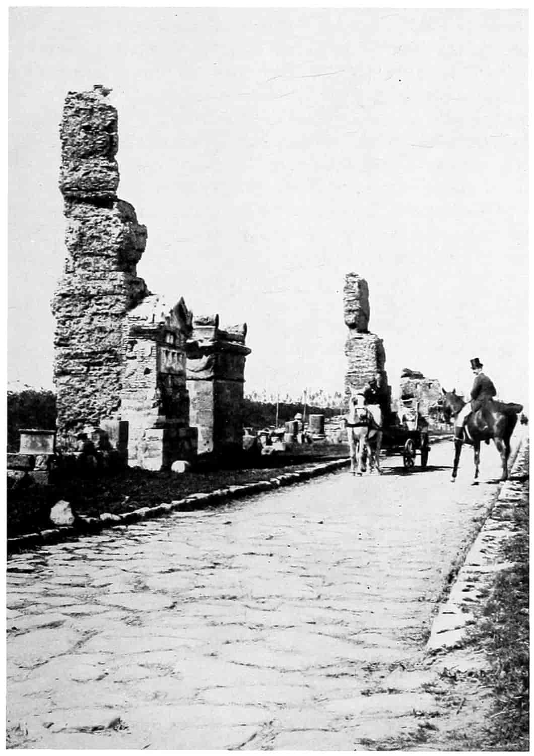
© Underwood and Underwood
THE APPIAN WAY
Showing the original Paving Stones laid 300 B.C.
[23]
How many roads Rome built it is difficult to state, for they were found in all parts of the empire. Some, as those in Italy, were very carefully and substantially built; others less so, grading down to mere trails in the hintermost districts. The Via Egnatia, which was one of the important provincial roads, is said by Strabo to have been regularly laid out and marked by milestones from Dyrrhacium, (Durazzo) on the coast of the Adriatic across from the heel of Italy’s boot through Thessalonica (Saloniki) and Philippi to Cypselus on the Hebnis and later to the Hellespont, for Cicero speaks of “that military way of ours which connects us with the Hellespont.” This road became historic as the scene of the conflict between the friends and enemies of the decaying Roman republic. Brutus and Cassius on the one hand here in 42 B.C., met the forces of Antony and Octavius. There tradition states the ghost of the dead Caesar met Brutus, and as a matter of fact, the “liberators” were cut to pieces in two engagements. Brutus and Cassius, believing the cause of the republic lost, both committed suicide, and the Roman world was soon thereafter in the hands of two masters—Antony in the East and Octavius in the West. Three centuries later this road became the leading highway to Byzantium (Constantinople), the great city founded by Constantine, impregnable in its rocky seclusion, dominating the waterway to the Black Sea and the rich agricultural land beyond.
Some twenty of these roads, more if their branches be counted, concentrated at the Eternal City and passed through her several gates. Rome could sit on her seven hills and by means of these roads rule the world. Among the most important of these were the Via Appia, Via Flaminia and Via Aemilia, Via Aurelia, Via Ostiensis, and Via Latina. One peculiarity of these Roman roads was their straightness, passing almost in a direct line between determining points. Another, to which is due their[24] durability, was their massiveness. Their general construction may be described as follows: The line of direction having been laid out trenches were made along each side defining the width, which was from 13 to 17 feet. The loose earth between was excavated to secure a firm foundation and the road was then filled or graded up to the required height with good material, sometimes as high as 20 feet. The pavement usually consisted of a layer of small stones; then a layer of broken stones cemented with lime mortar; then a layer of broken fragments of brick and pottery incorporated with clay and lime; and finally a mixture of gravel and lime or a floor of hard flat stones cut into rectangular slabs or irregular polygons fitted nicely together. The whole was frequently 4 feet thick. Along the road milestones were erected, some of them quite elaborate with carved names and dates. Near the arch of Septimus Severus in the Roman Forum still remains a portion of the “Golden Milestone,” a gilded pillar erected by Augustus, on which were carved the names of roads and lengths similar to a modern guide post. Some of these roads were used hundreds of years until they fell into neglect after Rome had been invaded by the northern barbarians. From a statement of Procopinus, the Appian Way, construction begun 312 B.C., was in good condition 800 years later, and he describes it as broad enough for two carriages to pass each other. It was made of stones brought from some distant quarry and so fitted to each other (over some 2 feet of gravel) that they seemed to be thus formed by nature, rather than cemented by art. He adds that notwithstanding the traffic of so many ages the stones were not displaced, nor had they lost their original smoothness. The papal government excavated, repaired, and reopened that road as far as Albano and it is still being used as a highway.
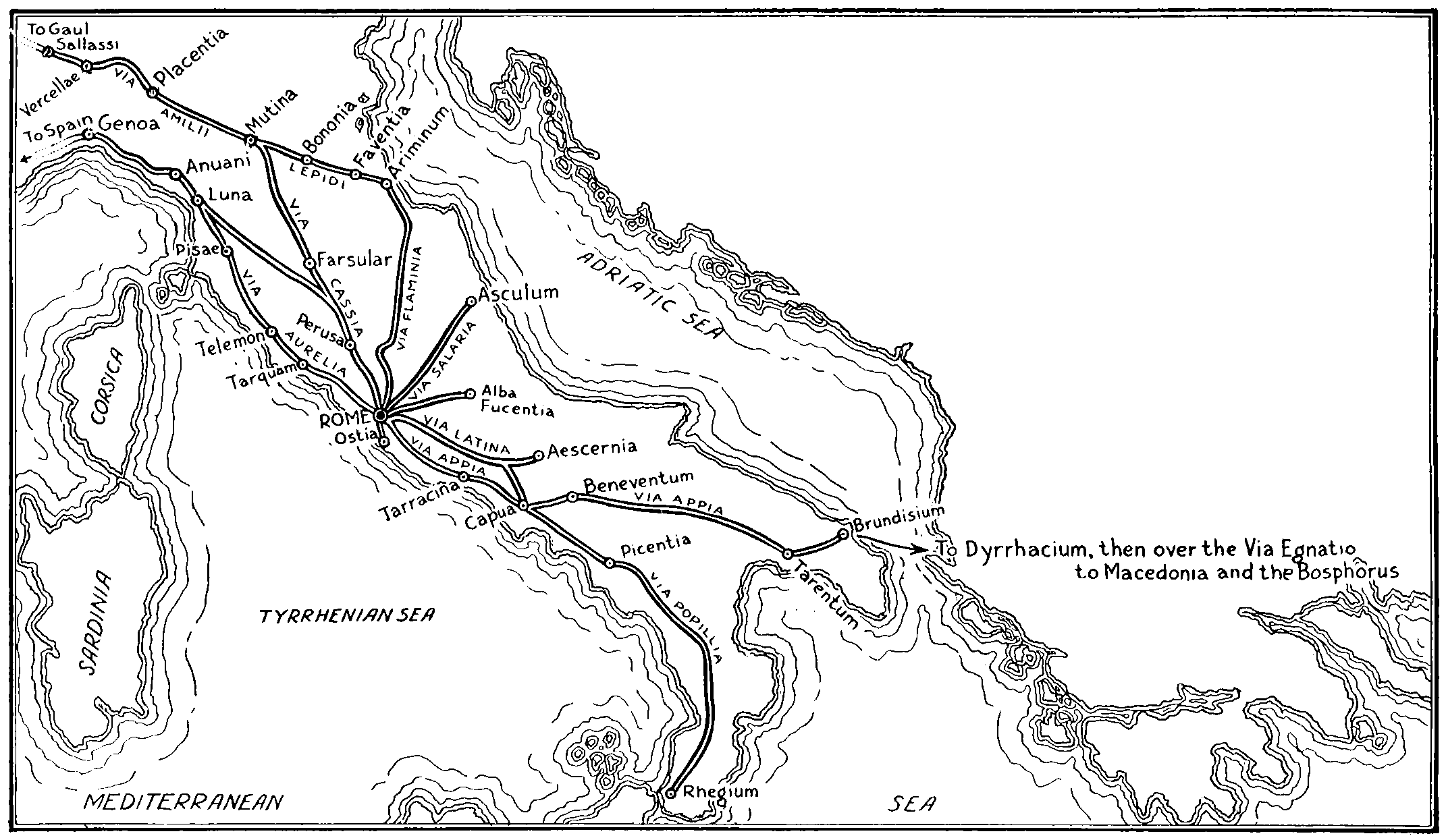
MAP OF ITALY
Showing some of the twenty or more roads that radiated from Rome
[25]
The Flaminian Way extended from Rome to Ariminum and thence was carried under the name Via Aemilia through Parma, and Placentia across to Spain. While not so much traffic passed over it, because the West was sparsely settled, as over the Appian Way, it nevertheless was a worthy rival. The Aurelian Way followed up the coast through Etruria and furnished another highway to Spain and Gaul. The Ostien highway connected Rome with a splendid harbor at the mouth of the Tiber. But the Appian Way was rightly the most famous of all; it was the earliest made, it was perhaps the longest paved road, and it carried the greatest amount of traffic. The road was built by Appius Claudius Caecus—then a Roman Censor, afterwards a Consul, from whom it takes its name—to Capua, a distance of 142 miles. Later it was extended across the Apennine Mountains through Beneventum, Venusia, and Tarentum, to Brundisium, a port on the Adriatic Sea, in the heel of the boot, a total distance of 350 miles. The improvements of Appius were begun in the year 312 B.C., and carried out at least as far as Capua. Livy speaks of a road over part of this way some thirty-five years earlier. A portion outside the walls was paved with lava (silex) in 189 B.C., and during the reign of Trajan (A.D. 98-117) the Via Appia was paved from Capua to Brundisium (Niebuhr). From Brundisium (Brindis) traffic could be carried by ship to Dyrrhacium and thence over the Via Egnatio to Macedonia and the Bosphorus; or along the coast to the Grecian towns, to the cities of the Far East and to Egypt. Many are the references to the noted highway in literature; Milton, in “Paradise Regained,” book four, bids us to watch flocking to the city, enriched with spoils, proconsuls, embassies, legions, in “various habits on the Appian road.”
“What a cosmopolitan throng must have graced that highway in the first century,” says Dr. Carroll.[11] “Thick-lipped Ethiopians with rings in noses and ears, swarthy-browed turbaned Mesopotamians, haughty Parthians, burnoosed Arabs still worshiping their polygods, hook-nosed Hebrews, carven with the humility of the despised[26] rich, Greek Pedagogues and Rhetors and Tutors, togaed senators, white-clad vestals with modest faces, and painted harlots with amber hair. Lictors clearing the way with rods for some purple clad dignitary of Nero’s court and carrying the fasces and the ax; street merchants and hawkers of small wares, slaves scantily clad, stark bemuscled gladiators, Cives and Peregrini, citizens and strangers, displaying, in varying degree, arrogance and curiosity; long yellow-haired Germans, their faces smeared with ocher and their yellow hair with oil; kilted soldiers with long spears and short broad swords; beggars (the lazzaroni of that bygone age), pathetically sullen or volubly mendicant in the sunshine lecticae; couches carried by bearers containing pampered nobles or high-born ladies; the cisium and the rhoda meritoria; the carriage and the hack of that time crossing each other’s path in the narrow road; children naked and joyous; merchants on caparisoned asses; the swinging columns of the legionaries; brown, straight-featured Egyptians. For part of the distance a canal runs parallel and travelers have their choice to take the pavement or to ride in state on painted barges dragged by mules; on the pavement a Pontifex in his robes of office and Augurs exchanging cynical smiles; the rattle of chariot wheels and some haggard-eyed noble, redolent from the warm and scented bath, with flower-crowned brow, drives in furious guise along the Appian Way, while barbarian and Scythian, bond and free, yield the way before him.”
MAP OF ROMAN ROADS IN ENGLAND
(After Jackman: “Development of Transportation in Modern England.”)
[27]
Davis[12] tells us that the Roman road system after it had become a network over Italy began to spread over the whole Empire. That admirable highways were built by peaceful legionaries for commercial purposes—and that even to-day in North Africa and in the wilds of Asia Minor where travelers seldom penetrate may be found the Roman road with its hard stones laid on a solid foundation. He further states that as a consequence of these roads commerce expanded by leaps and bounds. A great trade passing down the Red Sea sprang up with India, reaching to the coast of Ceylon, returning with pearls, rare tapestries, and spices. Another set penetrated Arabia for much-desired incense, or unto the heart of Africa for ivory. Also with such merchandising there came a money system with banks, checks and bonds rivaling those of the present day. The bridges are an important part of any road. Those across the Tiber in Rome were regarded as sacred. They were cared for by a special body of Priests called pontifaces (bridge-makers). The name Pontifex Maximus was borne by the High Priest and became a designation for the emperor; it is now applied to the Pope as the highest authority in the papal or pontifical state.
Pre-historic American Roads.
—When America was discovered it was sparsely settled with tribes of semi-civilized peoples. The ordinary aborigine was in the hunting and fishing stage, just beginning to cultivate crops. True, tribes claimed regions and attempted by force to keep other tribes from trespassing thereon. They had no literature save perhaps a few rough diagrams or drawings. There was no trade or commerce and consequently no roads except mere trails. Their methods of transportation consisted in walking or in paddling canoes. In the making and operating of canoes and of weapons of warfare and of the chase they were most advanced.
In many parts of the country there had been a civilization, but so long ago no very authentic knowledge of its character can be predicated upon the mounds, utensils, and other evidence now remaining. The Mound Builders and the Cliff Dwellers are as yet to us unknown peoples.
In Mexico, Central America,[13] and Peru a much higher civilization prevailed. Especially in Peru where a very high state of agriculture was in vogue. There is even evidence[28] of a considerable degree of Art and Literature.[14] Many of the remains remind one of early Egyptian and Persian temples and roads, but perhaps no more lucid description of the ancient Peruvian roads and transportation exists than that given in Prescott’s justly celebrated classic, “The Conquest of Peru.” Slightly abridged it reads thus:
Those who may distrust the accounts of Peruvian industry will find their doubts removed on a visit to the country. The traveler still meets, especially in the central regions of the tableland, with memorials of the past, remains of temples, palaces, fortresses, terraced mountains, great military roads, aqueducts, and other public works, which, whatever degree of science they may display in their execution, astonish him by their number, the massive character of the materials, and the grandeur of the design. Among them, perhaps the most remarkable are the great roads, the broken remains of which are still in sufficient preservation to attest their former magnificence. There were many of these roads, traversing different parts of the kingdom: but the most considerable were the two which extended from Quito to Cuzco, and, again diverging from the capital, continued in a southerly direction toward Chili.
One of these roads passed over the great plateau, and the other along the lowlands on the borders of the ocean. The former was much the more difficult achievement, from the character of the country. It was conducted over pathless sierras buried in snow; galleries were cut for leagues through the living rock; rivers were crossed by means of bridges that swung suspended in the air; precipices were scaled by stairways hewn out of the native bed; ravines of hideous depths were filled up with solid masonry; in short, all the difficulties that beset a wild and mountainous region, and which might appall the most courageous engineer of modern times, were encountered and successfully overcome. The length of the road, of which scattered fragments only remain, is variously estimated at from fifteen hundred to two thousand miles; and stone pillars, in the manner of European milestones, were erected at stated intervals of somewhat more than a league, all along the route. Its breadth scarcely exceeded twenty feet. It was built of heavy flags of freestone, and, in some parts at least, covered with a bituminous cement, which time has made harder than the stone itself. In some places where[29] the ravines had been filled up with masonry, the mountain torrents, wearing on it for ages, have gradually eaten away through the base, and left the superincumbent mass—such is the cohesion of the materials—still spanning the valley like an arch.
Over some of the boldest streams it was necessary to construct suspension bridges, as they are termed, made of the tough fibers of the maguey, or of the osier of the country, which has an extraordinary degree of tenacity and strength. These osiers were woven into cables of the thickness of a man’s body. The huge ropes, then stretched across the water, were conducted through rings or holes cut in immense buttresses of stone raised on the opposite banks of the river and then secured to heavy pieces of timber. Several of these enormous cables bound together formed a bridge which, covered with planks, well secured and defended by a railing of the same osier materials on the sides, afforded a safe passage for the traveler. The length of this aerial bridge, sometimes exceeding two hundred feet, caused it, confined as it was only at the extremities, to dip with an alarming inclination towards the center, while the motion given to it by the passenger occasioned an oscillation still more frightful, as his eye wandered over the dark abyss of waters that foamed and tumbled many fathoms beneath. Yet these light and fragile fabrics were crossed without fear by the Peruvians, and are still retained by the Spaniards over those streams which, from the depth or impetuosity of the current, would seem impracticable for the usual modes of conveyance. The wider and more tranquil waters were crossed on balsas—a kind of raft still much used by the natives—to which sails were attached, furnishing the only instance of this higher kind of navigation among the American Indians.
The other great road of the Incas lay through the level country between the Andes and the ocean. It was constructed in a different manner, as demanded by the nature of the ground, which was for the most part low, and much of it sandy. The causeway was raised on a high embankment of earth, and defended on either side by a parapet or wall of clay; and trees and odoriferous shrubs were planted along the margin, regaling the senses of the traveler with their perfumes, and refreshing him by their shades, so grateful under the burning sky of the tropics. In the strips of sandy waste which occasionally intervened, where the light and volatile soil was incapable of sustaining a road, huge piles, many of them to be seen at this day, were driven into the ground to indicate the route to the traveler.
All along these highways, caravansaries, or tambos, as they were called, were erected, at the distance of ten or twelve miles from each other, for the accommodation, more particularly of the Inca and his suite and those who journeyed on the public business.[30] There were few other travelers in Peru. Some of these buildings were on an extensive scale, consisting of a fortress, barracks, and other military works, surrounded by a parapet of stone and covering a large tract of ground. These were evidently destined for the accommodation of the imperial armies when on their march across the country. The care of the great roads was committed to the districts through which they passed, and under the Incas a large number of hands was constantly employed to keep them in repair. This was the more easily done in the country where the mode of traveling was altogether on foot; though the roads are said to be so nicely constructed that a carriage might have rolled over them as securely as on any of the great roads of Europe. Still in a region where the elements of fire and water are both actively at work in the business of destruction, they must, without constant supervision, have gradually gone to decay. Such has been their fate under the Spanish conquerors, who took no care to enforce the admirable system for their preservation adopted by the Incas. Yet the broken portions that still survive here and there, like the fragments of the great Roman roads scattered over Europe, bear evidence to their primitive grandeur, and have drawn forth the eulogium from a discriminating traveler, usually not too profuse in his panegyric, that “the roads of the Incas were among the most useful and stupendous works ever executed by man.”
The system of communication through their dominions was still further improved by the Peruvian sovereigns by the introduction of posts, in the same manner as was done by the Aztecs. The Peruvian posts, however, established on all the great routes that conducted to the capital, were on a much more extended plan than those in Mexico. All along these routes, small buildings were erected, at the distance of less than five miles asunder, in each of which a number of runners, or chasquis, as they were called, were stationed to carry forward the dispatches of government. These dispatches were either verbal, or conveyed by means of quipus, and sometimes accompanied by a thread of the crimson fringe worn round the temples of the Inca, which was regarded with the same implicit deference as the signet-ring of an Oriental despot.
The chasquis were dressed in a peculiar livery, intimating their profession. They were all trained to the employment and selected for their speed and fidelity. As the distance each courier had to perform was small, and as he had ample time to refresh himself at the stations, they ran over the ground with great swiftness, and messages were carried through the whole extent of the long routes, at the rate of one hundred and fifty miles a day. The office of the chasquis was not limited to carrying dispatches. They frequently brought various articles for the use[31] of the court and in this way fish from the distant ocean, fruits, game, and different commodities from the hot regions on the coast, were taken to the capital in good condition, and served fresh at the royal table. It is remarkable that this important institution should have been known to both the Mexicans and the Peruvians without any correspondence with one another and that it should have been found among two barbarian nations of the New World long before it was introduced among the civilized nations of Europe.
By these wise contrivances of the Incas, the most distant parts of the long extended empire of Peru were brought into intimate relations with each other. The while the capitals of Christendom, but a few hundred miles apart, remained as far asunder as if seas had rolled between them, the great capitals Cuzco and Quito were placed by the high roads of the Incas in immediate correspondence. Intelligence from the numerous provinces was transmitted on the wings of the wind to the Peruvian metropolis, the great focus to which all the lines of communication converged. Not an insurrectionary movement could occur, not an invasion on the remotest frontier, before the tidings were conveyed to the capital and the imperial armies were on their march across the magnificent roads of the country to suppress it. So admirable was the machinery contrived by the American despots for maintaining tranquillity throughout their dominions! It may remind us of the similar institutions of ancient Rome, when, under the Caesars, she was mistress of half the world.
Hiram Bingham, Director of the Geographic Society-Yale Peruvian Expedition[15] gives an interesting description of the tracing out of two of these old roads. Evidently the trail was mostly used by foot passengers, or possibly llamas, for there were frequently steep grades and flights of steps and open ravines which had more than likely been crossed by the osier suspension bridges. No doubt much commerce beside fertilizer from the great nitrate beds was carried on over these roads.
Conclusion.
—If the story, very briefly given, of these old roads does not verify the thesis that transportation is a measure of civilization, a view might be taken of the tribes and peoples now living in the various parts of the earth. If the character of the transportation of the tribes of Africa and of Asia, of the Arctic and Antarctic regions,[32] the least civilized now known, be compared with that of those nations considered most civilized, the same general conclusion would be drawn. Compare the railways, canals, highways, cars, automobiles, ships, and aircraft of the present-day United States with the pack animals and ox-carts of many less favored nations and the further evidence of amount of traffic and travel per person, will be unnecessary to establish the relative states of civilization. It is not necessary even to go beyond the confines of the great American Republic. Writers who traveled through it in the ’forties, ’fifties and ’sixties are wont to call attention to the uncouthness of the inhabitants, to the lack of the refinements of speech and manners characterizing those who dwelt in the more populous communities. But the honesty, integrity, generosity, willingness, and ability of the American pioneers to dare and to do, were unquestioned. It is a pity that many of the best traits of humanity disappear when people are crowded into cities, when their wants and desires are increased, when the refinements of civilization have replaced the ruggedness of pioneer life. Then, as now, upon the action of a bare majority, which in a republic is called “the will of the people,” often hung the political, social and financial destiny of the nation. A slight change would have changed the course of civilizing evolution; who knows whether for good or ill. As the trivium and quadrivium were the roads, believed by the ancients to lead to a liberal education, so the government and the civilization of this now great nation has rested consecutively in its upward progress, upon the slender path of the aborigine, swelled to the well defined trail of the pack-train, broadened into the cart and wagon road, cast up into a turnpike; and upon the rippling trace of the light canoe, the dugout, the keel-boat, the pole-boat, the flat-boat, the canal-boat and the steam-boat; all to be supplanted by the thunder of the locomotive. What in the process of evolution will follow it? The automobile, the truck, the flying machine? Time alone can tell.
[33]
SELECTED REFERENCES
Davis, William Stearns, “The Influence of Wealth on Imperial Rome,” pp. 85-105. The Macmillan Company, New York.
Ely, Richard T., “Outlines of Economics,” The Macmillan Co., New York. Chapter III.
Encyclopaedia Britannica. Articles on the “Steam Engine,” “Yarn,” “Weaving,” and “Railway.”
Green, John Richard, “History of the English People,” Book IX, Chapter III.
Havell, H. L., “Republican Rome,” p. 112, Harrap & Co., London, 1914.
Heitland, W. E., “The Roman Republic,” University Press, Cambridge.
Livy, Titus, “History of Rome,” Translated by William A. M’Devitte, Book IX, Chap. 29; XXII, 15; XXIV, 8; George Bell & Sons, London, 1890.
Macaulay, Thomas Babington, “The History of England,” Vol. I, Chapter III.
Mommsen, Professor Theodor, “The History of the Roman Republic,” Abridgment by Bryans and Hendy, pp. 95, 97, 98, 108, 175, 219, 251, 318, 319, 320. Charles Scribner’s Sons, New York, 1893.
Morley, S. T., “Excavations at Quirigua, Guatemala,” The National Geographic Magazine, March, 1913.
Account of explorations made in Peru by a joint expedition of Yale University and The National Geographic Society in The National Geographic Magazine, April, 1913, February, 1915, and May, 1916.
Niebuhr, B. G., “Lectures on Ancient History,” Vol. III, p. 156; “Lectures on the History of Rome,” Vol. III, p. 229. Taylor, Walton & Maberly, London, 1852.
Osborn, Henry F., “Men of the Old Stone Age.” C. Scribner’s Sons, New York, 1915.
Prescott, William H., “Conquest of Peru,” 2 Vol., Vol. I, pp. 62-67, J. B. Lippincott & Co., Philadelphia, 1869.
Sands, W. F., “Mysterious Temples of the Jungle,” in The National Geographic Magazine, March, 1913.
Selfridge, H. Gordon, “The Romance of Commerce,” John Lane, London.
Stanley, Henry M., “In Darkest Africa” (two volumes). C. Scribner’s Sons, New York.
FOOTNOTES
[1] “Outlines of Economics,” by Richard T. Ely. The Macmillan Co., N. Y.
[2] See “The Man of the Stone Age,” by H. F. Osborne.
[3] “In Darkest Africa” (two volumes), by Henry M. Stanley. Charles Scribner’s Sons, New York.
[4] “The Romance of Commerce,” by H. Gordon Selfridge. John Lane, London.
[5] Quoted by Ely in “Outlines of Economics.” Macmillan, New York.
[6] “The History of England,” by Thomas Babington Macaulay, Chapter III.
[7] “History of the English People,” by John Richard Green, Paragraph 1527.
[8] It is well to note that Watt in his application for a patent on steam engines granted in 1769 also laid claim for a rotary engine. The rotary engine has been lately developed into the steam turbine.
[9] “Germany and Austria-Hungary were increasingly convinced that in the further disintegration of the old Turkish Empire they must be recognized in an exceptional way and must be allowed ... to acquire an undisputed influence from the Adriatic to the Black Sea and the Persian Gulf.”—Albert Shaw in the introduction to Simonds’ “History of the World War.” Also see map Vol. II, p. 346.
[10] From the report of a lecture at Shreveport, La., 1905, by B. H. Carroll, Professor of History, Baylor University, Waco, Texas.
[11] Lecture delivered at Shreveport, La., by B. H. Carroll, Ph.D., Professor of History, Baylor University, Waco, Texas, later U. S. Consul at Naples.
[12] “The Influence of Wealth in Imperial Rome,” by William Stearns Davis, The Macmillan Company, N. Y., pp. 95-105.
[13] See “Mysterious Temples of the Jungle,” by W. F. Sands, and “Excavations at Quirigua, Guatemala” by S. T. Morley. The National Geographic Magazine, March, 1913.
[14] See several excellent articles with illustrations on the explorations made in Peru by a joint expedition of Yale University and The National Geographic Society in The National Geographic Magazine, April, 1913, February, 1915, and May, 1916.
[15] Geographic Magazine, May, 1916.
[34]
CHAPTER II
TRANSPORTATION DEVELOPMENT IN THE UNITED STATES; EARLY TRAILS AND ROADS
The early settlements of this country were made upon the shores, naturally, because the settlers were brought by ships from Europe and supplies of various sorts were from time to time renewed by ships. The settlers were not skilled in the art of living on the country as were the natives and when supply vessels failed to put in their appearance there was real hardship in and sometimes entire extermination of the colonists. The penetration of settlement to the interior was slow and even to times within the memory of men now living much of the interior was an unknown wilderness.
The Birch Bark Canoe.
—Travel from place to place was at first insignificant and what little there was was carried on by walking, horseback riding, or by boat. Settlement, which had begun on the ocean or at the head of ocean navigation on inlets or rivers, was eventually pushed farther inland. The rivers and other waterways being at hand were utilized; the birch-bark canoe, the dugout, and the plank boat, furnished the principal vehicles of transportation. The Indians were very expert in the manufacture and operation of light birch-bark canoes. Longfellow in “Hiawatha” gives a poetical description of this:
[35]
Then he explains how the framework is made of cedar:
After which they were tied together and the bark fastened to the frame by fibrous roots of the larch, then Hiawatha
The aborigine paddled this frail bark so skillfully that the noise of rowing was scarcely audible or the waves visible. And when he came to the headwaters of the stream he was able to raise the light craft above his head and follow the dim trail across the lower lying hills to the stream beyond the water-shed leading in the opposite direction.
The white man, profiting by the Red Man’s experience learned to build these boats, as well as heavier ones of logs and timber for transporting goods, and utilized the same trails to push his civilization farther into the unknown.
Meagerness of Early Roads.
—In the “History of Travel”[16] Mr. Dunbar quotes from a document in the New York Historical Society’s collection, written by Benjamin Fletcher, Governor of His Majesty’s Province of New York, and dated 1694, which shows the lack of roadways or even passable trails in northern New York: “It is impossible to march with any party of men to Canada by Land, either in winter or summer, but they must passe a Considerable Part of ye way over ye Lake, ye land on each side being extream steep and Rocky mountains or els a meer cumbered with underwood, where men can not goe upright, but must creep throu Bushes for whole days’ marches, and impossible for horses to goe at any time of ye year.”
The same author quotes from a letter by Deputy Governor Hinkley of Plymouth Colony, about 1680, asking the English Government for favors because this Colony was “the first that broke the ice, and underwent ye brunt, at[36] our own charge, for the enlargement of his Majestie’s dominions in this heretofore most howling wilderness, amidst wild Indians and wild beasts.”
In Massachusetts,[17] on the other hand, it is stated that while communication was usually by water one writer boasts that “the wild and uncouth woods were filled with frequented ways and the large rivers were overlaid with bridges, passable both for horse and foot.” But notwithstanding this it was probably not before the beginning of the sixteenth century that any very serious attempts were made even to widen the trails so that wagon traffic was possible. In 1754[18] four days were needed to go from Boston to New York by stage, and three days more to go to Philadelphia. Twelve years later it required the “Flying Machine” two days to make the trip between New York and Philadelphia.
Settlement Follows Waterways; Portages.
—The opening up for settlement of new territory necessitated means of communication. That near waterways was most easily reached and most easily kept within reach of older settlements and was, therefore, naturally first taken up and occupied. To penetrate farther the interior made it necessary to cross from one water system to another. As necessity arose the trails were widened into roads and often at these portages were established forts and villages for protection against the natives and to facilitate trade. Villages grew into towns and towns into cities. Portages became known and were talked about just as railroad lines were later.[19] To go from the region near New York the Hudson River was available to the watershed near Lake George, where there was a 15-mile portage guarded by Forts Edward on the Hudson and William Henry on Lake George. After traversing Lake George there was another portage to Lake Champlain guarded by Fort Ticonderoga. These names are often mentioned in the histories of the French and Indian and of the Revolutionary wars.
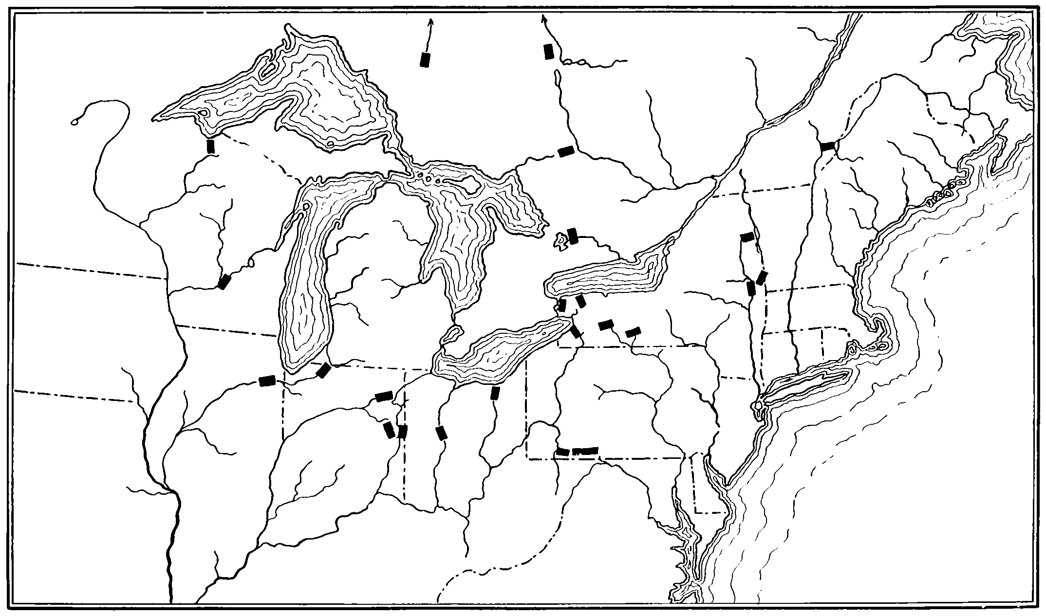
MAP OF THE NORTH-EASTERN PORTION OF THE UNITED STATES SHOWING PORTAGES
Showing the Location of Well-known Portages. There Were Other Portages Wherever Two Water Courses Came Near to Each Other. (See Farrand: “American Nation,” Vol. I, and Thwaites, Ib. Vol. VII.)
[37]
The Oneida portage, leading from the Mohawk, a tributary of the Hudson, to Wood Creek thence by the Oswego River furnished a way to Ontario and the other Great Lakes. A portage around Niagara Falls is now supplanted by the Welland Canal.
Lines of Travel.
—To reach the Ohio Valley travelers might go by way of the north along the routes just mentioned to the Great Lakes, thence to the interior of Ohio, or they could leave the Mohawk and portage across to the upper waters of the Allegheny. The Indians gave trouble along these lines, so a more southerly route was often taken. Some of these, commencing on the north, were: Up the Susquehanna to its headwaters, portage to one or the other of tributaries which flow into the Allegheny near Kittanning; leave the Susquehanna and go up the Juniata and portage over to the Conemaugh, thence to the Allegheny—a course partly occupied now by the Pennsylvania railroad; or, by way of the Potomac, and Wills Creek, then across the Youghiogheny, and Monongahela. Several other trails crossed the Alleghanies. A trail through southern Pennsylvania called occasionally Nemacolin’s Path afterward formed the line of Braddock’s Road, hastily constructed for military purposes during the French and Indian War, and over which Braddock’s unfortunate expedition traveled. Still farther south there was a well-known trail often followed by the Cherokee Indians, by trappers, hunters, traders, and missionaries desirous of reaching the lands beyond the mountains. Skirting the north end of the Blue Ridge range the traveler followed up the Shenandoah to near the present town of Staunton, thence across the ridges to the headwaters of the James, thence to upper tributaries of the New River, then by crossing a few more ridges to the Holston River, thence into the bountiful hunting grounds of Tennessee. The Cherokee Indians were jealous of this territory and as far as possible kept it[38] closed to the settler. Therefore the country beyond the Alleghanies was not well known to the Virginia colonists, even up to 1800. True, records of Dougherty, a trader, who had visited the Indian tribes in this region as early as 1690 were known, and another (Adair) in 1730, and still others after 1740. Glowing reports were brought back by the few traders, hunters, trappers, and occasional talkative Indians, who had visited those regions of magnificent rivers, vast woods, and extended prairies. The wild beasts with which this fertile country abounded were likened to the leaves on the trees, they were so abundant. Even the great Ohio River was but a tributary of a larger river of which they had no definite information. The trip, in the language of the Indian, from the headwaters of the Holston (Hogo higee) to the Wabash (Ohio) required for its performance “two paddles, two warriors, three moons.”[20] These glowing descriptions only whetted the adventurous appetite and soon such hardy pioneers as Daniel Boone and his comrades sought this territory where they could live near to nature and be freed from high taxes. There was also a well-worn trail from Philadelphia, east of the Cherokee (Shenandoah) through Virginia to the Yadkin, from which travelers could diverge at various points and reach the Cherokee trail or go on through Cumberland Gap farther to the west.
Trails from the North.
—Traders from Virginia who reached far out in Tennessee and Kentucky found competition from those who came down by one of the several routes from the Great Lakes or up from the lower Mississippi. A route left Lake Erie at what is now Cleveland, passed up the Cuyahoga, portaged across to a tributary of the Ohio, then into Kentucky; another left the Lake at Sandusky, followed the Miami, crossed to the Scioto, thence down to the Ohio, across Kentucky to Cumberland Gap, sometimes called the Scioto trail and farther south the Warrior’s Trail.
As western territory settled, trails and roads became[39] more numerous. Readers desiring further detailed information are referred to Hurlbert, Thwaites, Dunbar, and Farrand.[21] A few other routes, however, should be mentioned on account of the importance they assumed in the settlement of the nation.
Boone’s Trace, or The Wilderness Road.
—This road is said to be the first road built into the wilderness for the purpose of encouraging settlement and development. In the late years of the nineteenth century it was no uncommon thing for a railroad to precede settlement, but at the beginning of the eighteenth century roads were, in America, made largely for military purposes or where demanded by the traffic of earlier settlement.
Daniel Boone, the noted hunter and explorer, had several times left his home in North Carolina to hunt and travel in the wilds of Kentucky. He brought back to the eastern side of the mountains glowing descriptions. These excited the cupidity of a friend, a judge and prominent citizen of North Carolina, James[22] Henderson. Henderson employed Boone to confer with the Cherokee Indians who claimed this territory for the sale of their rights. Boone sought out the Indians and by means now unknown got them to agree to sell. The fact that they were persuaded to dispose of their great hunting grounds shows what influence Boone had among them. It has been intimated that the chiefs realized the futility of further fighting the white settler or that the Cherokees felt they had no real right to this land as it had been rather held as neutral territory[40] among several tribes. However, as soon as they had given their pledge Boone is said to have gone immediately to Henderson, who repaired at once to Fort Watauga on a branch of the Holston in North Carolina, where he met 1200 natives in council and completed the deal in the name of the Transylvania Company. The main opposition came from an eloquent and powerful chief named Dragging Canoe,[23] who was able to disrupt proceedings the first day. After his speech the council broke up in confusion. The next day, however, the Indians again went into council and the treaty was ratified. Estimates of the price paid range from “ten wagon loads of cheap goods and whiskey,” to “the equivalent of ten thousand pounds sterling.”[24]
As soon as the deal was consummated Boone, employed by Henderson, began the marking and cutting out of a road from Watauga, North Carolina, to Boonesborough, Kentucky. The party numbered about forty men, consisting of colored men to care for the camp duties and the necessary pack animals and a body of woodsmen with axes. Boone went ahead and blazed the way by chopping notches in the sides of trees along the way, the axmen following cleared away the underbrush and felled and removed such trees as stood in the way. However, as it was easier to detour than to chop, usually only small trees were cut. It was not intended that this should be a wagon road, as wagons had but just made their appearance in this region. However, it was to be an easily followed way for future settlers. In Boone’s Autobiography, dictated to John Filson, the matter of the road is referred to thus:
After the conclusion of which (a campaign against the Shawanese Indians which Boone commanded by order of Governor Dunmore), the militia was discharged from each garrison, and I, being relieved from my post, was solicited by a number of North Carolina gentlemen, that were about purchasing the lands lying on the north side of Kentucky River, from the[41] Cherokee Indians, to attend their treaty at Wataga, in March, 1755, to negotiate with them, and mention the boundaries of the purchase. This I accepted; and, at the request of the same gentlemen, undertook to mark out a road in the best passage from the settlement through the wilderness to Kentucky, with such assistance as I thought necessary to employ for such an important undertaking.
I soon began this work, having collected a number of enterprising men, well armed. We proceeded with all possible expedition until we came within fifteen miles of where Boonesborough now stands, and where we were fired upon by a party of Indians, that killed two, and wounded two of our number; yet, although surprised and taken at a disadvantage, we stood our ground. This was the 20th of March, 1775. Three days after, we were fired upon again, and had two men killed and three wounded. Afterwards we proceeded on to Kentucky River without opposition; and on the 1st of April began to erect the fort of Boonesborough at a salt lick, about sixty yards from the river on the south side.
A letter from Captain Boone to Colonel Henderson is quoted by Peck in his life of Boone, relating to this same enterprise, which shows the dangerous nature of the work and that even Boone seemed somewhat worried over the matter:
Dear Colonel: After my compliments to you, I shall acquaint you with our misfortune. On March the 25th a party of Indians fired on my company about half an hour before day, and killed Mr. Twitty and his negro, and wounded Mr. Walker very deeply but I hope he will recover.
On March the 28th, as we were hunting for provisions, we found Samuel Tate’s son, who gave us an account that the Indians fired on their camp on the 27th day. My brother and I went down and found two men killed and scalped, Thomas McDowell and Jeremiah McPeters. I have sent a man down to all the lower companies in order to gather them all to the mouth of Otter Creek. My advice to you, sir, is to come or send as soon as possible. Your company is desired greatly, for the people are very uneasy, but are willing to stay and venture their lives with you; and now is the time to flusterate their (the Indians) intentions, and keep the country whilst we are in it. If we give way to them now, it will ever be the case. This day we start from the battle-ground for the mouth of Otter Creek, where we will immediately erect a fort, which will be done before you can[42] come or send; then we can send ten men to meet you if you send for them.
I am sir, your most obedient,
Daniel Boone.
N. B.—We stood on the ground and guarded our baggage till day, and lost nothing. We have about fifteen miles to Cantuck at Otter Creek.
The road began “at the settlements,” which were probably in what are now Sullivan and Hawkins counties. Tennessee, but mostly along the Watauga River, then thought to be a part of Virginia. The road was a continuation of the Cherokee trail through the mountains. This trail served the great migration following the Revolutionary War in Tennessee and Kentucky. From the settlements there is a westerly course to the Holston River at Long Island near the site of old Long Island Fort constructed by Colonel Bird to winter his army during the French and Indian War in 1758. At this place he received some reinforcements and then continued in a generally westward direction through country he was more or less familiar with to the Clinch River, then across the ridge to the Powell River, and finally to Cumberland Gap, through which he entered the land of “Kentucke.” Here he arrived at the Warrior’s Trail leading northward, so called because Kentucky had been a sort of neutral hunting grounds of the Indians from the North, the Miamis, Shawnees, Wyandots, and others and of the Cherokees, Creeks, Catawbas, and others, from the South. Nevertheless the Indians from the South habitually crossed over and fought those from the North and vice versa, hence a large and much frequented trail.
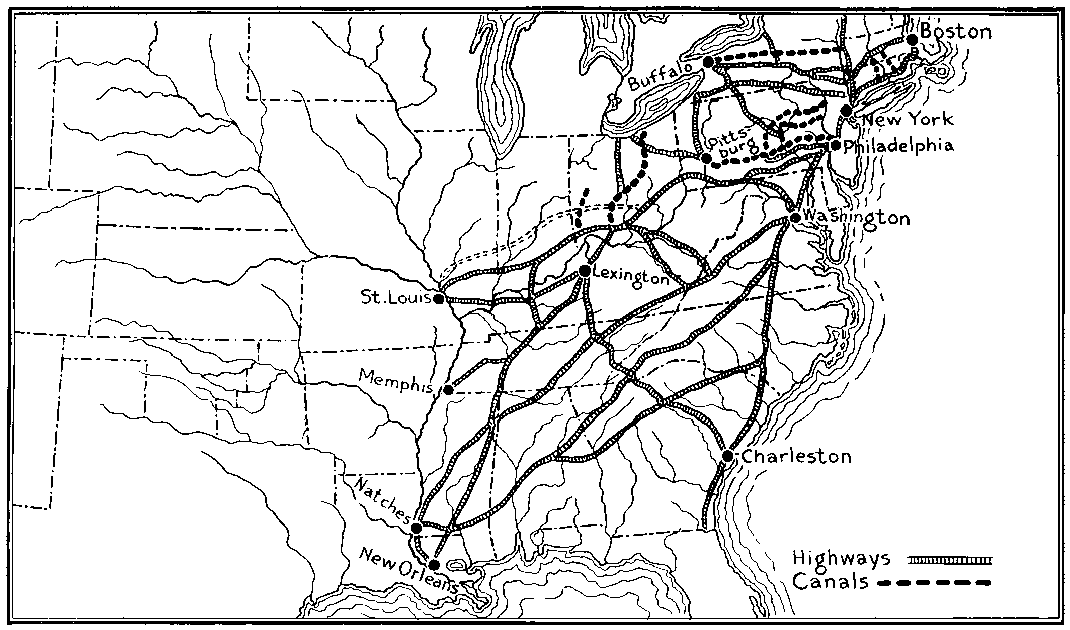
MAP SHOWING MAIN HIGHWAYS AND WATERWAYS IN UNITED STATES ABOUT 1830
When the Railroads Entered the Industrial Arena, the Country Was Being Covered With a Net Work of Highways. (Based on Tanner’s Map of 1825 and Turner in “American Nation,” Vol. XIV.)
Boone appropriated this native route for a distance of about 50 miles to near the present town of Manchester in Clay County. Here he found a “street” made by the buffalo, which were wont to travel through the cane-brakes about five or six abreast, thus with their thousands of hoofs breaking and hardening a way wide enough for a team and wagon. Turning west he followed the bisons’ street[43] to Rock Castle River, then turned northward again to the Kentucky River and the site of Boonesborough. A fort was here erected by placing stout log cabins with heavy stockades between about a rectangular space some 150 x 260 feet. A pair of strong wooden gates furnished ingress and egress. Several times was this fort attacked by Indians, the last time in 1778, by nearly 500 warriors, but always, because of the block houses at the corners with their loop-holes and the heavy barricades, also with loop holes, they were able to withstand the attacks and finally repulse the Indians.
The first legislature of the Transylvania Republic, as Henderson’s scheme came to be known, was held here. Boone was a member, as was Harrod from Harrodstown, and other early settlers of Kentucky.
There is no doubt but that this highway and blockhouse fort were of great assistance in settling and developing the country of Kentucke.
Calk’s Diary.
—One of the first parties to make use of Boone’s Trace was that of Henderson in response to Boone’s letter heretofore quoted. A naïve diary kept by one of its members, William Calk, is still in existence. It has been made available by the publications of the Filson Club. Speed[25] and Dunbar[26] quote it extensively. Theodore (afterward President) Roosevelt[27] says “the writer’s mind was evidently as vigorous as his language was terse and untrammeled.” While spelling, capitalization, and punctuation may not conform to the best modern style it must be remembered that in those early days there were no public schools. A few private schools were taught by more or less shiftless school teachers, but the man who could read and write at all was fortunate. Boone’s schooling, of a very meager nature, closed when he and some of his schoolmates exchanged the teacher’s whisky bottle for a similar one doped with tartar emetic. The sick teacher[44] made a “rough house” with Boone and his companions but was finally knocked down and the school dismissed.
To return to William Calk’s diary. It is a sort of log or running account of the trip and events from day to day as they impressed him, from its beginning March 13, 1775, in Prince William County, Virginia, till he arrives at Boonesborough. It is certainly a very good commentary on the early travel conditions. A few of the entries are:
1775, Mon. 13th—I set out from prince wm. to travel to Caintuck on tursday Night our company all got together at Mr. Priges on rapadon which was Abraham hanks phipip Drake Eanock Smith Robert Whitledge and myself thiar Abrahms Dogs leg got broke by Drakes Dog.
Wednesday, 15th—We started early from priges made a good days travel and lodge this night at Mr. Cars on North fork James River.
So he continues with his daily items. It may be interesting to note that
Wedns 22nd—We start early and git to foart Chissel whear we git some good loaf bread and good whiskey.
On “fryday 24th” they turned out of the main wagon road in order to go to “Danil Smiths” on the Clinch River, where they arrived Saturday evening and very hard traveling they found it through the mountains. Those who have had experience with pack animals in the timber will relish this incident which occurred soon after the few days’ sojourn at Smith’s.
Thusd 30th—We set out again and went down to Elk gardin and there suplid our Selves With Seed Corn and irish tators then we went on a little way I turned my hors to drive before me and he got scard ran away threw Down the Saddle Bags and broke three of our powder goards and Abrams beast Burst open a walet of corn and lost a good Deal and made a turrable flustration amongst the Reast of the Horses Drakes mair run against a sapling and nocht it down we cacht them all again and went on and loged at John Duncans.
They “suplyed” themselves with bacon and meal at “Dunkan’s.” This was their last chance to get provisions[45] other than the game afforded by the country. They found this a “verey Bad hilley way.” Were mired in the mud, fell in the water and got their loads wet. Since they turned off to go to Smith’s they had been traveling unbroken or dim trails; on “mond 3rd” after traveling the woods without any track they “git into hendersons Road,” that is the trail which Boone had recently blazed for the Transylvania Company. On “Tuesday 4th” they overtook “Col. henderson and his company Bound for Caintuck,” at Capt. Martin’s where “they were Broiling and Eating Beef without Bread.” They now formed a company of about “40 men and some neagros.”
Saturday 8th—We all pack up and started crost Cumberland gap about one oclock this Day. Met a good many peopel turned back for fear of the indians but our Company goes on Still with good courage.
News of the depredations of the Indians frightened many and caused them to turn back. The Henderson party were able to pursuade some of these to remain. On the 9th they met “another Companey going Back they tell such News abram and Drake is afraid to go aney farther there we camp this night.”
However, after many hardships, swollen streams over which they must sometimes swim their horses, “obliged to toat” the packs over themselves, they arrived at their destination. Once “Abrams mair Ran into the River with her load and swam over” he followed her and “got on her and made her swim back again.” He mentions occasionally Killing game: one “Eavening two Deer,” another day a “beef,” and again “2 bofelos.” The writer was evidently disgusted with the uncleanly and unsanitary Drake, whose dog is mentioned in the first entry, for he notes that “Mr. Drake Bakes Bread without washing his hands,” which evidently was unusual in even these frontier times.
After arriving at “Boones foart” they drew “for chois of lots;” some as will always happen were dissatisfied. This small company, however, must have decided to accept the verdict of chance for Calk writes:
[46]
Wednesday 26th—We Begin Building us a house and a plaise of Defense to Keep the indians off this day we begin to live without bread.
Satterday 29th—We git our house Kivered with Bark and move our things into it at Night and Bigin houseKeeping Eanock Smith Robert Whitledge and myself.
Thus ends this interesting journal kept under difficult conditions when ordinary men would have considered it useless labor to make such a record. There is no doubt but that Boone’s Wilderness Road and Boone’s Fort were both very instrumental in the settlement of Kentucky and Tennessee. The territory of Kentucky was separated from Virginia in 1786 and admitted to the union as a state in 1790, when it had a population, by U. S. Census, of 73,077.
Marquette’s Explorations.
—Religious devotion and zeal has done much for the settlement of North America: the Puritans in New England, the Quakers in Pennsylvania, the Catholics in Maryland and Canada, and very much later the Mormons in Utah are familiar examples. A French Jesuit missionary, Jacques Marquette, who with another, Claude Bablon, had founded (1668) a settlement at St. Mary’s on the falls between Lakes Superior and Huron, said to be the first French settlement within the present boundaries of the United States, had made friends with the Illinois Indians and learned their language. He also collected the remains of the Huron tribes at St. Ignace and established a mission there (1671). Marquette had heard from the Indians many tales of the Great river to the west, and decided to explore the region along its borders, despite their assertion of great dangers, that its warriors never spared the stranger, and that monsters would devour both men and canoes. Traveling with his company up the Fox River from Green Bay he crossed the portage, which still retains the name “Portage,” to the headwaters of the Wisconsin. With the explorer Joliet and five subordinates as companions, he boldly embarked upon the Wisconsin and floated down its course, knowing not where it would lead nor what dangers might be in store. After[47] seven days of solitary travel they floated with inexpressible joy on the broad bosom of the Mississippi, June 17, 1673. They continued their lonely voyage along its placid waters until they reached the mouth of the Moingona, where were seen evidences of habitation. Fourteen miles in the interior was a native village. They said they were received most friendly with a calumet, invited into their dwellings, and feasted. They explained their religious doctrines and were sent away with the gift of a calumet or peace pipe embellished with the heads and necks of various colored bright and beautiful birds.
They sailed along their solitary way and were soon rewarded by hearing the rush of the swifter, more turbulent, muddy waters of the Missouri, which seemed from thereon to enhance the speed of the current. They went on past the mouths of the Ohio and the Arkansas, where they found savages who spoke a new tongue and were armed with guns, proof that they had trafficked with the Spaniards from the Gulf of Mexico, or with the English from Virginia. These exhibiting hostility which was only allayed by the peace pipe, they retreated and sailed back up the river. When Marquette reached the Illinois he entered and ascended that river where he beheld the magnificent fertility and coloring inuring to the late summer and early autumn of the extensive plains and vast wooded tracts of Illinois. An easy portage brought him to the Chicago River, a short stream whose waters are now reversed and flow into the Illinois. Some authorities claim Marquette to have been the first white man to set foot upon the site of Chicago (1673). Others[28] state that the French Jesuit Nicholas Perrot and his party of fur traders pitched their tent on its prairies the latter part of 1669.
To Marquette, however, belongs the honor of discovering two very important routes to the Mississippi Valley; the one by way of the Fox and Wisconsin Rivers, and the other by way of the Illinois. Unfortunately the hardships of this journey undermined his health and the next year[48] (1674) a half hour after he had retired for devotion to a small altar of stones on the banks of a little stream now called by his name, he was found dead. Thus judged by the extent and value of the territory traversed, passed away, at the early age of thirty-one, one of our country’s greatest explorers.
The Lewis and Clark Expedition.
—Another exploring expedition sought a path to extend the commerce of the United States in the far Oregon country. The great Rocky Mountain ranges precluded direct approach. The idea had evidently fastened itself upon Thomas Jefferson, even before he became president, that the Missouri River might be made the highway across the continent, and that trade and commerce thus engendered would inure to the benefit of the country. Also being a highly educated man, he was deeply interested in extending the geographical and biological knowledge of this vast region even though no remuneration to the nation might come therefrom. Furthermore, it is possible, he desired to secure the territories beyond the Rockies as a part of the country, but he was too shrewd to make plain statements to that effect. His shrewdness and the business sagacity of Livingston, minister to France, coupled with the financial straits of Napoleon resulted in obtaining an extensive portion of the country without which the United States could not have developed into a strong well-bound nation reaching from coast to coast. Whether Mr. Jefferson would have attempted to take this country by force matters not now. The fact that the Lewis and Clark military expedition was ready to start almost as soon as the purchase was made, lends suspicion to that idea. The nomination of Monroe to be Minister to France, the man whom Jefferson expected to conduct the Louisiana negotiations, and who arrived in France just in time to see them completed by Livingston, was made January 11, 1803; while the message proposing the expedition was submitted January 18; the treaty of cession for the purchase was signed May 2; and during that same month the expedition which had previously organized[49] left its winter quarters about a day’s journey from St. Louis, and proceeded up the Missouri River. The expedition consisted of forty-five persons in three boats, one a flat boat decked over at the ends and two pirogues[29] together with a number of horses which were to be driven along the bank for the use of the hunters. The personnel consisted of the two officers, Captain Meriwether Lewis and Lieutenant (by courtesy Captain) William Clark, both of whom were from families already distinguished in border service; twenty-seven men who expected to make the entire journey; seven soldiers and nine voyageurs who were to go only to the Mandan villages of the Missouri, where the party would winter. Of the twenty-seven permanent members one was a half-breed hunter who would also act as interpreter, two were French voyageurs, and one a negro servant of Clark. All, except the black slave, were enlisted in the army that discipline might be secured. Their progress was necessarily slow and a full account of it reads like a romance. They of course had to live off the country as they proceeded. There was no roadway along the river, often the brush was thick and the grass high; the river with its turbulent waters, snags, and sand bars made navigation difficult; flies and mosquitoes, those pests of bottom and marshy land, were abundant. They had some trouble with the Sioux Indians, but Captains Lewis and Clark were evidently able to cope with them successfully. They reached a point near the present site of Bismarck, N.D., that summer. This region was occupied by the Mandan Indians, who lived in villages of rather permanent character. Among these they found some who had traveled far toward the headwaters of the Missouri. One woman, known as the Bird Woman, was especially helpful to them. She had been captured some time previously from a mountain tribe and according to Indian custom married to one of their own number, a half breed. During the stay at[50] winter quarters, in addition to writing up their journals and records very carefully, they cultivated the acquaintance of this woman. She, with her half breed husband and small child, accompanied the expedition when it began its onward journey in the spring of 1805. There was real need for them not only to act as guides and interpreters, but to replace those who had been sent back down the river with reports of the progress and observations of the expedition up to this time. Part of the duties of the expedition, as heretofore intimated, was to note the character and productivity of the land, as well as the nature and number of Indians found and general information concerning them and their mode of living.
When the falls of the Missouri were reached there seemed to be an impasse. But from logs and other timbers found there they constructed a crude wagon on which their supplies and equipment were transported to the river above. They had brought with them the iron framework of a smaller boat than those used heretofore with the idea of covering it with stretched skins. They found difficulty, however, in getting it watertight. They attempted to get pitch by heating pine tree trunks but were again unsuccessful. They resorted finally to a combination of powdered charcoal, beeswax, and buffalo tallow—practically natural products of the land. The boat floated nicely and they were greatly encouraged but when it was taken from the water the mixture dropped off and the seams opened up. Lewis finally gave up the attempt and buried the framework and built canoes according to the Indian fashion. In passing up they came to forks in the river and were often at a loss which to take. By conference with the Indian woman and reports of scouts sent ahead they were usually fortunate in choosing the right course. Being explorers of a new country they assigned names to the rivers as they discovered them. At three forks, they called the rivers, Gallatin, Madison, and Jefferson, names which they still retain. Three branches of the Jefferson were Philosophy, Philanthropy, and Wisdom; these names have not[51] remained—probably they were too fanciful—the Philanthropy is now the odoriferous Stinking Water.
They followed up the Jefferson until it became too shallow and precipitous to navigate longer. Lewis started out overland into the interior hoping to find an Indian habitation and someone who would guide him to waters flowing Pacificward. Game, which had been very abundant practically all the way, was here scarce and the company were often hungry, and very likely despondent. After arduous and weary wandering Lewis came across an old Indian woman and some girls. They were afraid of him and bowed their heads for execution. Instead he gave them trinkets and face paint. The men of the tribe having come up he with difficulty persuaded them to go with him to the river where the “Bird Woman” who had come with them from the Mandan village was recognized as the sister of the chief of the band with which Lewis had fortunately come in contact.
Their food up to this time, which was mostly meat, was easily supplied from the numerous herds of buffalo, elk, deer, and antelope; from flocks of wild fowl, and prairie chickens; and from several varieties of fish found in the waters. “On the return voyage, when Clark was descending the Yellowstone River, a vast herd of buffalo, swimming and wading, plowed its way across the stream where it was a mile wide, in a column so thick that explorers had to draw up on shore and wait for an hour, until it passed by, before continuing their journey.”[30] They frequently found hungry wolves, grizzly bears, and rattlesnakes which gave them more or less trouble, but they complained mostly of the mosquitoes.
But now having left the open country they found game very scarce. The Indians occasionally brought them a Rocky Mountain sheep but they themselves claim never to have seen one alive. After a short exploration in the region of the headwaters of the Jefferson they decided to continue toward the west. So purchasing ponies from the Indians[52] and cacheing most of their goods went on until the rivers were again passable for boats, where making new canoes they again took to the waters and voyaged to the mouth of the Columbia. Hunger harassed them, while rapids and whirlpools made their downward travel very disagreeable. The Indians on the lower reaches were generally friendly but their food consisted largely of dog meat, which at first was nauseating; however, after awhile they became reconciled to the Indians’ favorite dish.
The party wintered on the coast at a post they named Fort Clatsch. The damp winds here were cold and raw and to persons used to active outdoor life the winter’s enforced idleness cloyed, and they were glad when spring came and they could turn back. The streams toward the mountains are very swift so much of the return journey to the place where they had left their horses with the Nez Percé Indians had to be made on foot. Upon again securing their horses they separated at the top of the divide, Lewis returning by way of the Missouri and Clark going by way of the Yellowstone. Clark for a portion of the way subdivided his party in order that the maximum territory might be explored. They met again at the confluence of the Missouri and Yellowstone and concluded their expedition at St. Louis, September 23, 1806. Thus ended a marvelous journey of three and a third years through a wilderness beset with many dangers, inhabited by savage tribes, venomous reptiles, and ferocious beasts; but a wilderness on the whole extremely friendly, abounding in succulent vegetation and edible game, and endowed with a healthful and invigorating climate. During all this time, notwithstanding hardships and exposures, one man only had died, one had deserted and not more than two Indians had been killed.[31] To Lewis and Clark for their ability to handle men, for their courage, and fidelity should be given much praise.
Upon the report of this expedition being made public[53] very many hunters, trappers and fur traders came to the lands beyond the Missouri. These in turn were followed by bona-fide settlers. Soon this country was furnishing supplies for those farther east, the great rivers Missouri, Mississippi, and Ohio being busy routes of internal commerce. As a result of Lewis and Clark’s labors the United States was able to lay claim to the Oregon country some years later. The door was opened for the development of a vast empire with versatile resources far beyond the fabled riches of the far east.
Transcontinental Trails.
—Following the purchase of the Louisiana territory there was, of course, an extension of settlement to the prairies beyond the Missouri. The State of Missouri was early occupied and became a state in 1821, but it was many years later before other portions of the Louisiana Purchase were sufficiently settled to become territories.[32] The settlement of these lands, together with the opening up of Oregon and later California with its great gold rush, created a demand for transcontinental roads. The mountain ranges were searched for passes, possibly not so much for the purposes of settlement as means for going to and coming from fur trading posts which large companies established throughout the whole Rocky Mountain region. St. Louis became the greatest fur center in the world, a position which she probably holds[54] still.[33] Provost, leader of a detachment of the Rocky Mountain Fur Company (Wm. H. Ashley, of Virginia, founder), found the South Pass by way of the Sweetwater branch of the North Fork of the Platte River, 1823. This pass held preëminence as a crossing through the Rockies to the great interior basin and to the Pacific coast. Already has been mentioned the crossing of Lewis and Clark in the North. Bridger discovered the pass in Southern Wyoming bearing his name, about 1824. This defile though wide enough for an army to pass through seems narrow because of its lateral walls of red granite and metamorphic sandstone extending almost perpendicularly from 1000 to 25,000 feet. The overland mail route prior to the building of the Union Pacific Railroad was through this pass. Jedediah Smith, who succeeded Ashley as head of the Rocky Mountain Fur Company, explored practically all the region from Great Salt Lake to the Pacific, and from San Diego to the upper Columbia River in Canada. To him is the world indebted for its first knowledge of much of the vast region west of Salt Lake as by other active members of this company was revealed the sources of the Platte, the Yellowstone, the Green and the Snake Rivers, and possible routes through the almost impassable mountains drained by them. New England was especially interested in the Oregon country and through men from there the Humboldt River route was discovered.
During this same period there were being opened up trade and trade routes with the Spanish possessions farther south. In 1822 a wagon train was taken from Missouri to Santa Fé by a man named Beckwith to trade for horses and mules, and trap along the way. For years St. Louis was headquarters for many overland traders to these regions, taking to them cloths and other manufactured goods and bringing back furs, silver, mules, and horses.
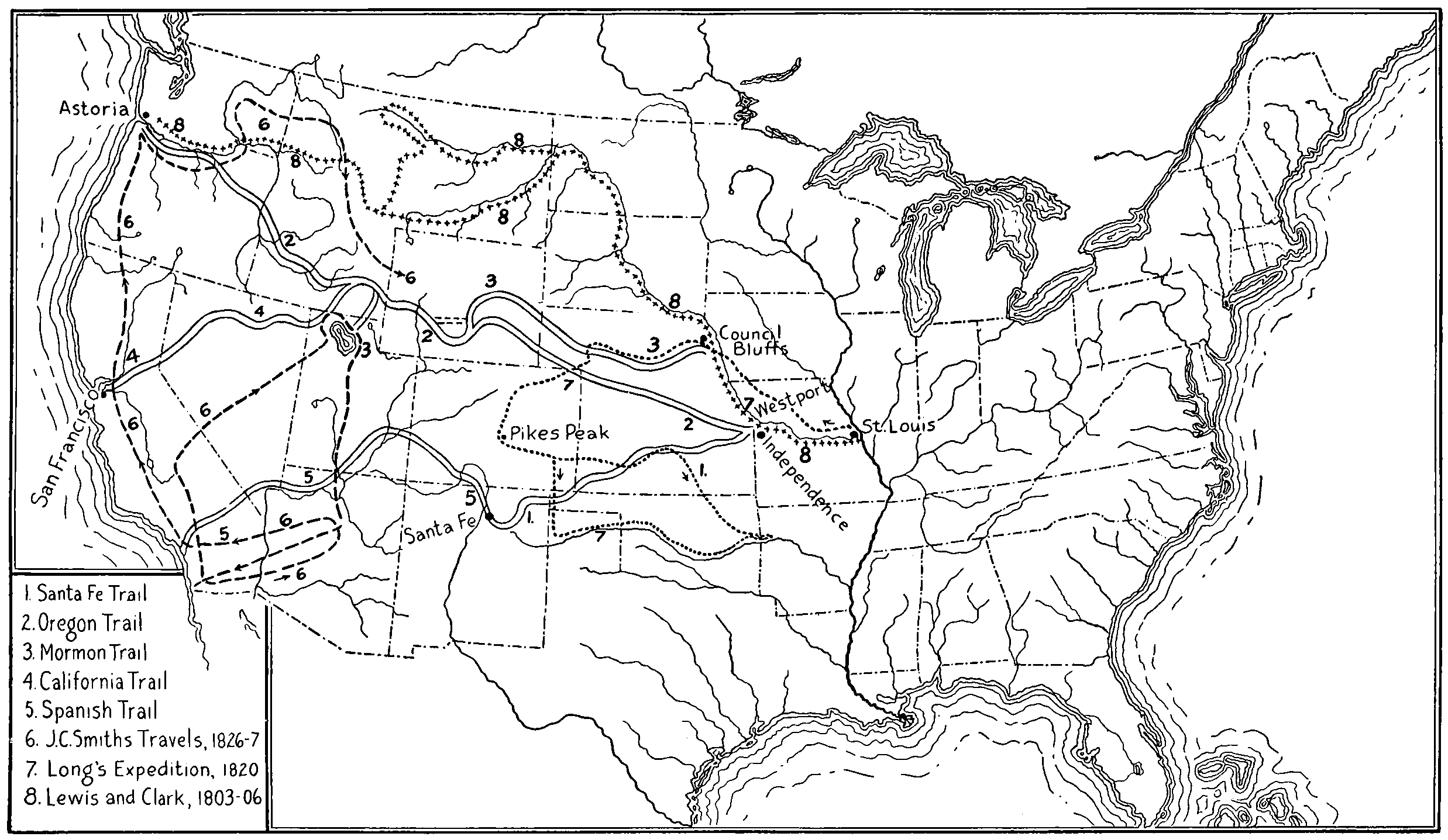
TRANSCONTINENTAL TRAILS IN THE UNITED STATES
[55]
The Oregon Trail, the Santa Fé Trail, the Spanish Trail and the Gila Route, had become quite well known by the early ’thirties and after the discovery of gold in California in ’forty-nine carried many people and much traffic across the continent.
Origin of the Oregon Trail.
—At Bellevue the Nebraska State Historical Society erected, June 23, 1910, a monument a part of the inscription on which reads:
Commemorative of the Astorian Expedition organized June 23, 1810, by John Jacob Astor’s American Fur Company. This Expedition discovered the Oregon Trail which spread knowledge of the Nebraska country leading to its occupancy by white people.
John Jacob Astor’s purpose in organizing the Pacific Fur Company, a subsidiary of the American Fur Company, was to establish himself and American control in the already disputed Oregon country.[34] As a result two expeditions were fitted out to go to and establish trading posts in Oregon with a central control or main post at Astoria. One of these expeditions went by water around Cape Horn to “carry out the people, stores, ammunition and merchandise, requisite for establishing a fortified trading post at the mouth of the Columbia River.” The other “conducted by Mr. Hunt, was to proceed up the Missouri, and across the Rocky Mountains, to the same point: exploring a line of communication across the continent, and noting the place where interior trading posts might be established.”[35]
The overland expedition, consisting of about sixty men with four boats left their winter quarters in Missouri and proceeded up the river in the spring of 1811. They deviated somewhat from Lewis and Clark’s route by leaving the Missouri River at the mouth of the Grand River, near where the Pacific extension of the Chicago, Milwaukee, and St. Paul railroad crosses. They seem to have gone across the country north of the Black Hills into Wyoming to the Wind River and Wind Mountains south of the Yellowstone Park, using present-day terms for locations; thence a short[56] distance to the head waters of the Snake River, a part of the Lewis and Clark route, which with some deviations they followed to the Columbia. At the mouth of the Columbia they met the sea party, and on July 28, 1812, a party of six men started back with dispatches. They wintered near Scott’s Bluff, Nebraska, having crossed the mountains substantially along the line afterwards known as the Oregon Trail. In the spring of 1813 they continued down the Platte to the Missouri. This trip proved the possibility of a direct route avoiding the long roundabout journey by way of the headwaters of the Missouri River. The evolution of the Oregon Trail has been summarized by Albert Watkins, Historian of the Nebraska State Historical Society, in Collections, Vol. XVI, p. 26, as follows:[36]
The Missouri Fur Company sent an expedition of 150 men to the upper waters of the Missouri in 1809. The powerful and ferocious Black Feet Indians, who were the providence of the Oregon Trail, discouraged the attempts of these men to gain permanent foothold there. Part of them retreated and another part, headed by the intrepid Henry, crossed the mountain divide in the fall of 1810 and established Fort Henry on Henry’s Fork of the Snake River. This was the beginning of the southern movement. In 1821 Pilcher, who succeeded Lisa as head of the Missouri Fur Company, made another attempt at a foothold in the Black Feet country, but was forced back. Ashley, leader of the Rocky Mountain Fur Company, organized in 1822, was also beaten back in 1823. By this time Henry was discouraged about holding on to the upper Missouri and turned his attention to permanent exploitation of the Green River valley. In that year Provost made the important discovery of South Pass. In 1824, Ashley conducted an expedition to the lower fields along the regular trail except that he went to Council Bluff and from there west up the Platte Valley. In 1830, his great lieutenants, Smith, Jackson and Sublette, went west with a train of fourteen wagons—the first to go to the mountains over the cut-off; that is, up the Little Blue valley to its head, across to the Platte, following the river to the mountains. In 1832 Bonneville also went over the cut-off and took a wagon train over the South Pass, the first wagons to cross the mountains. In 1832 Nathaniel Wyeth went over the cut-off to Oregon, but did not take wagons over the mountainous part of the course. In 1836 Marcus Whitman, one of the intrepid[57] winners and founders of Oregon, went almost through to the Columbia with a wagon, thus demonstrating and illustrating the practicability of a transcontinental road for all purposes. The Oregon Trail was now clearly outlined. It was thoroughly established in 1842 by the aggressive Oregon emigration.
The Final Trail.
—The Trail as finally adopted and used by emigrants and freighters to Oregon in the “forties” started from Independence and Westport (outfitting stations near the present metropolis of Kansas City, Missouri) then followed in a general way the Kansas, Big Blue, and Little Blue Rivers to near the Platte, crossing over to the latter river a short distance west of the present city of Kearney. The trail here proceeded up the South bank to the forks, and from there up the North Fork to the Sweetwater which it followed through South Pass. Thence it bore southwestward, westward, and northwestward to the Snake River which was followed to a point about west of Boise where a cutoff was made through the Blue Mountains arriving at the Columbia River about the mouth of the Umatilla, thence down the Columbia to the Pacific Ocean.
Salt Lake Trail.
—Many variations of the above described trail were in use. Travelers up the Missouri River disembarked at St. Joseph, Nebraska City, Plattsmouth and especially at Council Bluffs. The great Mormon trek was made from the last-named place. They reached the Platte River west of Omaha and followed it on the north bank, paralleling the Oregon Trail from Fort Kearney to Fort Laramie, where they crossed over and joined with the Oregon Trail through South Pass then leaving that trail turned south and west to Great Salt Lake.
Later California Trail.
—A continuation of the Salt Lake route north of Great Salt Lake and along the Humboldt River, across the desert to near Lake Tahoe, where there was a crossing through the Sierra Nevada Mountains, the Truckee Pass, thence to the Gold Diggings or across California by way of the American and Sacramento Rivers, was a trail very popular to California gold miners and was afterwards used by the overland stage, and known as the Later California Trail.
[58]
Santa Fé Trail.
—This road passed westward and a little south to the Arkansas River, which it followed to Bent’s Fort (Colorado), thence up Timpas Creek and over the Raton Pass to Las Vegas (New Mexico). Then westward through Apache Cañon to Santa Fé. This trail was too rough for wagon traffic, so later a route which crossed over south from the Arkansas to the Cimarron and meeting the old trail at Las Vegas was used.
Gila and Spanish Trails.
—Two routes were possible from Santa Fé. One southwestward by way of the Rio Grande and Gila Rivers into southern California. The other took a northwesterly direction up the Chama River, down the Dolores Valley, and across to the Grand River near the present site of Moab, Utah. Then west to the Sevier, up which it followed until it crossed over to the Virgin River; up this for a short distance then turned directly south-west across the Mohave desert toward Los Angeles. This last route received the name of Spanish Trail.
Many of these trails were difficult on account of scarcity of water in the deserts. Descriptions of early travel over them are replete with hardships, sickness, and deaths. Some of the graves were marked with wooden, stone, or iron markers with names roughly chiseled, but more received no marking whatsoever. Many travelers and settlers were killed by the Indians; the tribes apparently becoming more hostile as the number of whites increased until their own numbers became so decimated they could no longer command sufficient warriors to warrant further attacks. It would seem as though no advance in civilization is unaccompanied by its toll of human lives.
Era of Turnpiking.
—The need of better transportation facilities was “borne in” on the people of the eastern part of the country long before the west had been developed. The Indian trail, a single path,—for they always traveled in single file—gave way to the “tote path” over which each year the settler’s surplus crops were transported to market on pack animals. Even if they owned wheeled vehicles the[59] roads were generally so bad they could not be used. However, wheeled vehicles were not many prior to 1800. When Braddock wished to transport his army to western Pennsylvania he called upon the colonies for wagons, but Maryland and Virginia furnished only twenty-five. He appealed to Franklin, who by his influence was able to secure 154 wheeled vehicles[37] from Pennsylvania, probably the best supplied with wagons of all the colonies.
It was the custom for communities to join together after crops were gathered to start a caravan of packers to market.[38] A master driver with one or two assistants could manage a pack-train of a dozen or so horses. “Hides and peltries, ginseng, and bear’s grease” are mentioned as articles to be bartered for salt, iron, nails, pewter plates and dishes, and cloth and articles of clothing, although the latter were usually made at home. The horses traveled in single file each fitted with a natural crotch of wood for a tree. Hobbles and bells were provided that the horses could be turned loose to graze at night. Sometimes packs had to be taken off to be carried over streams or through narrow defiles. Naturally, methods of transportation had much influence on the character of the crops raised. Stock—cows, sheep, and pigs—could be driven to market by the raiser or sold to a drover who acted as a middleman. Farm products were concentrated by being fed to stock or manufactured into something requiring less space. Settlers complained that it required two bushels of grain to get one to market. Whisky and brandy were easily made, served to concentrate the grain and surplus fruit and always had a ready sale. When the government placed an excise tax on it the opposition was so great as to produce an insurrection in Pennsylvania (1794). Had there been good transportation facilities probably there never would have been a “Whisky Rebellion.” Sixteen gallons (two kegs) of whisky worth $1.00 per gallon east of the Alleghanies was[60] a horse load; whereas the same animal would only pack about two bushels of grain worth, perhaps, 80 cents. That packing was a business of considerable importance is shown by a statement in “The History and Topography of Dauphin (and) Cumberland Counties (Pa.)” quoted by Dunbar: “Sixty or seventy years ago five hundred pack horses had been at one time in Carlisle, going thence to Shippenburg, Fort London and further westward.” This was written in 1848.
Naturally so much traffic induced men to make packing a means of livelihood. They became so numerous and strong that when wagons began to take over the business of freighting they considered it an infringement upon their vested rights. But as goods could be transported more easily and cheaply by wagon the old had to make way for the new. Wagon roads and at first two-wheeled then four-wheeled vehicles began to appear. This created a demand for better roads. At first that consisted in merely widening the packtrain trails. But about the beginning of the nineteenth century, Tresaguet in France, and Macadam and Telford, in Great Britain, were building broken-stone roads which greatly changed and augmented the internal commerce and the industry of those countries. The most populous and wealthy of the colonies likewise began to consider the road question. A few military roads, such as Braddock’s, had been constructed; there was a road along the coast of Massachusetts, and some roads and bridges in the interior, there were roads connecting the larger cities as from Boston to New York and from New York to Philadelphia. The cities in order to retain and extend their trade needed highways of commerce.
Turnpike Roads.
—The construction of turnpike roads many of which were stoned was encouraged by a number of the states, especially by Pennsylvania. The Lancaster turnpike from Philadelphia to Lancaster was “stoned” in 1792 by throwing on it stones of all sizes. These were afterwards removed and stones “passing a 2-inch ring” substituted. This is said to have been the first scientifically[61] built hard surfaced road in America. In 1800 Pennsylvania fostered the construction of a system of turnpikes (toll roads), by granting franchises and subscribing stock, which was eventually to cover the state and control the western market. By 1828 there had been 3110 miles of chartered turnpike in Pennsylvania costing over $8,000,000. These thousands of miles of fine turnpike roads including many good bridges placed Pennsylvania in the lead for internal improvements. But other states were similarly employed. New York and New England by 1811 had chartered 317 turnpikes.[39] Virginia appropriated funds “to be used exclusively for river improvements, canals and public highways,” in 1816. South Carolina voted a million dollars, in 1818, to be raised in four annual levies for similar purposes.
During these years the states were opening public roads but the only good roads were those built by the turnpike companies, which erected gates and collected tolls every few miles. This resulted in a higher cost of transportation than was liked by the public who clamored for free roads and canals. They were wanted by both the producer and the merchant. The turnpikes were opposed to anything which would tend to reduce their control of transportation.
Wagon Road Desuetude.
—The introduction of the steam railway with its quicker, better, and cheaper form of transportation put out of existence the freighting and coaching business of the turnpikes, in fact of all wagon roads. Roads which had had a thriving trade found their toll boxes scarcely held enough to maintain the gate keeper. As there was no adequate system of maintenance, although many of them had been macadamized, they gradually fell into a state of disrepair. Freighters and coachers gravitated westward or took shorter runs as feeders to the railroads. Turnpikes, built as private or semi-private enterprises, were gradually being taken over by the public and maintained by local road overseers. The old practice[62] of calling on the freeholders to work out their road tax annually was in vogue and is still in use in places. By it no road was ever kept at a high state of efficiency. Even the National highway, the Cumberland Road, which had been constructed to Vandalia, Illinois, and surfaced with stone to Columbus, Ohio, at an expense to the nation of nearly seven millions of dollars, had lost its ardent supporters. Jackson’s theory that national money should only be spent for roads in territories, and the states’ right idea that each state should be the unit of government and look after all its own internal affairs, seemed to prevail. As a result wagon road building further than to make a mere way for crop marketing at odd seasons of the year stood still until bicycle enthusiasts began an agitation for better roads about 1890. However, a real awakening to the advantages of good roads came only after the advent of the automobile about 1900.
National Participation.
—The Revolutionary War had shown the need of roadways for quick intercourse between the seaboard and the trans-Alleghany regions. The efforts of the different states, still retaining their colonial jealousies, to secure the control of the trade of these regions emphasized the need of a unifying influence which would bring harmony. The debate proceeded in a desultory fashion for a number of years. Strict constitutionalists did not believe the national government has the authority to construct roads at all. States’ rights men argued that road construction is the province of the states and the National Government has jurisdiction only in the territories. On March 29, 1806, President Thomas Jefferson approved a bill to survey and construct a road from a point on the Potomac near Cumberland to the Ohio River near Steubenville popularly known as the Cumberland or National road, and appropriated therefor $30,000. This was in the minds of friends of government control to be the beginning; there was increasing need of travel and traffic facilities from the Hudson to the Great Lakes, from the Delaware to the Ohio; from Virginia and the Carolinas to Kentucky and Tennessee,[63] to say nothing of north and south routes, which unfortunately did not mature in time to prevent the great Civil War a half-century later.
Alfred Gallatin and Henry Clay sponsored the Cumberland Road. The former in compliance with the wish of Congress (1808) drew up a scheme for a national system of internal improvements by roads and canals at an annual expense of $2,000,000 for ten years. But its opponents were able to stay it off and the war of 1812 coming on caused financial troubles and the entire scheme was indefinitely postponed.
The first appropriation for the Cumberland Road had been made, not from the general funds of the government, but from the proceeds of the sales of land, a fiction, of course, for the benefit of the strict constitutionalists. Gradually, however, Congress came to accept the doctrine of “implied powers.” Madison in his last message invited the attention of Congress “to the expediency of exercising their existing powers and, where necessary, of resorting to the prescribed mode of enlarging them, in order to effectuate a comprehensive system of roads and canals, such as will have the effect of drawing more closely together every part of the country, by promoting intercourse and improvements and by increasing the share of every part of the common stock of national prosperity.”[40]
Up to this time there had been completed only 23 miles of the road. In 1816, $300,000 was appropriated for its completion; two years later $260,000 was voted; but a proposal to appropriate $600,000 for internal improvements failed in 1817, as did also a bill providing for the extension of the Cumberland Road. But as a result of the labor of Henry Clay, Albert Gallatin, Thomas Jefferson, President James Madison, and other friends of cheap and rapid transit, by 1820 the total of Congressional appropriations for the Cumberland Road amounted to more than $1,500,000; in 1844 the thirty-fourth appropriation made a total of nearly $7,000,000.[41] The growth of the road was[64] slow: the first contract was let in 1811 for 10 miles; contracts for short sections were let from year to year and the road by 1817 had crawled, following approximately the Nemacolin Path, with the Potomac through the Cumberland gateway over the Alleghany range by way of Negro Mountain at an elevation of 2325 feet, down to the Youghiogheny, past the scene of Braddock’s defeat and the cairn which marks his resting place, through the Laurel Hill Range over to Brownsville within reach of Pittsburgh, thence westward slightly north through Washington (Pennsylvania), to Wheeling (West Virginia) on the Ohio River.
Thus had the old Indian trail developed into a route for Washington and his band to Fort Necessity; into Braddock’s road to Great Meadows; into a pack train trail trampled by thousands of caravan hoofs; and, finally, into a finished paved highway cleared to 66 feet in width, having no grade above 5 per cent which Washington and Jefferson and Madison had visions would be the means of binding together with the strong bands of commerce the cis- and trans-Alleghanian countries.
Extension of the Cumberland Highway.
—The road immediately proved its worth. The mail coaches were placed upon it; great freight lines were established having their own stage houses and depots in towns along its way; inns and hotels thrived; apparently the “pulse of the nation beat to the steady throb of trade along its highway.”[42] Like the Appian Way it became noted the world over. The National, Good Intent, June Bug, and Pioneer stage coach lines were common names as are the Pennsylvania, New York Central, Burlington, and Union Pacific railroad lines of to-day. The coming to town of these coaches, which had developed from the plain square box, through the oval type to the finished Concord painted in brilliant colors, perhaps bearing the name of some prominent personage, drawn by four and six horses, with the proud and arrogant driver often better known than the eminent patrons whose names[65] now grace the pages of history, was an important event in the work of the day. Hardly had the stage stopped before the hostlers were busy changing the horses, taking the tired animals to rub-down, rest, and feed, bringing on fresh high-stepping spirited ones, champing their bits, apparently very anxious for a galloping start toward the next post; the passengers were alighting to stretch their legs, rest and refresh themselves at nearby food “emporiums” or select an inn from among the claims of numerous barkers; agents were transferring and recording baggage, mail, and express; and the curiosity loungers constituted most of the remaining populace. The stage driver, Westover, made a record of forty-five minutes for the 20 miles between Uniontown and Brownsville, while “Red” Bunting’s drive of 131 miles, with the declaration of war against Mexico, in twelve hours remains, like Paul Revere’s ride, a part of the nation’s history.
The amount of traffic over the National road was tremendous. The annual traffic was probably not less than 3000 wagons.[43] One firm in Wheeling is said to have, during the first five years of its existence, done a business of over 5000 wagons carrying 2 tons each.[44] A view of the road must have been interesting, for the Conestoga wagons with their sway-backed canvas covers were said to have been “visible all day long,[45] at every point, making the highway look more like a leading avenue of a great city than a road through rural districts.... I have staid over night with William Cheets on Nigger (Negro) Mountain when there were about thirty six-horse teams in a wagon yard, a hundred Kentucky mules in an adjoining lot, a thousand hogs in their enclosures, and as many fat cattle in adjoining fields. The music made by this large number of hogs eating corn on a frosty night I shall never forget. After supper and attention to the teams, the waggoners would gather in the bar-room and listen to the music on the violin furnished[66] by one of their fellows, have a Virginia hoe-down, sing songs, tell anecdotes, and hear the experience of drivers and drovers from all points of the road, and, when it was over, unroll their beds, lay them down on the floor before the bar room fire side by side, and sleep with their feet near the blaze as soundly as under a parental roof.”
Ah! where is the poet whose facile pen will engrave upon the tablets of literature the tales of these men as has Longfellow the “Tales of a Wayside Inn” in Sudbury Town so alike, where:
The success of the Cumberland Road to the Ohio created demands for its extension. In conformity to this demand $10,000 was appropriated in 1820 to lay out a road from Wheeling to the Mississippi River near St. Louis. This continuation was for a road 80 feet wide and in spite of much congressional objection and occasional presidential vetoes, the road was pushed on; the last appropriation being made for a portion west of the Ohio, May 25, 1838. The exact total of all appropriations amounted to $6,824,919.33. The road proper reached southern Illinois.
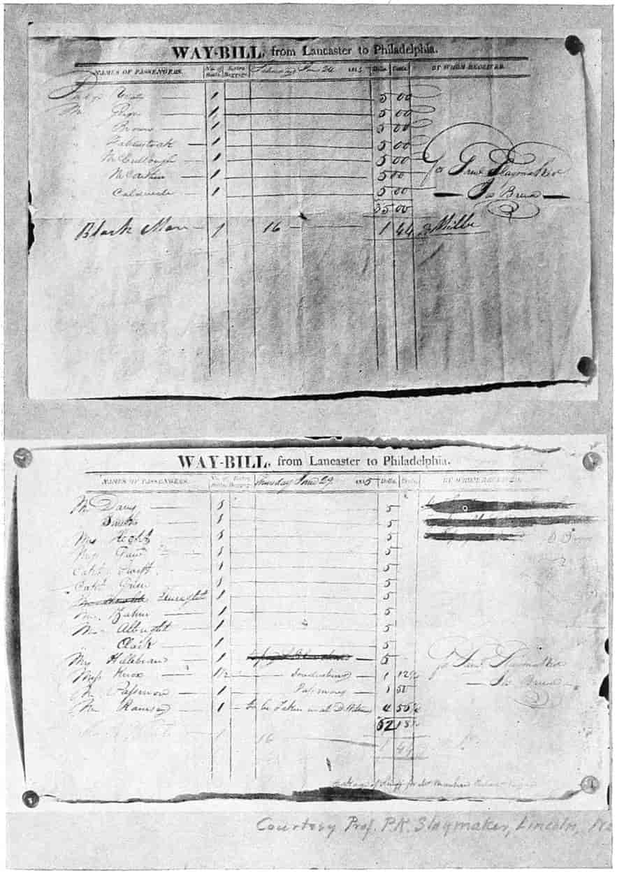
Courtesy of Prof. P. K. Slaymaker
WAY BILL USED ON SLAYMAKER STAGE LINE FROM LANCASTER TO PHILADELPHIA, 1815
[67]
States wanted appropriations for other roads, but these were pretty generally vetoed. One important case was the veto, 1830, by Jackson of the bill authorizing a subscription by the United States for stock in the Maysville, Washington, Paris, and Lexington Road Company. The company was incorporated in Kentucky to build a road from the Cumberland Road at Tanesville, Ohio, to Florence, Alabama, on the Tennessee River, which had been surveyed by U. S. engineers in 1827. Maysville, through which the road was to pass, was on the south side of the Ohio River, and did considerable trade in Kentucky and Tennessee. A census was taken of the existing road, admitted to be in bad condition, showing an average daily traffic of 351 persons, 33 carriages and 51 wagons. The $150,000 to be subscribed by the government was not to be paid until an equal amount had been subscribed in equal parts by the State of Kentucky and private individuals. Other bills of a similar character were before Congress, one for a road from Buffalo to New Orleans having been laid on the table, and opponents of the bill insisted any road anywhere could be as well regarded to be a national road as could be the Maysville road. The Washington Turnpike Company bill of a similar tenor was vetoed.[46] Jackson evidently doubted the constitutional right of the government to enter into internal projects of this character. In his message to Congress he had conceded that “every member of the Union, in peace and in war, will be benefited by the improvement of inland navigation and the construction of highways in the several states,” he noted the opposition to methods heretofore adopted as unconstitutional and inexpedient. He therefore proposed an amendment to the constitution, to be submitted if it could not otherwise be done, whereby the surplus revenue might be appropriated to the several states in proportion to their representation in Congress for the purpose of internal improvements. State sovereignty was always to be maintained.
In 1838 when the road had reached Southern Illinois a new element entered the industrial world. The railroads were proving their ability to compete most successfully with other forms of transportation. The building of national highways ceased; canal and river transportation were practically put out of business with the entrance of this new leviathan.
[68]
SELECTED REFERENCES
Adams, Henry, “Life of Albert Gallatin,” Edited by Henry Adams, Vol. I, pp. 78, 79, 305, 309, 370, 395. J. B. Lippincott & Co., Philadelphia.
Boone, Daniel, “Autobiography,” dictated to John Filson, 1784, is given also as an appendix to Hartley’s “Life of Daniel Boone.”
Calk, William, “Diary of” in Filson Club publications.
Doddridge, Joseph, “Notes on the Settlement of Indian Wars.” Chaps. I, XIII, XVIII, XXIV; First publication, 1824, Third—Rittenour & Linsey, Pittsburgh, 1912.
Dunbar, Seymour, “A History of Travel in America,” 4 volumes, 1915, Bobbs-Merrill Co., Indianapolis.
Early, Alice Morse, “Stage Coach and Tavern Days.”
Channing, Edward, “The Jefferson System,” Vol. XII, The American Nation Series, Harper & Brothers, New York.
Farrand, L., “Bases of American History,” Vol. II of the American Nation Series, Harper & Brothers, New York.
Hartley, Cecil B., “Life of Daniel Boone,” 1865, Porter & Coates, Philadelphia.
Howard, George E., “Preliminaries of the Revolution,” Vol. VIII of the American Nation Series, Harper & Brothers, New York.
Howe, Henry, “History of the West.”
Hurlbert, A. B., “Historic Highways of America,” 16 volumes, 1902-05, A. H. Clark Company, Cleveland, O.
Hurlbert, A. B., “The Paths of Inland Commerce,” Chronicles of America Series, Vol. 21, New Haven, 1920.
Irving, Washington, “Astoria,” Irving’s Works, Vol. I, G. P. Putnam’s Sons, New York.
Longfellow, Henry W., “Poetical Works,” Houghton Mifflin Co., Boston.
McMaster, John Bach, “History of the United States,” Vol. V, Chap. XLIV, D. Appleton & Company, New York.
Monette, John W., “History of the Valley of the Mississippi,” Vol. II, Chap. II, pp. 52-58, Harper & Brothers, New York, 1846.
“Register of Debates in Congress,” Vol. VI, pp. 433-435, 806, and 820. Published by order of Congress, 13 Vol. Washington, 1825-37.
Richardson, James D., “Messages and Papers of the Presidents.” 8 volumes, Government Print, Washington.
Roosevelt, Theodore, “Winning of the West,” Vols. I, II and IV. G. P. Putnam’s Sons, New York, 1889.
[69]
Speed, Thomas, “The Wilderness Road,” No. 2 of the Filson Club publications, Louisville, 1886.
Turner, Frederick J., “Rise of the New West,” Vol. XIV of the American Nation Series, Harper & Brothers, New York.
Tyler, L. G., “England in America,” Vol. IV of the American Nation Series, Harper & Brothers, New York.
U. S. Census review of “Agencies of Transportation,” 1880.
Watkins, Albert, “The Oregon Trail,” Nebraska State Historical Society Collections, Vol. XVI, p. 26 et seq.
FOOTNOTES
[16] “A History of Travel,” by Seymour Dunbar.
[17] “The American Nation,” “England in America,” by L. G. Tyler. Vol. IV, p. 322.
[18] “American Nation,” Vol. VIII, p. 15.
[19] Cf. “Historic Highways of America,” by A. B. Hurlbert, and “Basis of American History” (Vol. II of “The American Nation”), by L. Farrand.
[20] Ramsey’s “Annals of Tennessee.”
[21] “Historic Highways of America,” by A. B. Hurlbert, 16 volumes, 1902-05, A. H. Clark Company, Cleveland. A series of annotated reprints of some of the best contemporary volumes of travel in America, compiled by Reuben Gold Thwaites, 1904-07, 32 volumes, A. H. Clark Co., Cleveland.
“A History of Travel in America,” by Seymour Dunbar, 4 volumes, 1915, Bobbs-Merrill Company, Indianapolis, Ind.
“Basis of American History,” Chapter II, “Routes of Travel,” Vol. II of the American Nation Series, by Livingston Farrand, 1907, Harper & Brothers, New York. There is good bibliography in this volume.
[22] Cecil B. Hartley in his “Life of Daniel Boone,” gives the name of the head of this company as Colonel Richard Henderson.
[23] “The Winning of the West,” Vol. II, by Theodore Roosevelt.
[24] Dunbar’s “History of Travel,” Vol. I. Roosevelt’s “Winning of the West,” Vol. II.
[25] “The Wilderness Road.”
[26] “A History of Travel in America.”
[27] “Winning of the West.”
[28] Henry Howe.
[29] A pirogue proper is a canoe dug out of a single log. These may have been and probably were keel boats built of timber and the name pirogue extended to them colloquially.
[30] “The Winning of the West,” Vol. VI, by Theodore Roosevelt.
[31] Cf. “Winning of the West,” Vol. VI, p. 259; and “The American Nation,” Vol. XII, p. 94.
| State | Settled | Admitted a Territory |
Admitted a State |
|---|---|---|---|
| Missouri | 1755 | 1812 | 1821 |
| Arkansas | 1685 | 1819 | 1836 |
| Kansas | 1854 | 1854 | 1861 |
| Nebraska | 1847 | 1854 | 1867 |
| North Dakota | 1812 | 1861 | 1889 |
| South Dakota | 1859 | 1861 | 1889 |
| Wyoming | 1834 | 1868 | 1890 |
| Colorado | 1859 | 1861 | 1876 |
| Idaho | 1852 | 1863 | 1890 |
| Montana | 1861 | 1864 | 1889 |
| Iowa | 1833 | 1838 | 1846 |
| Minnesota | 1846 | 1849 | 1858 |
[33] Reports for 1920 show that New York has exceeded St. Louis in manufactured furs but St. Louis seems still to be the largest market for raw furs.
[34] Albert Watkins in “Collections of the Nebraska State Historical Society.” Vol. XVI, p. 22.
[35] Washington Irving’s “Astoria.”
[36] Cf. p. 230, Ibid.
[37] Dunbar’s “History of Travel.”
[38] Doddridge’s “Notes on the Settlement of Indian Wars.” Monette’s “History of the Valley of the Mississippi.”
[39] Cf. Gallatin’s report for a scheme of national roads and pavements (Adams’ Gallatin, p. 350 et seq.).
[40] Richardson, “Messages and Papers.”
[41] Hurlbert, “Cumberland Road.”
[42] Hulbert, “The Paths of Inland Commerce.”
[43] “American Nation,” Vol. XIV, p. 100.
[44] Hurlbert, “The Paths of Inland Commerce,” p. 121.
[45] Searight, quoted by Hurlbert.
[46] Debates of Congress VI, 433-435, 806, 820.
[70]
CHAPTER III
WATER WAYS AND CANALS
From the earliest exploration and settlement periods rivers and coast inlets have been used for transportation. As has been pointed out, the Indian, before the coming of the white man, made good use of his canoe. Boats and barges propelled by oars, poles, or snubbed along by ropes attached to trees on the banks were in early use. Along the coast and the larger rivers sails were made use of. Upon the ocean there was a large development in wooden sailing vessels. The great number of American ships and the inroads made by American merchants upon English trade had much to do with bringing on the war of 1812.
Canals.
—Canals had shown their usefulness in England and other European countries, for transporting the internal commerce cheaply and efficiently; it was but natural, therefore, that they should be considered in the United States. The first canal was in Orange County, New York, and was used for transporting stone as early as 1750. Numerous short canals were constructed in Pennsylvania, New York, and Massachusetts prior to 1810, but the peak of canal building came after this date. The first lock used in the United States was part of a canal extending from the Schuylkill River to the Susquehanna in Pennsylvania.
New York, seeing the trade of the Northwest Territory going to Philadelphia on account of the turnpikes which had crossed the Alleghanies through state and private means, was anxious to do something to get control. An agitation for a canal joining the Hudson River with Lake Erie or Lake Ontario consummated in a commission, 1810,[71] headed by Gouverneur Morris, to investigate the question of building one or both of the canals which seemed feasible, namely (1) from Albany up the Mohawk and westward to Lake Erie near Buffalo; (2) from Albany to Lake Champlain, thence an opening to the St. Lawrence, which had already been surveyed. In 1812 a second commission was formed which included with Morris, such men as De Witt Clinton, Robert Fulton, and Robert R. Livingston. An endeavor was made to secure Congressional aid. The war coming on no action was taken, but the demands for the canal continued. To the energy and political ability of DeWitt Clinton is attributed the final success of the enterprise. When he was elected governor in 1816 he made this the paramount effort of his administration. He stirred public interest by addresses and presented a convincing memorial to the legislature. He argued that “As a bond of union between the Atlantic and western states it may prevent the dismemberment of the American empire. As an organ of communication between the Hudson, the Mississippi, the St. Lawrence, the Great Lakes of the north and west, and their tributary rivers, it will create the greatest inland trade ever witnessed. The most fertile and extensive regions of America will avail themselves of its facilities for a market. All their surplus productions,” he prophesied, “whether of the soil, the forest, the mines, or the water, their fabrics of art and their supplies of foreign commodities, will concentrate in the city of New York, for transportation abroad or consumption at home. Agriculture, manufactures, commerce, trade, navigation and the arts,” he continued, “will receive a corresponding encouragement. That city will in the course of time become the granary of the world, the emporium of commerce, the seat of manufactures, the focus of great moneyed operations, and the concentrating point of vast, disposable and accumulating capitals, which will stimulate, enliven, extend, and reward the exertions of human labor and ingenuity, in all their processes and exhibitions. And before the revolution of a century, the whole island of Manhattan,[72] covered with habitations and replenished with a dense population will constitute one vast city.”[47]
As bombastic as this may seem his predictions have been more than realized and the realization began with the completion of the canal to Buffalo in 1825. There grew up along its way the great cities of Buffalo, Rochester, Albany, and scores of smaller ones. The products of the entire west did seem to flow through it, for the tolls are said to have been a half million dollars per year immediately upon its completion and over a million by 1830.[48]
This the largest canal project in the United States is still in use. As first constructed, it was 40 feet wide at the top, 4 feet deep, and was navigable for 76-ton boats. It was later enlarged to a general width of 70 feet and depth of 7 feet, navigable for boats of 240 tons burden. Some of the locks had been replaced by power lifts; the transfers are more quickly made.
The increase of New York’s prestige of course diminished that of Philadelphia. Pittsburgh was, too, growing up at the head of Ohio River navigation and in the coal and iron regions of Pennsylvania.
While numerous canals had been constructed by private enterprises an extensive system of canals was begun under an act of 1825, to connect Philadelphia with Pittsburgh as well as other objective points. Jealousies sprang up over the state, as usually do with any improvement. Always one part thinks the other is getting more than its just share. But notwithstanding, nearly a thousand miles of canals have been constructed in Pennsylvania, some of which washed out and were never replaced, some were abandoned and some are still in operation. In Ohio two canals were built by the state from Lake Erie to the Ohio River, over 400 miles in all. One of these extended from Toledo through Defiance, St. Mary’s, and Dayton to Cincinnati; the other from Cleveland through Akron, New Philadelphia, Coshocton, Newark, Columbus, Chillicothe, to[73] Portsmouth. Branch lines were run down the Muskingum to Marietta, down the Hocking to Athens, and from Junction westward to Antwerp to connect with the Indiana canal system. Making a total for Ohio about 1000[49] miles. In Indiana the Wabash & Erie Canal, begun about 1834, was constructed through Fort Wayne, LaFayette, Terre Haute to Evansville, in 1853, on its way to the Ohio River. By this time the railroads had paralleled its course and its trade had practically ceased.
One of the earliest projects, said to have had the backing of President Washington, culminated, eventually, in the Chesapeake & Ohio canal extending from Georgetown, the upper limit of tidewater on the Potomac, to Cumberland. After numerous efforts and years of talking, representatives of Maryland, Virginia, District of Columbia, and Pennsylvania met in a convention in the city of Washington and passed resolutions stating that “Whereas the connection of Atlantic and Western waters by a canal leading from the city of National Government to the River Ohio ... is one of the highest importance to the states ... Resolved that it is expedient to substitute for the present defective navigation of the Potomac River, above tidewater, a navigable canal from Cumberland to the eastern base of the Alleghany and to extend such canal as soon thereafter as practicable to the highest constant steamboat navigation of the Monongahela or Ohio River.” Jealousies between the states delayed matters somewhat, but in 1825 the proponents obtained governmental participation. Delays occurred for various causes, but in 1828 Congress authorized the U. S. treasurer to subscribe for $1,300,000 worth of stock and went further and guaranteed[74] subscriptions made by the towns of Washington, Georgetown, and Alexandria to the amount of $1,500,000. The United States had then once more endorsed the policy of spending national money for internal improvements, and had become a partner in a canal proposition. Building proceeded slowly. Many difficulties were encountered. Opponents fought it in the legislatures of Maryland, Pennsylvania, and Virginia, as well as in Congress. In two years the money was gone and the canal not completed. Maryland extended further aid, and then still more aid by the help of which the canal was completed to Cumberland in 1850. In 1870 efforts were made to have the Government carry the canal on to the Ohio River, but the plan was never consummated. This canal is still in use, the bulk of its traffic being coal brought down to Washington.
Canals were constructed in many other states, but they need not here be followed in detail. Illinois was connecting Chicago with the Mississippi River; Massachusetts built artificial ways about falls and rapids; New Jersey connected the Hudson with the Delaware; and numerous other schemes were carried out.
Canal Prosperity and Desuetude.
—Until the greater advantages of railway travel and traffic lessened the usefulness of the canals, they did a thriving business. As has already been noted with regard to the Erie canal so was it with the others.[50] In the whole United States there was a “grand total of 4,468 miles[51] of canals, costing approximately $214,141,802.” Not all these were remunerative. To the end of 1872 the New York Canals had only averaged[75] a profit of 3.2 per cent, while the Erie Canal proper paid but 4 per cent on its cost.[52] The speed at which the barges traveled was about 2 miles per hour; this was reduced on account of time lost by regular stops, passing through locks, and accidents, to 1.7 miles per hour on the average. Rates for freight were about 0.3 cent per ton per mile. The railroads later hauled through freight at 0.7 cent per ton per mile. Both these rates were, no doubt too small, for proper maintenance and remuneration.
Passenger traffic, notwithstanding the slow speed, amounted to a considerable volume. Packets were in use, that for workmanship, finish and convenience vied with the Pullman cars which later supplanted them. They were decorated in bright colors—green, yellow, brown, red, white, blue—with windows and panels done in contrasting and harmonizing shades and tints. On the interior in addition to compartments for the crew which were separated from those for the passengers, were usually a large general assembly room ordinarily occupied by the men for lounging, writing letters, playing games, and protection from stormy weather. There was a special cabin for the women, also lavatories and conveniences for men and women. In addition there were kitchen, lockers, and cupboards. Three times daily the assembly saloon was transformed into a dining room by re-arranging and setting the tables which constituted a regular part of the room’s furniture with others of a temporary nature, carried stored away on the boat, into one long table lengthwise of the room. The captain and his two assistants—the mule driver and steersman not on duty at the time—performed this service and waited upon tables. At night both the saloon and ladies’ cabin were converted into dormitories by attaching shelves about 6 feet long and 31⁄2 feet wide to hooks in the wall, the outer edges being held up by wooden supports extending from the floor. In each berth was placed a “mattress,” that is a tick having some straw in it and a pillow of similar make.
[76]
The passenger usually furnished his own sheets if they were wanted, although some of the later boats were supplied with sheets and coverlets. The berths were three high along the wall and had curtains suspended in front of them. The passengers selected their berths in the order in which they had secured passage, late comers being obliged to sleep on the tables or on the floor. Sometimes the whole floor was thus covered. Travelers complained bitterly of the mosquitoes. Crude as this may seem at the present time, these packets were no doubt the forerunners of the present Pullman palace car. The outside decks and the roof of the car were utilized for promenading, lounging and sight-seeing. They were often enlivened by music and dancing.
Greeley[53] speaks of the “‘cent and a half a mile, mile and a half an hour,’ line boats.” The expression he puts in quotations as though it were common or a slogan. Charges on the Wabash and Erie Canal in Indiana were for the 221 miles from Cincinnati to Fort Wayne, $6.75; 138 miles from LaFayette to Fort Wayne, $3.75; 104 miles from Fort Wayne to Toledo, $3.25.[54] An average of about three cents per mile.
The canals were unable to compete with the railroads when time became an element. Passengers would not be content to travel 36 miles per day along a tortuous canal when they could travel a much more direct route at nearly 36 miles per hour. The swifter speed of freight traffic accelerated business; the merchant’s capital could be turned over more frequently; his net profits were consequently greater. Is there any wonder, therefore, that the business of the canal continually decreased while that of the railroad as continually increased. Many canals were actually abandoned, others allowed to depreciate from want of proper maintenance, and now only occasional barges are run to transport heavy non-perishable freight such as grain, iron-ore, and coal. And of these commodities, because of better terminal facilities and the time element, the railroads soon were carrying much more than the canals.
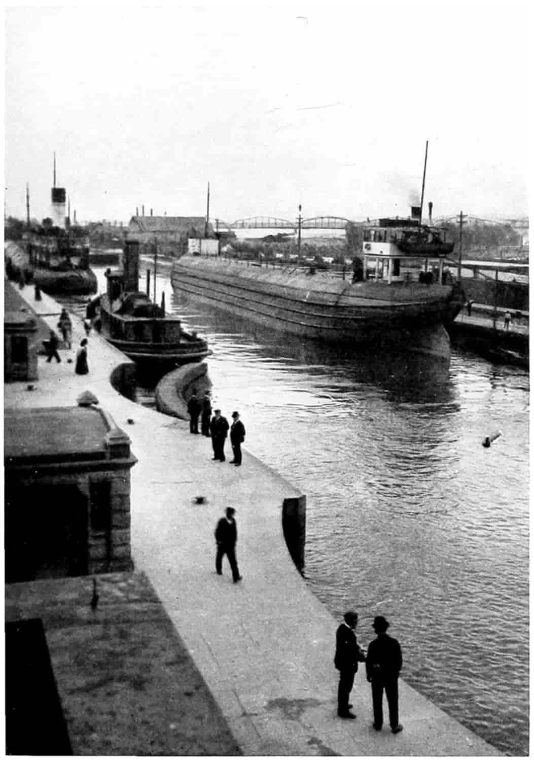
© Underwood and Underwood
THE SAULT ST. MARIE CANAL
[77]
Ship Canals.
—Reports show the tonnage of the Erie Canal to have continually decreased from 2,031,735 tons in 1911 to 667,374 tons in 1918. The total tonnage of all the New York state canals shows a like decrease from 3,097,068 tons in 1911 to 1,159,270 tons in 1918. Notwithstanding such records there are those who firmly believe canal transportation will again take an upward trend with better terminal facilities and possibly electric propulsion. There is one class of canals that seems to have held its own, that is ship canals. The great canal and locks at Sault Ste. Marie transfer a vast lake traffic annually from one level to another between Lakes Superior and Huron. Vast quantities of iron-ore are brought in mammoth vessels by this route from docks near the Mesaba mines for the great iron mills at Gary, at Cleveland, at Pittsburgh, and other points. Similar vessels loaded with wheat, oats, and flax from the Northwest grain fields are unloaded at Buffalo for transportation to the seaboard. Agitation has been going on for some time to enlarge the Welland Canal and its locks between Lakes Erie and Ontario, thus giving seagoing vessels the opportunity of coming up by way of the St. Lawrence River and traversing the entire Great Lake system. The ambition of cities is here again manifest; Chicago would like such transportation, but it would not be beneficial to New York.
A ship canal across Cape Cod saves 70 miles and considerable time and makes the trip much less dangerous from New York to Boston. Ship canals within the islands along the Atlantic and Gulf coasts have been proposed to make safe coast commerce. There is also talk of a ship canal from Chicago to the Gulf of Mexico by way of the Illinois and Mississippi Rivers; and still another from Lake Erie to Pittsburgh.
The Panama Canal.
—All present-day readers are familiar with the greatest of all ship canals, the Panama Canal, constructed by the Government at a cost of approximately[78] $400,000,000, and open to the ships of the world. It will be remembered that a canal across the isthmus had been dreamed of practically ever since Balboa passed over and for the first time a white man saw the Pacific from the west coast of America. With the opening of the Oregon territory there was increased interest in such a canal. With the discovery of gold in California much traffic went by way of Panama being freighted across and transshipped on the other side. Soon a railroad was established for that purpose. Other crossings, too, were much in mind. In 1846 a treaty of amity and commerce was entered into with New Granada, afterwards the United States of Colombia, which gave the United States a right of way across the Isthmus by any available method. In return the United States agreed to guarantee the neutrality of the Isthmus. Great Britain had likewise long been interested in a canal scheme and courted Nicaragua. Also because of English settlements at Belize or British Honduras they claimed rights which had been confirmed by the treaty of Versailles in 1773. Another route, across the isthmus of Tehauntepec, had also assumed importance. In 1848 a company of American citizens was formed for and began at once to construct a railway across the isthmus of Panama. Another contracted with the Nicaraguan government for a canal there. A treaty was made with Nicaragua whereby a concession was granted the company for the waterway, the United States guaranteeing the neutrality of the way as had been done with New Grenada. But the British government claimed control of the eastern terminus, therefore a treaty had to be negotiated with her. As a result the Clayton-Bulwer Treaty was signed and ratified in 1850, whereby the United States and Great Britain agreed to join in promoting a canal by the Nicaraguan route promising that neither “would obtain or maintain for itself any exclusive control over the ship-canal,” nor, and here was the joker, “assume or exercise any dominion ... over any part of Central America.” Neither was to acquire nor have any rights the other did not have and they both guarantee[79] the neutrality of the canal. This, apparently, was a violation of the Monroe Doctrine in so far as it did allow a European nation a foothold upon this continent, and it was contrary to the Washingtonian policy of avoiding “entangling alliances.” However, it was considered at the time to be a victory for American diplomacy. But Great Britain retained her hold on Belize and some islands along the coast, and finally it was made known that before the signing of the treaty Sir Henry Bulwer had left with Clayton a memorandum to the effect that British renunciation in Central America should not apply to “Belize” or any of its “dependencies.” Greytown, a British trading post, had been established as a “free” city at the eastern terminus of the Nicaraguan route through British influence and support.
In 1851 Greytown levied tribute upon the steamers of the transit company. One of these refused to pay and was fired upon by a British man-of-war, the fiction of Greytown being a “free city” apparently went glimmering. The situation was critical and for some time looked as though a war might result. Meanwhile the Accessory Transit Company continued in a state of trouble with the Greytown government. So bad was it that the United States vessel Cyane was called upon to protect the buildings of the Canal Company from destruction. Conditions remained strained, feelings ran high, until in 1854 one of the officers of a company steamer killed an individual and in a riot which followed the mob attacked the United States consul. Lieutenant Hollins, commanding officer of the Cyane, demanded reparation, and as this was not forthcoming he bombarded and destroyed the town. This accentuated the trouble between the United States and Great Britain but did not particularly enhance the building of the Nicaraguan canal.
About this time Great Britain became involved in the Crimean War while in the United States the slavery question divided the country. Some hot-headed southerners wished forcibly to annex Nicaragua and filibusters[80] actually joined in some of the “revolutions” which are almost always in progress in Central American States with the idea of extending slave territory.[55] Through one of these a man by the name of Walker had made himself head of Nicaragua and for two years remained a dictator. His rule was marked by severity and a series of acts that won him the enmity of the Central American States and also that of the Accessory Transit Company, whose charter and steamers he confiscated. He had secured the presidency and opened the state to slavery; he had also been able to get recognition at Washington. But another revolution broke out and he was driven out in 1857.
The action of Walker had destroyed American influence in Central America. In the United States opinion was divided. Slavery enthusiasts openly advocated control of any transit route across the isthmus and that “no power on earth should be suffered to impede.”[56] This and numerous other troubles which followed, off and on intermittently, delayed and prevented canal construction.
French Participation.
—After the opening of the Suez Canal in 1869 by the French an organization of French scientists made a careful study of the various routes across the Isthmus and decided the one at Panama to be the most feasible. As a result, in 1875, De Lesseps, the engineer of the Suez Canal, began a careful survey of that route and in 1878, Lucien Bonaparte Wyse, of the French Navy, secured from the United States of Colombia (which had succeeded New Granada) a concession giving a company to be organized by him exclusive right to construct a canal and railroad across the Isthmus of Panama. Neutrality was to be maintained and troops transported only by permission of Colombia. In return for this privilege and certain grants of land Colombia was to receive 5 per cent of the gross tolls collected. The concession was for ninety-nine years and the canal was to be opened within eighteen[81] years. While it was claimed this concession did not conflict with the treaty of 1846 between New Granada and the United States, nevertheless it provided that the latter might share in its advantages. The concession was transferred to De Lesseps, who arranged for an International Congress of Geographical Sciences, which assembled in Paris, May 15, 1879. The United States was one of the twenty-five nations there represented. Fourteen projects involving seven different routes were discussed and included all that were considered feasible.
Without going into detailed description some of these routes may be mentioned. The Tehauntepec route was 148 miles long and required 120 locks, would take about twelve days to pass a vessel through, and was in the region of earthquakes. The Nicaraguan Route was favored by many—it was 180 miles long, needed 17 locks, but it required an actual construction of only 60 miles as existing rivers and lakes could be utilized. A route from the Chiriqui Gulf to the Gulf Dulce, another from the Gulf of Darien by way of the Atrato and Napipi Rivers, and another into the San Miguel Bay, were discarded for various reasons. The choice centered upon the route from Colon to Panama by way of the Culebra pass and the Chagres River. This route, the shortest of all, was only 45 miles in length, but there were several disadvantages. The Chagres River must be diverted by a large dam or carried for miles in an aqueduct.
A company (Compagnie Universelle du Canal Interoceanique) was organized and popular subscriptions invited. It was claimed that further than granting the charter the French Government had nothing to do with the canal. Stock could be owned by people of all nations, but the United States did not take kindly to the measure, although no formal action to prevent the construction of the canal was taken. Several promotion schemes were advanced by private individuals to head off the French and Congress was petitioned for aid. Captain Eads, who by jetties had deepened the mouth of the Mississippi River,[82] and an engineer of note, suggested a ship railway across the isthmus of Tehauntepec. A “Marine Canal Company of Nicaragua” wanted Congress to guarantee its capital stock; another Nicaraguan company had Ex-President Grant as a sponsor.[57] The surveys made by the United States of the Panama and of the Atrato-Napipi routes in 1875, were printed by order of Congress. In 1880 the House asked the president for the report of surveys made in 1872 and submitted in 1875 which had not yet become public; this report recommended the Nicaraguan route.
From time to time indignation was manifested in the United States against allowing a foreign country to gain a foothold even though by a neutral company on the American continent. The Monroe Doctrine was brought out; the Clayton-Bulwer treaty was presented; the reports of Congressional Commissions were referred to as arguments against the De Lesseps Canal. Various other complications entered, one of which was a possible conflict of authority if in case of a revolution on the Isthmus it were necessary to send troops by the United States to maintain the neutrality of the railroad and by France troops to maintain the neutrality of the canal.
Sweeping aside these questions De Lesseps made preparation to construct the canal, and landed a force of seventy engineers, superintendents and workmen on the Isthmus of Panama in 1881. De Lesseps planned a tide-water canal which would require a cut of 285 feet in the Culebra pass. Difficulties encountered from slides in this cut and other reasons made it advisable afterwards to change the plans. De Lesseps purchased much machinery in Europe and America at large expense; bought the Panama railroad for $17,000,000, because the line of the Canal crossed it frequently and it could be utilized for transporting materials, and began the operation of opening up the cut at various points along its course. The engineers estimated the cost at 843,000,000 francs; this, De Lesseps cut to[83] 600,000,000 francs, and set the opening ceremonies for 1888.
During the Garfield administration Secretary of State Blaine held out for a strong American policy and informed Colombia, which was charged with making arrangements whereby certain European powers might assume joint guarantee over the canal, that “any movement in the sense of supplementing the guarantee contained (in the treaty of 1846) would necessarily be regarded by this government as an uncalled for intrusion into a field where the local and general interest of the United States of America should be considered before those of any other power save those of Colombia alone.”[58] England claimed to be a new world power equally interested with the United States in maintaining the neutrality of the canal. Blaine proposed amending the Clayton-Bulwer treaty so that the United States could fortify the canal, also to annul that part extending it to any other practical routes so that the United States might be free to build a canal at Panama or elsewhere as it chose. Garfield’s death and Blaine’s retirement from the cabinet ended for the time being policies regarding South and Central Americas that would either have brought the United States in trouble with England or secured to her complete control of the canal and also, perhaps, much of South American trade. A treaty with Nicaragua allowing the construction of a canal wholly under American control, the United States guaranteeing the integrity of the territory of Nicaragua, which was undoubtedly a violation of the Clayton-Bulwer treaty, and prepared by Frelinghuysen, Secretary of State under Arthur, for the purpose of testing that treaty, was withdrawn by President Cleveland who was inaugurated before its confirmation.
There was a growing feeling that the De Lesseps company would never finish the canal. The company had spent $10,000,000 more than the estimate of 600,000,000 francs ($120,000,000), and had not paid the $17,000,000[84] promised for the Panama railway. In fact it was bankrupt. While a large amount of excavation had been done, it was small compared with what was necessary. A magnificent plant with much costly machinery was going to decay.
The Spanish-American war brought forcibly to the attention of the public the need of an interoceanic canal.
In 1900 a treaty negotiated by John Hay and Sir Julian Pauncefote embodying some modifications of the Clayton-Bulwer treaty had been so amended in the Senate that Great Britain would not accept it. A new treaty made in view of the Senate amendments and the British objections was submitted a few months after Roosevelt became President. It abrogated parts of the Clayton-Bulwer Treaty and gave to the United States full ownership and control of the proposed canal. Colonel Roosevelt had strongly advocated this while governor of New York before his accession to the presidency.[59]
Two commissions in the past had reported favorably on the Nicaraguan route. A third commission with Admiral John G. Walker as chairman was appointed and authorized in 1899 to expend a million dollars, if necessary, to make a thorough investigation of the several routes. In 1901 the committee reported that the “Commission is of the opinion that the most practicable and feasible route for an Isthmian Canal, to be under the control, management, and ownership of the United States is that known as the Nicaraguan route.”[60] The Commission placed the estimated cost of the Nicaraguan Canal at $189,864,062; of completing the Panama Canal at $144,233,358; and that to this latter sum should be added the cost of acquiring the rights of the French company. The company asked $109,141,500, but the Commission estimated its worth at $40,000,000. The company considered this unfair but finally offered to[85] negotiate with the United States and sell on the best terms possible. The Commission made a supplementary report recommending the Panama route and purchase of the French company’s work and rights at $40,000,000. An act was signed by the president, June 28, 1902, which had passed Congress, not without opposition, authorizing the president to acquire control of the rights and property of the Panama Canal Company, to acquire perpetual control of a strip of land not less than 6 miles in width, across the Isthmus, to proceed as soon as these rights were acquired to construct a canal through “The Isthmian Canal Commission” created by the act; but should he be unable to get satisfactory title to the property of the French company and the control of territory from Colombia, then the president was authorized to negotiate with Nicaragua and build a canal along the Nicaraguan route.
Attorney General Knox reported that the French company could give a clear title; a convention was entered into by which the United States upon the payment of $10,000,000 in cash and an annual rental of $250,000 per year was to receive the necessary control and strip of land. The Senate ratified this March 17, 1903. When it went to the Colombian congress, however, it was rejected by unanimous vote. President Roosevelt declared Colombia wanted to wait until they could forfeit the title of the French company then sell to the United States for $40,000,000.[61] This view may and possibly was erroneous. There was again a demand that the Nicaraguan route be chosen. But on November 3, 1903, the Panamanians, instigated by the French company, whose entire concession and undertaking would revert to Colombia in less than a year,[62] seeing their interests being sacrificed by the cupidity of Colombia, consummated a revolution. Many were of the opinion that the president of the United States was particeps criminis. In a letter to a friend[63] dated October[86] 10, 1903, he says, “I cast aside the proposition at this time to foment the secession of Panama. Whatever other governments can do, the United States can not go into the securing, by such underhand means, the cession. Privately, I freely say to you that I should be delighted if Panama were an independent state, or if it made itself so at this moment; but for me to say so publicly would amount to an instigation of a revolt, and therefore I cannot say it.”
Many years later when chaffingly accused of being a wicked conspirator, Mr. Roosevelt is quoted as having said: “What was the use? The other fellows in Paris and New York had taken all the risk and were doing all the work. Instead of trying to run a parallel conspiracy, I had only to sit still and profit by their plot—if it succeeded.”[64]
The revolution was bloodless except for the accidental killing of a Chinaman and a dog. Colombia, however, as soon as possible sent troops to Colon. The following day the U. S. Ship Nashville landed fifty marines. The next day the Colombian troops left, said by some to have been bribed. A Panamanian government was formed; on November 6th, the American consul was ordered from Washington to recognize it; a week later their minister was formally received by President Roosevelt. On January 4, 1904, the president presented for ratification a treaty. The Senate ratified it February 23, 1904. Thus rapidly did things move. By this agreement the United States secured from the Republic of Panama a zone of land 10 miles wide for the canal with full power over it. In return the United States guaranteed the independence of the Panama republic, and agreed to pay $10,000,000 upon exchange of ratifications and the sum, beginning nine years thereafter, of $250,000 per annum.
The Colombians protested and sent their former president General Reyes to Washington to persuade the Government to abrogate its compact with Panama. The counsel for Colombia is quoted as saying that “Reyes was authorized to accept $8,000,000 for all the desired concessions[87] and he would have taken $5,000,000, but Hay and Roosevelt were so foolish they wouldn’t accept.”[65] Be that as it may, the effort was several times made to get for Colombia a gratuity much greater than Reyes would have accepted, and in 1921 Congress appropriated for that purpose $25,000,000, thus, in a way, acknowledging that Colombia was wronged and that the United States had been profited thereby.
A commission was formed to undertake the construction of the canal. This was changed two or three times during the construction. The immensity of the work necessary to make a tidewater canal, and the fact that its completion would be materially delayed, caused the abandonment of that plan. Three sets of locks were provided—at Gatun, Pedro Miguel, and Miraflores. A great dam was built across the lower end of the Chagres, entirely blocking the flow of that river and creating a large artificial lake 165 square miles in area whose maximum height is 85 feet above sea water. This lake serves for storage water necessary to manipulate the canal and locks; any surplus flows through a spillway into the Pacific Ocean. Great breakwaters were constructed to make smooth harbors at Colon and Panama and prevent silting. The canal is at sea level to Gatun, 8 miles, then three steps lead it to Gatun Lake; it continues on that level for 32 miles; then down one step at Pedro Miguel to Miraflores Lake, 55 feet above sea level; thence through the Miraflores locks to sea level again and then out to deep water in the Pacific, 11 miles. The locks are 1000 feet long and large enough in every way to accommodate the largest ships afloat. These great locks with their mammoth gates, tunnels for filling, and mechanical means of operation are one of the seven wonders of the modern world. The cost was about $400,000,000 to date of opening. Since that time considerable sums have been spent in fortifications, improvements, and maintenance—several large slides having occurred in the Culebra Cut. The “total amount expended or advanced to disbursing[88] officers for purchase, construction, fortification, etc., to June 30, 1919, $452,075,376.”[66] The tolls amount to about $7,000,000 annually.
The principal arguments in favor of the United States building the inter-oceanic canal were its utility as a measure of preparedness for and strategy in case of war. By furnishing quick passage between the east and west coasts the navy necessary for the protection of these coasts could be reduced one half. With the canal entirely in the control of the Government no foreign nation could take advantage of it to our detriment. Notwithstanding the need of the canal for war purposes, the benefits to be derived by the commerce of peace will doubtless be manifold more valuable. It furnishes cheap transportation between the west and east coasts, and shortens materially the distance from the Atlantic seaboard to western South America as well as to the islands of the Pacific Ocean. During the year 1920, “2814 ships representing 11,236,119 tons of cargo, passed through the waterway” being a considerable increase over any preceding year.[67] Of these 45.5 per cent were registered United States vessels, more than any other one nation. Fuel-oil, nitrates, steel and iron hold leading places in the line of commodities carried.
River Transportation.
—As has already been stated streams and rivers were early adopted as a means for transportation. Birch-bark and dug-out canoes, flat-boats and keel-boats, with and without sails, and rafts were extensively used. For small boats paddles and oars furnished the means of navigation, while several pairs of oars were utilized on the larger boats. In shallow water poling was much in vogue. Two men by pushing poles against the bottom of the stream from opposite sides of a small boat could easily propel it. On still larger boats and rafts the men as they pushed walked toward the stern as far as possible while the craft moved through the water under them. A third man held it with his pole until the first[89] two regained a position near the front for another push. By this arduous and crude means boats were propelled up shallow but often swift currents. On the larger rivers sails were employed. Going downstream offered little difficulty except to keep clear of sand bars and snags. Sails, oars, and poles were sometimes relied upon to assist the current in making speed. Large rafts of logs and lumber made by tying timbers together with wooden pins were floated down the rivers and broken up and sold when they reached their destination. Furs, hides, bacon, cured hams, or jerked-meat might form a cargo, stored during transit, in a small cabin erected at the center of the raft, which might occupy from 400 to 600 square feet.
The construction of a practicable steamboat in 1807 by Robert Fulton[68] and another by John Stevens, the same year, revolutionized both river and sea navigation. While many attempts had been made to utilize the steam engine for propelling boats, and some of them mechanically successful, Fulton’s was the first boat built and adapted for the conveyance of freight and passengers on a scale commercially successful. Fulton had had the confidence and backing of R. R. Livingston and the firm of Fulton & Livingston was formed. This firm secured a monopoly for operating steam vessels in the waters of the state of New York. The first boat, the Clermont, named after Livingston’s estate on the Hudson River, was 130 feet long, 18 feet beam, and 7 feet deep, with a burden of 160 tons. The Boulton & Watt engine had been brought from England the year previous by Fulton and the boat built for it. The vessel made a successful trial trip to Albany, August 7 to 9, and returned the following two days; her running speed had only averaged about 5 miles an hour, but she had demonstrated the practicability of steam navigation on inland waters. Following close after this event, Stevens, who had been experimenting for years and, it is claimed,[90] had launched a screw propeller vessel driven by steam as early as 1804, perfected his vessel, but because of Fulton & Livingston’s monopoly took it to the Delaware River at Philadelphia. The trip around by sea demonstrated the feasibility of steam navigation on the ocean. Very shortly thereafter Fulton & Livingston had placed a fleet of their vessels on the Hudson River and Long Island Sound, and had begun to build them at Pittsburgh while John Stevens & Sons had their vessels on the Delaware and Connecticut Rivers. Soon all navigable waters were covered with steam propelled vessels.
Prior to the introduction of the steamboat Mississippi River traffic had been, as has been stated, carried on by flat boats, rafts, and perhaps some twenty barges[69] of a better quality. These latter had been making one round trip a year requiring sixty days down and ninety days back from Louisville to New Orleans. This time, by 1822, had been reduced to seven days down and sixteen days up. By 1830 all the navigable tributaries of the Mississippi were traversed by steamboats and the produce of a western empire teeming through the portals was rapidly making New Orleans a great city. The value of these commodities were given as approximating $26,000,000 annually.[70] In 1860 a writer said: “upward of two hundred millions of dollars worth of merchandise are annually brought to this market.”[71] New Orleans was an extremely busy place with all the picturesqueness of pioneer cities generally. Ranking twelfth of the cities of the United States in 1790, it had steadily climbed up to third place in 1840,[72] when the northern cities through the influence of the railroads and the decline of river traffic began to outstrip it. The levee, an embankment along the river, several feet higher than the city, was bordered by a long line of warehouses on the land side and by quays extending into the river on the[91] other side. Miles of ships, boats, and barges were anchored along the levee as automobiles are now parked along a street, heads in. A contemporaneous writer describes it thus:
The New Orleans levee is one continuous landing-place, or quay, 4 miles in extent, and of an average width of 100 feet. It is 15 feet above low water mark, and 6 feet above the level of the city, to which it is graduated by an easy descent. During the business season, from November to July, the river front of the levee is crowded with vessels, of all sizes and from all quarters of the world, with hundreds of large and splendid steamboats, barges, flat-boats, etc. The levee presents a most busy and animated prospect. Here are seen piles of cotton bales, vast numbers of barrels of pork, flour and liquors of various kinds, bales of foreign and domestic manufactures, hogsheads of sugar, crates of ware, etc., draymen with their carts, buyers, sellers, laborers, etc. Valuable products from the head waters of the Missouri, 3000 miles distant, center here. The Illinois, the Ohio, the Arkansas and Red Rivers, with the Mississippi, are all tributaries to this commercial depot.
Under the influence of the river traffic many other cities were springing into importance. Many of these later became centers of railroad activity and thus retained or even bettered their rank. Others gradually wasted away until they are mere hamlets to-day.
The times seem to have been ripe when Fulton’s Clermont appeared, for almost immediately the steamboat industry thrived. During the first ten years 131 steam vessels had been built and by 1832, 474;[73] in 1836 and 1837, 145 and 158 respectively were launched. Building was for a few years checked by business depression but soon revived and in 1846 there were constructed 225 steam vessels. The Civil War reduced the number; immediately following business sprang up again and taking into account coasts, rivers, and lakes has continued brisk ever since.
With the growth in the number of vessels, up until railroads began to monopolize travel and freight, the accommodations[92] and speed were continually improved until river and sound boats were frequently spoken of as “floating palaces.” Packets were built to accommodate several hundred passengers, with staterooms, saloons, dining rooms, bathrooms, barber shops, and other features. The river steamboat may be said to be a development of the pole-boat or flat-boat. On account of the shoals they must be broad and shallow. The paddle wheels on the sides are operated independently in order to facilitate quick turning. The weight of engines, boilers, fuel bunkers, freight and passenger burden, are distributed fairly well over the entire surface. Some of the best lower Mississippi boats had a length of hull of 300 feet, a width of 50 feet and depth of hold of 9 feet. The boat fully loaded drew about 10 feet of water, when light, 4 feet. “Mark twain,” 6 feet, represented the shallowest water the vessels piloted by Samuel L. Clemens could navigate; after quitting steam-boating he adopted that term for a nom-de-plume, under which his inimitable writings were published.[74] The main deck overhangs the hull and is about 90 feet wide. A complete system of ties and braces above the hull gives it strength and stiffness. Modern boats are electric lighted and have swinging gangplanks, capstans, and all the recent power improvements for the rapid handling of freight and passengers. The staterooms are erected on the saloon deck with doors opening into the saloon and on a narrow passageway along the outside. The saloon generally extends the full length of the house, giving a large well-lighted room, used as a lounging and dining room. Above this is another deck on which are officers’ quarters and above all fully glassed in is the pilot house. The freight capacity of these boats is given as 1500 tons, and there are 70 staterooms to accommodate 140 passengers. Deck passage could be provided for a number more. The cost of a “floating palace” was in the ’eighties from $100,000 to $120,000.
Extremely handsome, well equipped, and finely decorated boats ply regularly on the Hudson River and on Long[93] Island Sound. Some of the vessels of one line are over 400 feet long and 50 feet wide. The decks are about 90 feet wide and they have over 350 state rooms; many of them are magnificently equipped.
O’Hanlon’s “Irish Emigrants’ Guide to the United States,” published in 1851, would indicate that all traveling in that day was not as comfortable as might be inferred from the preceding. With regard to steamboats it says:
These have been termed “flying palaces,” and many of them are fitted up in style of great magnificence. But the comfort of traveling by them is confined to cabin passengers, state rooms, accommodating two persons each, in separate berths, are appropriated for retirement by day and for rest at night; ladies and gentlemen have separate cabins, but dine at the same table, which is set out in the “social hall,” and stocked with a variety of luxuries.... The deck passengers are immediately under the cabin, and in the hinder part of the boat.
A few berths are fitted up for their reception without bedding. Provisions must be provided at their own expense, and also a mode of preparing them. Sometimes numbers are huddled together on board without having room to move, or stretch themselves out for rest; the inconvenience of this mode of traveling can hardly be appreciated without being experienced.
It is also stated that steamboat traveling was dangerous because of the explosions. It is true there were a number of boiler explosions. Mark Twain mentions one of the very worst,[75] the explosion of the Pennsylvania. He also discusses the subject of racing, which after the Government rules regarding steam pressure went into effect, he claims not to have been dangerous. One of the later races, that between the Robert E. Lee and the Natchez in 1870 was an event of national interest. The time of the Robert E. Lee from New Orleans to St. Louis was 3 days 18 hours and 14 minutes from dock to dock. Mark Twain claims the fastest long-distance running was made by the Eclipse in 1855 when she made the trip from New Orleans to Cairo at an average speed “a shade under fourteen and three-eighths miles per hour.”
[94]
An idea of the rates charged for passenger fare and for freight traffic on steam-boats may be obtained from the following.
In 1816 from New York to Albany the fare was $7, about 4 cents per mile. For way stations between about 5 cents per mile, but no charge less than $1.[76]
Steamboat Fares
| Date | Between | Distance | Fare | |||||||
|---|---|---|---|---|---|---|---|---|---|---|
| Total | Per Mile Cents |
|||||||||
| 1816 | New York and Albany | 145 | $7.00 | 4 | ||||||
| 1817 | New York to Providence | 200 | 10.00 | 5 | ||||||
| 1825 | Boston to Portland | 160 | 5.00 | 3 | - | With meals |
||||
| 1825 | Boston to Bath | 6.00 | ||||||||
| 1825 | Boston to Augusta | 7.00 | ||||||||
| 1825 | Boston to East Port | 275 | 11.00 | 4 | ||||||
| 1848 | New York to Albany | 145 | .50 | .3 | - | [77] | ||||
| 1848 | New York to Erie | 600 | 7.50 | 1 | .3 | |||||
| 1848 | New York to Detroit | 825 | 8.50 | 1 | ||||||
| 1848 | New York to Chicago | 1520 | 12.50 | .7 | ||||||
| 1848 | Baltimore to Richmond | 378 | 10.00 | |||||||
| 1848 | Tuscaloosa to Mobile | 675 | 12.00 | |||||||
| 1848 | Boston and New York to New Orleans | Sailing Packet |
- | 40-50 | ||||||
In 1817 from Rhode Island to New York, $10, approximately 5 cents per mile.
The Government’s Attitude Toward River Improvement.
—The individual states had been encouraging turnpikes, canals, and other interior improvements by subscribing and underwriting stock in private companies authorized to build and operate the improvements. Frequently monopolies were granted to operating companies.[78] States[95] were jealous of each other and hesitated to appropriate money for improvements which would inure to the benefit of another state, and frequently an improvement in one state was worthless unless joining improvements could be made in neighboring states. Many men, believing in a large and unified nation rather than a confederation of several small nations advocated governmental action. Strict constitutionalists and states’ rights men objected. President Madison had vetoed Calhoun’s Bonus Bill for roads and canals upon the ground that the constitution did not vest Congress with power to undertake such improvements.[79] Calhoun had used all the power of his great eloquence based upon the “common defense and general welfare” clause of the constitution in favor of such improvements. He considered it the duty of Congress to “bind the republic together with a perfect system of roads and canals.” He exclaimed that the very extent of the country “exposes us to the greatest of all calamities,—next to the loss of liberty,—and even to that in its consequences—disunion. We are great, and rapidly—I was about to say fearfully growing. This is our pride and our danger; our weakness and our strength. We are under the most imperious obligation to counteract every tendency to disunion.... Whatever impedes the intercourse of the extremes with this, the center of the Republic, weakens the Union.”[80]
Monroe’s first message indicated that he followed Madison in the belief that Congress was not empowered by the constitution to establish internal improvements; and later he vetoed a measure to authorize the president to erect toll houses along the Cumberland Road, appoint toll gatherers and otherwise regulate its use, on the ground that it exceeded the power of congress. He favored internal[96] improvements but thought a constitutional amendment necessary.[81]
The next year, however, some bills for internal improvements got through among them the first act for the improvement of harbors. In 1802, under the influence of Gallatin, Randolph and Jefferson, 5 per cent of the Ohio lands sold were appropriated for the building of roads.[82] In 1809 was passed the first act for river improvement.[83]
These were the beginnings of National aid for internal improvements in the United States. The “implied powers” adherents seem to have been in the ascendency for a report of the treasurer shows that up to 1830 the United States had appropriated for internal improvements—Cumberland Road, $2,443,420.20; subscriptions to canal stock and improvements of the Mississippi and Ohio Rivers, $1,263,315.65; for other items such as building of piers, preservation of ports and piers, making roads and removing river obstructions, $1,603,694.31. It was pointed out that only $234,955.92[84] had been expended in the territories where the question of constitutionality did not arise. Presidents had nearly always declared in favor of internal improvements but desired that constitutional provision be made for the same. Jackson, a strong state sovereignty man, suggested that the surplus funds of the Government be distributed among the several states in proportion to their representation in Congress; and in 1830 vetoed a bill for subscription to the stock of one canal and pocketed others, and closed his administration by pocketing a bill for the improvement of the Wabash River. While Jackson’s attitude checked federal appropriations, especially for roads and canals, those for rivers and harbors became almost a national scandal, and were with other public appropriation bills frequently referred to as “pork bills.” A congressional appropriation, whether for rivers and harbors,[97] a federal building, or an irrigation project, brought considerable money into a state; it was considered a feather in the cap of a congressman and enhanced his chances for reelection. Consequently nearly every congressman introduced such an act for his district and “log-rolling” schemes were entered into by many to procure their passage. River and harbor appropriations continued to increase until 1882, when they amounted to the vast sum of $18,743,875 to be applied to some 500 different localities. President Arthur[85] vetoed the bill, but Congress passed it over the veto and the “barrel of pork” was divided up as usual. The publicity given the matter checked appropriations for a while but they soon climbed higher than ever. The appropriation for the fiscal year of 1920 was $33,378,364.[86]
SELECTED REFERENCES
Arthur, President Chester A., Veto of river and harbor bill, Richardson’s “Messages and Papers,” VIII, pp. 120-122.
Barnard, Charles, “Inland Navigation of the United States,” The Century Magazine, Vol. XXXVIII, pp. 353-372.
Calhoun, John C., “Works of.” Edited by Richard K. Cralle, 6 volumes, 1853-1855. Vol. II, p. 190. D. Appleton & Company, New York.
Canals.—“Report of the Committee on Roads and Canals (of the House of Representatives) in reply to memorials of Chesapeake & Ohio Canal, Baltimore and Ohio Railroad, and inhabitants of Virginia, Maryland, and Pennsylvania, asking additional subscriptions by the United States to the capital stock of the Canal.” Report No. 414, H. of R. 23d Cong. 1st Sess., pp. 378 et seq.
Dunbar, Seymour, “History of Travel in America,” 4 volumes, Bobbs-Merrill Company, Indianapolis.
Greeley, Horace, “Recollections of a Busy Life.” J. B. Ford & Co., New York, 1869.
Hazard, George S., “The Erie Canal. Its National Character.” Published by order of Board of Trade, Buffalo, N. Y., 1873.
Howe, Henry, “Historical Sketch of the West.”
[98]
“Isthmian Canal Commission Report,” Sen. Doc., 57th Congress, 1st session, No. 54.
Johnson’s Cyclopaedia. Article on Canals.
MacDonald, William, “Jacksonian Democracy,” Vol. XV of the American Nation Series, Chapter VIII, “Internal Improvements.” Harper & Brothers, New York.
McMaster, John Bach, “History of the United States,” Vol. V, Chap. XLIV. D. Appleton & Company, New York, 1911.
O’Hanlon, Rev. J., “Irish Emigrant’s Guide of the United States,” Boston, 1851.
Panama Canal.—Financial Statement to June 30, 1919, The American Year Book for the year 1919, p. 364, D. Appleton & Co., New York.
Richardson, James D., “Messages and Papers,” Vol. I, 584, President Madison’s Veto of Calhoun’s Bonus Bill. Published by order of Congress, 8 Vols., Washington, 1896-1899.
Roosevelt, President Theodore, “Messages to Congress,” January 4, 1904, Sen. Doc. 58th Sess., No. 53, pp. 5-26.
Smith, Theodore C., “Parties and Slavery,” Vol. XVIII, of the American Nation Series, Harper & Brothers, New York.
Sparks, Edwin E., “National Development,” Vol. XXIII of the American Nation Series, Chapters IV and XIII, Harper & Brothers, New York.
Thayer, Wm. R., “Theodore Roosevelt,” p. 178 et seq. Grosset & Dunlap, New York.
Thayer, Wm. R., “John Hay,” Vol. II, pp. 339-41. Houghton Mifflin Company, Boston, 1915.
Turner, Frederick J., “Rise of the New West,” Vol. XIV of the American Nation Series, Chapter VIII, “Western Trade and Ideals,” Harper & Brothers, New York.
Twain, Mark (Clemens, S. L.), “Life on the Mississippi,” Harper & Brothers, New York.
U. S. Census review of “Agencies of Transportation,” 1880.
Warner, I. W., “Immigrant’s Guide and Citizen’s Manual.” New York, 1848.
FOOTNOTES
[47] “American Nation,” Vol. XIV, p. 32.
[48] McMaster, “United States,” Vol. V.
| Length | of | Miami and Erie Canal | 301 | .49 | miles |
| „ | „ | Ohio Canal | 512 | .26 | |
| „ | „ | Penn. and Ohio Canal | 76 | ||
| „ | „ | Sandy and Beaver Canal | 79 | ||
| „ | „ | Whitewater Canal | 32 | ||
| Total | 1000 | .75 | miles | ||
—Dunbar’s “History of Travel in America”.
| Total mileage of boats clearing from | |
| Fort Wayne in 1849 | 209,982 |
| LaFayette | 162,297 |
| Total mileage by passengers from and to | |
| Fort Wayne in 1849 | 519,336 |
| LaFayette | 505,397 |
“Annual Report of the Trustees of the Wabash and Erie Canal,” 1849.
[51] U. S. Census review of “Agencies of Transportation,” 1880.
[52] Johnson’s Cyclopaedia.
[53] “Recollections of a Busy Life,” by Horace Greeley.
[54] “A History of Travel in America,” Dunbar.
[55] Smith: “Parties and Slavery,” (“American Nation,” Vol. XVIII).
[56] Democratic Platform, 1856.
[57] North American Review, Vol. CXXXII, p. 107.
[58] “American Nation,” Vol. XXIII.
[59] “Theodore Roosevelt,” by W. R. Thayer, 180. “John Hay,” by W. R. Thayer, II, 339-41.
[60] Isthmian Canal Commission Report, Sen. Doc. 57th Congress., 1st session, No. 54.
[61] Message of January 4, 1904, Sen. Doc., 58th Cong. 2nd Sess. No. 53, pp. 5-26.
[62] “Theodore Roosevelt,” by William Roscoe Thayer, p. 184 et seq.
[63] Letter to Albert Shaw by President Theodore Roosevelt. Literary Digest, October 29, 1904.
[64] “Theodore Roosevelt,” by W. R. Thayer, p. 190.
[65] “Theodore Roosevelt,” by W. R. Thayer, p. 186.
[66] “The American Year Book,” 1919. Appleton, N. Y.
[67] Panama Canal Record.
[68] For a long list of steamboats built in America, and operated under their own power prior to Fulton’s Clermont, see “A History of Travel in America,” by Seymour Dunbar.
[69] “American Nation,” Vol. XIV.
[70] “American Nation,” Vol. XIV, p. 105.
[71] Henry Howe, “Historical Sketch of the West.”
[72] Statistical Atlas 1900. 12th Census of the U. S.
[73] Charles Barnard in The Century Magazine, Vol. XXXVIII, from which also is derived information relative to dimensions and decorations of steam vessels, pp. 353-372.
[74] See “Life on the Mississippi,” by Mark Twain, p. 117.
[75] “Life on the Mississippi,” by Mark Twain, Chapter XX.
[76] Dunbar, “A History of Travel in America.”
[77] Warner’s “Immigrant’s Guide and Citizen’s Manual.”
[78] March 18, 1786, John Fitch was granted by New Jersey “the sole and exclusive right of constructing making using and employing or navigating, all and every species or kind of boats, impelled by the force of fire or steam” within the limits of that state. Delaware gave him similar rights in 1787 and New York, likewise, the same year. In 1798 Fitch’s grant in New York, which was to have run fourteen years, was canceled and Livingston given a monopoly for twenty years providing within a year he run a steamboat at four miles an hour. This he failed to do, but got his grant renewed in 1803, and again extended until the successful operation of the Clermont in 1807.
[79] “Messages and Papers,” Richardson, I, 584.
[80] Calhoun: “Works II,” 190. “American Nation” XIII, 253.
[81] “American Nation,” XIV, 231.
[82] “Laws of the United States,” VI., 120.
[83] MacDonald, “American Nation” Vol. XV, 134.
[84] “American Nation,” Vol. XV, pp. 136-137.
[85] Richardson, “Messages and Papers,” VIII, 120-122.
[86] “The American Year Book,” 208.
[99]
CHAPTER IV
RAILROADS
During the period of the development of the canals there was growing up along side of them an agency for transportation that was destined practically to put them out of business. Engineers in both Europe and America were straining every energy to apply the steam engine to the propulsion of wagons along a highway. No one at first looked upon the railroad as a separate and distinct industry. For years upon roads over which there was much hauling of heavy loads planks had been placed in the tracks to prevent rutting. These planks had developed into rigidly set timbers or rails either attached to cross timbers or to stones set in the roadway. A little later iron straps were fastened to the tops of the rails to lessen wear and friction. It was found that a horse could haul on these tramways several times as much as he could on the dirt roadway. The steam engine had revolutionized industry and was turning all sorts of machinery with an efficiency unknown before, why then could it not be applied to propel vehicles? In England George Stephenson and associates were proving that it could. But prior to their time many thinkers of America believed in it. John Fitch, the half crazy inventor of an early steamboat, had built a model locomotive. Oliver Evans, who had placed wheels under a steamboat of his invention (1804) and run it over the streets of Philadelphia, predicted “The time will come when people will travel in stages moved by steam engines, from one city to another, almost as fast as birds fly, fifteen to twenty miles an hour.” His vision went still further; he saw what most people think to be absolutely modern[100] innovations: “A carriage will set out from Washington in the morning, the passengers will breakfast at Baltimore, dine at Philadelphia, and sup at New York, the same day ... and travel by night as well as by day; and the passengers will sleep in these stages as comfortably as they do now in steamboats.”[87] Evans antedated Stephenson’s thought that speed with a locomotive could only be made on nearly level rails. John Stevens, who is often spoken of as the father of American railroads, of course, had similar beliefs, and wrote a pamphlet to impress his ideas of the importance of railways upon Congress. He said: “I am anxious and ambitious that my native country should have the honor of being the first to introduce an improvement of such immense importance to society at large, and should feel the utmost reluctance at being compelled to resort to foreigners in the first instance.”[88] Had Congress not turned a deaf ear to him it is quite possible that he might have been before Stephenson in demonstrating the practicability of the locomotive.[89] Stevens built a small locomotive and demonstrated it on a piece of track on his grounds with himself as passenger in 1820. Several tramways or railroads operated by horse were established in different parts of the country. One of them—sponsored by the people of Baltimore, anxious to retain their trade—was the Baltimore & Ohio Railroad, which had secured from Maryland, Virginia, and Pennsylvania charters for its construction in 1827 and 1828. It was being built with many curves, as it, too, was expected to have horse propulsion. Many persons thought it should be made straighter in order to take advantage of the steam locomotive when the inventors had perfected it sufficiently to be usable. It was not considered feasible to operate locomotives on crooked roads. Peter Cooper, justly praised for many benefits to his country, decided to build a locomotive[101] to prove it could run on a crooked track. In his own words: “Under these discouraging circumstances many of the principal stockholders were about to abandon the work, and were only prevented from forfeiting their stock by my persuading them that a locomotive could be so made as to pass successfully around the short curves then found in the road.”[90]
Accordingly in 1829 Cooper fitted up a small engine and boiler on a flat car and with that crude locomotive, the Tom Thumb, was able to demonstrate that curves could be “navigated.” Having made some changes in the Tom Thumb, Cooper, the next year, ran it over the 13 miles from Baltimore to Ellicott’s Mills in an hour and a quarter, an average of 6 miles per hour, returning in sixty-one minutes, including a stop of four minutes. The engine pushed ahead of it a flat car carrying twenty-four passengers. The wheels of the engine had been constructed on the “cone principle” which allowed it to round the curves of 400 feet radius without trouble.[91] This was the first time a car filled with passengers had been hauled over a railroad in the United States by means of steam power.
In England steam engines had been tried out but not until 1820 was the first commercial road, the Stockton & Darlington Railroad, 37 miles in length, completed. Prior to this time the tram roads had been erected for specialized private transportation (from colliery to canal, for instance) or as improvements to the public highways. The Stockton & Darlington was intended to be operated with horses. And even as late as 1828 the Liverpool & Manchester Railroad, intended primarily to haul freight and relieve the congested condition of the canals, was chartered with a provision that the owners could exact toll of all who might put vehicles on the road for the transport of goods. The engineer, George Stephenson, however, was a strong[102] advocate of steam power and the success of the Rocket, built by his son Robert, in 1829, as this road was nearing completion, definitely determined the power to be used. Roads in America followed the same idea that they were public highways. In Pennsylvania the state built a railroad from Philadelphia to Columbia and licensed over twenty different companies to run their horse-drawn cars over it.[92] In other states the same idea prevailed and the right to charge tolls “upon all passengers and property” transported upon the road was legalized by the charter.
The utility and economy of the railways were so manifest that organizations were formed rapidly over the whole well settled portions of the country. Several locomotives were imported from England. One of these, the John Bull (locomotives were for a number of years all named like sleeping cars are now), brought over by Stevens & Son, is said to have given Baldwin information which enabled him to build Old Ironsides, the first locomotive to run on Pennsylvania tracks, and establish a business which afterwards became one of the largest locomotive works in the world. Old Ironsides was built by Matthias Baldwin and his brother-in-law Rufus Tyler for the Philadelphia, Germantown & Norristown Road. Tyler seems to have made the drawings. Baldwin was by trade a jeweler but his mechanical ingenuity had carried him further. He had added to his business that of constructing tools and calico printing apparatus and machinery. He had built a steam engine for his own shop. A museum operator in Philadelphia desiring to add to the attractions of his place of amusement wished to put in a miniature locomotive and railway. He applied to Baldwin, who built the road with its small locomotive and cars. On April 25, 1831, its installation was completed and it hauled two four-seated passenger cars about a circular track, to the great delight of the patrons, who were anxious for the experience of riding on the railroad.
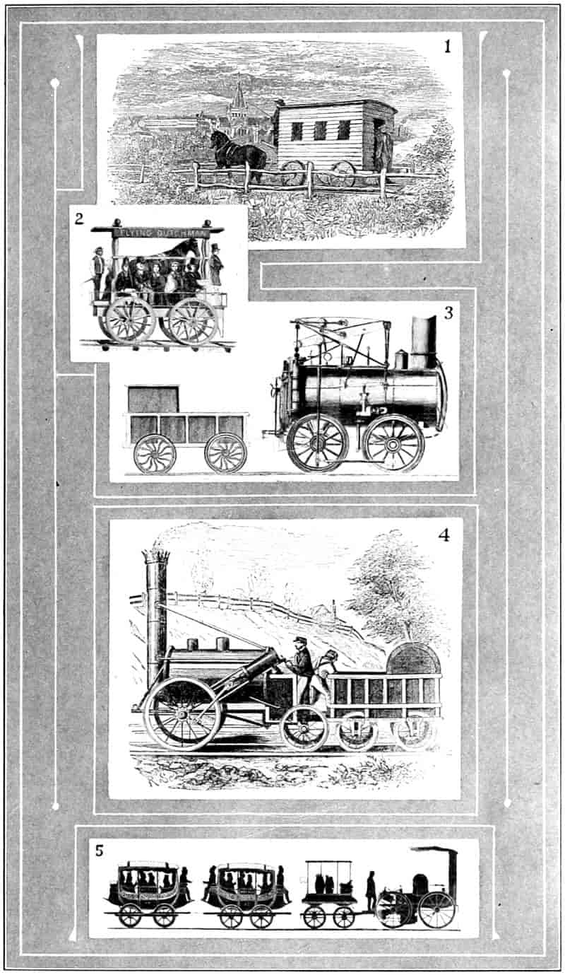
The Evolution of the Railway Train
- 1. The First Railway Coach—1825.
- 2. Horse Power Locomotive—1829-30.
- 3. Stourbridge Lion—1829.
- 4. Stevenson’s Rocket Locomotive—1829.
- 5. The DeWitt Clinton Locomotive—1831.
- (From Brown’s “First Locomotive”—Courtesy of D. Appleton & Company.)
One of the roads that seems to have been prolific in[103] “first things” was between Charleston and Hamburg, South Carolina. Chartered in 1827, again in 1828. In 1829-30 it experimented with sailing cars, as did also the Baltimore & Ohio and with treadmill horse powers. But the company fortunately employed Horatio Allen, who had studied the English roads and was strongly inclined to steam power. He so convincingly presented his ideas that it was decided to strengthen construction and use such locomotives. This then, very likely, was the first railroad in the world to adopt formally the steam locomotive as its means of propulsion (January 14, 1830). The company accordingly built its lines substantially and placed upon them the “first locomotive made in America for regular and practical use on a railway.”[93] This locomotive known as the Best Friend of Charleston was built in New York and shipped to Charleston by sea. After some adjustments it satisfied the demands of the contract, but distinguished itself by being the first locomotive to explode. It is said a negro fireman sat upon or held down the safety valve to prevent escaping steam from annoying him. The Charleston Courier’s account closes with the gratifying information that “none of the persons are dangerously injured except the negro, who had his thigh broken.” A new locomotive, the West Point, was secured, upon which several improvements suggested by experience had been made; among them the safety valve was placed out of reach of the fireman, making it fool-proof.
The beginning of the New York Central may be traced to a charter granted in 1826 to the Mohawk & Hudson Company, which with five or six other small lines was joined together into that company. Its first locomotive, the De Witt Clinton, had a rather interesting initiation. The engine was constructed by the West Point foundry, the same concern that had built the Best Friend and the West Point. A demonstration was announced for August 9, 1831, the road having 17 miles of rails at that time. The locomotive, a small affair compared with the modern[104] engines, is still in existence and with its train of that day was exhibited at the Pageant of Progress, Chicago, July 30, 1921, as the “pioneer American steam passenger train.” The whole engine was only about 12 feet long with large wheels, tall smoke stack and a central steam dome. Back of it were the tender and wood for fuel and two barrels of water, two passenger coaches modeled after stage coaches, and following these several small flat cars to which had been attached temporary benches for seats. The locomotive and cars were joined together with short sections of strong chain. When the engine started these jerked so badly the passengers could not retain their seats; stopping had a similar effect. On the trip it is said the passengers appropriated rails from a near fence and made braces to keep the cars the full length of the chains apart. The wood fuel produced many sparks which flying backward set fire to and ruined much of the passengers’ clothing. But according to a newspaper report[94] the train “passed over the road from plane to plane, to the delight of a large crowd assembled to witness the performance. The engine performed the entire route in less than one hour, including stoppages, and on a part of the road its speed was at the rate of 30 miles an hour.”
On May 10, 1893, Engine No. 999, of the New York Central Railroad, made, traveling alone, a record of 112.5 miles an hour.
The Camden & Amboy road was chartered in 1830 and was somewhat unique in that New Jersey in return for $200,000 worth of stock had granted a monopoly of the right of way between Philadelphia and Newark. Poore says:[95] “The state became a willing party to the scheme, under the idea that it could thereby draw the means for supporting its government from citizens of other States, thus relieving its own from the burdens of taxation.” He says, “the state now (1860) derives a revenue of over[105] $200,000 annually from transit duties and dividends on the stock presented to it.”
NewEngland started three railway projects about the same time: Boston & Lowell, chartered in 1830 first used in 1834, 26.7 miles long; Boston & Providence, chartered in 1831, first used in 1834, 43.5 miles long; and the Boston & Worcester, chartered in 1831, first used in 1834, 44.6 miles long.[96] These roads were chartered with the idea of using horse-drawn vehicles, except the Boston & Worcester, where steam locomotives were authorized, but it was not until about 1834 that they were used. Some of these roads, as did most of those built farther west, followed the English practice of laying track. One of them, at least, laid its track upon wooden cross-ties, thus securing the necessary resiliency for service. It was not many years, however, before several other roads were established with regular trips of locomotive drawn cars arranged both for passenger and freight traffic. The time of passenger service from Boston to New York had been materially shortened by connecting the schedules of stage coaches to Providence with those of steamboats down the Sound. When the steam railway came into existence the time of the trip was again shortened, and still again when an all rail route was opened in 1848, as shown by the following table:
| 1775 | General Washington was 12 days en route. |
| Early coaches required a week. | |
| 1800 | Stage coaches required 4 days. |
| 1832 | Stage coaches required 41 hours. |
| 1822 | Coach to Providence, steamboat to New York, 28 hours. |
| 1835 | Coach to Providence, steamboat to New York, 16 hours. |
| 1835 | Railway to Providence, steamboat to New York, 15 hours. |
| 1848 | All railway, 10 hours. |
| 1922 | All railway, 5 hours, 10 minutes. |
| 1922 | Air plane, 3 hours. |
While the railroads of the East were gradually working west, the trans-Alleghany states were themselves looking toward railroad transportation. The first railway in Ohio was begun in 1835 and had completed 30 miles by 1840. It[106] extended from Sandusky to Springfield. When it was chartered, 1832, under the name of the Mad River & Lake Erie Railway, the intention was to connect Lake Erie with the Ohio River. A locomotive was purchased and shipped to Sandusky by canal and lake. It arrived before any track was laid hence the gauge of the track was made to fit the locomotive, 4 feet 10 inches. Other roads in Ohio were laid at that gauge and in time the state adopted that as a standard.
Michigan in 1832, then a territory, incorporated the Detroit & St. Joseph Railroad Company. After several years without doing anything the road was completed to Ann Arbor in 1840. Later its western terminal became New Buffalo, from which point there was steamboat communication with Chicago. This was the germ which has grown into the Michigan Central.
A railroad was begun from Frankfort, Kentucky, to Lexington, a few miles from the pioneer settlement at Boonesborough. By 1840 this road had extended to the Ohio River near Louisville and was 92 miles in length. Indiana chartered not less than a half-dozen railways in 1832 and continued with a score or more in the next few years. The Lawrenceburg & Indianapolis line, chartered 1832, was opened with a Fourth of July celebration, 1834, and had laid less than 2 miles of track by 1836.[97] The Madison & Indianapolis road was opened in 1838. The report of the principal engineer, 1837, states that “the exclusive use of steam as a motive power” had been adopted, thus saving “the cost of a horse path” and avoiding “the delay and confusion arising from the simultaneous use of both steam and horse power,” as well as elevating the “character of the road by greater dispatch in the conveyance of passengers.” He thinks “in the use of the railroads constructed by the state it will probably be best for the state to furnish the motive power, leaving the cars for the conveyance of freight and passengers to be furnished by individuals or companies, from whom the[107] state will exact the proper toll for the use of the road, and for the motive power.” The idea seems everywhere to have prevailed that a railway was a public highway to be used by and for the benefit of the public. Only for a very short time in the history of the country did the theory have prominence that a railway is private property to the extent that its owners could do as they pleased with it and the “public be damned.”
At various points in the South were railways projected and built. Besides the Charleston & Hamburg, which has already been mentioned, and which by 1850 had extended across the state to Hamburg directly across the Savannah River from Augusta, Georgia, and northward to Columbia with some branches, should be noted a few others. From Richmond there was a line westward to the coal fields (1830-31) and a line which by 1840 connected the Potomac with Fredericksburg, a distance of 75 miles. It was constructed in the ordinary manner of wooden rails with strap-iron plates. In Virginia there were the Petersburg & Roanoke, about 60 miles long and other lines sufficient to total in 1840 more than 300 miles. North Carolina also took up the rail question rather early. The Wilmington & Raleigh, chartered in 1833, had laid upwards of 160 miles in 1840. Georgia was building lines in the ’thirties and ’forties from Augusta across the state to link with lines in Tennessee. The lines of these several Southeastern states were joined together later and became parts of large systems. Of the several projects authorized amounting to more than 1000 miles (1837) only one materialized, namely, the road from Springfield to Meredosia, and 58 miles had been completed by 1842. A locomotive was purchased and according to the Springfield Journal, March 18, “the cars ran from Jacksonville, 331⁄2 miles, in two hours and eight minutes including stoppages.” On account of the unsettled condition of the country and the accidents along the way,—no doubt the track was poorly constructed,—it did not pay. The locomotive for a considerable time lay out in the open where it had jumped the track. A man bought it,[108] equipped it with wide tired wheels and attempted to operate it on the wagon roads. This proved unsuccessful and it was finally abandoned on the prairie.[98] The road was sold in 1847. Several roads were reaching out for the Mississippi River and the fertile prairies beyond. The bustling young city of Chicago began its first railway toward the west in 1848. The other extremity was set for Galena on the Mississippi River. Not being financially able to buy T-rails they purchased some second-hand strap-irons. Likewise a second-hand locomotive was obtained, but when it arrived at the water front in Chicago the city authorities having refused the privilege of laying tracks on the street the company was at a loss to know how to get it to the end of their rails. After much discussion permission to lay a temporary track was given, and the Pioneer finally reached her destination. The railway proved successful from the first; later it became part of the Illinois Central System. The locomotive Pioneer is still retained in the Field Museum of Chicago.
There is not space to trace the development of the railways in all the individual states. In all natural growths, increases at first are slow, then accelerated until a maximum is reached, followed by a gradual retardation. So with the railway growth. The number of miles of railroad constructed up to 1830 was 41; 1835, 918; to 1840, 2797; in small widely scattered locations, but from that time on to the Civil War the work went on rapidly. By 1860 about 31,000 miles had been constructed and was going on at the rate of 5000 miles per year. Seven trunk line roads had passed through the Appalachian Mountain system; at eight places they and their connections touched the Ohio River, and the Mississippi at ten.[99] By 1850 there was railway connection between Boston and the east end of Lake Erie, and from the west end of Lake Erie to Lake Michigan with steamboat connection across the two lakes; before 1860 there was a network of rails between the Atlantic seaboard and the Mississippi River. Construction[109] lagged behind in the South. Up to 1856 the building was approximately as follows:
| Northeastern States | 4000 | miles |
| Northern Central States | 7500 | „ |
| South Atlantic States | 2750 | „ |
| Southern Interior | 2150 | „ |
And the very fact that few of these were north and south roads, that travel and intercourse were east and west, that the people of the North did not fraternize with the people of the South, that they grew apart and worshiped at the shrine of different ideals, furnished at least one cause for the cruel Civil War. There are still too few north and south trunk lines of travel and commerce, too little trade and friendly intercourse to heal the differences engendered by a century of separation. There lies one of the hopes of the interchange of summer and winter automobile visitors.
The building of railroads offered an opening for surplus capital; the opportunity for fortune and fame was attractive; but above all the people were crazed with the idea of improvement; every town wanted to grow bigger and a railroad was an absolute necessity; scores of companies were formed with the intention of beginning construction, then deeding the improvement to some established line to operate. Many communities subscribed stock, others voted bonds, others paid for right of way by private subscription in order to secure a railroad. Mob psychology had got in its work; the people were frenzied. The result was often overbuilding, parallel lines, too many roads attempting to occupy the same territory, with the result that branch lines often never paid interest on the cost of construction. On the other hand the gambling instinct was rampant, many roads were overcapitalized, stock was voted influential persons without money consideration, and stock sold to others for more than it was worth.
As there had been for turnpikes, as there had been for canals, once again there came a popular call for governmental[110] aid. Land was then plenty and the general belief was that the prosperity of the country demanded its settlement. If railways could be induced to go out into the open prairies and by their selling agencies bring about the occupation and tillage of these lands, other lands owned by the Government would soon be in demand. There would be no particular hardship on anyone, since Government land was sold to actual settlers for such a small sum, the railroads would be unable to dispose of their land at a much larger price. As a matter of fact the land was sold by the railroads for whatever it would bring; the prices increased as settlement became more dense. In Iowa railroad land sold from $5 to $50 per acre during the ’sixties and ’seventies. The remaining land held by the government was ordinarily increased in price from $1.25 to $2.50 per acre.
Congress, evidently influenced by the demand for railroads, and falling back upon the precedent of the National Highway, heretofore mentioned, granted in 1850 to the State of Illinois a strip of land about 12 miles wide lengthwise through the state to be transferred by it to the Illinois Central Railroad. The act gave six sections per mile on each side of the track, amounting, as certified to later, 2,595,053 acres. In consideration of this and in lieu of all other taxes, the company agreed to pay the state an amount equal to 7 per cent of the gross earnings from freight and passenger traffic. The company had received from the sale (principal and advanced interest) of 2,250,633 acres, up to January 1, 1873, $24,296,596;[100] an average of about $11 per acre.
Other companies were quick to take advantage of this precedent. Each had its representative in Congress. For over twenty years there was scarcely a Congress that did not make one or two such grants. More than a hundred such grants[101] were made between 1850 and 1872,[111] aggregating 155,000,000 acres.[102] Several roads did not comply with the conditions of the grants hence the donation lapsed. Up to June 30, 1880, grants amounted to 155,504,994.59 acres, according to Donaldson, of which there had been patented to the same date, 35,214,978.25 acres.
Pacific Roads.
—The most gigantic land grants made by the Government were for the benefit of the trans-continental or Pacific roads. The idea of a transcontinental railroad has been traced back practically to the beginning of railroad building in the United States.[103] During the ’fifties the debates in Congress waxed strong. Should the states’ sovereignty idea prevail and federal aid be first granted to the states and dealt out by them to the builders as had been done with the Illinois Central and numerous other cases, or should the National Government undertake the work itself or grant the aid to a company for that purpose? Where would the road be built: in the North, which would give an advantage to the abolitionists, or in the South, with corresponding advantage to slavery partisans? The two classes were absolutely antagonistic to each other’s desires. Then there was a middle class, who desired to prevent separation and war who refused to vote upon either side for fear it would create trouble with the other.
As a compromise a bill was passed in 1853 to have the country west of the Mississippi River surveyed to determine the most feasible region for building the transcontinental railroad. The report of the survey is contained in eleven volumes, and was made by the War Department, of which Jefferson Davis was the Secretary. This cabinet officer reported in favor of “the route of the 32d parallel” as the “most practical and economical from the Mississippi River[112] to the Pacific Ocean.”[104] A line this far south, of course, was not acceptable to the North. The election and Civil War coming on changed the status of affairs and on July 4, 1862, President Lincoln signed the bill by which the first transcontinental road should be constructed by two companies: the Central Pacific working from the west, and the Union Pacific working from the Missouri River at Omaha westward. A grant of land of approximately 35,000,000 acres was made, namely, the odd sections lying contiguous to the line on either side. This was not quite a return to the position of the Government when it built out of the funds from the sale of public lands the National Road westward from Maryland, through Pennsylvania, Ohio, Indiana, into Illinois. Then the construction was done under the direction of the federal Government and the road remained the property of the Government. Now federal aid was given to private companies to be operated for their own benefit. What might have been the result in this country had the Government taken a firm stand for national ownership is problematical, but the fact that it has made a success of the construction and operation of the Panama Canal leads many to believe that the railroad question would have been handled as easily if that system had grown up from the beginning. Opponents of government ownership point to the roads of continental Europe as being less efficient than those of England and the United States under private ownership. And more recently the fiasco of Government operation under war emergency is considered a strong argument against public ownership.
In addition to the land granted to the Union Pacific for the “purpose of aiding in the construction of said railroad and telegraph line, and to secure the safe and speedy transportation of the mails, troops, munitions of war, and public stores thereon, every alternate section of land, designated by odd numbers, to the amount of five alternate sections per mile on each side of said road,”[105] the company[113] was given for “right of way” 200 feet each side of the track,[106] “including all necessary grounds” for stations, side-tracks and various other purposes enumerated, also to take from the public land “adjacent to the line of said road” (afterwards limited to 10 miles on each side) “earth, stone, timber, and other materials, for the construction thereof.” Further help was also granted by the provisions of the act (Section 5): “That ... the Secretary of the Treasury shall, upon the certificate in writing ... of the completion and equipment of forty consecutive miles ... issue ... bonds of the United States of one thousand dollars each, payable in thirty years after date, bearing six per centum per annum interest ... to the amount of sixteen of said bonds per mile.” The act provides that this loan shall constitute a first mortgage lien on the property, but the act of 1864 allowed the company to issue bonds to the same amount and subrogate the Government bonds to those issued by the company making the Government claim a second mortgage instead of a first. The Government gave similar grants and privileges to the Central Pacific, although it was a purely state corporation and, at first, was only to build to the east line of California. Apparently the last vestige of the traditions of Madison and Monroe, of Jackson and Buchanan had disappeared.
There was danger that other lines would be built. A line was preparing to go west from Leavenworth, lines were converging on St. Joseph and Sioux City, any of which might become rivals of the Union Pacific, so the act provides that they shall unite with the Pacific not farther west than the one hundredth meridian of longitude, and if they do so grants of lands and subsidy bonds will be given to them.
However, the demand for transcontinental lines was so great that three other lines were authorized. In 1864 the Northern Pacific Railroad to connect Lake Superior with[114] Puget Sound, with a land grant of 58,000,000 acres; in the Atlantic & Pacific to follow the old 32d parallel route, now a part of the Southern Pacific, with a grant of 42,000,000 acres; and last, the Atchison, Topeka & Santa Fé received also a large grant. The total Congressional grants certified or patented to railroads and military wagon roads from 1850 to 1880 were as follows:
| To States | 35,214,978.25 | acres |
| To Corporation and Pacific Roads | 10,435,048.08 | |
| Military Wagon Roads | 1,301,040.47 | |
| 46,951,066.80 | ||
| Deduct lands forfeited | 607,741.76 | |
| Grand Total for Railroads and Military Wagon Roads | 46,343,325.04 | |
| Acres necessary to fill grants providing all roads are constructed | 155,504,994.59 | [107] |
Construction of Pacific Roads.
—It would be interesting to take up in detail the work of constructing these roads, but space will not permit. Nothing can be said of the intense interest throughout the United States; of the romance and adventure of penetrating 1700 miles of wilderness and desert with hostile Indians ready at any time to attack; with worse than hostile Indians in the rough-necks, gamblers, and prostitutes who followed the camps; of the magnitude of the work employing 2000 graders to go first, 1500 wood choppers and tie-getters spreading their labors over thousands of miles of Government forests; of the engineers and their feats of searching out easiest passages; of the track layers; of the boarding houses; of general camp life; of the exciting race with the Central Pacific ending in the union of the two lines and the driving of the golden spike at Promontory Point on the north shore of Great Salt Lake, 1086 miles westward from Omaha and 689 miles eastward from Sacramento, on the 10th day of May, 1869; and of the crowds in Omaha, Chicago, Cincinnati, New Orleans, Washington, New York, San Francisco, and every other place of importance in the whole nation, who patiently[115] waited the sounds of the bells rung in unison with the sounds of the strokes upon the spike, transmitted instantaneously through the intervening space by the electric telegraph.
There is no doubt but that the benefits that have come from the railways through the increased facilities for transportation and the corresponding gain to civilization has amply repaid the Government for all its bounties, notwithstanding some of them were unnecessary, in fact, a willful waste and led to an orgy of financial and political corruption a little later.
The Crédit Mobilier.
—Perhaps the most widely noticed scandal connected with the railroads was the scheme known as the Crédit Mobilier. This was made much of by the Grange and other anti-monopoly movements which reached their height in the ’seventies. Charges having been made that many congressmen had been bribed by an organization known as the Crédit Mobilier, a Congressional investigation was made,[108] Thomas Durant, vice president, and other leading stockholders of the Union Pacific Railroad, secured a controlling interest in the stock of the Pennsylvania Fiscal Agency in 1864 and had its name changed to the Crédit Mobilier of America. One of the ostensible functions of the company was to loan money for railroad construction. The same men were instrumental in awarding the contract for the building of the Union Pacific Railroad to one of their number, Oakes Ames, a member of the United States House of Representatives, for stipulated amounts per mile for the different sections ranging from $42,000 to $96,000, amounting in the aggregate to $47,000,000. The contract was right away transferred to seven trustees composed of the same controlling stockholders, who were to execute it receiving therefor $3000 per year each, and the profits were to be divided among those stockholders of the Crédit Mobilier of America who would comply with certain conditions. The Crédit Mobilier agreed to furnish the necessary money at 7 per cent per annum and 21⁄2 per cent commission, not to exceed the[116] amount provided in the contract to be paid by the Union Pacific company. These same leading stockholders of the Union Pacific being also controlling stockholders of the Crédit Mobilier were thus, because the contract prices were said to be twice the actual constructing prices, making a big profit, practically all of which was coming from the United States treasury. Complaints were being made and adverse legislation was feared. Stock in Crédit Mobilier was offered to members of congress at a very low figure on which it is said they made dividends of 340 per cent. It amounted to this: The men entrusted with the management of the road let the contract for its construction to themselves at a figure double its real cost, and pocketed the profits, estimated at about $30,000,000. These same men started the scheme, which afterward became common, of watering the stock, that is increasing the outstanding stock, and distributing it as dividends, upon the plea that the property had increased without any new outlay of money. It also appears to be a method of earning dividends upon money never invested.
Railroad Consolidation.
—It has been shown that at the beginning railroad building consisted of short stretches from town to town, or from the end of one water communication to the beginning of another. It was but reasonable that these would join for the purpose of through traffic. The result was also better efficiency as the equipment could be used to better advantage; the terminal costs were reduced as there were not so many of them; and, what may have been a leading cause, the control, and perhaps prevention, of competition. Unrestricted competition caused rate wars; rates once down it was difficult to get them back and frequently bankruptcy occurred. Government regulations were made prohibiting rate agreements and pooling. Such apparently hastened consolidation. One objection to consolidation was the concentration of vast financial powers in the hands of a few, and since money had much influence in Washington and in the state capitals, political power as well. This and combinations of other industrial concerns were causes which brought about the[117] enactment of the Sherman Anti-Trust law of July 2, 1890.[109] This law did not come in time to stop consolidation and it may be doubtful if it would for the Supreme Court has decided that combinations are not unlawful unless they exercise an unreasonable restraint upon trade.[110]
The methods of consolidation are: merger or outright purchase, in which case the individual lines lose their separate identity; stock purchase, wherein a controlling share of the stock of another road is held by the purchasing line or by a holding company; lease usually for long periods, a rental being paid periodically for the use of the line; and, community of interest, that is the establishment of friendly relations. The consolidations are more often financial than physical. When two roads physically combine under one management it is customary to reorganize and assume the same name. In the consolidations given in the table below many of the roads are operated separately and almost independently but are dominated by common financial interests with common policies or very friendly relations. Some of the principal consolidations prior to 1912 are:[111]
| Vanderbilt Interests | |
| Mileage | |
| Boston & Albany | 392 |
| New York Central | 3,591 |
| Lake Shore & Michigan Southern | 1,663 |
| Michigan Central | 1,805 |
| New York, Chicago & St. L. | 561 |
| Lake Erie & Western | 886 |
| Big Four | 1,979 |
| Pittsburgh & Lake Erie | 215 |
| Chicago, Indiana & Southern | 329 |
| Other affiliated eastern lines | 1,759 |
| Western Maryland[112] | 575 |
| Chicago & North Western Systems | 9,827 |
| Total | 23,582 |
| Morgan Interests | |
| Erie Railroad | 2,565 |
| Pere Marquette | 2,334 |
| Southern Railroad System | 8,667 |
| Cincinnati, New Orleans & Texas Pacific | 335 |
| Mobile & Ohio | 1,114 |
| Atlantic Coast Line | 6,818 |
| Louisville & Nashville | 4,590 |
| Chicago & Great Western | 1,495 |
| Total | 27,918 |
| Harriman Interests | |
| Oregon Short Line | 1,646 |
| Oregon Railway & Navigation Company | 1,737 |
| Union Pacific System (remainder) | 3,791 |
| Southern Pacific[118] | 10,257 |
| Illinois Central System | 6,340 |
| Central of Georgia | 1,915 |
| Baltimore & Ohio | 4,555 |
| Delaware & Hudson | 875 |
| San Pedro, Los Angeles & Salt Lake | 1,105 |
| Cincinnati, Hamilton & Dayton | 1,015 |
| Total | 33,236 |
| Atchison, Topeka and Santa Fé | 10,472 |
| Chicago, Milwaukee and St. Paul System | 9,657 |
| Seaboard Air Line | 3,084 |
| Pennsylvania Railroad Interests | |
| Pennsylvania Lines | 11,197 |
| Norfolk & Western | 1,990 |
| Total | 13,187 |
| Gould Interests | |
| Wabash System | 2,663 |
| Wheeling & Lake Erie | 457 |
| Missouri Pacific System[113] | 3,920 |
| St. Louis, Iron Mountain & Southern[113] | 313 |
| St. Louis, Southwestern[113] | 1,675 |
| Texas & Pacific[113] | 1,991 |
| International & Great Northern[113] | 1,159 |
| Denver & Rio Grande[114] | 2,778 |
| Western Pacific[113] | 979 |
| Total | 15,935 |
| Moore Interests | |
| Rock Island System | 8,144 |
| Delaware, Lackawanna & Western[114] | 1,052 |
| Lehigh Valley[115] | 1,431 |
| Total | 10,627 |
| Hill Interests | |
| Great Northern | 7,397 |
| Northern Pacific | 6,281 |
| Chicago, Burlington & Quincy | 10,443 |
| Colorado & Southern | 1,249 |
| Total | 25,370 |
| New Haven Interests | |
| New York, New Haven & Hartford | 2,887 |
| Boston & Maine | 3,594 |
| Total | 6,481 |
| Hawley Interests | |
| Minneapolis & St. Louis | 1,027 |
| Iowa Central | 559 |
| Toledo, St. Louis & Western | 451 |
| ’Frisco System | 7,147 |
| Chicago & Alton | 1,025 |
| Chesapeake & Ohio System | 2,232 |
| Missouri, Kansas & Texas | 3,393 |
| Hocking Valley | 350 |
| Total | 16,508 |
| Philadelphia and Reading | 2,137 |
| Grand Total of above Groups and Systems | 198,638 |
| Total milage of railways in the United States, Dec. 31, 1916 | 397,014 |
For a more extended discussion see “National Consolidation of Railroads,” by George H. Lewis.
[119]
Mechanical Development.
—There is not space to follow in detail the mechanical development of railroads. The rail, for instance, was at first a mere plank placed in the cart track to prevent rutting; this evolved into a rail of timber about 4 x 6 inches held in proper position by cross-ties not to be considered as sleepers or supports especially. On top of the rail was later placed a strap iron. Since this strap iron under the wheel loads curled up, thicker plates began to be used. Then cast-iron rails some 4 or 5 feet long from tie to tie, cast deeper at the middle for greater strength. Then the rolling mills were becoming sufficiently improved to roll out wrought-iron rails, at first rectangular plates, then T-rails held up by chairs and finally through a dozen or more forms to Bessemer, then open-hearth steel rail shapes as at present used. The fastenings and fish plates have gone through a stage of evolution. The track soon assumed a standard form and has retained it with little variation notwithstanding attempts to use steel and concrete ties.
The freight cars, at first boxes with wheels on them, have gradually developed into monsters of steel with draw bars, automatic brakes and couplings. Passenger cars at first very variable were developed from stage coaches and Conestoga wagons hitched together. In Europe they remained short, like stage coaches with side doors. In the United States they lengthened out with seats through the interior and doors and platforms at the ends. Platforms were eventually housed in with vestibules. Both types have their advantages and disadvantages. Sleeping cars seem to be a development of the canal and steamboat sleeping quarters. Here a single company early obtaining a working, if not a legal, monopoly of the business of making and operating sleepers. As a result no improvements of note have appeared in them for years. For financial efficiency the monopoly seems to be a good thing; for mechanical progress it is not.
Locomotives have shown a continual progress. One reason perhaps is their short lives; new ones must always be coming along and there is ample opportunity for experimentation.[120] From the Tom Thumb to the powerful Mountain Type is a long climb, but as each step was taken the individual changes were not very noticeable. Like the hour-hand of a watch only by observing its position at times quite separated can it be noticed to have traveled.
In fact the entire railway system with its millions of cars operating on hundreds of roads has grown complex and yet standardized. To get a common gauge that cars from one road might pass to another required an act of Congress. At first companies adopted diverse gauges that their cars could not go onto another road, but when transcontinental roads were to be built and through lines of traffic established President Lincoln was called upon to set a gauge. He “side-tracked” the matter and threw it onto Congress, who established the distance 4 feet 81⁄2 inches as the standard width between rails.
Without the telegraph the present amplification of railroad business could not have taken place. The early trains traveled by time schedule. No extra train could be added, although looking-posts were established at the stations up which the train men could climb to watch for the smoke of an approaching train. Now every division point must have its coterie of dependable dispatchers. Each wire carries multiple messages. Electric signals and other safety devices to lessen accidents are universal, while the bewildering network of tracks in the ordinary city yard are operated easily from distant towers by interlocking switches. That railroads have brought about an industrial and social revolution, that they have increased enormously the country’s transportation, that they have thus been very instrumental in bringing the present civilization to its high and uniform state of attainment, cannot be denied.
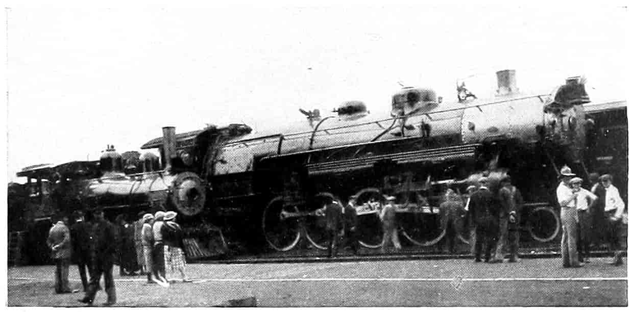
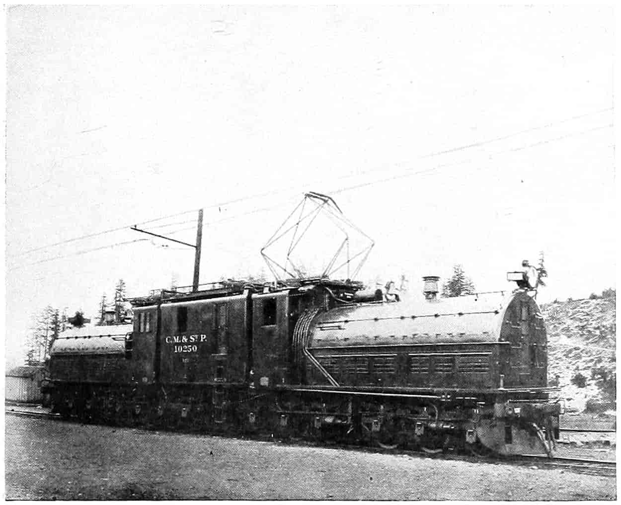
© Underwood and Underwood
MODERN LOCOMOTIVES
- 1. Showing the Growth in the Size of Locomotives During the Past Twenty Years. The Smaller Locomotive is an American Type Class Engine of 1900. The Larger is a Mountain Type Engine. Both are Used on the C. B. & Q. R. R. Photographed at Lincoln, Nebr., Sept., 1922.
- 2. One of the New Gearless Electric Locomotives Built by the General Electric Company for the C. M. & St. Paul R. R.
The Evolution of the Sleeping Car.
—Mr. Husband has made a very interesting book of the story of the Pullman car and its evolution[116] in which he traces with much detail, step by step, the improvements from 1836, when the first[121] sleeping car was offered to the traveling public, to the most modern parlor car now in use. The discomfort and inconvenience of travelers by rail was so much greater than that by canal that only the greater speed of the former caused it to forge ahead of the latter. As the mileage of the roads increased so also did the comforts of travel. It has already been noted that sparks set fire to the clothing of passengers. Soon box-like cars replaced the open carriages and bogie trucks replaced the rigid wheels, the former giving much more protection and the latter comfort while rounding curves. But yet passengers were herded like cattle on stiff-backed narrow benches in cars with scant head clearance and width. Clean stone ballast for the road bed had not yet been thought of and the dust blew in clouds through the open windows in the summer time, and a stove vitiated the air in the winter. There were no screens or vestibules. It is a far cry from the dim flaring candle to the brilliant white incandescent electric lights. Passenger cars were rapidly improved until by 1844 they had taken on something of the appearance of the present coach.
George M. Pullman, a Chicago contractor, having experienced the inconveniences of railway travel and also being acquainted from close association with the Erie Canal and the sleeping arrangements of the canal boats, had visions of similar or better rail comforts. In 1858 he engaged Leonard Seibert, an employee of the Chicago & Alton Railroad, to remodel two coaches into the first Pullman sleeping cars. Mr. Pullman’s invention of upper berth construction whereby it could be closed during the day and serve as a receptacle for bedding was introduced into these cars, before which time sleeping car bunks had been stationary and on one side only. The success of his venture was such that he established a shop for the manufacture of the cars and employed technical skill to plan and make them. He had such organizing ability, however, that before his death he saw the Pullman Company holding a practical monopoly of all the sleeping cars in the[122] country, with through cars scheduled so that change of Pullman was unnecessary from coast to coast, or if a change had to be made it was merely a transfer from one car to a connecting car on another route. A single ticket will carry a passenger from Portland, Maine, to San Francisco, by way of Washington, D.C., New Orleans and Los Angeles with only two changes of cars, namely, at New York and Washington, a total distance of 4,199 miles.
It may be interesting to note that some 26,000,000 persons are annually accommodated by the 7500 cars operated by this company.
Street Car Service.
—Now that more than one half the population of the United States live in cities makes the matter of local transportation of at least passing interest. Railroads were at first tram cars and many of them were built through the city streets, it was easy, therefore, to make of them street cars caring for such local traffic as desired to take advantage of them. They became a popular means of local transportation in the decade 1850-60. As the demand became greater the one-horse car gave way to the two-horse with its longer body and greater capacity. These not being sufficient steam locomotives were used in some cities, in others the tracks were elevated above the surface, the first in New York in 1876, or depressed below with steam locomotives operating trains of cars rapidly loaded and unloaded at stopping points about four blocks apart. In 1879 or 1880 in San Francisco where the hills were too steep for horses the cable car was designed, whereby an endless cable operated from a central station ran continuously in a trench or conduit under the track. A grip attached to the car could be made to take hold of this cable and the car was thus drawn along. Notwithstanding they were expensive to install cable cars were rapidly replacing horse-drawn cars when electric traction came in and displaced them.
Electric Traction.
—There are reports of attempts to obtain magnetic traction by the use of batteries, but not until the electric dynamo and motor had become practical working[123] machines was anything like a successful working electrically propelled car developed. The ordinary method is to generate the electricity at a central station, carry it along the track by means of a wire, from which it is taken by a trolley or some form of conductor to a motor on the car completing the circuit through the track and ground. Such a car was practically demonstrated at the Berlin Exposition of 1879, by Werner Siemens, with a line 219 yards long.[117] This was the first practical electric railway. But long before this time in America experiments had been made with electric traction. Dever exhibited a model at Springfield, Massachusetts, in 1835.[118] In 1879, the year of Siemens’ exhibition, another model railway having a “third rail” to carry the current was exhibited at Stockbridge, Massachusetts. Edison had a car in operation at Menlo Park, New Jersey, in 1882, and the following year a small road carried passengers at an exhibit in Chicago. Miniature roads were exhibited at Philadelphia, Denver, Cleveland, New Orleans, and possibly elsewhere. The first electric railway built and operated for profit in American streets was at Richmond, Virginia, in 1885 on 21⁄2 miles of track. During the same year 2 miles between Baltimore and Hampton were put in operation.[119] By 1890 the number of cities having trolley cars had increased to forty-nine.[120] From that time on the change from horse-drawn cars was very rapid. Trolley lines were even extended throughout the country districts. At one time it looked as though they might replace steam cars for passenger traffic, especially short-haul traffic. There was a complete network of interurban trolley lines in the Eastern and Central Western states by 1910.[121] The trolley is also being used upon hard-surfaced roads without tracks by buses and trucks. Steam railroads running into New York City[124] through the tubes use electric locomotives to draw the trains, thus avoiding the smoke nuisance and the danger therewith connected. The Milwaukee Railroad is using electric locomotives on its mountain division in Montana and Idaho. Electricity is generated by water power; also the trains going down grade are run against a dynamo and storage battery thus acting as a brake as well as renewing the batteries.
SELECTED REFERENCES
Brown, William H., “History of the First Locomotive in America.” D. Appleton & Co., New York, 1871.
Burch, Edward P., “Electric Traction for Railway Trains,” Chap. I (Historical). McGraw-Hill Book Co., New York, 1911.
Callender, Guy S., “The Economic History of the United States,” Chapter VIII, “Transportation,” Ginn & Co., New York.
Census, U. S. Eleventh (1890) “Transportation on Land.”
Census Bureau, U. S. Special Report (1902) “Streets and Electric Railways.”
Davis, John P., “Union Pacific Railway.” S. C. Griggs & Co., Chicago.
Donaldson, Thomas, “History of the Public Domain,” Published by order of an act of Congress, 1884.
Dunbar, Seymour, “A History of Travel in America,” 4 volumes. Bobbs-Merrill Company, Indianapolis.
Ericsson, John, “Life of” by William C. Church, Chap. IV. Charles Scribner’s Sons, New York.
Husband, Joseph, “The Story of the Pullman Car.” A. C. McClurg & Company, Chicago, 1917.
Johnson, Emory R., “Elements of Transportation,” 1909. D. Appleton & Company, New York.
Larrabee, Wm., “The Railroad Question,” Shulte Publishing Company, Chicago, 1893.
Le Rossignol, J. E., “Monopolies Past and Present.” T. Y. Crowell Company, New York.
Lewis, George H., “National Consolidation of Railroads.” Dodd, Mead & Co., New York.
Maps of Interurban Lines, Century Atlas. Century Company, New York.
Martin, E. W., “History of the Grange Movement, or The Farmer’s War against Monopoly.” A subscription book published in 1874. National Publishing Company, Chicago.
[125]
Poore, Henry V., “History of Railroads and Canals of the United States,” Vol. I, p. 377. New York, 1860.
Sanborn, John B., “Congressional Grants of Land in Aid of Railways.” University of Wisconsin Bulletin, Vol. II, No. 3, Econ. pol. Sci. and Hist. Series.
Selfridge, H. Gordon, “The Romance of Commerce.” John Lane, London.
Sparks, E. E., “National Development,” Vol. XXIII, The American Nation Series, Chapter III and IV. Harper & Brothers, New York.
U. S. Statutes, 1862-1864, Pacific Railway Acts, Investigation of the Crédit Mobilier.
U. S. Statutes, 41st Congress, 1st Session, Chap. DCXLVII, Sherman Anti-Trust Law.
U. S. Statutes, Railroad Bills, 1850-1880 House Report 42d Cong., 3d Session, No. 77.
FOOTNOTES
[87] Quoted from “Niles’ Register” of 1812 by Dunbar.
[88] Stevens’ pamphlet published in 1812.
[89] Stephenson’s first locomotive was put out in 1814. His Rocket and Ericsson’s Novelty had their famous contest resulting in favor of the Rocket in 1829.
[90] Brown’s “History of the First Locomotive,” letter from Cooper, 1869.
[91] The coning of wheels is an invention of Jonathan Knight, Engineer of the Baltimore & Ohio Railroad Company.
[92] Dunbar, “A History of Travel in America,” 932.
[93] Dunbar, “A History of Travel in America,” 960.
[94] The Albany Argus, August 11, 1831.
[95] “History of the Railroads and Canals of the United States,” 1860, Vol. I, p. 377.
[96] Dunbar, “A History of Travel in America,” 998, 1383.
[97] Dunbar, “A History of Travel in America,” 1071.
[98] Potter’s American Monthly, July, 1879.
[99] T. C. Smith, American Nation, Vol. XVIII, p. 60.
[100] E. W. Martin, “History of the Grange Movement,” 1874, p. 35.
[101] Donaldson, “History of the Public Domain.” University of Wisconsin Bulletin: “Congressional Grants of Land in Aid of Railways,” by J. B. Sanborn, Pol. Sci. and History Series, Vol. II, No. 3.
[102] The “History of the Grange Movement,” a subscription book by Edward Winslow Martin, published in 1874, but which can hardly be taken as wholly reliable, says: “The lands granted by the Government to various railway corporations make up a total area of 198,165,794 acres, or about 300,000 square miles—an area larger than the State of Texas, which contains 237,504 square miles ... and the railway subsidies comprise nearly one-tenth of the entire Union.”
[103] Dunbar, “A History of Travel in America,” Chap. LVI, et seq. Donaldson, “History of the Public Domain.”
[104] Senate Executive Document No. 78, 33d Congress, 2d Session.
[105] U. S. Statutes. Acts of 1862 and 1864.
[106] By subsequent provision the right of way was cut to two hundred feet, although the company still holds four hundred feet through parts of Nebraska.
[107] Thomas Donaldson’s “History of the Public Domain.”
[108] “House Reports,” 42 Cong., 3d Session, No. 77.
[109] U. S. Statutes, 51 Cong., 1 Sess., Chap. DCXLVII.
[110] Digest U. S. Supreme Court Reports, Vol. IV, “Monopoly,” pp. 4043-4052, The Lawyers Co-operative Publishing Company, Rochester, N. Y., 1908.
[111] Funk and Wagnalls’ Encyclopedia.
[112] Jointly with Gould Interests.
[113] Jointly with Rockefeller, Kuhn, Loeb, & Co., Vanderbilt and other interests.
[114] Jointly with Standard Oil interests.
[115] Jointly with Erie, Reading and Vanderbilt interests.
[116] “The Story of the Pullman Car,” by Joseph Husband. A. C. McClurg & Company, Chicago, 1917. Cf. Literary Digest, February 10, 1923, p. 25.
[117] Funk and Wagnalls’ Encyclop.
[118] “Special Reports, Streets and Electric Railways,” U. S. Census Bureau (1902). This, of course, was not a practical machine.
[119] “American Nation,” Vol. XXIII, 39.
[120] U. S. Eleventh Census (1890), “Transportation on Land.”
[121] See Maps in Century Dictionary.
[126]
CHAPTER V
THE MODERN WAGON ROAD
Gone are the long picturesque lines of emigrant and freight wagons, with their conestogas, their stage coaches, their oxen, their mules and horses; gone are the hospitable inns with their gay and social crowds of happy travelers; gone are the nightly wagon-formed corrals into which the freighter was wont to drive his animals to prevent their stampeding by the wily red-skin; gone are the complacent but slow-going canal barges so plentiful and popular that at the cry of “low bridge,” everybody ducked by reflex action; gone are the floating palaces on the vacillating and changeable waters of the interior river systems; these yesteryear implements of transportation have been all but superseded by more powerful or more speedy instruments. The canals are very frequently but weed-grown scum-covered channels through the soil, while many of the wagon roads are similarly weed-grown or dust-covered lanes on top of the soil. Perhaps a rejuvenation will come. Already the public road shows signs of a more vigorous growth than the world has ever witnessed even in the heyday of road building under the Roman Caesars.
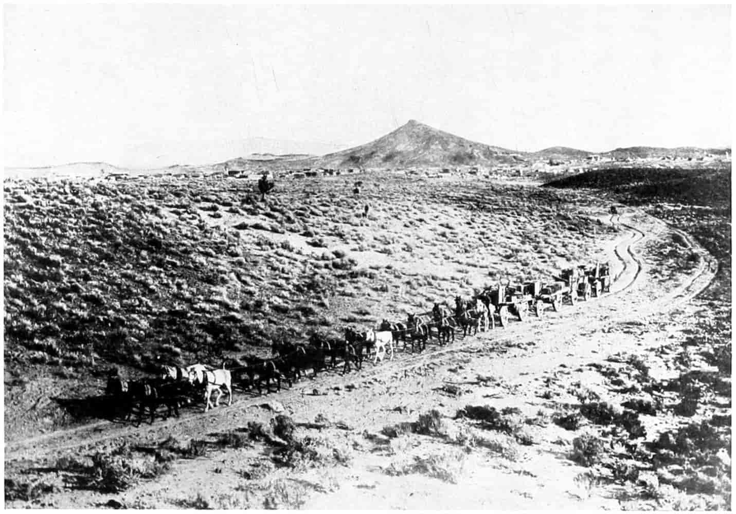
© Underwood and Underwood
TRANSPORTATION ACROSS DEATH VALLEY
A Picturesque Method of Earlier Days.
Public highways began their desuetude (partial at least) about 1830, at the advent of the steam railway. To be sure, arrangements were made for the laying out and care of roads. There were, also, usually poll and property taxes levied for road and bridge purposes. But generally the old English custom of allowing such taxes to be worked out prevailed. In Iowa, for instance,[122] the county court was given “general supervision over the highways” which[127] must be 66 feet wide unless otherwise specially directed. The manner of establishing roads is set forth and the county judge may if he wishes call in a competent surveyor and “cause the line of the road to be accurately surveyed and plainly marked out.” “Where crops have been sowed or planted before the road is finally established the opening thereof shall be delayed until the crop is harvested.” The county supervisor must appoint a deputy in each township, but the deputy “must regard himself as an actual laboring hand” and his compensation “shall not exceed one dollar and fifty cents for each day actually employed.” It is the duty of the supervisor “to place and preserve the roads in as good a condition as the funds at his disposal will permit, and to place guide boards at such points as he may think expedient or as the court may direct.” In the Eastern states and in the hilly districts the method of locating each individual road to follow a trail or stream or ridge usually prevailed, but in many of the prairie states roads were located by law on each section line and in some states on each half-section line as well. This made every man’s farm adjacent to a road, although it was certainly a waste of land. In nearly all the prairie states the legal right of way is now 66 feet,[123] in other states it is made 491⁄2 and 33 feet. Massachusetts state-aid roads have a minimum of 50 feet. Texas divided her roads into three classes with widths of 60, 30 and 20 feet. New Jersey has some state roads 33 feet wide. On the whole 66 feet seems to be favored. This, if roads are made on every half-section mile, appropriates almost 5 per cent of the land, a quantity that by proper selection and location might be materially reduced. The section line method is liked by farmers because it leaves the fields rectangular, a convenient form for efficiency in cultivation.
The Influence of the Bicycle on Roads.
—Road construction remained in a lackadaisical state with here and there a spurt, with now and then an intelligent supervisor who appreciated the need of better wagon roads, until the coming[128] of the bicycle. That machine may be considered a descendant of the old celeripede, which consisted of two wheels connected by a horizontal bar on which the rider sat and propelled himself by pushing with his feet alternately on the ground, through the velocipede, which had the front wheel pivoted to the framework for easy steering. The attachment of pedals is credited to a Scotchman, Kirkpatrick Macmillan, about 1840, who applied them to the rear wheel. In 1886 Lallement in the United States and Michaux in France, placed the pedals on the front wheels. The front wheel was gradually increased in diameter until in the ’eighties it sometimes measured as much as 60 inches. The rear wheel decreased as the front increased. The stability of the wheel was not very great; headers were common, and mounting was difficult. To overcome these defects of the “ordinary” there was developed, 1885, the “safety,” approximately the present bicycle, in which the pedals are carried on a separate shaft and the power transmitted by chain and sprocket to the rear wheel. With the invention of the Dunlop[124] pneumatic tire, and consequent overcoming of much of the jolting so objectionable in more solid tires, the adoption of the bicycle as a means of pleasure and business locomotion was extremely rapid. The cycling boom reached its height about 1896 or 1897, by which time a great many large manufactories of bicycles had been established over the country. A frenzy seized upon the people and men and women of all stations were riding wheels; ardent cyclists were found in every city, village, and hamlet.
As a result of the cycling craze there were organized numerous “wheel clubs” and finally a national one known as the League of American Wheelmen, organized about 1887. Its object partly social and partly to popularize the new sport of cycling, became a few years later almost wholly a form of propaganda for “better roads.” Newspaper space was freely utilized; many papers making[129] special and regular features of “good roads”; pamphlets were published and distributed broadly, and a magazine was established.[125]
At first the wheelmen were met by the cry of selfishness, with the argument that the city folk wanted the farmers to build good roads for their pleasure; but men of foresight, men of affairs, saw the benefits accruing to all kinds of business and added their influence. Mr. Potter, a lawyer of New York City, who had graduated in civil engineering at Cornell University before turning to the law, became interested in the good roads movement, studied and made himself one of the best posted men on roads in the United States. When the League of American Wheelmen decided to start a magazine he was selected for its editor and manager. Under his direction the subscription list of Good Roads soon reached more than 30,000.[126] “The articles strive to show the value of roads in a commercial sense and by a comparison with other countries demonstrate how far behind America is in this respect.” Pictures of good and bad roads were used freely, thus holding the attention where reading matter alone would have failed. European roads, the French especially, were described and played up through newspapers generally. Scarcely a journal that did not run leaders and other articles on the benefits of good roads and methods of building and maintaining the same. Our ordinary roads were decried on every hand. A lady voices her opinion thus:[127]
I came to this country with the best prejudices, having enjoyed the privilege of meeting with some of its noblest representatives in my fatherland. I admired much the individual independence, the high standing of women, the gentle sway of the church, the liberal education of the children, and the unsurpassed charity that extends even to distant countries. I must confess[130] that I was struck with the bad roads everywhere, in cities as well as in the country, and at the same time, amused at the compensation one gets when one meets with an accident. Why not spend the money in the improvements of the roads—make these roads perfect, and then let everybody look out for himself.
In summer the worst road is good; but in winter schools have to be closed, the children are stopped in their regular pursuits, learning becomes desultory, and the strong feeling of duty that has to be developed from the very beginning of life by strict good habits gets slackened and slighted; and so also the attendance of the churches—for many people the only comfort in the struggle for existence—becomes an impossibility. And especially the painstaking farmer must find it hard to drive his team through the muddy, clayey road, in bringing the fruits of his labor to the market. I hear him, with many a suppressed oath on everything under the sun, dragging his cartload through the mud and standing pools, and in snowstorms he is sometimes totally lost. All communication stops.
And so on for a column or more. She inserts by way of anecdote which shows that two of the greatest Germans who ever lived did not think the lowly road too insignificant to discuss:
When Heinrich Heine for the first time met with the royal poet, Goethe, he was so impressed with the majesty of his personality that he could speak of nothing less than the plum trees on the chaussée, between Jena and Weimar.
Also Bill Nye, the humorist, takes a rap at the roads in this manner.[128]
Our wagon roads throughout the country are generally a disgrace to civilization and before we undertake to supply Jaeger underwear and sealskin covered bibles with flexible backs to the African it might be well to put a few dollars into the relief of galled and broken down horses that have lost their breath on our miserable highways.
The country system, as I recall it, was in my boyhood about as poor and inefficient as it could well be. Each township was divided up into road districts, and each road district was presided over by an overseer of highways, whose duty it is to collect so many days’ work or so many dollars from each taxpayer in the district. Of course no taxpayer would pay a dollar[131] when he could come and make mud pies on the road all day and visit and gossip with the neighbors and save his dollar too.
The result seemed to be that the work was misdirected and generally an injury to the road. With all our respect to the farmer, I will state right here that he does not know how to make roads. An all wise Providence never intended that he should know. The professional roadbuilder, with the money used by the ignorant sapheads and self-made road architects, would in a few years make roads in the United States over which two or three times the present sized load could be easily drawn, and the dumb beasts of the Republic would rise up and call us blessed for doing it.
This bit of doggerel appeared in Good Roads about the same time:
They May Be Sinking Yet
Thus was the propaganda for better roads spread during the last decade of the nineteenth century. And this is not all the country owes to the enthusiastic wheelman of that period. Their efforts had resulted in a stirring of the whole populace. True, some were opposed to spending money for highfalutin highways, but many of the best thinkers of the country caught the true spirit of the wave and did all they could to continue the good work. In many states organizations were formed and good roads meetings called. In Des Moines, August 16, 1892,[129] more than 300 delegates representing boards of trade, boards of supervisors, county road conventions, 88 counties and 130 cities met in an enthusiastic convention of two days’ duration with Judge E. H. Thayer of Clinton as presiding officer. On the programme were such men as Horace Boies, Governor of the state, Judge Peter A. Day, Railway Commissioner, and Charles A. Schaeffer, President of the State University. The resolutions adopted among other things recommend that, until further legislation can be had, the following steps by county associations be taken: “(1) To set on foot a movement in every township in the respective counties looking to the consolidation of road districts...; (2) to impress on boards of supervisors the duty of levying the county fund tax...; (3) where it is apparent that the public interests will be best subserved by a larger immediate[133] expenditure ... to urge ... the propriety of submitting to the people the voting of a higher levy or the issuance of bonds ... to agitate in cities and towns the question of the propriety of expending money beyond their limits in improving highways leading thereto....”
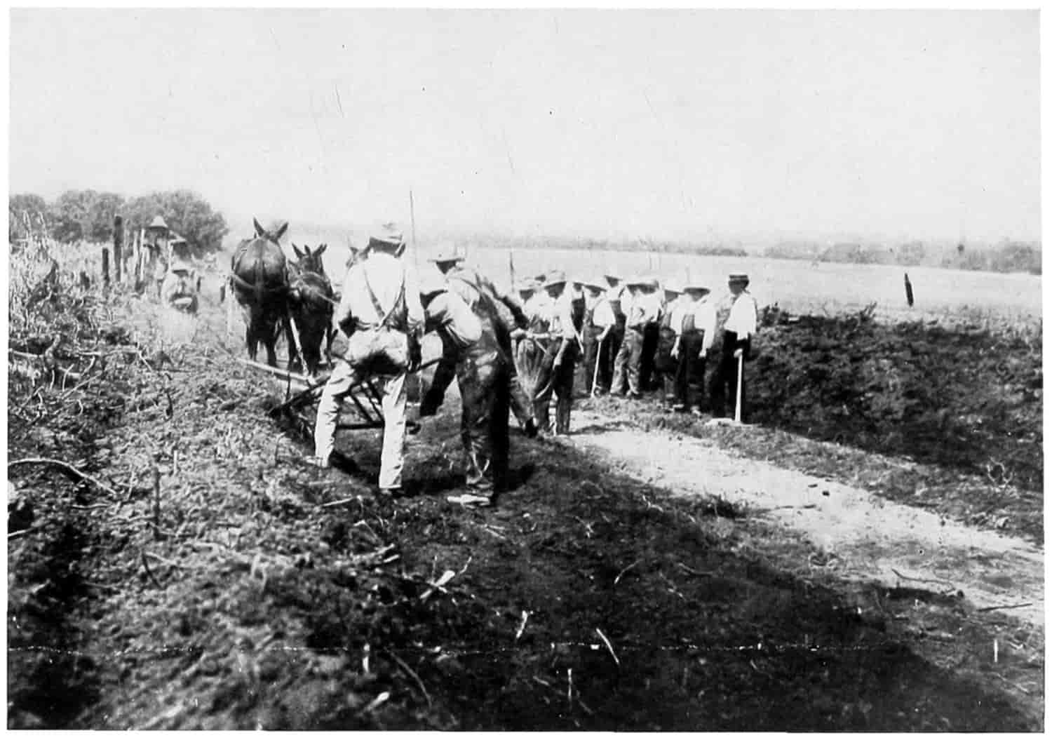
© Underwood and Underwood
GOOD ROADS DAY IN JACKSON CO., MO.
While this convention was in session a similar one was meeting in Missouri; in fact practically all the states in the Union were getting “in the band wagon.”
The League stopped not here, but were interesting the political men of the country in the issue. They visited the president of the United States, Benjamin Harrison, at Washington in July,[130] at which time he turned to Colonel Charles L. Burdet, head of the League, and said: “One thing; if wheelmen secure us good roads for which they are so zealously working, your body deserves a medal in recognition of its philanthropy.”
The great World’s Fair was coming off at Chicago in 1893, and “good roads boosters” were extremely anxious that a suitable exhibition be made there. General Roy Stone framed a bill which was favorably reported by the Senate Committee July 23, 1892. It was a bill to create a National Highway Commission and prescribe its duties, “composed of two Senators and five members of the House of Representatives, and five citizens appointed by the president” for the purpose of a general inquiry into the condition of highways in the United States and means for their improvement, and especially the best method of securing a proper exhibit at the World’s Columbian Exhibition of approved appliances for road making, and of providing for public instruction in the art during the exhibition.[131]
Colonel Albert A. Pope, of Boston, a zealous road worker, secured the opinions of hundreds of prominent men, which he presented to the members of congress. Only a few extracts can be made here.[132]
[134]
A want of understanding and system has resulted in a nearly useless expenditure of enough labor and money to have furnished the settled portions of our country with good substantial roads. —President Benjamin Harrison.
Looking at it from a postal standpoint enlarged free delivery or anything like universal free delivery will have to be postponed until there are better facilities of communication through the rural and sparsely settled districts. The experiments that we have made in the smaller towns and villages have proved the practicability of greater extended free delivery, but without good roads it must necessarily be limited to the small towns. —John Wanamaker, Postmaster General.
There is no doubt that the diffusion of knowledge in regard to the good construction of roads will be of immense benefit to all the people. —John A. Noble, Secretary of the Interior.
I think the people of the United States are taking more interest in the improvement of good roads than in any other non-political matter. —O. H. Platt, Senator from Connecticut.
I have often thought that the people, speaking of them generally, have never yet understood the value of good roads. They are not only matters of convenience, but they are really matters of great economy in every community. The farmer with one team of two horses is able to move on a good road more than he could move with four horses and a wagon of much greater strength on a poor road. This I have tested personally many times. Farmers are constantly in need of the use of highways to transport their property and to move themselves from place to place. The average farmer is five miles distant from the nearest railway station and his surplus produce must be moved that distance year after year. If he were to compute the saving that he and his neighbors would have by reason of first-class roadways, they would discover that it would amount to more than the expense of putting the roads in good condition and keeping them so. Our road system is miserably deficient. —William A. Peffer, Senator from Kansas (Populist).
Aside from the benefits that good roads bring to the people in times of peace I do not know of a great city in this country that is provided with such highways as would admit of the expeditions marching of a great army in times of war. Washington City is a fair example in this regard. The highways leading to this city through Maryland and Virginia are both narrow[135] and crooked. There is not a single public outlet or inlet that can be called a great national highway. —H. C. Hansbrough, Senator from North Dakota.
In the old Roman days all roads led to Rome, and they were good roads. They built roads for military and commercial purposes, and the wisdom of their enterprise was apparent even in that early day. European nations to-day regard road-making as one of their economic questions, and it does seem that our Government in its honest endeavor to benefit the agricultural classes, should have thought of good roads long ago. We want and must have splendid highways, owned not by corporations but by the people. They will be an economical investment, and an untold comfort to the traveler. —James H. Kyle, Senator from South Dakota.
The country could spend no money so economically and enlist no genius so usefully as in making better roads for communications between one neighborhood and another. —John W. Daniel, Senator from Virginia.
I esteem good roads throughout the country to be as necessary as railroads. —Francis E. Warren, Senator from Wyoming.
The prosperity of our country depends so largely on the prosperity of our farmers that everything possible should be done to render life in the rural districts agreeable as well as profitable and nothing could conduce more to the comfort and happiness of our people than the improvement of the roads. —Joseph Wheeler, Representative from Alabama.
That good roads in good condition are always of great value in a military point of view is plain enough; for any section of active operations the prompt transportation of material and the moving of an army would demand it. —Major General Oliver O. Howard, United States Army.
The importance of good roads has been brought to my attention most forcibly on many occasions when my wagon trains have been forced to move at a snail’s pace over almost impassable roads, and when every hour’s delay might mean untold disaster. The expenditure of animal force on such occasions was fearful. In times of peace good roads are no less important; the general condition of country roads is a very good index of the civilization and prosperity of the community. It is not difficult to show by mathematical deduction that money expended in constructing[136] good roads is economy from a financial standpoint, while from a social standpoint the benefits are incalculable.
We have splendid railroads traversing the whole country in every direction and we have in most cities very creditable means of rapid transit, but the country roads in most parts of the United States are really deplorable. This condition of affairs is something like putting a boy at work on Latin and Greek before he has mastered the alphabet of his own language. —Brig. Gen. D. K. Stanley, United States Army.
The above are only a small portion of the letters from which they were extracted, but they serve to show that the League of American Wheelmen and such men as Colonel Pope were very active in spreading the gospel of good roads. The arguments in these and hundreds of other letters, from men of all classes and professions, of all political parties from all parts of the nation, cover a very wide range and the effect has been lasting.
About this time, also, Senator Charles F. Manderson, of Nebraska, introduced a concurrent resolution in the Senate to print a lot of consular reports relating to streets and highways in foreign countries and distribute them in bulletin form. The edition consisted of 30,000 and served to show how the United States was lagging behind other countries in the matter of road building.[133]
Office of Public Roads Inquiry.
—A very few lines of the Congressional Record serves to introduce the beginning of a great instrumentality for good roads in America. On January 26, 1893, Representative Deborow introduced a resolution in the House of Representatives, “instructing the committee on agriculture to incorporate in the agricultural appropriation the sum of $15,000 to be expended for the purpose of making investigations for a better system of roads.”[134] On the same day Representative Lewis presented a similar resolution “instructing the committee on agriculture to incorporate in the bill making appropriations for the Agricultural Department a clause authorizing the[137] Secretary to make inquiry regarding public roads.”[135] Both resolutions were referred to the committee on agriculture. As a final result a statute carrying an appropriation of $10,000 was approved March 3, 1893. Under this statute the Office of Public Roads Inquiries was instituted, October 3, 1893, with “General Roy Stone, of New York, recognized as a superior civil engineer, and thoroughly identified with the popular movement toward the improvement of the highways in the several states, in charge.”[136]
The Letter of Instructions of the Secretary of Agriculture to General Stone upon his appointment summarizes the statute and defines the object and scope of the inquiry to be made. The last paragraph of the instructions shows that the old theory of “state sovereignty,” still had a place in the mind of the Secretary, and it was not for several years that this office did more than the mere collection of information relative to roads. The letter follows:[137]
U. S. Department of Agriculture,
Office of the Secretary,
Washington, D. C., October 3, 1893.
Sir: You have been this day appointed to supervise and carry out the investigations pursuant to the statute approved March 3, 1893, which has four branches:
(1) To make inquiries in regard to the systems of road management throughout the United States.
(2) To make investigations in regard to the best method of road-making.
(3) To prepare didactic publications on this subject, suitable for distribution.
(4) To assist the agricultural colleges and experiment stations in disseminating information on this subject.
It will not be profitable to enter upon all of these points at first. The work under the appropriation will need to be of gradual growth, conducted at all times economically. Therefore, it is not expected that there will be any considerable force of clerical help, and aside from your salary, no considerable expenditure for the present. It is understood that you have at your command the data for a compilation of the laws of several[138] of the states, upon which their road systems are based. It should be your first duty, therefore, to make such collection complete, and prepare a bulletin on that subject.
Incidentally, while preparing this bulletin, you should charge yourself with collecting data relating to the different methods of road making, which, in the first instance, should be generic in their character; including—
(1) The best method of constructing a common highway, without gravel or stone.
(2) Gravel highways.
(3) Macadam and other stone roads.
(4) Data upon which to base suggestions for the transportation of material within reasonable access, for the proper surfacing of the roadbed. These data should form the foundation for the second bulletin, or second series of bulletins.
There are certain restrictions I wish specifically to bring to your attention. It must be borne in mind that the actual expense in the construction of these highways is to be borne by the localities and states in which they lie. Moreover, it is not the province of this Department to seek to control or influence said action, except in so far as advice and wise suggestion shall contribute toward it. This Department is to form no part of any plan, scheme, or organization, or to be a party to it in any way, which has for its object the concerted effort to secure and furnish labor to the unemployed persons or to convicts. These are matters to be carried on by states, localities, or charities. The Department is to furnish information, not to direct and formulate any system of organization, however efficient or desirable it may be. Any such effort on its part would soon make it subject to hostile criticism. You will publish this letter in the preface to your first bulletin.
Yours truly,
J. Sterling Morton,
Secretary.
Mr. Roy Stone,
Special Agent and Civil Engineer in charge of
Good Roads Investigations.
The Office followed these instructions pretty closely for several years. General Stone and his successor General Dodge encouraged the formation of good roads organizations. In fact General Stone prior to the institution of the Office of Road Inquiries was instrumental in organizing at Chicago in connection with the dedication of the World’s Fair in 1893, the National League for Good Roads. General[139] Stone himself attributed to the influence of this League the organization of the Office of Public Roads and the great work which it has since accomplished.[138]
Other good roads organizations were springing up. The Office of Public Road Inquiries encouraged these to the extent of publishing addresses given at their conventions as bulletins upon the theory that the information relative to road improvements throughout the United States was in line with the object and scope of the Office.
The organization known as the National Good Roads Association, with W. H. Moore of St. Louis, Missouri, as president, and R. W. Richardson, of Omaha, Nebraska, as secretary, seems to have been especially active. Colonel Moore was a man of impressive manner, suave and affable, and was able to interest and associate with him many very influential people. He was a born “good roads booster.” He always worked with the men in power. Directors Stone and Dodge not only had prominent places on his convention programmes, but recommended to the Secretary of Agriculture that the proceedings be printed as Departmental Bulletins. This was for a time helpful to the cause of good roads, for the conventions were addressed by able and influential men. Director Dodge in his letter of transmittal of the proceedings of the convention held at St. Louis, Missouri, April 27 to 29, 1903, to Hon. James Wilson, Secretary of Agriculture, says:[139]
Among the distinguished speakers who delivered addresses were Hon. Theodore Roosevelt, President of the United States; Hon. William J. Bryan, of Nebraska; General Miles, of the United States Army; Governor Dockery, of Missouri; Governor Cummins, of Iowa; Hon. A. C. Latimer, United States Senator from South Carolina; Hon. W. D. Vandiver, member of Congress from Missouri; Hon. D. R. Frances, president of the Louisiana Purchase Exposition Committee; Hon. J. H. Brigham, Assistant Secretary of Agriculture; General Roy Stone, of New York; and Mr. Samuel Hill, of Washington. Addresses were also delivered by prominent men engaged in agriculture, railway transportation, commercial pursuits, and newspaper work.
[140]
This organization, like many state good-roads organizations, had no permanent membership list. Any city that would “finance” a convention could get one. Invitations were sent to governors, mayors, county officers, city officers, commercial clubs urging them to appoint delegates to the conventions. As a result large conventions were promoted and held at Chicago, St. Louis, Buffalo, Portland, and elsewhere, usually in connection with some exposition or fair.
There being no permanent membership the only way to finance such undertakings was by popular subscriptions and donations from social, commercial and political bodies. Colonel Moore[140] went to New York and talked to the president of the Illinois Central railroad, Mr. Stuyvesant Fish, and asked for a special “train of fifteen cars to carry modern road machinery.” “How much will this project cost?” asked Mr. Fish. Moore replied, “As near as we can figure it out, to furnish and operate this train for three months will cost you $40,000 to $50,000.” President Fish replied, “That is a large amount to throw in the mud, but we will consider it.” The train was granted. In the language of Colonel Moore, the “railroad company shouldered the burden.” The government through the Office of Public Roads furnished two expert engineers, other engineers and necessary employees were hired. This train made the trip from Chicago to New Orleans. Advance-agents were sent along the way to secure the coöperation of the various communities. They were asked to raise a sufficient amount of money to defray the local expenses. Moore states, “we did not visit a single city in the South where we laid the matter before the mayor, the city council, and the supervisors that they did not promptly respond in the affirmative.” Road machinery carried on the train was explained by men frequently sent along for this purpose by the manufacturers who had donated its use or by engineers and others in[141] charge. Short sections of road were graded and stoned—“object lesson roads were built.” Similar trains were run over the Lake Shore Road, and later over the Southern Railway. The latter at a cost of about $80,000; the road equipped the train, fed the men and furnished Pullman cars for sleeping accommodations. The last such train was over the Northern Pacific. This particular organization (there were others) and its work has been thus fully mentioned to show how thoroughly the propaganda was carried on which resulted later in the greatest road-building campaign in the history of the world. The National Good Roads Association came to grief at the Portland Exposition in 1905, where strenuous opposition developed to the financing methods of Mr. Moore and an unsuccessful effort was made to oust him from the presidency of the association. James W. Abbott, Pacific Coast Agent for the Office of Public Roads in a newspaper interview among other things said:[141]
“We feel that the wild, reckless and impossible things which Colonel Moore promises to do for communities must later produce a reaction positively disastrous. He has already promised that the construction train of the National Good Roads Association will do an amount of work gratuitously for communities, which, allowing for unavoidable delays, climatic and otherwise, would take more than ten years. The three good roads trains which have heretofore done object-lesson road work have been under the direct operation and executive management of Colonel Richardson. They were wonderfully well-equipped trains, but they demonstrated that the building of suitable object-lesson roads efficiently and economically was not and could not be made a circus proposition.”
In addition to good roads associations, the agitation for better roads was taken up by governors who devoted a not inconsiderable portion of their messages to the legislatures to a discussion of the subject. Even presidents of the United States paid it attention in their messages to Congress.[142] With the coming of the automobile the need of better highways and hard pavements was greatly emphasized. With lots of money for propaganda, with nearly everyone becoming a disciple of good roads, is it any wonder that Congress finally voted for federal aid?
Participation in road conventions and coöperation with more or less spurious organizations was greatly curtailed when Logan Walter Page was promoted to the Directorship of the office. Still, speakers and experts were freely sent to address meetings for the purpose of educating the citizenry to the need of better roads, and how they should go about to obtain them and what such roads will cost. Speakers were, therefore, supposed to give definite and specific information on which local committees might act intelligently. Propaganda for the purpose of influencing legislation in any state or city was tabooed and bulletins took on a more scientific nature relating more to quality, availability, and cost of materials; methods and costs of construction; and efficiency of types of roads.
Road associations have continued to increase and many have and are doing praiseworthy work for the cause of better roads. The Good Roads Year Book, 1914, published by the American Highway Association, of which Director Page was president, listed, giving the names of the principal officers, 1 international, 38 national and 617 state and county associations.
Object-Lesson Roads.
—The Office of Public Roads inquiry beginning, as has been shown, very simply, has by devoted service and extreme economy been able to do a remarkable amount of good for the public highways of this country. The men at its head and employed by it deserve much praise. Their salaries were small, yet they worked with missionary zeal. They were able to coöperate with scientific and professional organizations, such as the American Society for Testing Materials, The American Society of Civil Engineers, The Bureau of Standards, and a number of organizations employing reputable high-class scientific men in research work pertaining to road construction and road materials. The government’s appropriation beginning at $10,000 or excluding the Director’s salary $8000, was increased from time to time until it was in 1896, $37,660 and in 1911, $135,000. Since the adoption of the system of Federal Aid, there has naturally been greatly increased operation. The total appropriations for the Bureau of Public Roads are now approximately three quarters of a million dollars.
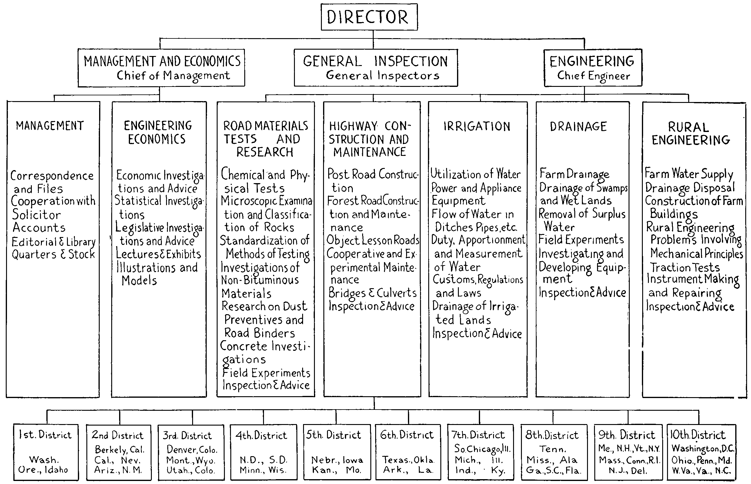
Chart of the Organization of the U. S. Bureau of Public Roads and Rural Engineering, 1917
[143]
The duties and scope of the Office of Public Roads Inquiry was gradually widened and its name changed to the Office of Public Roads. In 1915 by reorganization of the Department of Agriculture it became the Office of Public Roads and Rural Engineering and took charge of all the Department’s work which partook in any way of an engineering nature. In 1916 the Secretary of Agriculture directed the Office to act for him in the routine administration of the Federal Roads Act. The work of the Office or Bureau of Public Roads, as it is now designated, was in 1916, carried on along three general lines:[142] (1) Educational; (2) Research, and (3) Administration of the Federal Road Act. By its educational or extension work the Office was endeavoring to reach the people by means of lectures, addresses, the publication of bulletins and the exhibit of models. Emphasizing the economic value of improved roads and the efficiency of various types. Special advice and assistance to communities was given by furnishing engineers and experts to confer with municipal officers on their particular problems. Actual demonstration by the construction of object-lesson roads was freely carried on. The community furnished the material and labor; the Office sent its engineers and experts to design and superintend the construction. These “seed miles” resulted in the construction of many other miles by the community itself. The Office tried to impress also the need of proper maintenance from the beginning.
Fully as important as its educational work was the research or investigational work carried on. The Office was[144] able to secure the services of several young men of scientific attainment and the bulletins put out by L. W. Page, Prévost Hubbard, A. S. Cushman and their successors have commanded world-wide recognition. Laboratories were erected to test road materials, and experimental roads were built to demonstrate the actual use of the same according to various methods. In this manner careful studies were made of a vast number of materials, including oils, asphalts, tars, concrete, brick, crushed stone and gravel. In connection with practical road men and research committees of such organizations as the American Society of Civil Engineers, and the American Society for Testing Materials many useful standards have been adopted for road materials and road construction. The effect of traffic on various types of roads has also been a profitable subject for study. The organization of the Bureau may be best shown by the chart.
Rural Free Delivery.
—A brief mention of this agency for better roads should not be omitted. Postmaster-General Wanamaker, in 1890, recommended the extension of free delivery to villages of less than 10,000 population and he inaugurated an experimental “village delivery.” After an existence of about two years this was ordered discontinued. However, free delivery on a broader basis was demanded by State Granges of the Patrons of Husbandry and other farmers. Congress made small appropriations for rural free delivery, but the Postmaster-General, W. S. Bissell, declined to make any use of them. When Hon. W. L. Wilson became Postmaster-General (1895) he agreed with his predecessor in believing the project impractical, but if Congress would make the money available he was willing to try it out. An appropriation of $40,000 was placed at his disposal.[143]
The first Rural Free Delivery routes were established on October 1, 1896, at Halltown, Uvilla, and Charlestown, West Virginia. Others immediately followed. President[145] McKinley in a message to Congress December 3, 1900, states that “by the close of the current fiscal year about 4000 routes will have been established, providing for the daily delivery of mails at the scattered homes of about three and a half million of rural population.”[144] So successful did it prove that it soon displaced nearly all the star routes and was well established in practically all rural districts of the United States. In 1919 out of a total expenditure by the Post Office Department of over $362,000,000, a little less than $51,000,000 was distributed to the rural delivery service.[145]
The Department having adopted a rule to the effect that the rural delivery service would only be established along reasonably good roads, and that a carrier need not go out unless the roads were in fit condition spurred the inhabitants up to better attention of the roads for after a man once got in the habit of receiving his mail daily he wanted it regularly.
“When a heavy snow blocks the way of the rural carrier it is customary for the farmers to turn out and break the roads, and this is done several days earlier than would be the case ordinarily. In this way communication throughout neighborhoods and with the outside world is opened up promptly. In consequence the farmer is able to take advantage of good markets and the townspeople are not cut off from the supply of fresh country produce, as often has happened in severe storms. Also cases of distress in isolated farm homes are sooner reached and relieved.”[146]
The Department finding the rural delivery popular determined to make it not only more so but to make it pay also. So they took precautions to protect the mail in the farmer’s boxes by regulating the kind of boxes to be used and promptly prosecuting cases of thievery and molestation of mail; they established registration by rural carriers and allowed carriers to receipt for applications for[146] money orders; carriers were also authorized to receive and deliver “drop” letters on their routes without passing them through the terminal post office. A little later when the parcel post was instituted the popularity of rural delivery was greatly enhanced. Like many other conveniences the rural inhabitants cannot now realize how they could get along without free delivery of the mails. Postmaster-General Charles Emory Smith in his report of 1900[147] says of the then quite new system:
Rural delivery has now been sufficiently tried to measure its effects.... It stimulates social and business correspondence, and so swells the postal receipts. Its introduction is invariably followed by a large increase in the circulation of the press and of periodic literature. The farm is thus brought into direct daily contact with the currents and movements of the business world. A more accurate knowledge of ruling markets and varying prices is diffused, and the producer, with his quicker communication and larger information, is placed on a surer footing. The value of farms, as has been shown in many cases, is enhanced. Good roads become indispensable, and their improvement is the essential condition of the service. The material and measurable benefits are signal and unmistakable.
But the movement exercises a wider and deeper influence. It becomes a factor in the social and economic tendencies of American life. The disposition to leave the farm for the town is a familiar effect of our past conditions. But this tendency is checked, and may be materially changed by an advance which conveys many of the advantages of the town to the farm. Rural free delivery brings the farm within the daily range of the intellectual and commercial activities of the world, and the isolation and monotony which have been the bane of agricultural life are sensibly mitigated. It proves to be one of the most effective and powerful of educational agencies. Wherever it is extended the schools improve and the civil spirit of the community feels a new pulsation; the standard of intelligence is raised, enlightened interest in public affairs is quickened, and better citizenship follows.
With all these results clearly indicated by the experiment as thus far tried, rural free delivery is plainly here to stay. It cannot be abandoned where it has been established, and cannot be maintained without being extended.
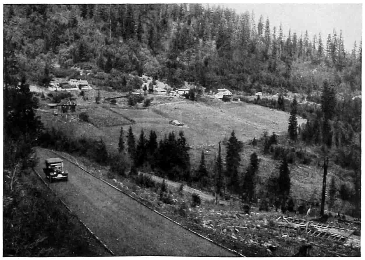
© Underwood and Underwood
HARD SURFACE HIGHWAY IN OREGON
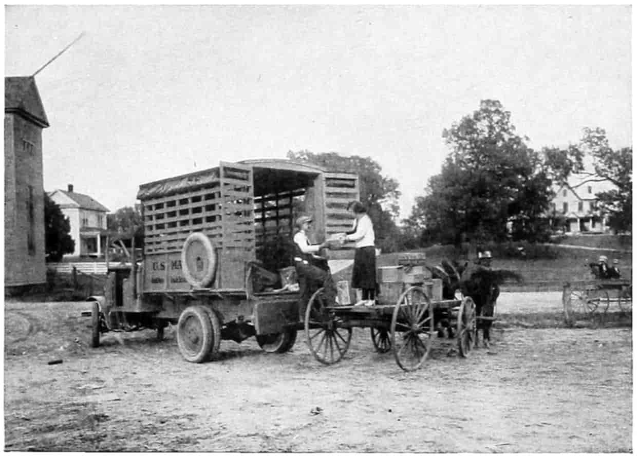
© Underwood and Underwood
A FARMER’S WIFE MEETING THE POSTAL TRUCK
[147]
The law for federal aid is based upon the clause in the Constitution giving Congress power “to establish post offices and post roads.”[148] and the money made available may only be expended on post roads outside of towns “having a population of two thousand five hundred or more, except that portion of any such street or road along which the houses average more than two hundred feet apart.”[149] Thus may be seen the very great importance to better public highways of the “rural free delivery.”
State Aid.
—While the bicyclist and voluntary road organizations were creating sentiment favorable to improved highways, the states were not idle. It will not be possible to follow the progress in each of the states, but since some form of state aid has been adopted by all of them the development of that idea will be sketched. By state aid is meant a plan whereby a part of the expense of constructing roads is borne by the state and a part by the locality in which the road lies.
New Jersey,[150] like many of the other Eastern states, had a few turnpike roads constructed and maintained by private corporations. These roads were much better than the public roads on which there were no toll gates. The public roads were administered under ordinary laws of overseers of highway districts. Charges of partiality had led to amendments, then other amendments until the laws were a maze of intricacies. To eliminate these, the state board of agriculture in 1887 called a mass meeting of farmers and others interested in good roads. The result of the conference, which was well attended, was the appointment of a committee, consisting of one member for each of the Congressional districts in the State, to examine the laws of New Jersey, of other states and of foreign countries and report methods for bettering the New Jersey system. After careful consideration they drafted a law[148] abolishing the overseers and conferring the powers and duties of caring for the public highways on the township committee. This was presented to the State Board of Agriculture and received unanimous approval. But when it came before the State Legislature, of 1888, for adoption the opposition of the road overseers succeeded in defeating it. In 1889 it was again presented and defeated; and met a similar fate in 1890. But in 1891 with the coöperation of the governor its passage was secured.
Mr. Clayton Conrow of New Jersey[151] claims the honor of proposing the first state aid road law in the United States. He asserts that he learned from actual observation of the travelers on a section of highway that it was used not only by “teams of the local township but also from the adjoining township and the township beyond, and so on and on they came until a score of townships were represented on this section of the road.” He therefore concluded that the county and the state by rights should assist in building the main traveled roads, and that “every citizen of the state is entitled to the free use thereof.” This, he says, was in 1890, just the time the state board of agriculture was pushing its law to discontinue the overseers. Conrow says he consulted with Hon. Edward Burrough, president of the state board of agriculture, and outlined his plan for a State Aid Road Law. Burrough was highly pleased, but there was an obstacle in the way, namely the turnpike corporations. They were creatures of the law and had rights that should be respected. Mr. Burrough advocated the adoption of the law having faith that the people would buy the turnpike roads so that no citizen would be the loser. Judge William M. Lanning put the draft of the bill in legal form. It was then submitted to Governor Abbett for his approval as they did not care to encounter a veto if a slight change of form would[149] reconcile him to its provisions. Mr. Conrow claims his original draft was changed only slightly by the board and again by the governor, then submitted to the legislature by a Mr. Davidson of Gloucester county. This is the act that was passed in 1891.
Salient Features of the State Aid Law.
—The essential points of the law are set forth in the following extract being the preamble and parts of the seventh and fourth sections:
An Act to provide for the more permanent improvement of the public roads of this State.
Whereas public roads in this State have heretofore been built and maintained solely at the expense of the respective townships in which they are located; and
Whereas such roads are for the convenience of the citizens of the counties in which they are located, and of the entire State as well as of said townships; and
Whereas the expense of constructing permanently improved roads may be reasonably imposed in due proportions, upon the State and upon the counties in which they are located: Therefore, ...
And be it enacted, That whenever there shall be presented to the board of chosen freeholders of any county a petition signed by the owners of at least two-thirds of the lands and real estate fronting or bordering on any public road ... praying the board to cause such road ... to be improved under this act, and setting forth that they are willing that the peculiar benefits conferred on the lands fronting or bordering on said road ... shall be assessed thereon, in amount not exceeding ten per centum of the entire cost of the improvement, it shall be the duty of the board to cause such improvements to be made: Provided, that the estimated cost of all improvements ... in any county in any one year shall not exceed one-half of one per centum of the ratables of such county for the last preceding year....
And be it enacted, That one-third of the cost of all roads constructed ... shall be paid for out of the State treasury: Provided, That the amount so paid shall not in any one year exceed the sum of seventy-five thousand dollars....
It will be seen that under this law the property owners pay one-tenth, the State one-third and the county the remaining 562⁄3 per cent. Except for the 10 per cent paid[150] by the abutting property holders the burden borne by all citizens of the county is the same.
The friends of the movement demanded its enforcement; the opponents were equally determined which resulted in an appeal to the courts and the mandatory features were sustained. As it was first enacted the total expenditure was $20,000 and a Commissioner of Agriculture was to supervise its disbursement. But as there was no such officer the next legislature, at the suggestion of the governor, authorized the president of the State Board of Agriculture to perform these duties; this he did until the office of the Commissioner of Public Roads was created. The first money paid out under the act was December 27, 1892, $20,661.85, and this was the first money paid in the United States for state aid for the construction of roads. With slight amendments the law remains to the present and has been emulated by nearly all the states in the Union.
In Massachusetts advocates of better roads attempted legislation looking toward a system of state highways in 1887 and annually thereafter until 1892.[152] In 1892 the demand became so great that the legislature enacted a law providing for a commission of three to inquire into the entire subject and report to the legislature of 1893, with suitable appropriation for the purpose. The commission made a thorough investigation, held public hearings, and made inquiries among all classes. Their findings were brought before the legislature and a general road law was enacted providing for a commission of three competent persons who should give advice to those having charge of the public highways; it further contemplated the building and care for by this commission of a system of state highways connecting the several municipalities. At first the counties were supposed to grade the roads and the Commonwealth to surface them but the law was changed (1894) so that the Commonwealth through the highway commission[151] does the entire work of construction and maintenance then charges back to the counties 25 per cent of the cost, so that finally the State pays 75 per cent and the county 25 per cent. In 1913 an amendment was made to relieve small communities from the payment of the entire amount thus the State, in reality, pays more than 75 per cent of the expense.
The state aid principle has been adopted by all states in the union; many before federal aid came, the remainder since. Connecticut was third in 1895 and New York fourth in 1898.
In order to raise money to meet the demands for state aid roads many of the states bonded themselves for large amounts. New York voted a bond issue of $50,000,000 in 1906 and another of the same amount in 1912. California voted bonds of $18,000,000 in 1910 and $15,000,000 in 1916. Illinois voted $60,000,000 in 1920 eventually to be paid from automobile licenses. Maryland authorized a bond issue of $5,000,000 for trunkline roads; additional issues were made in 1910, $1,000,000; in 1912, $3,170,000; in 1914, $6,600,000; and in 1916, $2,700,000. Missouri authorized a $60,000,000 bond issue in 1921 and so on for other states. On January 1, 1914[153] there were outstanding highway and bridge bonds in the United States to the amount of $445,147,073; of which $158,590,000 had been voted by the States and $286,557,073 by counties and townships. After the war increased interest in road building became manifest. Between November 1, 1918, and December 31, 1919,[154] state highway bonds amounting to $234,000,000 were voted: Illinois, $60,000,000; Pennsylvania $50,000,000; Michigan, $50,000,000; Missouri, $60,000,000 and many other states smaller amounts. There is pending legislation for nearly $300,000,000 additional bonds, among which are Minnesota, $75,000,000; Texas, $75,000,000; West Virginia, $40,000,000; Washington, $30,000,000; Alabama, $25,000,000. Funds are otherwise raised by[152] direct taxation, property and special, by appropriations from the general fund, by automobile licenses, and from court fines. The grand total for road construction expended in the United States from 1910 to 1920 is over $2,500,000,000.
Federal Aid.
—The real road building age in the United States was ushered in by the enactment of the law providing that “the Secretary of Agriculture shall on behalf of the United States in certain cases aid the States in the construction and maintenance of rural post roads.” From the time Representative Brownlow startled the country in 1904 by introducing a bill to appropriate $24,000,000 for road building, not a session of Congress passed without several such bills being introduced. Most of these took the form of creating a commission to administer any fund for national aid that might be appropriated, and many feared such large appropriations would result in “pork barrels” all over the country. In 1915 one such bill passed the House but did not become a law. However, the leaven continued to work. The influence of the automobile was making thousands of new road enthusiasts every day. Many petitions were being rained upon Congress and scores of bills introduced for national aid both for specific roads and of a general nature. During the 63d Congress, forty-nine bills were introduced, 10 in the Senate and 39 in the House. A report had been submitted by a joint congressional committee on January 21, 1915[155] embodying data from foreign countries showing systems in effect, the mileage and cost of roads constructed; similar data from the several states; extracts from state constitutions showing limitations of state debts; statistics on tonnage transported over rural roads; statistics on length, character and condition of rural routes; transportation rates on road materials by rail; comparative statistics embodying possible factors in apportionment of Federal aid; statistics of wealth, debt, and highway expenditures; comparative statistics on the cost[153] of road construction, historical sketches of national roads, work of the Office of Public Roads; and a synopsis on congressional action on Federal aid to road improvement.
The report speaks of the economic importance of good roads, the constitutionality of Federal aid and gives data to show the public sentiment in favor of Federal aid. Of 10,000 replies to inquiries received from every state in the Union, 97 per cent favored Federal aid and 3 per cent opposed.
On January 6, 1916, Representative Shackleford of Missouri, chairman of the committee on roads, introduced the bill which later became a law. The bill ran the usual course and created a great deal of interest and was freely debated in both House and Senate. The discussion on it comprises more than 300 pages of the Congressional Record[156] and cover practically every reason for and objection to the betterment of highways and the use thereon of national money. The bill finally passed the house January 25, 1916, by a vote of 283 Yeas, 81 Nays and 70 not voting; and the Senate as amended, May 8, 1916, by a unanimous vote. The bill went to conference, the Senate agreed to the conference report June 27, and the House June 28, 1916. President Wilson approved the bill July 11, 1916, and it became Public Law, No. 156, 64th Congress.
The title of the bill as amended is “An Act to provide that the United States shall aid the States in the Construction of rural post roads, and for other purposes.” In brief it authorizes the Secretary of Agriculture to coöperate with the states through their respective highway departments in the construction of rural post roads. In order to keep state sovereignty intact no money apportioned under the act could be expended in any state until the legislature of that state shall have assented to the provisions of the Act. The Secretary of Agriculture and the State Highway department agree upon the roads to be constructed therein and the character and method of construction. By providing that all roads constructed under[154] the provisions of the act shall be free from tolls of all kinds Congress avoided the objection raised by President Monroe in his veto of the National Road bill in 1822. A most liberal definition of Post Roads is also given in the bill, namely, “the term ‘rural post road’ shall be construed to mean any public road over which the United States mails now are or may hereafter be transported, excluding every street and road in a place having a population, as shown by the latest available federal census, of two thousand five hundred or more, except that portion of any such street or road along which the houses average more than two hundred feet apart.”
For the purpose of carrying out the provisions of the act there was appropriated for the fiscal years ending June 30, 1917, the sum of $5,000,000; 1918, $10,000,000; 1919, $15,000,000; 1920, $20,000,000; 1921, $25,000,000. After deducting the amount necessary for administration not exceeding 3 per cent, the remaining amount available was to be distributed as follows: “One-third in the ratio which the area of each State bears to the total area of all the States; one-third in the ratio which the population of each State bears to the total population of all the States as shown by the latest available Federal census; one-third in the ratio which the mileage of rural delivery routes and star routes in each State bears to the total mileage of rural delivery routes and star routes in all the states.” The Secretary of Agriculture is to approve only projects which are substantial in character. Items of engineering, inspection and unforeseen contingencies may not exceed 10 per cent of the estimated cost. The share paid by the Government shall not exceed 50 per cent of the total cost.
The same act appropriated $10,000,000 for the survey, construction and maintenance of roads and trails within the national forests when necessary to develop the resources upon which communities within and adjacent to the national forests are dependent.
The Secretary of Agriculture issued September 1, 1916, a set of rules and regulations for carrying out the Federal-Aid[155] Road Act.[157] These are quite detailed and require a close supervision by the Office of Public Roads and Rural Engineering, the Director of which or other officers and employees designated by him, was officially appointed to represent the Secretary of Agriculture in its administration. These rules explain and relate specifically to definitions of terms; information to be furnished the Secretary; project statements; surveys, plans, specifications and estimates; project agreements; contracts; construction work and labor; records and cost keeping; payments; submission of documents to the Office of Public Roads.
A State, County or District making application for aid must present a Project Statement “to enable the Secretary to ascertain (a) whether the project conforms to the requirements of the act; (b) whether adequate funds, or their equivalent, are or will be available by or on behalf of the State for construction; (c) what purpose the project will serve and how it correlates with other highway work of the State; (d) the administrative control of, and responsibility for, the project; (e) the practicability and economy of the project from an engineering and construction standpoint; (f) the adequacy of the plans and provisions for proper maintenance of roads; and (g) the approximate amount of Federal aid desired.” Also there must be submitted for approval forms of contract, with documents referred to in them, and the contractor’s bond. Likewise maps of surveys, plans, specifications and estimates, showing quantity and cost shall have the approval of the Secretary. The state shall provide the rights of way and railroad grade crossings shall be avoided where practicable. A project agreement between the State Highway Department and the Secretary is executed. It must also be shown that adequate means either by advertising or other devices were employed, prior to the beginning of construction, to insure economical and practical expenditures, and rules for submitting and tabulating bids[156] are given. Samples of the materials to be used must be submitted for approval whenever requested, and all materials, unless otherwise stipulated, must be tested prior to use by the standard methods of the Office of Public Roads. Supervision shall include adequate inspection. Reports of progress, records and cost accounts must be kept in approved manner.
Many states in order to take advantage of the Federal aid within the time stipulated by the Act have, as has been shown, issued long-time bonds. Others have relied on increased taxation, and many require abutting property to pay a special tax for improvements.
The success of the Act was extremely marked. So much so that the Post Office Appropriation act of February 28, 1919,[158] carried an amendment to the original Federal Aid Act providing an additional appropriation of $200,000,000 for post roads and $9,000,000 for forest roads. Fifty million dollars of the post road fund was made immediately available and $75,000,000 was made available for each of the fiscal years of 1920 and 1921. Of the forest road fund $3,000,000 was made available for each of the fiscal years 1919, 1920 and 1921. This bill transferred to the Secretary of Agriculture all available war material and equipment suitable for use in the improvement of highways for distribution to the several states on a value basis the same as provided in the Federal Aid Act of 1916. Under this provision trucks, road equipment, and road materials having when new a value of over $100,000,000 had been distributed by November 1, 1919.
SELECTED REFERENCES
Anderson, Andrew P., “Highways,” American Year Book, 1918, pp. 317-321; 1919, pp. 308-311. D. Appleton & Company, New York.
“Bonds for Highway Improvement,” Office of Public Roads Bulletin No. 136, U. S. Dept of Agr.
[157]
Boston Transcript, Letter by a foreign visitor giving her opinion of American Roads. Aug. 10, 1892.
Burrough, Edward, “State Aid to Road Building in New Jersey,” Office of Public Road Inquiry Bulletin No. 9, 1894. Dept. of Agriculture, Washington.
Chatburn, George R., “Highway Engineering,” pp. 125-126, John Wiley & Sons, New York.
Congressional Record.—Good Roads Resolution introduced in the Senate by Senator Manderson, Vol. XXIV, pp. 157, 261, 300. Introduced in the House by Representative Lewis, Vol. XXIV, p. 883.
Conrow, Clayton, “Inside History of the State Aid Law,” Report of the New Jersey Commissioner of Public Roads, 1900, p. 81.
Department of Agriculture Year Book, 1900, p. 522.
Federal Aid Road Law, History of, Congressional Record, Vol. LIII, 1916. The Federal Aid road bill, the one that was finally passed and became the most effective road law the world has ever known, had a history in Congress that would make a large volume in itself. The pages of the Congressional Record where it may be found follow: House Roll 7617—To provide that the United States shall aid the States in the construction of rural post roads, and for other purposes—was introduced by Mr. Dorsey W. Shackleford, of Missouri, January 6, 1916 and referred to the Committee on Roads, 637.—Reported back (H. Rept. 26), 746.—Debated, 1131, 1165, 1234, 1269, 1285, 1353-1368, 1373-1408, 1451-1480, 1516-1537 (Appendix, 21, 36, 141, 157, 160, 162, 172, 177, 178, 188, 203, 207, 208, 209, 211, 213, 214, 216, 218, 593, 1273, 2247).—Amended and passed house January 25, 1916, Ayes 283, Noes 81, Present 3, not voting 67, 1536, 1547.—Referred to Senate Committee on Agriculture and Forestry, 1551.—Motion for change of reference debated, 2049-2057, 2329-2335.—Reference changed to Committee on Post Offices and Post Roads, 2334, 2335.—Reported with amendments (S. Rept. 250), 3460, 3881.—Debated, 6425-6433, 6494-6504, 6532-6549, 6565-6585, 6731, 6782-6785, 6840-6849, 6897-6899, 7119-7127, 7225-7228, 7291-7300, 7414, 7451, 7456-7465, 7499-7518, 7560-7571.—Amended and passed Senate unanimously, May 8, 1916, 7571.—Referred to House Committee on Roads—Reported back (H. Rept. 732), 8357.—House disagrees to Senate amendments and asks for a conference, 8749.—Senate insists on its amendments and agrees to a conference, 8783.—Conference appointed, 8749, 8783.—Conference report (S. Doc. No. 474) made in Senate, 9964.—Conference report unanimously[158] agreed to in Senate June 27, 1916, 10086.—Conference report (No. 856) made in House. 10171.—Conference report debated in House, 10162-10173 (Appendix, 1316, 1318, 1334, 1340, 1360, 1361, 1647, 1719, 1724, 1793, 1860, 2082).—Conference report agreed to in House, June 28, 1916, by a vote of 181 ayes to 53 noes, 10173.—Examined and signed, 10348, 10371.—Presented to the President, 10446.—Approved (Public Statutes No. 156, July 11, 1916), 10836.
“Federal Aid Road Act, Regulations for carrying out,” Office of Public Roads Circular No. 65. U. S. Dept. of Agriculture.
Free Delivery of Mail. Agricultural Year Book, 1917; Postmaster General’s Reports, 1892-1899; Ex. Doc. 1, Pt. 4, 52d Cong., 2d Sess., p. 11; Ex. Doc. 1, Pt. 4, 53d Cong., 2d Sess., pp. ix, 55; Ex. Doc. 1, Pt. 1, 54th Cong., 3d Sess., pp. 11, 120; H. Doc. 4, 54th Cong., 1st Sess., pp. 8, 116; H. Doc. 4, 54th Cong., 2d Sess., pp. 25, 129; H. Doc. 4, 55th Cong., 3d Sess., pp. 12, 104; American Year Book, 1919, p. 556. D. Appleton & Company.
Funk and Wagnalls’ Encyclopaedia, Article “Cycling.”
Good Roads Year Book, 1917, “State Highway Department Legislation,” pp. 37-218.
Good Roads Meetings.—“Iowa Highway Meeting,” Engineering Record, August 27, 1892; National Highway Association at Portland, Oregon, The Morning Oregonian, June 22, 1905; Office of the Public Roads Bulletins, Nos. 15, 17, 19, 21-26.
Greathouse, Charles H., “The Delivery of Rural Mails,” Year Book, 1917. U. S. Dept. of Agriculture.
“Highway Bonds,” The American Year Book, 1919, 1920. D. Appleton & Co., New York.
House Document No. 1510, “Federal Aid to Good Roads,” being Vol. 99 of the House Documents.
Iowa Code of 1851, “Road Laws.”
Office of Public Roads Established, Bulletin No. 1, 1894, Report of Secretary of Agriculture, 1893, p. 36. U. S. Dept. of Agriculture.
New York Times, Good Roads Department, Sept. 11, 1892.
Nye, Bill, “On Good Roads,” Good Roads, September, 1892.
Perkins, George A., “State Highways of Massachusetts,” U. S. Dept. of Agri. Year Book, 1894, p. 505.
Post Roads.—The Constitution of the United States on, Section 8.
Potter, I. B., “The Gospel of Good Roads,” League of American Wheelmen.
Smith, Charles Emory, “Rural Mail Delivery,” Agricultural Year Book, 1900, p. 522. U. S. Dept of Agriculture.
FOOTNOTES
[122] Code of 1851.
[123] “Highway Engineering,” by G. R. Chatburn, pp. 125-126.
[124] J. B. Dunlop, a surgeon of Dublin, invented the pneumatic tire in 1888.
[125] One of the early books was entitled “The Gospel of Good Roads,” by I. B. Potter, and appealed directly to the farming interests.
[126] New York Times, September 11, 1892.
[127] Adolphine Hingst, under the heading “Surprised at America. A European’s Shock on Seeing its Roads and Highways,” Boston Transcript, August 10, 1892.
[128] Good Roads, September, 1892.
[129] Engineering Record, August 27, 1892.
[130] New York Times, Sept. 11, 1892.
[131] Ibid.
[132] Printed as a Senate Document.
[133] Cong. Record, Vol. 24: Dec. 15, 1892, p. 157; Dec. 21, p. 261; Dec. 22, p. 300. Senate Documents.
[134] Congressional Record, Vol. 24, Jan. 26, 1893, p. 883.
[135] Ibid.
[136] Report of the Secretary of Agriculture, 1893, p. 36.
[137] Bulletin No. 1, Office of Road Inquiry, p. 5.
[138] Bulletin No. 26, Office of Public Road Inquiries, p. 46.
[139] Bulletin No. 26, Office of Public Road Inquiries.
[140] Address on the “History and Purposes of the Good Roads Movement,” by William H. Moore, president National Good Roads Association, Bulletin No. 26, Office of Public Road Inquiries, p. 10.
[141] The Morning Oregonian (Portland), June 22, 1905.
[142] “Goods Roads Year Book,” 1917, p. 29.
[143] “The Delivery of Rural Mails,” by Charles H. Greathouse. Department of Agriculture Year Book, 1890.
[144] Cong. Record, Dec. 3, 1900, p. 12.
[145] “The American Year Book,” 1919, p. 556.
[146] Dept. of Agri. Year Book, 1900, p. 522.
[147] Year Book, 1900. Department of Agriculture, Washington.
[148] “The Constitution of the United States,” Section 8.
[149] Public Law No. 156, 64th Congress.
[150] “State Aid to Road Building in New Jersey,” by Edward Burrough, Chairman of the New Jersey State Board of Agriculture, Office of Road Inquiry Bulletin No. 9, 1894.
[151] “Inside History of the State Aid Road Law,” by Clayton Conrow, President of the New Jersey State Road Improvement Association, Report of the New Jersey Commissioner of Public Roads, 1900, p. 81.
[152] “State Highways in Massachusetts,” by George A. Perkins, Chairman Massachusetts State Highway Commission, U. S. Department of Agriculture Year Book, 1894, p. 505.
[153] Office of Public Roads Bulletin No. 136.
[154] “The American Year Book,” D. Appleton Co., New York, 1919, 1920.
[155] House Document No. 1510, “Federal Aid to Good Roads,” being Vol. 99, of the House Documents.
[156] Vol. LIII, 1916. See page references at end of chapter.
[157] Circular No. 65, U. S. Department of Agriculture, Office of Public Roads.
[158] “American Year Book,” 1920, p. 308. D. Appleton & Company, New York.
[159]
CHAPTER VI
INTERRELATION BETWEEN HIGHWAY AND OTHER KINDS OF TRANSPORTATION
Transportation has been classified as primary and secondary. Transportation on the public highway, whether of raw products to the market or finished products to the consumer, is denominated primary; transportation by railroads, canals, and ships as secondary. Practically all secondary transportation is of products which were first or last or both subjects of primary transportation.[159] There should, therefore, be a natural harmonious relation between them. Suppose the foot should say to the hand, “You are useless, it is I who support the body”; and the hand should retort, “Think you’re smart, don’t you? I’ll let you know it is I who collect and prepare the food which nourishes it; a log of wood could easily replace you”: would that make either one of them independent of the other?
Too true that the great railroad corporations have not always acted in a manner suitable to the man in the street, that they have often taken too much toll, that they have become rich and arrogant, that they have frequently manipulated the political machinery of government in their own favor, that they have exploited where they should not, that they have shown favoritism to prominent shippers, and that they have often borne down heavily on the laboring man; but, this country would never have been developed to its present state of civilization and prosperity without some powerful and efficacious method of transportation. The railroads, proving themselves to be more[160] efficient than either the public highways or the waterways, without perhaps intending any maliciousness, put them practically out of business. Now that improved roads and automobiles and motor trucks are giving the railroads a race for their life some unthinking persons are gloating over the fact and shouting “to the victor belongs the spoils.” The evolutionary law that the “fittest will survive” does not necessarily mean that what is best for the world, for government, for society, for business will always survive. Weeds will often choke out the corn unless prevented by outside influence. A beautiful elm stands on the corner. Every spring it sheds an abundance of seeds; soon these germinate and there springs up throughout the lawn, flower and vegetable gardens, myriads of young elm trees. Now elm trees in their proper place are desirable, are useful, are ornamental and furnish pleasure, but when they become weeds they should be rooted up that the lawn, the vegetables, and the flowers may persist. Here the fittest for society survives only because of artificial regulation. The railroads, steam and electric, the waterways and the highways all have spheres of usefulness; let each perform its function and there need be no incongruity or discord.
Experience has proved time and again that any machine has a particular capacity at which it can be most efficiently operated. A simple stone crusher kept half full is running at a loss; if crowded and speeded up it will wear and break unduly. It would be foolish to run continually a 50 horse-power engine to serve a 2 horse-power motor. An electric light plant is most economical when operated at its “capacity.” Horse and wagons, motor trucks, railways, canals, and ships, are but machines, and the law holds with all of them that they are most efficient when operated at their proper capacity.
Another economic truth is that the unit cost of production is usually lowest when the output is great. Quantity production is the goal of practically all successful manufacturing enterprises. Automatic and near-automatic[161] machines replace the human hand. One person by the aid of mechanical and electrical devices produces as much in the same time as could a score or even a hundred without such help formerly. The chief reason why quantity production is cheaper than individual production is that it allows for a division of labor, a separation of the preparing processes into several operations or occupations. Growing the grain, transporting it to market, grinding it into flour, baking it into bread, and selling the bread, indicate some of the several occupations, that arise in the simple preparation of “our daily bread.” The meat-packing industry affords an excellent example of the principle: The animal is surveyed and “laid off like a map”; and each workman as the carcass passes him has one operation to perform. One man sticks the pig, another scalds it, another pulls the hair from a particular portion of the body, one cuts the slits for the gambols, another inserts the sticks, still others hoist the body to the hanger, and so on as it proceeds along its course scores of persons are each doing a very limited portion of the work until the entire animal is prepared and packed for shipment. The workmen are classified and the highest paid are put to the most delicate or important parts while for the less delicate and less important duties the pay is very much lower. But each workman having only a small variety of work to perform soon becomes adept and can do a much greater amount than if he attempted the entire round of labor. The building of automobiles wherein materials start from different places and eventually coalesce as they proceed on their journey through the shops by each workman as they pass adding one thing or performing one operation until the whole emerges a complete machine ready to run away under its own power, is another case in point.
Mr. James J. Hill, when president of the Great Northern, Northern Pacific and Chicago Burlington & Quincy railroad companies, applied the principle of quantity production to railroad transportation. Under his supervision locomotives and cars increased in size; this necessitated[162] heavier rails and more substantial track; trains were not allowed to leave the terminals until a full load had been accumulated; regular schedules were of course done away with except for passenger and a few local freight trains. Other trains were to be run only at the full capacity of the locomotive. This was not conducive to speed, but the unit cost of hauling a ton of freight one mile was very materially reduced. The same crew with comparatively small increase in costs may operate a train of many cars about as easily as one of few cars.
The same principle underlies the efforts of motor transport companies. They are increasing the size of trucks and loads to decrease cost. They have not used discretion, however, in this and their heavy trucks have ground to powder high-cost roadways with the result that public sentiment is reacting against them and regulatory laws are being passed by many legislatures.
Increasing the size of the plant, train, or truck will not bring economies unless it can be run at its capacity load, consequently when the trade or traffic will not utilize full loading a smaller plant should be adopted. To run a 12 horse-power gasoline engine to turn a 11⁄4 horse-power washing machine motor is no more foolish than to run 100-car locomotives to pull 2-car trains, or 7-ton trucks where the load never exceeds 2 tons, or 7-passenger automobiles with 1 or 2 passengers. The contention is well founded that western railroad methods are futile on New England railroads[160] and that if prosperity is ever to come to New England roads they must reduce their rates and rates can only be reduced by making the size and number of cars commensurate with the character and amount of traffic. In England where shipping distances are comparatively short the small van or car and quick deliveries have been evolved. In well-settled portions of this country, as in New England, similar practices might well be adopted that the railways may not be entirely eliminated and the[163] public forced eventually to resort to more expensive transportation methods when both direct and indirect costs are considered over the public highways.
The railroads are also complaining that the automobile is cutting into their passenger earnings. This is no doubt true. What else can be expected with approximately 11,000,000 machines now in operation? Thousands of tourists are daily traversing the country. They find the outing pleasant and when several occupy one car it is cheaper than railroad travel. Free camping along the way avoids hotel bills which have grown inordinately during the past few years. If these rates continue, simple inns as in the olden days may grow up and cut into the business of the high-priced hotels. Lower charges for both railroads and hotels will mitigate but not entirely eliminate the automobile competition. The motor car is here to stay and automobile travel will continue to increase. It is no longer a theory but a condition which exists, and the railroads and hotels should adopt the policy of the wily politician,—who said, “If you can’t lick ’em, jine ’em,”—meet the automobile half way and make the most of it.
If predictions of those in close touch with the automobile business be any criterion the railroads will feel the influence of the motor car more and more. H. F. Blanchard, writing in Popular Science Monthly, January, 1923, p. 26, claims that the $150 passenger car is in sight, and that the “saturation point” which has been a worry for years has not yet arrived and will not if the lowering of prices keeps pace with increased production. It is pointed out that the production of automobiles and trucks is still increasing. The 1922 output (2,577,220 machines) is more than the 1920 output (2,276,000) and these are bought by the public as fast as made. Mr. Durant, a prominent manufacturer, is quoted as saying that: “The development of a cheaper car than we now believe possible is only a question of the development of the highways. Millions more of automobiles would be in use in America to-day if the conditions of our highways permitted. When our automobiles can be built[164] to run on highways that are on the average as good as our city streets—and this is bound to come sooner or later—we shall have lighter, better and far cheaper cars. And the time is not far distant.”
In Roger W. Babson’s weekly comment dated September 30, 1922, we read:
Railroads have already felt the effects of pleasure automobiles, but they have not really begun yet to feel the effects of auto trucking. The trucking of goods within a radii of 50 or 100 miles has only begun and this radius may readily be extended to cover 200 or 250 miles. Transcontinental systems ... have nothing to fear from trucks. In fact the trucks may help them. Other roads [those intermediate in length] can survive and perhaps profit under this competition. With roads such as [short-line roads] this is not true. These roads are bound to suffer far more from the truck than they now think possible.
We shall live to see great highways built by the state exclusively for truck use. Railroads are destined ultimately to lose all of their short haul business and hence the roads which are in comparatively small and compact territories are sure to suffer. The only hope for some roads ... is to sell certain of their rights of way to the state in order that the tracks may be removed and concrete highways laid in their place. Many roads have parallel lines to-day under their control. The wise railroad company will develop one of these for itself and will sell the other at a good price to the state for a concrete truck highway.
If the steam railroads are feeling the competition of the motor, the interurban trolley lines and the street-car companies are harder hit. The interurban lines are most of them short and depend upon local traffic. Their cars stopped at any cross-road along the way to pick up passengers and freight. But the motor transport is going them one better; it picks up its load at the front gate, saving the trouble of even a short walk, or in the case of freight, of loading and unloading and a short haul to the track.
The case of street-car lines is slightly different. So many persons are purchasing and daily using automobiles to go to and from business that the street-car people have[165] complained bitterly. Many lines are running behind and one at least, Des Moines, Iowa, entirely stopped operation (August, 1917). The moment they found their revenues decreasing they ran to the railway commissions and city councils with requests for permits to increase rates of fare. The increase when allowed not only failed to alleviate but aggravated the trouble. Even old-fashioned persons who formerly traveled home for luncheon and back afterward began patronizing cafeterias and clubs. The habit of eating noon luncheon down town was soon formed. Others emulated their example, resulting in the loss of hundreds and even thousands of fares per week. Riding to and from work in an automobile has a fascination for most men, and every one in a street car who sees his neighbor whizzing along by the side vows that he, too, will drive a car as soon as he can save enough money to make the first payment. Useless for the street car managers to try to prove to him that the expenses of a car—gas, oil, tires, repairs and depreciation—are vastly greater than street car fares; everybody knows that, but he must be in the style. Farmers, as the implement dealers have found to their sorrow, will do without or tinker up old harvesters and plows in order to enjoy the pleasure of owning an automobile. The mechanic may change his seven-passenger for a light-four as wages go down but he still insists on riding his own car. The merchant while complaining that others should give up their machines and pay their bills, hangs on to his own with the grip of death. Women, even, are willing to give up pretty dresses and wear khaki overalls at least half the time. It looks as though many will hereafter live a nomadic life using their cars and garages more than their one- and two-room apartments. Stop the people from using motors and force them back to the street cars? Never, until the hardships of living reach the state of starvation and nakedness.
In addition to the owners of automobiles there are the taxicabs, “jitneys,” and buses. If the street car system is the logical plant it is desired to maintain for the good of[166] the community then these others are weeds if allowed free rein. If, when the street-car companies go bankrupt and quit business, the motor cars could give a better service, outside of the fact that property had been destroyed without compensation, no particular damage would be noticeable to the community as a whole. But the experience of Des Moines shows that while special efforts were made to transport every one; buses were brought in from distant cities and owners of cars most freely picked up the pedestrians, nevertheless, there was much inconvenience and discontent. Private cars cannot long be depended on to carry free the throng; taxicabs are too expensive, insufficient in number and have no regular schedule; jitneys are unreliable sporadic cars, and half of them go out of business on days of bad weather. There is left then the buses. These may be made of such size and be run with such regularity as to be really valuable for local transportation service. No doubt they will survive and always be a strong competitor of the electric surface street car. Not being confined to a track they load and unload at the curb thus eliminating an element of danger from passing vehicles much feared by timid people. Not having to keep up a track, trolley lines, or a plant for generating electricity the expenses are not particularly great per bus, from $25 to $35 per day will cover them, it is estimated,[161] which puts the bus on a par in this respect with the small street car.
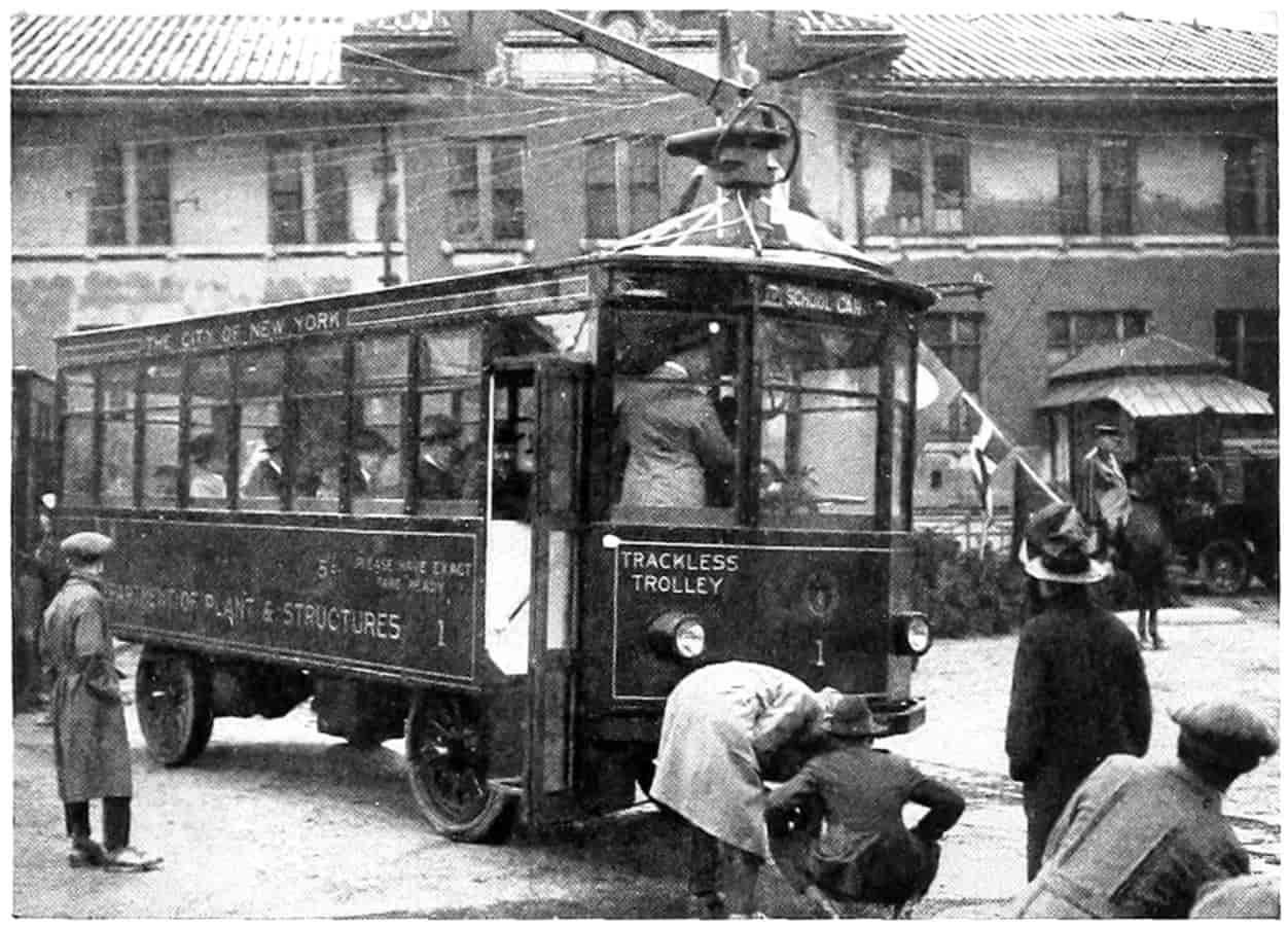
© Underwood and Underwood
TRACKLESS TROLLEY OPERATED ON STATEN ISLAND, N. Y.
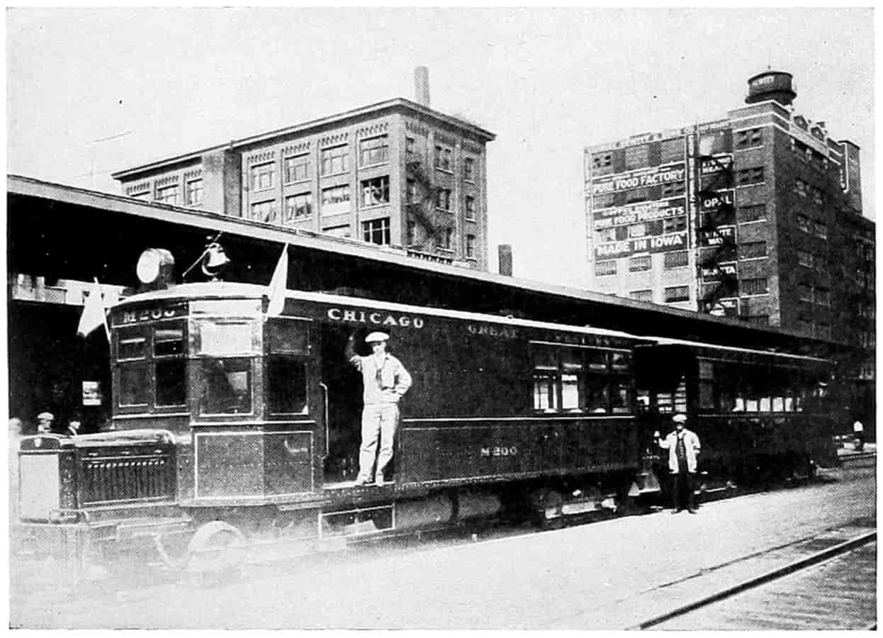
© Underwood and Underwood
GASOLINE LOCOMOTIVE AND TRAILER
Operated by the Chicago & Great Western R. R.
[167]
There is a legitimate field for these buses in the smaller cities and on streets in large cities not easily reached by, or upon which it is desirable not to have street-car tracks. But they should not be free lances—they should be under regulations as street cars are under regulations, they should make scheduled trips, they should be backed by capital or insurance sufficient to pay indemnities in cases of accident and upon payment of license fees are entitled to protection and possibly monopoly in their prescribed territory.
A cheap form of transportation, either electric trolley, with or without track, or buses, is absolutely necessary. Buses and individual jitneys cannot, where the business is heavy, carry passengers as cheaply as the electric street car, but for a more limited traffic the buses may take their place, and for still less traffic jitneys can find a useful occupation. If buses and jitneys are allowed absolute freedom without restrictions as to schedule or route they will skim the cream from the street transportation business and so reduce the revenues of the street cars that they will have to discontinue operation. A thing so undesirable that the public will have to subsidize the street cars and guarantee a certain percentage of earnings or take over their ownership, run them at a nominal fare and let the taxpayer take care of the deficit. By these means those persons who ride their own automobiles, the heavier taxpayers, who are, or should be, most vitally interested in maintaining cheap transportation for the unfortunate residue who cannot possibly afford automobiles, yet whose labor is absolutely essential to the industrial and commercial prosperity of the city, will be required to pay a portion of the upkeep of street-car transportation. If a subsidy be adopted it would be better that it should not be a direct guaranty of a fixed percentage of earnings for in that manner there is no premium on efficiency as our Government found to its cost in dealing with the railroads during the recent war. It would be better if some sort of a sliding scale could be[168] worked out whereby the lines should be relieved of occupational taxes or license fees in proportion as they lowered fares, and such that the lower the fares the greater the percentage of profit they might earn.
The contract or charter might provide that all earnings above a specified percentage, due allowance having been made for operation, repairs, and upkeep, on bona fide capital invested should be turned over to the city as a license for the use of the streets. For example with a fare of three cents the city might guarantee a 5 per cent income, but allow, by reduction of taxes and all payments to the city an earning of 10 per cent; on a five cent fare guarantee 3 per cent and allow earnings of 8 per cent; and so on as shown by the accompanying table the figures of which are merely illustrative:
| With a fare of |
The City Guarantees |
And allows an earning of |
|||
|---|---|---|---|---|---|
| 3 | cents | 4 | per cent | 10 | per cent |
| 4 | 3 | 1⁄2 | 9 | ||
| 5 | 3 | 8 | |||
| 6 | 2 | 7 | |||
| 7 | 1 | 6 | |||
| 8 | 0 | 5 | |||
To make a workable contract of this sort there would first have to be an agreement as to the corporation capital upon which earning percentages are to be based. If this could be made equal to the real investment it would be absolutely just to both the public and the corporation. However, the so-called unearned increment would in some cases have to be considered. Publicity in accounting, capitalization, bonded indebtedness and earnings, and the feeling engendered that the public is in a sense a co-partner with the corporation would add to more harmonious relations between the two.
Similar contracts might be arranged between bus lines and the city, or between bus lines and the state where rural[169] roads are used, and between railroad and other transportation corporations and the Federal Government for interstate lines.
Objection may be raised to this plan on the ground that it violates usury laws. Nearly every state in the Union provides by law for a maximum rate of interest. Laws of this kind have existed almost since the beginning of history and are so imbedded in the minds of the people that they believe 6 or 7 per cent is all a public service corporation should be allowed to make on its investment, when as a matter of fact all sorts of private businesses are making profits many times that amount without hindrance by law or public sentiment. People who risk money in adventures which are in general for the good of the public should be allowed returns fully as high as those suggested, even though they do go beyond the customary 7 percent. Whatever the right figures are careful accounting and publicity will have a tendency to establish, and once established they ought to be as stable and permanent as life insurance rates and thus encourage the investment of funds in such enterprises.
Legitimate Fields of Transportation Agencies.
—Agreeing, then, that the present systems of transportation should not be put out of business by less efficient ones, what seems to be the most feasible interrelations that will allow all of them to live and let live?
There seems to be no doubt but what the railroads can and do transport large quantities long distances quicker, better, and more efficiently than can be done on the highways. Highways may be considered as feeders of the railways. With good roads the zone from which the railway can profitably draw products for long distance or quantity transportation is widened, and again widened very materially when better roads allow the use of motors in place of horses. This, if no other railway interferes, means a larger grand total of traffic hauled. Again the character of the farming along the zone served by a railroad will depend upon the facilities for marketing as well as soil and[170] climate. Those products ordinarily called perishable may be raised if the roads are good so that they may be marketed quickly and cheap enough to compete with other localities. Such produce yield a larger net return per acre than the staple grain products. Intensive farming is usually necessary in such cases so that a smaller farm will support a family allowing an increase in rural population, a thing most highly desirable in this country. The railroad benefits again, then, because of the increased produce raised by intensive farming brought about by quick marketing facilities, and by increased freight and passenger traffic necessary to supply the greater population.
Furthermore, if roads were good throughout the year marketing would be spread over the entire period and there would not at times be a glut with corresponding scarcity of cars, and other facilities for handling. If cars, warehouses and elevators were sufficient to care for these periods there would be an over supply of facilities at other times and capital would be unnecessarily tied up producing larger overhead charges. With good roads there would likewise be less need for large quantities of money at particular periods of the year as uniform marketing would allow a smaller capital to be turned oftener. Moreover, unproductive branch lines would by the increased traffic brought to them by the improved highways be either made productive or they could be dispensed with altogether. The unproductive short-haul traffic would then be cared for by electric railways, motor trucks or even by horse wagons.
Intra City Traffic.
—Mr. J. C. Thirlwall, of the railway and tractive engineering department of the General Electric Company (General Electric Review, Vol. XXIV, pp. 974-985), discussing the fields of the rail car, trolley bus and gasoline bus, tabulates the respective costs of these types on a comparative basis for a variety of conditions. In general the calculations indicate that:
(a) Where rush hour headways of 3 min. or less are required with safety cars, rail cars are the most economical and[171] up to 6 min. headways offer successful competition to the other types where the road is a going concern.
(b) On longer headways the trolley bus appears to have the advantage due to the lower fixed charges.
(c) The gasoline bus on account of higher operating expense does not offer competition to the rail car until minimum headways of 10 min. are reached on new routes and 20 min. on existing lines.
(d) The trolley bus is more economical than the gasoline bus up to headways of 60 min. or longer.
A tabulation of the respective fields is as follows:
Minimum headways, 3 min. or less; rail cars.
Minimum headways, 3 to 6 min.; rail cars or trolley bus.
Minimum headways, 6 to 60 min.; trolley bus.
Minimum headways, 60 min. or more; gasoline bus.
This does not mean that existing lines with headways of 71⁄2 to 10 minutes should be scrapped and replaced with the newer forms of transportation. It would not pay to do this until a headway greater than 15 or 20 minutes has been reached.
Length of Haul for Economical Trucking.
—The railroads would not be alone in the benefits due to better roads. Truck lines could be established to care for freight and passenger traffic between farm and station. Here the truck and railroads would coöperate, there would be no competition, for each would be performing a function incapable (or unprofitable) of performance by the other; the net result would be a benefit to the entire community. But most transport lines that are being established come into actual competition with existing railroad lines. Just how far a motor truck may profitably compete with the railway depends, of course, on the relative costs of transportation. Mr. Cabot[162] calculates that twelve miles is the dividing line between motor truck transport and rail transport. He figures the cost of delivery and removal from the railway station at 15 cents per hundred weight, or $3 per ton at each end for terminal charges and that the cost of motor truck haul is at least 50 cents per ton mile. A ton[172] may be hauled, therefore, on truck, 12 miles to balance the railway terminal expense or charge.
A formula might be worked out this way.
| Let | x | = | the number of miles where rail and truck charges just balance; |
| m | = | motor truck charge per ton-mile; | |
| r | = | rail charge per ton-mile; | |
| t | = | terminal railroad charge-cost of collecting and delivery to the railroad plus the cost of removal from the railroad. |
Thus motor charge for x miles is mx and railroad charge for same distance is rx + t, equating these,
mx = rx + t.
Solving for the distance traveled,
x = tm - r.
With Mr. Cabot’s figures this formula gives
x = 6.00 .50 - .055 = 60044.5 = 13.5.
Using the cost 25 cents per ton mile made up by actual averages compiled by the Motor Truck Association of America and 5.5 cents used by Mr. Cabot as the railroad cost charge, there results
x = 6.00 .25 - .05 = 60020 = 30 miles.
It will be noticed that this formula contemplates no terminal charge for the motor truck as it is expected to pick up and deliver the freight at the doors of the consignor and consignee and that the cost of doing this is absorbed in the cost per mile. The dividing distance between profitable rail and freight transportation, x, is seen by the[173] formula to vary directly with the terminal charge and indirectly with the difference between motor and rail cost per mile. To lessen this distance is in the interest of the railroads and can be accomplished by decreasing the terminal charges and the cost of transportation per ton-mile. Express companies have for years accomplished this by employing the system of free collection and delivery, and railways in England do likewise. The motor transport companies will have to decrease their cost per ton-mile in order to increase the distance that it is profitable for the shipper to utilize motor trucks. If the difference in cost per ton-mile could be reduced to twelve cents with terminal costs at $6 per ton, and doubtless this may be done under favorable circumstances, the distance would be lengthened to 50 miles. This is probably the maximum motor truck haul which can in general profitably compete with rail transportation. With better roads, larger trucks, trailers, or, in special cases, with certain classes of goods and commodities, longer hauls will be profitable.
The distances which it seems profitable to do trucking are continually being lengthened. Forrest Crissey, writing in the Saturday Evening Post of December 16, 1922, relates a case in which household goods were hauled from Boston to Cleveland at a saving over rail rates and expenses incurred by delays of $417.50 on the shipment.
His figures summarized are as follows:
| Rail— | |
| Crating and Hauling to Station | $ 300.00 |
| Freight | 150.00 |
| Hauling and Uncrating at destination | 75.00 |
| Hotel Bill of Family of five, two rooms and board, while waiting | 525.00 |
| House rental while waiting | 67.50 |
| Total | $1117.50 |
| Van company’s charge from home to home | $ 700.00 |
| Calculated saving | $ 417.50 |
It should be remembered that certain kinds of goods,[174] such as household, lend themselves readily to truck shipments. With this class of goods expensive packing and several handlings are eliminated. Such is true of much merchandise which can be delivered directly from the store of the seller to the door of the buyer; to many varieties of manufactured goods which are sold within comparatively short distances of the factory. Each case should be worked out for itself and all the various kinds of transportation used that prove to be practical and economical. Where large concerns like packing houses are supplied with railway tracks right to their doors, shipping in car load and train load lots is not only more economical but absolutely necessary where such large quantities are transported in refrigerator cars. But for distribution to towns near-by the truck is much more convenient and economical. It is impossible to say for so-many-miles it is cheaper to ship by truck, because each commodity must be considered individually in connection with the character of the roads, the conditions of weather and climate, and the time of delivery. While the case of shipping household goods alluded to above proved very successful the next one might meet inclement weather, the truck might have to remain out in the rain and some of the goods become damaged, as was the case of one such shipment that came under the writer’s observation. A single swallow does not make a summer, but the trend is no doubt toward much longer truck trips. And as the roads and vehicles become stabilized and standardized this will be even more evident. For example, milk collected at stations 50 and 60 miles from the large cities can be hauled in to market in large tank cars which are built somewhat on the thermos or vacuum bottle principle, the milk arriving at its destination cooler and in every way better than if hauled in small containers. The truck has a large field open for its especial qualities. Let it confine its operations to these and rail competition will not injure it.
Short-Haul Roads Reduce Express Rates.
—The Boston[175] & Maine Railroad is reducing express rates between Boston and towns within a radius of 50 miles in an effort to win back short-haul traffic lost to motor trucks.[163] The average reduction is given as about 40 per cent on less than carload lots. The old rail service rate between Lynn and Boston was $1.50 per ton, 71⁄2 cents per hundred, with a minimum loading of 20,000 pounds per car, while the truck service charge is about $3 per ton, yet it is estimated that 80 to 90 per cent of the business was by truck. The reduced rail rate is 5 cents per hundred, $1 per ton with the minimum loading eliminated. It remains to be seen whether people are willing to pay a higher rate to ship by truck, or whether the trucks will meet the express rates. The railroads may still lower costs by one or two other devices: They may use lighter weight cars and locomotives; they may use gasoline motor cars such as the McKeen used on several branch line runs by the Union Pacific, or a motor car now being tried out capable of running on rails or on the pavements at will. Such a car would take advantage of the light traction on the rails between stations but could go through the main streets to pick up its load. A rail-motor bus following the main features of the street bus and embodying “the same elements of simplicity in construction, reliability in performance, flexibility in operation, light weight, and low first cost,”[164] has been built and operated at an average of 14 miles to the gallon of gasoline, a sufficient indication that it can save in operating expenses. The car weighs 11,000 pounds and has a maximum speed of 30 miles per hour, and when required trailers may be used without materially decreasing the speed.
Avoiding Waste.
—Such methods of cheapening and bettering railroad transportation together with a lowering of rates generally to a point that the traffic can bear, and the adoption of managerial methods that will lessen avoidable wastes, which the railroad unions estimate at one[176] billion dollars per year,[165] may eventuate in a rehabilitation and stabilization of the railway industry. The taking over by motor trucks of short-haul freight and passenger traffic, even though it cause the discontinuation of unprofitable branch lines may prove to roads but a pruning which will be beneficial and inure to the growth of the main trunk and remaining healthy branches.
[177]
William H. Manse, a member of the Congressional Joint Commission of Agricultural Inquiry,[166] has called attention to another economic waste. He states that “city freight houses were established when team hauling was the only hauling.” These now are the cause of much congestion because of the delivery there of tremendous amounts of less-than-carload freight. The loading and unloading tracks being limited much of the freight must pass through the depot necessitating double handling. Again, in the large cities a considerable percentage of land in the business section, stated to be from 25 to 30 in Chicago, is occupied by the railroads for tracks, road and station purposes. This land is worth from $10 to $50 a square foot, and if freight cars stand upon it intermittently for the receipt and discharge of l.c.l. freight, it is not earning continuously but, on the other hand, it is spending every minute in interest, taxes and maintenance. With demountable containers, which are described in Chapter VII, and the motor truck, and with concerted action of the railroads, much of this high-value land could be given over to other business and cheaper land farther out purchased for trackage.
Enough has been said to intimate a firm belief that the railways as purveyors of secondary transportation will persist. On economic grounds if for no other reason, for no cheaper method of transportation, except by water, has been devised; and secondary transportation over canals and rivers ought, for the good of the country, to be revived. There is a large class of freight that could with proper management travel at a slow rate of speed without any detriment or inconvenience whatsoever to the public.
Carve Out New Fields of Usefulness.
—It is quite likely that the newer systems of transportation, by inter-urban electric railways, by automobile and motor-truck, and by air-plane and dirigible, will all carve out for themselves[178] new grooves of usefulness, thus opening up for labor and capital new fields of endeavor. The telephone did not, as many believed it would, replace the telegraph; neither, yet, has “wireless” put “wires” out of use. The telephone, rural free delivery of mail, and the automobile have already put new life into agriculture. Farming has rapidly reached the enchanted plane of professionalism and men are as proud now of being farmers as they were formerly of being lawyers or ministers. And of the three instrumentalities named, the motor car, including the improved roads it makes necessary, has probably been most influential. In return the farmers have supplied themselves with motor vehicles most generously. These will result in the marketing of increased quantities of food and products that prior to improved roads and the introduction of the motor car it was unprofitable to raise because of the cost of transportation, or the time consumed in transportation, or the condition in which they reached the consumer. This, then, is one of the ways in which the motor car may be beneficial to both producer and consumer, that is to the entire public. In the more thickly populated districts the dairy interests practically depend upon the motor truck; milk reaches its destination in better condition than when hauled by horses and wagons or when delivered to the railway station, shipped by train, and hauled again to the distributing agency. Also in regions near the large cities vegetable gardeners and orchardists are becoming more and more dependent upon the motor truck for the rapid transit of their perishable products to the jobber, retailer, or even consumer. During the railway congestion in the period of the war, not only the dairymen, gardeners, and orchardists that supplied the large eastern cities were saved from ruin but the consumers themselves were saved from food shortage and hunger by the motor car.
This condition is not peculiar to the Eastern states, but applies to the grower of perishable products near every large market; it also applies to the raiser of live stock. During the congested period mentioned there was difficulty[179] to get stock cars in which to ship hogs, sheep, and cattle. Motor trucks were seized upon and last year there came to the Omaha stock yards in them more than 200,000 head of live stock, St. Joseph, Missouri, yards are said to be receiving 2500 head of live stock per day by motor truck. Sioux City, St. Paul and other markets report similar receipts. The record day at Indianapolis is given as 6800 head of live stock delivered to the stock yards in 500 motor trucks from a radius of 50 miles. Hogs delivered by truck to the early market at Omaha are said to be in much better condition than those received by train.
In some sorts of transportation light automobile delivery wagons will give best service; this is especially true where the distance between stops is such that considerable time may be saved by rapid transit. In still other lines a horse and wagon may be most efficient; this is especially true where the stops are continuous or nearly continuous along a street like a milk or ice route, and where a trained team can be started and stopped by the attendant from the street by word of mouth.
It seems then that there is room in this country for various kinds of transportation. The horse and wagon; the light motor and the heavy motor; the waterways; the electric railroad and the steam railroad. All should work together in harmony for the good of the Nation. The little handwheel that opens and closes the throttle valve is of as much importance to the big Corliss engine as the large and more spectacular flywheel; the black iron foundation, grimy with grease, as the bright highly polished brass band around the cylinder lagging darting and reflecting beams of light into the eyes of the beholder. Each has its own work to perform and if done well is deserving of equal honor.
SELECTED REFERENCES
Agricultural Inquiry, Report of Joint Commission on, Published by order of Congress, 1922, Washington, D. C.
Babson, Roger W., “Weekly Comment” of September 30, 1922, Syndicated.
[180]
Banham, W. J. L., “Motor Truck and Railroad Freighting,” Address delivered at Highway Transport Conference, 1920, published as a bulletin by the National Automobile Chamber of Commerce, New York.
Blanchard, Harold F., “Is the Day of the $150 Car in Sight,” Popular Science Monthly, January, 1923, p. 26.
Brosseau, A. J., “Is Highway Transport an Aid to Railroads?” Commercial Vehicle, Jan. 15, 1922. Also published in bulletin form by the National Automobile Chamber of Commerce.
Cabot, Philip, “Root, Hog or Die: The New Englander and His Railroads.” Atlantic Monthly, August, 1921, p. 258.
Chatburn, G. R., “Highway Engineering,” p. 5. John Wiley & Sons, New York.
Crissey, Forrest, “Our New Transportation System,” Saturday Evening Post, December 16, 1922.
Graham, George M., “Highway Transportation,” Proceedings of the Eighth Annual Meeting of the United States Chamber of Commerce. “The Motor Vehicle—Competitor or Ally?” National Automobile Chamber of Commerce.
Green, G. A., “Motor Bus Transportation,” Society of Automotive Engineers, Journal, 1920.
Johnson, Emery R., “Elements of Transportation,” D. Appleton & Company, New York.
MacDonald, Thomas H., “Federal Aid Highways,” Proceedings of the 8th Annual Meeting of the Chamber of Commerce of the United States.
Norton, S. V., “The Motor Truck as an Aid to Business,” Part I. A. W. Shaw Company, Chicago.
Riggs, Henry E., “Report of the Committee on Interrelation of Highway, Railway, and Waterway Transport,” National Traffic Association of Chicago, N. A. C. C., 1920.
Thirlwall, J. C., “Fields of the Rail Car, Trolley Bus and Gasoline Bus,” General Electric Review, Vol. XXIV, pp. 974-985.
White, Windsor T., “Benefits of War Experience,” Proceedings of the Eighth Annual Meeting of the Chamber of Commerce of the United States.
FOOTNOTES
[159] Chatburn’s “Highway Engineering,” Wiley & Sons, N. Y.
[160] Cf. “Root, Hog or Die,” by Philip Cabot, Atlantic Monthly, August, 1921.
[161] This estimate includes the following items:
| Heavy Car |
Light Car |
|||
|---|---|---|---|---|
| 2 Drivers | $8.00-10.00 | $10.00 | per day | $10.00 |
| Tires | 4.00- 6.00 | 6.00 | 4.00 | |
| Oil, etc. | .75- 1.00 | 1.00 | .75 | |
| Gasoline | 3.50- 5.50 | 5.00 | 3.50 | |
| Depreciation | 4.00- 6.00 | 6.00 | 4.00 | |
| Interest | 1.00- 1.50 | 1.50 | 1.00 | |
| Insurance | 1.00- 1.50 | 1.50 | 1.00 | |
| Garage | .50- 1.00 | 1.00 | .50 | |
| License, taxes | .75- 1.50 | 1.50 | .75 | |
| Repairs | .50- 1.00 | .50 | .50 | |
| 24.00-35.00 | $34.00 | 26.00 | ||
[162] “Root, Hog, or Die: The New Englander and His Railroads,” by Philip Cabot, in Atlantic Monthly, August, 1921, p. 258.
[163] Wall Street Journal, August 26, 1921.
[164] The Railway Review, Chicago, July 30, 1921.
[165] W. Jett Lauck, a union-labor economist, in a report laid before the Railroad Labor Board, specifies the avoidable wastes as follows:
1. Modernizing locomotives.—Gross reparable deficiencies are pointed out which it is claimed might be avoided by the applications of improvements such as superheaters, brick arches, mechanical stokers, feed-water heaters, there would result an annual saving of at least $272,500,000.
2. Locomotive operation.—The magnitude of the railways’ coal bill is considered and certain of the larger wastes calculated, and it is concluded that by use of better methods of coal purchase, coal inspection, careful receipt, and efficient firing of the locomotives, an annual saving could be effected of at least $50,000,000.
3. Shop organization improvements.—The sad and almost incredible inadequacy and out-of-date equipment of the railway shops is reviewed, and defenseless wastes considered, and it is conservatively estimated that by a proper shop organization an annual saving could be effected of at least $17,000,000.
4. Power-plant fuel savings.—The obsolete and wasteful condition of the power plants in the railway shops is considered, and it is estimated that in this field the possible saving of fuel would by itself amount to an annual total of $10,000,000.
5. Water-consumption savings.—The railroads’ expenditure in maintenance of way and structure is reviewed, necessary wastes noted, and it is estimated that easily attainable savings in the consumption of water alone would amount annually to $12,600,000.
6. Service of supply savings.—The expenditure of the railways for supplies has been inquired into and the avoidable losses surveyed, and it is estimated that the wastes and abuses amount annually to not less than $75,000,000.
7. Shop accounting savings.—Attention has been given to the matter of uniform railroad statistics and the use of efficient methods of cost accounting. An annual saving would be feasible to the amount of $10,900,000.
8. Labor turn-over savings.—The industrial losses due to unnecessary labor turn-over and to inadequate training of personnel have been reviewed, and it is estimated that the avoidable wastes incident to labor turn-over alone amount to more than $40,000,000.
9. Loss and damage savings.—Inquiry has been made into the amount of the annual damage account of the railways and into preventable causes of such losses, and it is estimated that an annual saving might be effected to the amount of $90,000,000.
Other alleged losses, he says, would bring the total waste to over a billion.
[166] Report of the Joint Commission on Agricultural Inquiry.
[181]
CHAPTER VII
AUTOMOTIVE TRANSPORTATION
Automotive transportation is a matter of such recent growth that only a few of the elements entering it have as yet become fixed or standardized—the whole question is still in the experimental or growing stage. The next few years will probably see as many, if not as radical, changes in equipment and operation as have the past few. The law of evolution seems to include a period of slow growth or sort of weak feeling-out; then a period of very rapid growth, developing usually along several lines; and finally a ripening or fixing period in which standardization is reached. The automotive industries are now beginning the third period. Revolutionary changes are not to be expected, but there will be many minor ones seeking efficiency or economy. The machinery of transportation, the motor car and the roadway, are, perhaps, in a later stage of standardization than are the social and legal phases of the subject. The relative rights of the people on the street and driver of the car have yet to be determined. The relation between automotive transportation and the older forms of transportation is still in a very formative stage. Plans and organizations for operating systems of highway transport and methods of accounting which shall be fair to owner and patron have in a large measure yet to be developed.
These things must necessarily be true in a new and growing industry. Why, encyclopedias published in the ’eighties make no mention whatever of the motor car or automobile. In fact, the first practical automobiles were[182] put on the market after 1893, and trucks were not sold as such until 1903, ten years later. This was about the period when automobiles were being made over by change of body into “business wagons.” But so rapidly has the use of the motor car grown, automobile registrations increasing from about one million in 1912 to more than eleven millions in 1922, that, so it is stated, 80 per cent of all cars manufactured are still in use.
Automotive transportation may be considered to include all conveyance from one place to another by means of motor vehicles. A motor vehicle is one which carries within itself the source of mechanical power which propels it providing that source be not muscular. This definition would include the tractor, the road roller, the torpedo, and the locomotive, which are ordinarily excluded. For the purposes of this discussion an automobile or motor car may be considered as a self-propelled vehicle which transports a burden other than itself as a weight upon its own wheels. This will exclude the tractor and the locomotive, which though self-propelled, are intended to draw other vehicles rather than to carry the load; also the road roller and the torpedo, which have no burden to transport other than their own weights. Some definitions would confine a motor vehicle to one designed to move on common roads or highways. However, motor cars are now being used on railroad tracks; they are entitled to and should be allowed the use of the name. The automobile may have as the source of power internal-combustion engines using such fuel as gasoline, kerosene, benzol, and alcohol; it may use steam generated by these fuels; or an electric storage battery charged by sources outside the engine may furnish the propelling force. The load transported will either be passenger or freight. Passenger traffic may be classified as business or pleasure. If a vehicle is used mostly for business, first cost and economy of operation may play a more important part in the purchase of the car than if used for pleasure, in which case appearance and luxurious appointments may be the deciding factor.

The Evolution of the Steam Automobile
- 1. The Cugnot Steam Carriage—1770.
- 2. The Trevithick & Vivian Steam Carriage—1801.
- 3. The Gurney Steam Carriage—1827.
- 4. The Church Automobile Carriage (Steam)—1833.
- 5. Gaillardit’s Steam Carriage—1894.
- (Courtesy of the Scientific American.)
[183]
Business Passenger Traffic.
—All machines that haul passengers for hire, that are used as a means of performing, promoting, or extending business relations, while so used, may be rightly considered business machines and the traffic business traffic. The physician who finds that he can quadruple the number of his daily calls; the traveling salesman who can double the territory covered and do it much more efficiently; the business or professional man, of whatever kind, who uses his automobile in going from one place to another in the performance of his duties; the farmer who comes to town to get his mail and information relative to markets or otherwise to assist him with his farm industry; and the multifold other uses which are for the advantage of financial or industrial enterprise may constitute a legitimate business passenger traffic. The transportation, however, by taxi-cab, jitney or bus is considered by many persons to be the type that should be classified under the term business passenger traffic.
Jitney and taxi-cab traffic are of vast importance in the cities and are of real economic use in furnishing a rapid means of transit from point to point. The jitney is usually a privately owned vehicle not especially constructed for the business, which plies with more or less regularity over a route that may or may not be set out in the owner’s license. In early days the price of a ride was a “nickel” or “jitney” hence the name.
Taxi-cabs are regularly licensed automobiles that carry passengers for hire, usually making the charge dependent more or less upon the distance traveled, which is registered by a taximeter. For example, the charge may be 25 cents plus 15 cents per mile or fraction thereof. This would make the charge for distances less than 1 mile, 40 cents; from 1 mile to 2 miles, 55 cents; from 2 to 3 miles, 70 cents; and so on. The driver usually turns the taximeter up to the fixed charge plus 1 mile, if fractions are counted as full miles, when the passenger enters, and the instrument adds on as the cab travels. Of course the taximeter may be made to register every quarter, every fifth, or every[184] tenth of a mile, or even continuously. A special waiting charge is made if the cab is held by the passenger. Taxicabs are variable in form, from “flivvers” to limousines. Many of the larger cities are supplied with cabs owned in quantity by substantial companies which put on a line of cars usually all alike and painted with some striking feature or color. The larger ones are limousines seating five or seven passengers in the tonneau and one on the seat with the driver. Some of these cars are almost luxuriously fitted with fine cushions and special lighting. They have speaking tubes or electrical devices to signal the driver. The drivers for the large companies wear the livery of the company. Taxis, as may be inferred, have no established routes, but go wherever the passenger may desire.
The motor-bus is well established both in city and cross-country traffic. As at first made motor-buses consisted of special bodies with seats placed upon freight truck chassis. This did not prove altogether satisfactory because of their excessive weight, too much of which is “unsprung.” They also have a high center of gravity, high floors, long turning radius and rather rigid suspension. A bus, to be efficient, durable and comfortable, should be especially designed. There should be lightness and strength; small unsprung weight; a low center of gravity; a flexible control; special transmission; wide treads; ample wheel base; short turning radius; low step entrance and exit; low top clearance; curb receipt and delivery of passengers; ample brake capacity; and high lowgear efficiency.[167] Pneumatic tires on account of their resiliency make the bus much more comfortable for the passengers by absorbing shocks, and for the same reason they also increase the life of the car and make it possible to travel faster. Cushion tires are next in order of merit and are an effort to combine the durability of the solid tire with the easy riding qualities of the pneumatic. Tests made by the U. S. Bureau of Public Roads show that the cushion or semi-solid tires stand between the solid and the pneumatic as regards riding comfort. With many bus operators a combination equipment is being used—pneumatics are used on the front to protect the engine and gasoline tank from vibration and cushion tires on the rear where the hardest wear comes.
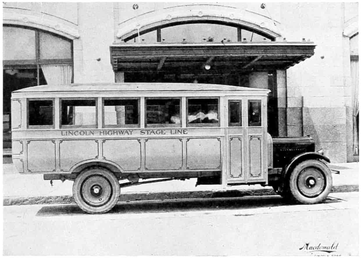
A MODERN RURAL PASSENGER BUS
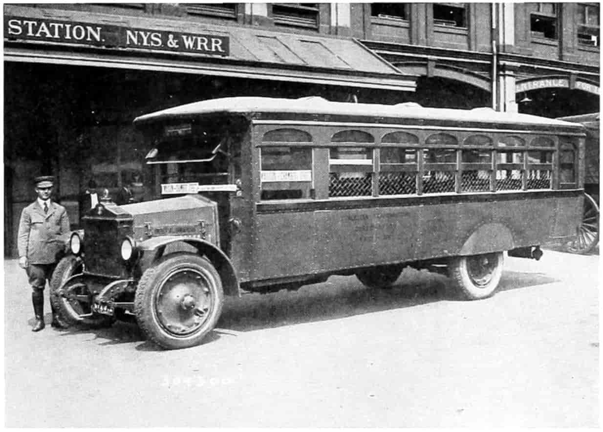
© Underwood and Underwood
A NEW YORK CITY “STEPLESS BUS”
It Has an Emergency Door, with Wire Window Guards, and will Seat 30 Persons.
[185]
Buses are made both single and double deck. The latter are in demand where traffic is large and also where sight-seeing is an important item, the upper deck being usually open to the weather.
The fare charged by the bus is either the same or in many cases a little higher than that by the trolley car, but the bus has the advantage in that it can travel over streets where the trolley is not allowed, can usually make better time, and can load and unload at the curb, thus avoiding danger from passing vehicles, a matter of no little importance to timid passengers. The trolley car is able to haul large numbers at a less expense. In such cases no passenger transportation is cheaper. But the field for the auto bus is wide and no doubt it will come more and more into competition with the street car and steam railroad lines. The former, whose single and primary business is transporting passengers, are already complaining bitterly of the inroads made upon their business by the privately owned automobile and motor bus. The automobile is the larger factor because there are more automobiles than buses. Since about every tenth person owns a machine which can accommodate from two to seven passengers, one can readily see the importance of this item to the traction companies. The result has been a falling off in passenger fares, which the companies have endeavored to offset by increasing rates, and this in turn has only accentuated the trouble by driving more men to automobiles. The only way the street car can hope to compete with the motor car is by keeping its rates low and hauling large numbers of passengers. The handiness of the automobile, going at the instant wanted, avoiding the usual walk of two or three blocks to and from a car line at the beginning and the end of the journey, the consequent saving in time, coupled with the[186] exhilarating effect of riding rapidly through the open air furnishes a great handicap which the traction companies will have difficulty in overcoming. About the only things the street car has in its favor are cheapness and dependability. It can no doubt be shown that it is cheaper to patronize the trolley than to own and operate the average car. The street car will go in rainy or snowy weather when motor cars must be laid up. But the average American does not count cost; he thinks more of his own comfort and doing as his neighbors do, i.e., being in style. It may become necessary, as stated in another chapter, for the public to take over the street-car lines, run them at as low rates as possible for the accommodation of those who cannot afford motor cars, since their work is an absolute necessity to the community, and charge any deficit to the taxpayers.
There seems to be another feasible and legitimate use for the motor bus which may help the street car companies as well. That is extensions by means of buses at the ends of the car lines or into territory not well served by them. The bus might collect passengers from an outlying district and bring them to the car line where the trolley can take them on to the heart of the city. Thus motor buses will become feeders rather than competitors of the regularly established traction lines. The car companies should attempt to take advantage of this sort of thing, using either the trackless trolley or gasoline motor, as may be thought the more suitable for the situation in hand.
Cross-country motor service has proven quite feasible and scores of buses now leave every large city for the surrounding smaller towns. The bus seems to negotiate a 50-mile trip very easily at a speed of approximately 20 miles per hour including stops. These buses or stages carry from 12 to 20 passengers and are operated by one man; they are well sprung and equipped with pneumatic tires. For country traffic seats cross ways of the car are much more comfortable to the rider than lengthwise seats. Their usefulness[187] seems to lie in suburban traffic or as feeders to railroads.
Such buses are also largely used as carriers of children to and from consolidated schools. The little red school house, wherein began the educational training of so many of our great men, of which silver tongues have orated, whose virtues have been painted in poetry, and praises commemorated in song, cannot stand against the superior advantages of the consolidated graded school brought near to the pupils by the advent of the automobile. Since each consolidated school with about five teachers replaces eight to ten ungraded schools, and since it is easier and cheaper to maintain and heat one consolidated school than eight ungraded schools, the advantage is economical as well as educational.
Another place where the motor bus seems extremely well adapted is in the transfer of travelers from one railroad terminal to another. Railroads contract with transfer companies to do this and a coupon, a portion of the traveler’s ticket, is detached by the bus-man when the transfer is made. To one who is not used to the city this is a great convenience. In the city of Chicago, through which many long-distance tourists pass and through which no or at least few railroads extend in both directions, hundreds of such transfers take place daily. Passengers and baggage are thus taken care of on a through ticket with despatch and little inconvenience.
Pleasure Passenger Traffic.
—Vast and important as may have become the business passenger motor traffic, purely pleasure travel by automobile probably exceeds it. Of the more than ten million motor cars licensed in the United States perhaps 80 per cent of them were purchased not for their use in the business of the owner, although that might have been the final excuse that consummated the deal, but for the pleasure the purchaser and his family would get from owning a car. The great car industry which has sprung up like a mushroom during the past quarter century may thank the people’s desire for personal pleasure[188] for its tremendous prosperity. The movie picture industry is another instance of the same character; likewise the newest epidemic to attack the people—radio. It is not claimed that these have no economical uses. But the business and economical uses have followed rather than preceded the pleasurable uses. There are many who think the automobile fad, like the bicycle fad, will eventually wear out and the whole automobile question settle down to a purely business basis. Such a thing is not likely to occur, however. The automobile is a much more perfect pleasure machine than is the bicycle. The knack of riding a bicycle has to be learned and requires considerable muscular exertion. It is not the thing a tired person eagerly turns to for recreation and rest. Anyone without exertion and with complete relaxation may ride in an automobile. Soon there comes a desire to drive the machine; then complete relaxation while no longer possible is replaced by a mental effort which drives out all thought of business, all care and anxiety regarding the ordinary affairs of life. The mind for the driver’s own safety must be confined to his effort to manage the machine and make it go where and as he wants it to go—change of work is often better than complete relaxation, although the latter has its beneficial effects in the treatment of diseases.
For these reasons then, if for no other, the use of automobiles to cater to the pleasure propensities of the people will continue. There are very few persons who do not enjoy an automobile ride—they are only the timid who fear accident. The recreational and pathological benefits to be derived cannot be overestimated. During the recent war the Government gave much attention to the entertainment of the soldiers and endeavored in many, many ways to divert their minds from the serious side of war. So with the people generally. They are much better off for pleasurable diversions and the automobile furnishes these in a very high degree.
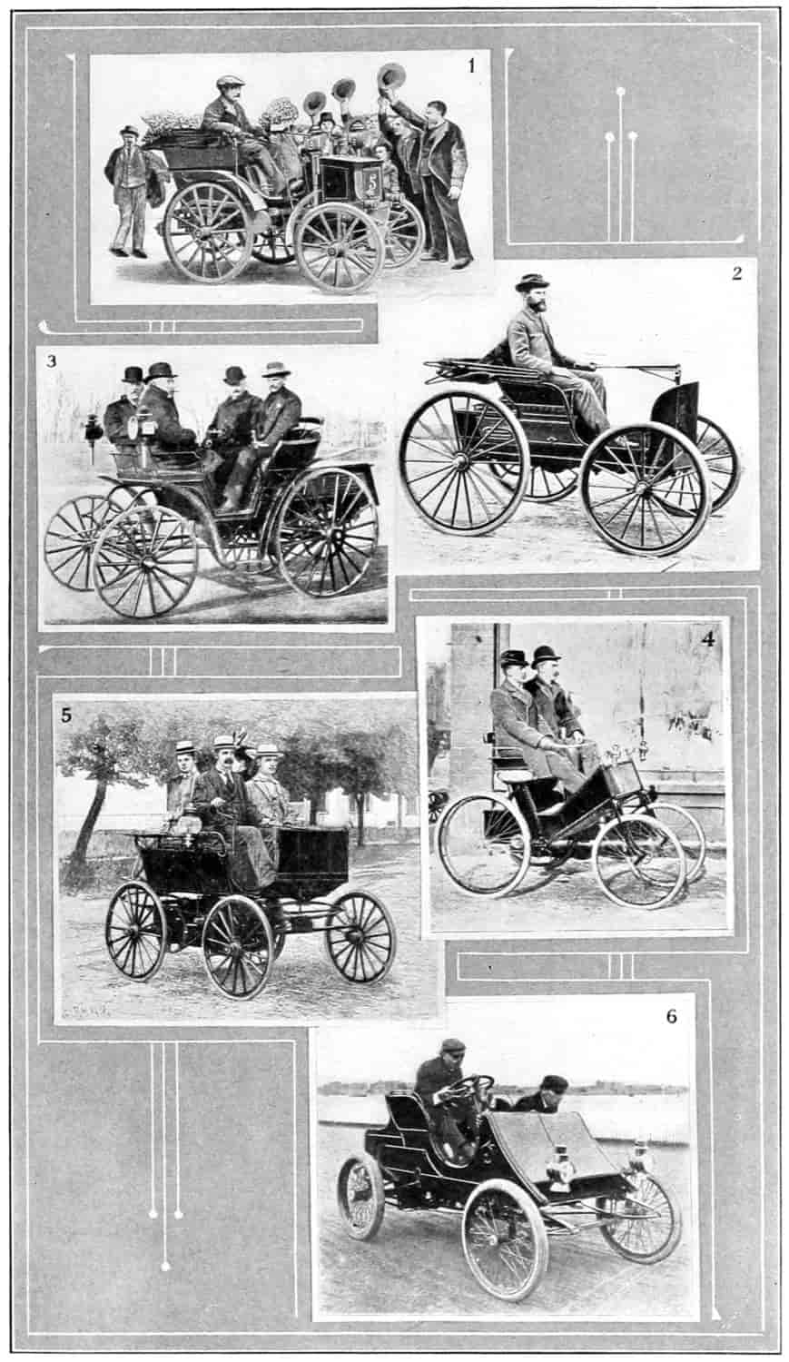
The Evolution of the Gasoline Motor Car
- 1. Panhard & Levassor Carriage—1895.
- 2. Duryea Motor Wagon—1895.
- 3. The Benz Motocycle.
- 4. Hertel’s Gasoline Carriage—1896.
- 5. The Olds Horseless Carriage.
- 6. Winton’s Racing Machine.
- (Courtesy of the Scientific American.)
[189]
If, then, there be included under the head of pleasure passenger traffic all not purely business it may with propriety be estimated that three-fourths of all automobile travel is for pleasure. Considering ten million automobiles in use in the United States, that they average 4000 miles per year and carry two passengers each, there results a total passenger mileage of
10,000,000 × 4,000 × 2 = 80,000,000,000
80 billion miles. A number beyond ordinary comprehension. The passenger mileage upon the steam railroads is roughly speaking about 371⁄2 billion miles, a little less than half as much as that by automobile. It is evident that all this travel, even though a large percentage be local, must affect seriously the earnings of the steam and electric railway lines. Since 75 per cent may be estimated to be for pleasure purposes, it will not be possible for the steam and electric lines ever to regain it. The people who do the dancing are perfectly willing to pay the piper, and even though automobile riding cost more than trolley or train riding the people will continue to have it as a means of entertainment.[168] Most men who own cars pay the expenses in lump sums and forget about them. To have the speedometer register in dollars and cents instead of miles, while[190] it might be a deterrent on the use of the automobile, would “take the joy out of life.”
Freight Traffic.
—When it comes to freight traffic cost and time will be the principal factors to determine the type of performance. The element of pleasure is here eliminated and only cold economical features remain. Already horse trucking is rapidly disappearing as it seems to be able to compete with the motor only where many stops are to be made. In large cities motor trucks are utilized to haul packages to certain districts at considerable distances from the store, where they are turned over to small wagons for delivery. Ice and milk are often distributed in the same manner, thus taking advantage of long rapid hauls upon fully loaded trucks and less expensive delivery wagons where many stops are to be made and smaller loads are to be carried. Even in delivery service some merchants have by carefully arranging and timing their routes brought the cost of delivery to below ten cents per parcel. All purchasers of goods at the store whether delivered or not should be interested in reducing this cost because usually in the accounting it is spread out over the entire turnover and charged to the expense of doing business. It may be possible that in a few years horses will be barred from the streets for sanitary reasons; then it will be necessary to use motors for all sorts of deliveries, possibly large ones for hauling to the distant districts and small ones for the house to house delivery in the district.
In very congested districts motor trucks are at a great disadvantage because they cannot be used at their most efficient speed. If the congestion can be eliminated or at least relieved by such means as one-way traffic, paving parallel streets, removing buildings which obstruct passage, widening driveways, elevating railroads and street cars, supplying overhead crossings, making subways, or by careful rearrangement and planning of terminal facilities, warehouses, and other accommodations, the cost of transportation in the large cities may be materially reduced.[191] In many such cities public service commissions are studying these questions and applying remedies which will allow motor trucks to operate at a greater rate of speed and much more efficiently.
Accurate observations of motor truck performance in city trucking business has shown that a large part of the day is given up to loading and unloading, that the truck stands still so much of the time that the cost is more nearly proportional to time than to mileage. Since certain charges such as interest and insurance go on whether the truck is idling or not, it is better to keep it moving. To do this effectively depots, warehouses, and other terminal facilities are provided to lessen the time of loading and unloading. It may be wise to hire an extra stevedore or two to assist with these operations, or mechanical devices may be installed where the saving will justify it. Usually there is not only a saving in time when a mechanical device is used but the amount of expensive manual labor is decreased.
Among the practical devices used are removable bodies. The whole body of the truck may be swung by means of a crane from the chassis to a platform where it is loaded or unloaded while the truck with another body is proceeding on its way. Other bodies are so arranged on rollers that they may be readily rolled from the chassis to the platform. Railways are also taking advantage of removable bodies for the shipment of less than car-load lots. These bodies are made to fit a truck and also of proper sizes so that several of them may be nested or interlocked upon a flat car. One of these units or containers may be left for any length of time for loading then rolled upon the truck and off it to the steam train. At the other end of its journey it is rolled from the car to the truck and from that to the unloading platform with a great saving of time at each terminal. The New York Central railway places nine containers of 6000 pounds capacity on one flat car. These are unloaded by means of a crane in less than five minutes for each container, or the whole car in approximately[192] forty minutes. By this means the railroad is able to take advantage of what has been called store-door delivery. Instead of the consignor hauling its goods to the station and unloading them on the platform to be loaded into cars by stevedores, transported, unloaded into the warehouse, and the consignee notified to come for them, the railway leaves a container which when filled is hauled by truck to the railway yard and in five minutes’ time placed upon the car, which upon reaching its destination is placed upon a truck and hauled to the consignee. Goods shipped in these containers which may be made of steel and securely locked are considered just as safe from predacious hands and the weather as in a way car, and possibly are safer.
The demountable container which is rapidly coming into general use, and which has for some time been used by the New York Central Railroad and the interurban railways of Australia, consists of a large steel box or safe, the doors of which can be locked. When it is placed upon a steel flat-car with sides two feet high it cannot possibly be opened as the doors are on the side of the container. And it cannot be removed from the car without the use of a derrick, the top corners of the container being equipped with hooks for this purpose. The containers have a capacity of 438 cubic feet and will hold from 6000 to 8000 pounds of package freight. When the packages are locked and sealed within the containers they are safe from fire and rain as well as marauders. One flat-car will accommodate from 4 to 9 containers, depending upon their size.
In addition to the safety furnished by these containers they are economical in saving time of transportation. Re-handling is unnecessary. The transfer of the entire container from truck to car and from car to truck is very quickly made. The mileage of the flat cars is thus greatly increased—with mail cars it is claimed to be doubled. Expensive packing and crating is avoided and the checking at each rehandling of parcels is eliminated.
Mass loading or unloading, whether the whole truck[193] body is swung off by a crane, rolled off, or even if trailers and semi-trailers are left to be worked upon after the truck has gone, save little in the way of manual labor. On the other hand they require the installment at each end of the route of special arrangements to facilitate their use.
Another class of devices are those connected with the truck itself. For example it may have a winch on it to draw up an inclined plane at its rear such heavy articles as pianos, safes, and large castings. It may have a crane with a pulley running along a central beam over it to facilitate loading and unloading heavy boxes or other things. A swinging crane is also used with some trucks. On others, hoists are arranged to tip the body backward for unloading building and road materials, grain, and so on. Many of these devices make use of the truck power for their operation. Pumps with suction hoses empty catch basins, cess-pools, stopped-up sewers and flooded cellars, pumping the fluid to a tank body of the truck, whence it can be hauled away and dumped by elevating the front end of the tank and opening a gate in its rear. Devices for lifting and dumping coal truck bodies directly into the bin save much time over hand shoveling.
Still another class of devices are entirely separate from the truck and may or may not be connected with the warehouse. For example a chain conveyor which can be rolled up to the back of a truck elevates barrels and boxes, sand and stone, and is operated by a small electric motor the lead wires of which are plugged into a suitable socket, up to the floor at the rear of the truck from which place they can be easily pushed or shoveled to proper position. Elevated bins are utilized to store road materials from which the materials run by gravity into the body of a small motor-car which then goes to the mixer where it is grabbed by a device that empties the body into the mixer, thus saving much handling of material.
Many special types of bodies are made for peculiar purposes. These often facilitate loading and unloading, for[194] example tank ears for hauling water, milk, gasoline or other fluids; or trucks fitted with shelves on which are placed trays containing fruits and so forth. As the motor truck enters newer fields of usefulness multiple devices will be developed to lessen the time of loading and unloading. The financial importance to both the owner and the public of keeping the truck moving will no doubt lead to the adoption of these devices providing they are practical and will accomplish the desired result.
Traffic between Towns.
—Wherever the roads are dependable and passable at all seasons of the year truck and bus lines have sprung up to ply regularly between the towns. The length of haul most profitable seems to be that over which the motor can make the round trip each day and have sufficient time at terminals for loading and unloading. Forty to 50 miles for trucks and 60 to 65 miles for buses seem to be negotiable and double these distances are proving to be practicable. In many of the states such enterprises have been declared to be common carriers subject to the laws governing such carriers, and must secure licenses to do business from the public service commissions. It is but reasonable that the public should be safeguarded and these concerns be required to take out insurance or give indemnifying bonds to cover loss of goods to shippers by carelessness or theft or injury to passengers by accident. On the other hand the licensed motor transport is entitled to protection against irresponsible truckers. The modern method of state regulation does not contemplate competition as an economic factor in the determination of rates and routes. The old doctrine of “everyone for himself, and the devil take the hindmost,” is certainly most wasteful. This is about the way that method worked. A starts a bus line between two towns. After he has run it a short time and built up a trade B, seeing his success, decides to put a competing bus on this same route. Then there is a period of competition. Rates may be cut and speeds quickened until each bus is running at a loss. This cannot continue indefinitely. The result is that either one man goes[195] out of business or there is a combination of interests by actual coalescing or by a “gentlemen’s agreement,” so that there is practical monopoly anyway. The modern method is to regulate all common carriers as far as rates and routes are concerned so that each may make a justifiable profit. This may be tending toward socialism and away from individualism; it may be a violation of the Darwinian doctrine of a survival of the fittest. But that is departed from every day. Our cornfields and gardens would amount to nothing if the weeds were allowed undisputed sway.
It would seem to be the duty, therefore, of public service commissions to grant licenses to truck and bus lines, to establish routes and equitable rates, to require careful and complete accounting and to make public from time to time such items as the people may be interested in.
The Railway Commission of the state of Nebraska was, perhaps, the first public service commission to exercise the right of regulating highway transport (1918). Colorado, California, and other states soon followed. In California the matter came upon a complaint that adequate service was not given by the railway and the decision was:
“We are of the opinion that the public deserving transportation of freight and express ... is entitled to a more expeditious service than that at present being given by the Southern Pacific and American Railway Express.”
It went on further to state that notwithstanding their ability to give service the evidence was to the effect that it was not given, hence motor highway transport was licensed.
The first highway transport freight rates established by the Railway Commission of Nebraska placed the freight under four classes, describing 103 items. The rates were:
1st Class 20 c. plus (11⁄2 c. per mile per 100 pounds).
2d Class 85 per cent of the 1st class.
3d Class 70 per cent of the 1st class.
4th Class 60 per cent of the 1st class.
In addition they established rules and regulations, standard bills of lading, etc. These rates have since been rescinded.
[196]
In Colorado two sets of rules were adopted, one for the prairie and one for the mountain division. For the prairie division the minimum charge was 25 c. and the mountain 30 c. per 100 pounds. The rates for motor truck hauling was made, for the prairie division, 30 c. per 100 pounds for 5 miles and for distances up to 100 miles graduated 5 or 10 c. for each additional 5 miles until they reached $1 per 100 miles. For the mountain division, the rate for 100 pounds carried 5 miles is 36 c., graduated to $1.20 per 100 miles.
Motor Bus Traffic.
—Suburban and interurban motor bus passenger service is growing rapidly. Buses accommodating as high as sixty persons are being used on the haul where the roads are well paved, but twenty to thirty seems more popular. At present these buses seem to be well patronized, usually bringing their passengers to the larger city in time for business or shopping and returning them home in the afternoon or evening. The rates of fare for bus travel are about the same as those for steam car travel, or approximately 4 c. per mile. The rate of travel depends upon the character of the roadway and the condition of traffic, being usually routed upon dependable but less congested roads.
Just what may be the outcome of this traffic is problematical. Can the buses compete with other forms of transportation in fares and speed? If so, they will survive; otherwise they will gradually discontinue. Some writers seem to think they will not only live but will eventually kill the older forms of transportation. Although they will no doubt take over very much of that transportation it seems highly improbable that all transportation can be taken care of by motors.
To and from the Farm.
—Farm trucking seems to be firmly established and very much if not all farm hauling will eventually be done by automobiles. Very many farmers now own their own trucks and the number is constantly being increased. Glowing statements by government officials, reports of investigational committees, and[197] propaganda by manufacturers and dealers have worked up the farmers’ desire for trucks. A congressional joint committee on agricultural inquiry has recently stated that,
No single development since the railroads were first constructed has had so marked an economic and sociological effect upon productive life as the motor vehicle. Previous to its appearance the economic zone of transportation was sharply defined by the haulage range of the horse and the cost of such transportation.
There is the evidence of no less a person than Secretary of Commerce Herbert Hoover that the farm motor truck will be of vast importance to the agricultural interests of the country. Here is his statement:
Fifty per cent of our perishable foodstuffs never reach the consumer because the farms on which they are raised are too remote from the market at which they are sold.... Forty to 60 per cent of our potato crop is lost each year by rotting in the ground owing to poor transportation to market because of inadequate transportation over long distance.... By motor trucks the farmer will be able to reach better markets farther away than now by horse and wagon. He will be able to spend more time actually producing on his farm and be able to sell food more cheaply by eliminating the present tremendous waste. By use of the motor truck the farmer will be able to produce more and sell at less cost.
Some of the arguments advanced in favor of the farm truck are:
(a) The motor truck allows the farmer to haul larger loads, longer distances in less time, thus reducing the actual cost of haulage.
(b) That he can better take advantage of market fluctuations and thus be able to sell at high markets.
(c) That a truck on the farm will replace several horses; that the cost of keeping these horses far exceeds the cost of keeping a truck.
(d) That the truck may be used to market produce while the horses are busy in the field.
(e) That the truck will allow land otherwise too far[198] from market to be farmed with perishable but better paying crops.
(f) By means of trucks the farmer is often enabled to put his hogs or other live stock on the early morning market in less time from the farm and consequently fresher, gaining the advantage of better prices.
While there may be some question as to the validity of all these assumptions they are no doubt, in the main, correct. The United States Department of Agriculture, Bureau of Crop Estimates, collected data showing that in 1918, the hauling in wagons from farm to shipping point cost on the average for wheat 30 cents per ton-mile; for corn, 33 cents; for cotton, 48 cents. For hauling by motor truck the average costs were: wheat, 15 cents; corn, 15 cents; and cotton, 18 cents. These unit costs were, consequently, reduced to less than half by the use of the truck. The same bulletin gives the average length of wagon haul for these products to be 9 miles, and of motor truck haul, 11.3 miles; furthermore the average number of round trips by wagon per day was 1.2 while by truck it was 3.4.
Whether or not the truck on the farm will release any horses will depend on what determines the number of horses kept. To do his hauling does the farmer keep more than is necessary for farm operations alone? The passenger automobile, no doubt, did release many driving and riding horses, but will the truck release many more? The thoughtful, foresighted farmer usually plans his yearly work so that he may do his hauling when the horses are not otherwise busy. This of course limits his farm operation to products which, like wheat and corn, can be stored indefinitely. This limits also diversified cropping which farmers find in the long run to be very much safer than “putting all eggs in one basket” by raising a single product. It is seldom that a wheat crop, a corn crop, a beet crop, a hay crop, an apple crop, and gardening crops all fail by drought, wet weather, hail, or other untoward events during the same season. Good roads, trucks or anything[199] else which will lend assistance to diversified cropping are without doubt beneficial to the farmer.
Intensive farming of perishable crops can be done only where the roads allow daily contact with the market. The truck, because of its more rapid speed, will widen the zone of such farming very much over the old zone when the horse-drawn vehicle was in vogue. Because of the risk involved and the labor necessary the net returns per acre for this sort of farming are high, allowing small parcels of land to keep a family. As the distance, or rather time, the “fourth dimension,” from market increases the less intensive the farming operations and the less net returns per acre. The community as a whole is deeply interested in widening the zone of intensive farming in order that more people may profitably make a living upon this land.
Persons who are not familiar with stockyard activities will be surprised on visiting them early in the morning at any one of the packing-house industries to see the large number of hogs and other farm animals arriving for the early market in motor trucks. These animals have been brought from distances up to 60 miles, but have been on the way less than three or three and one-half hours. Careful stockyard figures show that in 1921 more than 6,000,000 cattle and very many more hogs were transported in motor trucks. These animals upon arrival are very much fresher and show less shrinkage than those that have been driven to their home station and loaded into stock cars the day previous. Other things being equal, the top of the market is accorded to the fresher animals. Also for short hauls, say up to 60 miles, the transportation costs are in favor of the trucks.
The farmer may obtain the benefits of motor transportation in at least four different ways: (a) He may own and operate his own truck. This pays when the farm is of sufficient size to keep the truck reasonably busy. (b) Two or more neighbors may coöperate in the ownership of a truck. This is applicable to small and medium-sized farms. (c) By patronizing truck lines privately owned which haul[200] products, freight, and express upon a charge basis. (d) By the trucks of the United States Postal Service.
Whether or not it pays for a farmer to own and operate a truck depends upon the size of the farm, kind and quantity of the commodities hauled, distance from market, character of the roads, and the loading on the back trip. A small farm could not be expected to furnish sufficient hauling to keep a truck busy unless intensively farmed and producing commodities which require frequent marketing. Even a small farmer, though, might by hauling for neighbors keep his truck reasonably busy. Or several neighbors may coöperate in the purchase of the truck and arrange how it shall be operated. They may even form an express line and go into the transportation business as a side issue.
The parcel-post service has been very successful in handling packages of produce even as large as a case of eggs. The post-office department allows its carriers to pick up and deliver packages along the route the same as letter mail. Privately owned Rural Motor Express vehicles are also operated successfully which pick up and deliver all sorts of express packages, farm produce in small quantities, fruit, butter, eggs, and cream. Trucks which haul nothing but milk and cream are quite common. The farmer leaves his full cans of milk or cream at a specified place, usually a platform at a level with the truck floor, on the roadway. The driver of the milk truck picks up the full cans, leaving empties in their place. Or he may pick up the full on his way to the market, creamery, or railway station, and leave the empties on his return. Such routes are both privately owned and coöperatively owned by the several farmers patronizing them. Often these trucks deliver the milk and cream to the railway in time to catch a special milk train into the city.

HAULING BEANS BY MOTOR TRUCK AND TRAILER
Sacramento Valley, Calif.

HAULING SUGAR BEETS TO MARKET IN A MOTOR TRUCK
[201]
Since the trucks come directly to the farmer’s gate to pick up and deliver express or freight, the convenience is much greater than the service given by either the steam railway or the interurban trolley. As a result the trucks will probably be patronized when the railways would not. The habit of sending eggs, cream, and other perishable products daily to the market is formed. The daily credit the farmer receives amounts to a considerable sum by the end of the month when he collects from the dealer. Many farmers much more than pay living expenses from the sale of small items utterly ignored before the days of the motor express.[169] Even the farmer who owns his own truck could hardly afford a daily trip of several miles and the time entailed to market small amounts of cream, eggs, vegetables, and fruits, but the express man by combining the incoming and outgoing commodities of many farms can without much expense to anyone do a very good business for himself at an economic benefit to his patrons.
If the farmer, or several farmers, desire to purchase a truck it would be well first carefully to consider the question with an idea of finding out the character and amount of trucking at hand and then purchase a machine best adapted for the purpose. The kind of bodies available should be studied, remembering that he may wish to haul grain on one trip, hogs or sheep on another, then cream and vegetables. He will want, probably, to haul back groceries, flour, feed, lumber, hardware, implements, fertilizer, cement, and gravel. In looking ahead he should estimate the increase in the quantity of hauling that more rapid transportation, the going to more distant markets, and the possible raising of different products which may come about through the owning of a truck, will bring to his farm. In this connection the reader is referred to the chapters on “Highway Transport Surveys” and “Effects of the Ease and Cost of Transportation on Production and Marketing,” given later.
Terminal Facilities.
—Railways have found it advantageous to spend enormous sums of money upon terminal facilities. Depots and warehouses, garages and repair shops will be necessary if truck lines are to prove efficient[202] and successful. It would be quite feasible and profitable for all the truck lines leading from a city to have a union or common terminal station. Portland, Oregon, has such a station owned by a corporation composed of bus lines that operate from there to every city of any importance within a radius of 100 miles. The terminal resembles a railroad depot with waiting rooms, ticket office, announcer, and conveniences. Buses load and unload on a platform at the rear of the building reached by a drive-in from the street. Patrons remain in the waiting room until the bus is announced. Two buses are sent out if more than enough tickets are sold for one. Under the present schedule 150 departures in 21 different directions are provided for. This gives the farthest cities two stages per day while many closer ones are served hourly.
Some of the advantages of a terminal station may be inferred from the above. Another is that the total number of clerks and employees may be cut down, for one clerk can route goods on half a dozen different lines almost as easily as on one, and there will be no competition between lines, except by service, if the public service commission has allowed no duplication of lines and establishes rates. Much of the freight and express will be brought by the shipper to the depot, where bills of lading will be made out and charges paid. To be sure, large shippers may desire freight to be picked up elsewhere, or small express trucks may be used for this purpose, but orders for this can conveniently be phoned to the central office and directions given from there accordingly. Similarly one garage and one repair shop may easily look after the cleaning, repairing, oiling, and fueling of several cars more economically than could each keep its separate shop or even go to a commercial shop.
The terminal building may be arranged, if desired, so that it can be used jointly for a passenger station, a freight depot and a storage warehouse. If for a passenger station there would be need for the agent’s office, waiting rooms, and toilet accommodations for men and women. The[203] freight depot is a place for the collection of freight and should be arranged for convenience and rapid loading and unloading of the trucks. The installation of devices for this purpose may become advisable as the amount of traffic increases. Storage room should be provided for those articles which are to wait some little time for shipment. A check stand to care for parcels is a convenience to passengers and furnishes the company some revenue.
The Social Aspect of Motor Transportation.
—The change from poor roads and horse-drawn vehicles to good roads and motorized vehicles has produced in society changes quite as radical. These changes are not entirely separate from economic changes and one cannot always say that this particular thing or that particular thing is due to the automobile alone because every activity in life has its effect on every other activity. As the waves upon a pond circling about the point of shock come into contact with other waves their effect is enhanced, minimized, or transformed, and just what part of the resultant may be due to one agency or to another agency is impossible to decipher. That each has entered into a combination with the whole and affected the result there is no doubt. For example it is claimed that because of the prevalence of pleasure riding the giving and receiving of dinners and teas have very greatly diminished. No doubt the high cost of living has had its effect also. Clothiers and haberdashers complain that automobile owners finding it impossible to keep grease spots from their clothing, are now buying an inferior grade and losing the art of good dressing. Builders claim that the expense of buying and maintaining an automobile has prevented many persons from making needed repairs on houses or even building new ones. As people live most of their leisure time in the car a very small apartment will accommodate them for the remaining time. Fewer books and newspapers are read, it is claimed, and there is less attention paid to the cultural niceties of life. People go riding in the evening, so the Sunday evening church service is not attended.
[204]
An editorial in the Nebraska State Journal of August 31, 1921, puts the matter piquantly, at least:
The savage determination with which the American is sticking to his automobile despite the drop in his income is an occasion for wonderment and no little irritation with a lot of us. For the sake of economy we may have to exchange our seven passenger for a light six or one of the little fours. Beyond this we need not go. But the farmer, yelling his head off at the fall in corn prices, what does he mean by sticking to his car? Your mechanic resisting the inevitable fall in wages, would be well enough off if only he would give up trying to ride like a millionaire. These merchants, claiming they aren’t making a living, don’t give up their cars, you will observe. Why pity them, then?
Thus does the general assumption that the automobile is a super-luxury impinge upon the fact that the automobile has become a prime necessity. You laugh. Well, go inquire what are the other things the people will sacrifice before yielding up their speed machines. A sharp automobile manufacturer assured a gloomy harvester manufacturer the other day that not only would the men do without harvesters rather than lose their cars, but the women would yield up their very chewing gum. Yea, more than that, their pretty clothes. Food is, of course, a superior necessity, but even that can be reduced and simplified in favor of gasoline.
As to houses, we like to be conservative, but there is a perfectly obvious disposition to put house shelter second to automobile shelter. That is why the house shortage isn’t hurting us as we expected it to hurt. The people are in automobile camps. Observe the sudden energy in developing automobile camps. They are wise. It looks now as if half the population will have deserted houses and flats for their automobile tent within another year or two.
In winter time a corner of the garage will do well enough for a living room during the few minutes at a time we are at home. If we insist on a separate house, then the tendency is toward a very small one. What is the sense in maintaining a big house not to live in? That is the way our minds run now. This will help the lumber men to understand why building doesn’t pick up as it should. And that is how we manage to keep the car while incomes fail. It is done by cutting out such unnecessaries as houses and furniture and clothes and heavy dinners.
America has been living at a fast gait on its nerves. Isn’t that which we see now the natural reaction from the nervous overstrain of fixed habitation and the relaxing ways of the nomad?[205] The automobile came along in the nick of time to furnish the transportation, and off we go. The universal gypsy is breaking out in us. This isn’t more than half moonshine. It is at least half solid fact, with economic and social consequences which, whatever they prove to be, will be important.
The above editorial indicates that people are beginning to notice the social changes being brought about by the automobile, and more, they are ascribing them to the automobile. Changes usually come about so gradually that, like the hands on a watch, the movement can be noticed only by comparing what is with what was some time previous.
Rapid transportation and rapid communication has extended Broadway clear across the continent. One writer by taking an automobile tour found the American world extends from ocean to ocean, that the hat she purchased in New York had its duplicate in every millinery window all the way across to Los Angeles. She further found that the people between were not all “hicks,” and that farmers did not go around with alfalfa on their chin and straws in their mouths as shown in the cartoons of the funny section. Some farmers play golf on their own pastures. The fact that the sack containing their clubs is often tied with binding twine is of no consequence.
The social intercourse which good roads and the rapid moving automobile makes possible between neighbor and neighbor and between country and town tends to produce a more homogeneous people. Each gets the view point of the other, which reacting modifies his own. Factions are largely broken up. Tolerance gains sway and more satisfaction and happiness results.
High wages and profits during and following the war led the average citizen to purchase some of those luxuries which before then he was unable to afford. He has had a taste of a “higher standard” of living. No wonder he objects to a return to pre-war conditions, no wonder he objects to giving up his automobile, the thing which has furnished him with more pleasure than his previous humdrum life[206] believed possible. No, he will fight to maintain the new standard and new living conditions. A social revolution has taken place, and in traveling about the spiral the world is one step higher.
And while some will for a short time be content to live in one corner of the garage, as the editorial writer opines, the natural longing for a home will assert itself. By the aid of the automobile property will be bought in farther-out district where lots are cheaper, where taxes are not so high, where there is more breathing space, and healthful conditions are more likely to prevail. Men of wealth can build suburban estates, and men of less means comfortable homes leaving the downtown apartments and tenements to those who cannot yet afford motor cars, and many there be, more’s the pity.
It will be a good thing to have the farms near large centers of population divided into smaller tracts whereon by intensive cultivation can be supported many families. Here there is always a demand for garden products which by means of a small car, or through the agency of motor express lines, can be marketed daily. It does not require a very great deal of land to support a poultry farm from which there will be a continuous income. By diversifying crops something will be coming in at all seasons.
Good roads and the automobile not only make it possible to diversify farming but make the home life in the country less monotonous. No trouble to go after supper 12 or 15 miles to the town to take part in civic affairs, to attend a lecture, watch the movies or go to church. No extra horses need to be kept for these purposes, neither are the farm horses deprived of their rest. While the swift ride through bracing air rests the weary farmer after his day’s toil in the fields and gives new life to his faithful spouse upon whom the lonesomeness of isolation lies the much more heavily.
Salesmen have in great numbers provided themselves with automobiles large enough to carry their samples. With these they can make many more towns than when[207] they were compelled to depend upon trains and the small-town livery stables. The result is either a wider territory or more frequent calls upon customers.
Hotels, during the summer season, especially, if located on one of the popular cross country roads, are seldom without tourist guests. Nina Wilcox Putnam[170] states that from Washington westward the “wily tourist will always wire ahead for rooms, and preferably two days ahead. The truth is that the best places to stop are not nearly large enough to accommodate the crowd.” Speaking of these hotels she finds them well equipped, clean, and well cared for. There is no doubt but that the automobile tourist traffic has had its effect, too, upon them. Each spring they clean and spruce up with the idea of securing as much of this traffic as good service reported by the camaraderie of travelers all along the way will bring to them.
Mention has been made of the country people going to the larger cities to market their products and purchase goods wanted. It is not considered at all unusual for country and small town people to auto 30 miles to patronize the large department stores in the city. If a trade which satisfies both trader and tradee is beneficial and of economic importance to both then this would seem to be a good thing. The selling of the goods is beneficial to the store-keeper because he makes his profit. The trader has a large variety to select from and having made a voluntary selection is satisfied, because he or she may secure exactly what the city cousin gets.
But what is to become of the business of the country store-keeper? How is he to get along? The best thing he can do is to put upon his shelves goods of a standard quality. His rents and overhead are less than those of the city competitor; he, therefore, can sell at a less profit. This is so true that the writer has known of city dwellers going to the country store for these standard articles. Such interchange while of economical importance is also sociological[208] in differentiating between city and country merchandising and in bringing together in a new way the city and country dwellers.
Consolidation of Rural Schools.
—The people of the United States have been justly proud of her public schools. No one has ever considered them to be perfect, but the influence exerted upon the minds of the growing children has been wholesome. The very life of a republic depends upon an educated citizenry. With thorough education along right lines there is no reason why the nation should not live forever. To obtain such an education as is commensurate with right living and with the upbuilding and maintenance of our government and civilization requires that every means at hand should be utilized. The broadening, informational, and unifying influence of the automobile should not be underestimated. Edison’s theory that the movie should supplement the textbook because visual education is remarkably interesting and effective, needs more than a passing thought. The instruction which the young people receive from parents, from associates, from newspapers, magazines, and miscellaneous books, from civic organizations of various kinds, and from Sunday school and church cannot be overestimated. Neither should be forgotten the vast and important education which comes through the hard knocks of experience.
An illustration of what the public schools may do for the preservation of the country can be drawn from the history of the Great War, the worst and the fiercest the world has ever seen. During that war the patriotism of the people shone forth with undiminished luster. The response to the President by the citizenry of the country, whether of his own or opposite political faith, by every honest organization, public or private, by business and professional men, by Congress and legislatures, was all but unanimous. This surprising unanimity was, no doubt, due to the influence of the public schools. The public schools have always inculcated patriotism and loyalty, and these lessons were potent as was evident because even before the[209] draft many young men with Teutonic names took their places with others whose forebears were of other nationalities as well as with those of long-standing American descent. Therein went astray one of the guesses of the enemy, namely, that our Teutonic citizens with their children would prove more loyal to the “fatherland” than to democratic America. The lessons of patriotism the children brought home from school, the stories of Valley Forge and Yorktown, of Gettysburg and Appomattox, were communicated to their parents and penetrated deep, so that only a moiety of our foreign born element could be classed with the enemy. Thus have the public schools in this great melting pot of the world been the conservators of liberty.
The effect of the public school upon the ideals of peace is no less than that upon their state of mind during war. Every day examples are so plentiful they need not here be mentioned. Suffice it to say that it should be made possible for all the young people to come under the influence of the public school learn the American’s Creed, and be steeped in the symbolism of the flag that stands for true democracy.
Changing Concepts of the Public Schools.
—Schools have continually had to change with changing society. During the pioneer period, and that extended through many years from the first settlements along the coasts, and the occupation of the great fertile areas of the mid-west to recent efforts to subdue the semi-desert and desert regions of the farther west, the schools taught for a few months only a little reading, writing, and arithmetic. The farm and home life supplemented this with manual labor and the attainment of skill in making and repairing necessary articles and machinery by the boys, and the arts of home making, weaving, and cooking, by the girls, thereby completing a well-rounded education for the times. But with the increase in population there came a division of labor and specialization. This meant that the simple school of the pioneers could no longer fit for life, hence[210] new and additional subjects were added to the curriculums, until at the present time no one pupil can hope to complete all the work given by the larger secondary schools. The changing character of society caused the earliest private schools to be transformed into semi-private and semi-religious schools, and these to tax-maintained schools. The graded schools in the larger communities were found to be more efficient than the ungraded. In country districts the advantages of the graded system could only be brought about by consolidating several small schools thus enlarging the districts to get sufficient pupils. This made distances from home so great that walking to and from school was no longer possible; pupils must be hauled. Considerable progress was made in such schools with horse-drawn vehicles, but not until the advent of the motor bus was attained anything like a practical solution of the problem. So rapidly has the consolidated school made its way that now there are more than 12,000 such schools served by motor buses. Since a six-room consolidated school will replace about nine small schools the greater efficiency of a graded school extending through a longer school period is gained at little if any increased cost. In the years to come the results of these schools must have a marked beneficial effect upon the entire country.
Rural Mail Delivery.
—The development of the Rural Mail Delivery and its relation to the better roads movement has been touched upon in Chapter V. It will only be necessary to say here that the psychological effect of a daily mail upon the inhabitants of the rural districts has been most remarkable. Through its means these people are no longer isolated, they know daily what is transpiring in the world; they are thinking of the great questions of finance, politics, and what not, at the same time as their fellows in other parts of the country. The nation is thus more or less unified, the country dweller looks and thinks of himself as an integral part of the whole. Rural mail, telephone, the automobile, modern home conveniences and, now, radio telephony are rapidly making agriculture one[211] of the great and desirable professions. The rural home need no longer be a place where there is nothing but ten hours’ work and six hours’ chores. The farmer of to-day, with his daily paper, his market reports, his books and magazines, his furnace-heated and electric-lighted house, his automobile ready at hand, is better off, more independent, and should be more happy and contented than those who dwell in the murky city.
The Automobile and Health.
—“Health is something more than strength, it is a universally good condition,” according to Munger. The automobile, by inducing people to get more into the open air, may be considered to be a prophylactic, and something that will bring them into that universally good condition. The forgetting of business, the obliteration of household cares, the unstringing of high-tensioned nerves by a swift run like a swallow in its flight over smooth and undulating roads brings rest with relaxation, and cure with comfort. Then away from the mad’ning crowd, away from close poorly ventilated rooms, away from foul-smelling germ-laden cars, to the roads, to the hills, to the country with their varied shades of living carpets, with freshening winds and glad’ning brooks, with bees, and birds, and flowers into nature’s great laboratory where are brewed nectars and panaceas for the ills which infest mankind.
But all cannot have automobiles, pity ’tis, ’tis true, but all may have the benefit of fresh air and the style for an open air life set by those who can afford to drive the “red flyers,” the “quivering arrows,” the “bear cats” or the “poodle dogs,” have been followed by the less fortunate hoi polloi. Thus outdoor exercises and amusements have been popularized.
While motoring may not be the best form of exercise, may not bring into play as many muscles as walking, horseback riding, or rowing, say, it must be remembered that not many can have horses to ride or boats to row and walking is too slow. Gymnasium exercises or even home gymnastics are not exciting enough to keep one practicing, so[212] that the outdoor life of the present day, brought about largely by the automobile, has had a more wholesome effect on the people generally than perhaps any other measure.
Styles of clothing have kept close pace, and the garments now worn by both men and women are both comfortable and sanitary, allowing freedom of bodily movement. It is to be hoped that the same influences which induced such hygienic clothing will continue and that never more may the autocratic demands of style force people into close-fitting uncomfortable, unsanitary wearing apparel. For years hygienists, health reformers, and physicians preached against tight lacing for women without results until the automobile came to their assistance. Until very recent years women’s long skirts have swept clouds of germ-laden dust into the air from sidewalks to be breathed by all passers-by. All men know that their present dressing, while it might be bettered, is so much more comfortable than formerly that they have much reason for rejoicing. Formal dressing except for an occasional party has almost disappeared. In the summer time men may be comfortable on the streets without coats. But the women, though more responsive to style changes, now go the men one better and abandon long sleeves and high collars.
Medical science, always alert to adopt modern improvements, was one of the first to take advantage of the time-saving benefits of the automobile. Its universal use by physicians and surgeons, allowing them to reach the bedside of sick patients more quickly and allowing them to visit more patients in the same time, is certainly a pathological asset of great value. Automobile ambulances called in emergency cases save the lives of many injured persons by getting them quickly to the hospitals and under the care of competent medical and surgical attention.
From a purely sanitary point of view good roads have been great agencies for health. Clean streets, clean pavements, and clean roads are much more wholesome than the mud puddles and quagmires that formerly served as passageways for man and beast. In order to get better[213] roadways drainage was resorted to. Ponds and standing water along the side of the road were done away with, at the same time obliterating the breeding places of the myriads of mosquitoes that always abounded in summer time. Since mosquitoes are carriers, as is well known, of such diseases as malaria and yellow fever, the consequence has been a very great reduction, almost elimination, of these ailments.
Again just as the use of the horse on the highways has diminished, so has the summer pest of flies grown less. The favorite breeding place of the housefly is horse dung. When nearly every house in both city and country had its stable with a pile of horse manure by the door flies bred abundantly. The fly has been convicted of being a most energetic distributor of typhoid and other bowel complaints, hence the distruction of its breeding places will be the most effective means for its extermination, and with it one of the most virile sources of contagion.
Thus, upon analysis, it may be seen that the influence of the automobile extends throughout the whole domain of life, changing and modifying nearly all social customs. It is called into use at the birth of the babe to bring the physician to the bedside of the prospective mother. It is the correct equipage at the wedding and starts the bride and groom upon their honey-moon and, it is to be hoped, a happy journey through life. And finally, it bears the remains to their last resting place in the silent city of the dead.
The Automobile and Crime.
—But not always have the changes produced by automobiles been in the interest of better living. Criminals and those who verge upon criminality have been quick to employ the superior advantages of modern means of rapid transit to assist them in their nefarious work. Automobile theft has taken the place of horse thievery, and automobiles are used daily as a means of getting to and getting away from the place of the crime. Trucks are utilized to haul the loot. Since the adoption of prohibition laws motor cars have been seized upon by[214] booze runners as a convenient vehicle for transporting liquor from one place to another, thus becoming an aid to “bootlegging.” In several of the states cars used for illegally transporting intoxicants are confiscated upon discovery and sold by the state. Drastic laws also deal with operators and owners.
Highway robbery of trucks hauling goods across country is reported. In New Jersey two trucks were robbed of $120,000 worth of merchandise. In other places express drivers have been held up and relieved of their money. One of the earliest improvements of the roadways of England was due to the prevalence of highway robbers—the brush and trees were ordered to be cut from the highway in order that their might be fewer lurking places for robbers.[171]
Here the results of robbery may lead to interesting possibilities. For instance if the trucks above mentioned as robbed in New Jersey were owned by the shipper the $120,000 is a dead loss to him unless he had insurance. Even if the trucks were owned by a small capitalist he would probably not be able to recompense the shipper. Had it been lost on a railway it would have been paid for. If motor shipping is to continue shipments must be covered by bonds or insurance. Even then there is a loss to the public when outlaws seize a loaded truck and drive it into wilds whence its contents can be disposed of at leisure. Shall truckers, like the ancient caravans of the deserts maintain guards with long guns to fight off marauding Bedouins? The western stages of some years ago furnished employment as guards to the quickest shots in the world. Is it the duty of the community to make its highways safe for transportation or must the shipper take the risk and employ guards and machine guns?
[215]
Vandalism.
—Complaints are made that those who drive or walk to the country are often guilty of vandalism and disregard for the rights of property. Note this editorial utterance in the Saturday Evening Post of June 17, 1922:[172]
On Sunday one dare not leave one’s farm or country place unwatched or unprotected for a moment. The whole countryside is aswarm with Nature lovers from the near by city. First come the makers of forbidden beverages, trooping across fields and lawns, picking the once despised dandelion and anything else that happens to be loose; then the happy motorists in long procession, embowering their cars in the spoil of orchards, woodlands, and wayside shrubberies. If there are no flowers near the road these free-and-easy visitors will penetrate one’s garden and break off the blooming branches of the rhododendrons or lilacs or whatever other bush happens to engage their fancy. With trowel and spade the woods are looted and sometimes, if it looks safe, an unwatched garden. Following come shy maidens, in twos and threes, daintily pulling up the woodland flowers by the roots—arbutus, azalea, and a hundred little blossoms that wilt in the hand that picks them; and everywhere are bands of half-grown hoodlums helping in the spoiling of the countryside.
The bolder spirits are usually those who come in motors. They can destroy more, steal more, and get away faster than the man on foot. They meet remonstrance with effrontery and resent the notion that a hick has any rights of property and privacy that they are bound to respect. The flowers, the shrubs, the orchards, and occasionally the unguarded gardens are their prey. They camp beside the woodland brook or the shaded spring, hack the trees, trample the flowers, and turn the spot into a garbage hole with their greasy papers, tin cans, bottles and refuse food. Then up and away to the snug flat in the big town, throwing out the wilted flowers as they go.
Spooning in automobiles parked along the roadways is a subject of regulation in the city of Omaha. An ordinance makes it a misdemeanor subject to fine.
However, the motor car will not be discarded or outlawed because unscrupulous persons put it to illegal and immoral purposes. A net cast into the sea gathers fishes of every kind, and among the wheat there will always spring up tares.
[216]
Conclusion.
—The world cannot now get along without the motor car. What was a luxury yesterday has become a necessity to-day. Automotive transportation is carving out a path for itself. While it perhaps will take much from the older forms of transportation it can never hope to supplant them. The final result will come only after the world has had opportunity through competitive experience to determine which is most economical in time and money and which is most desirable and comfortable from a personal or a sociological standpoint for the various purposes and various kinds of transportation.
At present it would seem as though the automobile will be used more largely than ever: I. As a pleasure and business vehicle driven by its owner for passenger traffic: (a) for local travel near home; (b) for short runs from town to town; (c) for more extended tourist traffic, and (d) for the use of salesmen. II. For pay passenger traffic: (a) Taxi-cabs in the cities: (b) Motor-bus service in the cities either in competition or in conjunction with street car service; (c) motor bus service to suburban and outlying districts; (d) motor bus service between towns up to 75 or 100 miles, with towns not more than two hours apart, (e) motor bus service between railway terminals. III. For freight and express traffic: (a) Haulage of farm products to market or shipping point in owner’s truck; (b) Haulage to market of perishable farm products in rapid going privately or coöperatively owned trucks; (c) Heavy trucking lines through farm districts; (d) Light express lines through farm districts; (e) Suburban or radial distribution of goods from large cities; (f) Short-haul traffic between towns; (g) Short branch-line or stub-end transportation to be taken over by trucks either in competition or conjunction with railways; (h) Trap car and store to door service by railways; (i) Terminal distribution allowing cars to be loaded and unloaded at a greater distance from congested centers; (j) Terminal distribution between different lines of railway or between railway and waterway either to relieve congestion or where there is no physical[217] connection; (k) Longer hauls where there are no rail facilities; (l) Logging and lumbering formerly done by horses, oxen, or even light railway, (m) Rural mail service, and IV. By modified or combination motors: (a) Trackless trolley; (b) Rail motors.
Addendum.
—Since the above was written President Harding has issued the annual legislative message to Congress (December 8, 1922), in which he discusses at some length the transportation problem in the United States. Among other things he says:
Manifestly, we have need to begin on plans to coördinate all transportation facilities. We should more effectively connect up our rail lines with our carriers by sea. We ought to reap some benefit from the hundreds of millions expended on inland waterways, proving our capacity to utilize as well as to expend. We ought to turn the motor truck into a rail feeder and distributor instead of a destroying competitor.
It would be folly to ignore that we live in a motor age. The motor car reflects our standard of living and gauges the speed of our present-day life. This transportation problem cannot be waived aside. The demand for lowered costs on farm products and basic materials cannot be ignored....
Government operation does not afford the cure. It was government operation which brought to us the very order of things against which we now rebel, and we are still liquidating the costs of that supreme folly.
Surely the genius of the railway builders has not become extinct among the railway managers. New economies, new efficiencies in coöperation must be found. The fact that labor takes 50 to 60 per cent of total railway earnings makes limitations within which to effect economies very difficult but the demand is no less insistent on that account.
The President then urged merger of railroads, pooling of equipment and a central agency to aid in their financing and to suggest economies. This portion of his message was evidently inspired by the great labor strike during the summer of 1922, and the subsequent shortage of cars and inadequacy of transportation facilities. He argued that there “should be a guaranty against suspended operation. The public must be spared even the threat of discontinued service.” He then recommended[218] an abolition of the Labor Board as not being “so constituted as best to serve the public interest.” This board is composed of three members selected by the railways and three by railway employees, and three by the Government. According to President Harding “it is inevitable that the partisan viewpoint is maintained throughout hearings and in decisions handed down. Only the public group of three is free to function in unbiased decisions.” He, therefore, suggested the abolishment of the partisan membership and that the work of the board be performed by or in very close contact with the Inter-State Commerce Commission which already has supreme authority in rate making to which “wage cost bears an indissoluble relationship.”
When a president of the United States takes up so much of his annual message with transportation and the relationship which the different forms bear to each other, when he argues for harmony between them and between them and their employees, there is certainly reason for study and legislation which will bring about just and adequate methods of administration, operation and regulation.
SELECTED REFERENCES
Agricultural Inquiry, Report of Joint Commission on, Part III deals with Transportation, Washington, D. C., 1922.
Alden, H. W., “Automotive Obligations Toward Highway Development,” Journal of the Society of Automotive Engineers, Vol. VIII, pp. 161-162, 426-432.
Automotive Industries.—“Automobile Service Stations,” Vol. XLVII, pp. 174-175; “Automobiles in Postal Service,” 178-179; “Cost of Operation of Bus Lines,” 482-483; “Motor Trucks on the Farm,” 315; “Railroad Officials Recognize Truck as Transportation Ally,” Vol. XLIII, 1201-1203.
Baker, C. W., “Relative Economy of Truck and Railway,” Engineering News-Record, Vol. LXXXIII, pp. 52-67.
Bassett, W. R., “Avoiding Industrial Traffic,” Industrial Management, Vol. XLI, pp. 342-346.
[219]
Blanchard, A. H., “Traffic and Transportation,” Canadian Engineer, Vol. XL, pp. 129-131.
Blum, H., “Transportation of Bulk Freight,” Kali, Halle, Germany.
Bus Transportation.—“Baltimore Service,” Vol. I, p. 484; “Motor Buses,” 479-80; “Bus and Electric Railways as Essentials in Transportation,” by G. A. Green, 293-295; “Battle of the Bus and the Street Car,” by F. H. Warren, 85-88; “New Englanders Hold Meeting to Study Motor Bus and Trackless Trolley,” 124-129, 191-193; “Railway Men Discuss the Bus and its Relation to Rail Transportation,” 195-196.
Davis, F. W., “Motor Truck Transportation,” Engineering News-Record, Vol. LXXXV, pp. 1194-1195.
Donnelly, William T., “Comparison of Cargo Transportation,” Marine Engineering, Vol. XXV, pp. 899-903.
Engineering.—“Bringing the Food to the Table,” Vol. VI, pp. 387-391.
Electric Railway Journal.—“Report of Committee on Trackless Trolley Transportation to the American Electric Railway Association,” Vol. LX, pp. 576-577; “Freight and Motor Truck Competition,” Vol. LVI, pp. 157-160.
Development of the Automobile:
Hiscock, Gardner D., “Horseless Vehicles,” Norman W. Henley & Co., New York, 1901.
Homans, James E., “Self-Propelled Vehicles,” Theo. Audel & Company, New York, 1902.
“History of Automobile Carriages,” reprinted from La Nature by the Scientific American, Vol. LXXII, p. 389, June 22, 1895.
Many other articles in the Scientific American, some of which are: “Ponchain’s Electric Carriage,” Vol. LXX, p. 69; “The Tachocycle,” p. 181; “Gaillardet’s Steam Carriage,” p. 200; “Simonds’ Steam Wagon,” p. 398; “Bicycle of 1816,” Vol. LXVII, p. 180; An Account of an automobile race from Paris to Bordeaux with descriptions of some of the machines participating, LXXIII, p. 40; “An English Horseless Carriage of 1827,” p. 214; “Duryea Motor Wagon,” p. 293; “Petrolium Tricycle,” p. 234; “Kane-Pennington Victoria,” p. 293; “The Benz Motocycle,” p. 315; “De La Vergne Motor Drag,” p. 377; “Steam Omnibus in London, 1833,” p. 404.
Firestone Ship by Truck Bureau, Bulletin No. 6, “Consolidated Rural Schools and the Motor Truck”; Bulletin No. 7, “The Motor Truck Terminal.” Akron, Ohio.
[220]
Facts and Figures, 1922. “Motor Bus Aids Rural Education,” National Automobile Chamber of Commerce, New York.
Greenough, M. B., “Motor Trucks and Highway Transportation,” Engineering and Contracting, Vol. XLIX, pp. 157-158.
Johnson, Emory R., “Elements of Transportation,” D. Appleton & Co., New York, 1909.
Lacy, V. E., “Inland Waterway Transportation,” Journal of the Society of Automotive Engineers, Vol. VIII, pp. 59-62.
Lane, F. Van Zant, “Motor Truck Transportation,” D. Van Nostrand Company, New York, 1922.
Mackall, J. N., “Motor Bus as a Factor in Highway Transport,” Engineering News-Record, Vol. LXXXIII, p. 234.
Mantell, John J., “Transportation Problems of the Metropolitan District,” Official Proceedings of the New York Railroad Club, Vol. XXXI, pp. 6369-6393.
Mechanical Engineering.—Discussion on Motor Truck Transportation, Inland Waterways, etc., Vol. XLIII, pp. 181-183.
Motor Rail Cars:
Railway Review.—Vol. LXIX, pp. 753-755, 792-796; 860, Vol. LXX, 49-50, 191-192, 389-392, 501, 656, 669-673, 741-747, 928-929, 930.
Railway Age.—Vol. LXXI, pp. 841-843, Vol. LXXII, pp. 749-750, 886, 920, 1008-1009, 1069-1070, 1183-1184.
Electric Railway Journal.—Vol. LXIX, pp. 419, 513, 685-686.
Municipal Engineering.—“Text of Colorado Decision Affecting Commercial Use of Highways.” Vol. LXIII, sup. pp. 17-18.
National Automobile Chamber of Commerce.—Graham, George H., “The Motor Vehicle—Competitor or Ally,” 1920.
Norton, S. V., “The Motor Truck as an Aid to Transportation,” A. W. Shaw Company, Chicago.
Power Wagon.—Various articles March, July, October, November, and December, 1921, and during the year 1922.
Stocks, C. W., “The Bus Transportation Field,” Electric Railway Journal, N. Y., Vol. LVIII, pp. 517-522.
Spence, Lewis J., “New Era of Railroad Transportation in America,” Paper before the National Industrial Traffic League, Railway Age, Vol. LXIX, pp. 1153-1154.
Upham, C. M., “Car Shortage and Its Relation to Highway Work,” Engineering News-Record, Vol. LXXIX, pp. 1099-1100.
White, W. T., “War Development of Motor Transportation,” Good Roads, n. s. Vol. XIX, pp. 291-292.
Whiteside, W. J., “Motor Truck Competition,” Electric Railway Journal, Vol. LIV, pp. 981-982.
[221]
Willard, Daniel E., “Railroad Transportation. Fundamentals for developing a complete and well-articulated national transportation system,” Mechanical Engineering, Vol. XLIII, pp. 17-18.
Williams, C. C., “When Ship Freight by Motor Truck and When by Rail,” Engineering News, Vol. LXXVIII, pp. 315-316, 660-661.
Young, H. E., “Freight Movements by Motor Truck,” Western Society of Engineers’ Journal, Vol. XXVI, p. 204.
FOOTNOTES
[167] See “The Motor Bus Field as a Market for Trucks,” Automotive Industries, September 29, 1921.
[168] One method of estimating cost of automobile riding, for a machine costing originally $1000, which having a life of 30,000 miles is then worth for scrap $100, may be given thus:
| Original cost expressed in cents per mile (1000-100)10030,000 | 3.0 | ||
| Cost of repairs, estimated, | 0.5 | ||
| Gasoline and oil | 2.5 | ||
| Tires | 1.5 | ||
| Garage | - | 1.5 | |
| Interest | |||
| Taxes | |||
| Insurance | |||
| License | |||
| 9.0 | |||
The cost is about 9 cents per car mile. If an average of two passengers ride that is 41⁄2 cents per passenger mile. The above is merely an illustration and cannot be applied generally.
[169] See Bulletin 770, U. S. Dept. of Agriculture, Bureau of Markets, “Motor Transportation for Rural Districts,” Also Bulletin 931.
[170] “A Jitney Guide to the Santa Fé Trail,” Saturday Evening Post, June 10, 1922.
[171] The statute of Winchester enacted during the reign of Edward I, of England, provided “that highways leading from one market town to another shall be enlarged, where woods, hedges or dykes be, so that there be neither dyke, tree nor bush, whereby a man may lurk to do hurt, within two hundred foot on the one side and two hundred foot on the other side of the way.”
[172] Reprinted by permission from The Saturday Evening Post, Copyright 1922, by the Curtis Publishing Company, Philadelphia, Pa.
[222]
CHAPTER VIII
PLANNING HIGHWAY SYSTEMS: SELECTION OF ROAD TYPES
A road is a strip of land set apart or appropriated for travel, public or private. When a road has been dedicated to the public or has been used so long that the public has a legal right of easement therein, it becomes a highway.[173]
The object of a road is to provide a way for transportation. It goes without saying, therefore, that its situation should be such that it can perform this function most efficiently, and a system of highways should perform the same function for the public in the same manner. Efficiency here includes the ideas of economy and satisfaction combined.
In order to make a layout of a system of highways they should first be classified as to use, for the proper treatment will depend upon the use to which the roads are to be put. Anyone attempting a layout will make his own classification suitable to the inherent conditions pertaining to the district covered. The classification of Mr. T. H. MacDonald, Director of the Bureau of Public Roads, U. S. Department of Agriculture, made for another purpose may be adopted:[174]
1. Those used chiefly related to agriculture.
2. Those which are recreational in character.
3. Those which are commercial.
4. Those which are military.
[223]
Agricultural roads comprise those leading from farm to town and are used chiefly for marketing, and for social, educational, and religious activities.
Recreational roads are either local, upon which driving is done for pleasure, or through, those followed by tourists in traveling over the country. Either of which may lead to places of interest within or without the state. The national park roads and forest highways can be classified under the head of recreational.
Commercial highways comprise those exclusive of agricultural, upon which the haul is chiefly of a business nature such as freight and express and bus traffic.
The War Department of the United States during the war refused to designate any roads as special Military Highways, saying a road which would adequately serve the agricultural; recreational, and commercial interests would serve the military. However, it might be well to keep in mind this possible use of the highways. A classification of roads into National, State, County and Town has frequently been suggested. Since national roads do not exist as such in the United States the most densely traveled routes and those used largely for through traffic are usually designated state roads, and all others local roads.
Keeping the cost and use of the roads in view the problem before the road planner is:
(1) To secure the most economical routes in construction and maintenance and future haulage, taking into account topography, alignment, grades, and amount of traffic.
(2) To accommodate the greatest number of people commensurate with the money available for expenditure.
(3) To utilize existing roads as far as practicable.
The system will ordinarily consist of one or more trunk lines to be laid down first and several branch lines connecting with the trunk lines. Some of the essentials to be considered are:
(1) Ruling points. These ordinarily will be (a) the main community centers—the large cities and villages, for[224] to and from these will naturally flow the greatest traffic; (b) Natural configurations such as mountain passes, low points in hills, ridges and valleys, rivers and bridge sites; (c) Parks, scenery, and recreational and amusement centers; (d) Articulation with the highways of adjoining jurisdictions, so that they may eventually be united into one continuous passage.
(2) Branch lines and detours. The question will frequently arise whether to run a branch line to some locality or detour the trunk. Much pressure will be brought by the inhabitants along the way and the deciding power will needs have firmness and fairness in the highest degree.
(3) Alternate routes. If two roads of equal or almost equal importance are available a choice must be made between them.
(4) Existing highways and principal streets of cities should be utilized as much as practicable. Although sometimes betterments so great may come through changes that old routes should be discontinued, in which case the
(5) Vested rights of citizens living along discontinued routes and damages caused by any improvements made must be considered.
(6) The widening of existing roads and streets and costs of the same.
(7) The location of railways, trolley lines, and street car tracks may influence the layout for grade crossings should be eliminated, or at least placed where there is clear vision each way for a considerable distance.
(8) Bridges, culverts, and railroad crossings should, preferably, be directly along the highway and at right angles to the obstruction.
(9) Ruling grades, dependent upon the class of road will also affect the layout.
(10) Esthetics. Perhaps the people of the United States have been too materialistic and have paid too little attention to the beauty and interest elements in highway location. Especially for pleasure riding and recreation should the esthetic side be considered.
[225]
Motor Transport Efficiency Outline.
—At this point it would be well for the road planner to consult an excellent paper by M. C. Horine and his efficiency chart which is substantially as follows:[175]
- Economic Efficiency
- Highway Efficiency
- Adaptability of road to carrier
- Road capacity
- Width of road
- Pressure capacity
- Impact capacity
- Seasonal limitations
- Tractive resistance
- Grades
- Route
- Curves and corners
- Adaptability of carrier to road
- Dimensions
- Capacity and weight
- Speed
- Climbing ability
- Accelerating ability
- Stopping ability
- Turning radius
- Tractive effort
- Transport Efficiency
- Adaptability of carrier to volume and character of load
- Total load units to be carried
- Range of load units to be hauled
- Average load units to be hauled
- Density of load
- Length of haul
- Route
- Number and probable duration of stops
- Comparative adaptability of motor transport
- Horse transport
- Highway efficiency
- Transport efficiency
- Vehicle efficiency
- Public health
- Railway transportation including trolley express[226]
- Transport efficiency
- Economy
- Haulage cost
- Packing cost
- Adaptability of carrier to traffic
- Legal restrictions on equipment and operation
- Possible average running speed
- Bridges and ferries
- Vehicle Efficiency
- Operation
- Moving factor
- Loading delays
- Unloading delays
- Waiting for loads
- Clerical delays
- Loafing
- Traffic delays
- Load factor
- Body capacity
- Special deliveries
- Return loads
- Outside hauling (custom work)
- Pickups
- Deliveries
- Trailers
- Maintenance
- Active factor
- Disability layups
- Chassis repairs
- Body repairs
- Accessory repairs
- Tire repairs and replacements
- Overhaul and painting
- Driver’s disability
- Requirement layups
- Seasonal fluctuations
- Off-peak period
- Shut downs
- Labor troubles
- Economy
- Earning factor
- Unit miles
- Packing cost
- Loading cost
- Unloading cost
- Time in transit[227]
- Marketability
- Insurance
- Interest on value
- Shrinkage and breakage
- Perishability
- Tracing and follow up
- Advertising value
- Goodwill of trade
- Increased radius of trade
- Increased business turnover
- Cost factor
- Operating cost
- Fixed charges
- Maintenance charges
- Running charges
- Overhead
- Loading devices
- Shipping room devices
- Office and clerical expenses
- Telephone
- Labor
- Loaders
- Watchmen
- Clerks
- Supervisors
- Accountants
- Traffic department
- Miscellaneous
The Highway System Unit.
—Ordinarily the units will be the same as the political divisions, that is, national, state, or local. A national system would include the whole United States and will comprise trunk lines paralleling each other across the country east and west and north and south, considering, of course, ruling points, with a few branch lines of importance. The total number of miles of such highways should probably never exceed 2 per cent of the total mileage in the United States, or about 50,000 miles. A national highway committee estimated that this mileage of roads would serve 87 per cent of the people. The arguments made in favor of a national system of highways may be briefly summarized as follows:
[228]
(1) Political lines would be obliterated, thus welding together and unifying all the people. Commercial and social intercourse would wipe out sectional differences, hatreds, and enmities. The people of one section would learn that the people of another section are human beings as they themselves are, and are actuated by the same instincts and inspirations.
(2) Economic, commercial, and pleasure routes cut across state lines and it would be much better to have the roads continuous and administered by one central control. They would then be kept in a more uniform condition of usefulness. The roads radiating from New York City are mentioned as an example. They pass out of the state of New York and into the states of Connecticut, Rhode Island, Massachusetts, New Jersey, Pennsylvania, Delaware, Maryland, and the District of Columbia. On any one of these roads it would be difficult to say which state you are in by observing the license tags on the trucks and automobiles. A Connecticut traffic census on a road carrying approximately 3000 passenger cars and 500 trucks per day showed that 47 per cent of the cars in the analysis came from without the state.
(3) Military. All roads would become military during war. It is frequently stated that the good roads of France saved Paris from invasion and probably saved the war to the allies. The German General Kluck admits that while he was advancing upon the British and French south of the Marne, an army of which he had no suspicion had struck outward from Paris and put his flank in deadly peril.[176] This army was one that Joffre had concentrated in Paris under General Maunouri, which had been brought over two or three good French roads from Paris by motor trucks and lorries to a point within striking distance of the German right flank, where he attacked and began the First Battle of the Marne. In the Second Battle of the Marne, motor cars performed a very important part in the concentration of troops which were to make a surprise attack.[229] In addition the motorized armed cars known as tanks played an important part.
On this side of the ocean the trunk line roads during the war supplemented the railways, which were badly congested at the eastern terminals, by hauling large quantities of men, materials and munitions. It is said that 16,000 trucks were engaged in this work.
(4) The benefit of example. The federal government not hampered by local prejudices may construct roads of the highest type along best possible locations which when completed will serve as an example for state and local officers to pattern after. The people having seen such roads will more willingly vote bonds and taxes for road betterment.
State System.
—The benefits to be derived from and the arguments for a national system of roads apply with equal force to a state system. In fact it may be better to avoid the two extremes of one consolidated central control for the whole country and a very highly dispersed decentralized local control. The state seems to be a sufficiently large unit to do good work and sufficiently small to be approachable. Competition with other states may bring out developments which under a single central control would never have been thought of. Notwithstanding the excellent research work that is being carried on by the Bureau of Public Roads there is no doubt but that that which is being done by the several states more nearly solves those special problems arising on account of climate, topography, soil, and so on of the particular state.
The state system should cover a greater per cent of the roads than a national system can hope to do. The effort seems to be to take over about 10 per cent of the established roads as state highways. Such roads, if carefully selected and located, can accommodate from 90 to 95 per cent of the inhabitants of the state.
The remaining roads would continue under local—county and town—authorities. A county system might be[230] laid out and money expended upon its roads about in proportion to their use.
Again there is a feeling on the part of many that the first expense of improving a road (that would include grading, bridging, and paving, even if the latter should be done some time subsequent to the former) should be borne by the state and the abutting property, that the maintenance should be under the direction of the local authorities, and paid for by local taxation and by a portion of the state automobile license and gasoline taxes to be returned to the county for this purpose.
The Procedure of Laying out a Road System.
—To fix the mind definitely suppose it to be a state road system that is to be laid out. It is generally conceded that the planning should be done by an unprejudiced commission headed by an engineer of wide experience, one who is fair but will show no favoritism. The first question, after deciding to make a layout and who shall make it, is what shall be the determining factor of the lay-out. Shall it be primarily a farm to market system, primarily a commercial system, or primarily a recreational system? A wise commission will, no doubt, attempt to embody all these features in one system, as they should be, for, nowadays, more than half the population of the country reside in the cities and villages. They pay taxes and are as much entitled to road facilities for their particular industries and pleasures as are the “farm bloc,” and every fair-minded person will admit this.
Good maps must of course be obtained. Government contour maps when available will assist materially in selecting roads that will come within a ruling grade. On these maps will first be noted the trunk line terminals and other ruling points. The trunk lines should be as direct as practicable from one ruling point to the next. An endeavor should be made to have the roads with the greatest travel upon them the straightest, so that the total future haul may be a minimum. The roads having the greatest travel will usually be those connecting the largest cities of[231] the state or articulating with roads leading to large cities of other states. Then will be drawn in branch lines and detours so that when the plan is complete every county seat, every village of more than 1000 inhabitants, and every manufacturing, scenic, and pleasure resort of importance will have been reached, as well as connections with the main roads of adjacent states.
This will form a tentative system. Observation upon the roads themselves will now be necessary. A reconnaissance survey may be made quite rapidly from an automobile. Two men are necessary. The engineer will ordinarily drive while the topographer will be supplied with a clip board and ruled sheets of paper. The straight line up the center of the sheet represents the roadway. Small squares on the sheets represent distances and areas. The scale should be made according to the work. On a road with few houses and few topographical features to be recorded 1 inch to the mile might be sufficient. With more houses, and other features, 1 inch to the quarter mile might be none too much. As speedometers (odometers) usually read to a tenth of a mile cross-section paper with ten smaller divisions equal to one larger is convenient. The engineer will observe features and the recorder will record them as the machine is driven along. The miles may be marked off on the sheets ahead then very quickly by a series of notations, such as a  for a farm house, a dot with a roof over it
  for a school house, a steeple or cross on top
  makes a church. A crossing wagon road
  , railroad track
  , a trolley line
  , stream
  , and so on. Written explanations can be made along the margin where necessary.
The reconnaissance survey should cover all routes on the tentative map together with alternative or competitive routes and others when found to be worthy of consideration. The record will show all farm houses within a prescribed limiting distance of the roadway, factories, stone quarries, sand and gravel pits, schoolhouses, and churches. All intersecting roads, railroads, trolleys, mail routes, creeks, canals, rivers, drainage and irrigation ditches, culverts[232] and bridges, together with the approximate angle of crossing the highway. Note should be made whether grade crossings may be eliminated by underground or overhead crossings, or by change of route. The character of the soil whether clay, loam, gumbo, or sand, when it differs from the general run of soil should be recorded, also hills, swamps, bad condition generally with brief notes as to how they may be bettered. Turns in the road itself may be noted by an angle thus  ,
,  ,
,  ,
,  . Where no turn is shown, straight away is understood. Other information and natural or artificial features that may prove interesting or helpful will suggest themselves for record as the survey proceeds. Of course the mileage of each route as measured by the odometer or speedometer from fixed and known points on the map will be taken. By tabulating and mapping the information recorded it will be possible to get at the comparative merits of alternative routes.
A few simple surveying instruments will be useful in the work of reconnoitering. A steel 100-foot tape, a hand level and inclinometer, a pedometer, a pocket compass, a small aneroid barometer in mountainous countries, a pioneer ax for blazing, and a small spade may be mentioned.
After the reconnaissance, hearings should be held, usually at county seats, notice of such hearings having been given ahead of time. At these hearings the maps are shown and a statement made relative to the procedure. After which an invitation for suggestions and constructive criticism and even complaints is given. From these people who are locally interested in the roads many valuable suggestions will be received, and if they cannot be followed the reasons therefor may be stated. The people will thus know the investigation and the location of the road have been fairly made and that any suggestions that cannot be settled offhand will be duly considered before final location.
The final location will usually be arrived at or at least influenced by the following considerations: Alignment and[233] distance, population served, grades, amount and character of haulage, other kinds of transportation available, character of soil (sand, clay, gumbo, loam), structures, bridges, railroad grade crossings and their possible avoidance, discovery of entirely new routes, topography, geological formation, and other natural features and numerous local conditions, including availability and freight charges of road materials. These are not intended to be in the order of importance, for no two roads may have the same determining factors. The character of the road surface to be used in construction may greatly affect the location. For example it does not pay to use steep grades with hard smooth pavements. But steeper grades may be used with earth and gravel roads without material loss in efficiency.
It will seldom be necessary to resort to preliminary or complete survey to lay out the plan. Sometimes further viewing of alternative roads may be desirable and many times compromises will have to be made. A traffic census on the several routes would be extremely valuable for it would determine to which class, agricultural, commercial, or recreational, the road belongs, and also the character of the traffic and what type of construction is best suited. Especially where there are alternative roads, as is usually the case in midwestern states where the roads were established along the section lines of the U. S. land survey, it is very difficult to determine which is the important highway without a traffic census. It must be remembered, however, in this connection that the improvement of a road will often draw to it much traffic from an equally short competing line. It is quite likely that if 10 per cent of all roads, provided they are properly selected, should be well improved they would carry 90 per cent of all traffic.
Financial Considerations.
—While little has been said of financial considerations they are, of course, of prime importance. The amount of money as a whole that may be expended is usually limited by the taxes voted or the bonds issued. The planner must cut the garment according to the[234] cloth. He must know the approximate unit costs of the roads that will be constructed as well as the mileage of the several types. To know this he must estimate the amount of traffic that will pass over the road, he should know also about what part of this is local and what part through, in order that a just division of the cost may be made between the local and larger units. If all the money of construction were to be furnished by the national government, say, and only through traffic were considered, directness and grades between controlling points would be the determining factors. But since local traffic cannot be excluded from the use of such roads it is but just that part of the cost of building be paid locally, and if so, that modifications in the lay out be made to accommodate the local conditions.
While the first cost of the road or the road system is of very great importance and will probably be the greatest influencing factor for any particular improvement or layout, the continued cost or cost covering a series of years approximating the life of the road surface should also have consideration.
Traffic Census.
—An important consideration in the selection of a road alignment, of its grades, its width, and of the type of its foundations and surfacing, is the amount and the character of the traffic which will pass over the roadway after it is built. The best way to get a reasonable estimate of this is to take a traffic census. This is to be used as a basis and to it should be added an estimate of the increase in traffic which the improvement itself will produce by drawing from parallel and contributing lines, and by the probable change that the improvement will work in the character of the farming, the industries and the settlements along its way.
The alignment will be affected by the quantity of traffic, for the cost of haulage depends, though not proportionally, upon the length of haul. No less will the alignment be affected by the class of traffic. With horse-drawn vehicles curves of 40-foot radius were perfectly acceptable, but with the automobile a 200-foot radius is none too great. The new road systems now being adopted by states quite generally endeavor to make all curves to have radii greater than 200 feet except in mountainous regions, with a preference of 500 to 800 feet.
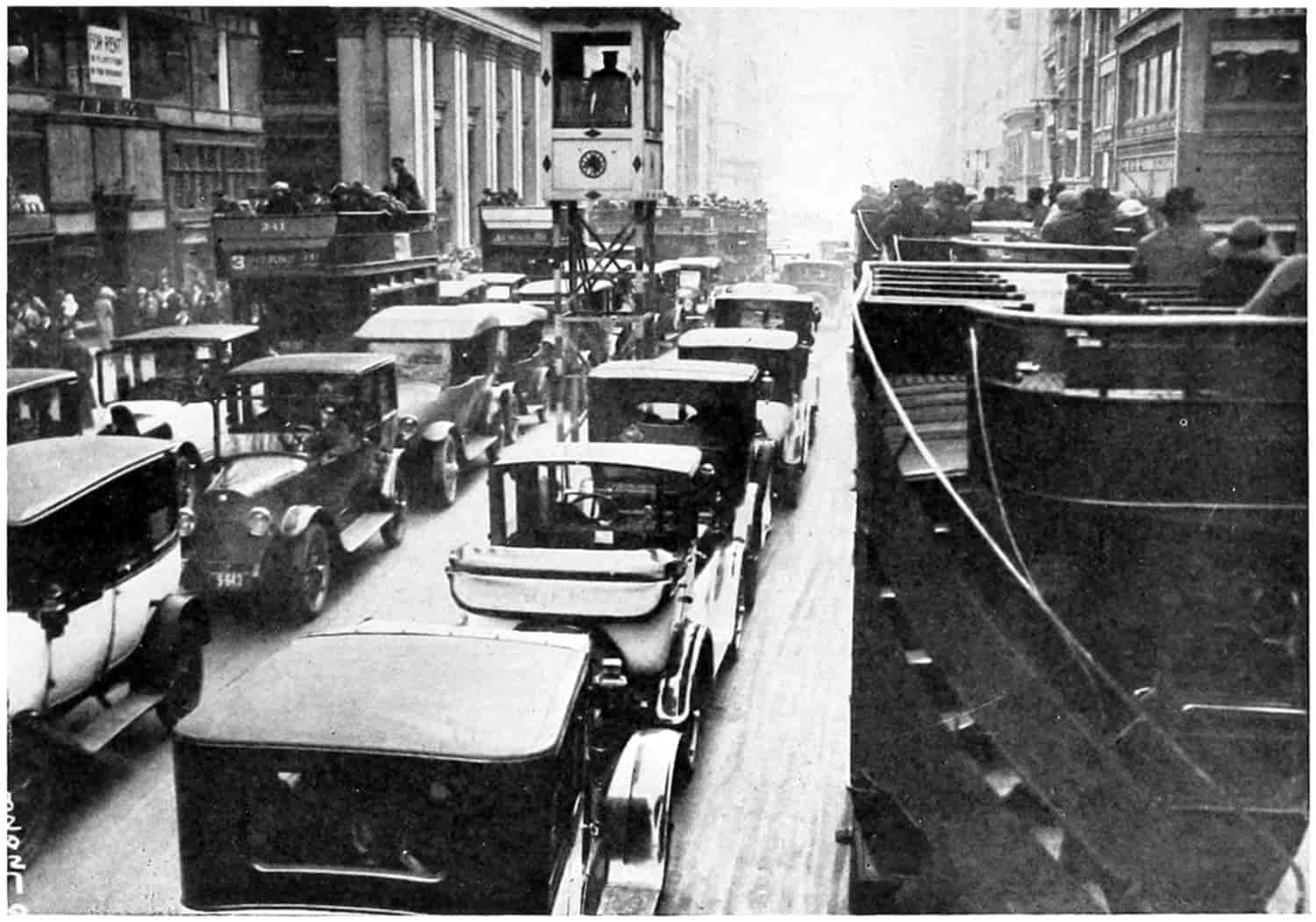
© Underwood and Underwood
TRAFFIC ON FIFTH AVENUE, NEW YORK CITY
[235]
The longer radii allow the turns to be made without slowing up the traffic, providing there is proper superelevation of the outer edge. The longer the radius, that is, the flatter the curve, the less superelevation is required, and the less the tipping sensation experienced by slow-moving vehicles on the turn. Moreover, on short curves a considerable widening of the pavement is required in order that the inner and outer edges, and therefore all traffic lanes, may have the same degree of curvature. Also, clear vision for the longer distances necessary for fast-moving traffic is easier to obtain on flat than on sharp turns.
The minimum grade of a roadway is usually a question of drainage, but the character and quantity of traffic is a determining factor in the establishment of steeper grades. Passenger cars can more easily negotiate grades than can commercial trucks. The average passenger car shifts to second gear at about a 7 per cent grade and there is very little shifting necessary on a long 6 per cent grade, hence for such cars 6 per cent may be considered a maximum for the high-speed gears. This same car will have to drop into low at about 10 per cent. Hence from the standpoint of the convenience of operating a passenger car there is no justification in going to great expense to cut a 10, or a 9, or an 8 per cent grade to a 7 per cent grade. For the average 5-ton truck 4 per cent and 8 per cent are the maximum grades for convenient running in high and intermediate. There may and possibly are many other reasons for cutting grades wherever possible. Where time is an element economy is effected by the possible speeds on grades.
The width of the roadway will likewise be influenced by the quantity and character of traffic. With slow-going wagons a width of 8 feet was sufficient for one lane of[236] traffic, but with the automobile safety demands 10, and the Good Roads Conference of 1922 voted that no road should be less than 22.
The best type of foundation and surface is a factor of quantity and class of traffic, and while as yet all engineers do not agree, the numerous experiments now being made may lead to standardization. Just as an example may be mentioned the change that has taken place in the effect of vehicles on waterbound macadam. Under horse-drawn, iron-wheeled wagons and carriages this was considered an ideal pavement. The horses’ shoes and the iron tires wore off of the stones a sufficient amount of dust to keep the road crust well cemented. The rubber tires of the automobile do not do that; furthermore, what dust is on the road is picked up and scattered to the winds. The force of the drive wheels also is sufficient to loosen the stones and roll them from their bed, causing the roadway to ravel and disintegrate rapidly.
These arguments might be multiplied indefinitely, but enough has been given to demonstrate the value to the road planner and the road designer of a traffic census.
Methods of Taking Traffic Censuses.
—It is well known that the traffic on any road is not constant. A count, then, made on a single day could not be applied for an entire year. Counting every day for the year would, of course, give a correct total, but that is impracticable. It is customary, therefore, to take the count on a limited number of days and consider their average to be the average for the year. There seems to be a seasonal variation in traffic and a weekly variation. The season variation in crops affects all sorts of commercial enterprises, of which the road traffic is one. Sunday traffic is largely pleasure traffic, and is more dense as a rule than week-day traffic, which is partially pleasure and partially business. In France, where more regular and scientific censuses have been made than in any other country, the counting days are divided uniformly between the seven days of the week and the four[237] seasons of the year, in order to eliminate, as far as possible, the periodic variation. The number of counting days per year is therefore, 28, and these are so arranged that each of the days of the week figures once in each quarter. The interval between counting days is, consequently, 13. For 1923, then, the count might be made as follows:
| Days of the Week |
1st Quarter |
2d Quarter |
3d Quarter |
4th Quarter |
||||
|---|---|---|---|---|---|---|---|---|
| Monday | Jan. | 1 | Apr. | 2 | July | 3 | Oct. | 2 |
| Sunday | 14 | 15 | 16 | 15 | ||||
| Saturday | 27 | 28 | 29 | 28 | ||||
| Friday | Feb. | 9 | May | 11 | Aug. | 11 | Nov. | 10 |
| Thursday | 22 | 24 | 24 | 23 | ||||
| Wednesday | Mar. | 7 | June | 6 | Sept. | 6 | Dec. | 6 |
| Tuesday | 20 | 19 | 19 | 19 | ||||
This method distributes the counting days uniformly over the entire year, but evidently the expense would be considerable unless it can be done by the regular patrolman. For the purpose of laying out a system of highways quicker results might be desired. In Massachusetts, Connecticut and other states two counts were made about two or three months apart. If one were taken in July, say, and another in October and the results averaged it is thought they might fairly represent the year. Each period could cover an entire week, thus giving an average of 14 days during those seasons of the year when traffic might most nearly represent the normal. Blanchard’s method[177] contemplates taking the census in four periods of three days each, one in April, May, or June, one in July, one in August, and one in September or October, as local conditions may dictate. The days selected should include Sunday in order to include the heavy automobile traffic on that day. If further information is desired additional three-day periods could be taken during the winter season.
[238]
Most of the authorities seem to think that the daylight hours from 5 A.M. to 9 P.M. are sufficient. But in the light of the tests being conducted by the Illinois Highway Commission which show alternate convex and concave warping of pavements from day to night it might be well to take account of night traffic.
Some of the latest censuses, namely Iowa and Connecticut, placed scales on the highways and actually weighed the vehicles. In Connecticut road scales were used which weighed the individual wheel loads.
The observers are supplied with cards on which is printed the classified list of vehicles and animals likely to pass with columns for tallying them during the separate hours. The in-and-out-of-town vehicles are recorded separately, and, if actual weights are not taken, whether loaded or unloaded. Information relative to the weather and condition of the roads is also noted, and there are blank spaces for the station, the date, and the signature of the observer.
The station, or stations, should be so placed that the road or district will be fairly represented, since it will not be practicable to get exact data on every portion of a highway, for every turn-out, branch line, or tributary will alter results. Each station should be established in some place where a good view of the road for some little distance may be had, and where the observers may be reasonably comfortable. The number of observers will depend upon the amount of traffic and the detailed information desired. With considerable traffic it may be necessary to divide up the work, giving one set of observers the in-traffic and another the out-traffic, one man to observe passenger automobiles another trucks and delivery wagons, or one man to jack up and weigh front wheels and another rear. System will result in more accurate results, and in less loss of time for the drivers, and less congestion of traffic. It is customary to take the census over the entire system on the same days although that is not absolutely necessary.
[239]
Classification of Traffic.
—The object of a classification is to obtain: (a) the maximum loads and average number of heavy loads per day. (b) The lighter loads, whether horse drawn or motor driven, iron, solid rubber or pneumatic tire, trailers, traction engines, animals, harnessed and unharnessed, and any other load which might affect the wear of the roadway. (c) Any other interesting data regarding the traffic, such as, local or through, cars belonging within or without the state or county, camping parties, and so on.
Maximum wheel loads are required, primarily, to see if state regulations regarding them are being complied with. In the Connecticut census it was found that a majority of trucks were loaded beyond their rated capacity and many of them beyond the legal maximum wheel loads.
Again heavy loads stress a pavement near to its elastic limit every time they pass over it. It is well established that any structural material when stressed near, to, or beyond the elastic limit will become fatigued with repeated stresses. The higher the stress the quicker they will fail by fatigue. It is not considered good practice to stress a material, especially a brittle material, repeatedly to a point half-way to its elastic limit. (The elastic limit is that stress that may be given to a body without producing a permanent set; below which it will return to its original shape upon the removal of the stress.) A walnut may not crack at the first blow but with a sufficient number of no harder repeated blows will crack. The higher the stresses the sooner the crack occurs. So it is important to know how many loads daily are stressing a pavement near to its elastic limit. From all the loads it has been the endeavor of road engineers to work out “importance factors” that will measure the relative damage done by the several classes. The Road Board of Great Britain has adopted the British ton as a unit and calculations are based on the traffic in tons per yard of width per year or per mile.[178]
[240]
The British Road Board Unit Weights are as follows:
| Classification of Vehicles | Assumed Average Weight in Tons. |
|---|---|
| Ordinary cycles | 0.09 |
| Motor cycles | .13 |
| Motor cars (including motor cabs and any other motor vehicles) | 1.6 |
| Motor vans (covered) | 2.5 |
| Motor omnibuses | 6.0 |
| Motor lorries (rubber tires) | 6.0 |
| Trailers to rubber tired lorries | 5.0 |
| Motor lorries (steel tires) | 10.0 |
| Trailers to steel tired lorries | 5.0 |
| Light tractors | 5.0 |
| Trailers to light tractors | 5.0 |
| Traction engines | 12.0 |
| Trailers to traction engines | 8.0 |
| Light vehicles (one horse) | 0.4 |
| Light vehicles (two or more horses) | 0.6 |
| Heavy vehicles (one horse) | 1.25 |
| Heavy vehicles (two or more horses) | 2.5 |
| Omnibuses (two or more horses) | 3.0 |
| Tram cars (electric, steam or horse, as the case may be) | .... |
| Horses (led or ridden) | 0.5 |
| Cattle | 0.3 |
| Sheep and pigs | 0.1 |
| Hand carts and barrows | .... |
| Horses drawing vehicles (to be calculated from number of vehicles) | 0.5 |
The French unit of traffic is technically known as the “collar,” a draft animal harnessed to a wagon being counted as 1.0. The metric ton, 1000 kg., is also sometimes used. The French, feeling that the dead weight of a vehicle or animal did not truly measure its effect as to wear on a road surface, classified the traffic and assigned importance factors to the several classes. From 1882 to 1903 the classification consisted of: 1st, Trucks and farm wagons, loaded; 2d, Public vehicles designed for transporting passengers and their baggage; 3d, Light vehicles, such as private vehicles, and empty farm wagons; 4th, Larger animals, such as horses, mounted or not, mules, and[241] large cattle; 5th, Small beasts, such as sheep, goats, and pigs. In 1903 motor vehicles were separately listed; they were divided into five classes: 1st, Metallic-tired automobiles, “which in general are heavily loaded, have a slow movement and produce the effect of wearing away the road surface”; 2d, Elastic tired automobiles licensed to make a speed of not more than 30 km. per hour; 3d, Automobiles whose speed was less than 30 km. per hour; 4th, Bicycles or velocipedes propelled by the feet of the rider; and 5th, Motor cycles, whether having two, three, or four wheels. The report of the second international road congress further states that “it is necessary to attribute to each element of the traffic an importance which belongs to it from the viewpoint of the destructive effect exercised on the road crust.” Consequently the numbers of vehicles or animals in the several classes were modified by multiplying them by importance factors arbitrarily assumed.
| Importance | Classification factors |
|
|---|---|---|
| An animal harnessed to a loaded vehicle | 1 | collar |
| Loaded trucks and farm wagons | 1 | |
| Public vehicles for transporting passengers | 1 | |
| Light vehicles, and empty farm wagons | 1⁄2 | |
| Harnessed horses to light vehicle or empty wagon | 1⁄4 | |
| Mounted horses or with load on back | 1⁄4 | |
| Unharnessed horses | 1⁄5 | |
| Cattle | 1⁄5 | |
| Small beasts (sheep, pigs, goats) | 1⁄30 | |
| Automobiles with metallic tires, weight in metric tons times 11⁄4 = No. of collars | ||
| Automobiles with elastic tires |
||
| Motor cycles | 3⁄10 | |
| Vehicles licensed to make a speed over 30 km. per hour | 3 | |
| Vehicles licensed to make a speed of less than 30 km. per hour | 1 | |
From this it was possible to reduce all traffic to the unit “collar,” which was used as a comparative measure of the[242] use of the several roadways. The tonnage was calculated by multiplying the numbers by average weights obtained by weighing a sufficiently large number of the units in each class.
Consideration was also made of the weight of the useful load as separate from the weight of the vehicle itself. Animals not harnessed were considered as a part of the useful load.
In Italy traffic censuses followed practically the same classification and methods as in France.
In the United States some of the states have used coefficients of reduction, or importance factors, while many others have contented themselves with a count of vehicles only.
In 1910 Maryland used the following:
| 1. | Ridden horse and one-horse vehicle | 2 |
| 2. | Two-horse vehicles | 4 |
| 3. | Three-horse vehicles | 6 |
| 4. | Four-horse vehicles | 8 |
| 5. | More than four-horse vehicles | 12 |
| 6. | Motor cycles | 2 |
| 7. | Motor runabouts | 10 |
| 8. | Four- or five-seat touring cars | 20 |
| 9. | Six- or seven-seat touring cars | 40 |
| 10. | Motor trucks or drays | 20 |
The New York State Highway Department took a census in 1909 in which the following classification and reduction coefficients were used:
| Class of Traffic | Relative Weight |
|---|---|
| Horse-drawn traffic | |
| Horses with vehicles | 1 |
| One-horse vehicle, light | 2 |
| One-horse vehicle, heavy | 3 |
| Two-horse vehicle, light | 3 |
| Two-horse vehicle, heavy | 4 |
| Three-horse vehicle, heavy | 5 |
| Four-horse vehicle, heavy | 6 |
| Motor vehicles[243] | |
| Motor cycles | 1 |
| Two-passenger cars | 2 |
| Three-passenger cars | 3 |
| Four-passenger cars | 4 |
| Five-passenger cars | 6 |
| Seven-passenger cars | 7 |
| Trucks, omnibuses, etc. | 10 |
| Miscellaneous | |
| Traction engines | 15 |
| Two traction engines | 30 |
| Miscellaneous heavy traffic | 5 upward |
The Massachusetts Highway Commission, 1912 Report, say, “After all it is not numbers which tell the story, it is weight, and it is not weight alone, but the vehicle by which it is transported, whether by horses or by motor.... All these considerations are probably not so important on many road surfaces as the actual weight imposed upon the road per inch width of tire resting upon the road.” There was used in this census the following weights:
| Motors | Tons |
|---|---|
| Runabouts | 1.43 |
| Touring cars | 2.23 |
| Trucks | 6.25 |
| Horse-drawn vehicles | |
| One-horse, light | .36 |
| One-horse, heavy | 1.12 |
| Two or more horses, light | .54 |
| Two or more horses, heavy | 2.46 |
James and Reeves, with the United States Bureau of Public Roads, recommend the ton-mile basis and give the following weights:
| Tons | |
|---|---|
| One-horse wagon, loaded, 0.88; unloaded | 0.28 |
| Two-horse wagon, loaded, 1.57; unloaded | 0.47 |
| Four-horse wagon, loaded; 3.88; unloaded | 0.54 |
| Pleasure vehicles, one-horse, 0.28; two-horse | 0.47 |
| Rubber-tired pleasure vehicle | 0.28 |
| Saddle horse | 0.50 |
| Motor cycle | 0.20 |
| Excessively heavy vehicle | 3.94 |
| Motor, runabout, 1.68, touring car | 2.00 |
| Motor dray, loaded, 2.43; unloaded | 1.23 |
| Draught horses | 0.50 |
[244]
In a traffic census taken by the Borough of Brooklyn, New York, the weights were reduced to traffic units per minute per foot width of roadway which was called density. By this rule, “the number of vehicles passing a given point in eight hours times the traffic unit divided by 8 times 60 times the width of the roadway equals the density.” The weights and traffic units used were:
| Rubber-tired vehicles | Weight in tons |
Traffic value |
||
|---|---|---|---|---|
| Large automobile trucks, loaded | 9 | 5 | ||
| Large automobile trucks, empty | 4 | 4 | ||
| Small automobile trucks, loaded | 3 | 3 | ||
| Small automobile trucks, empty | 1 | 1⁄2 | 2 | |
| Pleasure automobiles | 1 | 3⁄4 | 1 | |
| Carriages | 2 | 2 | ||
| Steel-tired vehicles ranged in weight from 1 to 71⁄2 tons and in traffic value from 2 to 10. | ||||
A suggested form for a traffic census sheet presented by a committee appointed to study the question of traffic censuses to the New Jersey State Association of Roads is shown on p. 245. This sheet also bears, for the use of the office, blanks for the tabulation of the traffic by classes:
| Kind of Vehicle | No. | Weight | Vehicle-Tons | |
|---|---|---|---|---|
| Motor cycle | ..... | 0.25 | .......... | |
| Light-horse, empty | ..... | 1.25 | .......... | |
| Light-horse, loaded | ..... | 2.00 | .......... | |
| Heavy two-horse, empty | ..... | 3.20 | .......... | |
| Heavy two-horse, loaded | ..... | 6.00 | .......... | |
| Light pleasure motor car | ..... | 1.50 | .......... | |
| Heavy pleasure motor car | ..... | 2.50 | .......... | |
| Light motor truck, empty | ..... | 1.00 | .......... | |
| Light motor truck, loaded | ..... | 2.50 | .......... | |
| Heavy motor truck, empty | ..... | 5.00 | .......... | |
| Heavy motor truck, loaded | ..... | 10.50 | .......... | |
| Specials: | 10 tons | ..... | ..... | .......... |
| 15 tons | ..... | ..... | .......... | |
| Over 15 tons | ..... | ..... | .......... | |
| Total | ..... | ..... | .......... | |
| Tonnage per foot width of pavement | .................... | |||
| Tonnage per foot width of roadway | .................... | |||
[245]
SUGGESTED FORM OF TRAFFIC CENSUS SHEET
Traffic Census Sheet County Number........ Station No....... County......
State Highway Department of New Jersey................................ 192...
............................................... Road at..........................................
Exact location................................................................................
Count taken..............from...........to.............from...........to..............
| Time Count Was Taken |
Motor Cycle |
Light Horse |
Heavy Horse |
Pleasure Motor Cars |
Light Motor Trucks |
Heavy Motor Trucks |
Specials | Street Cars |
Hourly Totals |
|||||||||||
|---|---|---|---|---|---|---|---|---|---|---|---|---|---|---|---|---|---|---|---|---|
| Empty | Loaded | Empty | Loaded | Light | Heavy | Empty | Loaded | Empty | Loaded | 10- tons |
15- tons |
Over 15-ts. |
||||||||
| 6 | a. m. | to | 7 | a. m. | ||||||||||||||||
| 7 | a. m. | to | 8 | a. m. | ||||||||||||||||
| 8 | a. m. | to | 9 | a. m. | ||||||||||||||||
| 9 | a. m. | to | 10 | a. m. | ||||||||||||||||
| 10 | a. m. | to | 11 | a. m. | ||||||||||||||||
| 12 | noon | to | 1 | p. m. | ||||||||||||||||
| 1 | p. m. | to | 2 | p. m. | ||||||||||||||||
| .. ... ... ... .. | ||||||||||||||||||||
| 3 | a. m. | to | 4 | a. m. | ||||||||||||||||
| 4 | a. m. | to | 5 | a. m. | ||||||||||||||||
| 5 | a. m. | to | 6 | a. m. | ||||||||||||||||
| Total | ||||||||||||||||||||
Of above motor vehicles.........carried foreign licenses as follows.........
................................... Weather.....................................................
Type of pavement....................... Condition of pavement...................
Width of roadway........ Width of pavement........ Traffic.... Narrow ...
Tires................... Special............... Inspector..................................
Notes............................................ Checked by...............................
Destructive Factors.
—From the above it appears that there is a general opinion that there should be some common measure for the destructive effect of vehicles upon road surfaces. As yet no unanimity of opinion has crystallized. While density of traffic influences the surface wear of the road crust—considerably in the case of earth and gravel, less for macadam and asphalt, and still less for brick and concrete—the actual weight of the wheel load[246] seems to have a much greater destructive effect. The impact due to speed and irregularities of the road surface, the resiliency of the tires, the proportion of sprung to unsprung weight, and the shoving forces of the wheels all have their effects which are usually in some way connected with either the weight or the speed, or both, of the vehicle. The many experiments now being carried on by the United States Bureau of Public Roads, and the several states may furnish data from which a practical measure will some day be devised. Mr. Older, Chief Highway Engineer of the State of Illinois, under whose direction the comprehensive investigational and endurance tests under way in that state are being carried on, recently stated to a party of visitors, of which the author was one, that in his opinion weight, including impact, is the prime factor in the destruction of a pavement. Wear is of very minor importance, temperature and weather is of considerable importance.
Road surfaces must be considered as bodies acted upon by forces. Some day the stresses produced by these forces will have been analyzed, then will it be possible to standardize the importance of the several vehicle loads. At present it is known that the weight of the load and the weight of the pavement itself are under some circumstances sufficient to produce cracks in the pavement and disruption of the road crust. Bearing tests and bending tests are being devised to measure the effects of such loads. Road crusts, earth, gravel, macadam, asphalt, brick, concrete, are to varying degrees elastic bodies and when loaded they give, as an elastic band stretches, a spring shortens, or a bow bends, until the internal stresses reach a limiting point where the crust is broken or permanently distorted. It is well known that the effect on an elastic body of a suddenly applied load is twice as destructive as the same load gradually applied. And when the action is an impact the destructive effect may be very great indeed, depending on the physical properties of the impinging bodies. But however the load is applied, whenever the internal stresses reach the limiting strength of the material of which the[247] road crust is composed it will go to pieces. The sudden application of the load by fast driving is a sort of impact. The stresses produced by this impact are now being studied. Much good is expected to come toward the solution of the problem of destructive vehicle influence from these researches.
Another effect of speed is noted on the more or less viscous materials of which road surfaces are composed. The pushing of the wheels against the surface causes wrinkles which continue to grow until the wrinkles become waves entirely across the pavement. Such waves may also be produced by expansion and contraction due to changes in temperature, but are probably always accentuated by wheel pressure. Side thrust of wheels often produces longitudinal waves in viscous road crusts.
In the classifications given no one seems to have considered the proportion of sprung and unsprung weight in the motor car. There can be no doubt but that the resiliency of the springs relieves the pavement of very much of the shock of impact. This is illustrated by an attempt to drive a nail into a springy board. It can hardly be done because the springiness of the board uses up, absorbs, the work of impact. A mechanical statement is, the work of impact equals the change in kinetic energy, or algebraically stated
Fs = Wv22g
when the entire energy has been absorbed. Here F is the acting force and s the distance through which it acts, Fs, is the work done by the force F. W is the weight of the ram or moving body (vehicle, wheel load), v the velocity of impact and g the acceleration of gravity, a factor that enters the equation in the expressing of mass in terms of weight. Solving this equation for F there results,
F = Wv2 2gs,
[248]
which shows that the smaller s is the greater the force of impact F. When s is made long by means of a spring the force F becomes smaller. This is illustrated by the old method of catching a baseball without gloves—the hands were allowed to go backward so that the work of stopping the ball was spread over a greater distance, the impact force thus becoming so small it did not sting the hands.
The effect upon the road, and also the vehicle, is like that of the hammer which hits a nail on the anvil. The nail is flattened, pounded to pieces very soon. But if the nail were not placed upon the solid anvil but upon a slab of springy steel, it might be pounded all day without doing it much harm, the spring at all times absorbing the shock. So with the weight of the vehicle largely sprung the damage to the roadway is comparatively small. Therefore, it would seem, as though a fair classification would take into account the springs of the vehicle.
The pneumatic tire, and the cushion tire and wheel, each act as springs and shock absorbers in varying degrees. In some of the censuses, pneumatic or solid tires were noted, and very many of the earlier noted whether rubber or steel tires were used.
Just how far all these things should be taken into account is questionable. Whether or not just as good results would not come for even a simpler classification is not yet determined. It might be that only the heavy loads and their frequency is all that need be considered if the destructive effect of traffic alone is aimed at.
The great amount of pleasure riding and the tremendous desire for such riding should be considered in laying out a system of roads and in the selection of a type of road, therefore all passenger cars and motor cycles should be counted and given an influence number.
Other Methods of Estimating Amount of Traffic.
—The amount of road traffic may be roughly estimated from the area served by the highway. Upon a map is outlined the tributary territory and its area measured by any one of several means. The area may be divided into small squares[249] of known size and the number of squares counted; it may be divided into strips and the length of the strips measured with a scale and thence the area computed, or a planimeter may be used. Having found the area the unit tonnage is estimated from a knowledge of the character of the crops raised and the industries in the territory from which the haulage is calculated. The average haul may be determined, if desired, by finding approximately the center of gravity of the area and measuring its distance from the market. If the market place is at the center of a circle surrounding it and the products are uniformly distributed over the circle the mean distance is two-thirds the radius of the circle.
The tonnage, arising from farms, which is transported over the roads varies with the kind of crop, the fertility of the soil, the amount of stock fed, or kept for dairying, and numerous other local conditions. Studies made by various authorities[179] indicate that the marketable products vary from 1⁄10 to 1⁄2 ton per acre. If a circular area with market place at the center is served by six uniformly distributing radial roads a mathematical analysis will show that the tonnage upon each one of these roads, one-sixth that from the whole circle, will be
T = 335.12qr2
| where | T | = | total tons per year, |
| q | = | yield of marketed crops in tons per acre, | |
| r | = | maximum haul-radius of the circle. |
Dividing T by the number of working days per year (usually taken as 300) gives the average daily haul into the market. The average length of haul may be taken as 2⁄3 r. The haul over any zone whose edges are concentric with the circle is considered to be all that originating in the area outside the zone plus that originating within the[250] zone times the mean distance from the inner edge of the zone. The result of the analysis gives this equation, for the haul over any zone having an outer radius a, and an inner radius b,
H = Tr - Ta + 2a2 - ab - b2 3(a + b) (Ta - Tb),
where Tr, Ta and Tb represent the tonnage originating on the sectors of radius r, a and b respectively.
For the first mile,
a = 1, b = 0.
H = Tr - 1⁄3Ta.
For the eighth mile,
a = 8, b = 7.
H = Tr - T8 + 23⁄45(T8 - T7)
Theoretical Average Tonnage of Six Uniformly Distributed Market Roads[180]
| Maxi- mum Haul |
Aver- age Haul |
Uniform Yield per Acre of | ||||||||
|---|---|---|---|---|---|---|---|---|---|---|
| One-tenth Ton | One-fourth Ton | One-half Ton | ||||||||
| Total Tons per Year |
Tons Hauled per day |
Total Tons per Year |
Tons Hauled per day |
Total Tons per Year |
Tons Hauled per day |
|||||
| Over 1st Mile |
Over 8th Mile |
Over 1st Mile |
Over 8th Mile |
Over 1st Mile |
Over 8th Mile |
|||||
| 1 | 0.67 | 33 | 0.07 | 84 | 0.17 | 168 | 0.34 | |||
| 2 | 1.33 | 134 | 0.40 | 335 | 1.00 | 670 | 2.01 | |||
| 3 | 2.00 | 302 | 0.96 | 754 | 2.40 | 1,508 | 4.80 | |||
| 4 | 2.67 | 536 | 1.74 | 1,340 | 4.36 | 2,681 | 8.71 | |||
| 5 | 3.33 | 838 | 2.75 | 2,094 | 6.87 | 4,189 | 13.74 | |||
| 6 | 4.00 | 1206 | 3.98 | 3,016 | 9.95 | 6,031 | 19.90 | |||
| 7 | 4.67 | 1642 | 5.43 | 4,106 | 13.58 | 8,211 | 27.15 | |||
| 8 | 5.33 | 2145 | 7.11 | 0.85 | 5,362 | 17.76 | 2.13 | 10,724 | 35.52 | 4.25 |
| 9 | 6.00 | 2714 | 9.00 | 2.75 | 6,786 | 22.51 | 6.88 | 13,572 | 45.02 | 13.75 |
| 10 | 6.67 | 3351 | 4.13 | 4.87 | 8,378 | 27.82 | 12.18 | 16,756 | 55.63 | 24.35 |
| 11 | 7.33 | 4056 | 13.47 | 7.22 | 10,138 | 33.68 | 18.05 | 20,279 | 67.35 | 36.10 |
| 12 | 8.00 | 4826 | 16.04 | 9.79 | 12,064 | 40.10 | 24.48 | 24,128 | 80.20 | 48.95 |
| 13 | 8.67 | 5663 | 18.83 | 12.58 | 14,158 | 47.08 | 31.45 | 28,316 | 94.15 | 62.90 |
| 14 | 9.33 | 6568 | 21.85 | 15.59 | 16,420 | 54.63 | 38.98 | 32,840 | 109.25 | 77.95 |
| 15 | 10.00 | 7540 | 25.09 | 18.83 | 18,850 | 62.73 | 47.08 | 37,700 | 125.45 | 94.15 |
[251]
The table shows the theoretical average tonnage on each of six uniformly distributed radial roads. It is taken from Bulletin 136, U. S. Department of Agriculture. Since roads do not run in practice in this manner the results can only be used for comparison in confirming estimates.
Mr. E. W. James, of the Bureau of Public Roads, U. S. Dept. of Agriculture, makes an analysis of the distribution of traffic over the roads of a township located along the section lines of the United States land survey. The market place is taken at the center of the township.[181]
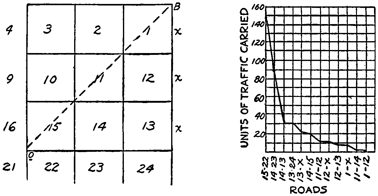
Graphic representation of distribution of traffic on roads located along section lines.
His analysis assumes the lay of the country makes all roads equally traversable and that the traffic seeks the nearest highway thence to the main traveled road east and west or north and south through the market center. This analysis shows that 4.8 per cent of the total mileage carry 39.3 per cent of the traffic; that 9.5 per cent of the roads carry 71 per cent of the traffic. In his opinion this analysis corroborates the observation of engineers to the effect that 20 per cent of the roads carry 80 per cent of the traffic.[252] Of course the most important roads, measured in traffic, are the ones nearest the market, 15-22, 15-16, 16-21, 21-22. Following these naming only one of the four symmetrical roads, in the order of importance are 14-23, 14-13, 13-24, 13-x, 14-15, 11-12, 12-x, 12-13, 1-x, 11-14, and 1-12.
| Road between Sections |
Relative Importance |
||
|---|---|---|---|
| 15 | - | 22 | 100 |
| 14 | - | 23 | 60 |
| 14 | - | 13 | 25 |
| 13 | - | 24 | 20 |
| 13 | - | x | 15 |
| 14 | - | 15 | 13 |
| 11 | - | 12 | 7 |
| 12 | - | x | 7 |
| 12 | - | 13 | 2 |
| 1 | - | x | 2 |
| 11 | - | 14 | 1 |
| 1 | - | 12 | 1 |
The same objections to this method hold as to the preceding. Local conditions always affect the travel on roads; hills, valleys, soil, drainage, nearness to other cities, railways, streams, and location of farmhouses, schoolhouses, churches, and factories, all enter into the estimate. A reconnaissance and the good judgment of the observer must supplement any method of formal procedure.
The Selection of a Suitable Type of Road.
—The highway plan should, if it has been carefully and scientifically made specify the type of roadway as well as the location of the highway. However, when the improvement is to be paid for by a special tax on the abutting land, it is customary to allow the taxpayers to have something to say about the type. Road engineers often object to this as being unscientific and unsound, on the theory that the layman is ignorant of the properties and behavior of road materials and that only an expert can make the proper selection. The author’s observation is, however, that hard-headed business men and farmers who have passed through the experiences of rough knocks are no more likely to make a mistake in the selection of a road type than is the young engineer fresh from the halls of college, or the engineer[253] whose experience has prejudiced him in favor of particular types of road surfacing. The best and fairest of engineers cannot agree, then why not give the man who must pay the fiddler an opportunity to dance?
It will be well, nevertheless, for the engineer to suggest a type, or types, of roadway with his reasons for its or their suitability. If he can show that one type is superior to another the tax-payer will usually follow his advice, and agree to the type suggested. The final decision must rest with the road officials. They should know the requirements of the road, whether, for example, it is to be largely commercial or used largely for pleasure; whether durability or noiselessness is a determining factor; or whether a pleasing appearance and convenience to the inhabitants living along the way are of greater importance than directness and low grades. The decision must be made after taking all things into consideration even to the whims of the property-holders. The best road for a given location is the one which at a reasonable cost will give over a long period of time a service which is most satisfactory to the majority of its users. What is a reasonable cost and what is satisfactory service are debatable questions and usually must be compromised to a greater or less extent.
An ideal road is one that is cheap to construct and maintain, one that is durable, presents light resistance to traffic but is not slippery, is comfortable to travel and not annoying to users or dwellers along its side, and one that is easily cleaned and is sanitary. No road can contain all these qualities to the same degree, neither are they all of equal importance, but each should be given some weight in the selection.
Perhaps the first and most important item to be considered is the economic one of cheapness in construction and maintenance. In making a decision between two types of pavement the first cost will probably have more weight than will the ultimate cost. The fact that a higher priced article will last longer and in the end prove to be a saving[254] has little charm for the man who has not the ready money to pay for the article. He will content himself with the cheaper until he can afford the better. If a community cannot pay for a certain type of road, no matter how desirable that may be, that type cannot be used. Types of roads must be selected which will utilize the materials most available. It would seem to be unwise for brick to be shipped from the Middle West to New England, or granite blocks from New England to the Middle West. Gravel, being plentiful in many states, is being used, and rightly so, more than any other road material notwithstanding the durability of a gravel roadway is less than that of many other types.
Durability is an important factor from an economical standpoint, as it enters vitally in the long-run cost of a pavement. It is also of importance on account of the infernal nuisance of having a roadway full of pot holes and rough places, to say nothing of the inconvenience to users of frequent repairs. Road officers are no more given to regarding the adage “a stitch in time saves nine,” than are other people, consequently non-durable roads are usually more or less out of order.
Durability depends upon the materials used in construction and their manipulation, proportioning, and other treatment; the character weight and density of traffic; system or lack of system in making repairs; the opening up of pavements for water, gas, and sewer or other purposes; building operations along the street; cleanliness; the absence or presence of street-car tracks; climate and possibly other factors.
Materials and Design.
—The physical properties of materials—their tensile, compressive, and shearing strengths, their elasticity, brittleness, etc.—while important elements in the durability of pavements, the design of the pavement, its thickness, the proportioning and mixing of parts, the laying, as well as the subgrade and its treatment are all elements that count very much also. No matter how good a material it can easily be spoiled in the handling. Some materials like vitrified brick and stone will last indefinitely on a little-used street while others like asphalt and creosoted wood block are much better for considerable wear. The use of definite and often meticulous specifications is to insure good materials and proper manipulation of the same, while the plans are carefully prepared ahead, so that durability and satisfaction may result.
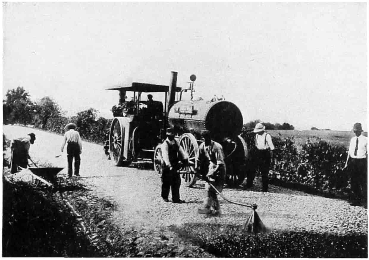
© Underwood and Underwood
GIVING A MACADAM ROAD AN APPLICATION OF TARVIA BINDER
This is Followed by a Coat of Screenings and then the Road is Rolled Again.
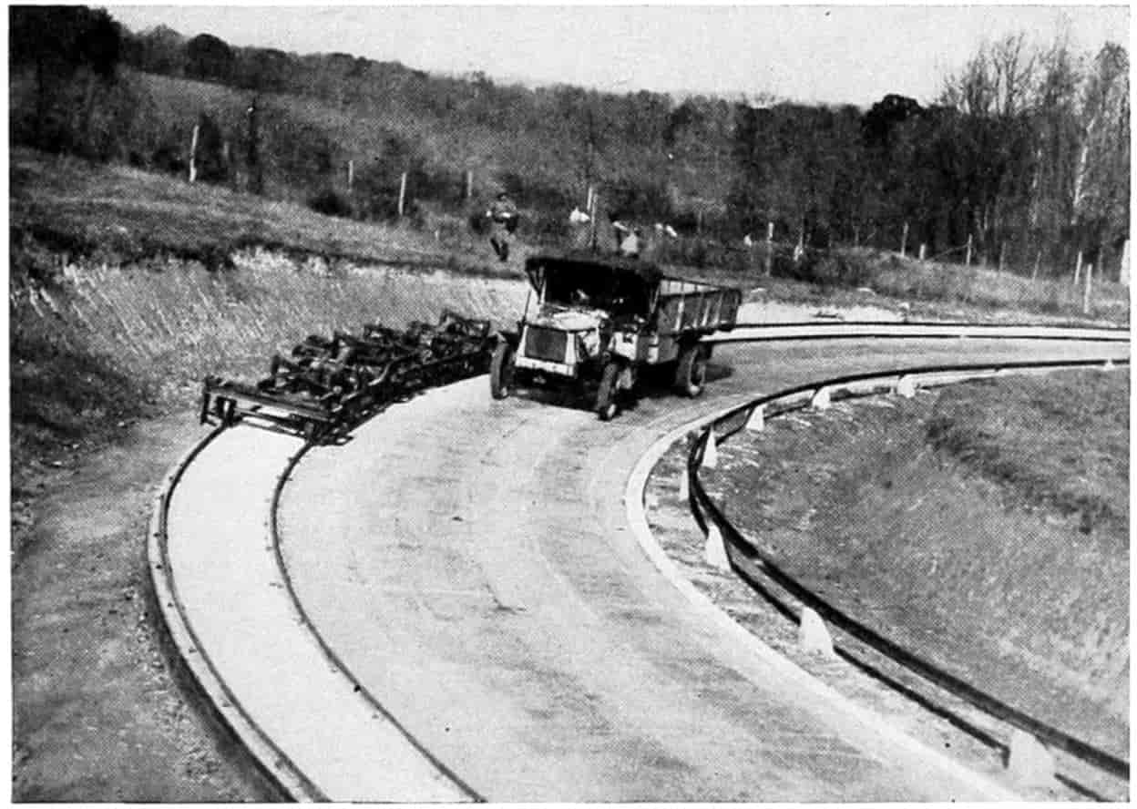
© Underwood and Underwood
A ROAD OF MIXED ASPHALT AND CONCRETE BEING TESTED OUT
[255]
The effect of character, weight, and density of traffic has been frequently mentioned and will again be referred to in what follows. There is no doubt a relationship between materials and design and the character and amount of traffic. A cinder road may be perfectly acceptable for a park drive where the traffic is light, but absolutely worthless under heavy commercial trucking.
Resistance to traffic varies with different road surfaces. A smooth hard surface offers a very great deal less resistance than does a rough or soft surface. To illustrate, a horse is said to be able to pull directly on the traces one-tenth his own weight without being overworked. With a resistance of 100 pounds per ton (earth road in medium condition) a team of horses weighing 1200 pounds each could draw over a level road 2 × 120010 × 100 = 2.4 tons. On a concrete, asphalt or brick pavement having a tractive resistance of 30 pounds per ton the team could draw 2 × 120010 × 30 = 8 tons. In other words the load that can be drawn is inversely as the tractive resistance. Here speed was not considered. It was the natural walking gait of the horse about three miles per hour. If the speed is greater the load must be cut down proportionally. With a truck the direct pull is the effective power of the engine in foot-pounds per minute divided by distance in feet per minute; and the load that can be drawn is the direct pull times the tractive resistance. Thus if a truck may exert h effective horse power = 33,000h foot-pounds per minute, and the speed is v miles per hour, the load T, in tons, that may be[256] hauled on a road having a tractive resistance of t pounds per ton, is
T = 33,000h 5280v60 · t = 375hvt.
Therefore a truck of 20 effective horse-power will haul over a road whose tractive resistance is 100 pounds per ton at a speed of 10 miles per hour a load of
T = 375 × 2010 × 100 = 7.5 tons;
and on a smooth road with a tractive resistance of 30 pounds per ton at the same speed, 25 tons, or the same load 7.5 tons may be drawn at a speed of 331⁄3 miles per hour.
It must be remembered that when the speed is increased the tractive resistance is likewise increased. The air resistance is in about the ratio of the square of the velocity, so that 33 miles per hour would be too great in the last case.
Experiments to determine the tractive resistance due to the surface vary considerably, for it is impossible to secure like conditions of surface smoothness and cleanliness, to say nothing of hardness. The tractive resistance will with some materials vary with the temperature. That of sheet asphalt, for example, may be twice as much in summer as in winter. The tractive resistance may not be directly proportional to the load although it is customary to express it in pounds per ton. It is conceivable that a heavy load because it sinks into the road crust may require a greater number of pounds to move it than a light load that does not greatly sink in. This also leads to the effect of width of tire and diameter of wheel. Many experiments have shown the tractive force to be less with wide than narrow tires, due, no doubt, to the unequal sinking into the road crust. Likewise wheels ought, for the same reason, to show[257] less resistance for large diameters; in fact some engineers give it as varying inversely as the diameter of the wheel.
The results of tests, while varying much, show in a general way, the direct pull necessary to draw a load at slow speed on the level in well-lubricated wagons to be approximately as follows:
| Lbs. per Ton | μ = coefficient of Resistance |
|
|---|---|---|
| Upon Steel rails | 10 | 1⁄200 |
| Sheet asphalt, good condition | 20 | 1⁄100 |
| Asphaltic macadam or concrete, good condition | 20 | 1⁄100 |
| Concrete, good condition | 20 | 1⁄100 |
| Brick, good condition | 20 | 1⁄100 |
| Broken stone water-bound macadam, good condition | 30 | 3⁄200 |
| Gravel, good condition | 30 | 3⁄200 |
| Sand clay, good condition | 60 | 3⁄100 |
| Earth, best condition | 67 | 1⁄30 |
| Earth, medium condition | 100 | 1⁄20 |
| Earth, poor condition | 300 | 3⁄20 |
Resistance Due to Grade.
—The resistance due to grade is just as marked as that due to surface. The work necessary to draw a load up an inclined plane is the same as that of drawing on a level along the base of the plane and lifting it directly up to the height of the plane. A mathematical analysis[182] based upon this fact leads to the formulas:
For a horse-drawn load,
L = t - g μ + g H. (1)
For a tractor,
L = P μ + g - T. (2)
[258]
For an automobile or truck,
L = P μ + g, (3)
| where | L | = | weight of load drawn, including weight of vehicle (subtract weight of vehicle for net load); |
| H | = | weight of horse; | |
| T | = | weight of tractor; | |
| P | = | effective tractive force exerted (available engine effort); | |
| μ | = | coefficient of road resistance; | |
| g | = | grade (gradient) = tangent of angle of incline, nearly the same for small angles as the sine of the angle of incline, that is, the height of the incline divided by its length; | |
| t | = | the direct pull of the horse divided by the weight of the horse; | |
| h | = | horse-power = work of 33,000 ft.-lb. per minute. | |
| v | = | velocity in miles per hour. |
Equation (3) indicates that the load, including its own weight, that a truck or an automobile can draw varies directly as the horse-power exerted effectively, and inversely as the velocity. Also it decreases as the coefficient of road resistance, μ, and the gradient g increases.
The resistance coefficient, μ may include axle or internal resistance of the vehicle plus road surface resistance plus air resistance. The axle resistance is nearly a constant, the road resistance likewise, but the air resistance depends upon the speed v, varying approximately as the square of the velocity. W. S. James, in the Journal of the Society of Automotive Engineers, June, 1921, uses the formula
F = CAV2
| where | F | = | the wind force in pounds; |
| C | = | a constant, varies from .003 to .004; | |
| A | = | frontal area of automobile in square feet approximately 26; | |
| V | = | velocity in miles per hour. |
[259]
His researches show that the available engine effort P of equation (3) or horse power h is not quite constant but varies with the speed. His table follows:
| Car Speed m.p.h. |
Available Engine Effort Per 1000 lb. of Car Weight, Lbs. |
Air Resistance Per 1000 lb. of Car Weight, Lbs. |
|---|---|---|
| 15 | 107.3 | 4.9 |
| 16 | 105.2 | 6.8 |
| 20 | 107.6 | 8.8 |
| 25 | 106.0 | 13.4 |
| 30 | 103.9 | 19.2 |
| 35 | 101.2 | 26.0 |
| 40 | 98.0 | 34.1 |
| 45 | 94.1 | 43.4 |
| 50 | 86.8 | 53.8 |
Returning to Equation (3) which has been plotted in two different ways on page 260, it may be seen that the load that can be hauled up a grade decreases with the per cent of grade very rapidly for the roads having a small coefficient of resistance and very much less rapidly for larger resistances. For example, on steel rails, resistance 10 pounds per ton, μ = 1⁄200, a 1 per cent grade reduces the load to one-third the load that may be hauled on the level, and a 5 per cent grade reduces it to less than one-tenth of the same load. With a good asphalt, brick or concrete road, resistance 20 pounds per ton, μ = 1⁄100, a 1 per cent grade reduces the load to one-half, while a 5 per cent grade reduces it to about one-sixth the load that can be drawn on a level road. While for an earth road in bad condition or a dry sand road, 300 pounds per ton resistance, μ = 3⁄20, a five per cent grade only reduces the level grade load by one-fourth. This shows clearly that the better the road surface the less the grade must be in order to benefit by it. The plots on page 260 show the same thing in different ways, and also that the maximum load that can be hauled with a given force at a constant speed is greater, no matter what the grade, on the better types of roads than on the poorer, but that the very great advantages due to hard roads come with the better type of roads. Incidentally this plot shows that the load that may be hauled, other things being equal, on steel tracks, is very much greater than that that can be hauled on the best hard surfaced road with same power, therefore it will never be possible to haul loads on highways as cheaply as on railways unless the operating expenses on the highways can be made materially less than on railways.
[260]
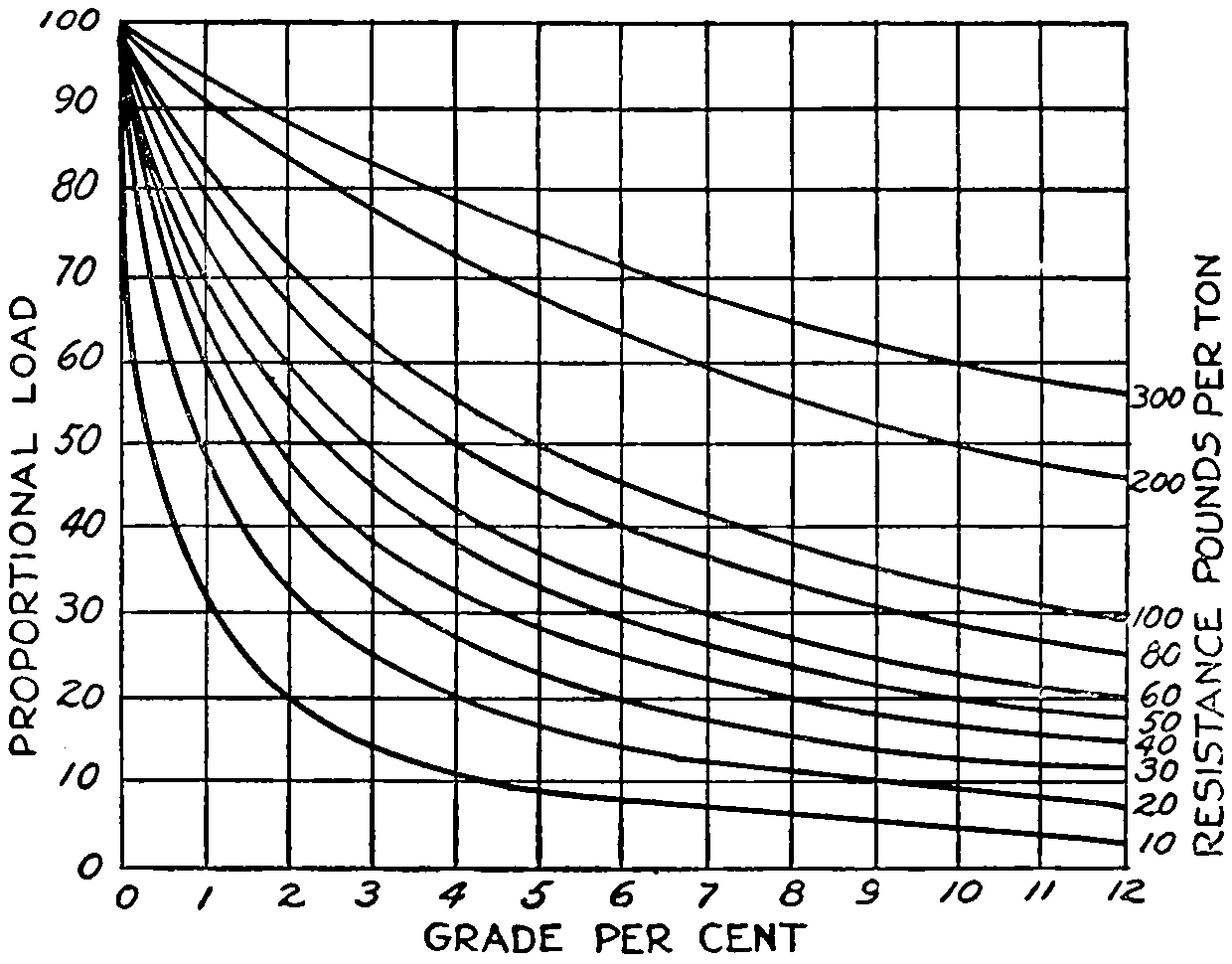
Graphical representation of the effect of grade on the load that can be drawn.
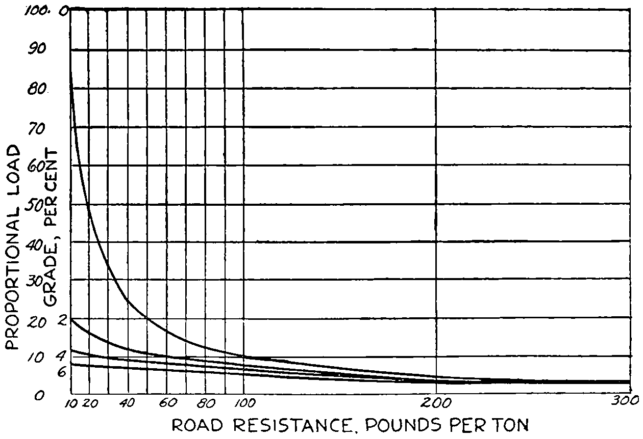
Graphical representation of the effect of road resistance on the load that may be drawn.
[261]
Slipperiness.
—Road surfaces which become slippery not only decrease the tractive effort of horses and motors but are very dangerous also. Non-slipperiness ought then to be given weight in the selection of the type of roadway. Observations in London in 1873 by Heywood on slipperiness of pavements indicated granite-block most slippery, then asphalt and wood-block. Greene, in 1885, analyzing a series of observations made in the principal cities of the United States, gave the order of slipperiness as wood-block, granite-block, and sheet-asphalt.
Slipperiness increases with grade. A special committee upon road materials of the American Society of Civil Engineers[183] recommend the following maximum grades for various kinds of pavements:
| Kinds of Roadway | Maximum Grade Per Cent |
|---|---|
| Gravel | 12 |
| Broken stone | 12 |
| Bituminous surface | 6 |
| Bituminous macadam | 8 |
| Bituminous concrete | 8 |
| Sheet asphalt | 5 |
| Cement concrete | 8 |
| Brick, cement grout filler | 6 |
| Brick, bituminous filler | 12 |
| Stone-block, cement grout filler | 9 |
| Stone-block, bituminous filler | 15 |
| Wood-block | 4 |
[262]
This would indicate that in the belief of the committee slipperiness is about in the inverse ratio of the grades. Those on which the steepest grades are allowed being the least slippery.
Climatic conditions affect slipperiness. Roads which are non-slippery in dry weather may be very slippery in wet weather. Pavements having a small amount of clay or earth on them are quite slippery when dampened, but after a hard rain may be much less slippery. Earth roads that have been thoroughly dragged are much more slippery immediately after a small shower than after a hard or soaking rain. Stone blocks and brick are worse after they have worn turtle-backed. Ice and sleet render all pavements slippery, but some more than others.
Sanitariness.
—The sanitariness of a road is the measure of the effect it has on the health of its users and the dwellers along its side. A dusty road is ordinarily an unsanitary one because of the germs of disease carried on the dust particles and which may be widely spread by the wind. An earth or gravel road when not dry or dusty is a sanitary road. A concrete or asphalt pavement when clean is very sanitary, but because dirt and debris brought upon it soon becomes ground into dust may become more unsanitary than an earth road. Mud, when clean, if that expression may be allowed, is sanitary, but when mixed on the road with the droppings of animals, sputum and other unclean things may become very unsanitary.
Noisiness.
—Noisiness is a real source of disease, especially mental disorders. The less noisy types of pavement are usually laid in front of hospitals.
Acceptability.
—The acceptability of a roadway depends in addition to the things mentioned on its looks, appearance, esthetics; on the degree of heat and light which it reflects; upon its springiness and comfortableness to travel over as well as its easiness upon horses’ feet and rubber tires.
© Underwood and Underwood
CROWNING A CALIFORNIA DIRT ROAD WITH TRACTOR DRAWN GRADER
[263]
Some Types of Roads and Their Qualities.
—Earth Roads.—The good qualities are: low first cost, not slippery, noiseless, easy on horses’ feet and on rubber tires, comfortable when in first-class condition. The poor qualities are: high tractive resistance, not durable, high cost of maintenance when traffic becomes dense, requiring constant attention to be kept in good condition, difficult to clean, muddy in wet weather, dusty in dry weather, choppy when dust blows away, rut easily, wear down rapidly under heavy traffic especially in windy localities, uncomfortable except when in prime condition. Adaptability: Satisfactory for light or medium traffic when properly drained and constantly maintained. It will probably pay to put in better roads when the traffic amounts to more than 400 vehicle-tons per day.
Sand-clay Roads.—The good and poor qualities are about the same as for earth roads. In fact they are earth roads with a selected mixture of sand and clay. They are more durable, harder and smoother than the ordinary earth road. They are appropriate for a light or medium traffic and are especially adaptable for sandy stretches or over clay or gumbo soils. The cost will depend upon the availability of materials; the cost of maintenance should be no more or very little more than earth roads. They should be good up to 800 vehicle-tons per day.
Gravel Roads.—The good qualities are: moderately hard, compact, and smooth, not slippery, noiseless, easy on horses’ feet, and not very hard on tires, not muddy, are comfortable, and low in first cost. Poor qualities: rut rather easily and require constant attention to keep them in first-class condition, dusty in dry weather. Gravel sometimes becomes loose on top and rolls under fast moving vehicles, causing skidding. When not thoroughly compacted gravel roads have high tractive resistance. They are particularly well adapted to country roads under medium traffic, especially where gravel may be obtained at[264] a reasonable cost near at hand. At the present time more miles of gravel roads than of any other type of surface are being constructed in the United States. This is because of their low first cost and general satisfactory character for medium traffic.
Macadam Roads.—Moderate first cost and when well compacted smooth but not slippery. They require new dust continually to keep the stones cemented together. Under rubber tires the dust is not worn off the stones and what little there is on the roadway is picked up and spread to the winds. If covered with tar or asphaltic oil the stones cement together and form excellent roadways under medium traffic, where there are no extremely heavy trucks to cut through the surface. Traffic up to 1200 vehicle-tons per day is accommodated well by these roads.
Bituminous macadam roads are ordinary macadam roads impenetrated with bituminous materials. When well made they are excellent roadways, and unless extremely heavy trucking comes upon them ought to prove satisfactory for medium to moderately heavy traffic.
Bituminous Concrete Roads are made of broken stone mixed with a bituminous cement before laying and rolling. They, like bituminous macadam, are smooth, non-slippery, easy riding, have small tractive resistance and the first cost and cost of maintenance are moderate. Such roads have proven very satisfactory where the traffic is dense but not composed of real heavy units. On account of their dustlessness and general sanitary character as well as for their durability they are deservedly popular.
Brick Roads.—Vitrified paving brick give a hard durable surface, reasonably smooth and not slippery. The cost of maintenance is low and the appearance is good. Brick roads are expensive as a heavy concrete foundation is necessary, and they are noisy. They are well adapted for heavy hauling.
Concrete Roads.—This type of roadway is rapidly forging to the front. With the exception of gravel it leads in[265] mileage of hard-surfaced roads. When made of good concrete sufficiently thick it has proven itself to be durable, hard, smooth, of small tractive resistance, comfortable, and not particularly expensive in first cost or maintenance.
With horse-drawn iron-tired vehicles it is doubtful if it would prove as durable as some other types but for rubber tired motorized vehicles it seems to be extremely well adapted. There is no doubt but that this type will continue to be popular. It has a tendency to crack under the action of temperature and moisture. It is customary to fill these cracks with tar, pitch or asphalt, giving an appearance which some people think not pleasing. The pavement is rigid and noisy, therefore objectionable for some localities.
Creosoted Wood Block Roads.—Wood blocks treated with creosote to preserve them from decay make an excellent pavement. They are smooth, durable, noiseless and sanitary, have small tractive resistance and are comfortable to ride upon. The principal objection is their habit of “bleeding” in the summer time. The sticky oil tar that oozes out is very objectionable, as it adheres to shoes and is tracked into houses. The first cost is considerable, but maintenance is low for many years after laying. Wood block roadways seem well adapted for bridge floors, for stable and shop floors, and for heavy teaming when placed on a substantial concrete foundation. They seem to last better for a moderate or semi-heavy use; when left idle they are more subject to decay.
Asphalt Block Roads have proven satisfactory for both country and city roads where the traffic is reasonably heavy. They are laid on both cement concrete and asphaltic concrete bases. They are smooth, easy riding, have light tractive resistance, are not very noisy, and are sanitary. The dark color is rather pleasing.
Sheet Asphalt Roads and Streets, considering their cost, durability, smoothness, ease of riding, low tractive resistance, and general acceptability, are among the most[266] popular roads. What has been said of sheet asphalt will apply to asphaltic concrete of the Topeka specification and bitulithic types. The road is better for use. The asphalt and sand surface has the habit of swelling and cracking when not used. The proportioning and laying of a sheet asphalt surface is a particular job and requires a person of technical knowledge and experience to do it properly. Sheet-asphalt pavements seem well adapted for city streets and roads where there is a medium or dense traffic. With a firm foundation it stands up well under the heaviest traffic. Its popularity is truly deserved. The pavement under some conditions of moisture is inclined to be slippery but when dry is not. Neither is it very noisy.
Miscellaneous.—There are numerous other types of roads that have their proper uses in many localities. Burned clay, shell, furnace slag, coal slack, cinders, plank, corduroy, hay, bagasse, and possibly other materials have and will continue to be used with more or less success. The proper places for their use will depend upon local conditions which every good engineer always takes into account before deciding upon a type of roadway.
Comparison of Roads.
—In order to compare the relative merits of different types of roads weights are usually given to the different qualities entering into the roadway that they may be compared with a predetermined ideal. It must be remembered that such tables apply only to the particular road for which they are made out. No two can be exactly alike.
Here is one adapted from the author’s work on “Highway Engineering.”[184]
[267]
Comparative Table of Several Types of Roadway for Some Particular Locality
| Qualities | Ideal Road for this Particular Location |
Best Earth Road |
Sand Clay Road |
Gravel Road |
Mac- adam Road |
Brick Road |
Con- crete Road |
Asphalt Block |
Cre- osoted Wood Block |
Bitu- minous Con- crete |
Sheet Asphalt |
|---|---|---|---|---|---|---|---|---|---|---|---|
| Low first cost | 20 | 20 | 16 | 16 | 15 | 10 | 12 | 10 | 8 | 14 | 13 |
| Low cost of maintenance | 20 | 15 | 15 | 10 | 8 | 9 | 8 | 8 | 10 | 8 | 10 |
| Ease of traction | 10 | 1 | 4 | 6 | 8 | 10 | 10 | 9 | 9 | 9 | 10 |
| Non-slipperiness | 10 | 9 | 9 | 9 | 9 | 8 | 5 | 5 | 5 | 5 | 5 |
| Noiselessness | 5 | 5 | 5 | 5 | 4 | 1 | 1 | 2 | 4 | 2 | 2 |
| Healthfulness | 10 | 5 | 5 | 6 | 8 | 9 | 9 | 9 | 8 | 9 | 9 |
| Freedom from dust and mud | 10 | 1 | 2 | 3 | 4 | 9 | 9 | 9 | 9 | 9 | 9 |
| Comfortable to use | 10 | 3 | 4 | 5 | 6 | 8 | 8 | 9 | 9 | 9 | 9 |
| Appearance | 5 | 2 | 3 | 3 | 4 | 3 | 4 | 5 | 5 | 5 | 5 |
| Total | 100 | 61 | 63 | 63 | 66 | 69 | 66 | 66 | 67 | 70 | 72 |
Tilson gives the following weights for city pavements having heavy traffic:[185]
| Pavement Qualities | Per- cent- age |
Gran- ite Block |
Wood Block |
Brick | Sheet As- phalt |
Bitu- lithic |
|---|---|---|---|---|---|---|
| Cheapness | 14 | 8 | 8 | 13 | 14 | 12 |
| Durability | 21 | 21 | 16 | 12 | 15 | 15 |
| Easiness of cleaning | 15 | 10 | 14 | 15 | 14 | 14 |
| Light resistance to traffic | 15 | 13 | 14 | 15 | 11 | 12 |
| Non-slipperiness | 7 | 7 | 4 | 6 | 5 | 6 |
| Ease of maintenance | 10 | 10 | 8 | 6 | 6 | 6 |
| Favorableness to travel | 5 | 2 | 5 | 3 | 4 | 4 |
| Sanitariness | 13 | 9 | 13 | 10 | 12 | 12 |
| Total | 100 | 80 | 82 | 80 | 81 | 81 |
| Less cheapness | 72 | 74 | 67 | 67 | 69 |
[268]
The Forest Service of the U. S. Department of Agriculture presents the following table:
| Pavement Qualities | Per- centage |
Granite Block |
Sheet Asphalt |
Brick | Mac- adam |
Wood Block |
|||||
|---|---|---|---|---|---|---|---|---|---|---|---|
| Cheapness | 14 | 4 | 6 | 1⁄2 | 7 | 14 | 4 | 1⁄2 | |||
| Durability | 20 | 20 | 10 | 12 | 1⁄2 | 6 | 14 | ||||
| Ease of maintenance | 10 | 9 | 1⁄2 | 7 | 1⁄2 | 8 | 1⁄2 | 4 | 1⁄2 | 9 | 1⁄2 |
| Ease of cleaning | 14 | 10 | 14 | 12 | 1⁄2 | 6 | 14 | ||||
| Low resistance to traffic | 14 | 8 | 1⁄2 | 14 | 12 | 1⁄2 | 8 | 14 | |||
| Non-slipperiness | 7 | 5 | 1⁄2 | 3 | 1⁄2 | 5 | 1⁄2 | 6 | 1⁄2 | 4 | |
| Favorableness to travel | 4 | 2 | 1⁄2 | 4 | 3 | 3 | 3 | 1⁄2 | |||
| Acceptability | 4 | 2 | 3 | 1⁄2 | 2 | 1⁄2 | 2 | 1⁄2 | 4 | ||
| Sanitary qualities | 13 | 9 | 13 | 10 | 1⁄2 | 4 | 1⁄2 | 12 | 1⁄2 | ||
| 100 | 71 | 76 | 74 | 1⁄2 | 55 | 80 | |||||
Crosby gives three sets of ideal crusts for country roads: V for main roads, carrying a fairly heavy mixed traffic, W, secondary roads carrying moderate traffic, and X on minor roads with light farm travel almost wholly.[186]
| Components | Ideal | Brick | Plain Cement Con- crete |
Bitumi- nous Mac- adam |
Water- bound Mac- adam |
||
|---|---|---|---|---|---|---|---|
| V | W | X | |||||
| First cost, cheapness | 15 | 15 | 15 | 8 | 10 | 10 | 15 |
| Maintenance, cheapness | 25 | 25 | 20 | 25 | 20 | 20 | 10 |
| Durability | 7 | 7 | 7 | 7 | 5 | 5 | 3 |
| Ease of maintenance | 8 | 10 | 10 | 7 | 8 | 8 | 10 |
| Cleanliness | 5 | 5 | 5 | 3 | 3 | 5 | 2 |
| Low tractive resistance | 10 | 5 | 5 | 5 | 4 | 4 | 4 |
| Non-slipperiness | 10 | 10 | 10 | 4 | 7 | 5 | 10 |
| Sanitariness | 5 | 5 | 5 | 4 | 4 | 5 | 3 |
| Noiselessness | 5 | 5 | 5 | 3 | 3 | 5 | 4 |
| Acceptability | 5 | 5 | 8 | 2 | 3 | 4 | 5 |
| Favorableness to travel | 5 | 8 | 10 | 3 | 5 | 6 | 8 |
| Total | 100 | 100 | 100 | 71 | 72 | 77 | 74 |
[269]
Anderson gives the following economical table to assist in arriving at a proper type of surfacing:[187]
Method of Making Economical Comparison of Road Surfaces
| Item | Possible Types of Surfacing |
||
|---|---|---|---|
| A | B | C | |
| Estimated life of surface with proper maintenance, years | 4 | 8 | 12 |
| Original construction cost per mile | $ 8,000 | $15,000 | $30,000 |
| Annual charges for interest, depreciation and resurfacing | 2,364 | 2,528 | 3,797 |
| Cost of maintaining surface per mile, average, annual | 1,000 | 750 | 200 |
| Total cost per mile at end of 12th year, period | 40,368 | 39,336 | 47,964 |
| Value of road surface per mile at end of 12th year period | .... | 7,500 | 12,000 |
| Net outlay per mile of road | 40,368 | 32,836 | 35,964 |
The choice of selection here is evidently between B and C, with the figures so close together that the one with the least number of uncertainties would probably be adopted if economy is the determining factor.
Another method of making economical comparisons is shown in the table and plot following:
| Item | 1 | 2 | 3 | 4 | 5 | 6 | 7 |
|---|---|---|---|---|---|---|---|
| Earth Road |
Gravel Road |
Bitumi- nous Macadam and concrete |
Portland Cement Concrete |
Sheet Asphalt Bitulithic |
Brick Stone Block |
Wood Block |
|
| First cost per mile | $1,000 | $5,000 | $10,000 | $20,000 | $30,000 | $40,000 | $50,000 |
| Annual Interest, 5 per cent | 50 | 250 | 500 | 1,000 | 1,500 | 2,000 | 2,500 |
| Annual Maintenance | 250 | 250 | 500 | 100 | 100 | 50 | 50 |
| Life of surface, yrs. | 0 | 5 | 10 | 20 | 20 | 25 | 25 |
| Cost of resurfacing | $ 0 | $2,500 | $ 5,000 | $15,000 | $15,000 | $25,000 | $35,000 |
| Annual Sinking Fund 31⁄2 per cent | 0 | 466 | 427 | 530 | 530 | 884 | 899 |
| Annual Total Cost | 300 | 966 | 1,427 | 1,630 | 2,130 | 2,934 | 3,449 |
| Daily Cost, per mile | 0.82 | 2.74 | 3.90 | 4.45 | 5.84 | 8.03 | 9.46 |
[270]
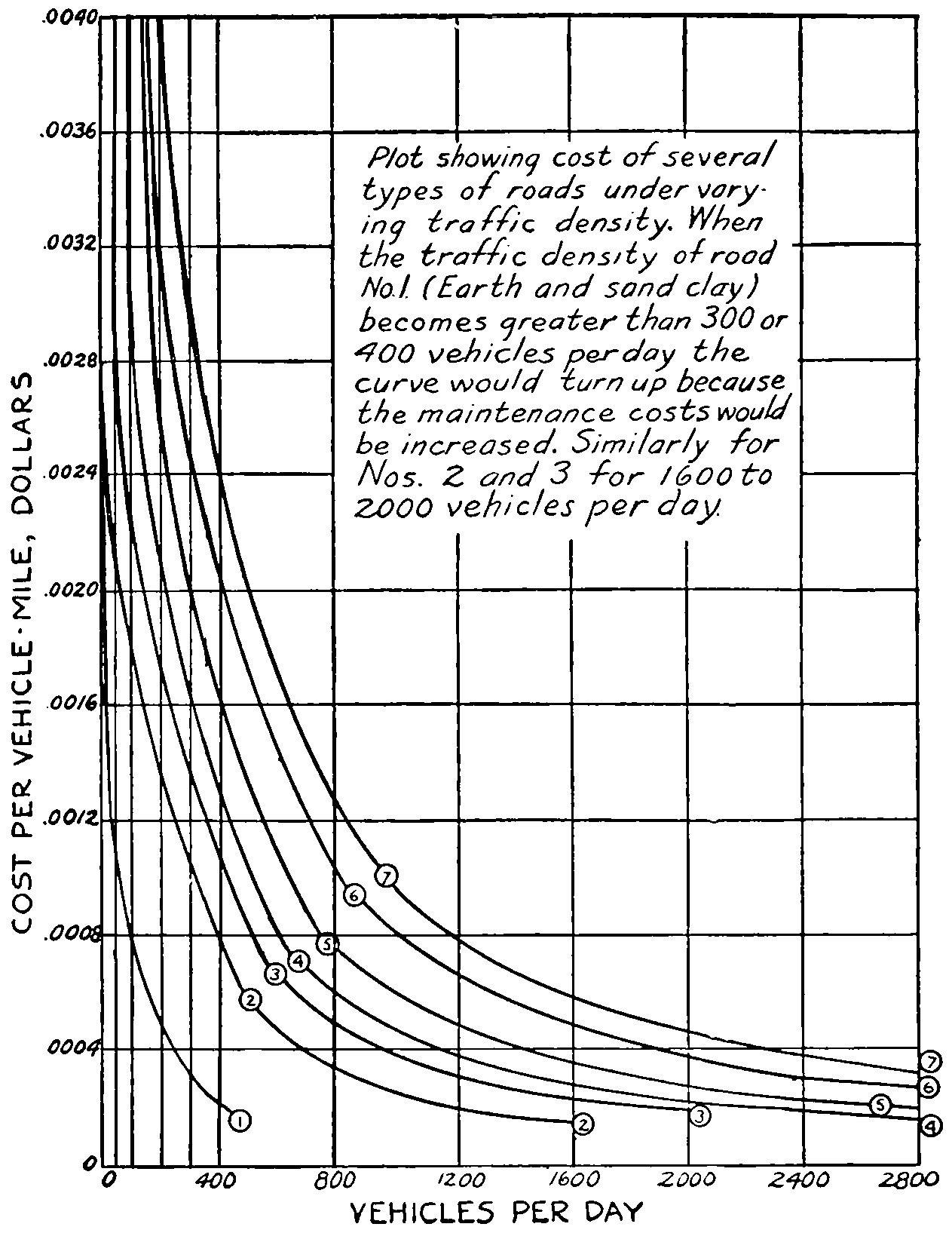
Plot showing cost of several types of roads under varying traffic density. When the traffic density of road No. 1 (Earth and sand clay) becomes greater than 300 or 400 vehicles per day the curve would turn up because the maintenance costs would be increased. Similarly for Nos. 2 and 3 for 1600 to 2000 vehicles per day.
[271]
SELECTED REFERENCES
“American Civil Engineers’ Pocket-Book,” Sec. 15, Art. 4, John Wiley & Sons, New York.
“American Highway Engineers’ Handbook,” p. 1360, John Wiley & Sons, New York.
American Society of Civil Engineers, Proceedings, 1918, p. 2327.
Anderson, Andrew P., “Modern Road Building and Maintenance.” Hercules Powder Co., Chicago.
Automotive Industries, “The Motor Bus Field as a Market for Trucks,” Vol. XLV, pp. 627-628, Sept. 29, 1921; “Weight of Trucks,” May 18, 1922.
Blanchard and Drowne, “Textbook of Highway Engineering,” Chap. II, John Wiley & Sons, New York.
Bullard, General Robert Lee, “The Motor Truck’s Importance on the Battle Front of France,” National Automobile Chamber of Commerce, New York.
Chatburn, George R., “Highway Engineering—Rural Roads and Pavements,” pp. 22-28; John Wiley & Sons, New York.
Collins, J. A., “Transportation Surveys for Rural Express Routes,” Good Roads, March 17, 1919.
Cornell Agricultural College Bulletin No. 205; Ithaca, New York.
Crissey, Forrest, “Our New Transportation System,” Saturday Evening Post, December 16, 1922, p. 14.
Crosby, W. W., “The Scientific Selection of Pavements,” Municipal Journal, May 29, 1913.
Dalton, James C., “Highways Must Be Made Self-supporting,” Automotive Industries, May 25, 1922.
Good Roads.—“Benefits of a National Highway System,” A committee report of the American Road Builders Association, Jan. 19, 1919.
Haydock, Winters, “The Pittsburgh Traffic Count,” Proceedings of the Engineering Society of Western Pennsylvania, Vol. XXVII, pp. 477-513.
Hirst, A. R., “Laying out Wisconsin Trunk Line Highways,” Good Roads.
Horine, M. C., “Economics of Motor Transport,” Journal of the Society of Automotive Engineers, May, 1922.
James, E. W., “Distribution of Traffic on a Rectangular System,” Engineering Record, Vol. LXXIV, p. 439.
Johnson, A. N., “The Traffic Census,” Public Roads, Dec. 1920, Appendix; also p. 16.
“Traffic Census and its Use in Deciding Road Width,” Public Roads, July, 1921, p. 7.
[272]
Jadwin, Colonel Edgar, “Relation of the War Department to Improved Highways.” Bulletin No. 25 of the Texas Engineering Experiment Station, Agricultural and Mechanical College of Texas, May 1, 1922, p. 40.
MacDonald, “Classification and Uses of Highways,” Engineering News-Record, Vol. LXXXIII, pp. 984-985, 635.
Massachusetts Highway Commission Report, 1912.
Simonds, Frank H., “History of the World War,” Vol. I, p. 118, Vol. V, p. 115. Doubleday, Page & Company, New York.
New Jersey State Highway Commission, Committee Report on Traffic Census—Engineering News-Record, Vol. LXXXVI, p. 338.
Taylor, Colonel B., “Similarity of Military and Commercial Motor Transportation,” National Automobile Chamber of Commerce, New York.
United States Bureau of Public Roads, “A Study of the California Highway System,” Public Roads, pp. 124, 136-138, 196-197, 200-209.
United States Census Reports.
United States Department of Agriculture, Bureau of Statistics Bulletin 49. Bureau of Forestry Bulletin.
FOOTNOTES
[173] Highway is sometimes used in the sense of greater importance and road in that of less, as in the expression “highways and roads.” Baker in his “Roads and Pavements” uses roads to indicate unpaved highways.
[174] See Engineering News Record, Vol. LXXXIII, p. 985.
[175] “Economies of Motor Transport,” by Merrill C. Horine, Engineer International Motor Company, New York City, in the Journal of the Society of Automotive Engineers, May, 1922.
[176] See Simonds’ “History of the World War,” Vols. I and V.
[177] “Am. Civ. Eng’s. Pocketbook,” Sec. 15, Art. 4, Wiley & Sons, N. Y.
[178] Report of Third International Road Congress, 1913.
[179] Bulletin 205, Cornell Agricultural College; Bulletin 136, U. S. Department of Agriculture; Bulletin 49, Bureau of Statistics, U. S. Dept. of Agr. Reports of the 1910 U. S. Census.
[180] From Bulletin 136, U. S. Department of Agriculture.
[181] Engineering Record, Vol. LXXIV, p. 439.
[182] See “Highway Engineering,” by G. R. Chatburn, pp. 22 to 28, Wiley & Sons, New York, publishers.
[183] Am. Soc. C. E. Proceedings, 1918, p. 2327.
[184] “Highway Engineering—Rural Roads and Pavements,” by George R. Chatburn, John Wiley & Sons, New York.
[185] “American Highway Engineers’ Handbook,” p. 1360, Wiley & Sons, New York.
[186] “The Scientific Selection of Pavements,” by W. W. Crosby, in Municipal Journal, May 29, 1913.
[187] “Modern Road Building and Maintenance,” by Andrew P. Anderson.
[273]
CHAPTER IX
EFFECT OF EASE AND COST OF TRANSPORTATION ON PRODUCTION AND MARKETING
The creation of economic utilities by the application of the mental and physical powers of man to the materials of nature is called production. Grass grew abundantly for thousands of years over the great plains of the Mississippi valley, but there was no production until it was utilized by the hand of man for economical purposes. Just so far as change came to that grass through the application of labor, physical or mental, or stored up in capital, there was production. Productive activities may be classified as those which have to do with: (1) a change in form, (2) a change in place, (3) a change in the potential time of use. Productive activities add to the materials as received other values, namely, form utilities, place utilities, and time utilities. The farmer through the processes of sowing, cultivating and harvesting, is instrumental in changing the elements of nature into grain, of adding form utility; it is transported over the roads and railways to elevators, thus is added place utility; it is there stored until needed thereby the third or time utility is attached. In the illustration just given wheat stored in the bin is considered the finished product. But a finished product of one productive activity may be the raw product of another. For instance, the wheat is taken from the bin and ground into flour, the flour transported to the place of storage, and held as a finished product until it is wanted by another productive activity in which the flour is the raw product. The baker takes the raw product, flour, molds and bakes it into bread, which is held by the merchant for sale.[274] The wheat thus has passed through the three productive processes three different times. Other things may have passed through more before the final consumptive process occurs.
Production is very commonly thought of as being only the first one of the three operations, but the changes brought about by the transporter and the merchant are productive of economic wealth through the application of human physical and mental efforts hence are as truly a part of production as is the first operation.
The factors which enter into production are by some economists given as nature and labor, by others as land, labor, and capital. Under nature or land are included all natural elements, external to man, such as the forces of cohesion, gravitation, of moving air and water, and also the stored-up riches of nature. Under labor are placed all those things or utilities which have been added by the application of human endeavor, either mental or physical. Physical strength in and of itself is not sufficient, for the productive output increases with mental strength. The ox or the horse is capable of exerting greater physical force than is man, but without the guiding, directing force of man’s mind it would produce nothing. Moral qualifications are also placed under the general heading “labor” as they affect production. Temperance, dependability, prudence, frugality, etc., have in them productive elements of importance the same as the intellectual qualifications of quick perception, alertness, imagination reason and judgment.
Capital has been frequently defined as stored-up labor. It is the finished product of some previous effort, but as wheat and flour may be considered as intermediate products between nature and bread, so capital may be looked upon as an intermediate product between nature and more labor necessary to produce anew. “Its own origin, its existence, its subsequent action are nothing but stages in the continuous working of the true elements, nature and[275] labor.”[188] Capital—raw materials, tools, machines, buildings, equipment, means for transportation and selling, stored products—is absolutely essential to more production, hence may be considered as an independent factor, although it may have been the product of previous labor allied to natural powers.
From what has been said it will be readily seen that transportation and marketing (selling) are a part of the process of production. Transportation can be divided into two classes: primary, transportation upon the public roads; and secondary, transportation on railroads, canals, steamboats and steamships. Marketing is likewise divided into two classes: wholesaling and retailing. The wholesaler buys goods in quantity from the manufacturer and sells them to the jobber who in turn sells them to the retailer. The jobber usually divides the larger purchased quantities into smaller or job lots in any quantity suitable to the retailer. The wholesaler and the jobber may be combined into one individual or firm. The jobber will, usually, not sell directly to the consumer; he sells only to retailers. The retailers frequently have a sort of “gentlemen’s” agreement with the jobber not to buy directly from the producer. This sort of complicated machinery often involves more expense than direct trading. After each of the transactions mentioned there is usually a change of place and a waiting in store.
Grain Exchanges.
—In the grain business there has been developed a great system of selling through commission merchants, that is, the selling agents take commissions on the sales for their remuneration. A limited number of the commission merchants of a particular city organize themselves into incorporated bodies for the purpose of providing themselves with houses and facilities for doing business and establishing rules for the transaction of the same. Such organizations with places of doing business are known as Grain Exchanges or Boards of Trade. The Board of[276] Trade of Chicago, the most noted grain market in the world, was established in 1846.
Mr. Vincent of the Omaha Grain Exchange explains the matter as follows:[189]
Suppose that a group of twenty-five mule breeders in Missouri came to Omaha to sell several hundred mules, and buyers assemble from several states. The mule dealers find a vacant lot in a convenient locality and secure permission to use it temporarily. It is the mule market, or mule exchange. The buyers and sellers meet and dicker, each trying to secure the best bargain he can. Every purchase or sale is an individual transaction—between one seller and one buyer. The vacant lot or “mule exchange” has nothing to do in the transaction—it occupies no place in the trade. It is simply the location where the traders gather for their own convenience. If the traders hire a clerk to act for all in settling the trades and collecting the money, it is simply because the clerk has the knowledge of a technical nature not possessed by all traders and his employment is a convenience to all concerned. He represents the individual traders and not the mule market.
Now translate mules into cars of grain and the “vacant lot” into a board of trade building erected for the convenience of traders engaged in a permanent business. The transactions held on the board of trade are the individual trades between the individual seller and buyers, just the same as in the mule market. The board of trade is simply the location where buyers come to meet sellers (or their agents the commission men.)
Vincent’s theory that the board of trade is the “location where” is hardly inclusive enough, for only a favored few who have “purchased seats” or are stockholders of the incorporation are privileged to buy and sell on the board of trade, that is, are a part of an organization known as a board of trade. His own pamphlet states that he is a “Member of the Omaha Grain Exchange.”
Vincent defines a commission merchant as “the agent of men (1) who do not have enough grain to sell so they[277] can afford the time and expense to come with the grain so as personally to make the sale, and (2) who would be meeting strangers and who would not know which of the buyers might want the particular kind or grade he might have for sale.” He contends that it is not only an economy to the seller to employ the services of the commission merchant but that it is necessary to have the selling done by some one “who knows who the buyers are in the various lines—corn, oats, barley, and wheat of the different kinds and qualities,” and who knows “the inspection rules and sees that the grain is properly graded—in short” one who “does for his employer, or principal, all those things that he would do for himself if he were in the central market and acquainted with the buyers.”
Vincent upholds the custom of dealing in futures, as it furnishes a sort of insurance to the legitimate dealer in grain. When the local dealer buys, say, 10,000 bushels of wheat which by ordinary methods of business may require from two to four weeks to get to the terminal marketing point, he at the same time sells on board of trade 10,000 bushels for future delivery, thus “hedging” the purchase. If wheat goes up he gains on the actual wheat in transit but loses on his hedge. If wheat goes down he loses on the 10,000 bushels in transit, but gains on his hedge; thus, either way, the one transaction balances the other so there is no gain, and no loss, except the cost of the hedge, and hence no speculation. Hedging is, in short, a sort of insurance that protects the dealer should the price of grain fall between the time he purchased it and the time of selling it at the terminal. The process of hedging when honestly carried on is a stabilizing operation and according to Vincent “effects the commercial transfers of grain from farmer to miller at a less expense than is involved in the marketing of any other product of human endeavor—at less expense than would be possible if grain merchants alone carried all the risk—the speculation.”
Coöperative Marketing.
—Coöperative marketing associations and the intermediate dealer, that is a man who[278] buys directly from the producer and resells to other purchasers, are said to have two points of superiority over the commission merchant: (a) The care and solicitude of the owner replaces the zeal of the agent; (b) by combining the products of many they are able to handle large quantities and thus secure better shipping rates, and take advantage of other benefits of quantity business. The farmer or local dealer, or coöperative association, ships to the commission merchant only in carload lots. The freight charge, nowadays, no matter what the custom may have been in the past, is the same whether one or a dozen cars are shipped at a time. There may be some favoritism in the securing of cars when asked for by the large shipper. The inspection charges are fixed by law. The commission merchant’s fee is a percentage of the sale and thoroughly regulated by custom and the rules of the grain exchange. The commission merchant being acquainted with buyers can usually place all grain the day it is received, so the advantage, if any, of an intermediate dealer are more in name than in reality.
With the idea of eliminating some of the cost of marketing coöperative associations have sprung up over the whole country. While there are many advantages of coöperation, such as by pooling interests, larger quantities can be handled in one bulk, thus getting any advantage that might come in freight rates. Also where large quantities are collected it is practically always possible to take care of buyers; or, the agency may know where to find buyers when an individual would not. The buyer for overseas exports wants to get his grain in as large lots as possible to reduce handling charges. The association usually has facilities to examine and separate the grain or other commodities into the several grades, and the buyer can rely on the grade being as stated by the seller. In the case of some perishable goods, such as fruit, the association advertises freely, spreading the cost over many raisers, and creating a desire on the part of consumers for the association’s[279] named brand of fruit. “Sunkist” lemons and oranges and “Sun Maid” raisins are household words due to extensive advertising by their respective coöperative associations. Coöperative associations purchase from non-members and profits on these purchases go to the association and in due time are distributed to its members. The California Fruit Growers’ Exchange advertises itself as “A non-profit coöperative organization of 10,500 growers.” The object of all such associations is two-fold: (1) To decrease the cost and trouble of marketing, and (2) to increase the common desire for their products. Both of which will tend to increase the grower’s profits.
The grain merchant, whether in business as a dealer for himself, or a coöperative concern must have an elevator, or place, where the grain may be collected and prepared for the larger market. Fruit dealers have houses for the collection and care of the fruit. Since these commodities are collected a little from one, a little from another, or for ripening, grading, or other purposes, they must be kept usually several days before the car is loaded. After it is loaded there is quite a little time before it reaches its destination. During this time there is money invested in these products, that is, capital is required. The local banker is called upon to help finance the purchases. The elevator company or fruit company has some capital, he depends upon borrowing for more. The banks when commodities are freely moving are frequently severely taxed to furnish the required money for the movement of crops. The banks at the terminal markets are also stressed for they are furnishing money to the buyers there, and the export commodities are paid for by money from abroad. So that many financial institutions are intimately interested in the crop movement capital.
Whenever a local dealer consigns a car load of wheat to a responsible merchant he can deposit the bill of lading with his banker and draw upon the merchant for some 90 per cent of the value of the grain, providing the dealer has[280] hedged so that there is no chance of loss. The banker will honor the dealer’s checks and hold the credit of the merchant as collateral.
When grain or other food commodities have been stored the warehouse receipt is considered the best possible collateral for bank loans. Mr. Forgan, president of the National City Bank of Chicago, is quoted as saying:[190] “I have seen the time more than once when high-class stocks and bonds, and even government bonds, could not readily be sold, but I have never seen the time, nor do I ever expect to see it, when anything that has to be eaten could not be sold.” The warehouse receipts, therefore, above alluded to, constitute a collateral which is always available for the payment of debts. Furthermore, if the grain or provisions represented by the warehouse receipts are sold for future delivery, that fact adds a great element of strength to the loan, because there is a third party obligated to take the grain at a certain time for a given price.... The sale for future delivery—the ‘hedge’—is the final link in the chain that makes such loans the best in the world.”
It has been shown that in the production of grain or other farm commodities the three elements, change in form, change in place, and potential change in time enter; while the factors entering are, nature, labor, and capital. These all must be present no matter which method of procedure is followed in the marketing. The cost of marketing must always be counted in the cost of production. A decrease in the cost of any element or factor will of course have its effect on the cost of the whole process. For example, it is claimed by grain merchants that where there is an opportunity to hedge there is less risk and consequently the profits of the middlemen may be less thus decreasing the cost of production.
To get a concrete example of what part transportation bears in marketing the following analysis is made:
[281]
Elements Entering into the Cost of Marketing Wheat Grown in Kansas or Nebraska
| Farm Expense | Cents per bushel |
|
|---|---|---|
| Loading | 0.25 | |
| If sacked, add about 5 cents per bushel. | ||
| Highway Haulage | ||
| A bulletin of the Bureau of Crop Estimates, U. S. Department of Agriculture gives the cost at 30 cents per ton-mile when horses are used and 15 cents per ton-mile by motor-car, the average distance being 9.4 miles, rough average, say | 6.00 | 6.25 |
| Total cost of getting to local market | 6.25 | |
| Local Elevator | ||
| Unloading, storage, cleaning, and mixing, shrinkage. Overhead—interest on investment, taxes, insurance, office expense, depreciation, repairs, hired help, etc., and profit | 3.00 | 3.00 |
| Total cost up to the commission merchant | 9.25 | |
| Freight | ||
| Terminal and hauling charge | 16.00 | |
| Inspection and weighing at terminal | .25 | |
| Profit of commission merchant | 1.25 | 17.50 |
| Total cost up to the exporter | 26.75 | |
| Exporter’s cost | ||
| Elevation, loading into boat, etc. | 1.25 | |
| Ocean freight (very variable), say | 6.00 | |
| Insurance, leakage, etc., in transit | .75 | |
| Overhead expenses of exporter | 1.00 | |
| Profit of exporter | 1.25 | 10.25 |
| Total to Liverpool market | 37.00 | |
The above would indicate that if all wheat were shipped to Liverpool the local price in Nebraska or Kansas should be about 27 cents per bushel below the New York price and 37 cents below the Liverpool price. As a matter of fact the Omaha and Kansas City prices are frequently equal to[282] or exceed the New York prices because there is quite a large local demand for wheat from the mills of the Middle West. It is said nearly one-half the Kansas wheat is milled in that state.
Highway Transportation from Farm to Local Market.
—The table indicates that the highway transportation amounts to about 6 cents per bushel. Had the cost been based on all team hauling it would have been 81⁄2 cents; on truck hauling, 41⁄4 cents. The grand total cost of production would be the
Cost of growing;
Cost of transportation;
Cost of marketing.
Taking up only the transportation from the farm to the local market point, the question arises, what, if any, effect would a change in it have on the character and amount of farm production?
Let there be considered a zone around a local market point; suppose the width of this zone limited the distance from the market at which wheat can be grown profitably when the hauling is all done by horses. Since it can, according to government authority, be hauled at half the cost by motor truck, other things being equal, the zone of profitable productions would be widened to twice its former width with no greater expense to the wheat grower. Or, looking at it another way, the size of the farm could be somewhat lessened and the farmer still make the same gross sum on his crop. This latter would allow a few more people to live in the same territory as formerly. If again by means of paved roads the cost was further reduced one-half the zone could again be doubled; it is then four times its original width. Also, since a living could be made on smaller farms the tendency would be to increase the rural population. But it is not likely that all farmers under increased advantages would continue to raise wheat. Other crops, more perishable but more profitable, would venture forth.
[283]
Such perishable crops as vegetables, head lettuce, tomatoes, cucumbers, cantaloupes, watermelons, etc., require dependable marketing facilities. They must be harvested and put on the market at just the right time or they deteriorate in quality and price very rapidly. Crops that could be hauled by team only 4 or 5 miles could be hauled by truck over a hard road easily 20 miles. Near the large cities truck gardeners by virtue of the truck and the good roads have been able to go out 15 to 20 miles and secure land at a very much lower rent, or purchase it on an amortization scheme at no more annual expense for double or treble the amount of land than they formerly paid in rent near the city for the smaller tract. According to Norton outside the large cities of the East market gardening extends back 25 to 30 miles. That it is not uncommon to haul vegetables to market in trucks 40 miles, and that a New Jersey fruit farmer was accustomed to make a 65-mile trip daily to market his fruit in New York City.[191]
Likewise small fruit farming. One acre of land highly cultivated this year, 1922, produced more than $1000 worth of strawberries, which were brought to the railway station every day on a small truck a distance of 15 miles. Raspberries and blackberries will give almost as good returns. Vegetables of all kinds, and cantaloupes and watermelons in favorable localities, will probably bring larger returns. Even potatoes sometimes give a gross return of from $100 to $300 per acre.
It should be remembered that in every case there must be a keen, avid market and adequate transportation facilities. The market, since more than half the people of the United States live in the cities, is likely to be sufficient if the marketing machinery is ample and properly functioning. Horse-drawn wagons may answer the purpose in some places, in others the motor truck, but other crops cannot be marketed without access to the steam railway. For instance, could trucks carry cantaloupes from the Imperial[284] Valley in California to New York City? This requires the steam railway and refrigerator cars drawn in rapid trains. The trucks will greatly widen the zone of cantaloupe culture near the shipping point. The same may be said of citrus fruits from Florida and California, tomatoes and watermelons from Texas, plums from Idaho, apples from Washington, grapes from New York and Michigan, and, indeed, some product from nearly every state of the Union, to say nothing of the non-perishable products.
Stock Raising.
—Marketing facilities and road transportation is greatly changing the character of stock raising. Not so very many years ago the great western plains were covered with large herds of cattle whose owners and caretakers were known as ranchers. The ranch usually consisted of the owner’s residence, which he also used as an office, sleeping and eating quarters for the cowboys, a corral or two for the horses and possibly cattle during the round-up and branding season, though this latter was usually on the open. The cattle ranged and fed upon the wild grass, the cowboys riding around the bunch daily in order to keep track of them. The round-up was held in the late summer while the calves were still running with their mothers and could be identified. The cattle of several ranches ran together and at branding periods had to be cut out—separated. Then the unbranded calves and mavericks were roped, thrown and branded; the bull calves were altered and the herd again turned loose upon the prairies. A little later in the fall they were again rounded-up and those to be sold selected and cut out. These were driven to the nearest railway track and shipped to market, sometimes a train load from one shipping point. During the winter season and in violent storms there were many hardships as well as loss of cattle. The cowboys also had to be on the lookout for “rustlers”—thieves who stole the cattle outright, branded unbranded mavericks they knew did not belong to them, or mutilated brands by placing their own over the rightful one.
Meat from these more or less wild, grass-fed animals was[285] seldom better than second class, and never brought on the market the equal of corn-fed cattle. However, they did furnish a reasonably cheap food and kept down the price of meat.
Along with better roads and markets came a demand for other products; land that furnished the open range was fenced in, and later subdivided into farms upon which were raised grain, hogs, poultry, and perhaps a few cattle. Dairying in many places took the place of stock raising. No longer were the animals driven to market on the hoof. They were fattened upon grain and hay and carried to market in wagons and trucks. Hogs replaced cattle. The turnover is more frequent and they do well on maize, requiring no hay or straw except perhaps a very little for bedding. The corn fed to hogs usually brings about twice as much a bushel as that sold to the dealer.
Since about 12 to 15 miles is the greatest distance hogs may with profit be hauled to market in horse-drawn wagons on dirt roads, there grew up at every small railway station a stock market. The railway company provided stockyards, a series of pens with a chute for loading. The dealers bought from the farmers and placed their animals in the railway pens until a car load was obtained, when they were sent on to the packing house located in one of the large cities. Therefore, between the farmer and the packer there were at least two middlemen, the local dealer and the commission merchant at the terminal stock yards which are nominally under a different corporation than the packing houses.
With the good roads and the motor truck has come much marketing directly by the farmer at the packing-house yards. The Firestone Ship by Truck Bureau, a subsidiary organization of the Firestone Tire and Rubber Company of Akron, Ohio, made a careful study of the use of the truck in marketing live stock, and in 1921 issued a bulletin thereon.[192] A detailed showing of the marketing of animals[286] at St. Joseph, Omaha, Cincinnati, and Indianapolis is given. From that bulletin will be copied some statistics and other information that may be of interest. Those wishing the full discussion should write for the bulletin.
Tables are given which “show that at each yard the driven-in receipts during the years 1918, 1919, and 1920 were very much in excess of those of 1917. Of the total receipts (the tables give them each month of the four years) of driven-in hogs at the St. Joseph yards in 1917 approximately 10 per cent were hauled to the yards by motor truck. While the driven-in hog receipts at the same yard during 1918 were twice those of 1917, 40 per cent of this total was driven by truck. In 1920, 60 per cent of driven-in hog receipts were truck hauled. The St. Joseph figures clearly indicate that the truck movement commenced about 1917 and that each of the following years have witnessed decided increases.
“At Omaha truck-hauled receipts appear to have commenced earlier than at St. Joseph; for during the years 1917 and 1918 the best estimates placed the truck-hauled receipts about 90 per cent of the total driven-in receipts, while the year 1919 amounted to 95 per cent of the total driven-in receipts. In 1920 virtually all driven-in receipts were truck-hauled.
“At Cincinnati in the year 1918 more than 90 per cent of driven-in receipts were truck-hauled while in 1919 at least 95 per cent of all stock delivered at this yard other than by freight car came on motor trucks. In 1920 driven-in receipts which were not truck-hauled were negligible.
“Indianapolis has shown the most conspicuous increase in truck delivered stock of any yard in the country. During the last year more than 95 per cent of all driven-in hogs to this yard were delivered by motor truck. It is seldom that team equipment is seen at this yard. At both Cincinnati and Indianapolis on an average day 100 trucks can be seen coming into the yards, while as many as 300 trucks have been counted at Cincinnati in one day, and as many as 450 at Indianapolis.”
[287]
From tables given in the Bulletin are extracted the following data for the Omaha and the Indianapolis yards:
| Omaha Yard | |||
| Year | Driven-in Receipts |
Total Receipts |
Percentage, Driven-in to Total |
|---|---|---|---|
| 1916 | 46,542 | 3,116,820 | 1.47 |
| 1917 | 65,922 | 2,796,596 | 2.36 |
| 1918 | 188,417 | 3,429,533 | 5.38 |
| 1919 | 179,036 | 3,179,116 | 5.64 |
| 1920 | 181,946 | 2,708,482 | 6.67 |
| 1921 | ....... | ........ | .... |
| Indianapolis Yard | |||
| Year | Driven-in Receipts |
Total Receipts |
Percentage, Driven-in to Total |
| 1912 | 110,624 | 1,824,260 | 6.06 |
| 1913 | 90,821 | 1,994,624 | 4.04 |
| 1914 | 96,521 | 2,099,787 | 4.58 |
| 1915 | 136,441 | 2,435,319 | 5.61 |
| 1916 | 173,191 | 2,576,611 | 6.74 |
| 1917 | 271,994 | 2,350,730 | 7.84 |
| 1918 | 462,313 | 2,749,976 | 16.8 |
| 1919 | 709,584 | 2,936,493 | 23.7 |
| 1920 | 787,100 | 2,896,894 | 27.2 |
| 1921 | ....... | ........ | ..... |
A graphical representation shows the continuous increase of driven-in to the total receipts. The table of percentages and the graphical representation are not given in the bulletin. They show very clearly what happened when the motor truck began to function in 1917. The truck has made a very much more effective showing at Indianapolis than at Omaha. No doubt this is because (1) the average haul at Omaha is longer; Omaha draws from a more sparsely settled country and from longer distances; (2) the roads adjacent to Omaha are nearly all, as yet, earth-surfaced. Only a few hard roads have been built; (3) many of the farms in the Omaha territory are large and[288] sell so many animals at a time that they can easily fill one, two, or three railway cars at a shipment. The percentage of truck-hauled stock will no doubt continue to increase until practically all hogs within the economic radius of truck operation are marketed by motor. When the time comes, if it ever will, when abattoirs are established at distances no farther apart than 100 to 150 miles, making the maximum haul 50 to 75 miles, the percentage of stock handled by the railroads to these abattoirs will be very small indeed. The larger packing houses with the advantages of great quantity production will still be able to reach out into the more remote districts and secure that proportion of animals necessary to keep them going which can not be obtained locally.
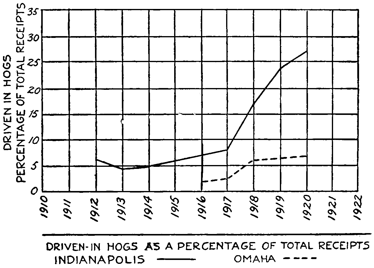
Showing the increase of truck-delivered hogs at Indianapolis and at Omaha.
That there is still an opportunity for increases of motor-hauled stock a further quotation from the Firestone Bulletin will show:
“The territory served by trucks in marketing live stock is principally within a 50-mile radius of the market center.[289] In the course of investigation the longest haul which came under observation was 140 miles. The average haul on the days the investigators were at the markets was about 30 miles. The following table gives some idea of the length of hauls at the four different yards:
| Yard | No. of Trucks Observed |
Longest Haul, Miles |
Shortest Haul, Miles |
Average Haul, Miles |
|---|---|---|---|---|
| St. Joseph | 48 | 100 | 9 | 27 |
| Omaha | 62 | 75 | 6 | 28.2 |
| Cincinnati | 40 | 72 | 3.5 | 28.9 |
| Indianapolis | 40 | 97 | 7 | 32.5 |
“While the average haul is 28.95 miles, most of the trucks observed in the course of investigation use solid-tire equipment. This type of equipment had a tendency to restrict the mileage.”
The bulletin also is authority for a statement that 91.3 per cent of the hogs within a 50-mile circle about the Indianapolis yards are carried by trucks, but that only 18.3 per cent at Omaha move that way, and at St. Joseph 10.8 per cent, which indicates to them that there are still great possibilities for the truck, especially as the truck has not come into as extended use at many other packing centers as at the four places treated in the bulletin.
There is no doubt but that pneumatic-tire equipment, and to a lesser extent, the cushion-tire equipment will extend the average haul to 50 miles. Hard-surfaced roads will again extend it 25 to 50 miles, making a haul of 75 to 100 miles not uncommon.
A further effect of the truck and the ease of marketing which it will bring about is that hogs will be marketed in smaller quantities but oftener. The farmer instead of turning off his marketable animals twice a year will send them in four times a year, possibly monthly. The tendency will be to stabilize the market over the several seasons. As[290] yet, the stabilizing, influence of the truck is hardly noticeable.
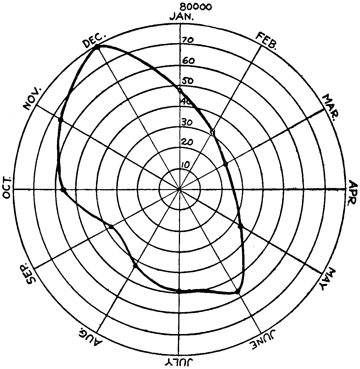
Average number of driven-in hogs marketed at Indianapolis each month; years 1917, 1918, 1919, and 1920 being averaged.

Average number of driven-in hogs marketed at Omaha each month; years 1917, 1918, 1919, and 1920 being averaged.
Diagrams on pages 290 and 291 show the average monthly number of hogs received at the yards of Indianapolis and Omaha by truck; the years 1917, 1918, 1919, and 1920 being averaged. At Indianapolis, where the roads are good the year around, the receipts from June to December are much larger than those from December to June, the peaks occurring in December and June. In Omaha, on the contrary, the greater number of driven-in hogs came in the other half of the year the peaks occurring in January and[291] July. These may be partially accounted for, in the West, on the theory that January 1st and March 1st are regular settlement days and farmers arrange to meet their obligations then by selling off a batch of hogs. They also plan to reduce the number of their hogs to the minimum during the months of May, June, and July, so as to have few fat hogs to carry through the hot weather. In the Eastern states the farmers seem to work on a different basis. If the selling of live stock could be spread out uniformly over the year prices would be more uniform. An analysis of prices on the Chicago hog market shows that they are[292] usually highest during the summer months, from April to August, the months when the fewest numbers are sold. The advantage which those crops which can be stored without deterioration, such as grain, cotton, wool, and lumber, is manifest. The price of meat is less fluctuating than that of live stock because meat can be kept indefinitely in the cold storage houses at a very small expense. It is quite likely that more good roads and a more extensive use of the truck will tend to a better distribution of live stock marketed throughout the several seasons of the year.
One of the principal advantages of marketing by truck is the less liability of losses in transit. Dealers and owners often crowd too many hogs into a freight car and as a result some smother. Or, if hogs from different farms are placed together in a car there may be fighting, which unduly heats up the hogs with equally dire results. It is reported that at the Chicago yards in 1918 there were removed from cars 24,785 dead hogs and in 1919, 28,356. To be sure many of these cars came from a distance and were, perhaps, several days on the way. But a fat hog is a delicate animal and a stream of cold water from a hose on a hot hog will often kill him instantly. Government figures state that one out of every 319 hogs shipped died in transit; of cattle one out of every 998; of sheep one out of every 936. Losses by motor, because the animals are not crowded so many together, because they are acquainted and do not fight, because the distances traveled are usually such that only three or four hours elapse between the times of loading and unloading, and because the driver is always at hand to quell disturbances and to see that there is no undue crowding, are said to be negligible.
The local buyer at points near packing houses has almost become extinct. These men formerly bought from the farmers and held the stock until they had sufficient number to fill a car. Since they would often have to hold them several days they had to buy on a wide margin to insure themselves against loss, from 3⁄4 to 11⁄2 cents a pound. Even where the farmer does not own a truck he can get the[293] hogs hauled at a cost of 1⁄2 to 3⁄4 cents a pound, or a saving of about $15 per truck load. If a return load is to be had, such as lumber or feeders the saving will be greater. One difficulty about the return load is the necessity of thoroughly cleaning the truck body. A shovel, a hose with a fair pressure of water, and a hard floor upon which to stand the truck while it is being cleaned are necessary.
Incidentally it may be mentioned that the local stockyards in the way they are often kept are very unsanitary and certainly a nuisance as far as bad smells are concerned as well as a menace to health.
Shrinkage.
—The argument that there is less shrinkage in motor-hauled hogs than in rail-hauled may be as a general rule true, but, according to the Firestone Bulletin, will not net the farmer much, because buyers base the price they are willing to pay on the dressed weight and not the live weight. It is stated that the buyer from long experience is able to estimate with considerable accuracy the weight at which a hog will dress, and that he makes his price offer accordingly. The percentage loss of weight in dressing is, of course, greater for thin than for fat hogs. By grading the hogs into classes the buyer is enabled to discount the price paid enough to take care of the “fill,” which is said to range from 3 to 5 pounds per hundred weight. But notwithstanding this the fact that the animals are fresher and livelier must have some effect on the mind of the buyer. This may be the reason for the rapid increase of hogs received by truck at the packing houses, being as many as 6800 in a single day at Indianapolis.
Dairying.
—The use to which the motor truck has been put in other industries is fully as important. Many industries use several hundred trucks in their work. Creameries have already been mentioned. The very fact that trucks make regular trips along designated routes is an invitation to the farmers to do more dairying. If John Jones can draw from $50 to $75 a month from the creamery for a few hours’ work each day, Henry Smith living on the next farm is anxious to do likewise. Many good farmers[294] find it to their advantage in the long run to allow the women folks to have all the poultry and creamery money while the men content themselves with the returns from grain, livestock, woodlot, and hay land. Thus is created a division of labor which if carried out to the limit will interest every member of the rural family in some particular part of the farm work.
Without going into detail it may be said that from raising beef on the natural grass of the plains region to the raising of stock for butter, milk and cheese may seem a far cry, but with adequate markets and dependable transportation this is rapidly coming to pass. Dairying has already reached enormous proportions, and since it is estimated that dairy products should constitute for the sake of health and economy about one-fifth the average diet, it can easily be seen that dairying always will be of great importance. Over $18,000,000 a year is now received for milk and cream by Nebraska farmers, and Nebraska is not a leader in this line. No doubt with better roads and better marketing facilities that will be doubled or trebled in a few years.
Poultry.
—We have just mentioned the Nebraska income from milk and cream sold by the farmers. It may be surprising that the sum received from the humble hen is nearly twice as much (given by state authorities as $35,000,000 from the fowls and eggs produced each year).
But the only way this can be successful is by quick and adequate markets. Dressed fowls and eggs are highly perishable products and must be put into the cold storage warehouses at the earliest possible moment. The motor car and the rural express, with their necessary accompaniment good roads, make this possible and thus increase the returns to the poultry industry as well as widen the territory over which it will pay to keep fowls for commercial purposes.
As an illustration of the efficacy of the motor truck in the poultry business this quotation from the New York Times, June 8, 1920, is given:[193]
[295]
At 6 o’clock one morning a motor truck was loaded at Lancaster, Pa., with 18,000 eggs in crates, and 1000 chicks a day old, and started for New York City, one hundred miles away, says the writer. At the same time a similar shipment was sent to the consignee by railroad. It took the truck twelve hours to reach New York. Four of the little chicks were dead and nine eggs were broken when the goods were delivered at the door of the consignee.
The train shipment was four days in reaching Jersey City. It took another day to send a notice to the consignee that the shipment had arrived. He was then compelled to send his own truck to Jersey City for the shipment. When it reached his door thousands of the eggs had been smashed and half the chicks were dead.
Diversified Farming.
—Before leaving the farm it might be well to say that easy marketing makes for diversified farming. All eggs are not put in one basket, and in case of a failure or partial failure in one crop the effect is not felt so much because there are others from which returns will be received. Often drought will injure a wheat crop but later rains will “make” the corn crop; or, earth soaked by winter snows will mature a wheat crop while the corn may, due to a few days of hot dry weather, be a partial failure. While chinch bugs may get the wheat, it is possible to kill potato bugs by spraying. And the year the potatoes die by blight may be excellent for alfalfa and timothy. Diversified farming also allows of the rotation of crops, thus conserving the fertility of the soil. And it all can be done over a wide range from the market place because of good roads and easy marketing facilities.
Forestry.
—Realizing that the lumbering methods in vogue in this country since its earliest settlement are most wasteful and are destructive of the future usefulness of the timbered regions the United States Government has set aside as forest reserves several hundred thousand square miles. A forest crop is like any other crop. It must grow from the seed and at maturity be harvested. Those trees that have reached the point in life where years do not add materially to the lumber content are marked for cutting. So that each year brings a harvest. New trees are planted[296] or allowed to spring up where the old were cut so that there is a continuity. It is estimated that there yet remains some 550,000,000 acres of forest land unsuited for agriculture.
The older lumbering methods meant that a company gained control of a tract of timber land, sometimes they had not purchased it, it was really government owned, and cut and slashed all the trees that were upon it. No attempt was made to utilize any of the tree except the bole; the limbs, containing thousands of cords of good wood, were left with the slash to become the prey later of fierce fires, which often got beyond the bounds of the cutting and destroyed millions of acres of growing timber.[194] At a still earlier day the trees were cut so that they would fall with their tops together, then they were burned in order to clear the land for farming purposes. The only reason settlers did not go to the great prairie lands of the Middle West where such wanton destruction was unnecessary, was the lack of means for rapid transportation, and communication.
Even the loggers and lumbermen were often isolated from all civilization except their own party or neighboring parties of like kind, with no roads but the trails of their own making. The highways of commerce were the streams and rivers to which the logs were rolled or snaked by oxen, mules, or horses, and down which they were floated in the spring when the flow was sufficient to carry them. When they reached the larger rivers they were often bound into rafts and floated hundreds of miles to the mills for sawing, a cheap means of transportation.
As the timber was cut off near the streams it was necessary to go farther back for logs. Then developed the logging railways. Usually narrow gauge lines with small locomotives which brought logs down from the forests to the streams or to other lines of railway. But as yet scientific means of lumbering had not been adopted. Not until the government by making large forest reserves and by insisting that loggers should clean up and burn the slashes in such a manner as not to injure standing timber, and leave the ground in such a condition that new trees of good varieties would spring up to take the places of those cut, did there come any real advancement along these lines.

© Underwood and Underwood
A MILK TRUCK
Equipped with both Cans and Tank
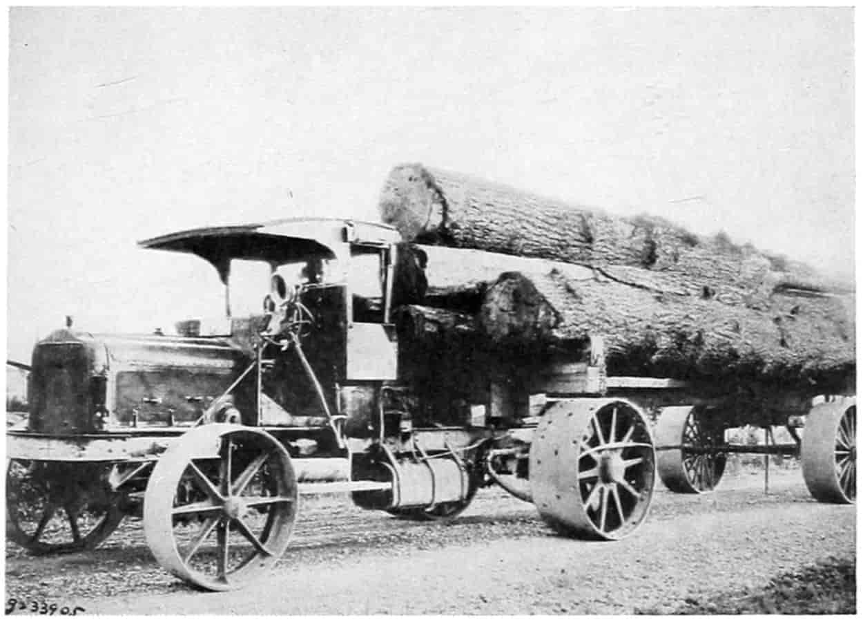
© Underwood and Underwood
A LUMBER LOG TRUCK
Used in the Northwest
[297]
In order that the better methods of lumbering and forest management could be successfully carried out it became necessary to supply roads of such a character that transportation would not be unduly burdensome. If the trees to be cut were to be selected hither and yon, getting the logs and wood from the tops would be a much more expensive process than the mere rolling of boles to the stream and leaving the slash to decay or burn. The Government, realizing this, is now expending millions of dollars on the forest roads making them usable not only by teams but by trucks and automobiles.
The truck and trailer have rapidly made their way in the logging and lumbering industries. By the use of the trailer and the Government-made good roads the truck is able to haul logs of almost any length down from the logging grounds. Trucks and tractors are utilized in the forests, too, for snaking logs and pulling stumps. In places where the grades are steep or on the interior where the roads have not yet penetrated causeways have been built of timber; these usually being cross-ties, and under trussing across draws, with lengthwise planks for the wheels to run on and side planks or logs to keep the machine on the track. Down this causeway by means of a two-wheeled semi-trailer, immense logs are transported. As they are sometimes very steep, chains on the wheels are necessary to prevent slipping and assist in braking.
The average load that a logging truck and trailer will haul is from 3000 to 5000 feet. Larger loads are hauled over snow on sleds, but when distance and time are considered the truck is claimed to be more efficient. F. W. Fenn states that a lumber camp truck to be efficient “must have maximum traction, ample clearance, and proper service and care and be stout enough and strong enough to[298] stand the severest strains.”[195] He further claims that the truck is replacing the older means of transportation, dragging by horses and oxen, skidding down mountain sides, rafting upon rivers, not because it is cheaper but because the great stands of timber are gradually decreasing and the modern method of cutting only properly developed trees is coming into vogue. “Thus the logging industry has developed from one of independence to almost total dependence upon improved transportation facilities, with its consequent problems and expense.”
The hauling of logs down to the water edge by trucks upon natural earth roads and upon specially prepared skidways is said to be cheaper than the narrow-gauge railways formerly in use in the state of Washington.
One of the types of trailers worked out has four wheels, 44 inches in diameter for the front and 46 for the rear with a 10-inch tread all around. The trailer is fastened to the truck by a long pipe coupling. The most satisfactory trailer, according to Fenn, is the two-wheeled rubber-tired with wheels 40 to 44 inches in diameter. Roads which theoretically require steel tires for ironing out ruts would better be planked or otherwise hard surfaced.
Proper attention and routing will greatly prolong the life of the truck. A longer smoother road is rather to be preferred to a short rough one. The depreciation of the truck is figured on a basis of 100,000 miles as its minimum life.
Other Uses of the Truck.
—But the use of the truck in the lumbering industries is not limited to logging. About the saw mills it is used for getting the logs to the saw and taking the sawed lumber away. And at yards, all over the country, for taking the lumber from the railroad tracks to the storage piles and for delivering it to customers. Special loading devices save much time. A gantry or other[299] type of crane will pick up and handle an entire load of lumber at one time.
Amos Log Loader.
—The Amos log loader is described as an efficient loading machine in which a friction drive takes power directly from the drive shaft of the motor truck and by means of a worm gear transmits it to a long winding shaft, or small diameter drum, which extends the length of the truck bed, being mounted parallel to it just under the bed. Loading chains are attached to this drum either at the ends or middle as the driver wishes. The movement is regulated by means of a lever just over the truck step. By a small movement of his foot the driver has control of the friction drive while his hands are free to operate the engine. He can raise or lower the log or stop it at any point. Stopping it if desired so he can leave his position to make needed adjustments of the log, chains, or skids. The small diameter of the winding drum insures steady strong pull. It may also be used for skidding logs into position for loading. It is claimed the truck driver soon becomes very expert as he realizes the possibilities of the loading device. After the logs are loaded the loading chains are used to bind them to the truck.
In the Yards.
—After the logs are sawed the lumber is stacked up in yards either at the point of sawing or elsewhere. It must be hauled to the shipment point and from the cars to the yards. Trucks are applicable for all these purposes. When it comes to delivering the lumber to the consumer a wagon known as a dolly is of great assistance for collecting materials to load on the delivery truck. Most retail yards now deliver their lumber by truck even to a distance of 15 or 20 miles. When an order for mixed grades, sizes, or kinds of materials is received, a light wagon or cart having a dolly upside down for its floor, the whole known as a “dolly,” is used in the loading. The dolly has a roller placed cross-ways of the wagon bed and the lumber is piled directly upon it, care being taken that some long pieces are used for the bottom of the load. The dolly is pushed by hand from place to place in the yard until the[300] order has been filled with the various pieces desired. The truck, which may be out during the time the selection is being made, is backed up to the end of the dolly, the floor of the truck body passing under the lower boards; then by turning the cross roller with a crank the whole load is conveyed to the truck. To facilitate the action another roller is placed in the floor of the truck near its rear end. Both rollers may be turned at the same time. The dolly may have two or four wheels.
A short truck is often arranged for a semi-trailer which may be loaded in a manner similar to the dolly. With two or three of these trailers a busy yard will keep the truck and driver on the road practically all the time at a considerable saving in expense over waiting time if the lumber is loaded directly upon the truck.
Mining.
—The building of railway tracks to mines was at one time a very expensive part of a railroad’s business. It required much expert knowledge on the part of the railroad officials to determine whether or not such a road would pay. In fact a great many miles of such tracks have been abandoned and very likely the loss to the railroad has been equal to that of the mining companies. Motor trucking is to a large extent doing away with the enormous track building that formerly went on in the mining communities. This eliminates the switching charge which seldom paid the railroad, and possibly the trucking is more convenient and cheaper to the mining company. Here again the use of trailers, special bodies, and mechanical loading and unloading devices will greatly expedite the work. When the mine has grown so that the quantity of ore or coal taken out will pay for it a railroad track may be laid without risk of loss to either railroad or mine.
The hauling of mine products a long distance is not altogether uncommon. Transporting borax from Death Valley, California, was formerly done by twenty-mule teams. It is now much more expeditiously and cheaply hauled by motor trucks. And the transport of supplies from point of purchase to interior and isolated mines, or to[301] depots from which they may be continued by pack horses is common practice.
Factory Products.
—Scarcely a manufacturing industry but that owns motor trucks, some of them running into the hundreds. No doubt these trucks have had their effect on the goods manufactured just as any other machine introduced into the process might do. In some instances goods that were marketed through jobbers are being sold directly to the retailer and sent to them by routings which return to the same customer every day, every two days, twice or once a week, or once a month, or in such regular periods the customer may look forward and depend upon the coming. Packing houses by delivering meat with truck directly to the retailer’s butcher block daily have practically driven out of business the old slaughter houses with their unpleasant odors and unsanitary conditions.
Special bodies have been devised for the different manufactured products. A slatted rack accommodates nearly 300 empty barrels; tanks are made to haul milk, gasoline, or other liquids; cracker factories have racks which will accommodate cardboard cartons without injury by crushing; low long-bodied trucks upon which cotton bales may be placed without much lifting lessens the time and labor of loading; different-sized drawers on the inside of a body have been used to take clothing-store goods to customers in outlying districts; plumbers fit up shops on wheels, claiming thereby to save time and expense to their patrons by not having to go back to the shop numerous times in the course of a job to get tools and supplies; furniture and automobile trucks have large roomy bodies to carry bulky but not very heavy goods. Hoists, cranes, tipping bodies, combination bodies, conveying belts and chains and many other devices facilitate rapid unloading and loading.
By sending goods from factory to retailer by motor railway terminal expense is cut out. Just how far it is profitable to send goods by truck is a question depending on the relative terminal charges, the hauling rate, and the collecting charges. The collecting charges at a factory might[302] or might not be the same for shipments by rail and by truck. If the railroad switch is such that there is no hauling from factory to car except that on the floor of the factory itself, there would be no difference, otherwise there would be the expense of hauling to the loading tracks. If the expense of selling is not affected by motor hauling the only thing to be considered is the actual cost of transportation. If this be taken to be made up of two items, namely, terminal costs, and hauling costs, the distributing charge by railway may be written:
D = T + Rx
| where | T | is the railroad terminal cost; |
| R, | the railroad rate per mile cost per unit-package, barrel, cwt. or ton; | |
| x, | the number of miles hauled. |
The distributing charge by truck would be a similar equation
d = t + rx
where the letters represent the same items referred to the truck. If D is made equal to d, there results,
t + rx = T + Rx
and,
rx - Rx = T - t
x = T - t r - R.
Railroads do not separate the terminal and hauling charge for the good and sufficient reason that if this be done there are a number of other factors of transportation that could with equal reason be segregated. The terminal costs, and by that is considered all the expense except the actual cost of haulage, has been variously computed. G.M. Jones, Bureau of Foreign and Domestic Commerce, United States Department of Commerce, estimates “that the average expense of hauling a ton of freight[303] 240 miles is 74 cents while the cost of handling the same freight at the terminals is 75 cents.”[196]
A more definite and possibly more accurate statement is that of the Inter-State Commerce Commission, also quoted by Lane, p. 53:
The combined average terminal cost at one end is shown to be 10.4 cents per hundred pounds. For two terminal buildings (origin and destination) this figure doubled results in 20.8 cents per hundred pounds; and as this figure contains no elements of overhead costs, or taxes, such costs are arrived at by dividing the terminal cost by the operating ratio.
The operating ratio of the Trunk Line roads for 1915, 1916 and 1917 is 69.6, and the result of dividing the terminal cost of 20.8 cents by the operating ratio is 30 cents per hundred pounds, which covers terminal expenses and overhead for less than carload freight.
An example may be worked out with the assumption that the railway terminal charge is 30 cents per hundredweight, the truck terminal charge is 10 cents, the railway haulage charge is 0.02 cent per hundredweight mile and the truck haulage charge 0.3 cent per hundredweight mile. Then the economical length of the haul must not be less than
x = 30 - 10.3 - .02 = 20.28 = 200028 = 5007 = 71 miles.
The length of haul varies directly as the difference in terminal charges and indirectly as the difference in rates.
The example given should not be applied generally, but each case must be considered by itself. If there are collecting and marketing costs, they may be added to the terminal costs and the sum treated as a terminal charge.
Construction.
—It will hardly be necessary here to take up more individual cases. The almost universal use of trucks in the handling of materials of construction no doubt has affected the quantity and cost of construction, truly a productive process. Everyone is familiar with one or[304] more of the many devices for loading and unloading, for in this class of haulage these things have reached a very high state of development.
Other Agencies.
—It is not the intention here to claim for the motor car entire credit for the manifold changes in marketing—buying and selling—which have occurred during the past two decades. Many other factors have entered into these changes and the corresponding advancement in the average standard of living. Transportation of all kinds, upon the highways, upon the railways, upon the waters, by telegraph, by telephone, by improvements in the postal service, and by the general increase in knowledge through the schools and printed literature, have all been instrumental in the development. But the automobile directly and indirectly has stimulated each of these activities and hence deserves credit with the rest.
SELECTED REFERENCES
Agricultural Inquiry, Report of Joint Commission on Part IV deals with Marketing, Washington, D. C., 1922.
American Forestry, “Forest Fires,” Dec., 1920, p. 707.
Bohm-Bawerk, “Positive Theory of Capital,” Translated by W. Smart, Books I-II. Macmillan & Co., London, 1891.
Boyle, James E., “Speculation and the Chicago Board of Trade,” Macmillan Company, New York; “The Chicago Board of Trade, What it is and What it Does,” Distributed by the Chicago Board of Trade.
Collins, J. H., “Motor Transportation for Rural Districts,” Bulletin 770 of the United States Department of Agriculture.
Cowan, D. R. and Hart, F. C., “Motor Transportation in Rural Ontario,” Bulletin 227, Ontario Department of Agriculture, 1920.
Dana, Richard T., “Hand Book of Construction Equipment,” pp. 550-559, 767-772.
Firestone Ship by Truck Bureau, Akron:
Bulletin No. 1, “Ship by Truck among Farmers through Coöperative Associations”; Bulletin No. 2, “How and Where to Establish Truck Routes”; Bulletin No. 3, “The Motor Truck at the Coal Mines”; Bulletin No. 4, “The Farmer[305] and the Motor Truck”; Bulletin No. 5, “Costs and Their Relation to Truck Transportation.”
Highway and Highway Transport Education Committee.—“Proceedings of a Conference on the Economics of Highway Transport, Held at the University of Maryland, July 27, 1921,” Washington, D. C.
Kentucky, University of, College of Agriculture Circular No. 130, “Marketing Farm Products.” Lexington, Ky., June, 1922.
Lane, F. Van Zant, “Motor Truck Transportation,” D. Van Nostrand Company, New York.
National Automobile Chamber of Commerce, New York:
“Facts and Figures of the Automobile Industry, 1921.”
“Factors in Food Transportation.”
“A State Endorses the Motor Express.”
By Arthur Capper, “The Midwest Farm Market for Motor Trucks.”
By F. W. Fenn: “The Field of the Motor Truck in the Petroleum Industry”; “The Motor Truck as an Aid in Extracting Raw Materials”; “Motor Truck Operation at the Mines”; “Motorizing the Factory”; “Organization and Operation of a Rural Motor Express Line.”
By R. O. Patten, “Merchandising Motor Trucks.”
By R. O. Patten and F. C. Horner, “The Evils of Overloading.”
Norton, S. V., “The Motor Truck as an Aid to Business Profits,” pp. 155-156, 406-410, 484; A. W. Shaw Co., Chicago.
Power Wagon Reference Book.
Tolley, H. R. and Church, L. M., Bulletin 910, “Experiences of Eastern Farmers with Motor Trucks”; Bulletin 931, “Corn Belt Farmers’ Experience with Motor Trucks”; and Bulletin 1201, “Motor Trucks on Eastern Farms,” The United States Department of Agriculture, Washington.
Vincent, C., “Letters on Grain Marketing Problems,” Privately published, Omaha, 1921.
FOOTNOTES
[188] Bohm-Bawerk, “Positive Theory of Capital,” translated by W. Smart, p. 96.
[189] “Letters on Grain Marketing Problems,” by C. Vincent, Secretary of the Farmers’ Grain Company, Author of Nebraska Co-operative Law, and Member of the Omaha Grain Exchange, pamphlet privately published, 1921.
[190] “Letters on Grain Marketing,” by C. Vincent.
[191] “The Motor Truck as an Aid to Business Profits,” by S. V. Norton, A. W. Shaw Co., Chicago.
[192] Bulletin No. 8. “Marketing Livestock by Motor Truck,” issued by The Firestone Ship by Truck Bureau, Firestone Park, Akron, Ohio, 45 pages.
[193] From a reprint by the National Automobile Chamber of Commerce.
[194] During the year 1919 there were reported 27,000 forest fires which burned over 8,500,000 acres.—American Forestry, Dec., 1920, p. 707.
[195] “The Motor Truck as an Aid in the Extraction of Raw Products at the Source,” by F. W. Fenn, National Automobile Chamber of Commerce, New York.
[196] Quoted by Lane in “Motor Truck Transportation,” p. 6. Van Nostrand Co., New York.
[306]
CHAPTER X
FINANCING HIGHWAYS AND HIGHWAY TRANSPORTATION LINES
Highway financing may be divided for consideration into two parts, namely: financing the road and financing the operation of the road. Both are necessary if goods are to be transported from where they are plentiful, grown, manufactured, or stored, to where they are needed for sale, consumption or transshipment. Money is required for both parts and it must be obtained in some legal manner.
As has been shown roads developed from mere trails that originally were paths along which by common consent, force, or otherwise the privilege of passing was gained. This, when ownership in land was recognized, became an easement. After the development of civil governments the right to traverse and transport goods over such roadways, that is, the easement, was vouchsafed to the inhabitants and protected by laws. In England the right of way over another’s land became known as the king’s highway, as all public property was held and measures taken in the name of the king. In the United States it is known simply as a public highway. The highway is in reality the right of passage, not the beaten track, for in both England and the United States the laws recognize the privilege the traveler has when for any reason the road becomes blocked or obstructed of taking to the fields and making another track. Equity courts may grant damages for such usage of private land by the public but no court will attempt to prevent it; if necessary they will, however, by writ of mandamus command road officers to repair the established roads so as to make them passable. In England the law[307] allowed the traveler to turn into the adjacent field, whether cultivated or not, whenever the track became worn or rutted. In order to keep the used way within due bounds and at the same time maintain it in a passable condition the freeholders, perhaps at first voluntarily then by force of laws, worked the roads once or twice a year. By doing this they saved their lands and crops from being trampled down. It has also been shown how Edward I took up the question of improving the highways as a police measure in order that it might be safe for man and goods to pass along the road without being attacked from ambush by robbers.
Such robberies have taken place in the development of every land, and those who have made a profession of it are variously styled highwaymen, bandits, brigands, and so on. Even to the present day, as has been shown in a preceding chapter, highway robbery still exists, although the profession of highwayman no longer commands the respect of reputable society as was the case during the time of Robin Hood, and Claude Duval of England, and of the Robber Barons of Germany.
Thus the public good demanded that the time of the freeholders and the money of the government be expended upon the highways. Of late years in the United States the “working out” of road or poll taxes has been practically abolished and the taxes are collected in money which is expended in road construction and maintenance by persons regularly delegated for that purpose. With the increased use and the building of better types of roadways more and more money is demanded so that the financing of highway improvements has become a matter of vast importance. The money must come from either private sources or from the public. If from the public it results directly from taxation or is borrowed and the obligations paid off by taxation.
Private Financing.
—A few persons of wealth have built roads as a benefaction to the public. Perhaps one of the most ambitious projects of this sort is the DuPont Road, which is located through the state of Delaware from north[308] to south. The intention of the DuPont family is to make this road eventually one of the finest in the world. It has been very carefully laid out and constructed. Later it is to be widened and beautified. Some $3,000,000 have already been expended, and it is contemplated to spend $1,500,000 more. It might be well if more men of wealth would commemorate their names by constructing and endowing roads.
In spaces about wharfs and depots, although on privately owned ground and privately constructed, the pavement is often used generally as a highway. Such places are of course primarily for the convenience of the steamship or railway companies and they are maintained at their own expense. However, all such expense forms a part of the cost of operation and no doubt is charged to the patrons in the overhead, or it is intended to be a means of advertising in the hope that it will increase business.
In timbered and rough mountainous countries, roads have frequently been built and maintained by the companies interested in lumbering, mining, or other enterprises therein, and thrown open to the general use of the public. Here the companies figure that the benefit to be derived by them more than balances the expense. Furthermore, the use of them by the public, while a minor consideration as far as the road itself is concerned, is a means of maintaining a friendly feeling with the inhabitants.
Turnpike or toll roads, as has already been pointed out, were very extensively built in the days preceding the advent of the steam railway. These were built with money raised by the ordinary methods for financing industrial enterprises. A good many thousands of miles of such roads were chartered and constructed by private capital amounting to millions of dollars before the steel tracks put them out of business. Only a few now remain in Pennsylvania and Virginia with now and then scattered short stretches of roadway, and bridges over larger streams elsewhere, and ere long they, too, will be taken over by the states and become a part of the great public highway. As[309] late as 1915 a private toll road in Tuolumne County, California, operated by a mining company was purchased by the state and nation, a portion of it being within the Yosemite National Park, and made a part of the California state system. The people will never be content to go back to the inconvenience of being stopped by a turnpike every 4 or 5 miles to pay a toll amounting in many cases from 1 to 2 cents per ton-mile, when the same amount of money in the form of licenses and taxes will keep up magnificent systems of public “free” highways.
Public Financing.
—Every civic government has its methods for the collection of revenue to pay its necessary expenses. One of the easiest things theoretically to do, then, is to collect by a tax on the property of the district—state, county, township—sufficient money to meet expenses, including the building and maintenance of roads, from the property holders in proportion to their wealth and turn it over to the proper officers for expenditure. When roads were yet simple things, before they had become elaborate and complicated structures, that might have been done. Practically, however, even then the working of the roads was a farce; men sat around, told stories, retailed the neighborhood gossip and smoked their pipes or whittled sticks, while the horses hitched to the scraper or plow stood limp with one hip lower than the other, eyes half shut lazily swishing at the flies with their long tails. Soon the necessary hours were passed, their poll or road tax had been “worked out.” The roadway was left in an almost impassable condition to be gradually worn smooth during the intervening six months until it came time again to work the roads. To most of those old timers the working of the road was a necessary evil and done only because the law required it. When occasionally a road supervisor insisted on a full day’s work for a day’s credit he was a skinflint and at the next election lost his job.
The tremendous amount of money necessary to construct present types of roads must, in the long run, be obtained from the citizens through some medium of taxation. A tax[310] is a compulsory contribution levied upon persons, property, business, occupations, privileges, or enjoyment of the people for the support of government or governmental functions. When levied upon persons it is usually called a poll or head tax; when upon property, a property tax; when upon business it may be a capital tax, sales tax or an income tax; when upon occupations, an occupation tax; when upon privileges, a license; and when upon enjoyment, a pleasure tax. A good many of them may be lumped together under the name of revenue taxes. Some are collected personally by a specified officer of the government, while others are collected indirectly by the sale of stamps which are attached to the article or transaction taxed.
Taxes may also be classified as direct, indirect and special, all of which are of great importance to the highway.
Direct Taxes.
—Direct taxes are levied directly upon property or persons. State laws usually prescribe that general property taxes shall be levied uniformly over the assessed values of the district concerned. A poll tax is levied on all persons of a particular age or class, as all able-bodied males between the ages of twenty-one and fifty years. An income tax is levied according to some prescribed rule on the annual incomes of persons and corporations. An income tax is really a tax on business, either present or past.
In either case, whether the levy is on his poll, upon the assessed valuation of his property, or upon his declared income, the taxpayer contributes, theoretically at least, in direct proportion to his ability to pay. The amount of the tax is definitely ascertained some little time in advance of payment and is collected directly by an officer of government.
The levying of labor or poll taxes on persons living within a particular road district easily expanded to the levying of property taxes to care for the local roads. However, as the cost of road building and maintenance increased the fronting or contiguous property could not stand the entire burden, the zone of taxation was widened[311] to include larger areas, the township, the county or the state, depending on the importance of the highway.
Indirect Taxes.
—Indirect taxes are those not levied upon the various persons or the property of the district, but are placed upon some article of consumption or some article of manufacture, upon imports and exports, or some privilege or pleasure. The government does not look to each individual for its money, but to the seller or manufacturer or importer of the article taxed, or the licensee, or the operator of the theater or other pleasure resort. The amount of the tax is added to the price at which the article is sold or to the fee charged so that it is at last borne by the ultimate consumer, in proportion to his consumption of the article taxed, or the privilege enjoyed.
Federal aid moneys all come from indirect taxes, for the Constitution forbids the national government to levy direct taxes.
In Alaska 65 per cent. of the “Alaska Fund,” a fund derived from all returns from liquor, occupation or trade licenses obtained outside incorporated towns, must by Congressional law of 1905-1906; be spent in Alaska for roads, trails, and bridges.
License fees on motor cars and sales taxes on gasoline belong to the class of indirect taxes, and are attempts to charge the user of the road in proportion to the wear and tear produced by him or his consumption of it. If the motor car is an express truck, a bus, or a taxicab the tax is passed on to the patron, and this patron charges it to the cost of living and attempts to pass it on to his employer through increased wages or those who do business with him. It is finally paid for by that visionary personage the ultimate consumer—everybody.
Special Taxes.
—Special taxes are those levied upon property for a particular improvement that is demanded by public interest. They are not uniform but must be levied in proportion to the benefits accruing to the property from the improvement. This class of taxes is very popular for financing the building of roads and the paving of streets[312] as well as other public construction. The area adjacent to the road or pavement for a certain specified distance back, or possibly, halfway to the next thoroughfare, is assessed for the improvement and in road work is technically known as “fronting property.” Each piece of fronting property is required to pay toward the whole cost of improvement an amount proportional to the benefits derived from the improvement.
These benefits evidently decrease as the distance from the improvement increases. They may not always vary in the same ratio, but appraisers will usually follow some definite rule and deviate from it only in extreme cases and as local conditions demand. That they should not decrease directly as the distance but in some geometrical ratio, most engineers agree. Law courts have frequently upheld assessments made upon some such basis.
For the purpose of initiating an improvement by petition it is customary to adopt a fixed scale for the measure of the benefits, based upon distance, that will probably be derived from the improvement. Some legislative bodies have enacted definite rules for evaluating “influence” in petitioning. Generally the rule is based upon some mathematical variation. For example that the assessed value or influence of property of uniform width extending back from the roadway shall vary as the square root of the maximum distance back. In the figure on page 313, a lot of one-unit area fronting the street is given a value of 31.62. This is from the mathematical formula
y2 = 1000x
where y represents the assessed value or influence in petitioning, and x, the distance back, considering the value of y = 100 for x = 10.
To draw the curve mark off on a straight line ten equal distances; at the mid-point of these distances or units erect perpendiculars. From the formula calculate values for y as shown in the table; lay these off on the verticals and plot the curve through their extremities. To clarify this[313] some, suppose that upon the center of the first space, there being one unit area or lot here, there is stacked up the value of the assessed benefits 32 (31.62) silver dollars. On the next space, since there are two lots extending back[314] from the street, the stack would contain 45 (44.72) silver dollars—continue this for each space and for the number of lots extending back. A curved line passing through the tops of the stacks representing the assessed values will be the influence curve plotted.
| x | y2 | y |
|---|---|---|
| 1 | 1,000 | 31.62 |
| 2 | 2,000 | 44.72 |
| 3 | 3,000 | 54.77 |
| 4 | 4,000 | 63.25 |
| 5 | 5,000 | 70.71 |
| 6 | 6,000 | 77.46 |
| 7 | 7,000 | 83.67 |
| 8 | 8,000 | 89.44 |
| 9 | 9,000 | 94.87 |
| 10 | 10,000 | 100.00 |
Assessment curve.
For the purpose of initiating an improvement the unit in which the prospective benefits are to be measured is usually adopted by the governing or assessing authorities. Dollars will not do because the cost will not be known until after the improvement has been finished. In the case of roads and streets the unit quite generally used is the “front-foot.” The number of front-feet in any paving district will be the same as the number of abutting feet along the street to be improved. A different definition for “front-foot” is given on page 318. The petitioning power or influence of the several properties constituting the whole frontage is proportional to the number of front-feet assigned to each property, and these are assigned according to the adopted rule which is supposed more or less closely to measure the benefits to be derived from the improvement.
When it comes to paying for the improvement the total cost up to the time of payment, including all charges against the district of whatsoever character, is divided by the number of front-feet giving the cost per front-foot, from which may readily be determined the cost to be assessed to each property according to the number of front-feet assigned to it.
To illustrate this more concretely, consider a road one mile long. Its abutting length is 2 miles, one on each side, or 10,560 feet. The total number of units of influence in the whole assessed area, and the number of units of assessed benefits, is 10,560 front-feet. The number of these units assigned or assessed to a particular plot of land is technically called its “frontage.” Since all land for a specified distance from the roadway must share in the benefits and in the cost, therefore, a piece of property may have[315] frontage even though it does not touch the street or roadway to be improved.
In order to facilitate computation, more or less arbitrary variations are made from the theoretical curve of assessment thought to be ideal. Each infinitesimal portion of land bears a different assessment value according to its position in relation to the improvement. It would be impracticable to divide the land into an infinite number of strips of infinitesimal width and calculate the assessment for each. This could be done by mathematical analysis if all the boundary lines were straight lines and mathematical curves, but the work would be even then too laborious to pay. It is customary to divide the assessed territory along each side of the roadway into zones with edges parallel to the road, and to each zone is given a weight or proportional part of all the assessed value. The weights are obtained from the mathematical curve and are given values corresponding approximately with theoretical calculations.
Zone Weights.
—To determine the proper zone weights the influence curve is plotted as in figure on page 319. The base line, AB, is divided into as many parts as it is desired to have zones; from the mid-point of each part a perpendicular to the base line is erected to meet the curve, shown in the table, as mid-ordinates. These are each multiplied by 100 and divided by the longest, in the case of five zones, 94.85, to get them into percentages of the whole. These are now adjusted to near numbers for easy multiplication. For example, to multiply by 331⁄3 add two ciphers and divide by 3; to multiply by 25 add two ciphers and divide by 4; and so on.
Five-zone Table
| Zone | Mid- ordinate |
Per- centage |
Weight | Adjusted Weight |
Sum | ||
|---|---|---|---|---|---|---|---|
| 1 | 31.62 | 33.3 | 33.3 | 33 | 1⁄3 | 33 | 1⁄3 |
| 2 | 54.77 | 57.7 | 24.4 | 25 | 58 | 1⁄3 | |
| 3 | 70.71 | 74.6 | 18.9 | 16 | 2⁄3 | 75 | |
| 4 | 83.67 | 88.5 | 13.9 | 15 | 90 | ||
| 5 | 94.87 | 100.0 | 11.5 | 10 | 100 | ||
[316]
To get weights for six zones take the mid-ordinates at 81⁄3, 25, 412⁄3, 581⁄3, 75, and 912⁄3, as follows:
| Zone | Mid- ordinate |
Per- centage |
Weight | Adjusted Weight |
Sum | Another Adjusted Weight |
Sum | ||||
|---|---|---|---|---|---|---|---|---|---|---|---|
| 1 | 28.86 | 31 | 31 | 30 | 30 | 33 | 1⁄3 | 33 | 1⁄2 | ||
| 2 | 50.00 | 52 | 21 | 20 | 50 | 20 | 53 | 1⁄3 | |||
| 3 | 64.45 | 67 | 15 | 15 | 65 | 16 | 2⁄3 | 70 | |||
| 4 | 76.70 | 80 | 13 | 12 | 1⁄2 | 77 | 1⁄2 | 10 | 80 | ||
| 5 | 87.02 | 91 | 11 | 12 | 1⁄2 | 90 | 10 | 90 | |||
| 6 | 95.73 | 100 | 9 | 10 | 100 | 10 | 100 | ||||
To Calculate the Frontage.
—As has already been stated, in some states in order to initiate a road improvement to be paid for by special assessment a petition for the same signed by the owners of a majority of the frontage is necessary. To determine the frontage for this petition general rules are laid down by proper authority or laws enacted, stating the necessary procedure and the weights allowed for calculating frontage based upon distance from the roadway to be improved. In one state the land up to a distance of 2 miles back on each side of the roadway may be formed into an improvement district which constitutes the fronting territory or frontage. The frontage on each side of the roadway is divided into four zones equal in width. The first zone, the one nearest the road, has a weight of 50, or it may be said to contain 50 per cent. of the total frontage; the second zone has a weight of 25, or contains 25 per cent. of the frontage; the third, 15 per cent.; and the fourth, 10 per cent. Along a mile of the road there are, of course, two miles or 10,560 front-feet frontage. This 10,560 front-feet is not considered to be uniformly distributed over the entire 4 square miles (assuming the district 2 miles each side the road) of assessed territory abutting the mile of roadway. Nor to be decreased according to the mathematical laws stated above. But the distribution is by arbitrary rule laid down by legislative authority. In this particular case, assuming a[317] straight roadway and equal zones, the first one will contain 50 per cent. of 10,560 = 5280 front feet. Since the actual area of the zone is 1 square mile = 640 acres, there are 5280 ÷ 640 = 81⁄4 front-feet per acre in this zone. The table will show similar results for each of the four zones:
| Zone | Weight | Front feet per mile |
Front-feet for varying acreages | |||||
|---|---|---|---|---|---|---|---|---|
| 1 acre |
10 acres |
20 acres |
40 acres |
80 acres |
160 acres |
|||
| 1 | 50 | 5280 | 8.250 | 82.50 | 165.0 | 330 | 660 | 1320 |
| 2 | 25 | 2640 | 4.125 | 41.25 | 82.5 | 165 | 330 | 660 |
| 3 | 15 | 1584 | 2.475 | 24.75 | 49.5 | 99 | 198 | 396 |
| 4 | 10 | 1056 | 1.650 | 16.50 | 33.0 | 66 | 132 | 264 |
As an illustration, suppose two taxpayers have farms of exactly the same size, 800 acres each, but placed differently in regard to the road, see figure below. Their influences or petitioning power may be calculated in front-feet from the preceding table thus:
Assessment Influence
Two farms of the same shape but situated differently with regard to the improved highway have different “petitioning influences” and are assessed differently for improvements. Farm A is in contact with the road for 5280 ft., and has an influence or assessment value of 4158 front-feet. Farm B is in contact 1320 ft. and has an assessment value of 2442 front-feet.
[318]
| Zone | Weight | Farm A | Farm B | ||
|---|---|---|---|---|---|
| Acres | Influence Front-Feet |
Acres | Influence Front-Feet |
||
| 1 | 50 | 320 | 2640 | 80 | 660 |
| 2 | 25 | 240 | 990 | 160 | 660 |
| 3 | 15 | 160 | 396 | 240 | 594 |
| 4 | 10 | 80 | 132 | 320 | 528 |
| Total | 800 | 4158 | 800 | 2442 | |
| Contact Feet | 5280 | 1320 | |||
Procedure with Unequal Zones or Irregular Lots.
—Where the zones are not equal in area or the property lines do not intersect the roadway at right angles or the lots are irregular in shape, the method of procedure is not quite so simple, although the principle is the same. While it is customary to make the zones of uniform width this is not absolutely necessary. Likewise the ratio of weights vary with different states and cities. One city uses 331⁄3, 20, 162⁄3, 10, 10, 10 for the weights in its six zones; another uses 331⁄3, 25, 162⁄3, 15 and 10. Neither of these, as shown in the tables on pages 315 and 316 varies materially from the theoretical ratio.
Using the latter of these ratios a small district has been worked out as shown in the figure and table on page 320. Incidentally this also shows a good method of recording lot assessments during the process of computations. The work is readily checked. The sum of the lot areas must equal the sum of the zone areas and that of the whole district. The sums of the weighted areas for the same divisions must balance. The sums of front-feet likewise. Also cross and vertical summations may be made to check.
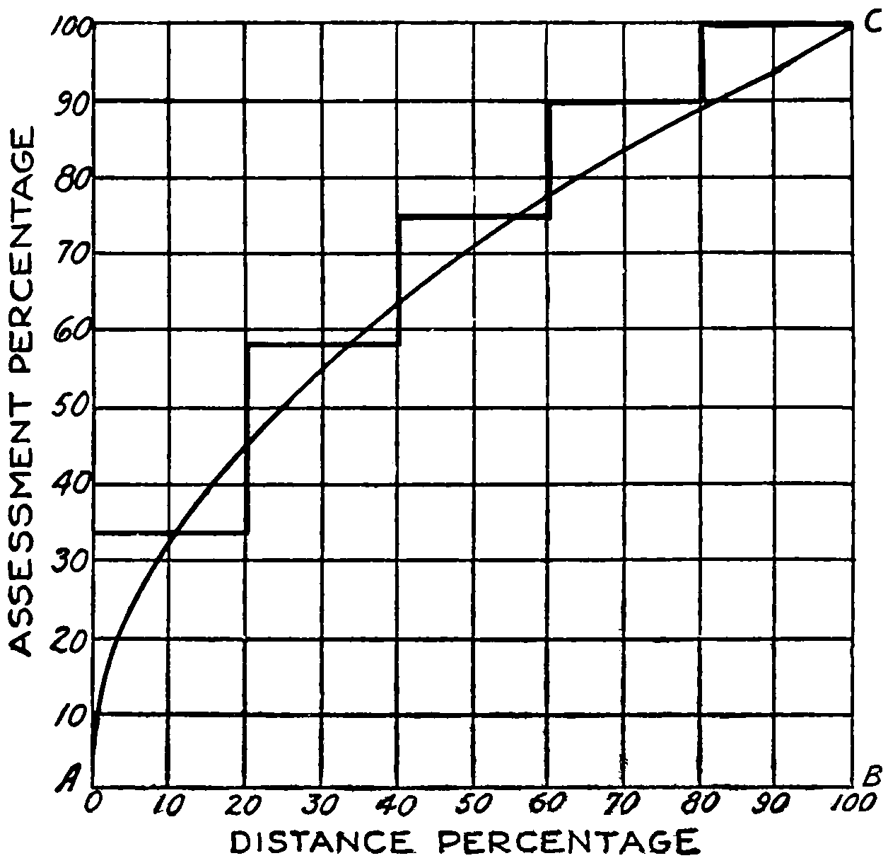
Second Method of Apportioning Assessments.
—A second method based upon a different definition has something in its favor. If the front-foot is defined as a lot 1 foot wide measured in the direction of the street extending[319] directly back through all the zones to the limit of the assessed area it will have a weighed area of W1z1 + W2z2 + W3z3 ... and so on, where W1 represents the weight of the zone, whose width is z1, and W2 the weight of the zone, width z2, etc. If z1 = z2 = z3 ... etc., as is usually the case the weighted area of 1 front-foot is (W1 + W2 + W3 ... ) z = Wz = 100z, since W is always = 100. The total number of front-feet in the district, or in any lot, will be the number of weighted feet in the district or in the lot, divided by 100z. In the district represented on p. 320, the number of front-feet is the total frontage, 1,936,000 divided by 4000 = 484; and for each lot the amount shown in the table. The results obtained by the two methods are directly proportional, so that either may be used for making[320] assessments. In fact they are proportional to the weighted areas, so that the weighted areas may be used instead of the front-feet if desired.
Rule for Assessment.
—To get the assessment for any particular lot divide the total cost of the improvement by the total number of front-feet in the district and multiply the quotient by the number of front-feet in the lot.
| ZONE | WT. | ZONES | LOT 1 | LOT 2 | LOT 3 | LOT 4 | LOT 5 | LOT 6 | LOT 7 | |||||||||
|---|---|---|---|---|---|---|---|---|---|---|---|---|---|---|---|---|---|---|
| AREA | WTD. AREA |
AREA | WTD. AREA |
AREA | WTD. AREA |
AREA | WTD. AREA |
AREA | WTD. AREA |
AREA | WTD. AREA |
AREA | WTD. AREA |
AREA | WTD. AREA |
|||
| 1 | 39 | 1⁄3 | 22,800 | 760,000 | 4800 | 160,000 | 3600 | 120,000 | 2400 | 80,000 | 3000 | 100,000 | 3000 | 100,000 | 6000 | 200,000 | ||
| 2 | 25 | 20,400 | 510,000 | 2400 | 60,000 | 3600 | 90,000 | 2400 | 60,000 | 3000 | 75,000 | 3000 | 75,000 | 6000 | 150,000 | |||
| 3 | 16 | 2⁄3 | 18,000 | 300,000 | 300 | 5,000 | 3300 | 55,000 | 2400 | 40,000 | 3000 | 50,000 | 3000 | 50,000 | 3000 | 50,000 | 3000 | 50,000 |
| 4 | 15 | 15,600 | 234,000 | 1200 | 18,000 | 2400 | 36,000 | 3000 | 45,000 | 3000 | 45,000 | 6000 | 90,000 | |||||
| 5 | 10 | 13,200 | 132,000 | 1200 | 12,000 | 3000 | 30,000 | 3000 | 30,000 | 6000 | 60,000 | |||||||
| Total | 90,000 | 1,936,000 | 7500 | 225,000 | 11700 | 283,000 | 10800 | 228,000 | 15000 | 300,000 | 15000 | 300,000 | 15000 | 400,000 | 15000 | 200,000 | ||
| Front Feet 1st Method600 | 69.73 | 87.71 | 70.66 | 92.97 | 92.97 | 123.97 | 61.99 | |||||||||||
| Front Feet 2nd Method484 | 56.25 | 70.75 | 57.00 | 75.00 | 75.00 | 100.00 | 50.00 | |||||||||||
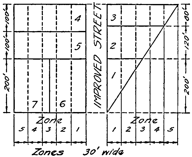
First Method
Front-Feet = 600
Weighted Area per front Foot = 1,936,000600 = 32262⁄3
Lot frontage = Weighted area of Lot ÷ 32262⁄3
Second Method
Front Feet = 1,936,0004000 = 484
Frontage of each lot = weighted area of lot ÷ 4000
It should be remembered that the assessment of cost must be in proportion to the benefits to be derived from the improvement. The assessors will therefore have to use sound[321] judgment and modify the mathematical results if deemed wise. As a rule it is best never to deviate, though, unless there are extraordinary good reasons.
Miscellaneous Sources of Revenue.
—A few years ago much was said relative to the right of a city to take a portion of the earnings of public service corporations as compensation to the public for the use of its streets. Many cities granted franchises under such agreements and until the automobile depleted the earnings of street railways and the general costs of manufacturing gas and electricity went up received considerable revenue from these public utility organizations. While in most cities this went into the general fund money was usually appropriated from that fund for street maintenance and improvement, so indirectly, at least, the roadways profited. In the large cities franchises for the use of the public streets at, above, or beneath the surface are sufficiently valuable to warrant good returns to the public. It seems logical that such money be used for street improvements. Bus and truck lines fall directly under this head, and since they are very largely conducive to the distruction of pavements, it would seem as though they ought to pay for at least a part of this damage. The tax might be graduated according to weight as is now in most states the automobile license tax.
A number of cities are entering the commercial and industrial enterprises such as the sale of water, gas, electricity, ice and coal. While usually these are operated on a low margin so as not to make money there is nevertheless, here, an opportunity to secure necessary funds for public improvements. And if the operation of these enterprises is such that private competitors can make reasonable profits the people will be the gainer by having more available funds for worthy objects. It may not be the proper province of the government to go into gainful enterprises in competition with its own citizens. In fact, public opinion in America has been so one-sided on such questions that wherever private enterprises have been taken over by the states or the nation they have thereafter been conducted[322] free or at the bare cost of operation. The turnpike roads were bought by the states and made part of the free public road system. Cities like Cleveland and San Francisco have handled their street railways at the bare cost of operation. Efforts are being made to make the Panama Canal free to certain classes of commercial shipping. Government land reclamation by irrigation and drainage has been made so that it could be paid for by the settlers in small amounts, running through long periods of time. But notwithstanding all this there is an awakening to the possibilities that may come from the development and operation by government of resources that were formerly considered fair game for private exploitation.
Such disputes as the two nation-wide industrial strikes of 1922, the coal miners and the railway craftsmen, are rapidly forcing those not directly connected with the “operators” or the “strikers” to the opinion that government ownership is the remedy for industrial ailments of this character. They point to the Post Office Department as an argument in favor. While it is a fact there has been no trouble so far with postoffice employees, it does not follow that the same would be true with the railway, coal mining, and cotton industries. And if the Government should begin taking over industrial and commercial enterprises, where would be the end of such paternalism, and would it lead to sovietism? It is barely possible that governmental regulation has already gone too far.
But, nevertheless, from some such sources as have been mentioned or from a sales tax on gasoline may eventually come a relief to the burden of taxation which now and increasingly so in the future must otherwise be borne by the land.
Bonds.
—It is not always possible to raise by taxes sufficient money to make public improvements on a pay-as-you-go basis. It would not be economical to attempt to pave one-tenth the width of a street each year. One patch would be worn out before the next is put down. The whole must be done at the same time in order not to be vastly[323] wasteful. And, in order to enjoy the improvement while money is being collected for its payment, the municipality must resort to borrowing. It is also argued that since future generations will enjoy the improvement they should be required to help pay for the same. The indebtedness represented by the bonds become a lien against the assessed property in the state, county, township, or district over which they have been laid. The taxes to pay off the bonds will be levied uniformly over all property or specially in proportion to accruing benefits according to conditions prescribed at the time the improvements were made.
Kinds of Bonds.
—Bonds are certificates of indebtedness by means of which the repayment of borrowed money may be spread over a series of years. They are classified as Sinking Fund, Annuity and Serial, depending on their manner of payment.
Sinking fund bonds are paid as a whole at the end of their term, interest being paid annually, or at some other fixed regular period, upon their face value. The name arises because of the custom of establishing a sinking-fund into which a certain proportion of the debt is to be paid annually, and this loaned out so that at the end of the period it will amount to the face of the bonds. Since there is always time lost between the collection and loaning of the sinking fund money the interest derived therefrom will not usually be the same as that of the bonds. For this reason and from the further fact that sinking funds are frequently drawn upon for other purposes than that for which they were created this type of bonds is less economical than either of the other two types.
The sinking fund which must be raised annually to discharge a debt of P dollars in n payments, if it can be loaned at i per cent, is given by the formula:[197]
Sinking fund = i (1 + i)n - 1 . P
[324]
To illustrate the use of the formula let the debt be $10,000, the average rate that can be expected from the sinking fund 4 per cent, and the time five years. Substituting in the formula,
S = .04 (1 + .04)5 - 1.$10,000
To solve, the denominator is first evaluated:
| Log (1 + .04)5 | = | 5 log 1.04 |
| = | 5 × 0.017033 | |
| = | 0.085165 |
Taking the antilog,
(1 + .04)5 = 1.21665
and
(1 + .04)5 - 1 = 0.21665
Then
S = 0.4 × $10,000 0.21665 = $1846.27.
Annuity tables, which may be seen at nearly any bank or brokers’ office, or in Bulletin 136, U. S. Department of Agriculture, give the annuity which will amount to 1 in five years at 4 per cent as 0.1846271; this multiplied by $10,000 gives $1846.27.
To the nearest cent the following tabular statement shows the growth of the sinking funds:
| Year | Sinking- fund at Beginning of Year |
Interest during Year |
Annual Payments into Sinking- Fund |
Total Sinking- fund at End of Year |
||||
|---|---|---|---|---|---|---|---|---|
| 1 | 0. | 0. | $1,846. | 27 | $1,846. | 27 | ||
| 2 | $1846. | 27 | $73. | 85 | 1,846. | 27 | 3,766. | 39 |
| 3 | 3766. | 39 | 150. | 66 | 1,846. | 27 | 5,763. | 32 |
| 4 | 5763. | 32 | 230. | 53 | 1,846. | 27 | 7,840. | 12 |
| 5 | 7840. | 12 | 313. | 61 | 1,846. | 27 | 10,000. | 00 |
If this loan, the bonds, bore 5 per cent interest the cost to the borrower would have been the principal plus the interest on principal less the interest on the sinking fund:
$10,000 + $2500 - $768.65 = $11,731.35;
[325]
or the interest on the loan plus the sinking-fund payments:
$2500 + $9231.25 = $11,731.35
Serial Bonds are such that a fixed amount of the principal is retired at definite periods of time. Usually the amount retired is an aliquot part of the whole. The payments to be made at any particular time is the fixed portion of the principal plus the interest on the unpaid portion up to that date. The periods of retirement are usually annual or semi-annual.
Assuming the principal to be P and that one nth part of it is paid each year, the formulas are:
Annual payment for the kth year
= P ( 1n + i (1 + 1 - k n)).
Interest for the kth year
= Pi (1 + 1 - k n).
Total amount of interest to the end of the kth year
= Pik (1 + 1 - k 2n).
Total amount of interest and principal paid up to the end of the kth year
= Pk (1 n + i (1 + 1 - k 2n)).
The following table shows how a debt of $10,000 bearing 5 per cent interest would be discharged by equal annual payments in five years:
| Year | Principal at Beginning of Year |
Interest for Year |
Principal Repaid at end of Year |
Total Annual Payment |
|---|---|---|---|---|
| 1 | $10,000 | $500 | $2,000 | $2,500 |
| 2 | 8,000 | 400 | 2,000 | 2,400 |
| 3 | 6,000 | 300 | 2,000 | 2,300 |
| 4 | 4,000 | 200 | 2,000 | 2,200 |
| 5 | 2,000 | 100 | 2,000 | 2,100 |
| Totals | $1,500 | $10,000 | $11,500 |
[326]
Annuity Bonds are those wherein a uniform periodic payment is made to discharge the debt in a given time. The formula for the necessary payment to discharge a debt of P, with interest rate i in n years is,
Annual payment = i 1 - (1 - i)-n . P.
Results may be taken from books of tables already referred to or by means of logarithms the formula may be solved. For example let it be required to discharge a debt of $10,000 in five equal payments, the rate of interest being 5 per cent.
Solution:
(1 + i)-n = 1.05-5.
Log 1.05 = -0.021189
-5 Log 1.05 = -0.105945 = 9.894055 - 10
Log-1 (9.894055 - 10) = 0.783529
1 - 0.783529 = 0.216471
Log Annual Payment = Log i - Log 0.216471 + Log P
= Log 0.05 - Log 0.216471 + Log 10,000
= (8.698970 - 10) - (9.335398 - 10) + 4.000,000
= 3.363572
Annual Payment = Log-1 3.363571 = $2309.748.
The following table shows the repayment of the loan by annual payments of $2309.75:
| Year | Principal Owing at Beginning of Year |
Interest for Year |
Principal Repaid at End of Year |
Total Payment for Year |
|---|---|---|---|---|
| 1 | $10,000.00 | $500.00 | $1,809.75 | $2,309.75 |
| 2 | 8,190.25 | 409.51 | 1,900.24 | 2,309.75 |
| 3 | 6,290.01 | 314.50 | 1,995.25 | 2,309.75 |
| 4 | 4,294.76 | 214.74 | 2,095.01 | 2,309.75 |
| 5 | 2,199.85 | 109.99 | 2,199.75 | 2,309.74 |
| Totals | $1548.74 | $10,000.00 | $11,548.74 |
[327]
Since it is more convenient to have the bonds in even hundreds of dollars and the interest in dollars some adjustment from the theoretical amounts are usually made but such that the annual payments will be near the theoretical. Sometimes, too, the bonds are made smaller for the first few years then gradually increase so that the natural growth in population and wealth may bear its proportional burden. One adjustment for the example just given is shown:
| Year | Principal Owing at Beginning of Year |
Interest for Year |
Principal Repaid at end of Year |
Total Payment for Year |
|---|---|---|---|---|
| 1 | $10,000 | $500 | $1,800 | $2,300 |
| 2 | 8,200 | 410 | 1,900 | 2,310 |
| 3 | 6,300 | 315 | 2,000 | 2,315 |
| 4 | 4,300 | 215 | 2,100 | 2,315 |
| 5 | 2,000 | 100 | 2,000 | 2,100 |
| Totals | $1,500 | $10,000 | $11,550 |
Total Cost by the Three Kinds of Bonds.
—The total cost of a loan, as shown by the following table taken from Bulletin 136, U. S. Department of Agriculture, is generally greatest under the sinking fund plan and least under the serial. The serial, too, is the simplest to compute.
Total Cost of a $100,000 Loan for 20 Years
Interest Compounded Annually[198]
| Annual Interest on Bonds |
Sinking-fund Bond Compounded Annually at |
Annuity Bond |
Serial Bond |
|||
|---|---|---|---|---|---|---|
| 3% | 31⁄2% | 4% | ||||
| 4 | $154,431 | $150,722 | $147,163 | $147,163 | $142,000 | |
| 4 | 1⁄2 | 164,431 | 160,722 | 157,163 | 153,752 | 147,250 |
| 5 | 174,431 | 170,722 | 167,163 | 160,485 | 152,500 | |
| 5 | 1⁄2 | 184,431 | 180,722 | 177,163 | 167,359 | 157,750 |
| 6 | 194,431 | 190,722 | 187,163 | 174,369 | 163,000 | |
[328]
The sinking-fund bonds are made out to run the full period and are paid for from the proceeds of the sinking-fund at the end of the term. Serial and annuity bonds are made to mature in proportion to the amounts paid each year. In the example used the serial system would retire $2000 worth of bonds each year, while with the annuity system $1800 would be retired at the end of the first year; $1900, the next; $2000, the third; $2100 the fourth, and $2200 the fifth.
Interest coupons, that is, notes for the payment of interest at stated intervals and providing for interest upon the interest if not paid at maturity, are usually attached to the bonds for the entire period that they run, one to be clipped at each interest pay day.
The Term of Bonds.
—Several states and some of the large cities have issued bonds for road improvements for long series of years. This has met considerable opposition on the ground that the bonds should not run longer than the life of the improvement, otherwise there may be another series of bonds lapping upon the first, and perhaps a second and third upon these. The arguments in favor of the long terms are that some parts, at least, of the improvement will be permanent, that reconstruction will cost less than original construction so that lapping will do little harm, and that money may be obtained at a lower rate on long-term than on short-term bonds.
It is a quite general practice for the abutting property-holders to pay for the first pavement by special assessment. Resurfacing is frequently and general repairs almost universally paid for by the city as a whole. It would seem, especially where property-holders pay on the installment plan, that a term of bond well within the life of the pavement ought to be adopted. Ten years seems a reasonable time, fifteen years at the longest. If borrowing is continued and one loan lapped upon another there comes a time when the charges for paying off the debt and the interest will more than equal the amount that can be borrowed. For instance suppose a man can continue to borrow $1000[329] per year on five years’ time, $200 to be paid each year. During the first year he would owe $1000, and at the end of the year he pays $200 on the principal and the interest. He borrows another $1000, so during the second year he is in debt $1800 and must pay at the end of the year $400 principal and $108 interest. The third year he is in debt $2400 and pays on principal $600 and interest $144. The fourth year his debt is $2800, and payment on principal $800 and the interest, $168. The fifth year and every year following the debt is $3000 and the payment necessary on principal $1000 and the interest $180. The payments on the principal amount is equal to exactly the sum he can borrow. While the amounts used in the illustration are small the principle is the same for loans upon long-term bonds.
It would be better for cities and states to progress more slowly than to have saddled upon them a debt in perpetuity. There are times, however, when municipalities or other districts will find it the best policy to borrow money and issue bonds. Serial and annuity bonds have this advantage that as the improvement depreciates in value with time the burden of indebtedness for the improvement becomes less. But it can scarcely be considered the part of wisdom to have the bonds run longer than the life of the pavement for which they were issued. The pay-as-you-go plan is by far the most economical method of procedure, but it cannot always be followed. There are times when budgetary appropriations are insufficient and the people will not stand for heavy taxation. In one city it had been the custom for the city by general taxation to pay for paving intersections. As the intersections amounted to about 30 per cent. of the total area paved that was thought to be an equitable division, because the entire city receives some benefit from each pavement put in. But the applications for paving were much more each year than the city could pay for from its ordinary budget. The amount of paving done each year was limited by the area of intersections that the city was able to lay. Some districts said, “We will pay for the whole[330] pavement, intersections and all, rather than go without or wait over one or two years.” The city council allowed this to be done, and, soon, even went further and passed an ordinance taxing the whole cost including the intersections to the fronting property. This method has been in use for several years and the city of less than 70,000 inhabitants has more than 200 miles of pavement, and no citizen was ever known to protest the scheme. Of course the public as a whole could have paid for all these intersections by general taxation just as easily as the private property-holders could, but if taxes had been raised for that purpose there would have been many complaints that the poor were being taxed to pave the streets in front of the residences of the rich.
In fact, the last idea mentioned is one of the arguments in favor of large bond issues such as are found in several of the states like New York, Maryland, Illinois, California, Missouri and other states, to say nothing of cities and counties. The argument is that the entire state, county or city system should be constructed about the same time that all may have equal benefit of it and that there shall be no intentional partiality. Nelson P. Lewis states in the American Highway Engineers’ Handbook in effect that on a 4 per cent basis the $100,000,000 bonds of the state of New York will mean an annual tax of $4,890,000 for interest and sinking-fund charges, to say nothing of the annual maintenance and renewal expenses, running through two generations. He claims the same system of roads could have been built, at no greater annual appropriations, in twenty years’ time and the people would not have been saddled with debt, and it will require at least half that time to complete the system with the bonds and the debt.
In Illinois, on the other hand, the debt, some $60,000,000 is to be paid from the automobile licenses, which will be used for its amortization. In Maine automobile licenses are also being used to pay bonds, but only $500,000 will be issued in any one year and the total outstanding cannot by law exceed $2,000,000.
[331]
Maryland uses a short-term-bond—fifteen years—and provides that any road renewals required before that time shall be paid for out of general appropriations.
New York city had issued bonds until more than two-thirds of the total taxation for streets had to go to interest and amortization so some years ago a change was made to what they called the pay-as-you-go plan. It took four years to make the change, so, now, non-revenue-producing improvements are made without issuing bonds. Revenue-producing enterprises, such as water supply, transit lines, and water-front improvements, are still financed by long term, 50-year bonds.
Stocks and Bonds.
—Railways, interurban trolley lines, street-car lines, and toll roads have been financed largely by stock subscriptions. Public roads, being without a revenue-producing power, cannot be financed in this manner, except perhaps in exceptional cases where a few persons are willing to donate their money or are building for private use but are willing to share the same with the public. Large bridges may occasionally be built in this manner, the stockholders exacting toll for passage in order to get a return on their investment. However, such cases are negligible in the great national scheme of public highways.
National and State Aid.
—The history of National and State Aid in the United States has been treated quite fully in Chapter V. It will not be necessary to repeat that here. Suffice to say that with possibly a few exceptions all the states in the Union now have some form of state aid—money, engineering advice, testing materials, convict labor, etc.; also the territories of Alaska, Hawaii, the Philippine Islands, and Porto Rico, or else the governments of these divisions directly take charge of the construction of a part or a whole of the roads. The acceptance of Federal Aid practically made it necessary for the states to have highway departments to distribute the Federal Aid money and the equal amount the state had to put up to match it. Several of the states like New York and California had raised by bond issues large sums of money before federal[332] aid was available and distributed it to counties that would coöperate in the building of roads to be united into a comprehensive state system. New Jersey, the first State Aid state, and Massachusetts, a close follower, had already “paved the way” as an example for other states to follow.
Federal Aid.
—The Federal Aid road act, approved July 11, 1916, appropriated “out of any money in the Treasury not otherwise appropriated, for the fiscal years ending June 30, 1917, the sum of $5,000,000; for the fiscal year ending June 30, 1918, the sum of $10,000,000; for the fiscal year ending June 30, 1919, the sum of $15,000,000; for the fiscal year ending June 30, 1920, the sum of $20,000,000; and for the fiscal year ending June 30, 1921, the sum of $25,000,000.” In addition there was appropriated $10,000,000—$1,000,000 per year until 1926—for the survey, construction and maintenance of roads within or partly within the national forests in coöperation with the states in which these forests are located.
The Secretary of Agriculture was by the Act, after making a deduction of 3 per cent, to cover expenses of administration, authorized to apportion the remainder “among the several states in the following manner: One-third in the ratio which the area of the State bears to the total area of all the States; one-third in the ratio which the population of each State bears to the total population of all States...; one-third in the ratio which the mileage of rural delivery routes and star routes in each State bears to the total mileage of rural delivery routes and star routes in all the States....”
States desiring to avail themselves of the benefits of the act were required to “submit to the Secretary of Agriculture project statements setting forth proposed construction of any rural post road or roads therein.” If approved the states were further to “furnish to him surveys, plans, specifications and estimates therefor as he may require.” Only such projects as were “substantial in character” might be approved. “Items included for engineering, inspection, and unforeseen contingencies” may not be greater than 10 per cent of the total cost of the work. Upon the final approval by the Secretary of Agriculture of the plans, specifications and estimates and its certification to the Secretary of the Treasury the Act provides that there should be “set aside the share of the United States payable under this Act on account of such project,” not to “exceed fifty per centum of the total estimated cost thereof.”
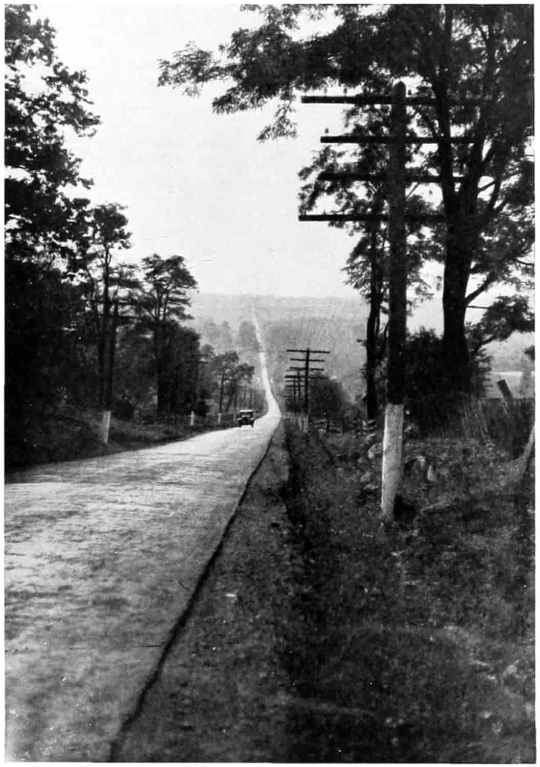
© Underwood and Underwood
A NATIONAL HIGHWAY IN THE MOUNTAINS OF MARYLAND
[333]
It was not the intention to take away from the states any right which they might enjoy for the construction work was to be done in accordance with the laws of the state within which a project lay but subject to the inspection of the Secretary of Agriculture. He also has power to pay to the states the amount of money set aside when a project has been satisfactorily completed and also to make payments on the same during the process of construction not to exceed the United States’ pro rata part of the value of the work done, and not to exceed $10,000 per mile of road exclusive of bridges more than 20 feet clear span.
The states snapped up this money greedily and the demand for more money became so great that in 1919 Congress appropriated $200,000,000 more, and still later, 1921, appropriated $75,000,000, and $15,000,000 for national forest roads. And still later, June 18, 1922, there was authorized an appropriation of $65,000,000 to be expended during the fiscal year ending June 30, 1923, and $75,000,000 for the succeeding fiscal year. At the end of five years after the passage of the Federal Aid road act, there had been completed under its terms 7469 miles of road and 17,977 miles additional were under construction. Texas ranked first in the number of miles completed, with 682; and Illinois had received the greatest amount of federal aid on projects completed and under construction, with $11,807,906; while Texas was a close second with $11,393,485.
While the mileage built by Federal and state aid is less in the more compact densely populated Eastern states, the cost per mile is much more as much more expensive types of roads are being built. In the West and South earth roads[334] largely make up the mileage. It has been objected that these do not properly come under the wish of Congress when it provided that the fund should be used only in the construction of “substantial” roads. Earth road advocates argue that such features as grading, draining and straightening roads may be considered permanent, in so far as the road is ready for any type of surfacing that may be desired to be laid at a later date. Recognizing the merits of both contentions The Bureau of Public Roads issued, in 1922, a decision practically as follows:
The question of a more definite policy to be followed in connection with the approval of earth road Federal Aid projects which involve grading and drainage only, has for some time been under consideration, and it has been decided that hereafter such projects will only be approved on condition that The (State) Highway Department agree, in so far as it may legally do so, that within a reasonable time after completion of the improvement of the project as an earth road, it will place or cause to be placed thereon, an adequate and substantial type of surfacing.
By adequate and substantial type of surfacing is meant such type as will carry the prospective traffic with such maintenance expenses that the total annual charges will represent a reasonable expenditure for the public service rendered by the highway.
It seems, therefore, that the Government expects to assist in the financing of roads that appear adequate for the purposes intended.
State Aid.
—The machinery of paying state money to finance local roads throughout the counties varies greatly with the different states. For example half may come from Federal Aid, half the remainder from State Aid, and half the remainder from County Aid, leaving only a very small amount for the local abutting property. In other states a large part falls on the abutting property. It would seem as though through main traveled roads should be largely financed by nation and state while local marketing roads which will not require such expensive surfacing should be largely locally financed.
Present State of Federal Aid.
—The Bureau of Public Roads gives out the information that 11,930 miles of road[335] have been constructed during the year 1921 by the States in conjunction with Federal Aid, at a total cost of $231,963,682, toward which the government allotted $94,057,089. There were under way during the year 31,228 miles, which was about one-half the road work carried on in the United States during the year. It is safe to assume, then, that through the stimulus of Government Aid, direct and indirect, more than 20,000 miles were built during 1921, and that more than 40,000 more miles are under way.
The effects of Federal Aid is just now beginning to be felt; a few years more will see the United States so well supplied with good roads that the national appropriations for Federal Aid may be reduced materially.
It is estimated that the $190,000,000 available for allotment, $65,000,000 for the year ending 1923, $75,000,000 for the year 1924, and $50,000,000 remaining from previous appropriations, will result in the construction of more than 25,000 miles of road, which added to the 46,000 miles that are expected to result from previous federal appropriations, makes a total of 71,000 miles, or nearly 40 per cent of the estimated 180,000 miles of good roads in the System of Federal Aid roads now being outlined.
The U. S. Bureau of Public Roads gives out the figures up to December 31, 1921, as follows:
| Federal Aid Apportioned, 1917 to 1922 inc., | $339,875,000 |
| Projects under Construction: | |
| Total Estimated Cost | 275,652,104 |
| Federal Aid | 117,049,690 |
| Miles | 15,834 |
| Projects on which Construction is Completed: | |
| Total Estimated Cost | 221,739,710 |
| Federal Aid | 95,054,184 |
| Miles | 12,907 |
Matching Federal Aid Dollars.
—The main argument that brought the Federal Aid law into being was the need of farm to market roads and the fact that in the past the expense for building and maintaining roads fell most heavily upon the farmer. In an excellent report made[336] by Senator Bankhead (Senate Report 250, 64th Congress, 1st Session) for the Committee on Post Offices and Post Roads, the statement is made that “it is probably conservative to say that at least 75 per cent of the money raised for road purposes” at that time, 1916, “is paid by the owners of country property.” He gives statistics to show that the owners of less than one-third of the real property of the United States were paying more than three-fourths of the cost of the public roads. This did not seem to be equitable, since the country people did not have a monopoly on their use. The burden of building and caring for the roads should be distributed among all who were benefited by them. There is no very adequate method of doing this, but inasmuch as all citizens, both city and country, share in the raising of national revenues, the result of federal appropriations would be to tend in some measure to equalize the cost of roads as between city and country.
It was not thought wise to make a direct gift of money from the federal treasury, as that would favor too much of paternalism, would result in “pork barrel” scandals, and would stifle local initiative, energy, and self-help. If the federal government were to enter upon the building outright of a system of roads, there would be a temptation for the states and counties to cease building in the hope the government would eventually get around to them. Likewise the demand for “pork” would be enormous. The plan was therefore devised of requiring the state to pay half the expenses of road building, that is, of matching dollars, fifty-fifty, with the federal treasury. It was further decided that federal money should go into road extensions, leaving repairs and renewals to the states. If states refuse to perform the necessary maintenance the only recourse the government has is to withdraw future Federal aid. The object of the government was to add to the stock of good roads, and eventually secure the necessary 20 per cent upon which engineers state, 80 to 90 per cent of the entire traffic can be adequately accommodated.
[337]
Many of the states were devoid of the necessary machinery to take care of this money and expend it efficiently in the construction of roads or to maintain them in good condition afterward; so the Government asked that highway departments be created, if they did not already exist, in order that there might be skilled supervision and efficient organization on the parts of the states as that was the best insurance that these duties would be thoroughly performed. Furthermore there would be some centralized authority at Washington and some at each state capital; the initiative and the choice of location, types, and materials for road building would not be left wholly to local administrations which were more likely to be swerved to meet the selfish interests of prominent local personages than is possible in larger political units. The judgment of Congress is less likely to be biased by local conditions or by selfish individuals than would that of a township or county board, or even the State Legislature. On the other hand from the very beginning of the national federation states have jealously guarded their rights, giving up very reluctantly to the Federal Government in any attempts toward centralization. So “no policy,” states the committee report, “should be adopted which does not permit the retention by the States of the fullest measure of control consistent with the necessary inspection and safeguarding which is customary with all federal appropriations.” Hence the states were left the power or not as they saw fit of availing themselves of the Government Aid money. Nearly if not all the states in the Union have availed themselves of Federal Aid. It is claimed by opponents of the system that this is because if a state does not take its quota the money will be appropriated to other states while this state will still have to pay its proportional part to the fund from which the money comes. This they claim is pernicious and has caused states to ask aid when voting the taxes to match the same was extremely burdensome to the people. In other words the people “are forced into a position where[338] their only justification is a presumption that they are grabbing while the grabbing is good.”[199]
It was the intention of the framers of the law that the contribution from the government would be so substantial that results of magnitude might be accomplished and still at the same time not raise taxes higher than the people could stand. The plan adopted seemed just. First the road is primarily for the use of the people hence population should be a factor. A secondary consideration was to make accessible the best products of the farm and to develop the land which on account of its remoteness to markets and the conditions of the highways was not in the highest or best state of culture. Area then was a second factor. The third factor was the post roads—rural delivery and star routes. This last as has been pointed out in a previous chapter was possibly the peg upon which the garment could be hung in the closet of constitutionality. However, it was thought that “the interests of the East are protected by the factor of population, the interests of the West should receive consideration through including area as a factor of apportionment. Finally, the direct interest of the federal government,” according to the Committee, “as represented by the great mileage of rural delivery and star routes for the transportation of mail and parcel post should have some weight in the granting of federal funds.”
Federal Aid has now been in operation for five years. Most people think it has demonstrated its worth. But it must be remembered that five years is a short time for the stupendous task of transforming an almost impassable conglomeration of roads into a usable system of comfortable highways. The soldiers who went to France during the World War came back enthusiastic converts of good roads. Foreigners traveling in this country have frequently marveled at the paucity of good roads. The natives having grown up here knew no better. The Federal Aid experiment has been the means of bringing the people to a partial knowledge of the benefits of better highways. They will not be content to go backward. In the words of a[339] committee report to the Legislature of the State of Nebraska[200]: “The (Federal Aid) System seems to be well grounded and is nourished and sustained by nation-wide organizations, that are banded together for the purpose of maintaining and extending the system, and inasmuch as they seem to be powerful enough to influence the maintenance of the system, it will no doubt be maintained until some organization equally influential makes of the matter an issue and overturns the system.” The Committee, while evidently prejudiced against matching dollars with the Federal Government, admitted the value to the state of the work done and that “there is no more important internal improvement in which the state can engage.”
Under a Federal highway act signed November 9, 1921, $75,000,000 becomes available by Federal Aid for road construction in the several states for the fiscal year ending June 30, 1922, and in addition $15,000,000 for roads in national forests. This new Federal Aid Act is very similar to the act of 1916. The method of allotment is as before; the ratio of allotment nearly the same, but a new feature is that the minimum allotment to any state shall not be less than one-half of 1 per cent of the total to all states, which in this case amounts to $365,000. This increases the apportionment to the four states of Delaware, New Hampshire, Rhode Island, and Vermont.
The new Act changes the manner in which a state may use its allotment. Each state must select a connected road system not exceeding 7 per cent of its road mileage for improvement with Federal Aid. This system will be divided into two classes, one to be known as “interstate highways” the other as “intercounty highways.” The interstate highways must not exceed three-sevenths of the system selected; on them not more than 60 per cent of the Federal Aid Allotment can be spent without the joint approval of the Secretary of Agriculture and the State Highway Department. The intercounty highways will receive the remainder of the allotment.
[340]
Some of the Western states where there are large areas of unappropriated public land due to the desert or mountainous nature of the country, found it to be impossible to continue the matching of Government funds. The new act provides that in states where the unappropriated public land amounts to more than 5 per cent of the area of the state, the 50 per cent allotment is increased by an amount equal to one-half the percentage of unappropriated public land in the state.
Before any funds can be paid to any state, the state must appropriate money under the direct control of the Highway Department to match the Federal apportionment or so much as it desires to avail itself of. Likewise it must provide suitable means for the maintenance of Federal Aid highways.
The allotment to each state of Federal Aid funds available June 30, 1922, under the act signed November 9, 1921, authorizing an appropriation of $75,000,000, follows:
| State | Allotment |
|---|---|
| Alabama | $1,553,420 |
| Arizona | 1,053,281 |
| Arkansas | 1,264,142 |
| California | 2,462,098 |
| Colorado | 1,341,175 |
| Connecticut | 480,897 |
| Delaware | 365,625 |
| Florida | 886,825 |
| Georgia | 1,997,957 |
| Idaho | 938,536 |
| Illinois | 3,246,281 |
| Indiana | 1,958,855 |
| Iowa | 2,102,872 |
| Kansas | 2,102,281 |
| Kentucky | 1,417,178 |
| Louisiana | 996,989 |
| Maine | 695,160 |
| Maryland | 640,629 |
| Massachusetts | 1,096,176 |
| Michigan | 2,249,532 |
| Minnesota | 2,123,597 |
| Mississippi | 1,294,906 |
| Missouri | 2,448,128 |
| Montana | 1,546,885 |
| Nebraska | 1,581,189 |
| Nevada | 953,436 |
| New Hampshire | 365,625 |
| New Jersey | 942,870 |
| New Mexico | 1,189,823 |
| New York | 3,696,447 |
| North Carolina | 1,709,333 |
| North Dakota | 1,164,714 |
| Ohio | 2,823,004 |
| Oklahoma | 1,752,339 |
| Oregon | 1,182,663 |
| Pennsylvania | 3,398,925 |
| Rhode Island | 365,625 |
| South Carolina | 1,061,237 |
| South Dakota | 1,204,060 |
| Tennessee | 1,647,692 |
| Texas | 4,425,172 |
| Utah | 849,417 |
| Vermont | 365,625 |
| Virginia | 1,456,828 |
| Washington | 1,103,709 |
| West Virginia | 802,359 |
| Wisconsin | 1,894,815 |
| Wyoming | 934,617 |
[341]
The question of whether or not it is wise for a state to match the Federal Aid appropriation for the purpose of building roads is a debatable one. When people see the amount of their taxes going up by leaps and bounds they naturally look for some place for retrenchment. The road tax being, now, one of the largest in the state is naturally subject to attack.
In the consideration of the problem two questions stand out prominently: Do the results so far obtained justify the expenditure? and can the United States and the States afford to continue the expenditures?
Reports from the Bureau of Public Highways indicate that with the aid of the $350,000,000 previously appropriated by the Government, 17,000 miles of road had been completed up to May 31, 1922, and in addition nearly 14,500 miles were under construction involving more than $287,500,000 of Federal Aid. To match this fund the states have appropriated approximately $380,000,000, making a total of $667,500,000. The Bureau states the average cost of roads per mile of all types of construction with Federal Aid has been $17,120, of which 43 per cent has been the cost to the government. About one-fifth of the Federal system, that it is thought will be sufficient to accommodate 80 per cent of the traffic, has been completed. This seems to be reasonable progress considering the stupendousness of the task.
The expenses so far are a little more than $6 per person in six years or approximately $1 per person per year, counting the population of the United States as 110,000,000. If any one is anxious to save this expense it can easily be done by a little economy. Refraining from smoking one cigar a month, from drinking one ice-cream soda a month, from going to three picture shows in a year, or by allowing the automobile to stand in the garage one or two Sundays per year.
Practically each state in the Union could easily collect its share of the match money by a one-cent tax per gallon on gasoline. A score of states have adopted this method[342] and more will, as by this means the land which is highly burdened with general and school taxes will be considerably relieved, and the road tax shifted to the road users. The man who owns an automobile will not thus have the ultimate amount which he pays for roads decreased, but the man who does not own an automobile will be relieved in so far as the gasoline tax is not passed on in the way of increased charges. But the gasoline tax will not appear on the annual tax receipts and therefore is less noticeable.
The answer to the question, “should the states continue to match the Federal Aid dollar?” in the opinion of the writer is, “yes, until the Federal system of 180,000 miles of road is completed.” This ought to be accomplished in about ten years.
Most of the Mid-west and Western states pay into the national Federal Aid fund, as duties, revenue taxes, etc., less than they receive in the way of Federal Aid. These states, therefore, are the gainers in the matching process. Even where there is no financial advantage as in some of the more populous states, there is a psychological advantage in the stimulus which this money gives toward the building of good roads. Good, dependable, 365-days-a-year roads must come. They are demanded by the 10,000,000 pleasure automobile owners and their 30,000,000 additional passengers; they are demanded by the more than 2,000,000 commercial vehicle owners and their 50,000,000 patrons; they are demanded by the man who lounges along in a smooth-riding silent $10,000 car; and they are demanded by the driver of the sputtering, rough-riding, ear-splitting $400 car. Yes, good roads must come, and the Federal Aid movement begun at the behest and in behalf of the farm element will continue even if the burdens of building and maintenance be shifted through the gasoline tax and the automobile license, from the farm and city real estate to the owners and users of motor-driven vehicles. With all these influences working it is not likely legislatures will refuse to match dollars with the Government.
[343]
Financing Highway Transportation.
—There are at least three methods of financing highway transportation: (1) Individual; (2) Partnership; and (3) Corporation.
Individual.
—The individual method may be divided into two classes: (1) Those that are a part of auxiliary to or accessory to other business, and (2) those that make up or compose the business itself.
The highway transport lines that are auxiliary to other business may be illustrated by the delivery truck of the grocer, the trucks for hauling to and from the depots of large department stores, or better the trucks owned by creameries which perform a sort of express service for the producers of milk and cream. The Fairmont Creameries, with headquarters at Omaha, operate more than 140 trucks, many of which make regular trips over established routes, picking up at the farmer’s gate full cans of cream and milk and leaving empty ones. The cost of these services, while ostensibly borne by the creamery, must of necessity be accounted for and charged to the expense of doing business or to the individual sellers of cream. The business is not run as a trucking or transportation business, but as a creamery, a department store, or a grocery, and is reckoned in as part of the annual expense or overhead charges. The motor to the truck gardener is of as much importance as any other part of his business. In fact his plant would be as handicapped without it as would a clock without its hour hand. The same may be said of practically all enterprises which depend on transportation upon the highways as a function of their business.
All such transportation, therefore, is financed in exactly the same manner as the business itself, in fact it is a part of it.
In the other class of individual ownership the business is usually so small that one person, the owner, can look after the whole of it. He may or may not have any assistants. However, he finances it as an individual. He either has the money at the beginning or is able to borrow it. If he borrows it he gives his note acknowledging the debt and stating[344] the time or times for payment, rate of interest and any other stipulations that might have been entered into at the time of securing the loan. He will probably give a mortgage on his property, that is a writ showing the debt to be a lien on the property under which the loaner of the money may, if it is not paid as stipulated, foreclose and sell the property for the settlement of the debt. It becomes null when the note on which it is based has been paid. If, however, it has been “recorded” in the office of the Register of Deeds or other place set aside for that purpose, it will have to be “released” and the release recorded in order to clear the title to the property.
Partnership.
—An agreement of two or more persons to combine their property, labor, or skill for the purpose of transacting any particular business for their joint profit is called a partnership. The agreement may be oral or written. The partnership is just as extensive as the business it is proposed to do, but no more so. Each partner is entitled to his share of the profits as arranged for in the agreement but in the absence of any stipulation the law will presume equal shares. The partners may agree on a way of dividing the losses, but such agreement will only hold as against those to whom it is made known and credit has been given accordingly. The laws usually provide that articles of partnership may be made known generally to the public by proper publication and recording in a place designated for that purpose. Although long neglect of any articles of agreement will act as a waiver against an innocent creditor.
In a partnership the action of one partner with some exceptions, binds the whole partnership, so that rather than have several members to a partnership it is better to form a corporation. A partnership may borrow money and mortgage its property just the same as an individual.
A transport line then could be financed by each partner putting in a definite proportion of the capital. Two men might enter into a partnership and one man furnish all the capital, the other the skill and experience necessary to[345] operate the business, the profits and losses to be shared in a manner agreed upon. However, without notice to a creditor at the time the debt was entered into each partner could be held for the entire debt if partnership property would not take care of it.
The advantages to be derived from a partnership are that larger capital may be obtained and more business done, the benefit of business skill and experience may be procured, and the work of management may be sub-divided among the several partners so that each may become more proficient, or more efficiently administer his own department.
There will be no particular difference between the financing of the partnership and the individual ownership, except perhaps more capital will come in with more partners. The partnership agreement should, to prevent misunderstanding, be carefully drawn up in writing and signed by each partner. It should state the amount and kind of capital each partner puts into the business, the relations and duties of the partners, and the manner in which profits and losses are to be shared.
Corporation.
—A corporation is a legal combination of two or more persons into an artificial personage for the purpose of carrying on some lawful business under such grants as secure to it a legal existence and power to act even though the individual memberships change.
In this type of proprietorship the individual owners called stockholders are liable for the debts of the business only to the extent of their stockholding, in some states to double the par value of their stock. The stockholders have a voice in the affairs of the business only to the extent of their ownership of stock, such ownership being evidenced by certificates of stock issued in proportion to the number of shares of stock owned. State laws are voluminous and restrictions are numerous for the regulation of corporations. The organization must be made according to law and then incorporated. It must conduct its work according to definite requirements, file regular reports, pay[346] special taxes, and so on. The business is conducted through a board of directors elected by the stockholders at regular intervals of time specified in the articles of incorporation. The board of directors usually elects its own officers and appoints a manager or managers for the business. The operation of the business is under the direction of a manager, who may as a rule appoint his assistants and employees, unless this latter be designated to under officers. The manager is under the supervision of the board of directors, and the directors hold their office at the hands of the stockholders. So that the real owners have only an indirect supervision over the affairs of the business. The corporation is given a name and seal and is empowered to act as an individual, may borrow money, own property, sue and be sued. Notwithstanding its somewhat cumbersome machinery the corporation is a favorite form of organization possibly because of its limited liability feature, its close centralized control even though the ownership be spread over large numbers, and the amount of money handled be great.
The large transportation companies, the railways, the steamship lines, electric street cars, canals, trolley lines, pipe lines, and so on, when held under private ownership, are all organized in this manner. There are many bus lines and many truck lines already incorporated, and with time the number will, no doubt, rapidly increase.
The shares of stock usually have a par value of $100. These are sold to investors to obtain the working capital. The amount of stock is limited by the articles of incorporation and must not exceed by the laws of most states an amount conducive to good business. The stock may be either common or preferred. Holders of preferred stock have some preferment such as drawing a definite fixed rate of interest while common stock receives no dividends until the interest on the preferred stock is paid.
Corporations may also raise money by selling bonds. These are certificates of indebtedness, bearing a fixed rate of interest, payable at definite fixed periods. Like other[347] bonds they may be either sinking-fund, serial or annuity. Bonds differ from stocks in that their owners have no voice in the affairs of the corporation.
Money may also be borrowed on the notes of the corporation signed by its officers, when authorized by the board of directors.
Since the laws of the several states vary so widely and there are so many of them, it is impossible to give even a brief synopsis here. Should any highway transport company wish to incorporate it would be well to seek the advice of a lawyer and have him draw up the articles of incorporation and see that the laws of the state are fully complied with.
Public Ownership.
—It is not the intention here to go into a lengthy discussion of the merits and demerits of public ownership, but merely to mention this as a method of financing transportation lines.
On the continent of Europe public ownership of railways and canals has long been the practice. In England there is private ownership of railways, but the post office department operates the telegraph lines. In this country the Government has built and operates several ship canals, including the great Panama canal. The state of New York owns and operates the Erie Canal. During the War the operation of railways was taken under supervision by the Government, but this has now been turned back to the several lines. The public regulation, however, of railways is so strict, that they have so little initiative and freedom left, so little power to make rates, so little choice as how to deal with employees, that they might just as well be operated by the Government. Indeed, it is frequently stated that there is quite a large minority of the American citizenship that would like to see the Government take over all the railways and operate them as it does the Post Office at the mere cost of operation and maintenance.
On the other hand, a very large number of persons believe that the best governed nation is the one least governed and that the ordinary commercial and financial laws of[348] supply and demand should regulate prices and that private capital should govern all industries.
There are places, however, where it seems to be the part of wisdom to establish public ownership. First, where the amount of money necessary to finance and operate the enterprise becomes a menace to the rest of the country, or where it is so large that it becomes a practical monopoly, then it would seem just for the Government to step in and, as in the case of the Standard Oil Company, force an unscrambling, or else take it over and run it as a public industry.
Second, where the work is so large that it is difficult to get private enterprise to take it over without grants of privileges that would be exorbitant and, perhaps, scandalous. The building of the Panama Canal proved too great a task for a French private company. This does not say that an American company could not have completed it, but to get money for a doubtful or uncertain proposition is not easy. The great Sault Ste. Marie locks under Government control are very satisfactory, probably more so than if they were operated by private capital for private profit.
Third, public ownership is advisable where private lines of transportation fail to accommodate the public. Numerous applications are being made nowadays by railroads for the privilege of discontinuing trains on branch lines. In some cases these have been allowed by railway commissions, in others refused. But if they are not paying, the public will not indefinitely force the railways to maintain them. Then it will be proper for the Government to take them over, finance and operate them, even at a loss if necessary, providing the same work can not be done by private highway transport lines.
Likewise, street-car lines are complaining bitterly at the inroads of the automobile upon their business. But street-car lines are necessary to the social and business functions of a city. It cannot very well get along without them. The streets are hardly wide enough to accommodate the passenger and commercial traffic as it is. With the street[349] cars off that would be doubled with very much increased congestion and loss of time and a correspondingly greater number of accidents.
The street cars in every considerable municipality must be kept going. The Des Moines strike of 1921 proved that conclusively. It may be necessary for the city governments to take them over and pay any deficit from public taxation. But even that will be money well expended.
The same arguments apply to those lines of railroad whose traffic consists largely of short haul and comparatively small lots. If they cannot be made to pay it may be necessary for the public to take them over and keep them running on their longer hauls even at a loss in order to prevent the congestion that would ensue to the public roads should all the traffic be forced to the truck. Also, trucks and buses are not altogether dependable in spells of bad weather, and there may be other conditions that would make the steam train the better and more economical transportion agent, as it always is where large quantities are to be transported. It would be better to try to regulate all transport service that each might be made into a paying proposition. If it cannot be done by regulation the powerful long arm of government will have to take charge.
SELECTED REFERENCES
Blanchard, A. H., “Elements of Highway Engineering,” Chapter II, John Wiley & Sons, New York.
Blanchard, A. H. and Drowne, H. B., “Text-book on Highway Engineering,” Chap. XXVII, John Wiley & Sons, New York.
Bradt, S. E., “Financing Permanent Roads,” Proceedings National Conference on Concrete Road Building, 1914, p. 26, Chicago.
Chatburn, G. R., “Highway Engineering,” pp. 335 et seq. John Wiley & Sons, New York.
“Financing and Bonding Highway Work,” Proceedings Am. Soc. C. E., Vol. XLVIII, four articles by F. S. Green, pp. 511-512; H. S. Sisson, pp. 513-515; E. C. Lunt, pp. 337-339; and J. N. Cole, 326-330.
[350]
Hews, L. T. and Glover, J. W., “Highway Bonds,” Bulletin 136, U. S. Department of Agriculture.
Lewis, Nelson P., “The Planning of the Modern City,” Chap. XIX; “Financing of Highway Improvements,” American Highway Engineers’ Handbook, Section 28; John Wiley & Sons, New York.
Nolen, John, “City Planning,” Chap. XVI, D. Appleton & Co., New York.
Robinson, C. M., “City Planning,” Chap. XVII, G. P. Putnam’s Sons, New York.
Tilson, G. W., “Street Pavements and Paving Materials,” Chap. VI, John Wiley & Sons, New York.
Van Ornum, “Theory and Practice of Special Assessments,” Transactions Am. Soc. C. E., Vol. XXXVIII, pp. 336-422.
FOOTNOTES
[197] See Chatburn’s “Highway Engineering,” Wiley & Sons, New York, p. 335 et seq.
[198] From Bulletin 136, U. S. Department of Agriculture.
[199] Newspaper article.
[200] Report of a Joint Committee appointed by the Governor and the 1921 Session of the Nebraska Legislature regarding the relative cost of road construction by the state and by various counties.
[351]
CHAPTER XI
HIGHWAY ACCIDENTS AND THEIR MITIGATION
It may be true that accidents are commonly the result of disorder, but as there seems to be no panacea for disorder, accidents cannot entirely be prevented. The best thing that can be done at present is to arrange everything connected with the road so that the chance of accident will be kept as low as it is possible for imperfect humanity to keep it.
Transportation accidents have always occurred and probably always will occur. In the early days of the railway such papers as Harper’s Weekly ran weekly illustrated accounts of railway accidents. If it was the intention to induce the people not to patronize the train service it utterly failed. To prevent shipping accidents the Government has spent millions in lighthouses and water-front protection. Great quantities of money have been spent to make safe river transportation. Elaborate national and international codes of rules for navigation have been adopted. Laws to regulate railways have been passed. The newest form of transportation, aviation, has already been a subject for the law makers’ wisdom.
Of all classes of accidents, whatever, as reported by life and accident insurance companies, that coming under the heading “Automobile” is by far the largest. The Insurance Press stated that during the year 1920 the automobile caused 12,000 fatalities and 1,500,000 non-fatal injuries. The 1921 statistics show approximately the same results.[352][201] Since it is quite likely that many accidents never get into the enumeration it may be assumed without fear of successful contradiction that about one car out of every seven has an accident causing injury to human beings each year. The number of accidents in which no human injury results must be fully as many more.
With ten million automobiles in every conceivable state of repair, with ten million drivers with every imaginable diversity of expertness, with many millions of unexpected conditions constantly turning up it would be, indeed, very strange if no accidents occurred.
Classification of and remedies for accidents can only be made in a most general manner. In some of what follows the mere calling attention to the nature of the accident will suggest the remedy; in others precautions will be mentioned.
The Driver.
—No matter how careful a driver may be there will be accidents, but the greatest number occur with drivers who may be classified as: (1) Mentally or physically unfit, (2) Ignorant, (3) Indifferent, (4) Reckless by nature.
The unfitness may be caused by sickness, acute or[353] chronic, business worry, overwork, loss of sleep, intoxication, the undevelopment of youth or the feebleness of old age. Men of ordinarily good judgment have become nervous and lost their heads in times of crises. The good driver must react quickly, his foot must press the brake pedal, his hand turn the steering wheel almost unconsciously. His mind works reflexively; the gas, the brake, the steering are operated and related to each other so perfectly that the car goes where it should without the conscious mind giving it any particular attention except in cases of emergency. With an untrained mind the car will frequently go where it should not quite as unconsciously as in the other case it goes where it should. The driver looks at a bump in the road and thinks, “I must not hit it,” but he watches it intently and almost as surely hits it. Instances are not uncommon of men who have become drowsy while driving and allowed the car to run into the ditch. Mental and physical alertness have saved many cars from serious accident. Ignorance of how to operate a car may not mean ignorance in other things. Too many persons try to operate a car without knowing anything whatsoever about it except to put on the gas, shift gears, and turn the steering wheel to the right or the left. They frequently lack decision, will power and imagination, or they go to the opposite extreme forget to be courteous and hog the whole road. The driver of a car is like the soldier going into battle, thinks the other man may be hit but not he. The driver, too often, believes himself to be immune. He knows there are bound to be accidents to some but he continues to take chances. Inexperience is as bad as any other kind of ignorance except that the tyro imagines continually that he may have an accident and is always on the watch. He usually, too, drives slowly until self confidence leads him to a quicker pace. Many an ignorant driver may, as the tyro mentioned, be absolutely careful, but not knowing how to manipulate his machine kills the engine in the most dangerous places, or otherwise brings about an accident.
[354]
The indifferent or “don’t care” personage is one of the worst offenders. He passes through a string of cars without paying any attention, taking it for granted that the other fellow will do the looking out. He runs over the walk lines without giving thought to the pedestrians who have as much right there as he. It is said that women are more likely to be afflicted with indifferency than men. If this be so, no doubt the scientist could explain it on the theory that for ages women have been given first place by the men, they have seldom been called upon to look out for themselves, but have always depended upon being cared for especially in times of danger, hence now they unconsciously expect all cars, especially those with men drivers, to avoid them. The indifferent person does not look both ways before crossing a railroad track. He starts to walk across a street without noticing whether or not automobiles are coming. He pays no attention to signs and danger signals along the way. He takes dangers as nonchalantly as though driving in the lonely desert. He knows that accidents do happen and imagines that some day or other he will “get his” but thinks that day is always a long time in the future. When spoken to in regard to his careless driving he laughingly puts it off with, “Oh, I am all right. Nothing will happen to me.” But, all too frequently something does happen.
The reckless by nature are not so uncommon as one might think. There is more or less recklessness in all mankind. Else why do they enjoy reading of and seeing deeds of daring? An aeronaut looping-the-loop used to draw hundreds to a fair. When that became common and ceased to produce thrills the daring air man leapt from the plane descending by parachute, or passed from one plane to another. The papers will fill their columns with accounts of a daring flight across the ocean, the people pay for and read these papers because they in a measure satisfy the natural reckless longing of mankind. Wild west stuff in the movies receives a large patronage when[355] everyone knows that the days of uncouth and reckless cow-boyism are gone forever. Horse races and automobile races because of the elements of contest and danger cater to the same wild propensities. When two race horses come beside each other they champ their bits and throw their heads in a wild endeavor to be off. The human animal, too, when another machine tries to pass him, has the same instinctive inclination to keep it from doing so.
Of course there are all degrees of recklessness and it certainly is not to be condoned on the theory that it is an inherited tendency. Might as well say that civilized man should continue the barbarous customs of head-hunting and cannibalism. The time has arrived when all such barbarian actions should absolutely cease. The slogan, “Wreckless, not Reckless,” should govern. Perhaps two-thirds of the automobile accidents can be charged either to carelessness or recklessness on the part of drivers. Can these propensities be done away with? Only by creating a sentiment in favor of careful and safe driving. DRIVE CAREFULLY should not only be posted on the wind shield of every automobile but in the mind and consciousness of every driver.
Driving and Operating.
—Mention has already been made of reckless driving. Speeding might be looked upon at times as reckless, at other times not, although it at all times is more or less dangerous, for there is always a chance that some part of the mechanism might suddenly go wrong, that another machine may come in from a side road, or that there may be an unseen bad place in the road. Reckless and fast driving together are almost sure, sooner or later, to lead to accident and perhaps loss of life. The Maryland State Road Commission has its patrolmen collect and report accident data. During the three months of May, June and July of 1921, their records show that 90 per cent of the accidents are due to speeding.
It has been suggested that automobiles ought to be installed with governors which will limit the vehicle-speed to twenty-five or thirty miles per hour. This is a very[356] doubtful expedient for very many accidents occur when vehicles are traveling at a very much less speed. Even trucks with governors that limit them to 12 or 15 miles per hour frequently have accidental collisions. Laws limiting speeds to 8, 12, or 15 miles through villages while possibly wholesome will not wholly prevent accidents. In congested cities speeds as high as 25 miles per hour are at times not only allowable but highly desirable to relieve the congestion. The driver in such instances must have his wits about him and drive with utmost care.
The sudden rounding of a sharp corner has caused many a car to turn turtle; likewise suddenly turning a car from a rutted track will sometimes cause the driver to lose control and the car to go into the ditch. If there is snow, ice, loose earth or mud on the roadway or pavement, skidding, which may result in a broken wheel or more disastrously, is quite likely to take place. The remedy, of course, is to slow up before turning.
Passing or attempting to pass a car on the wrong side, and driving on the wrong side of the street are sources of danger. So, also, is every infraction of road customs and rules such as driving rapidly over crossings and those portions of the street where the public have a right to walk, failure to slow down at railway crossings, not watching the car ahead for hand signals, or not giving hand signals when turning or stopping the car. How many drivers run on past a street car when it is stopped for taking on or discharging passengers. How many drivers watch the sidewalks, the store fronts, or turn around to talk to the passengers on the rear seat instead of watching the street with its many passing vehicles and pedestrians.
Horns.
—Every car is supposed to be equipped with a good horn and it should be used with caution when necessary but never when unnecessary or so often as to become a nuisance. Horns should be regulated by law in just the same manner as lights. The standard horn is one which honks, not one which whistles or screeches. The[357] siren is almost universally the property of fire-fighting motors and many cities reserve its use to the fire departments, making it a misdemeanor for any one else to use it. Screeching and whistling horns should be relegated to the scrap pile. The honking horns are now so well recognized that every one knows what they mean, and if they are used properly and not too close to crossings will not frighten the pedestrian. If honked too close a pedestrian may become excited and rush back right in front of the car. Boys, and bicycles should not be allowed to have honking horns, they should belong exclusively to the automobile.
Stopping Cars on Grades, Streets, etc.
—The stopping of machines on grades without thoroughly braking them or blocking the wheels, or leaving them without wheels blocked on ferries may be and has been productive of accidents. September 3, 1922, the papers reported that a taxi which had been left on the brink at Niagara Falls and whose brakes failed to hold, had carried a woman passenger over the cliff to her death.
Trucks, delivery wagons, ice-wagons, etc., frequently stop back of the line of parked automobiles in the street restricting the way and causing all passing vehicles to go over to the wrong side of the street thus congesting traffic and furnishing a source of danger. Deliveries should, if possible, be made at the alley or rear entrance. If that is impossible space might be reserved at each end of the block for this purpose. There must also be space reserved at the ends of blocks for the entry and discharge of street car and bus passengers. Likewise the space about a fire hydrant should be kept absolutely clear.
Backing.
—Mr. L. A. Held, adjuster for the American Railway Express Company, writing in the Express Messenger of July, 1922, says:
In those claims presented for damage arising out of accidents caused by our vehicles backing, settlement in most every case is necessary as there is not the slightest chance of successfully defending an action for damages resulting from such an accident.[358] The handling of an automobile while in reverse calls for the greatest care and continual vigilance. It is not sufficient to merely look once before starting to back. On the contrary, the operator should continually watch the rear of his truck and take almost extraordinary precautions to see that no harm befalls any person or property.
Where there is no one to guide him, it becomes quite difficult to avoid collisions, especially in congested thoroughfares, for truth to tell, there appears to be an absolute lack of road courtesy on the part of most automobile drivers. When more than one man is assigned to a vehicle, the helper should take the position on the ground where he has an unobstructed view of traffic and pedestrians approaching from all directions. This by no means is always done. It can be accounted for by no other reason than neglect and laziness.
What Mr. Held says regarding express trucks applies with equal force to all other motor cars.
Other Forms of Carelessness.
—Mr. Held also speaks of claims presented because drivers cut in ahead of street cars and were caught, demolishing the truck and injuring the street car and some of its passengers. Also, he continues, “there are a fair proportion of accidents from vehicles being turned to and from the car tracks. The driver should always determine whether the way is clear before diverting the course of his vehicle.”
There are many other forms of careless or reckless driving that might be mentioned, such as, driving too close in heavy traffic, cutting in on traffic—“stealing the road,” turning in the middle of a city block, attempting to turn in too small a space, failure to go slowly near a school house or children’s play ground, failure to be on the lookout for playing children elsewhere, failure to try to anticipate what the other fellow is going to do.
The Car.
—The car itself may be the cause of accidents. Faulty design may result in the breaking of essential parts when the car is going at a rapid gait. It must be said to the credit of modern design and manufacture that while many parts break, few of those that may cause the car to turn turtle or otherwise injure the passengers[359] are found in the number. It is remarkable that they are so few.
Skidding.
—Failure to use wheel anti-skid chains on a slippery road or pavement is a fertile source of danger. Skidding may break a wheel or cause a collision with another car, or the car itself may slide off an embankment into the ditch. Sometimes, too, cars skid on loose gravel, or clods of earth, or even on slightly rough roads where a sufficient contact between wheel and ground is not obtained for a good grip.
The Brake.
—Perhaps the most serious danger in the car mechanism is the brake. Mr. Harold F. Blanchard writing in Motor (New York), argues that more than half, probably as much as 90 per cent of all motor accidents may be eliminated by making the stopping ability of motor vehicles a maximum instead of 25 to 50 per cent, as is now the rule. He would have brakes put on all four wheels and claims thereby the braking power of the machine can be more than doubled. He further maintains that the braking power of the ordinary car is extremely low, due, sometimes to the design of the braking system and sometimes to the failure of the owner to adjust the brakes properly. He states that a car equipped with an efficiently constructed system of brakes on four wheels may be stopped from a speed of 30 miles per hour in 36 feet, whereas an average car in the hands of the average motorist will require from 100 to 150 feet. He thinks the brake should be powerful enough to lock the wheel through which it acts. This is not possible on many cars, especially trucks, and it is the reason, he says, why there are so many truck accidents in spite of their low speed. He argues that since very few crises arise so abruptly that the accident takes place before there has been some opportunity to slow down, and that a majority of accidents occur during the latter part of the stopping period, therefore, the substitution of 100 per cent braking power on four wheels instead of the present 25 per cent, the decelerating period will be reduced to one-half or one-quarter[360] its former length, and consequently the number of “accidents would be reduced to a mere shadow of their present magnitude.”
Some automotive engineers think it best not to lock the wheels completely in braking. That the best plan is to apply the pressure only until incipient locking has been reached but the wheels are still rolling. The driver has little control of a skidding car, and certainly would have none whatever with all four wheels locked. While the wheels are still moving there is a chance to guide the car so as to avoid an obstruction even though it can not be stopped in time. Steering and braking should go together.
On some of the steep mountain roads, which, because of their length and relative grade with the bottom of the canyon, appear to be nearly level, it is impossible to hold the car with the brake alone. It is customary in such cases to assist the brake with the engine; unless the driver is very expert at changing gears the engine should be put in low, or intermediate, depending on the steepness, at the top of the hill, then with brakes and clutch the car may be controlled and kept to a safe speed.
The brakes being under the car are more or less difficult to get at, they form no part of the ornamental finish, and as a consequence usually are neglected until they become so very bad that they scarcely brake the car at all. They receive the mud and water from the roadway. The joints and pivots become rusted so that even with good bands they are only a quarter to a half efficient. It will pay better than life insurance to keep the brakes in first class condition.
Flexibility.
—While the brakes are most useful in the prevention of accidents, it frequently happens that a quick pick-up is also important. In crossing the street ahead of a car coming at right angles, for instance, there may be no time to stop, no chance to turn, the only thing that can be done is to “give her gas” and shoot ahead at full speed. A flexible engine with ability to change quickly[361] from fast to slow and from slow to fast velocities will in the hands of an expert driver prevent many an accident.
Steering and Turning Ability.
—It has been mentioned several times that steering is a matter of importance in the prevention of accidents. Designing engineers should, therefore, take that into account. It was formerly thought that turning ability is a function of the length of wheel base, but there are other things to be taken into account and some late designs with reasonably long wheel bases are able to turn in half the radius that was required for some of the older designs with shorter wheel bases.
Lights.
—The lights whether on your car or another car are often serious sources of danger. If there is not enough illumination one is always liable to get off the roadway. If there is a large amount of illumination improperly controlled the glare is quite as dangerous to approaching vehicles. State regulations usually require two white lights ahead and one red light behind. The two-light regulation is wise. When one approaches a single lighted machine he can not tell which of the two lights is out, or whether or not it is a motorcycle. Many accidents have been caused on account of this fact by not giving sufficient clearance to pass the approaching vehicle. When meeting a one lighted machine the driver should always slow down and give as much clearance as the road will allow. Safety first. The red light behind of course saves many a rear end collision. As to whether it should be red or white is questionable.
Glaring lights became such a menace to safety that most of the states have enacted laws requiring all lenses used to comply with certain requirements, and providing that they be approved after tests by some competent authority. By doing away with plain lenses and properly corrugating the glass, lenses have now been produced which go far toward removing the glare. With proper lenses and reflectors the lights may be so regulated that the beam of light will illuminate the roadway almost completely across[362] its width and from 200 to 300 feet ahead of the vehicle and at no place go higher than 56 inches above the ground. But even with the best lenses and best adjustments it is impossible to see beyond an extremely bright light so in passing such a light there is always the chance of running into an unlighted parked car, or other obstruction, or a ditch at the side of the road. In passing such a light the eyes should be kept on the road and shielded, if possible, from the glare of the other machine. The precaution of driving slowly under such circumstances goes without saying.
Unlighted Vehicles.
—Unlighted, horse-drawn vehicles, bicycles, and animals driven or walking in the street frequently give the automobile driver palpitation of the heart. Even if the law does not require it horse-drawn vehicles ought to bear lights or reflectors which would give a warning to the coming automobilist. Bright reflecting surfaces will flash back the rays of light from the automobile lamps and are much better than no lights at all. A California freighter who had many pack mules going along the automobile highway to and from the mountains continually kept such reflectors on both the head straps and cruppers of his animals with the result that very many less were struck by automobiles than before the reflectors were used. It is only by the reflections from lenses and bright parts of automobiles parked without lights, contrary to law, along the streets that saves them from being run into and smashed, to say nothing of personal injuries and the probable loss of lives.
Speedometer.
—Every automobile should be equipped with a good speedometer. Speed limits are known to most drivers and if constantly stared in the face by good clear speedometer numbers they are not so likely to exceed them as if they depended entirely upon a sense of velocity, which is merely relative at the best. A motorist is driving along a country highway at a speed of 25 miles an hour, say, when he comes to a village with a sign out, “Speed Limit, 15 miles.” He slacks to that speed by speedometer[363] but feels he is only traveling 5 or 10 miles an hour. Railroad companies found it advantageous to equip their locomotives with self-registering speedometers in order to reduce the number of accidents due to speeding. The automobilist with a speedometer before him has no excuse, at least, for speeding.
Bad Roads Cause Accidents.
—It is not always the fault of the driver or the vehicle that there is an accident. The roads may be at fault, and while careful driving may decrease the number it can not eliminate all.
Slipperiness is hard to combat. This will vary of course with the types of road, with grades, and with height of crowns. But even a pavement, which in dry weather is perfectly safe, will, when it becomes moist, especially if there is a small amount of dust or clay on it, be extremely slippery. Earth roads when they are wet on top and hard below are very treacherous. All types become slippery in the winter when there is ice and snow. A thorough flushing of pavements, which will remove surplus dust and clay, preferably done at night, is a good remedy for slipperiness. The use of sand or cinders on turns is sometimes resorted to where absolute cleanliness can not be obtained by flushing. Extra precautions by the drivers over the slippery roads and streets is always a good thing. The investigations of the Maryland Highway Commission indicate that about 20 per cent of all the accidents can be attributed to wet and slippery roads.
In the construction of roads high crowns should be avoided. On earth roads the crowns should never exceed one inch per foot and if the road is one that is much used and carefully maintained so that it is hard, should be about one-half inch per foot. A crown of one inch to the foot is equivalent to an 81⁄3 per cent grade down which vehicles will easily run and off which they will slide in slippery weather. Vehicles seek the center of the road when the crown is high both for comfort and safety but two passing vehicles can not be there at the same time. On hard pavements a quarter of an inch per foot will[364] furnish ample drainage, and that is all the crown is for anyway.
Embankments and Guard Rails.
—Too many roadways are built on narrow embankments and often there are no guard rails. The embankment should always be wide enough to accommodate the traffic with an ample factor of safety. It is not uncommon for vehicles to slide off embankments with fatal results. The writer has before him a recent newspaper clipping of one such case where a bus slipped off the roadway and toppled into the ditch killing one man and injuring several others; the busman had no indemnity insurance. Chains on the wheels of the bus or heavy guard rails might have prevented the accident.
The danger from sharp turns
in roads is so well recognized that state systems are now specifying a minimum radius of 200 feet and when practicable laying curves out very much flatter. The pavement is also being widened at the turns so as to allow the same turning radius on the inner as on the outer track in order that the temptation for vehicles to cross over to the other track may be lessened.
Pavements should be widened on a curve so that the inner row of vehicles may pass around on the same curvature as the outer row.
Superelevation.
—The superelevation of the outer side of a curved roadway can not at one and the same time be made suitable for all rates of speed. Works on mechanics give the formula for the elevations of the outer edge as
e = av2 gR
| where | e | = | the elevation in feet; |
| a | = | the width of road in feet; | |
| g | = | acceleration of gravity in ft. per sec. per sec.; | |
| v | = | velocity in ft. per sec.; | |
| R | = | radius in feet. |
Or if the velocity, V, is given in miles per hour and the elevation, E, in inches this reduces to
E = 121aV2 150R = 0.807aV2R
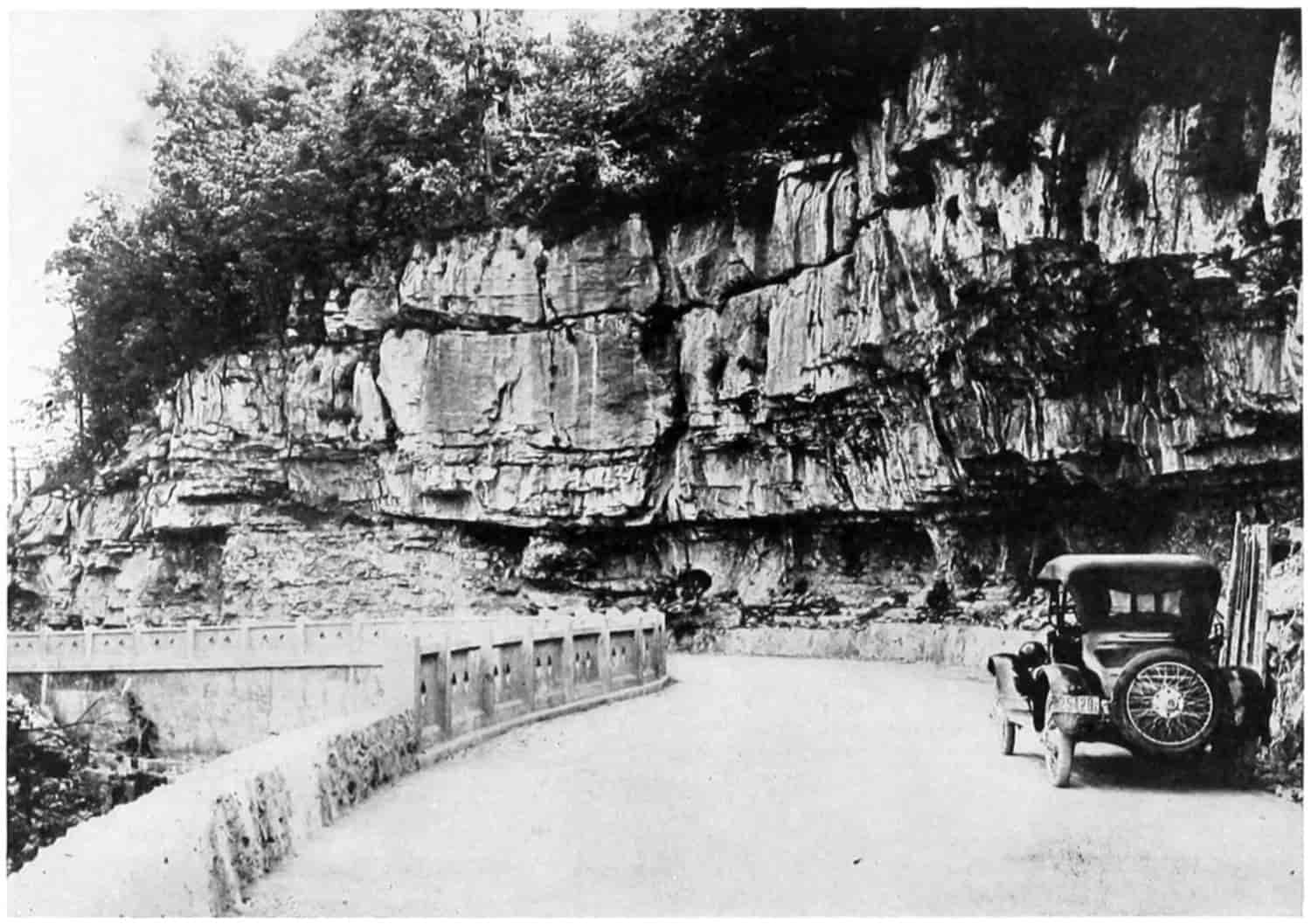
© Underwood and Underwood
A DANGEROUS CURVE AT LOOKOUT MOUNTAIN
A DANGEROUS CURVE MADE SAFE BY AN ARTISTIC CONCRETE WALL
The Tennessee State Highway at Lookout Mountain, Built of Cemented Concrete.
[365]
The country pavements are usually superelevated for 12 miles per hour. Even this with the minimum radius gives a surface so tipped that it is difficult for horse-drawn wagons to remain on it unless the horses trot around the curve. Substituting for a velocity of 12 miles per hour, a width of 20 feet, and a radius of 200 feet there results
E = 11.6 inches.
The following table gives the necessary elevation in inches that there shall be no side thrust at various speeds, for a road one foot wide. To get the elevation for any width multiply by the width.
Table of Superelevation in Inches per Foot of Width
| Radius Feet |
Speed in Miles per Hour | |||||
|---|---|---|---|---|---|---|
| 10 | 12 | 15 | 20 | 30 | 40 | |
| Inch | Inches | Inches | Inches | Inches | Inches | |
| 100 | 0.81 | 1.16 | 1.82 | 3.23 | 7.26 | 12.91 |
| 200 | .40 | .58 | .91 | 1.61 | 3.63 | 6.46 |
| 300 | .27 | .38 | .61 | 1.08 | 2.45 | 4.30 |
| 400 | .20 | .29 | .45 | .81 | 1.81 | 3.23 |
| 500 | .16 | .23 | .36 | .64 | 1.45 | 2.58 |
[366]
Unless the road is intended for a speedway, 12 miles per hour would be about the right speed to use. In rounding a curve of radius 200 feet at a speed of 30 miles per hour, superelevated as shown in the table for 12 miles per hour the coefficient of friction would have to be about one-fourth to prevent skidding. In dry weather this would practically always be exceeded. A committee of the National Highway Traffic Association, 1922, recommends “that on all curves of more than three degrees the pavement and inner-half of the earth shoulder should be banked. This superelevation should vary from 0 for a 3-degree curve to 1 inch per foot of width for curves of 20 degrees or sharper.”
Clear Vision.
—Clear vision is another thing that should be insisted upon as a means for safety. Weeds, brush and trees are all too frequently allowed to obscure the sight. With ordinary brakes on smooth roads from 100 to 150 feet is needed to stop a car moving at 30 miles per hour. With first-class brakes this might be decreased, but since it usually takes a driver a short period to react from the time a car heaves in sight or he sees a break in the pavement or some other obstruction, there should be allowed 150 feet to stop if the roads are smooth and hard. In order that there might be a good factor of safety it is desirable to get at least 250 feet clear vision. This will require for a 200-ft. radius that the brush, trees and so on should be cut back about 27 feet from the traveled way. As the radius becomes larger the distance necessary to clear back becomes less: 300-ft. radius, clearance, 12 ft.; 400-ft. radius, 7 ft.; 500-ft. radius, 4 ft. In case the curve is in a cut the bank on the inside at the height of the eye should be excavated far enough back to give the necessary clear vision.
At the corners of city streets it will, of course, be impossible to get a 200-ft. radius. A 12- or 14-ft. radius may usually be obtained. The rule to turn close to the curb may then be accomplished with the ordinary automobile providing it is not going very fast. With a square[367] angle or a short 2- or 3-ft. radius as it was formerly the custom to put in, and still is in places, it is practically impossible to keep from going at least to the middle of the street thus endangering motors on the other side. The cut shows the lines of travel.
Diagram to show why curb corners should be cut back.
Curves.
—Notwithstanding curves are dangerous the records of the Maryland State Commission, heretofore referred to, show that the largest number of accidents occur at places which always have been considered safe, while the sections that have been regarded as very dangerous are relatively free from accidents. On the long straight stretches, with good vision and free from any elements that might be considered dangerous, have occurred the greatest number of accidents. The commission accounts for this on the theory “that even the less careful motorists drive cautiously in the presence of recognized dangers, such as steep grades, sharp curves, grade crossings, etc., while the absence of such dangerous features gives the driver a sense of security which prompts him to take a chance and yield to the well nigh universal passion for speed.”[204]
Bridges and Culverts.
—Many road accidents can be attributed to poor and poorly located bridges and culverts.[368] Wooden bridges and culverts soon decay and become so weak that a heavy vehicle will break them down. Often culverts of the best type are not cared for as they should be or there is no abutment protection with the result that a freshet will wash under and about them so that they are real sources of danger. Frequently the damage is not visible to the driver and the first warning is when his vehicle goes down.
In order to shorten them and thus lessen the cost, bridges are often built straight across the stream or draw, but at a skew to the roadway, thus requiring a sudden turn to get on to them. Very frequently, too, bridges and culverts are built too narrow with no guard rails or markers leading up to them. Notwithstanding the fact that thorough bridging constitutes a considerable portion of the expense of road construction, the best plan is to put in substantial structures, wide as the traveled way, and straight with it, thus lessening a grave source of danger.
Railway Crossing Accidents.
—The great number of fatalities at railway crossings has for years been a theme for much talk, and many suggestions for the elimination of grade crossings have been made. The public seems to think that the railways are the ones that oppose the elimination. As a matter of fact they would welcome elimination if it could be done at reasonable cost. In 1919 there were eliminated 399 crossings “but there are still 251,939 crossings on Class 1 Railroads (revenue of over $1,000,000 annually) alone and the conservatively estimated sum which would be required to eliminate all remaining crossings in the entire United States is placed as high as $12,500,000,000, which cannot be immediately available.”[205] It is estimated that more than 2000 persons are killed annually in the United States at these crossings. The Pennsylvania R.R. Bulletin, February, 1914, states that 430 crossings[369] were eliminated on that road from 1904 to 1913 at a total cost of $27,742,433—an average of $64,518 per crossing. In Illinois the average cost of eliminating ten crossings was $58,000. In California the average cost is estimated at $30,000; in Colorado, $40,000; in New York, $48,000; and in Wisconsin, $25,000, according to the bulletin mentioned. Even at pre-war prices the average cost for the whole United States was put at $40,000. Since there are in the whole country something over 300,000 crossings that will account for the $12,000,000,000 necessary.
The public must remember that the elimination of crossings even if the railways could finance such a vast operation would eventually be charged up to and paid for by the public. While the railroads have a direct interest in checking crossing accidents, yet in the first and last analysis the public itself suffers the pain, the mutilation, and the passing to the Great Beyond, in addition to bearing the financial burden.[206]
F. T. Darrow, Asst. Chief. Engr., C. B. & Q. R.R., makes this calculation[207] for the State of Nebraska.
| Population | 1,350,000 |
| Miles of railway track | 6,516 |
| Number of grade crossings | 11,300 |
| Cost of entire removal | $452,000,000 |
| Cost per mile of track | 70,000 |
| Cost per person | 330 |
Nearly doubling the cost value of the railroads, at a price 11 times as much as railroad service now costs per annum per person.
But suppose the cost were put upon the public at the beginning, the state would have to finance the $452,000,000, and if it were placed as a charge against the 80,000 miles of rural highway and the 45,000 miles of city and village streets, it would amount to $3600 per mile. Similar calculations could be made for each of the States.
[370]
From the above it does not appear probable that either the railroads or the state or both together, can afford to pay for the elimination of all grade crossings right away. It is probable that they will be gradually done away with, although Mr. Darrow states that at present two or three crossings are added to the list for each one subtracted. The railroads realize that it is incumbent on them to make the crossings as safe as possible but that they must look to the education of the public as a means of immediately reducing fatalities. Hence the “Cross Crossings Cautiously” campaign in 1922. The bulletin states that the “Safety First” organized effort had reduced the number of deaths among railway employees from 4354 in 1907 to 2578 in 1920. A thing well worth while and a similar campaign against carelessly crossing crossings may change, at least, the rate of acceleration of crossing accidents, which have increased in the past thirty years 345 per cent in fatal and 652 per cent in injury cases, while the country’s population has increased in the same time only 68 per cent.
The Automobile and Crossing Accidents.
—To the automobile is attributed much of the increase. And to careless, indifferent and reckless driving the greater per cent of it. The railways have made numerous counts which show the carelessness of the people at railway crossings. Those given below are typical of them all.
In December, 1913, St. Louis:
| Per Cent | |
|---|---|
| Stopped and looked in both directions—pedestrians | 1 |
| Kept moving and looked in both directions (of all pedestrians, vehicles, teams and autos) | 2 |
| Kept moving and looked in one direction | 7 |
| Kept moving and looked straight ahead | 91 |
| (on a total of over 30,000 individual movements) |
On the Baltimore and Ohio, Southwest, 1914:
| Per Cent | |
|---|---|
| Stopped and looked both directions | 5 |
| Kept moving and looked in both directions | 13 |
| Kept moving and looked in one direction | 18 |
| Kept moving and looked straight ahead | 69 |
[371]
In California, 1913:
| Per Cent | |
|---|---|
| Stopped and looked in both directions | 0.2 |
| Kept moving and looked in both directions | 35 |
| Kept moving and looked in one direction | 7 |
| Kept moving and looked straight ahead | 58 |
The California Railway Commission in 1917 tested 17,000 motor vehicle drivers:
| 27.8 | per cent looked both ways |
| 2.7 | per cent looked only one way |
| 65.5 | per cent looked neither way before crossing. |
A Southern Pacific Railway folder gives these figures for automobile accidents during the period from January 1 to August 1, 1917, taken from the figures of eighteen railroads:
| Total number of accidents | 769 |
| Trains striking autos | 426 |
| Autos striking trains | 112 |
| Autos running through crossing gates | 143 |
| Accidents at protected crossings | 766 |
| Accidents at unprotected crossings | 3 |
| Accidents at night | 168 |
| Accidents during daylight | 540 |
| Persons injured | 515 |
| Persons killed | 99 |
The fact that practically all these accidents occurred at protected crossings would seem to indicate that most people trust the railway to look out for them, and do not assume any individual responsibility. It is to be noted, also, that those who did not look either way are in the majority in every count. Also the number of automobiles that run into trains is about one-fourth as many as those that try but fail to get by in front of the train.
Enough has been said to prove this to be an important item in the vital and financial economies of the nation. The question then is, what is the remedy? No specific can be given but relief, partial, may be secured.
[372]
(1) Eliminate grade crossings as rapidly as possible. For this a coöperation between public and railroad by legislation might be fair. Some States already do this going “fifty-fifty” on the expense.
(2) By combining public roads, that is vacating some, changing others by relocation following along the railroad rather than cross over the track twice as may be necessary if section lines be followed. Frequently the shortening of the distance and betterment of grades will pay for the improvement.
(3) By taking advantage of natural features in the location of new lines of road and railway, and the relocation of old, to avoid grade crossings. This has been done to a considerable extent in the more recent locations.
(4) By proper location and construction details:
(a) Sharp angles in crossing should be avoided. The crossing should be made as nearly at right angles to the track as possible. Flat easy curves can usually be made to lead up to the crossing to accomplish this. Secure an angle greater than 60° if possible. Catching wheels in the flangeways or slipping along the track is common when the angle is sharp. Also a view of the track to the rear is difficult.
(b) Steep grades near the track should be avoided. In Kansas and Colorado the rule is for a level grade for 20 feet from the track. It would be better to have this read “not steeper than a 2 per cent grade downward from the track for at least 40 feet.” The roadway would by this slight slope of not more than 2 feet in 100 feet be better drained and therefore would keep in better condition. Level roads are liable to hold water in the ruts and depressions softening them and the railway track as well. A definite rule should not be made, for circumstances alter cases. The rails are not always level. If the track is in curve at point of crossing one rail will be superelevated above the other. If the track is in cut,[373] or half cut, it may require different treatment than if in fill. The following sketches will illustrate this.
Steep grades at a crossing should be avoided. The grade of the highway must conform to the elevation of the rails.
(c) For the same reason the road should have a crown, the amount depending on the type, earth, sand-clay, and gravel roads from 1⁄2 to 1 inch per foot of width, concrete, asphalt, brick and other hard surfaces may have less.
(d) Clear vision for several hundred feet from the roadway along the track should be secured if possible. This may often be done by the removal of brush and weeds and the trimming of trees. During certain seasons of the year cornfields may obstruct the view from some little distance down the road, but if there is a comparatively level stopping place near the crossing the driver ought to be able to slow down his machine, to have it under thorough control, so that it could be stopped quickly and far enough away from the track for safety, while he looks both ways along the track. A little coöperation between railroad and farmer may result in the planting of low growing crops where the view would be obstructed by the high growing corn. The farmer might also be willing to have hedges trimmed low and trees trimmed high in such localities. In some states the laws provide[374] for the annual trimming of trees and hedges near railway crossings.
(e) The railways at the request of the road officers will usually arrange the rails so that no joint will come upon the crossing, thus keeping both road and track in better condition.
Safety turn at a railway crossing.
(f) The building of a right-hand turn along the railway track at each crossing on to which the motorist seeing that he could not pass ahead of the train or stop his car could drive. See the figure above.
(5) Drivers when they see a train approaching should make it a point to stop at least 100 feet away from the track. If a flying stop is made right near the track the engineman will be at a loss whether to apply the air for the train to stop or take a chance of hitting the vehicle. Enginemen will appreciate a little courtesy of this kind.[375] Also it will be much easier to get a start to make the grade over the crossing if a longer distance is allowed.
(6) Markers indicating the approach to a railroad crossing placed 300 feet back will serve as a caution warning. A good many states are providing their highways with standard markers. In Illinois certain crossings are designated with a stop sign and it is a misdemeanor to go over without first coming to a full stop. In another state the law requires a stop at all crossings and a ditch, or “thank-you-ma’am” practically enforces the law.
(7) Automatic electrically driven gongs, bells, colored disks, waving arms, or red lights are expedients in quite common use.
(8) Crossing gates and watchmen are used where the traffic is heavy. They are expensive and railroads like to avoid them wherever possible. On Long Island it is said light gates were run down by the motorists. Very heavy gates are said to have proven more efficacious.
(9) Locomotives should be equipped with whistles and bells sufficiently penetrating to be easily heard by drivers of moving automobiles. Mr. Byron Clark, Chief Counsel of the Burlington railway west of the Missouri River, called the author’s attention to what he believes to be a fact, namely, that automobilists when traveling at a rapid gait do not hear the locomotive whistle which the state law and the railway rules require to be sounded before each crossing. Since my attention has been called to this matter I have watched it quite closely and believe Mr. Clark to be right. Frequently I hear the engine bell but not the whistle. It might be well to experiment with whistles and bells of various types. Is there a difference in the audibility of high-pitched and low-pitched whistles and bells?
(10) But no matter what mechanical devices there are, how carefully the enginemen obey the law about whistling, or how vigorously the watchman swings his signal, lack of care on the part of the driver will be productive of accidents. Before they can be avoided or even decreased[376] materially it will be necessary for the people generally to come to a full understanding that they owe it to themselves, to the public and to the nation to be careful. Life and accident insurance is only a method of spreading the cost of loss due to death and accident over a larger number. The economic loss to the people as a whole is just as great whether there is or is not any insurance. An accident is always an economic waste. “A careful man is the best safety device known.”
Clearance.
—The New York State Highway Commission makes it a rule to secure the following clearance:
When a highway passes under a railroad the crown elevation is made 13.5 feet below the bottom of the bridge girder, and the minimum right angle distance between abutments is taken as 26 feet. The distance from the base of the rail to the bottom of the girder varies with the span of the bridge and ranges from 2 ft. 2 in. for a 30-foot span to 2 ft. 41⁄2 in. for a 110-foot span.
Where the highway crosses over the railroad a minimum clearance of 21.0 feet is required from the top of the rail to the bottom of the highway bridge girders. The span or right angle opening will vary with the number of tracks and the standards of the railways. It is, of course, well to have a clear opening over the entire used roadway. The practice in some places, of having piers or piles in the center of the road, unless there is placed around these a safety zone or park extending each way along the street so that traffic may be separated some little distance before coming to the pier, is not to be commended.
Pedestrians.
—While it has been said that 90 per cent of the accidents are due to lack of caution on the part of the driver, it must not be thought that there is no contributory negligence.
Pedestrians constantly go across the street without looking up to right or left. Others look with a leer as much as to say, “hit me if you dare,” and leisurely proceed. They will not hurry one bit, thus causing a slow down[377] of the approaching motor and that in turn of the next, and the next, producing a congestion in traffic with its known liabilities. Each party has a right to the street, but courtesy should be extended on both sides. When there is no traffic officer, motorists should remember to give pedestrians time to cross, and pedestrians should hurry a little so as not to delay motor traffic.
Jay Walking.
—Another source of danger which can not be too strongly condemned is the practice of “jay walking.” The driver of a car along a crowded thoroughfare is never sure but what some person will pop out from behind a parked vehicle and start across the street directly ahead of his machine. By the ordinances of most cities parking is prohibited near the ends of blocks and the proper walking spaces. Vision is there clear to the sidewalks. The motorist is expecting pedestrians and is on the lookout for them. But in the middle of the block with parked cars along each side with travel more rapid than over the walking spaces it is difficult to avoid hitting the exasperating jay walker.
Obstacles that Obscure Vision.
—Many pedestrians have received injury or been killed by stepping around the rear of street cars, trucks, and other obstructions to clear vision, directly in front of a passing vehicle. So suddenly does the pedestrian come into the path of the moving vehicle that the driver can not stop before hitting him. The remedy is care on the part of the pedestrian. Look before crossing, is always an excellent slogan.
Pedestrians on Country Roads.
—When pedestrians walk along country roads they should habitually take their left-hand side. Thus they will meet face to face those machines that are passing along that side of the roadway, whereas if they walk on the right-hand side the machines are coming up from their rear and may come near before sounding the horn. A startled person often jumps in the wrong direction, thus moving in front of instead of away from the impending danger.
[378]
Slow-Going Vehicles.
—Horse-drawn vehicles should travel on the outer side of the road if possible in order to allow faster going vehicles to pass them readily. Often a slow-going truck will take the middle of the roadway and stubbornly keep it even when asked courteously by horn to get over. In trying to pass by going partially off the paved way motors have slipped down due to the soft earth shoulders, with serious injuries to both persons and machines. Where traffic is heavy congestion results from slow-going vehicles not taking the outer side of the way, with its usual disastrous effects.
Bicycles.
—Boys on bicycles become extremely careless and fool-hardy. They cut in front of rapidly moving cars and weave from one side of the roadway to the other. They dart in from behind a parked car or from a side street. When moving not straight along the wheels are always likely to slip on wet spots in the pavement or catch in the flangeway of the street-car tracks.
The bicycle is in itself a very useful machine and, perhaps, the most economical vehicle built. Its use is to be encouraged by furnishing special pathways for it to run upon wherever that is practicable. When used on the main thoroughfares extreme care is necessary. The motorcycle is a rapidly going machine and should be treated in the same category as the automobile.
The matter of lights for non-motorized traffic has been mentioned. It would be well for all to carry lights or reflectors. Motor-cycles with side-cars should carry two lights in front, one for the cycle and the other for the side-car.
Road and Traffic Regulations.
—Very great credit for the development of traffic regulation in the United States during the past two decades is due to the persistent and unselfish efforts of William Phelps Eno,[208] who in the latter part of the last century began an agitation to reform the[379] traffic situation in New York City. In December, 1899,[209] he published an article on “Reform in Our Street Traffic Most Urgently Needed,” followed by many others, with personal letters and visits to the city officers, and with the publication of circulars and pamphlets. At first he was not received very favorably by city officers who seemed more interested in “what personal benefit” Eno expected to get out of it, than to the good that would come to the public through such regulation. He later received favorable consideration by Maj. Gen. Francis V. Greene, Police Commissioner, and by Capt. A. R. Piper, U. S. A. Retired, who had been placed in charge of traffic. In a letter dated October 14, 1909, General Greene gives due credit to Eno, thus,[210]
The plan for street traffic regulation owed its inception to you, and you have followed it up consistently and persistently to its present almost perfect development; and in so doing you have conferred a benefit upon New Yorkers and the dwellers in other large cities, of very large proportions.
As a result of the combined work of the city officers and Mr. Eno, a code was compiled which later furnished the basis for the code adopted by the Highway Transport Committee of the Council of National Defense, U. S. A., May 8, 1919. Most of the larger cities in the United States, together with Paris and other European cities, have adopted this or similar codes. A universal standardization of the National Defense Code is being sought now by a national organization—The Eno Foundation for Highway Traffic Regulation, Inc.[211] This code has been revised once or twice since first adopted by New York. The Foundation will be glad to receive suggestions for its betterment from any persons interested.
[380]
Campaigns like the “Safety First” and the “Cross Crossings Cautiously” and other “No Accident” campaigns have marked effects. If the necessity of care could be instilled into the mind of every person, if each could be made to realize that the next accident might be his, that accidents are not only painful and disagreeable but always result in the destruction of property, in personal injury or the loss of life, the sum total of savings in money and humanity would be tremendous. All the devices of human ingenuity, all the laws of the sages, and the education of all agencies will not bring absolute safety. The human race is too ignorant, too indolent, too self-complacent, too near, in short, the outskirts of civilization, and the person who suggests the utmost care, who would curtail the thrills of chance and danger is a “joy killer” and a “crèpe hanger.” Perhaps so. Infinite care might result in “innocuous desuetude.” It is said that there was introduced into a western legislature a bill providing that two trains on different tracks approaching their crossing point “should both stop and neither proceed until the other had passed.” The other extreme is fatalism: “on with the dance, let joy be unconfined”; “eat, drink and be merry.” Is there not a golden mean?
SELECTED REFERENCES
Accidents, Symposium on Automobile Hazards, by Ralph Stickle, James L. Roche, Joseph H. Handlon, and William G. Fitzpatrick. Electric Railway Journal, Vol. LVI, pp. 913-921.
American Railway Association, Bulletin issued as a part of the “Cross Crossings Cautiously,” campaign, 1922.
Darrow, F. T., Asst. Chief Engr., C. B. & Q. R. R., “Grade Crossing Elimination,” Nebraska Blue Print, May, 1920. Lincoln.
Eno, William Phelps, “The Science of Highway Traffic Regulation,” published by himself and distributed by Brentano’s, New York.
“Facts and Figures of the Automobile Industry,” 1922, National Automobile Chamber of Commerce, New York.
[381]
Harper’s Weekly, Accounts and pictures of early railway accidents, years 1840-1860.
Held, L. A., Adjuster for the American Railway Express Company, Express Messenger, July, 1922.
Williar, Harry D., Jr., “Maryland Road Accident Map.” Public Roads, September, 1921.
FOOTNOTES
[201] “Facts and figures of the Automobile Industry,” 1922, published by the National Automobile Chamber of Commerce, gives the following table under the heading “Ratio of Accidents to Traffic Declines”:
| Year | Number of Auto Deaths per Car |
Total Number Auto[202] Deaths |
Registration of Cars |
Number of Cars per 1000 Population |
Auto Deaths per 1000 Population |
|
|---|---|---|---|---|---|---|
| 1917 | .0019 | 9,184 | 4,983,340 | 48 | .0887 | |
| 1918 | .0016 | 9,672 | 6,146,617 | 59 | .0919 | |
| 1919 | .0013 | 9,827 | 7,558,848 | 71 | .0936 | |
| 1920 | .00123 | 11,358 | 9,211,295 | 87 | .1040 | |
| 1921 | .00119 | 12,500 | [203] | 10,448,632 | 99 | .1100 |
[202] Estimated of entire U. S. by National Workmen’s Compensation Service Bureau applying Census Bureau for registration area to grand total.
[203] Estimated from incomplete figures. Later statistics of the U. S. Census Bureau gives automobile accidents in 1921, 9103; in 1922, 10,168.
[204] Harry D. Williar, Jr., Assistant Chief Engineer, in Public Roads, September, 1921.
[205] Bulletin issued by the American Railway Association as a part of the “Cross Crossings Cautiously” campaign, June to September, inclusive, 1922.
[206] “Cross Crossings Cautiously” Bulletin.
[207] Nebraska Blue Print, May, 1920. Published by the Engineering Society of the University of Nebraska.
[208] Formerly Chairman of the Citizens’ Street Traffic Committee of New York City, Honorary President of the Highway Traffic Association of the state of New York, Chairman of the Advisory Committee for the Highway Transport Committee of the United States Council of National Defense, Chairman of the Board of Directors of the Eno Foundation for Highway Traffic Regulation, Inc., etc.
[209] “The Science of Highway Traffic Regulation,” by W. P. Eno. Distributed by Brentano’s, New York.
[210] Eno, op. cit.
[211] Main Office, Saugatuck, Fairfield County, Conn.
[382]
CHAPTER XII
HIGHWAY ESTHETICS
One test for success is the degree of satisfaction produced. A successful book satisfies the majority of its readers. A machine is successful when it performs the duties intended to the satisfaction of its operators. In business satisfaction brings repeat orders; in art it gives emotional pleasure, and we return again and again to look upon it. The ancient writer Vitruvius says the three indispensable elements of architecture are Firmitas, Utilitas, Venustas, stability, utility, beauty. That one which in the long run is most pleasing to the builder and gives the greatest degree of satisfaction is beauty.
Most people are sensible to the charms of nature and art, that feeling excited in the mind when observing those things called beautiful, and to a feeling of revulsion and, possibly, disgust when brought in contact with the ugly. The so-called esthetic sense enables us to appreciate and admire the beautiful in nature and art, to enjoy literature and music, to delight in wit and humor, and even to recognize beauty in a mathematical problem.
Can the principles of esthetic construction be applied to the humble road? Most assuredly, everyone recognizes that the first two elements, stability and utility, are very essential qualifications, but the public fails to get the greatest possible satisfaction from the road because it neglects the element of beauty. Until the profession of Road Aesthete has been evolved, therefore, it might be well, in at least a crude way, to apply to the highway some of the principles of architecture and landscape gardening. Since the roadway is of necessity flat it blends in well with landscape[383] gardening and the characteristics of unity, variety, and fitness are fundamental. All parts that are above the surface may receive a true architectural treatment. Bridges are especially amenable. With the very large bridges there is present the element of size, vastness, and when properly proportioned they excite in the mind of man a feeling of awe akin to appreciation of the sublime in nature and impress upon him a deep sense of the greatness of human power. In all bridges the elements of proportion, harmony and symmetry are applicable. And with the beauty and grandeur of form comes the heightened effect of embellishment—ornament and color. Here, however, the skill, experience, and taste of the artist must come in. Embellishment may be carried too far. A simple decoration of constructive parts is usually sufficient. Massive concrete is itself pleasing, but possibly a rubbing of the surface will enhance the effect of light and shade and bring into prominence the lines which the bridge architect desires to emphasize. The coloring due to the materials used is usually deemed sufficient, although there may be places where harmony demands a special treatment.
Much the same principles are involved in landscape gardening. It might be well if every road engineer also had a course in the art of landscape gardening, and some have gone so far as to contend that the need for the services of an expert landscape architect to assist in the design of highways is obvious. The artistic qualities of landscape gardening applicable to the beautification of highways may be conceived to be unity, variety, and character.
Unity means that in the landscape composition some leading idea, motive, shall prevail, and that details shall be subordinate to it. In order that a motive may be most effective one master mind should have charge of the landscape work for an entire road; plans should be completely made and all planting within and along the edges of the right of way should be absolutely under his supervision. In only a few instances has road gardening been carried to this extent. Perhaps this may be due to a lack of art education[384] on the part of the public, to a sort of inherent feeling that Nature will take care of her own and cover without artificial aid all ugly spots, or to a lack of necessary funds.
Two great styles ordinarily mentioned are the Natural and the Architectural. They are sometimes spoken of as the English and the Italian, because they have been respectively most highly developed in these countries. Another style called the Picturesque has its adherents for certain locations.
The natural style attempts to retain naturalness as far as possible—in extreme cases refusing to prune trees or clear out trees weakened by decay and blown down by the wind. Generally the best effects are obtained by not going that far. Open lawns, curved lines, and grouped trees are utilized to obtain the appearance of naturalness. Shrubs and flowering perennials are used to furnish a natural and pleasing connection between the open lawns and the wooded portions of the landscape. They may be used in profusion to hide unnatural and inartistic features, and often will be low enough to look over and therefore beautiful vistas need not be eliminated.
The Architectural style seeks to carry the architectural composition of the buildings into the landscape. The extreme Italian style is diametrically opposed to the extreme English. It has been said that they are mutually exclusive. For best effects that may be true, but the modern tendency seems to be to recognize that each has its advantage in special situations. Modern landscape architects are not adverse to a proper mixture of the two.
The writer is of the opinion that road gardening will be best as a compromise between the two extreme styles. The fact that the road must be laid down through a long, narrow stretch of land, that ditches must be maintained for drainage, that embankments and cuts must continually alternate, makes a purely naturalistic treatment impossible. The geometrical must be in evidence. In country districts with wide right of ways—in some places they are as much[385] as 200 feet—the road may be considered as separating two plots in which there is room for much open grassy space and group planting along the outer edges. With narrower roads the trees will necessarily be planted in rows uniformly spaced, depending upon the width of the street and species of trees, giving an “avenue” effect. In cities greater formality is necessary than in the country, but even there planting the less formal trees will tend to give more or less naturalness to the whole.
The architects will not agree with me in believing that satisfactory combinations of the two great styles may be obtained. They believe that street planting, for example, should be in (1) parallel rows with the street, (2) the trees should be uniformly spaced, and (3) the individual trees should be just as nearly uniform as possible. I will admit that the main lines of trees should be parallel with the street but do not admit that irregular groups of shrubbery and flowers will destroy the artistic effect. That the larger trees should be uniformly spaced and of the same variety and size for the same block or street is also admitted. But, that such trees as the American elm, for instance, because it is lacking in formality, is not a good street tree, cannot be admitted. Neither do I believe that an avenue made up of palms, Lombardy poplars, or dwarfed catalpas, is any more beautiful, harmonious or restful than a street of long curving pendulant elms, although geometrical boldness has not been so thoroughly carried out in the latter case. Clipped trees, occasionally in fantastic shapes, are sometimes seen. It scarcely needs to be said, that however appropriate they may be in an Italian villa, they have no place along an American highway. But neatly clipped hedges of privet or mulberry may add materially in outlining the geometrical arrangement.
It is my opinion that the main trees along a country highway should be much farther apart than they are usually planted. Two to three times the spread of a grown tree of the same variety in that region is none too much. Or the distance may equal the height plus the spread. If[386] they are placed on both sides of the roadway they should be alternated, staggered. This gives the trees each individually an opportunity of undisturbed growth, and if they are adapted to the locality and well fed will form large symmetrical trees. American elms, for the Mid-west states should be placed not less than 100 feet apart along country roads. Lombardy poplar closer, say 75 feet; while they do not spread so very far they do grow high. Another reason, in addition to that of unrestricted growth, for setting the trees far apart is that for some distance from a tree, perhaps because of the spread of its roots or the shade, crops do not grow well. And as the tree must usually be planted near the edge of the right of way, the farmer who owns the adjacent land is being robbed of the fertility of his soil. The fewer trees that may be set and still give a good appearance the better. The improved appearance of the highway and its benefit to the farm fully compensates for the loss of land, without doubt, when the trees are spaced wide as has been suggested.
The varieties of trees that should be planted along highways depends upon the location of the land. Those species that will thrive on low bottom land may not thrive on the table and upland. The eucalyptus grows rapidly into a tall, dignified stately tree in California, but would not live at all in Minnesota. The paper birch of Michigan and New York might be out of place entirely in Texas. Only those trees should be planted that experience shows are fitted for the region and locality. In Europe it is common practice to plant apple and other fruit trees along the highway. Such trees might not thrive under American vandalism. Mr. C. A. Reed of the United States Department of Agriculture[212] recommends the planting of nut trees. Among others he mentions black walnut, hickory, Japanese walnut, beech, chestnut, filbert or hazel, and pecan. Of non-nut-bearing trees he thinks the elm the best all-around tree. He also mentions the sugar maple, the[387] linden, the apple, and especially a native variety known as thorn apple, hawthorn or red haw.
There are many other species that grow well. The pin oak and other varieties of oak may be transplanted; two or three poplars—a variety of cottonwood known commercially as Carolina poplar is a rapid growing but short-lived tree; ashes, locusts, catalpa, sycamore, the pines, spruces, cedars, and larches, all do well in some localities. Plums, choke-cherries, and black haws make good screening thickets and furnish fruit for the birds. The wild grape and the Virginia creeper will soon completely cover unsightly fences, rocks, and stumps; the birds also like their fruits. For low planting practically all the shrubs used in decorative gardening are available, while the perennial herbaceous flowering plants become veritable splotches of color to delight the eye of the discerning wayfarer.
In the language of Oliver Wendell Holmes, “It will not do to be exclusive in our tastes about trees. There is hardly one of them which has not peculiar beauties in some fitting place for it.” Even a blasted and wind-torn tree, or those trees which have the quality of picturesqueness, such as the gingko, cut-leaved maple, Kentucky coffee, weeping larch, or those artificially dwarfed trees, catalpa and mountain ash, all may be utilized in their appropriate places.
Trees.
—Apple.—A rather good-looking tree with a beautiful show of blossoms in the spring. Used extensively as a road tree in Europe. The native crab-apple and the thorn-apple (red haw) are both fine for their blossoms. They do not grow large so can be used in group planting.
Arbor vitae.—A species of cedar used for screens, wind-breaks, and hedges, and for filling in shrubbery where a variety of color is desired.
Ash.—There are some half dozen or more varieties found native in the United States covering a region from the Atlantic to the Rockies and extending into Oregon and Washington. Nearly all of them are suitable for road and street trees. In parks they are good for massing as they stand close planting.
[388]
Aspen.—A species of poplar, rapid growing and often springs up in the pine forests after the conifers have been cut off. The color of the leaves makes it desirable in some plantings. Will grow in close masses.
Balm of Gilead.—A species of poplar (black cottonwood); a good-looking tree but like other poplars not especially desirable as a road tree, but in all the Northern states where quick growth is wanted might be used.
Bamboo.—Native of South Sea Island, Philippines, southern Asia, other southern countries and a species in Florida. A rapid growing plant, quite graceful, and can be utilized for group and massive planting where acclimated.
Basswood.—See Linden.
Bay.—See Laurel.
Beech.—A beautiful tree both in summer and winter. Best when grown individually. There are fifteen or more species belonging to the genus (Fagus). The blue beech or ironwood, a rather small tree, may be used where its peculiar color is desired.
Birch.—Some twenty-four species are known in the United States, inhabiting mostly the northern part, extending into Canada and Alaska. The birches, especially the paper or white birch, are distinguished by their light-colored bark. That of the white birch was used by the Indians for canoes. It is an excellent park tree if it can be saved from being peeled by the ubiquitous vandal.
Box Elder.—A species of maple found quite generally from the Atlantic Ocean to the Rocky Mountains. It grows to a height of approximately fifty feet with a spread about the same. It casts a dense shade and since it will stand severe climatic changes is a good tree for the naturally treeless sections. Has been used much as a street tree, although not particularly shapely as to trunk.
Buckeye.—The buckeye and horse chestnut are species of the same genus. To the native species is usually given the name buckeye. The Ohio buckeye is from 30 to 45 feet in height and is useful in mass planting and not at its best in road planting.
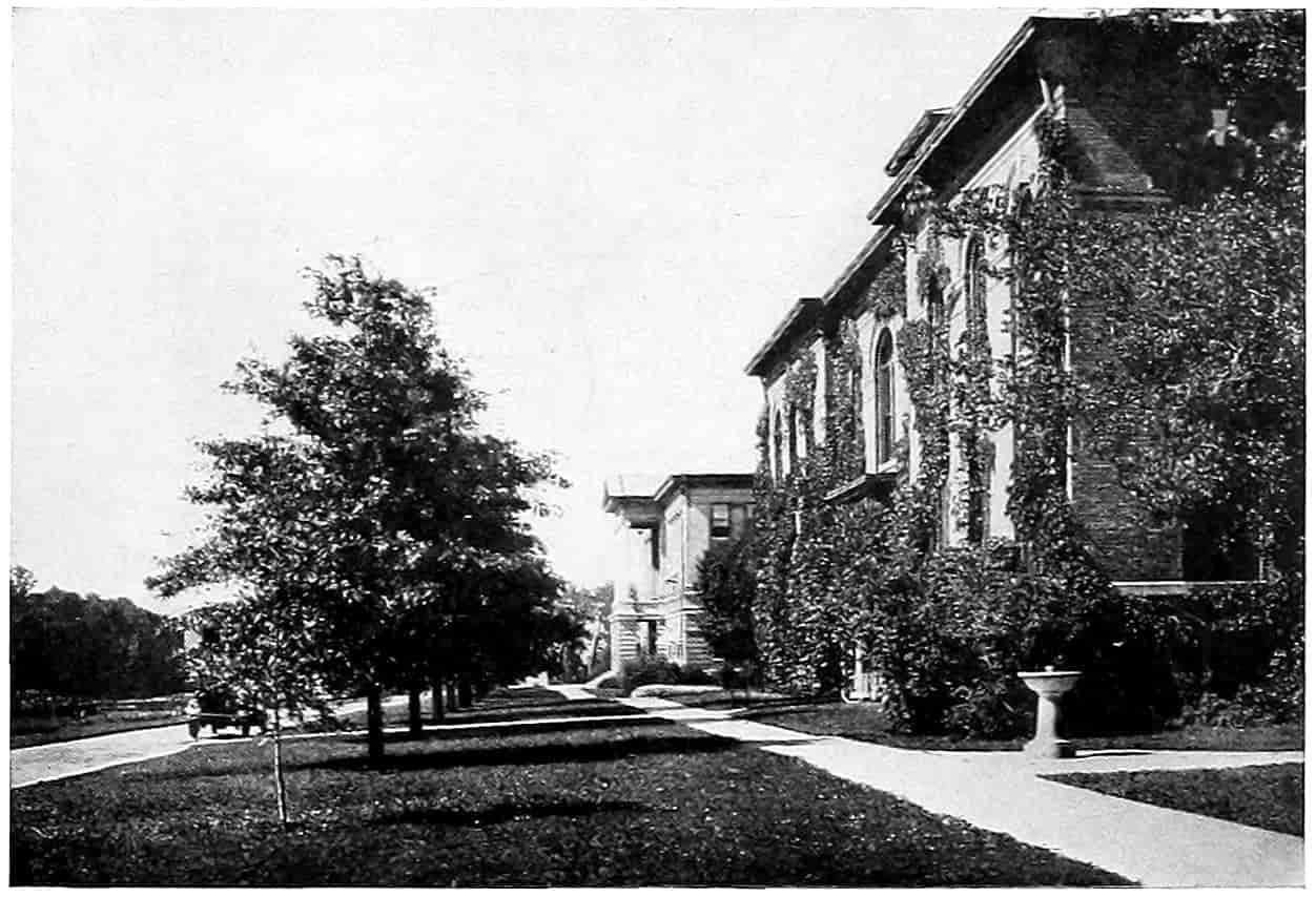
PIN OAK STREET TREES
About 15 Years Old on Land that Was Once Considered to be a part of the “Great American Desert.”
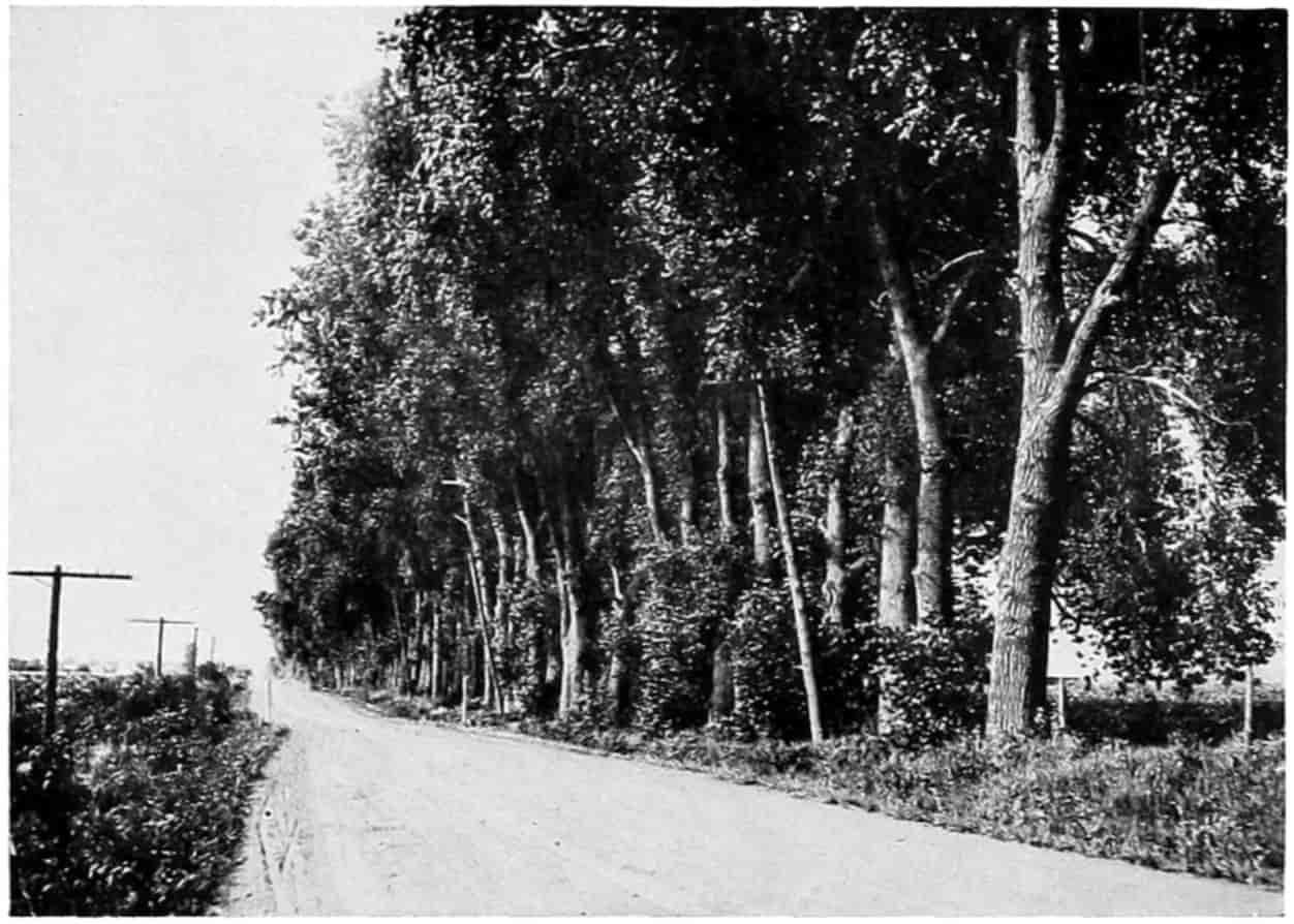
A COTTONWOOD WIND BREAK
Formerly very Common in the Prairie Region.
[389]
Camphor.—The Camphor Tree (Cinnamomum camphora) is quite commonly planted for street trees in the Southeastern, Southern and the Southwestern states. The tree is a thrifty grower and is nice and straight. The leaves and wood have the characteristic aromatic camphor odor, and from them can be extracted the juice. Another tree of the same genus C. zeylanicum has also been imported from Asia and may be found in the same states. From the roots is obtained cassia bark.
Catalpa.—Was planted extensively a few years ago because it was thought it would quickly develop timber large enough for fence posts and ties in a few years. The best variety is the Catalpa speciosa, which grows under favorable conditions to a height of 60 feet, with a spread of 30 feet. The leaves are large and of good color, but slow to appear in the spring and drop at the first frost in the fall. The flowers are very showy. For this reason, its general shapely appearance, and its rapid growth, it is a good road tree. It does not seem to be very long lived, and as a street tree it is objected to by those having close cropped lawns because of its bad habit of shedding its long seed pods all summer.
Cedar.—There are many species of cedars, both red and white. The arbor vitae has already been mentioned. Juniperus virginiana is perhaps the best road tree. It grows from 50 to 80 feet tall with a spread of one-quarter to one-third its height. It is suitable in nearly every place where evergreens can be utilized. Its pyramidal shape makes it well adapted to formal landscape architecture and hence would make a good road tree for avenue planting.
Citrus Fruit.—Orange, lemon, grapefruit, and citron are freely planted in Florida and California. Where these come up to the highway they answer for road trees. The citrus trees have a beautiful dark green shiny foliage with[390] a round top, and with their flowers and ripening fruit are always interesting.
Coffee Tree.—A good lawn or park tree, but a very few specimens will be sufficient.
Cherry.—The wild cherry, Prunus serotina, also called black-cherry, grows native over much of the eastern and central portions of the United States. It is the tree from which the cherry wood is obtained. It is hardy, grows to a good height, 40 to 80 feet, with a spread of 20 to 40 feet. It is a good road tree spoken of by one writer as “charmingly unconventional,” and bears a slightly bitter pea-sized fruit of which the birds are fond. It is deserving of larger planting as a road and street tree. The chokecherry is a much smaller tree, from 5 to 20 feet high and can be used in massing and screening. The blossoms in the spring and a little later the fruit of which birds are extremely fond, make it worthy of attention. The Japanese flowering cherry and tame cherries are sometimes used for their blossoms.
Cottonwood.—A species of poplar found native from Maine to Florida and westward to the Rocky Mountains. Being so hardy and a rapid growing tree, it was planted freely by the early settlers in the plains regions of the Mid-west. A variety known as Carolina poplar grows especially straight and tall, from 75 to 100 feet, with a spread of 25 to 30 feet. The cottonwood is not strong and is liable to be broken in the wind, because of this fact old trees are usually more or less unsightly. The shedding of cotton from the pistilate tree is objected to, but this trouble may be avoided by propagating only from staminate trees by cuttings. Nevertheless it is a valuable tree where rapid growth and quick shade is desired.
Chestnut.—The chestnut (Castania vulgarus) and one or two other species was formerly an important timber tree in the Eastern states. The tree when not in foliage looks something like red oak. It grows to a height of 75 to 100 feet, 5 to 12 feet in diameter. In Europe a chestnut is mentioned 204 feet in circumference. The spread of the[391] tree is from one-fourth to one-half its height. The nuts are edible. A bark disease has carried off most of the Eastern trees, and the larvæ of insects almost universally infect the nuts. However, it is a rapid grower and might be worth planting where it is known to thrive.
Cucumber Tree.—A large, handsome tree, symmetrical, 50 to 75 feet in height of the magnolia family, its fruit resembling cucumbers. It is a native of the Eastern states.
Cypress.—The bald cypress, though a large tree and of commercial importance, has little value as a road tree because it grows in swamps, the very worst place for a road. It might be utilized in the lake of a park.
Dogwood.—A native shrub of several varieties. Its low growing tendencies, its beautiful flowers and showy fruit make it a valuable ornamental shrub for parks. A species Cornus Florida grows into a tree some 25 feet high.
Douglas Spruce or Fir.—Snow[213] states this (Pseudotsuga) genus “is neither a true pine, spruce, nor fir, but a sort of bastard hemlock. The name ‘pseudotsuga’ is from pseudo, or false, and tsuga or hemlock.” These trees are among the largest known and the wonder of the traveler through the forests of Oregon and Washington. Along the lines of these roads it were well, if the pleasure of the tourist be of import, to retain the most beautiful specimens. It grows from 175 to sometimes 300 feet in height, and 3 to 5, and sometimes 10 feet in diameter.
Elm.—The American elm (Ulmus americana) is considered by many to be the best street and road tree in this country. It has a large rounded top with long graceful branches. The shade is not very dense and the lack of foliage near the ground allows the free circulation of air. It grows into an exceptionally fine individual specimen and will also group well. The general good appearance of the tree both in summer and in winter makes it a favorite. There are some fifteen different species of elm distributed over the temperate portions of the Northern Hemisphere,[392] except along the western coast of North America. The wood being tough and fibrous it withstands damage from the wind fairly well. Occasionally the long branches become so heavy they break down, but usually the tree is so well balanced that it stands up well. The white or American elm is the favorite for road work. The red or slippery elm (U. pubescens) is a beautiful tree and would be used more frequently in road and park work were it not that its delectable mucilaginous inner-bark makes it the mark of the road vandal. White elm grows from 90 to 100 feet in height with a spread of 50 to 75 feet. There is a tree now being featured by the nurseries called English elm which has a smooth bark and very shapely appearance. The cork elm (U. racemosa), grows from 75 to 90 feet in height, best developed in southern Ontario and Michigan, with a somewhat rough shaggy bark, is also a good road tree.
Eucalyptus.—This genus includes about 400 species. They are variously and locally known as gum trees, stringy-barks, iron-barks, mahoganies, and box, and are natives of Australia and neighboring islands. They have been widely planted throughout the world in warm climates. The blue gum (Eucalyptus globulus) does well at least as far north as Sacramento, and has practically changed the landscape of Southern California and Arizona. The tree has an extremely rapid growth, reaching a height of 200 and sometimes 300 feet. Some of the trees have a shaggy exfoliating bark while others seem smooth. The leaves of the young tree in some of the species, very noticeable in the blue gum, change their form and color as the tree reaches a certain age. Likewise the color and shape of the leaves and flowers differ widely with different species. They all are “evergreen” but the leathery leaves are blue, gray, or green. The leaves of the blue gum are blue, oval, and stalkless when the tree is young while the leaves of the older trees have stems, are dark green, some 10 or 12 inches long, an inch wide, and sickle shaped. In southern California they have been known to grow 25 feet in one year. The various varieties may be used in various ways, some for[393] wind breaks and massing and some for individual specimens. Some are brilliant with flowers during a period of year when other flowers are scarce. Eucalyptus oil extracted from them is used as a medicine. For dry warm climates they make an excellent road tree.
Fir.—There are a large number of species and like other evergreens have their uses in landscape work. They look much like the spruces. In the West many of them grow to tremendous sizes.
Gingko.—A picturesque tree, sometimes called the maiden-hair, has been used about the city of Washington for street purposes. Gingko biloba is a native of Japan. While beautiful it would require much care to get it properly started.
Gum Tree.—The name is applied to trees of diverse species. Sweet gum (Liquidambar styraciflua) grows from Connecticut to Florida, and westward, intermittently to Illinois and Texas. Greatest development in the basin of the Mississippi River. This is a tall, straight tree with symmetrical top, rather smooth bark with corky ridges. A good-looking road tree. The star-shaped leaves turn brilliant scarlet in the fall. The seed pods are a sort of bur or rounded ball. Black, or sour gum, while the wood is difficult to work and does not burn easily, ought to be a fairly successful road tree in some localities. Grows from 45 to 100 feet high.
Hedge.—See Osage Orange.
Hackberry.—In the Western prairie states has proven itself to be a very good street tree. Grows to a height of about 50 feet with a spread of 30 feet. The bark is corky and deep cut, giving it a rough surface. In general appearance resembles the elm. Deserves more general planting.
Hemlock.—Is found native, in several species, over the northern part of the United States and southern Canada. Frequently found with broad-leaved and other needle-leaved timber. Tsuga canadensis grows from 60 to 80 feet in height, has short leaves, green above and light beneath,[394] a straight trunk and beautiful appearance. Western hemlock is found as high as 6500 feet above sea level.
Hickory.—The several species of this genus are recommended highly for road purposes in the Eastern half of the United States. Probably at its best from Michigan to Missouri. The shagbark (Hicoria ovata) grows to a height of 75 to 90 feet with a spread of half as much. The bark is rough and shaggy—hence the name. It bears fine edible nuts in abundance. It will well repay planting along the roads. Pignut (H. glabra) a fine tree of about the same height has a smooth bark and nuts that are rather bitter and sometimes astringent, but from its fine appearance and useful wood is worthy of planting. Pecan (H. pecan) is especially adaptable to the more southern climates, growing very thriftily in Texas and other Southern states. Reed says,[214] “it is the noblest nut tree of all American species. Beautiful trees, sometimes 3 or 4 feet through at the base and from 100 to 150 feet tall, occur in the alluvial soils of the Mississippi River and its tributaries and in the Southwest. In the Southern states it forms a splendid roadside tree and orchards of it are worth going long distances to see. Very often enough nuts are gathered from a half dozen trees on a city lot to pay the taxes and keep up the insurance on the home.”
Holly.—Occasionally 50 feet in height but more often much smaller, particularly in the North. Occurs from Massachusetts to Texas. The foliage is evergreen and the beautiful red berries remain until spring. Might be utilized in park plantings.
Horse Chestnut.—See Buckeye.
Juniper.—See Cedar.
Koelreuteria.—Koelreuteria paniculata is recommended for a park tree for middle ground planting, being a small tree, 15 to 30 feet high, with feathery pinnate leaves and yellow blossoms.
Larch.—The larches are deciduous, needle-leaved conifers.[395] A tall, straight, slender tree. If planted at all should be in groups or masses. The winter aspect is not particularly inviting.
Laurel.—The laurels, known as magnolia trees, Magnolia grandiflora found along the Atlantic as far north as Washington, and Umbellularia californica and Arbutus menziesii found in California, are ornamental trees of the highest rank. They make fine individual specimens reaching a height from 50 to 100 feet and a spread fully half as much. The dark evergreen foliage and large showy flowers give them a most beautiful appearance. A magnolia avenue is certainly worth seeing. Several other varieties of laurel are recommended for planting as far north as New York.
Lemon.—See Citrus Fruit.
Lignum vitae.—A low gnarled tree grown in semitropical regions. Could be used in picturesque landscape work.
Linden.—Variously called basswood, whitewood, linn, beetree; is found intermittently throughout the eastern half of the United States. It is, when grown, 60 to 90 feet in height and has a spread of 30 to 45 feet. It has large, smooth leaves and in the spring its flowers are very productive of honey. It is quick growing but said to be long lived. The American linden (Tilia americana) is perhaps the most thrifty for a road tree. It can be used individually and deserves more extensive planting.
Locust.—The name locust seems to have been applied to three distinct genera of the family Leguminosae. The black locust (Robinia pseudacia) is a fine appearing tree but in the Middle West is much subject to attack by borers. In other regions it does not seem to suffer that way. It attains a height of 50 to 75 feet, and a spread half as great. The honey locust, a little larger tree, 75 to 90 feet high, with a spread of 30 to 40 feet, is less subject to borer attack, and is one of the hardiest trees for Western Kansas[215] upland planting. The long compound thorns are sometimes objectionable, but these may be avoided by selecting only those specimens having no thorns, for the thorns[396] are frequently absent. As a road tree the honey locust is worthy of much attention. Another genus of locusts is the ordinary mesquite (Prosopis juliflora) of the so-called desert regions. They sometimes grow to 40 or 50 feet in height, sometimes they are a shrub. They are naturally a dry country plant and should be used in places where the moisture is scanty. It is said,[216] “The easily agitated foliage cools the air to a surprising degree.” The “cool shade of the mesquite” is a characteristic phrase. A valuable tree in its own region. The roots furnish wood, the pods are filled with a sweetish pulp from which the Indians, it is said, made “bread, cake, and fermented drink.” “A black dye is obtained from the sap, and a good mucilage from the gum.”
Magnolia.—See Laurel.
Maple.—One of the best road trees, by some considered superior to Elm. The hard maple (Acer saccharum), the soft maple (Acer saccharinum), are the principal American species of the genus, comprising very many, which grow in the Northern Hemisphere. The Norway maple (Acer platanoides) similar to the hard or sugar maple, has been imported and is used to a considerable extent. The hard maple in New York state and the east is a rapid growing tree; when transplanted to the plains region its growth is very slow. The Norway maple seems to be more rapid, but that too, is slow in those regions. Hard maples grow to 70 or 100 or more feet in height with a spread of nearly the same. When allowed to grow individually and branch from the ground, they form an oval top nearly as wide as high. The shade is dense and the numerous branches in winter and heavy foliage in summer give to the tree a very fine appearance. The leaves turn yellow and scarlet in the fall giving to the woods a most fascinatingly gorgeous aspect. What has been said about the hard maple is true in a lesser extent of soft maples. In the western part of the Mississippi Valley the soft maple is a much more rapid[397] grower. The height attained is not quite so great, 40 to 90 feet. They have when allowed room a fine shape sometimes suggesting elm. The leaves are silvery white beneath, which is why they are sometimes called silver maple. They do not turn so yellow or so red in autumn as the hard maple. On the whole a road tree that may be recommended. The red maple has been mentioned under the name box elder. The Oregon maple (Acer macrophyllum) about the same size as the soft maple is one of the most ornamental broad-leaved trees on the Pacific Coast.
Mulberry.—Red and white, named from the color of the ripe fruit, under good conditions attain a height of 40 to 60 feet, and are quite ornamental. The fruit is sweet, lacking in acid, but is liked by the birds and by some people. A Russian shrub variety is used for low hedges and stands trimming remarkably well.
Oak.—The oaks not only furnish the finest of building lumber but are practically all good ornamental trees. The principal reasons they are not used more are the difficulty of transplanting them and their slow growth. However, they are well worth the trouble and wait. The oaks, of which there are some 300 species, are found native in most of the Northern Hemisphere and in a few places south of the equator. They are usually classified as white oaks, red oaks and live oaks. They are quite easily distinguished by the foliage, bark, and general appearance of the trees, but not easily, always, by the wood. In all cases the fruit is an acorn, an oval or oblongly lanceolate smooth nut having a thin shell and partly enclosed in a scaly woody cup. A dozen or more species could be described as good road and park trees, but a few will suffice. White oak (Quercus alba) is widespread throughout the north central and eastern United States. It rises to 75 or 100 feet in height and spreads nearly as much. It is truly a magnificent tree when grown. The cow oak (Q. michauxii) grows best in a slightly more southern region, is nearly the same size. The chestnut oak (Q. prinus) is slightly smaller, is found along the eastern border, has leaves somewhat[398] resembling a chestnut, and reaches 75 to 80 feet in height. Post oak (Q. minor), still smaller, inhabits the Gulf states. Bur oak (Q. macrocarpa), one of the largest of the oaks, extends farthest west and northwest of the eastern oaks. It is recommended for prairie planting. The red oak, (Q. rubea) best in the Northeastern states, is found native as far west as Nebraska. It is 90 to 100 feet in height, is rather more upright than the white oaks, the spread not so great. The pin oak (Q. palustris) has proven itself well adapted for transplanting. Since it has a straight upright trunk and symmetrical body is a good street and road tree, at least as far west as Nebraska. The live oaks (Q. virginiana), (Q. agrifolia), (Q. chrysotepis) do well in the Southern states and in California. They grow from 50 to 80 feet in height and are evergreen. Q. bicolor, and the scarlet oak, Q. coccinea, are also recommended for landscape gardening.
Orange.—See Citrus Fruit.
Osage Orange.—Used extensively for hedges, hence the name sometimes given to it, “hedge.” Fruit resembles an orange. Long thorns. Wood hard, but checks badly in drying; heart, a beautiful orange, sapwood yellow. Makes very durable fence posts.
Palm.—Palms come under the division Endogenous, or those that increase from within. Yuccas, cornstalks, sugar cane, bamboos are other examples of endogens. There are 1000 or more species of palms. Some of them are very decorative and in regions where they grow, such as Southern California and Florida, may be used very effectively for road and park embellishment. The Washington palm (Washingtonia filifera) grows to a height of 30 to 60 feet, with a tuft of fan-shaped leaves at the top. Old leaves die and hang down the tree like a thatched roof. Sometimes these are trimmed off, leaving a smooth stem nearly the same size all the way up. They are very effective in producing rows or avenues. Cabbage palmetto (Sabal palmetto) also has a long stem with a tuft of leaves at the top. The date palm (Phoenix dactylifera) has been grown[399] quite successfully in Arizona. Several other species are available.
Pecan.—See Hickory.
Pepper.—Snow[217] states that the California pepper tree or Peruvian mastic (Schinus molle) was introduced into California from Peru by the early Spanish missions. It is now a very popular street and road tree. In general appearance it suggests the drooping foliage of the weeping willow. It is very irregular and grows to 30 or 50 feet high with a spread nearly as great. The fine fern-like foliage and the long sprays of rose tinted berries make it very ornamental. It gives off a pleasant pungent peppery odor, and it is claimed to have the property of stopping dust, something greatly needed during the summer season in California.
Pignut.—One of the Hickories, q. v.
Pine.—Nearly forty species of pine are found in the United States. They have high ornamental qualities and are used extensively in nearly every part of the country. Except on the great plains, one or more species are to be found. The different species grow from mere dwarfs to immense trees. For park purposes the white pine (Pinus strobus), an imported Scotch pine, an imported Norway pine, and the dwarf mugho have been very popular. (The sugar pine (P. lambertiana) grows in the high regions of California, is a fine tree and has cones 16 to 18 inches long).
Plane Tree.—See Sycamore.
Plum.—Is used in thickets for screening and for its flowers and fruit. Pissard’s plum has been largely used for ornamental planting. The American plum (Prunus americana) works well in a general composition and is very thrifty.
Poplar.—The aspen, cottonwood, and balm of Gilead, have already been mentioned, one more needs attention, whitewood or tulip tree (Liriodendron tulipifera), found native in the eastern part of the United States. It is the tree from which the whitewood of commerce is mostly obtained.[400] It grows to a height of 90 to 150 feet, and to a diameter of 6 to 12 feet, with a corresponding wide spread. It has been cut out until it is not particularly common any more. On account of the wood being soft, without knots, and free from season checks, the logs were utilized by the Indians for “dugout” boats. Hough states some were large enough to carry twenty or thirty persons. This, one of the most useful of American deciduous trees, deserves more liberal planting.
Quercus.—See Oak.
Redwood.—These trees are native to California. There are two species—the mammoth trees (Sequoia washingtonia) of which a comparatively few large specimens remain, and the common redwood (S. sempervirens) which is now being rapidly cleared off by lumber companies. “Big or mammoth trees have been measured up to 320 feet in height and 35 feet in diameter” (Snow). These trees on account of the thick bark, on the large trees some 2 feet, resist fires very well. This is shown by ring counting and investigations on a fallen tree by Professor Dudley.[218] This tree dated back to 271 years before the Christian Era and showed that fires had occurred during the years A.D. 245, 1441, 1580, and 1797. The last fire charred a space 30 feet high and 18 feet broad, but full recovery had been made. The tree grows rapidly. Snow states that trees have been known to develop a height of 80 feet and a diameter of 16 inches in thirty years. In the Mariposa grove, at least partially under U.S. Forest Reserve, the roads wind about through the great natural avenues formed by these trees. On account of the great commercial value of redwood the trees might, in places where they will grow, be utilized for road planting to encourage their growth by others, and assist the government in its long-time forest plans.
Sassafras.—Native to the eastern part of the country is a good looking tree of small size, rising to a height of 30 to 50 feet with a spread one-third as great. It has the characteristic[401] sassafras odor, the bark of the roots being used for medicine. Will mass well. The leaves being some lobed and some not lobed lend a pleasing variety. Is best in naturalistic planting.
Sequoia.—See Redwood.
Shagbark.—See Hickory.
Spruce.—Perhaps the most important evergreen used in landscape gardening, sharing that position with the pines. They seem to enjoy long winters and short summers, hence are well adapted to the Northern states. As they have a very trim symmetrical shape they can be utilized exceptionally well in formal planting. They go well also with informal planting, lending a splotch of green on an otherwise gray winter landscape. When planted at uniform spacing along an avenue they outline it exceedingly well without very much obstruction to clear vision if they are not set close together. The black (Picea nigra) and white (Picea alba) spruces rise from 40 to 100 feet in height with a compact symmetric conical shape. The black spruce has the darker foliage. The Colorado blue spruce (P. parryana) has been much in vogue as an ornamental tree, the new foliage having a blue tinge. Norway spruce (P. abies) has been used very largely in ornamental cultivation. The cones are large, 5 to 7 inches, nearly cylindrical, and the branches droop in artistic fashion. The Sitka Spruce (P. sichensis) of the Pacific coast region from Alaska to Northern California is a large tree of great commercial importance, and will grow well on low grounds.
Sugar Tree.—See Maple.
Sycamore.—The plane tree or buttonwood (Platanus occidentalis) is found in the central and eastern portion of the United States, best in the Ohio and Mississippi River basins. It attains a height of 90 to 100 feet, and a spread of half as much. The outer bark peels off, leaving the inner exposed in white patches. Its straight, upright trunk and symmetrical form when allowed free growth ought to commend it for road planting. The fruit are rough balls about an inch in diameter which dangle in the air like ornaments[402] on a Christmas tree. The California sycamore (P. racemosa) is a smaller tree with a poorer quality of wood, but in general appearance somewhat the same.
Tamarack.—See Larch.
Teak.—A tree of great commercial importance in India and Africa. Has been transplanted to some extent in the Southern states but not yet sufficiently numerous to be considered a road tree.
Thorn.—Several members of the Cratægus family are suitable for landscape planting. Crataegus crus-galli, C. tomentosa, and C. coccinea, native plants, and the English hawthorn, C. oxyacantha, are all recommended where small trees are desired.
Tulip Tree.—See Poplar.
Tupelo.—Same as Black or Sour Gum.
Ulmus.—See Elm.
Walnut.—Three species of walnut are used for road trees—black walnut, butternut, and English (Persian) walnut. The black walnut (Juglans nigra) makes a handsome tree when allowed to develop individually, from 90 to 125 feet high, and 3 to 8 feet in diameter with a normal spread about one-half the height of the tree. The edible nuts are the delight of the small boy and as they are usually gathered up from the ground after they fall their collection will not injure the tree. The foliage is not very dense and it will not take away greatly the fertility of neighboring ground hence, makes an almost ideal road tree. Since the World War, according to Reed[219] it has been considered a favorite as a memorial tree. Its native habitat is the eastern half of the United States intermittently from the Atlantic to Nebraska and Texas, but it thrives when transplanted to the states of Oregon and Washington and is being used extensively by the State of California as a road tree. The trees grow well from the nut or they may be transplanted from a nursery by cutting the tap root one year ahead of transplanting as is necessary for most nut trees. The butternut (J. cinerea), sometimes called white walnut, is a[403] very similar tree, a little smaller and has not quite so extensive a native range. The nuts are not round like the black walnut, but lanceolate in shape. On the whole the black walnut is the better road tree. The English walnut (J. regia) is a native of Persia, but is grown very largely in orchards in California where the annual crop of nuts is more than 20,000,000 pounds. Hardy varieties suitable for more severe climates are advertised but it is not here recommended that they be planted where experience has not shown them to thrive. The tree itself is of fine appearance, and in the warmer climates makes a good road tree.
White Wood.—A name given to trees of various genera. See Basswood, Poplar.
Willow.—Willows may be used in decorative planting to a considerable extent, especially along banks to keep them from washing and other low places. The black willow (Salix nigra) grows into an interesting tree with a rough trunk and long pendulous limbs and narrow lance-shaped leaves. It resembles in general appearance the pepper trees of California. It should be used more as a road tree across low bottoms. It grows only 40 to 50 feet high, but its spread is fully as much, giving it a rounded, ball-shaped top. Salix regatis, S. alba, S. vitillina aurea, and S. laurifolia are all recommended for decorative effects.
Yucca.—Many of the yuccas are merely herbaceous plants with beautiful flowers, but the Joshua tree (Yucca arborescens) grows to be 25 to 40 feet in height, and two feet in diameter; it is so very ungainly that it is picturesque.
Shrubs.
—Any nursery catalogue will give a wilderness of shrubs from which a good selection may be made. But the discerning road gardener will take advantage of the native plants and not only preserve them but so arrange them along the roadside as to give unity and variety to a complete stretch of road. We notice the large trees because their size thrust them upon us, but we are likely to overlook the smaller plants or think of them simply as weeds to be got rid of. The native wild plants are all too fast[404] disappearing. Practically the only places where they may now be found are along the highways and the railways, and in the farther forests where the cattle have not yet trampled them out. The road man who has a love for nature in his heart will take interest in preserving for future generations, that they may know what this land looked like before the hand of man changed it for better or for worse, these narrow strips of natural loveliness. Then let the graceful wild flowers and the sturdy shrubs be a connecting link between the sordid interests of man, symbolized by the hard, hard pavement and the boundless breadth of God’s goodness exemplified by the abundance in the vast outspread of fertile fields and the deep and reverent dignity of the mighty forest.
If nature’s wild flowers and shrubs are selected there will be no need of artificial fences and pergolas for support or straw and hay covering in the winter thus losing to the passerby at least one-half the pleasure that Nature herself can furnish. Nature is liberal and will furnish artistic pleasure the year around if given a reasonable opportunity to do so.
Alder.—The green or mountain alder (Alnus virdis), 3 to 8 feet tall. Also A. incana, a little larger—8 to 20 feet. Adapted to damp soils.
Barberry.—Plant only the Japanese barberry (Berberis thunbergii) as the common variety has been convicted of carrying the spores of wheat rust. The barberry has slender graceful branches with fine bright green foliage. Small yellow flowers in June with berries turning scarlet and remaining on bushes all winter. Colors up nicely after frost. Three to 5 feet high.
Button Bush, Cephalanthus occidentalis.—Hardy native shrub, 4 to 8 feet high. Globular heads of white flowers in the spring. Foliage good.
Bush Honeysuckle, Lonicera tartarica.—Four to 10 feet. Upright somewhat spreading branches; bright green foliage. Flowers freely in May and June. A good background for smaller shrubs.
[405]
Buck Brush, Ceanothus.—North American species of the buckthorn family. Yellow or blue flowers in terminal clusters, small shrub.
Butterfly Bush, Buddleia Variabilis Magnifica.—This is advertised highly as an ever bloomer, beginning in early spring and continuing until frost. Hardy except in extreme Northern states.
Cinque Foil, Potentilla fruticosa.—Three to 4 feet. Hardy native shrub. Bright yellow flowers.
Cherries, Prunus.—The native plums and cherries are nearly all so small as to be called shrubs. They are worthy of planting for ornamental purpose. The sand cherries are natives of the western sandhill regions; P. besseyi, and P. pumila are excellent. For massing the common chokecherry is one of the best small trees known, the flowers are beautiful and the fruit is excellent food for the birds.
Coral Berry, Indian Currant, Symphoricarpus vulgaris.—Common native shrub, graceful, and holds through the winter bright little red berries. Two to 3 feet high.
Currant.—See Ribes.
Dogwood, Cornus, several species.—About thirty species distributed over the Northern Hemisphere. Chiefly shrubs, all hardy and ornamental, handsome foliage, stems, flowers, and fruits. The unfortunate name “dogwood” seems to have been fastened upon these beautiful plants because a decoction of the astringent bark was used to wash mangy dogs.[220] The dogwoods are mostly shrubs, except three or four species in the Southern states. Some of the smaller ones were called Kinnikinick[221] by the Indians, applied to at least the red osier (C. stolonifera) and the silky cornel (C. amomum). The highly colored red and purple stems give them a striking appearance in the winter. In the summer the foliage bright green in some, grayish green in others, the white flowers and white berries changing to[406] blue, always prominent even after the foliage has taken on gorgeous coloring in autumn, makes them stand out prominently from other bushes in their neighborhood. By all means let the dog-woods be preserved by planting along not too dry places in our roadways. The species especially desirable are, in addition to the two mentioned, C. baileyi, C. sericea, C. mas, C. sanguinea, and C. horida.
Daphne.—D. mezereum, a low shrub, 1 to 3 feet, with rose-colored flowers. D. cneorum, a hardy evergreen shrub from Europe.
Deutzia.—Not quite hardy in the North. There are several species.
Elder.—The common elder, Sambucus canadensis, is a rapid-growing plant with ornamental qualities of high rank. Its pinnately compound leaves, its beautiful little lacy flowers which combine into broad compound cymes giving them a very showy appearance, and its fruit—small berries in the same showy cyme bunches—make it worthy the notice of road gardeners. The golden elders give bright color but are probably freaky. In the South the Mexican elder (S. mexicana) grows into a tree 30 feet high. Likewise the pale elder (S. glanca) on the Pacific coast; it is said to grow 50 feet tall in Oregon. The fruit of the elder is edible; is used for wine and pies.
Exochorda grandiflora.—A shrub bearing white blossoms in spring.
Evergreens.—A number of the evergreens are dwarf or so slow growing that they may be very effectively used for shrubbing. The arbor vitæ has been used in hedges. Pines, cedars and spruces are commonly used to heighten architectural effects.
Fringe Tree, Chionanthus virginica.—A shrub or small tree blossoming profusely about lilac flowering time. Foliage not particularly good.
Flowering Almond, Amygdalus nana.—A dwarf almond cultivated for its flowers, imported from Russia. Grows 4 or 5 feet high and in the spring the slender stems are almost wholly covered with the blossoms.
[407]
Flowering Crab.—Nearly every state has the wild crab-apple, which is hardy and a most beautiful flowering plant when in bloom. The fruit is usually small and sour, but the early settlers found it fine for jelly, and the wild tang is delightful. Crab trees have been domesticated so that now nursery men claim a double flowering crab, extremely beautiful with fragrant double flowers of delicate pink. The tree is of medium height.
Golden Bell, Forsythia viridissima, and F. Fortunei bear great quantities of yellow flowers in early spring. At their best in the Eastern states. F. syspensa is a weeping or semi-prostrate form.
Hercules Club, Aralia spinosa.—Six to 18 feet high. Its large leaves give it a somewhat tropical effect.
Hydrangia paniculata grandiflora.—The shrub hydrangeas furnish large showy white flowers in the autumn after most flowers have gone. Very effective between the greens of the shrubs and trees and of the grass.
Indian Currant.—See Coral Berry.
Japan Quince, Pyrus japonica.—Cultivated for its brilliant scarlet flowers in early spring.
Judas Tree.—See Red Bud.
June Berry, Amalanchier canadensis.—Also called service berry (in the Black Hills, sarvice berry) or shad bush. A slender tree, 6 to 20 feet, with pretty flowers forming early before the leaves. Fruit, berries, one-third of an inch in diameter, edible, extremely well liked by the birds. Two other species, A. oboralis and A. alnifolia, are equally useful as ornamental trees. The first and second species native in Canada and North Central states; the third west of the mountains from Alaska to Oregon.
Kerria japonica.—Three to 8 feet. A pretty shrub with slender twigs and yellow flowers.
Lilac.—The common cultivated lilacs, an important gardening shrub, belongs to the genus Syringa. They may be used in clumps or in hedges, and require very little care except to cut them back occasionally and clean out dead wood. Several fine varieties are now on the market.
[408]
Mock Orange.—See Syringa.
Oleaster, Elaeagnus Longipes, E. argentia and E. hortensis.—Sometimes called wild Olive. Said to have edible fruits.
Pea-Tree, Caragana frutescens, a low shrub bearing yellow pea-like flowers in spring. C. arborescens, similar, larger.
Plums.—A number of wild plums are very suitable for road planting. In fact they plant themselves if given an opportunity. Good for massing and screening. Prunus americana and P. maritima are especially recommended.
Privet.—Hardy shrubby hedge plants. Best adapted for carefully trimmed low hedges 2 to 3 feet high. Ligustrum vulgare and L. ovalifolium are both used. For the North Central states it is recommended that “Amoor River” privet be used as the “California” privet is not altogether hardy. May also be used for massing.
Raspberry, Rubus odoratus.—The flowering raspberry grows from 3 to 5 feet tall and may be used in clumps for small massing wherever brambles may be desired.
Red Bud, Judas Tree, Cercis canadensis.—A very striking small tree, from 10 to 30 feet high, in the early spring when its bright red-purple flowers appear before the leaves. Very noticeable in the bluffs along the large rivers where it dots the gray and greening hillsides with splotches of color. The foliage and bark are also good, so that it is well worthy of note for roadside planting.
Ribes aureum.—Sometimes called the flowering currant. A very hardy native, useful for massing. It bears bright yellow flowers, whose spicy fragrance soon call attention to it when in bloom. Grows from 4 to 7 feet high and spreads rapidly by suckers. Other species of currant and gooseberries are valuable for massing.
Rhododendrons.—In the Eastern states as far north as Massachusetts these ornamental plants are very popular. As a road shrub it could hardly be used on account of the thieving propensities of some people.
Roses.—The hardy flowering roses in massed groups will[409] give color and interest to the roadside. The sweet-brier and single prairie rose grow profusely in the Central West. The ramblers may be used to cover old fences. The difficulty with most roses is a lack of artistic beauty after they have ceased flowering. A few have good foliage for massing. In Oregon and other Coast states the perpetual blooming roses may be utilized.
Shad Bush.—See June Berry.
Snowball.—There are several species and varieties. Viburnum opulus and its varieties are probably best. Very hardy, good foliage, from 4 to 10 feet high, and when in bloom in the spring a most impressive sight with each bunch of blossoms looking like a truly big snowball.
Snowberry.—Similar to the Indian currant, but has white berries. A very hardy native; blooming in the late summer its berries remain on the bush-like small pearls until late into the winter. Symphoricarpus racemosus is the native shrub well worthy of cultivation. Will make its way wild along the roads if given a chance.
Spice Bush, Calycanthus floridus.—A small shrub bearing spicy flowers.
Spirea.—The several species are all very artistic shrubs and worthy of the popularity which they bear. Can be used as a single bush, in hedges or in masses. The long graceful bends of the slender stems, reminding one of the streams of water from a fountain, their beautiful foliage and above all the foaming flowers in the spring time make them the horticulturist’s favorite. Spirea van houttei, bridal wreath, is considered to be the best, although S. prunifolia, and S. Thunbergii have their admirers. S. anthony waterer bears crimson flowers.
Squawberry.—A local name sometimes given to Indian currant and snowberry, q. v.
St. Johnswort.—A number of small shrubs of the family Hypericum. H. aureum has a height of 3 feet and flourishes in the Southern and Western states. Wild it prefers rocky situations and shady spots. Yellow flowers.
Strawberry Tree, Euonymus atropurpureus.—Also called[410] burning bush. Hardy in the South. Bright ornamental fruit persists into the winter.
Sumach.—Several species of the family Rhus. They are native over a wide range and very hardy. The leaves are pinnately compound and hang down from the top of the stem something like a palm leaf, giving a suggestion of the tropics. Of about 120 species of Rhus some sixteen are found in North America; all but four are shrubs. The poison sumach, Rhus vernix, should never be allowed to grow along the roads as touching the plant is said to be far worse than handling poison ivy. It grows in wet or swampy ground and the white berries are in drooping clusters. The ornamental sumach, R. glabra, is the ordinary common roadway plant, with its upright fruit clusters persisting late into the winter showing deep red against a gray or snowy white background. Its foliage is bright and clean during the summer and turns to rich colors in the autumn. Many ugly spots can with very little trouble be covered with this harmless roadside friend.
Sweet Gale, Myrica gale, and sweet fern, M. asplenifolia, are native small shrubs that can be well used in shrubbery border.
Syringa.—Sometimes called mock orange. This shrub grows to about 8 or 12 feet high and on account of its many white flowers in late spring or early summer is a favorite garden shrub. In shape and fragrance the flowers resemble orange blossoms. It may be used in clumps, masses or in hedges. It is very satisfactory because it seldom fails to bloom and has good appearance afterward. Old wood should be cut out. The best species to plant are Philadelphus coronarius, P. grandiflorus, and P. gordonianus.
Tamarix or Tamarisk.—A shrub of the genus Tamarix, which has been imported from the Mediterranean regions. The feathery foliage reminds one of the cypress vine. The species best adapted to the United States is T. gallica. It bears pink flowers in late summer. Is good for covering unsightly banks. May be propagated from cuttings. It will kill out in extreme winters.
[411]
Wegelia, Diervilla florida.—Several varieties. Good blooming plants and usually hardy. Rather poor foliage.
White Alder, Clethra alnifolia.—Native shrub 3 to 10 feet high.
Willow.—Many of the Salix family are shrubby and can be used well in low places. As they come into foliage early in the spring they are often used by the landscape artist. The shining twigs and leaves lend variety.
Yucca.—The yuccas may be used effectively with formal plantings, or to lend variety to naturalesque schemes.
Climbing Plants.
—A few climbing plants, perhaps, will be needed to complete the plan, but they can readily be found in such plants as:
The Wild Grape.—It will grow 50 feet in a season and cover the nakedness of an old fence or stump with lovely foliage and furnish quantities of fruit for bird or human consumption.
Ampelopsis quinquefolia.—Another rapid grower, also furnishing beauty and bird food. A. veitchii and A. englemanii are fine for covering brick and stone work.
Bittersweet.—Another native climber showing beautiful red berries throughout the winter.
Clematis.—Several varieties, some of them native, perfectly hardy, such as Clematis virginiana, not only gives its flowers but extends the pleasure long into the winter with the “old man’s beard.” C. paniculata is a favorite, flowering profusely late in the fall.
Honeysuckle, Lonicera.—White, red and yellow are found. L. sempervirens will be satisfactory for roadside work.
Trumpet Creeper.—A hardy rapidly growing vine with large trumpet-shaped red flowers.
Wistaria.—A rapid growing favorite with large spike like flowers, violently purple.
There are a number of other climbers available. The hop vine is a good grower, coming up year after year from the root. The several morning glories, from the old fashioned white that was the bane of the corn cultivator and the[412] purple glory our grandmothers loved to the Japanese variety and the moon flower, are all good in place.
There is not time to go into the wealth of hardy perennial flowers, and the annuals which seed themselves, nor the grasses that may be utilized. The author would refer those who are interested to works on landscape gardening and horticulture. For a brief discussion of “the principles governing outdoor art with sundry suggestions for their application in the commoner problems of gardening,” see “Landscape Gardening,” by F. A. Waugh, Orange Judd Company, New York.
Semi-Formal Style.
—In what precedes much has been said about beautifying the highway by proper planting. Perhaps one of the nicest and most ornamental pieces of road is that with a single row of trees, uniformly set and of uniform size, down each side; the grass from the roadway out neatly clipped; and the edge of the roadway where it joins the ditch a distinct line parallel to the road center line. This is the geometrical or formal style fully carried out. Hard maples set, say, 75 feet apart will give satisfactory results. For long level stretches the Lombardy poplar will give a pleasing variety to the landscape. Careful attention to the small details of keeping the road surface well smoothed, the side lines straight and the grass and weeds mowed, will add wonderfully to the pleasure of traveling on any highway. It is not the intention to have the grass smoothed with a lawn mower—however, with the horse-drawn and motor driven mowers now available that would not be impossible, and the road would look all the better for such clipping—but to have it mowed two or three times a season to give the grass a chance to overcome ugly weeds. For this reason the side ditches should be as wide and shallow as possible in order that they might grow grass on their bottoms and the mowing be done with a machine.
Telephone and Other Poles.
—The matter of telephone, telegraph, electric light, and other poles is one that will bother. Telephone companies pay no more and not as[413] much directly for the use of the highway as do trucks, but upon the theory that telephone communication is necessary for the transaction of community business and for the general dissemination of information, and from the further fact that any charge made for the use of the right of way would be passed on to the public as a sort of indirect tax, they are in most states allowed to set their poles along the roadside. The poles are more or less unsightly and as far as the beauty of the highway is concerned it would be better if they could be removed. In cities and villages the wires are being carried in cables and in many places under ground.
“The Ideal Section.”
—The so-called ideal section of pavement being sponsored by the Lincoln Highway Association, located about 40 miles south of Chicago, between Dyer and Schererville, Lake County, Indiana, is to have all pole lines and other unsightly features removed, that the natural beauty of the right of way may be enhanced. A prominent landscape gardener has made extensive studies of the land and natural features, it being in a wooded country, and has developed a plan of beautification which will be worked out along the roadside. The general specifications of the “Ideal Section” calls for 40 feet of concrete paving, 10 inches thick and reinforced with steel in such a manner that it is hoped to prevent cracking. Shoulders of 5 feet on each side will make the used roadway 50 feet wide. It is to be placed in the middle of a 100-foot right of way, allowing 25 feet each side for landscape gardening. The plans for the “Ideal Section” follow the advice of a highly trained technical committee of road engineers and road enthusiasts, and while they do not claim this represents the ultimate in highways, the Association believes an attempt should be made to crystallize the ideas of the foremost highway authorities of the country into a tangible expression of the ideal, even though the expression must lack perfection.
Of course, it is not possible that all roads in the country can be made “ideal sections.” Nor even can telephone[414] poles be banished from the right of way. To do this, no matter how desirable it might be from an esthetic standpoint, is impracticable at the present time. It would not only be a very great hardship to the pole-using companies but the expense of removal and the cost of new right of way, or, if they be forced under ground, the cost of conduits, cables, and installation would become a part of the capital investment on which dividends must be earned. Since this would not bring extra business it would be passed on to the public by increased rates. As “it is a condition and not a theory that confronts us,” we must make the best of it and design the roadside treatment with the poles and wires as a part of it.
Location of Poles.
—In prairie district where there are no trees to interfere it is customary to set the poles either on the fence line or half the length of the cross-arms into the right of way. In case there are high hedges, trees or other obstructions, the poles are set near the side ditch, and trolley poles often on the very edge of the traveled roadway. On the whole it would seem best in most places to set the poles just outside of the ditch, leaving if possible the extreme edge for the planting of trees and shrubs. Neither poles nor trees should be set on the middle of the space between the edge of the ditch and the right-of-way boundary. In either case the limbs of the trees and the wires will interfere and the wiremen will hack the trees and leave them unsightly. In some states an attempt is made to prevent this and other vandalism by legal enactment, making it unlawful to cut any trees on the right of way without express permission of the highway commissioner.
No definite fixed rule can be made for the position of the poles. It is a problem to make the best of them. Also having once been set the pole owners may refuse to reset them, and it might be difficult to get courts to see the necessity of doing so. Therefore the landscape gardener will have to make his design with reference to them or, in cooperation with the pole users, get them changed. In the[415] design natural condition should be preserved as far as possible. It might be wanted rightly to preserve large trees standing near the roadway; this would force poles to the fence line. When the poles are thus placed on the right-of-way boundary it may be necessary for the company to secure an easement from the owner of adjacent property. The highway officials, no doubt, under such circumstances would coöperate with the company in securing it.
By considering the poles as a part of the formal or semi-formal treatment of the roadside, having them arranged uniformly as to setting, distance, height, and length of cross-arms, they will not appear very ugly and even may unite interestingly, at least, with the landscape. Trees may be trained and pruned so that their branches will be above the wires, and shrubs may be grown below them. Anyway, the wires look like business.
Legislation.
—Michigan, California, Maryland, Massachusetts, New Jersey, New York, Oregon, Pennsylvania, Washington, and possibly other states have legislation covering some or all features that have been mentioned for improving and making attractive the appearance of the highway. Other states require property owners to mow the roadside abutting their land each year before weed seeds ripen, but this is not for the purpose of beautifying the roadway. The laws of Michigan provide for the planting and care of trees along state trunk line roads and national aid roads and allow counties and smaller political divisions to appropriate funds for this purpose. The injury or cutting of trees without authority from proper road officials is made a misdemeanor. Arrangements are also made for the Agricultural College to furnish trees and advice for roadside planting.
The laws of Michigan contemplate first a formal application by the counties for roadside improvement, then the plans are made by the staff of the Agricultural College. The necessary trees and shrubs will be obtained from the Agricultural College, or from local sources; nearby groves often furnishing all that are necessary, and the owners are[416] willing to donate them for thinning often betters their own property. In other cases automobile clubs and other local organizations pay for them.
Local Conditions Determine Planning.
—It cannot be too much emphasized that local conditions must determine the planning. The soil and topography, the future development of the roadway for the probable amount of traffic it is to carry, are all factors that should be considered. Neither must the planting be so profuse that the roadway is hemmed in with no lookout. Vision of the interesting points of view as well as vision along the highway itself must not be obstructed. Long vistas of fields, of hills and valleys, of mountain peaks and ranges, of lakes and rivers, are more interesting usually than all the planting that could be made on the right of way. Long, straight rows of trees uniformly spaced, while excellent in some places, might if continued too far become monotonous. Fit the planting to the landscape; possibly a clump here a clump there, or a small grove leading up a draw on land unfit for farming may be arranged in coöperation with the owner. Woodland should be purchased and parks prepared for picnics and outings. Massachusetts has done much in this way. The Government invites the public to make use of the National Parks and National Forest Reserves, but they are too far away from most people to fill an every-day want, therefore a need of local road beautification and roadside parks.
“Cover up ugliness and leave beauty,” is a good slogan, and it must not be thought to be inapplicable upon our home roads. But season everything with reason. A bold rock jutting out may be more interesting than the same rock covered with ivy. Appropriateness and fitness are fully as essential as beauty alone. So a bold line setting out clearly the safe boundary of the road may be more fitting than any attempt to harmonize the road with its surroundings. Good judgment and a sense of artistic fitness are the key to road esthetics.
[417]
SELECTED REFERENCES
Boehler, C. F., “The Appearance of our Highways,” Good Roads, Vol. LXII, p. 205; “Selection, Arrangement and Planting of Roadside Trees,” Engineering and Contracting, Vo. LVIII, pp. 233-234.
Bryant, Ralph C., “Logging,” John Wiley & Sons, New York.
Dame, L. L. and Brooks, Henry, “Trees of New England,” Ginn & Company, New York.
Dudley, Wm. R. Report to the U. S. Senate through Senator O. H. Platt, of the record obtained by counting concentric rings of a felled sequoia tree, Senate Document 156, Vol. V, 58th Congress.
Fernow, B. E., “The Care of Tree in Lawn, Street and Park,” Henry Holt & Co., New York.
Going, Maud, “Our Field and Forest Trees.” A. C. McClurg & Co., Chicago.
Hough, Romeyn B., “Handbook of the Trees of the Northern U. S. and Canada, East of the Rocky Mountains.” Hough, Romeyn B., Lowville, N. Y.
Kellogg, R. S., “The Lumber Industry.” Ronald Press Company, New York.
Lincoln Highway, Ideal Section of, Engineering and Contracting, Vol. LVI, pp. 537-538.
Muir, John, “Our National Parks.” Houghton Mifflin Co., Boston.
Parkhurst, H. E., “Trees, Shrubs and Vines of the Northeastern United States.” Charles Scribner’s Sons, New York.
Reed, C. A., “Useful Trees for Roadside Planting,” A paper before the Michigan Good Roads Association, 1921, Good Roads, Vol. LXI, pp. 173-176.
Rogers, Julia, E., “The Tree Book,” in “New Nature Library,” Doubleday, Page & Co., New York, 1914.
Sargent, Charles Sprague, “Trees and Shrubs.” Vols. I and II, 4 Parts to a Volume. Houghton Mifflin Co., Boston.
Snow, C. H., “The Principal Species of Wood,” John Wiley & Sons, New York.
Solotaroff, William, “Shade Trees in Towns and Cities.” John Wiley & Sons, New York.
“Trees for City Streets,” Public Works, Vol. LIII, p. 63.
Waugh, F. A., “Landscape Gardening,” Orange Judd Company, New York.
FOOTNOTES
[212] In a paper presented, 1921, at the meeting of the Michigan State Good Roads Association.
[213] “The Principal Species of Wood,” by C. H. Snow, Wiley & Sons, New York.
[214] “Useful Trees for Roadside Planting,” a paper before the Michigan State Good Roads Association, 1921.
[215] “Forestry and Irrigation,” August, 1903.
[216] Snow: “The Principal Species of Wood.” 2d Ed., Wiley & Sons, N. Y.
[217] Op. cit.
[218] Congressional Record, Senate Doc. 156, Vol. V, 58th Cong.
[219] Op. cit.
[220] New Nature Library, Vol. III, p. 411, “The Tree Book,” by Julia E. Rogers. Doubleday, Page & Co., New York, 1914.
[221] This Indian word seems to have been applied to many plants the leaves or bark of which was used for smoking.
[418]
CHAPTER XIII
AIDS AND ATTRACTIONS TO TRAFFIC AND TRAVEL
It is a well-recognized fact that pleasure riding constitutes by far the greater part of automobile riding. With ten million pleasure cars and two million trucks that is obvious, notwithstanding every pleasure car is used more or less for business.
Assuming that the pleasure cars average 3000 miles per year each, a conservative estimate, and that two-thirds of this is purely for pleasure,[222] and that the average number of passengers is 21⁄2, there results the almost inconceivable number of fifty billion passenger miles. If one person did all that traveling he would have to circle the earth two million times, or about one circuit every quarter of a minute. Each of the hundred million people in the United States, therefore, joy rides annually to the extent of 500 miles, at an expense of about $50, one-fourth of which is for gasoline and oil. Or, stating it another way the expense of this pleasure, recreation, outing, release from business cares, is about $1 per week per person.[223]
[419]
This hardly seems to be too much for the returns received, but if it is it cannot be helped. The automobile is here. It is here to stay. It is going to be used more and more. And economy is not the most stimulating element toward its use. Like the telephone, it is rapidly being emancipated from the luxury class and is establishing itself among the necessaries.
This being true, the road must not only be made usable in an economic sense but must also cater to the comfort and pleasure of the user. “Make business a pleasure and pleasure is business.” This means new developments not only in the road construction, surfacing, maintenance, but in the many other things that always follow improvements. The road was made smooth and hard and level because larger loads at less expense could be hauled; they were widened and the curves flattened that there might be more speed, thus cutting down the cost of transportation. All these things came along as a matter of economy, but at the same time they brought increased safety and much pleasure to the traveler. Now the beautification of the highway, discussed in the last chapter, while primarily for pleasure, has been found to increase the use of the road and bring money in new ways to the pockets of many. The beautiful and the scenic are truly economic assets of great worth. California will realize many times over from the tourist traffic alone the cost of her wonderful roads. The famous Columbia River Highway will return to Oregon again and again its cost through tourists and other pleasure riders attracted to it as bees to sweets by the lure of its scenic vistas. Standing upon the streets of my home city it is an unusual day if I do not see license tags from a half dozen states within a few minutes, sometimes ranging from coast to coast and from the Great Lakes to the Gulf.
Think what it means to a community to have all these[420] people pass through it. If they have good roads to travel upon, few hardships and a hospitable treatment along the way, they are bound to feel kindly toward the community, speak well of it when they go home. This, unintentionally perhaps, suggests to others to travel over the same roads, and some, no doubt, will return for the purpose of taking up their abode in a community so hospitable and up to date in its activities. If there are factories that make articles for sale the traveler having seen their signs and buildings as he passes by feels a kindly interest in them ever after. The manufactories, the stores, wholesale and retail, the farms, and all others will directly or indirectly benefit from the travel and interchange of social courtesies brought about by it.
The direct sale of goods and supplies, the sums spent at garages and hotels constitute a very small part of the benefits received from those who use the roads, yet it is by no means negligible, for “many mickles make a muckle.” It may be sordid to think of the money brought in by these persons, and taken out in almost equal amounts by our own travelers, but the money certainly is put into circulation and flows from those who have more to those who have less, balancing, as the rains do the rivers, the backward flow through various channels from those who have less to those who have more. If the transportation of commodities and goods from market to market over the country can be likened to the life blood of the human body, then the passage of citizens from place to place is like the lymphatic circulation repairing wastes due to ambition, greed, and ignorance.
Ranking and Parking.
—Frequently the things which will attract the motorist are those which also prevent accidents, which cause vehicles to interfere with each other as little as possible, relieve congestion, which make it easier for the stranger to find his way, as well as make it more pleasant and more comfortable for passenger and driver. All road regulations might be considered under the heading of conveniences and comforts, for they all tend to make[421] traveling more safe and pleasant. Of arrangements of this character the first to be discussed will be ranking and parking.
Ranking is defined by the “General Traffic Regulations of the Council of National Defense, U. S. A.” as “standing vehicles behind one another parallel with the curb,” and parking as “standing vehicles along side one another at an angle to curb.”[224]
Notwithstanding these definitions by common usage the word “parking” is made to include any method whatsoever of “standing automobiles.” Just as the generic term “man” includes both “man” and “woman” so the term “parking” includes both “parking” and “ranking,” and the verb “park” both “park” and “rank.” Usage makes this so whether it be scientific or not.
People who come to the city or have business in the city must have some place to stand their vehicles. The question of where this shall be is becoming one of great importance, as the number of vehicles is constantly increasing and the parking space does not increase correspondingly. A number of cities are making local regulations limiting the time of parking in certain localities. Such limitations seem just, for the reason that near large office buildings, for instance, all available space is appropriated by cars parked early in the day which remain there until their owners, the occupants of the offices, are ready to go home at evening. Outsiders and others wishing to park near places where they desire to do business find it impossible to do so. As a result they either walk back several blocks or make their purchase where they can find parking space. The writer has frequently done the latter when he really wanted to patronize the store near which he could not park. The stores at such places actually lose considerable trade that they are entitled to and for which they pay large rent or other overhead. Such practice may in the long run help[422] the little store farther out and cause a corresponding decrease in property and rental prices.
“RANKING”—STANDING VEHICLES BEHIND ONE ANOTHER PARALLEL TO THE CURB.
1
2

VEHICLES RANKED AT CURB
VEHICLES RANKED IN CENTER
VEHICLES RANKED NEXT TO CAR TRACKS
“PARKING”—STANDING VEHICLES ALONGSIDE ONE ANOTHER AT AN ANGLE TO THE CURB.
VEHICLES PARKED AT CURB
VEHICLES PARKED AT CENTER
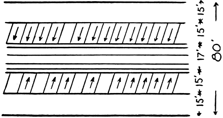
VEHICLES PARKED NEXT TO CAR TRACKS
AFTER END
Parking Spaces a Convenience to Motorists.
—The figures above show several methods for parking. Spaces in front of fire hydrants and certain building entrances,[423] at crossings, and street car stops are usually marked with no-parking signs and the curb painted a distinctive color. There may be other places where general parking and unlimited time may be allowed. If these spaces happen to be paved it would be well to have the parking stalls marked, as more machines will park when this is done. Such general parking places may be alongside public parks, vacant lots, in wide streets, and elsewhere where parking will not interfere with the flow of traffic. Special and limited parking spaces, such as those set aside for buses, cabs, and trucks, or those on which the parking is limited as to time should be marked by the city with a standard sign.
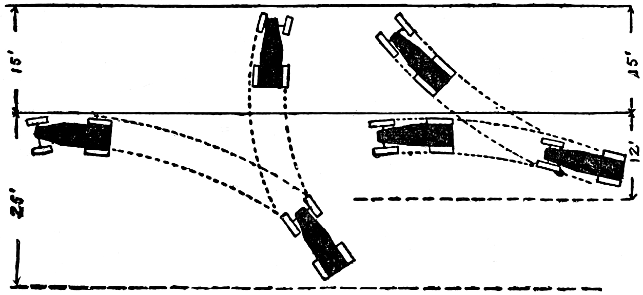
Space required for backing out.
The angle of parking depends upon the width of street and other local conditions. On narrow streets it may have to be zero degrees, that is, ranking; on others 30°, 45°, 60° or 90°. Since it is best to have machines head in, the 90° angle is difficult unless there is ample turning space. Likewise in backing out the same difficulty occurs.
The following widths are suggested[225] for parking spaces if in the middle of the street, and parking is at an angle of:
| 90°, | the space should be at least | 15 | feet wide |
| 45°, | 15 | ||
| 371⁄2°, | 14 | ||
| 30°, | 13 |
[424]
When the parking space is next to the curb the widths can be reduced 1 foot each. For any angle of stalls between 90° and 45° the parking space width must be greater than 15 feet; for 60° about 16 feet. There are streets where this could be allowed and more machines accommodated than at 45°. Ranking spaces should be marked off 9 feet wide. Some cities have special rules that ranked cars shall stand 6 feet apart to allow any one to get out. The stalls, whether the parking is to be on one side, both sides, or in the middle, should be slanted toward the approach of traffic.
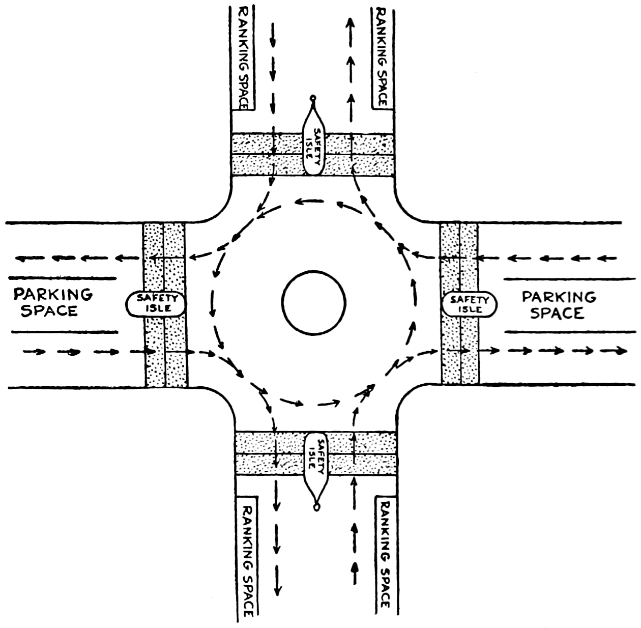
Rotary scheme for traffic around a danger zone where streets meet at right angles.
There is an advantage to parking in the center of the street in that other vehicles may drive up to the sidewalk[425] for loading or unloading passengers. It is objected to, however, on the theory that more space is required for mid-street parking. Where possible parking spaces should be paved with hard surfaces, like concrete or brick. Vehicles parked upon asphalt for a considerable time sink in, and as there is no ironing out by traffic of these depressions the pavement soon becomes rough, retains rain and sprinkling water and rots.
An asphalt strip for driving and a concrete strip for parking is ideal, for this separates distinctly by color the two spaces. On fairgrounds and picnic grounds where many cars are to be taken care of two rows of parked cars are headed together, then a lane and two more rows, another, lane, etc. Parking should usually be at 90° to the lane.
One Way and Rotary Traffic.
—In the crowded cities it has been found necessary to confine traffic to one direction in some of the streets. All streets not wide enough for two vehicles must of course have one-way traffic. Streets a little wider may wish to park or rank cars along one side and have one-way traffic on the other. With parallel streets near together, wide streets even, may be used advantageously as one-way streets with two or more lines of vehicles.
For the convenience of the public clear and distinct signs should be placed at every entrance to a one-way street. Of these more will be said further on.
At intersections there are two methods of procedure: The block and the rotary. The block requires a traffic officer who stops for a short time the traffic in one direction to allow the other to pass, then in the other. Even the short spaces of time between his whistle blasts are productive of much congestion. To alleviate this condition a movement about the center of the intersection in one direction has been devised. On the intersection of streets where there are small parks, monuments or safety zones the rotary method is most successful. The movement around is such as to leave the center of the intersection,[426] the park or monument, on the left, thus avoiding all left-hand turns. In establishing one-way streets attempts are usually made to avoid left-hand turns whenever possible. The figures on pp. 424 and 426 show sketch plans for rotary service. When there are street-car tracks or other local obstructions slight changes may have to be made. Note only two full passing places for vehicles, A, and as only a part of the traffic will want to cross congestion and danger are largely eliminated. There may be one, two, or more lines of traffic at B; depending on the width of the street. This scheme, according to Eno, is so practical that after it was put into use in New York in 1908, it was adopted the same year at Boston, by Paris in 1909, by Buenos Aires in 1910, and now is in use in many cities throughout the world.
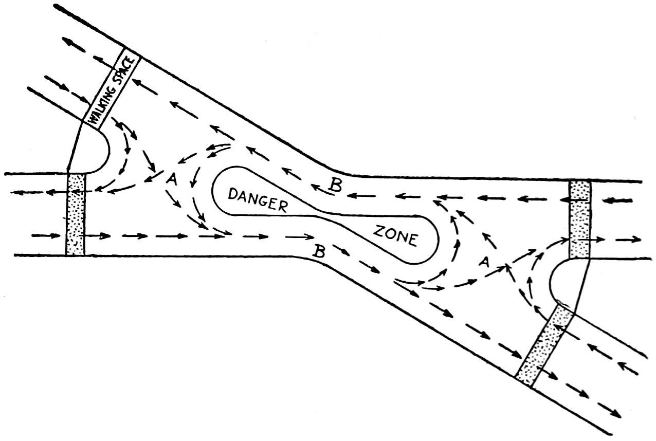
Rotary scheme for traffic around a danger zone where streets meet at an acute angle. Right angle passing at A. One, two or more lines of traffic depending on width of street at B.
Taking Care of Opera House Traffic.
—Special arrangement must be made in large cities in front of opera houses and other places where there are large gatherings.[226] A[427] most difficult problem occurs in New York city between 38th and 41st streets, where several large theaters, opera houses, and halls are located. Mr. Eno suggests that a numbered check be given to the owner of each vehicle with a duplicate to the driver on which are printed directions for lining up to be followed by the driver. As each vehicle comes along the line the number is flashed on a board continuously. Or, a roller blackboard could be used and as each number is rolled out of sight at the top a new number is written in at the bottom. As there might be several lines, at least one for each entrance, there would be several boards and the owner’s ticket would direct which one he is to watch.
Public Garages.
—As it was found necessary to go up into the air in large cities to accommodate the demands for room for offices, stores, and other businesses, so now some cities are preparing to build public garages of the sky-scraper type for its automobiles. If press items are correct Chicago is about to make a trial of the sky-scraping garage near the heart of the retail district for the accommodation of automobilists who wish to drive to business, leaving the streets where they now park their cars free for transient motor cars.
There is nothing particularly new in a sky-scraper garage. They have been used for private and for hire purposes for some time. The novelty lies in a municipality considering itself obligated to furnish parking places for automobiles. But why not? The public provides, now, roads for them to travel upon, and parking places upon the ground level. If extension to this space is made by piling one parking place on top of another instead of one beside another, what is the difference? It is presumed that a nominal fee would be charged and that outside parking places would be limited in time of occupation by any particular car.
The distinguishing feature of several-story garages is the manner in which the cars are taken to the upper floors—whether by elevator propelled from some outside source[428] or whether they are driven up inclined planes by their own power. The press notice regarding the Chicago scheme indicates the car will be driven up to its stall in any one of the ten stories, and when ready to go home the driver will ascend to his car and drive it down the exit ramp and go on his way. It will be an interesting experiment. If it succeeds central garages will be built in even the smaller cities.
The elevator garages are quite common. The car is driven onto an elevator large enough to handle it and taken to any story desired, then driven off to its stall. A reverse operation brings it back down. The elevator will probably be run by electric power. The present cost of installing a bus elevator[227] is practically as follows: First cost, $7500; repairs and depreciation, per annum, $500; cost of current, $750; interest on investment at 6 per cent, $450; assuming one operator, salary $1200. Total yearly charge $2900. These figures are claimed to be very conservative, as some run as high as $5000. The possibility of a break of the moving machinery tying up the rolling stock will make a second elevator imperative, the annual charges would be, assuming no extra man to be required, $1700; making altogether an annual charge for elevators of $4600, and the total cost of the installment, $15,000.
On the other hand it is claimed that when the ramps are constructed with the building the extra cost is slight, being little more than that of the floors which would be necessary to cover their spaces were they not put in. After being put in they are claimed to be superior because there are no moving parts to break down, there is no maintenance expense, no salaried operators, and they provide quicker service, as several machines may be run up or down in the same time it would take to transport one on an elevator.
The ramps are said to take up more space than the elevators, but the claim is made that by dividing the[429] garage into two parts and having the floors in one part come approximately half way between those in the other part, much shorter ramps may be used, and the space taken up is not so very much greater than would be required for elevators. The ramps are made about 16 feet wide, and the grade approximately 15 per cent.
Terminal Stations.
—For the purpose of accommodating patrons bus and express terminal stations are being installed. So far these have been established and financed by private companies. Where several bus lines or express lines radiate from a city a union depot may be expected not only to pay, but greatly to convenience the public. Small hotels and out-of-the-way places are ordinarily used when there is no central station. It is difficult to keep these in mind, and as they use the telephones of the hotels, restaurants, shops, etc., that they occupy for headquarters it is difficult for everybody to remember where they are located and find them when needed. Coöperation between the hotel employees and the bus lines for the giving of patrons information relative to schedules, fares, rates, etc., is not always satisfactory.
The organization of a stock company with bus lines, express lines, and merchants as stockholders for the purpose of building and operating a terminal depot may be formed. It will be necessary that the merchants be brought to see the financial returns that will come to them from the passengers which will be brought to the city every forenoon, allowed time to shop and return home in the afternoon; and that the number of passengers will be increased if convenient and accommodating terminal facilities are at hand.
Experience at Omaha shows that a large percentage, 85, of the passengers carried by the buses are residents along the routes and not commercial travelers, and are therefore potential customers. Many of these people when making their purchases ask that the purchased articles be delivered to the central depot in time to meet a particular bus. The purchaser is given a check upon the surrender of which he receives his package at the depot. Of course the more[430] central the location of the depot may be the better the accommodation to the passengers. On the other hand the rent of the station may and probably will increase as it is brought nearer to the center of the retail district. Anyway it should be within walking distance of the principal retail stores.
The main costs of such a station will be rent, light, heat, water, taxes, insurance, upkeep, and the personal service of an agent and janitor. At Omaha seven bus lines and eighteen merchants entered into an arrangement whereby the merchants were to guarantee the rent while the bus operators were to furnish, maintain, and operate the terminal. The rent was $200 per month. For current expenses each member pays $2 a month dues and a service charge of $15 a month in advance for each scheduled in-and-out daily trip. Thus the Omaha-Weeping Water line with one in-and-out bus would pay about 50 cents a day; Omaha-Lincoln line with two buses each way, $1 a day; and the Omaha-Fremont line with four buses in-and-out every day, $2. A small additional income is received from a cigar, candy, and miscellaneous sales concession, it being 121⁄2 per cent of the gross sales less $7 a week which the association pays toward the salary of the clerk who acts as their information and ticket agent. A limited free checking service is maintained for the accommodation of passengers and shoppers. A colored porter presides over a shoe-shine stand and calls the departure of buses and assists the passengers with their baggage. He also serves as janitor. Special courtesy to patrons is maintained as a means of increasing business. The depot has 36x80 feet space and is divided into a general waiting room and office, a ladies’ rest-room, a smoking room, and space for baggage.
Here is a joint terminal for a few bus lines running out of one of the smaller large cities of the country into an agricultural community with unpaved but excellent earth roads. The operators feel that even though small it has proven its worth, as they have a definite business center where patrons can get information about schedules[431] and buses and find comfort while waiting. It also makes for an esprit de corps among the several bus companies which very frequently loan buses to each other in cases of emergency. The compensation in such cases is 15 cents per mile if the borrower furnishes gasoline, oil and driver, or 22 cents a mile if these are furnished by the owner. In case one line does any work for another the basis of pay is cost plus 10 per cent.
It is considered that the bus lines are themselves a convenience to the public as their schedules and routes are planned to give service where the railroads do not. For example, a resident of Wahoo wishing to go to Omaha by train leaves at 11:15 A.M., there being only one train a day, arrives at Omaha at 1:15 P.M.; but must wait until the next day to return, as the only train leaves Omaha at 12:41 P.M.; arriving at Wahoo at 2:31 P.M. The citizen has, therefore, spent practically two days to make the trip. By bus he can make the round trip the same day—leave Wahoo 9:10 A.M.; arrive Omaha 11:30 A.M.; leave Omaha 2:00 P.M. and arrive back home at 4:20 P.M.; or he can have still more time in the city by leaving at 5:10 and arriving home at 7:30 P.M.
A number of instances like the above could be cited. On the contrary one of the bus lines runs between Omaha and Lincoln, passing through the same towns that are already well served by several trains per day. The time of making the trip from Omaha to Lincoln by bus is about one hour longer than by train. There seems little use for such a bus line except to pick up passengers between train stations.
Much more elaborate terminal stations have been established in other cities, for example Indianapolis, Indiana, and Portland, Oregon. A Minneapolis terminal to accommodate 100 buses a day has been opened and the company expects ultimately to spend $100,000 to create an adequate terminal.
At Poughkeepsie, New York, a city of 40,000 people, the Chamber of Commerce learning that an ordinance had been[432] introduced in the Common Council prohibiting the parking of motor buses on the streets, evolved the idea of a central waiting room for the convenience of all passengers from the rural districts, the establishment of a definite bus schedule and the installation of a checking department.[228] After a year’s operation the merchants were extremely well pleased with results. The bus drivers were invited to use the accommodations provided at the entire expense of the merchants, of a little less than $1500 a year. Rental is at the rate of $50 and janitor service $12 a month. The room is steam heated and made as comfortable and cozy as possible, so that women and children find it a pleasure to wait there. From 150 to 300 persons use the bus terminal daily. The bus drivers have formed an association and taken over the care of the building, as they believe this one of the best things ever put forward for the development of their own business.
As an example of how it works this is given:
A lady in Red Hook desires one of the Poughkeepsie merchants to send her certain goods, she simply telephones her order to the Poughkeepsie merchant, who then consults his time table regarding buses operating in that direction. He next selects the merchandise; makes up his package and his boy takes it to the motor bus terminal, where the attendant in charge receipts for the package. This bundle is then put by the attendant in the proper bin and the right driver takes it just previous to leaving the station. The driver delivers the package the same as the parcel post man would, with promptness and dispatch. No charge is made by the attendant for taking the package but a charge of 10 to 50 cents is put on the parcel by the bus driver, which he collects from the recipient of the package, or it is prepaid as the merchant prefers.
It is said there has been no loss by theft. The drivers each carry a key to the Bus Terminal Station which is opened by the first driver to arrive about 6:30 A.M. and closed by the last to leave about 11:00 o’clock at night.
[433]
This is not a freight-trucking depot, only packages being handled. From the customers which the buses have brought it is estimated the trade in the first year was over a half million dollars, a large part of which is partly traceable to the courtesy and convenience rendered to out-of-town patrons by the establishment of the depot.
Gas, Air, and Water Stations.
—Another business of great importance that has followed the increased use of motor cars is that of the sale of gasoline and oil. Of course there are the large manufacturing and wholesale companies; of those it is not the intention here to speak, but of the retailer who is endeavoring to accommodate the motoring public.
There is no city of any size now but what is supplied with one or more filling stations. Much money is being spent on the stations to make them convenient and attractive to the motorist. The modern filling station consists of the necessary storage tanks, usually placed under ground, for gasoline and oil, and the pumps for measuring and forcing the “gas” into the tank of the motor, with other pumps or facilities for care of oil. Then there is the building containing an office, a storeroom for oil and supplies, rest and toilet rooms for women, and possibly also for men. There is usually a marquise extending out over the place where automobiles stop for filling, to keep off rain and sun from the pumps and also from driver or passenger in case he or they desire to get out of the car for any purpose. Water and air are available at these stations and are looked after by attendants if desired. There are also pits where crank cases may be rapidly drained and refilled. While these accommodations are for the purpose of attracting trade, the very fact that they do, shows them to be real conveniences.
Of course, there are also those things which the automobile dealer calls “service.” That is places where may be purchased and repaired broken parts, where batteries may be filled with distilled water, and so on. Usually water, either fresh or distilled, is free, but in some places[434] in the “deserts” out West it has to be hauled miles and a cost charge is made.
Named and Numbered Roads.
—For a number of years road enthusiasts, automobile clubs, and chambers of commerce have been selecting and marking main lines of road across the country or through their particular cities. Some of these roads such as the Lincoln Highway, the Santa Fé and the Yellowstone Trails extend across the continent from coast to coast; or north to south as the Dixie, the Jefferson, and the Jackson Highway. There are very many of these volunteer organizations; they attempt to secure the improvement of highways, ranging in length from transcontinental routes to short county lines, by bringing influence to bear on road officials and creating in the minds of the public generally an interest for better roads. Some states like Iowa and Nebraska passed laws enabling an association promoting any route to register it together with the marker that is to be used, providing penalties for injuring or defacing any sign board, and making it unlawful for others to use the name or marker design on any other road. It is said over a hundred routes were marked in Iowa, fifty in Illinois, and other states somewhat proportionately.
Opposition has been offered on the theory that it is the State’s business to mark and maintain signs along roads. It has been suggested that since the General Government has selected a system of national roads and since these must be by law continuous, that they be numbered continuously by the same number. For example the transcontinental road farthest north should be numbered 1, the next continental road, 3, the next, 5, and so on. That the roads running north and south beginning on the east be numbered with even numbers. Several of the New England states have already agreed to a common number or name for roads running through them. The point is that when a road has been marked a tourist may travel clear across the continent on the same number and would not have to look up a new number or name when he crossed a state line. Also when once made public a map of the roads would be good next year or the year after, and the traveler need not fear its having been changed. It might be possible that places would be located by certain roads as they were once by rivers. In the practical work of drafting, numbers are more easily placed on the map than are names.
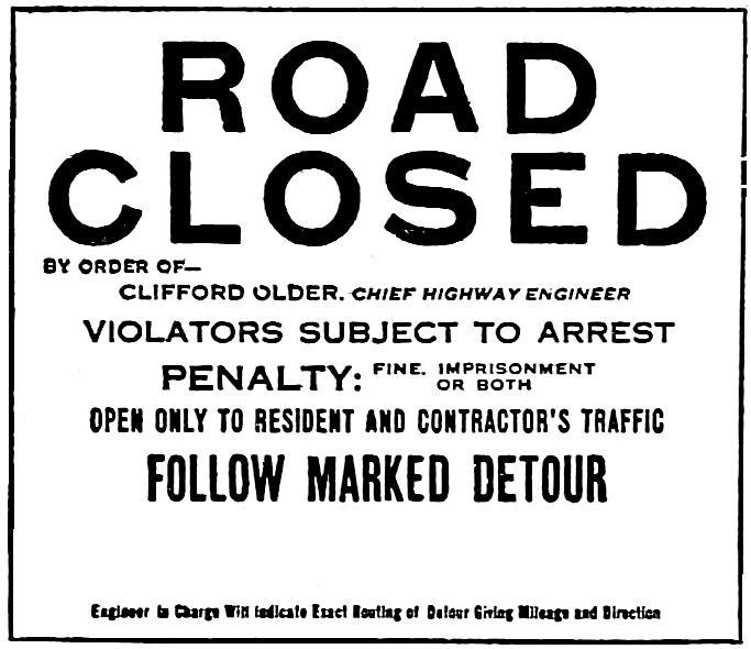
Fig. 2.—“Road Closed” Sign as Furnished by Department. The Engineer in Charge Inserts Routing of Detour and Mileage in the Space Under the Words “Follow Marked Detour.”

Fig. 1. Standard Warning Sign for Barricades.
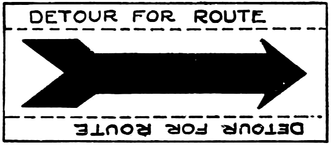
Fig. 3.—Standard Detour Sign as Furnished by Department. The Engineer in Charge Prints on the Sign the Route Number, Name of Trail, its Emblem if the Road has a Name and Emblem, the Next Town and County Seat or Main City On the Road.
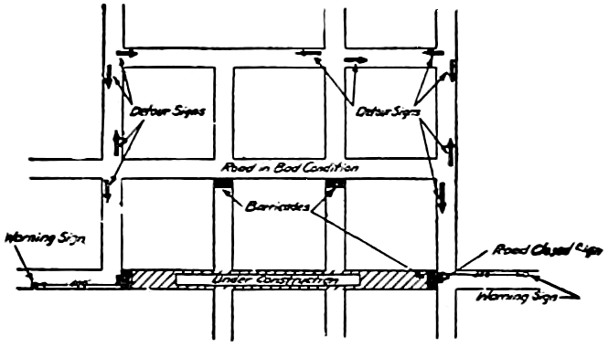
Fig. 4.—Map Showing Position of Barricade and Detour Signs.
ROAD
CLOSED
BY ORDER OF—
CLIFFORD OLDER, CHIEF HIGHWAY ENGINEER
VIOLATORS SUBJECT TO ARREST
PENALTY: FINE, IMPRISONMENT OR BOTH
OPEN ONLY TO RESIDENT AND CONTRACTOR’S TRAFFIC FOLLOW MARKED DETOUR
Engineer in Charge Will Indicate Exact Routing of Detour Giving Mileage and Direction
SLOW
BARRICADE — 400FT
DETOUR FOR ROUTE
Warning and Direction Signs Used in the State of Illinois
[435]
Marks, Signs and Guides.
—Whether or not the Government will take over the numbering of through roads the states and volunteer associations will no doubt continue marking. The marks are very comforting to a person traveling on an unknown road, and few there are who do not at sometime travel unknown paths. Not only does it keep him going along the right way but signs giving mileage to the next town are always watched for anxiously.
One of the most common and most effective methods of marking a road is to paint a band of distinguishing color around the telephone poles along the way. In addition to the color band a letter or insignia may be used. The Lincoln Highway uses a red strip at the top and bottom of the white band and a blue L. The Detroit, Lincoln, Denver route uses black strips at the top and bottom of the white band and black monogram made up of the letters D. L. D. The state of Nebraska erects markers showing the number of the road in its state system and the number of the mile on the road. This is partly for the convenience of travelers and partly to assist in systematic filing of records in the office. In case it is necessary to make a special report the patrolman can give the location almost exactly, for example, “Road 14, mile 32, north quarter, washout,” or more simply, “14, 32, N Q, washout.” This is very definite. The state of Wisconsin uses a triangle as an insignia in which is placed the legend “State Trunk Highway,” the number of the highway and the abbreviation Wis.
Several of the states have adopted the method of setting quite large signs alongside the roadway and forbid the placing of advertising signs, even though they give[436] road information, or signs by local volunteer associations. This would seem to be going a little too far for volunteer associations have done much for better road construction in this country as well as to give publicity to the advantages of traveling over the particular road in which they are interested. The influences which they have been able to bring upon local road officers by various means has had a wonderful effect in keeping in good condition the marked road and by emulation other roads joining with it. The most of these associations have contented themselves with marking a route from one terminal to another. They have not asked for a special kind of surfacing. They have aided by advice and perhaps occasionally assisted to put in a sample mile of good road. For example the Lincoln Highway is at the present time interesting itself in financing and constructing an “ideal section” of road in Indiana. (See Chapter XII, p. 413.) On the whole it is the belief of the writer that the good done by these associations inures to the great benefit of the general public and until a comprehensive plan can be agreed upon by all the states they should be allowed to continue their work.
Distance and Direction Signs.
—Direction signs are such as point out the direction which a traveler must take to keep on a particular route. Distance signs also give information as to distances from the sign to particular places. These two classes are often combined. In addition to these there are warning and detour signs which may also be direction signs.
Mile posts are not new. It was the custom to plant them along the old Roman roads. It has already been mentioned that board markers are frequently placed along the state numbered highways. It would be better to have well-designed cut stones or concrete posts set at even miles, and, perhaps, also at 1⁄2 or 1⁄4 mile points as well. The post should bear the number or insignia of the highway and the mile number, measured from some particular terminal. Wisconsin uses a triangle as an insignia; other states use an outline map of the state, which is usually not so simple[437] and requires larger sign boards and hence greater expense, and is not so symmetrical and neat looking. The abbreviation of the state name is sufficient. This is to be placed on the side facing the road. It has been suggested that on the side toward the approaching traveler may be placed the name of the next village, town or city in that direction with the distance in miles. On the other side visible after passing would appear the name of the last village passed. The only difficulty with this scheme would be the size of the post required. To get the name on in readable letters would require a post 16 to 24 inches square. So large a post would run the cost up materially.
A hollow circular post with a cap cast on its top could be made of cement.
Iron signs have been successfully used. The Automobile Club of Minneapolis used a malleable cast-iron form 30 inches long, 5⁄8 inch thick, and 3 inches wide. The letters are 2 inches high and the letters and a half-inch border are raised about 1⁄8 of an inch. The sign is bolted to a 21⁄2 inch galvanized-iron pipe set in concrete. The sign is galvanized, the background painted white and the raised border and letters finished in black. The cost was approximately $7 per sign.
Steel signs with letters spot welded to them are on the market.
Concrete posts with board signs are common and if occasionally repainted make a durable comparatively cheap sign.
One of the chief objections to the advertising signs placed along some highways is that the information relative to the highway occupies a very small portion of the space and is not easily read while the advertisement stands out very prominently. If the road authorities put the signs up at public expense they could be much smaller and would desecrate the landscape correspondingly less.
Uniformity of Signs.
—It would be well if simple standards could be adopted for the entire United States, or at least for each state, and that all signs be set with uniformity.[438] If placed consistently at the same distance and height from the roadway the eye of the traveler will naturally seek them and they will be more easily read. Evans and Batchelder[229] recommend that double-distance board signs be 36 inches long by 17 inches deep when they carry three rows of names and a fourth row for the authority responsible for the sign. If the fourth row is not on the sign 15 inches deep will be sufficient. They recommend that the size of the plain block letters be graduated according to the importance of the places mentioned. The top line for the most important places 4-inch letters; the second row, less important, 3-inch letters, and the third, least important, 2-inch letters. Single direction signs to be 20 inches long and the same depth. All signs on posts are recommended to be placed an average height of 6 feet above the roadway, on houses 9 feet. If the double direction names are placed below each other the board will not need to be so long.
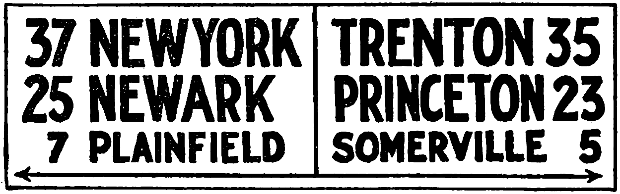
A New Jersey distance and direction sign.
Letters and Colors.
—The letters should be clear and distinct; the style known as block letter is good. The colors should be highly contrasting. Black and white is as good as any; however, Eno[230] thinks that black with yellow and red with white are the best combinations; yellow on black being better than black on yellow. Eno would classify signs as:
[439]
Primary, those for warning and directing moving vehicles, vivid yellow letters, arrows or graphics, on a black background.
Secondary, those for stationary vehicles, designating public parking spaces, cabstands, car and bus stops, etc., black on yellow background.
Tertiary, those for the control of pedestrians, designating crosswalks, safety zones, etc., red on white background.
Warning Signs.
—The name indicates their purpose, that they are intended to warn against danger or to indicate that extra precautionary measures should be exercised. They give notice of sharp turns, bad bridges and culverts, railroad crossings, cross-roads, and so on. Frequently the word “danger” is printed followed by a descriptive word indicating the kind of danger; for example, “Danger—sharp curve,” “Danger—bad bridge,” “Danger—railroad crossing.” Or there are used such words as “Slow” or more simply “Slo,” with a graphic or descriptive word following, as, “Slow—school,” “Slo—drawbridge.”
The International Road Congress suggested a standard graphical sign, 24 by 16 inches, with white symbols on a black background. Some American roads use a modification of these, p. 440.
Map Signs.
—There seems to be a tendency toward map signs and the necessary large boards which they entail. It is the opinion of the writer that it would be better except for exceptional places to keep to as small a marker as can be seen readily. The sizes recommended by the International Road Congress are plenty large enough and probably could be decreased without impairing their utility. An ordinary sign is itself an unsightly thing, and after the campaigns that have been made against the advertising bill boards it seems hardly consistent for the state to put up almost equally unsightly disfigurements of the landscape.
In Maryland the direction signs between towns are 30 inches wide by 20 inches high and display in white letters on a black background the name of the road, the distance to and from important points, and all principal connections. Evidently “the wayfaring men though fools shall not err therein.” Other states are putting up similar signs. Illinois is using about the same size boards setting them for each turn in the road, each entering road, whether or not it comes in from one or both sides, each school and other places where special care should be taken. On a map attached to some of these signs is a point or star indicating the position of the sign on the road.
[440]


CROSS ROADS
TURN TO RIGHT
TURN TO LEFT
DANGEROUS DESCENT
RAILROAD CROSSING
INTERNATIONAL ROAD CONGRESS WARNING SIGNS
WHITE ON BLACK BACKGROUND
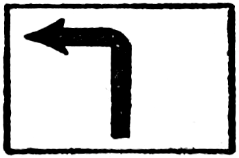

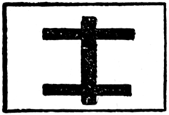
GO STRAIGHT AHEAD
TURN TO RIGHT
TURN TO LEFT
STOP SIGN
RAILROAD CROSSING
WARNING SIGNS AS USED ON SOME AMERICAN ROADS
BLACK ON WHITE BACKGROUND
[441]
In addition to direction and distance signs Maryland erects large, 10 feet square, map signs at the limits of each of the larger towns. Upon this map is delineated the main routes through the town in white and the secondary routes in gray, the names of the streets and well-established landmarks, so that a person can make a decision of the route he wishes to take and follow it without difficulty. The color scheme is white letters on black background. They are oriented to read in the direction of travel so that if the signboard were pushed over ahead on its back the road would point in the direction of travel. On the map in red is a star with the words, “You are now at this point.”
On the top of mountain grades Maryland erects boards similar in size to the map boards, which state the number of miles down the mountain, indicate curves and give concise instructions how to drive down so as to avoid accident and personal injury. This is to assist inexperienced drivers and those unacquainted with the region by telling how to brake their cars by putting them into “high,” “intermediate,” and “low” at certain places, which, of course, will be very helpful, and may save an accident.
Where the state roads cross from Maryland into neighboring states a large sign 15 to 25 feet is erected on which is displayed the salient features of the state motor vehicle law. No one, therefore, need be ignorant of the law and thus unpleasantly encounter the state police. The contract price of these signs range from $12 for a single face direction sign to $347.50 for a state-line motor vehicle law sign. They are kept in repair by the contractor at prices ranging from $3.50 to $20 each per year.[231]
[442]
Detour Signs.
—Perhaps nothing is more exasperating to the tourist than to come to a barricade with the word “Detour,” and then find the detour road practically impassable. In many states the contractor on a piece of construction work is obligated to care for detour roads and detour signs during the time the road is closed. Finding the obligation not well fulfilled several of the states are taking over that work in order that it might be done in a manner to satisfy the traveling public. Wisconsin[232] considers the proper marking and maintaining of detours more important than similar work of the regular trunk routes, for well-marked detours are necessary to keep enthusiasm for good road construction alive. Minnesota, North Carolina, and other states have adopted similar plans.
Before a road is closed a detour is selected and marked and thus automatically becomes a part of the state trunk line system. A map sign is placed at the ends of long detours showing the road under construction, the detour, the location of railways, cities, and prominent natural features. The traveler thus gets a definite idea of the way he must go to return to the main highway. Ordinary markers are placed along the line of detour.
In Connecticut and some other states a half width of the roadway is paved at a time, allowing the other half to be used while the first half is under construction. This is possible where the detour is not too long, or if there is passing room in the one-half way. Concrete is well adapted for this sort of construction. The joint down the center is a benefit rather than a detriment to this type of road surface; it acts as an expansion joint and allows a certain amount of flexibility under the warping action of heat, and furnishes a mid-line mark to keep passenger traffic in proper lanes.
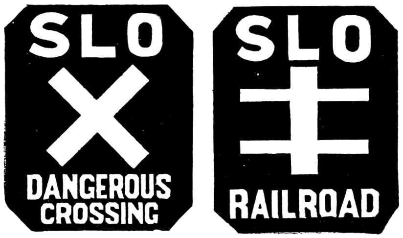
Yellow on Black.

Yellow on Black.

Yellow on Black.
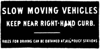
White on Blue.
An improved form is given below:
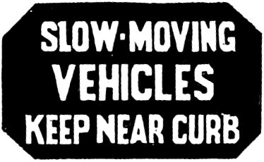
Yellow on Black.
Traffic Guides
(From Eno’s “The Science of Highway Traffic Regulation.”)
[443]
Widening the roadway before reconstruction has begun will also furnish room for the passage of vehicles. Of course under either of these two last methods the passing vehicles are more or less of a nuisance to the constructor and if a reasonably direct detour entirely away from the work under construction can be maintained in satisfactory condition so much the better. While the traffic must be inconvenienced to some degree by detours the fact that an effort is being made by the road authorities to make the substitute as pleasant as possible will leave a “good taste in the mouth” of the traveling public which is worth while whether that traffic is local or from a distance.
Location of Detour Markers.
—The location or arrangement of detour markers in reference to the traveled way has received considerable attention. Of course the first signs are the barricade warning and at the barricade. In Illinois the State Department of Highways requires the barricade warning to be placed about 400 feet from the barricade. The map signs of Wisconsin, Minnesota, and North Carolina are used also as barricade signs. Any driver, not authorized, passing a barricade is by the laws of some states subject to arrest and fine. Detour arrows are placed at road intersections in such a manner that traffic going in either direction may follow the arrow. Illinois uses a black arrow on a white background. Iowa has somewhat similar signs except that the color scheme is a white arrow on a black background. The word “detour” is printed above and below the arrow and the one painted out that is not needed after the sign is erected. In Iowa upon primary (State) roads the district engineer, and upon county roads the county engineer, is held responsible for the following:
First.—He shall determine whether or not a detour is needed.
Second.—He shall coöperate with the local officials in choosing a detour.
Third.—He shall provide for the proper marking of the detour.
Fourth.—He shall provide for the maintenance of the detour and report such provision in the central office.
[444]
Speed Signs.
—Most cities and towns have speed limits lower than that allowed in the open country. Some of them even divide the city into zones and make a different limit for each zone. On the outer edge of these zones and the outer edge of the city are often placed signs of warning such as “Speed Limit, 15 miles per hour.” In one city was facetiously added “Go slow and see our city, go fast and see our jail.” On the backs of these signs, the side seen by the traveler as he leaves, are sometimes painted the words “You’re Welcome—Come Again.” All of which is to give the traveler a good impression and thus advertise the community.
Traffic Guides.
—Before leaving the subject perhaps something more should be said about traffic guides in the cities as most of what precedes has been written with a view to country roads, although many of these signs are applicable to city streets.
Lines upon the pavement should be used to define crosswalks, parking spaces, and restricted and reserved zones. Curbstones may be painted white or yellow to indicate no parking against them. In parking spaces the stall lines are painted, as this will keep vehicles close together and more will be able to park. If they are allowed to drive in promiscuously there will often be half and three-quarter spaces which cannot be used. Painted lines should be about 4 inches wide. If well put on with good paint they will wear for a considerable period. A painted line down the center of a roadway, especially on curves, is a great convenience and safety device for passing vehicles.
Eno tells us that the earliest traffic regulation signs in New York were worded “Slow moving Vehicles, Keep Near Curb.” These were followed gradually by many others.
It is not necessary to place on signs the name of the department authorizing them as, “Police Department,” “Department of Streets and Alleys,” as these take up room and make the signs no more impressive. The simpler and shorter the wording the better. I have been told, I did not see it, that in Boston instead of having a sign read “One-way Traffic,” it is made to say, “Vehicles Using This Street Will Follow in the Direction of the Arrow Only.” This may be merely a slam at the Bostonese but it illustrates the point.
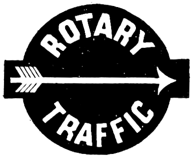
Yellow on Black.
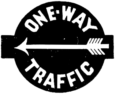
Yellow on Black.
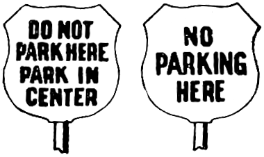
Improperly worded signs.
Properly worded

Black on Yellow.
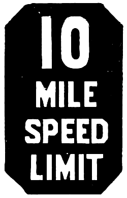
Yellow on Black.
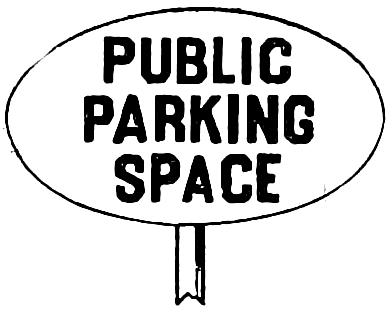
Black on Yellow.

Yellow on Black.

Yellow on Black.
New York City Traffic Guides
“In November, 1903, one hundred blue and white enameled signs, directing slow-moving vehicles to keep near the right-hand curb, were put in use in New York. These were probably the first traffic regulation signs ever used.”
(From Eno’s “The Science of Highway Traffic Regulation.”)
[445]
There are several types of signs in use. Most of them are made of enameled metal and may be placed on stationary or portable standards. The stationary standards may be made of iron pipe set in cement with the sign attached to its top. The sign should be just above a tall man’s head, say 6 feet 6 inches from the walk. Portable standards are frequently used, having an elongated (nearly elliptical) iron base, sufficiently heavy to hold them upright, and a pipe extending from a hole in the center vertically about 4 feet high, to bear the sign. These signs are placed on sidewalks to designate parking and no parking places, safety zones, etc.
Dummy Cop.
—A post, column, or monument designed to stand at the intersection of streets in place of a traffic officer has been called a dummy cop. Mushrooms or cement bumps are sometimes utilized in the same manner. Bumpers are used, too, to indicate restricted and safety zones, isles of safety, etc. A dummy cop at night ought to carry a lantern or be illuminated from some outside source.
Semaphores.
—A traffic officer sometimes uses a Go-Stop sign so arranged at the top of a standard that by turning a handle he can present one or the other of these two words to the traffic. Some of them carry a light at night, and an umbrella to shade the officer during the day. They are objected to on the ground that there is no neutral position, they always say either “Go” or “Stop.” If by a change in plan they could be designed so as to show neither word when the officer was not at his post they could act as dummy cops.
Crow’s-nest, or traffic tower, is a term given to a lookout or sentry box supported about 7 feet 6 inches above the street by a strong post. The crow’s-nest has a roof for shade and shelter and may carry a semaphore above it, and another lower down to attract the eye of nearby persons.[446] As used in New York the arms have electrical control, and at night carry red lights. The semaphore is for the block system and may be made superfluous when rotary traffic methods are in vogue. Mr. Eno, who is given credit for the suggestion of the crow’s-nest, does not believe that they should be installed at every intersection, as a “continuous block system wastes too much of the traffic capacity of the street because between the time the signal is given to stop and the time the signal is given to go the vehicles (just ahead of the break) have gone ahead a long distance.... This leaves a large proportion of the street surface unoccupied by vehicles.”[233] The rotary system is advocated as one which will distribute the traffic uniformly over the whole surface of the street, and also equalize the speed of vehicles to a safe mean. Crow’s-nests may be used where there are street cars by making them high enough to clear the top of the cars.
Signal Lights and Colors.
—The railroads in all these years have not come to a common usage of colors in signaling. All roads use red for stop, danger. Some use white and some green to proceed with caution; white and green are both used for clear, proceed. Here white is the same as yellow, because lanterns using oil burn with a yellow light which railroad men call white. Electric signals may be white in reality.
There now seems to be a demand for standardization and at a meeting of the American Association of State Highway Officers (1922, at Raleigh, N. C.) a color scheme was recommended that may become a standard for both motorists and railroads. One of the difficulties is that red and danger are no longer properly associated because of the common use of the red for tail lights of automobiles, for sandpiles or other street obstructions, for the tops of semaphores, and for various other purposes. The story is told that not long ago a bridge was being repaired and a red light was placed at one side. The signal was intended as a warning that the autoist slow down and proceed with caution. The driver of an approaching car took the lantern to be the tail light of an automobile. He swung to the left to clear the obstruction and plunged down an embankment.
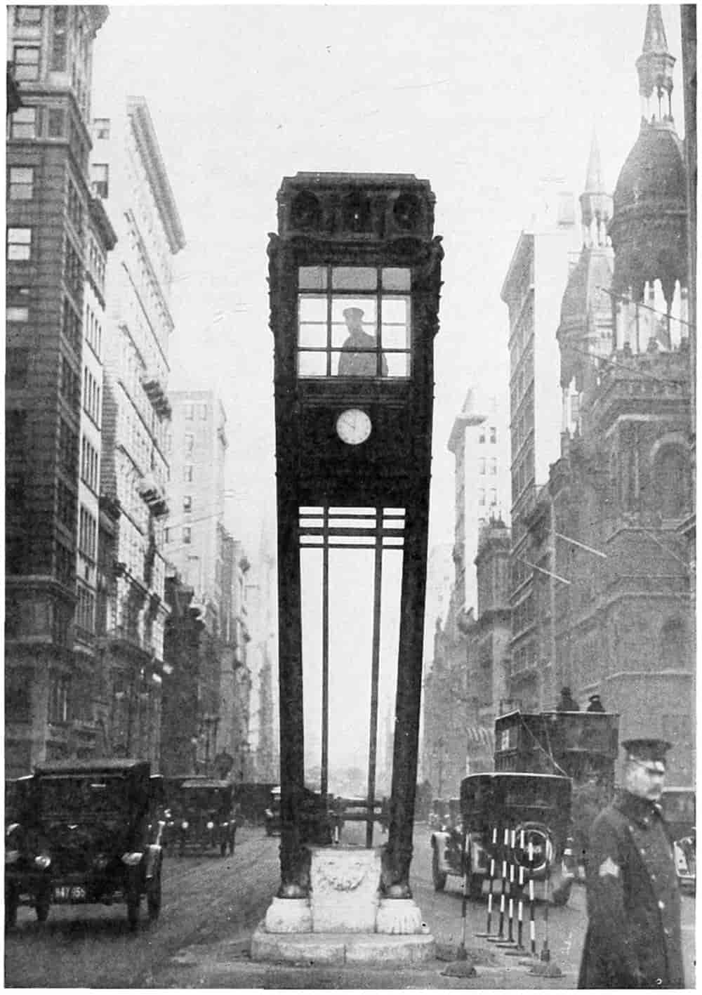
© Underwood and Underwood
TRAFFIC TOWER ON FIFTH AVENUE, NEW YORK CITY
[447]
It would be better if red should never be used as a precaution signal but only as a stop signal, but at the present time that cannot be done because automobiles now carry, and most states require it by law, a red light behind. The color once considered a sign of danger has become almost meaningless. Red lanterns are placed on roads, or at bridges, or in the street where the road is not impassable but merely hazardous and the light in reality means proceed carefully. If colors are to be signals to tell whether or not to stop on account of danger, to proceed cautiously or to go ahead without fear, they should be standardized and their proper use protected.
The code of colors as recommended by the Association of State Highway Officials is:
Color Green to mean proceed, the way is clear.
Color Yellow to mean that caution shall be exercised.
Color Red to mean stop.
The Association urges abolishment of the red for automobile tail lights and the substitution of yellow (white). There are other reasons why this should be done; one of them, a white light will illuminate the number tag much better than a red light. In fact Ohio requires a red light shining out behind and a white light to illuminate the tag. On the other hand by the different colored lights one can distinguish whether one is going toward the front or back of an automobile, a thing of importance, sometimes.
This may be far enough to go at the present time, but later the standardization of other signal and guide lights would be well. The red light on street obstructions should be abolished. Better a bright white light for with good illumination the danger will often disappear.
Road and Street Lighting.
—While road and street lighting are primarily for the purpose of promoting safety,[448] they, as signs and guides, are here treated under the heading of comfort and convenience to the user.
Like other things pertaining to roads, lighting has during the past few years seen wonderful development. Open-arc lights have all but passed out of use. Even in the field of incandescent lighting many improvements have and are still being made. Efforts have been made to cater to the esthetic sense and create beauty by artistic shapes and sizes of lamps and by harmonious groupings. Safety, comfort, and esthetic design cannot always be combined, then one or the other must give way.
Silhouette vision, that is, where the object appears dark against a lighter background, requires a much less illumination intensity than direct or detail vision. In the first case the object is between the observer and the light while in the second case the light is reflected from the object to the observer. Then there are spot lights and flood lights where the light is thrown directly upon the object and as little as possible allowed to disperse into surrounding space. Dean Ferguson[234] has pointed out that safety lighting is secured by any illumination that will reveal clearly the presence and nature of a danger, and also that low illumination intensities used in silhouette effect may serve for safety at a greatly reduced expense. Much of street lighting is of the silhouette type, depending on the relative positions of the observer, the illuminant, and the object to be seen. As we approach a post or sand pile on the street it appears first as a black object in silhouette, as we come nearer the reflected light becomes more intense and the object is seen in detail. There seems to be a sort of twilight zone between these two conditions where the visibility is least. The silhouette vision appears to be best when the intensity of the reflected light is least, and vice versa for the detail or direct vision. The indeterminate place between the two where visibility is least is, of course, where the light behind is equal in intensity to the reflected light in front. One object[449] of the illuminating engineer is so to arrange the lights as to avoid as far as possible points of low visibility. This he does by the size and spacing of the light units, their height of suspension and the shape and setting of the reflectors. These same elements enter into the avoidance of glare.
In city and street lighting it is nearly always desirable to illuminate the buildings as well as the road surface, so that the type of lamp used is entirely different from that desirable on country roads where only the surface of the roadway needs to be lighted. Ornamental lights of the luminous arc and the incandescent types are used. The former where a large amount of intense light is wanted, and the latter where smaller units will answer the purpose.
The latest road lighting is, perhaps, that developed for the “Ideal Section” mentioned heretofore.[235] Here it was important to concentrate the light on the roadway instead of diffusing it upward and over the adjoining fields, to have a flexibility of arrangement that would keep the light in line with the surface of the roadway, and that the cost should be reasonable. The scheme developed contemplates placing the lighting units on adjustable brackets 35 feet above the surface of the road, spaced 250 feet, staggered. They can be set for varying grades, for curves, or for the lighting of a portion of the roadside if thought necessary. The unit consists of a nest of three reflectors, one within another, and with an opening in each one side of the lamp. These collect and reflect the light to the surface as shown in the figure. The detailed article should be consulted by those who are further interested.
City Traffic.
—Projectors suspended above a traffic officer illuminates him and his semaphore much as spot lights are used in theaters and flood lights to illuminate statuary and buildings. Many of the busy cities are installing color lenses in the towers (crow’s-nests) to regulate the traffic. The colors which are used both day and night[450] are standardized as follows: Red, to indicate “Stop”; amber, to indicate “Change of traffic”; and green, to indicate “Go.”
Touring.
—Stand for a few minutes on any one of the transcontinental highways and note the tourists who have their bedding and baggage piled in and tied to the sides of their cars. Note the brown and healthy faces of the brown-clad travelers. Dust has no horrors to them; they expect it; they are prepared for it. Their khaki clothing cost little when purchased and wears well, and even if thrown away at the end of the journey has more than paid its way. The author of “Let me live by the side of the road and be a friend to man” could certainly enjoy himself during these mid-summer gypsying days. For one has the world brought to his own dooryard. Wait and there will come to you Maine, and California, and Texas, and Oregon, Michigan, Canada, Mexico. A man drove on my driveway a few days ago and used my hose to wash Texas soil from his fenders, and now that yellow dirt is nourishing a spirea bush in Nebraska.
Come around in the evening just after the supper, not dinner, utensils have been cleared away, and from these roadside campers in the course of the summer you may hear the Vermonter drop the “r” from “qua’teh” and put it into “idear,” the Georgian with his delightful Southern drawl, a Minnesotan with high-pitched voice and Scandanavian accent, or a musically soft Spanish from the Rio Grande regions. All the world’s make of automobiles may be inspected, their good and bad features discussed. Outing outfits of all characters and descriptions from the small compact bundle scarcely big enough for a flea, to the cumbersome behemoth mountain of canvas, boxes, and poles. There is the man who believes Detroit is destined to be the largest city in the world, and the man who is certain nothing can compare with Los Angeles. Truly the man who lives beside the road may have, if he is endowed with gumption, a joyful time as the perennial reel runs on.
[451]
But if such things come to the man who sits in his house beside the road and watches the race of men go by, what must be the feelings of the man of gypsying instinct as he climbs into his car, caring not for time or place, who has not painstakingly scheduled his route and must perforce make a certain hotel every night, who is no “speed lizard” but expects to take in as he journeys along all the scenic beauties and interesting features along the way. His only care is to head-about at the proper time to bring him home again at the end of his vacation.
It is estimated that more than a million persons are following some such nomadic life each year in the United States. The term “motor-gypsy,” has been quite definitely applied by the people to those who tour leisurely and camp more or less as they go. A part of the people set aside six months or a year to a long tour, seeking the north, south, coast or mountain as fancy, heat and cold dictate, a greater number travel from two to four months, going one year to the Michigan forests, another to the lakes of Wisconsin and Minnesota, passing through the great granaries of the world to the cooling breezes of Colorado, ambling along the coast to Georgia and Florida, following the windings of the Mississippi to the old Creole districts of Louisiana, up the Platte or through the Black Hills, to trout fishing in Wyoming, or stopping at the borders for walking trips over the wildernesses in the Yellowstone and Glacier National parks. The entire expanse of a most wonderful nation is open to the motor-gypsy.
Camping Grounds.
—So important has this sort of travel become that it is estimated that about 3000 cities and towns over the country, beginning in the Middle West and now spread to both coasts, have public automobile camping grounds for the traveling visitors. These are provided and kept up by the cities themselves or by chambers of commerce or automobile clubs; sometimes by combinations of these organizations.
The question often arises, “Does it pay?” From a financial[452] standpoint it probably pays the community as a whole even if every individual who subscribes does not receive reimbursement. In the first place the tourist’s impression of a city is influenced by the treatment he receives. If an effort is made to furnish him with a safe and comfortable camping site and with facilities for cooking and cleaning he returns home with praises for that city. He tells other tourists that he meets on the way, he tells his neighbors after he gets home, and other and still other tourists come. On the contrary if no provision is made for the tourist, if he is not met with a glad hand he naturally warns others to keep away or plan to pass through in the daytime, spending what spare time they have farther on in more hospitable centers.
Secondly, tourists always spend some money for food and supplies, for gasoline, tires, accessories, repairs, and with increasing frequency for hotels. Clothing and dry-goods stores profit to some extent. Since thousands of dollars are brought to those towns lying on the main thoroughfares having good camping facilities, and since this money will be respent by those receiving it directly, the entire community in the long run benefits by the touring traffic. Denver possibly averages 400 to 500 campers per day during the summer season. Omaha, Kansas City, Lincoln, Deadwood and all the smaller places to the Rocky Mountains entertain from 25 to 100 per day. The actual tourists are many more, for not nearly all camp along the way. The Omaha Auto Club registered cars in 1921 carrying over 40,000 tourists. Other gateways passed fully as many, and not nearly all took the trouble to look up the club office to register. During the winter season the gypsying traffic turns south and Georgia, Florida, and on west to California, benefit by it.
A traffic census made simultaneously on eighteen Nebraska roads, distributed widely over the state, of vehicles passing in one week (August 20-26, 1922), showed a total of 88,958 divided as follows:
[453]
| County | Inter- County |
Inter- State |
Total | Percentage | |||
|---|---|---|---|---|---|---|---|
| Co. | I-C. | I-S. | |||||
| Automobile | 40,598 | 25,595 | 13,560 | 79,753 | 51 | 32 | 17 |
| Light Truck | 2,465 | 886 | 242 | 3,593 | 68 | 25 | 7 |
| Heavy Truck | 1,547 | 556 | 140 | 2,243 | 69 | 25 | 6 |
| Horse-drawn, passenger | 1,303 | 1,303 | |||||
| Horse-drawn, freight | 2,066 | 2,066 | |||||
| Total | 47,979 | 27,037 | 13,942 | 88,958 | |||
What is especially interesting in this connection is that nearly one-sixth of all the automobiles or one automobile in six, comes from without the state, and one in three from without the county. Connecticut censuses, Connecticut being a small state between thickly populated states, shows a much higher ratio, 47 per cent without the state.
All sorts of cars from the most expensive to the cheapest are found and they seem to be harmonious when on the camping ground; the Pierce-Arrow and the Rolls-Royce do not look disdainfully at the Ford and the Chevrolet, neither do the latter pretend an importance greater than their due.
Democracy of cars and democracy of people ought to lead to a better understanding all around. Some very excellent and well-to-do ladies of a western city went to a hotel in one of the national parks for luncheon. They were clad in khaki trousers and blouses which had seen considerable wear. The dining room was full and they were placed at a table where some distinguished looking and well-dressed men were talking stocks and bonds. The ladies in such garb were nonplused, they were embarrassed to the limit; but the men, being also gentlemen, gave their names and became acquainted. So pleasant proved this little dinner participated in by the khaki-clothed ladies and stylishly attired men that at its conclusion they shook hands heartily and bade each other Godspeed for the remaining journey and hoped that, not like ships that pass each other in the night, they would again meet to renew an acquaintance so happily begun. Such is the democracy of touring.
[454]
On the contrary an editorial writer in the Saturday Evening Post, November 18, 1922, expresses incredulity of the offhand opinion “that travel of any kind must rub off the sharp edges of provincialism.” He says the “American tourist in Europe has long been the subject of ridicule,” and that travel in many cases “appears to accentuate narrow-mindedness.” It is further argued that “too much travel means practical disfranchisement and a total lack of interest in local affairs.” There is no doubt but that anything, even touring, can be carried to extremes. The editorial concludes with the statement, however, that travel “can teach no lesson of more value than the knowledge that everywhere, whether the climate be hot or cold, the towns large or small, men of upstanding character are spending their lives to make those communities better places in which to live.” It must be acknowledged that the fact that only about one-half of the persons eligible to the franchise exercise the right of voting at the general elections indicates that not enough interest is taken in affairs of government. Anything which tends to decrease the interest is, therefore, bad. But moderate touring in our own country ought to give a person a wider view, a stronger love of country, and a deeper sense of the importance and benefits of citizenship therein.
A majority of the cars are of the type that would cost less than $1500, because there are more cars of that type in use. One of the most elaborate caravans seen on the D. L. D. highway this summer is a Winton six, with a lengthened frame on which is built a square van-like structure, with doors and windows and a rear observation platform. The driver’s seat is completely enclosed. By its side is a door which gives entrance to the interior of the car. Its size may be judged from the fact that the wheel base is 202 inches. In the front part of the car are rattan arm chairs deeply upholstered for all the members of the party. There is an ample aisle. In the rear of the car is a kitchenette, a lavatory, storerooms, cloak rooms and many miscellaneous[455] conveniences. At night the car is run to a convenient place by the side of the road or in a special camping place. The end of the observation platform is let down, a tent is hooked over the rear hood, and there is room in a jiffy for cots for three people. Two double beds are made up in the aisle of the main car, giving plenty of room for seven.
In the morning it takes but little time to prepare breakfast in the kitchenette. The car has running water from a tank holding about thirty gallons. It is lighted by electricity and has every convenience that one can think of. This is the fourth car designed by its owner, Dr. E. J. Fithian of Grove City, Pennsylvania. It cost him a little less than $10,000. He believes it possible to plan a shorter car that will serve every purpose for a little more than $5000. The car makes from 150 to 200 miles a day over ordinary roads. It weighs 8200 pounds fully loaded with gas, water, and supplies. It is said to ride as easily as an ordinary automobile. The passengers sit in their chairs and watch the scenery glide by very much as from the window of a Pullman, but with this difference, that they are free to go and pause at will, and can see interesting sights, if they desire, off the main lines of travel.
Another caravan built on a Ford car passed through Lincoln last summer. It carried Mr. and Mrs. C. B. Hays of Great Falls, Montana, who have lived in it for two years, winter and summer. Failing health induced Mr. Hays to take to the simple life, and a stroke of paralysis made it impossible for Mrs. Hays to walk. Two years’ outdoor life and roughing it have restored health to both, besides during that time they have saved much on house rent.
In their caravan, the windows along the sides could be pushed out like an awning and an oil cloth curtain dropped down. On one side of the car a long cushion served as a seat during the day and by adding other cushions it made a bed at night. A large flat box did duty as a linen closet while fastened around the sides were numerous bags or pockets for taking care of articles which at[456] home are kept in bureau drawers. In one corner was a small oil stove with a tiny oven upon which was cooked wholesome meals well relished by the outdoor wanderers.
When dinner was ready, the door of the china cupboard swung down on its hinges and a table large enough for two was soon dispensing nourishment for the hungry nomads. They dine, too, in the restful atmosphere of delightful music. No, not a phonograph. From the beamed ceiling of this unique house swings a yellow canary in his gilded cage. Can you imagine any music more alluring to perfect joy and rest or more alarming to the dread monster indigestion?
Even the crumbs are not wasted, for they are relished by the pug, who likes to sleep curled up on his bed on top of the fender.
At the side of the car Mr. Hays has apparently solved the hand signal problem for closed cars. A stuffed glove attached to a broad arm may be raised partially for a left-hand turn, fully for a right-hand turn, straight out to stop, and dropped to the side of the car when not in use. A white enamel water cooler was an attractive accessory to the dining room. A wash-board and a small tub told the story of how wearing apparel was laundered. Mrs. Hays wants a sewing machine, and although space is very much limited she says she will find the room.
Is there any wonder that health and youth return with this sort of “play” housekeeping. “Can you beat it?”
Something More Moderate.
—While there are many persons of means, the owners of expensive cars, pitching their tents in shady nooks, enjoying the sociability of glowing camp fires, and sleeping to the music of gurgling trout streams, there are also those who drive cheaper cars who are enjoying the same starry nights, the hum of bees and the flash of birds, who take the gamy trout to help out their daily rations, who stop to regale themselves with wild berries and chokecherries, who relish the chuck-chuck of the red squirrel, and the flirt of the saucy chipmunk’s tail as he scurries to a hiding place. Wealth has no monopoly on[457] the enjoyment of nature, and most any one who is able to own a car of any kind is able to take a more or less lengthy gypsying tour.
Mr. Elon Jessup[236] says “Motor camping is the only way in which many people can afford to travel at all.” He tells of meeting in Banff, Canada, a farmer, his wife and five children, who were enjoying the wondrous sights in that region, and while their car was somewhat rickety, nevertheless it had drawn them there. The farmer’s explanation was to the effect that he had wanted for years to take his family to that country but had never been able to stand the expense until he got the flivver. Then going did not cost much more than staying at home.
There will be all sorts of conveyances ranging from the simple touring car with no modifications whatsoever to the elaborate caravan described. There are also on the market all sorts of special accessories. A pantograph luggage-holder clamps on the running board. Tents that cover the car at night and extend out sidewise, or endwise, to shelter cots, beds, or cooking and eating equipment. Beds that attach to the running board and fold up during the day; beds that fit on top of the seats. Sets of dishes and cooking utensils are now made to nest into each other in such a manner as to take up very little space.
Mr. Jessup in “The Motor Camping Book,” already referred to, elaborates considerably on equipping the camping outfit but intimates that it is a matter for individual judgment. No two persons can agree. This is right, as it gives flexibility and zest. Summed up there are two fundamentals: Only necessities should be taken and these should be selected for compactness. But what are necessities? blankets to roll up in on the ground? or should a cot or bed be included? Would a folding table and a chair help to make one more comfortable. It is a compromise between what one would like and what one has room for.
Mrs. Nina Wilcox Putnam[237] thinks that for a transcontinental[458] trip a touring car of medium size with good under clearance to avoid hitting the high centers in some of the western roads is best. As she patronized hotels exclusively no camping equipage was necessary. For clothing for women she says that east of the Mississippi she and her husband found it practical to wear just such motor clothes as one would wear at home, but they should be “dirt-colored.” West of the Mississippi “khaki for all hands becomes positively de rigueur.” West of Kansas City, both men and women wear trousers. She assures ladies they can “walk into the best hotels through the Far West in the aforesaid garments without the slightest embarrassment.” A complete list of the clothing carried by Mr. and Mrs. Putnam is given in the article above referred to and those who expect to take the trip might do well to look it up.
Heavy as well as light clothing will be needed when traveling through the Rocky Mountain region. The nights and mornings are always cool, but under the direct action of the sun the valleys often become extremely hot. The only rule is, carry as little as you can and still be comfortable.
Camp Sites.
—A gentleman, who with his wife and a Chevrolet coupé, the rear of which was modified into a large box about 5 feet square and 2 feet deep, who has “gypsied” across the United States several times from east to west and from north to south, says the problem of a camping ground for an average town is simple. Only a small tract is needed, and if it is properly looked after he thinks the tourists will not complain of a modest charge that will make it self sustaining. The average tourist would prefer the small charge and clean surroundings.[238] “A block is enough space, if the affair is in the hands of a competent caretaker, who will see that cars and tents are properly placed and guarded. People who tour in ordinary cars like to be close together. They are not aristocrats. They are folks. They like to visit around and talk roads, and examine outfits and discuss their plans. The best camps are divided into small plots by wooden palings on three sides. The caretaker shows you your place and it is your home for 25 cents a day. This money pays the caretaker and gives you the use of shower baths and lavatory. The best camps have city gas for cooking, bought through a slot meter. Some of them have ovens, but gas is better. The stoves are in a shed, which becomes the club house of the women. They meet there and cook and wash and complain about the reckless driving of their husbands, and tell where their married children live and have a glorious time.
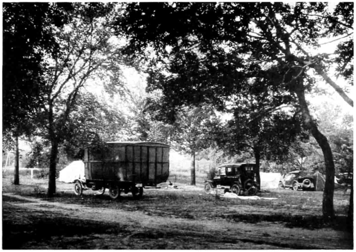
CAMPING GROUND AND CARAVAN
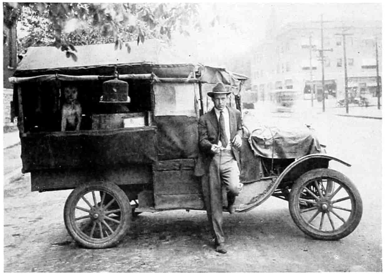
A GIPSYING TOURING CARAVAN
[459]
“The men spend their spare hours buying supplies and talking and smoking, chewing, and pitching horseshoes. They also have the best time in the world. If the auto camp is next door to a good garage so much the better. Between here and the coast the common thing is the private auto park.”
Camps, in Mr. Harrison’s opinion, should not only be near a garage, for convenience and information, but also as near the business center as possible “because the tourists like to go up town to get a restaurant meal, buy soda water and postal cards, and take a squint at the movies.” As the car is usually a part of the tent and usually more or less cluttered up with baggage the camp site should preferably be in walking distance of the center of town. Too many towns have the camp sites away out where more land is obtainable, and possible natural shade. They should be near the main lines of travel and as stated the nearer a garage and grocery store the better.
The time will no doubt come when garage men with business acumen will establish camping facilities, though the space be small, in connection with their garages and charge a small fee the same as they do now for stabling the car overnight.
Possibly the Denver public camp ground is the most liberally patronized of any in the United States. El Paso, Texas, has a small park not more than 200 feet square that tourists claim to be the best cared for of any in the west.[460] Olympia, Washington, is praised by tourists for her camping facilities. Only very recently has the camp idea reached the eastern coast, but the newspaper accounts indicate that it is taking hold.
Hotels.
—For those persons who do not care to camp there are always hotels. During the busy season, however, those in the larger towns which have gained a reputation with the traveling public are usually full to overflowing. Many tourists telegraph ahead, from one to two days, for accommodations. Rooms can be obtained in all the towns but not always bath in connection, or even running water. Throughout the well-settled communities meals and luncheons may be obtained at most any hour. In the sparsely settled regions lunches are put up by the hotels which can be carried in the car for the noonday refreshment, care being taken to reach the next settlement for dinner in the evening.
The evening scene in a popular tourist hotel reminds one of the old wayside inns. There the tourists, usually spruced up for the evening, with the travelers’ camaraderie, are talking, smoking, and enjoying each others’ company.
Parks.
—The great National parks are being used more each year by automobile tourists. Good hotel and camping facilities are available. These parks are set aside by the Government for the preservation of marvelous natural beauty and grandeur, and the government desires that they be used to the utmost by the citizenry. Perhaps 100,000 people will visit the Yellowstone National Park this (1922) season, of which 75 per cent will come by private automobile. Naturally the larger number come from the nearby states, but last year practically all states were represented. Montana sending 2892 and Maine 1. The patronage is likely to continue and grow. Other National parks and the United States Forest Reserves will also receive their share.
Several states are beginning to recognize the need for play and recreational grounds. New York has built a magnificent automobile road up the Bronx River Parkway[461] Drive and through the Adirondacks, and the State Conservation Commission has built along these highways many stone fireplaces for the special use of motorists. Colorado is building an automobile road up Mount Evans, thus heading off private parties who wished Government permission to build a toll road. Michigan will develop tourist roads to attract the summer traveler. The field secretary of the State Good Roads Association maintains that such roads will bring an annual revenue to Michigan of $75,000,000 to $100,000,000 annually through the resort trade. Scarcely a state but has some attraction to the tourist; it would be well to make its advantages known to the public that they might be enjoyed to their fullest extent.
Information.
—The last sentence brings us to an important topic. The tourist at the present time inquires at the nearest garage or hotel for information relative to routes and condition of roads, detours, accommodations, etc. This is well, but all these people do not have at hand a knowledge of the information sought, so the traveler must pass on and trust to luck that he may get through. Chambers of Commerce and automobile clubs have endeavored to fill the want, and in the Middle West these places are sought by hundreds of people daily. Some of the large newspapers have drawn on their advantageous news-gathering facilities and publish each morning a statement of road conditions and detours.
The Minneapolis Journal says that when it established its bureau of travel and resort information, “the new agency was overwhelmed from the start with eager inquirers for facts and advice.” Information is the one thing that a tourist fairly yearns for, even more than for food, gas, and oil; he knows where to go to satisfy these wants. The manager of the Journal, Perry S. Williams, who is also vice-president of the Associated Advertising Clubs of the World, has in mind a plan for “dotting the whole countryside with little information bureaus, where the traveler can learn what’s what and feel easy in relying on what he learns. Every community under this plan is to have its[462] own bureau and to make it easily accessible to the wanderer.”
But the state of Wisconsin which has long been among the foremost in the development of new road ideas, has beaten them to it, for already the Commission conducts a department of “Highway Information Service.” A blueprint map of the state trunk highway system is furnished weekly to all subscribers. The map shows the type of road on every mile of the system, the location of all construction jobs and of all detours and the condition of the detours. The map is revised weekly. Information up to Tuesday is mapped and in the hands of subscribers by Thursday, in time to supply information for week-end motor trips. This information is sold by the state to hotels, commercial associations, automobile clubs, garages, and other places where touring information is sought. The map is 54 by 60 inches in size and mounted on a frame or bulletin board to be placed in a conspicuous place. A charge of ten dollars is made for this service for the season from June 1 to September 15. The charge barely covers the cost of blueprinting.
While it may be the duty of the state to furnish the roads and do all possible to promote transportation, local bureaus will be able to supplement the State’s information in a very acceptable manner.
SELECTED REFERENCES
Bell, H. H., “Improved Lighting System to be Installed on the Lincoln Highway,” Electrical World, Vol. LXXIX, pp. 731-732.
Blanchard, Harold F., “A Comparison of Ramp and Elevator Types of Garages,” Bus Transportation, June, 1922.
Brook, Mark, “Highway Signs,” American Highway Engineers’ Handbook, pp. 1390-1394.
Capper, Arthur, “The Midwest Farm Market for Motor Trucks,” National Automobile Chamber of Commerce, New York.
Eno, William Phelps, “Science of Highway Traffic,” Published by himself and distributed by Brentano’s, New York.
[463]
Evans, P. and Batchelder, A. G., “Direction and Distance Signs,” Engineering and Contracting, July 30, 1913.
Ferguson, O. J., “Electric Lighting,” Chap. XXI, McGraw-Hill Book Company, New York.
Firestone Ship by Truck Bureau, Akron, Bulletin No. 7, “The Motor Truck Terminal.”
Harrison, J. L., “Color Schemes for Highway Signs,” Engineering and Contracting, Oct. 13, 1915, p. 280.
Isabella, N. M., “The Wisconsin Idea as Applied to Detours a Source of Satisfaction to Motorists,” Concrete Highway Magazine, April, 1922, Chicago.
Jenkins, Alfred, “A Motorized City,” National Automobile Chamber of Commerce.
Jessup, Elon, “The Motor Camping Book,” G. P. Putnam’s Sons, New York.
Lewis, Nelson P., “The Planning of the Modern City,” pp. 240-246, John Wiley & Sons.
“Omaha Union Stage Depot,” Bus Transportation, Vol. 1, p. 45.
Putnam, Nina Wilcox, “A Jitney Guide to the Santa Fé Trail,” Saturday Evening Post, June 10, 1922.
Halvorson, C. A. B., Jr. and Hussey, R. B., “Illumination of Highways,” Engineering and Contracting, Vol. LVI, pp. 535-536.
Underwood, W. E., “The Trend of Modern Practice in Street Lighting,” Engineering World, Vol. XVII, pp. 348-351.
Williar, Harry D., Jr., Articles on Road Signs, Public Roads, August, 1921, and Engineering and Contracting, October 5, 1921.
FOOTNOTES
[222] Senator Arthur Capper in an address delivered before the Highway Transport Conference, New York, 1920, said: “A recent investigation showed over 75 per cent of the Middle Western farmers bought their cars not for pleasure, but for business.” But he did not say how they use them. He did, in the same address, say, “A good road, plus a good motor truck, begets almost six motor trucks in any community and in any locality.” Emulation and rivalry are great selling agents.
[223] After the above was written there appeared in the New York Herald this statement: “This country consumed in May (1922), more than 13,000,000 barrels of gasoline. This is a matter of some 700,000,000 gallons.” The article goes on to calculate that in the use of this gasoline there was a travel of 10,000,000,000 car miles, and “at an average of four persons to the car, 1,600,000 individual motor trips around the world (in distance) in May.” The United States Bureau of Mines gives the domestic consumption of gasoline in the United States for 1921 as 4,516,012,979 gallons, an average of only about 7,000,000 barrels per month.
[224] See also “Science of Highway Traffic,” by William Phelps Eno. Published by himself and distributed by Brentano’s, New York City. A very valuable contribution to the literature of road regulation.
[225] Eno, op. cit.
[226] See Eno, op. cit., p. 53.
[227] “A Comparison of Ramp and Elevator Type Garages,” by Harold F. Blanchard, Bus Transportation, June, 1922.
[228] “A Motorized City,” by Alfred Jenkins, Secretary of, and published by, the National Automobile Chamber of Commerce, 7 East 42d Street, New York.
[229] “Direction and Distance Signs,” by P. Evans and A. G. Batchelder, Engineering and Contracting, July 30, 1913.
[230] Op. cit., p. 11.
[231] The information about Maryland’s signs is taken from articles by Harry D. Williar, Jr., Assistant Chief Engineer of the Maryland State Highway Road Commission, in Public Roads, August, 1921, and Engineering and Contracting, October 5, 1921.
[232] “The ‘Wisconsin Idea,’ as Applied to Detours a Source of Satisfaction to Motorists,” by N. M. Isabella, Assistant Maintenance Engineer, in Concrete Highway Magazine, April, 1922.
[233] An article entitled “Prevent the Proposed Permanent Traffic Towers on Fifth Avenue,” by Wm. P. Eno.
[234] “Electric Lighting,” by O. J. Ferguson; McGraw-Hill Book Company, New York.
[235] “Improved Lighting System to be Installed on the Lincoln Highway,” by H. H. Bell, Electrical World, April 15, 1922.
[236] “The Motor Camping Book,” G. P. Putnam’s Sons, New York.
[237] “A Jitney Guide to the Santa Fé Trail,” by Nina Wilcox Putnam, in Saturday Evening Post, June 10, 1922.
[238] Interview with Frank A. Harrison in Nebraska State Journal, July 12, 1921.
[465]
INDEX
- Accidents, highway, and their mitigation, 351-380
- Agriculture, stage of, in development of civilization, 4-6. See Farms
- Amos log loader, working of, 299
- Anderson, A. P., tables from “Modern Road Building and Maintenance” by, 269
- Appian Way, famous highway, 23-24
- Ashley, Wm. H., founder of Rocky Mountain Fur Company, 54
- Asia, early highways in western, 19-21
- Asphalt and asphalt block roads, good qualities of, 265-266
- Assessments for highway improvement, 311-321
- Astor, John Jacob, exploring expedition organized by, 55
- Automobiles, railway passenger earnings affected by, 163; effects of, on street-car lines, 164-166; great use of, for pleasure passenger traffic, 187-189; estimate of cost per mile of riding in, 189 n.; changes in society produced by, 203-208; effects on health, 211-213; and crime, 213-214; percentage of accidents due to, 351-352; responsibility of the driver for accidents and their avoidance, 352-355; horns for, 356-357; stopping on grades, backing, etc., 357-358; miscellaneous causes of accidents, 358 ff.; ranking and parking of, 420-425; ramp and elevator garages for, 427-429; gas, air, and water stations, 433-434
- Automotive transportation, analysis and discussion of, 181-218
- Auto trucks, effects of, on railroads, 163-164. See Trucking by motor
- Babson, Roger W., quoted on relations between railways and auto trucks, 163-164
- Backing of cars, accidents due to, 357-358
- Baldwin Locomotive Works, origins of, 102
- Beautification of roads, discussion of, 382-416
- Bible, references in, to highways, 19-20
- Bicycles, influence of, on roads, 127-136; highway accidents due to, 378
- Bodies, removable, a device for loading and unloading freight, 191-192
- Bonds, issuing of, for highway financing, 322-323; kinds of, 323-327; total cost of a loan, by the three kinds, 327-328; the term of, 328-331
- Boone, Daniel, “Autobiography” quoted, 40-42
- Boone’s Trace, account of, 39-43
- Boston, early railroads centering at, 105
- Brakes, parts played by, in automobile accidents, 359-360
- Brick roads, good qualities of, 264
- Bridger Pass, discovery of, 54
- Bridges, road accidents caused by, 368
- Buses. See Motor-buses
- Cabot, Philip, article by, on New England railways, cited, 162; calculations and figures by, 171-172
- Calk, William, “Diary” of, quoted[466], 43-46
- Camden & Amboy R.R., chartering of, 104
- Camping grounds for motor tourists, 451-456
- Canals, era of, in England, 14-15; in America, 70-75; passenger traffic on, 75-76; inability of, to compete with railways, and results, 76-77; ship, 77; Sault Ste. Marie, Welland, and Cape Cod, 77; Panama Canal, 77-88
- Canoes, travel and transportation by, 34-35
- Cape Cod, ship canal across, 77
- Cattle. See Stock raising
- Census. See Traffic census
- Central Pacific Ry., building of, 112
- Charleston & Hamburg R.R., building of, 103
- Chesapeake and Ohio Canal, building of, 73
- Civilization, transportation a measure of, 1 ff.; five stages in, 1-2; stage of Direct Appropriation, 2-4; Pastoral Stage, 4; Agricultural Stage, 4-5; Handicraft Stage, 6-12; Industrial Stage, 14-18
- Clark, William. See Lewis and Clark
- Clayton-Bulwer Treaty, terms of, 83
- Clermont, Robert Fulton’s steamboat, 89
- Clinton, De Witt, efforts of, in behalf of canal-building, 71
- Coaches. See Stagecoaches
- Colonial days, transportation in, 34-46
- Concrete roads, good and poor qualities of, 264
- Consolidated Rural Schools, importance of motor transportation to, 208-210
- Container, the demountable, 176, 192-193
- Cooper, Peter, locomotive built and operated by, 100-101
- Coöperative marketing, advantages of, 277-282
- Corporations, financing of highway transportation by, 345
- Crédit Mobilier, notorious railway-construction scandal, 115-116
- Crime, the automobile and, 213-214
- “Cross Crossings Cautiously” campaign, 380
- Culverts, road accidents caused by, 368
- Cumberland Road, building of, 62-64; extension of, 64-66
- Curves, dangers of, 367
- Dairying, use of motor truck in, 293-294
- De Lesseps, Ferdinand, and Panama Canal, 80-84
- Des Moines, Iowa, good roads, movement at, 132-133
- Destruction of highways, factors in, 245-248
- Detour signs, 442-443; location of, 443
- Distance and direction signs for motorists, 436-437
- Driver, responsibility of the, for automobile accidents, 352-355
- Dunlop, J. B., inventor of pneumatic tire, 128
- Du Pont Road, example of private financing of highway, 307-308
- Durability, an important factor in road building, 254
- Earth roads, good and poor qualities of, 263
- Efficiency outline of motor transport, 225-227
- Electric-light poles along highways, 412-413
- Electric traction, operation of street cars by, 122-124
- Elevator garages, 427-428
- Engine. See Steam engine
- Eno, William Phelps, development of traffic regulation due to efforts of, 378-379; cited on width of parking spaces, 423; cited on opera house traffic, 426, 427
- Eno Foundation for Highway Traffic Regulation, Inc.[467], 379-380
- Erie Canal, building of, 70-72; small profit from, 75
- Esthetics, highway, 382-416
- Express rates, reduction of, due to short-haul motor trucking, 174-175
- Express terminal stations, 429-433
- Factory products, transportation of, by motor truck, 301-303
- Farms, meaning of the automobile to, 177; motor trucking to and from, 196-201; Rural Mail Delivery one of many modern advantages, 210-211
- Federal aid, financing of highways and transportation lines by, 332-334; present state of, 334-335; plan of local matching of Federal Aid dollars, 335-342
- Federal Aid Road Act, passage of, 152-153; provisions of, 153-154; rules and regulations for carrying out, 154-156; marked success of, 156
- Feudal system, government under the, 5-6
- Financing, highway, 343-349
- Forestry, use of motor truck in, 295-298
- France, traffic censuses in, 236-237, 240-242
- Garages, public, 427-429
- Gardening, road, 382-387
- Gasoline, stations for selling, 433
- Gila Trail, 55; route of, 58
- “Good roads” movement, growth of, 128-129
- Government, U. S., attitude toward river improvement, 94-97; ownership of railways by, 112; aid of state and Federal, for better roads, 147-156
- Grain exchanges, account of, 275-277
- Gravel roads, good and poor qualities of, 263-264
- Greece, effects on ancient, of lack of roads, 21-22
- Greeley, Horace, quoted on canals, 76
- Guides, highway, for motorists, 435-445
- Guilds, medieval, 6-8; destruction or lapsing of, 9-10; functions taken over by government, 10
- Handicrafts, stage of, in growth of civilization, 6-12
- Harding, President, discussion of transportation problem by, 217-218
- Harriman interests, railway lines held by, 117
- Haulage. See Trucking by motor
- Hay-Pauncefote Treaty, terms of, 84
- Health, the automobile and, 211-213
- Henderson, James, early American pioneer, 39-43
- Highway, distinction between road and, 222
- Highways, important early, 19-22; of ancient Rome, 22-27; classification of, 222; planning systems of, 222 ff.; units of systems, 227-229; principles of esthetic construction applied to, 382-416. See also Roads
- Hogs. See Stock raising
- Hoover, Secretary, quoted on farm motor trucks, 197
- Horine, M. C., “Economics of Motor Transport” by, quoted, 225-227
- Horns for automobiles, 356-357
- Hotels, accommodations for tourists in, 460
- Humboldt River route, discovery of, 54
- Husband, Joseph, “Story of the Pullman Car” by, 120-121
- Individual financing of highway transportation, 343-344
- Information, supplying of, to automobile tourists, 461-462
- Interurban railways, effects of motor competition on, 164
- Intra-city traffic, calculations concerning[468], 170
- Inventions, industrial stage of civilization brought about by, 14-15
- Iron, invention of new methods of smelting, 15
- Italy, traffic censuses in, 242
- Jay walking, as a cause of accidents, 377
- Jefferson, Thomas, Louisiana Purchase arranged by, 48
- Jerusalem, effects upon, of strategic position, 20
- Jitneys, earnings of street-car lines diminished by, 165; importance of business done by, 183
- John Bull, locomotive, 102
- Joliet, Louis, early explorer, 46
- Kay, John, inventor of fly shuttle, 16
- Kentucky, Boone’s path into, 42; early railroads in, 106
- Knight, Jonathan, coning of engine wheels invented by, 101 n.
- Lancaster turnpike, building of, 60-61
- Land, grants of, to railways, 110; grants to Pacific roads, 111-114
- Later California Trail, route of, 57
- Lauck, W. J., quoted on avoidable railway wastes, 175 n.
- League of American Wheelmen, organization of, 128; good roads movement sponsored by, 129-136
- Lewis and Clark Expedition, account of, 48-53
- Lighting of roads and streets, 447-449
- Lights, on cars, as sources of danger, 361-362; for non-motorized traffic, 378
- Loading and unloading freight, devices for, 191-194
- Locomotive, invention and early development of, 18; the first, 99-103; progress in mechanical development of, 119-120
- Louisiana Territory, purchase of, 48
- Lumbering, improved methods in, due to motor truck, 295-300
- Macadam, J. L., road construction by, 60
- Macadam roads, good and poor qualities of, 264
- MacDonald, T. H., classification of highways by, 222
- Manse, W. H., cited on waste by railways, 176
- Map signs, sizes of, 439-441
- Marketing, effect of ease and cost of transportation on production and, 273-304
- Marks, highway, for motorists, 435-445
- Marquette, Jacques, explorations of, 46-48
- Massachusetts, state aid for highways in, 150-151
- Merger, railway consolidation by, 117
- Michigan Central R.R., beginnings of, 106
- Mining, use of motor trucks in connection with, 300-301
- Mississippi River, steamboat transportation on, 90-91
- Mohawk & Hudson Company, chartering of, 103
- Moore, W. H., “good roads booster,” 139
- Morgan interests, railway lines held by, 117
- Motor-buses, relations between street-car lines and, 165-166; character of business done by, 184-187; extent of suburban and interurban, 196; terminal stations for, 429-433
- Motor transport efficiency outline, 225-227
- National Good Roads Association, activities of, 139
- National Road. See Cumberland Road
- National system of highways, arguments for, 227-229
- Nebraska State Journal, editorial from[469], 204-205
- New England, early railways in, 105
- New Orleans, importance of, due to river traffic, 90-91
- New York Central & Hudson River R.R., beginnings of, 103-104
- New York City, Governor Clinton’s prophecy concerning, 71-72
- New York State, canal-building in, 70-74; automobile roads in, 460-461
- Nicaragua, canal route across, 84
- “No Accident” campaigns, 380
- Novelty, Ericsson’s locomotive, 100 n.
- Nye, Bill, quoted on roads, 130-131
- Office of Public Roads Inquiry, instituted, 136-137; duties and scope of, widened, 143-144
- O’Hanlon, J., “Irish Emigrant’s Guide to United States,” quoted, 93
- Ohio, first railway in, 105-106
- Ohio Valley, early lines of travel to, 37-38
- Old Ironsides, first Baldwin locomotive, 102
- Opera house traffic, special arrangement for, 426-427
- Oregon Trail, traffic over, 54-55; origin of the, 55-57; final route of, 57
- Pacific railways, building of and land grants to, 111-114
- Packing of goods on turnpikes, 58-60
- Page, L. W., worker for good roads, 142, 144
- Palestine, roads and highways of, 19-20
- Panama Canal, history of, 77-88
- Parking of automobiles, 421-422; spaces for, a convenience to motorists, 422-425
- Parks, National, visited by automobile tourists, 460-461
- Partnership, financing of highway transportation by, 344-345
- Pedestrians, contributory negligence of, toward accidents, 376-377; rule for, on country roads, 377-378
- Pennsylvania, turnpikes in, 61
- Pennsylvania R.R., railways held by same interests, 118
- Peru, roads in ancient, 27-31
- Pioneer, Illinois Central locomotive, 108
- Pittsburgh, Pa., growth of, 72
- Plants, climbing, for use in road gardening, 411-412
- Pleasure passenger traffic, use of automobiles for, 187-189
- Poles, telephone and other, along highways, 412-415
- Pope, Albert A., worker for good roads, 133, 136
- Portages, importance of, in early American period, 36-37
- Potter, I. B., good roads advocate, 129
- Poughkeepsie, Bus Terminal Station at, 431-433
- Poultry business, efficiency of motor truck in, 294-295
- Prescott, W. H., “Conquest of Peru,” quoted, 28-31
- Production and marketing, relation between ease and cost of transportation and, 273 ff.
- Public ownership, as a method of financing transportation lines, 347-349
- Pullman cars, development of, 120-122
- Railway crossings, accidents at, 368-370; increase in accidents due to automobiles, 370-372; means of diminishing fatalities, 372-376
- Railways, early development of, in England, 17-18; effects of, on canals, 76-77; account of growth and development of, 99-116; consolidation of, 116-118; mechanical development of, 119-120; street, 122; relation between transportation on, and on highways, 159-168
- Ramp and elevator type garages[470], 427-429
- Ranking of cars, 421-425
- Regulations, road and traffic, 378-380
- Resistance of road surfaces, 255-257; due to grade, 257-261
- Richmond, Va., first electric railway operated for profit in, 123
- River and Harbor Improvement Bills, 96-97
- Rivers, government’s attitude toward improvement of, 94-97
- Road, distinction between highway and, 222
- Roads, prehistoric American, 27-31; early, in North America, 35-36; evolution of modern wagon, 126 ff.; influence of bicycle on, 127-136; building of object-lesson, 142-144; state and Federal aid for, 147-156; good, as agencies for health, 212-213; selection of suitable type, 252-254; types of, and their qualities, 263; comparison of types of, 266-270; bad, as causes of accidents, 363-364; naming and numbering of, 434-435. See also Highways
- Robbery, automobiles used in, 213-214
- Rocket, George Stephenson’s locomotive, 100 n.
- Rome, roads of ancient, 22-27
- Roosevelt, Theodore, and the Panama Canal, 85-86
- Rotary scheme for traffic, 424-426
- Rural Free Delivery, an agency for better roads, 144-147; effects of, on farmer’s life, 210-211
- “Safety First” campaign, 380
- St. Louis, Mo., as a fur center, 53-54
- Salt Lake Trail, route of, 57
- Sand-clay roads, good and poor qualities of, 263
- San Francisco, cable cars in, 122
- Sanitariness of roads, 262
- Santa Fé Trail, traffic over, 54-55; route of, 58
- Saturday Evening Post, quoted on vandalism, 215
- Sault Ste. Marie, ship canal and locks at, 77
- Schools, motor transportation and the consolidation of, 208-210
- Semaphores, use of, by traffic officers, 445-446
- Service stations for automobiles, 433-434
- Shrubs, for planting along roads, 403-411
- Signal lights and colors, 446-447
- Signs, highway, for motorists, 435-445
- Skidding, accidents due to, 359
- Sleeping car, evolution of the, 120-122
- Slipperiness of road surfaces, 261-262
- Smith, Jedediah, discoveries of, 54
- South Pass, discovery of, 54
- Spanish Trail, traffic over, 54-55; route of, 58
- Speedometer, as an essential, 363
- Speed signs for motorists, 444
- Spooning in automobiles, 215
- Stagecoaches, era of, in England, 11-12; on Cumberland Road, 64-65
- State aid, 147-152; financing highways and transportation lines by, 334
- State system of highways, arguments for, 229-230
- Steamboats, the first, 89-90; on Mississippi River, 90-91; increasing luxuriance of, 91-93; dangers connected with early, 93; fares on, 94
- Steam engine, Watt’s improvements on early, 15-16; attempts to use, in locomotives, 99-100
- Stephenson, George, improvement of locomotive by, 18; first locomotive put out by, 100
- Stevens, John, called father of American railroads, 100
- Stock raising, effect of marketing facilities and road transportation on, 284-293
- Stock subscriptions for highway financing[471], 331
- Stockton & Darlington R.R., completion of, 101
- Stock watering, meaning of, 116
- Stopping cars on grades, streets, etc., 357
- Street-car service, progress in, 122; effect of motor transportation on, 164; effects of taxicabs, jitneys, and buses, 165-167; competition between motor-buses and, 185-186
- Superelevation of outer side of curved roadway, 364-366
- Systems of highways, planning of, 222-270
- Taxes for road construction, 309-321
- Taxicabs, character and importance of business done by, 183-184
- Telephone poles, highways disfigured by, 412-413; location of, 414-415
- Telford, Thomas, road construction by, 60
- Terminals, waste at railway, 176; transferring between, by motor-bus, 187; improvement of facilities at, caused by motor transportation, 201-203; for buses and express service, 429-433
- Tom Thumb, Peter Cooper’s locomotive, 101
- Touring by motor, amount of, 450-451; camping grounds for use in, 451-456; camp sites, 458-460
- Towns, truck and bus lines between, 194-196
- Traffic, one way and rotary, 425-426; taking care of opera house, 426-427; guides for, in cities, 444-445
- Traffic census, taking a, for planning of highway, 234-236; methods of taking, 236-238; classification of traffic in, 239-245
- Transcontinental railway lines, land grants to and construction of, 111-115
- Transportation, a measure of civilization, 1-32; classified as primary and secondary, 159; interrelation between highway and other kinds of, 159 ff.; legitimate fields of agencies of, 168-170; analysis and discussion of automotive, 181-202; social aspect of motor, 203-208; effect of ease and cost of, on production and marketing, 273-304; financing of lines of, 306-343; financing highway, 343-349
- Transylvania Republic, early settlement called, 43
- Trees, for planting along roads, 385-403
- Tresaguet, French highway engineer, 60
- Trucking by motor, effects of, on railway earnings, 163-164; length of haul for economical, 170-174; reduction of express rates due to short-haul, 174-175; freight traffic cost under system of, 190-194; traffic between towns, 194-196; general effect of ease and cost of, on production and marketing, 273-304
- Turnpikes, era of, in America, 58-60; construction of, 60-61; effects of railways on, 61-62
- Types of roadway, comparison of, 266-270
- Uniformity in distance and direction signs for motorists, 437-438
- Union Pacific Ry., building of, 112-114
- United States, transportation development in, 34-67
- Units, of highway systems, 227-229; of traffic, 240-242
- Vandalism by visitors to country, 215
- Vanderbilt interests, railway lines held by, 117
- Vehicles, unlighted, as sources of danger[472], 362-363
- Vincent, C., “Letters on Grain Marketing Problems,” quoted, 276-277, 280
- Virginia, transportation improvements in early, 61; first railroads in, 107
- Vision, clear, as a means of safety, 366-367; obstacles that obscure, a cause of accidents to pedestrians, 377
- Wagon road, the modern, 126-156
- Walker, American filibuster in Nicaragua, 80
- Warning signs for motorists, 439
- Washington Turnpike Company bill, 67
- Waste, methods of avoiding, by railways, 175-177
- Waterways, settlement near, in early American period, 36-37. See Canals and Rivers
- Watkins, Albert, quoted on Oregon Trail, 56-57
- Welland Canal, traffic through, 77
- Wilderness Road, the, 39-43
- Williams, Perry S., plan of, for information bureaus for travelers, 461
- Wood block roads, qualities of, 265
Text of Chart of the Organization of the U. S. Bureau of Public Roads and Rural Engineering, 1917
- DIRECTOR
- MANAGEMENT AND ECONOMICS
- Chief of Management
- MANAGEMENT
- Correspondence and Files
- Cooperation with Solicitor
- Accounts
- Editorial & Library
- Quarters & Stock
- ENGINEERING ECONOMICS
- Economic Investigations and Advice
- Statistical Investigations
- Legislative Investigations and Advice
- Lectures & Exhibits
- Illustrations and Models
- GENERAL INSPECTION
- General Inspectors
- ENGINEERING
- Chief Engineer
- ROAD MATERIALS TESTS AND RESEARCH
- Chemical and Physical Tests
- Microscopic Examination and Classification of Rocks
- Standardization of Methods of Testing
- Investigations of Non-Bituminous Materials
- Research on Dust Preventives and Road Binders
- Concrete Investigations
- Field Experiments
- Inspection & Advice
- HIGHWAY CONSTRUCTION AND MAINTENANCE
- Post Road Construction
- Forest Road Construction and Maintenance
- Object Lesson Roads
- Cooperative and Experimental Maintenance
- Bridges & Culverts
- Inspection & Advice
- 1st. District
- Wash.
- Ore., Idaho
- 2nd District
- Berkely, Cal.
- Cal., Nev.
- Ariz., N. M.
- 3rd. District
- Denver, Colo.
- Mont., Wyo.
- Utah, Colo.
- 4th. District
- N.D., S.D.
- Minn., Wis.
- 5th. District
- Nebr., Iowa
- Kan., Mo.
- 6th. District
- Texas., Okla.
- Ark., La.
- 7th. District
- So. Chicago, Ill.
- Mich., Ill.
- Ind., Ky.
- 8th. District
- Tenn.
- Miss., Ala.
- Ga., S.C., Fla.
- 9th. District
- Me., N.H., Vt., N.Y.
- Mass., Conn., R.I.
- N.J., Del.
- 10th. District
- Washington, D.C.
- Ohio., Penn., Md.
- W.Va., Va., N.C.
- IRRIGATION
- Utilization of Water Power and Appliance Equipment
- Flow of Water in Ditches, Pipes, etc.
- Duty, Apportionment and Measurement of Water
- Customs, Regulations and Laws
- Drainage of Irrigated Lands
- Inspection & Advice
- DRAINAGE
- Farm Drainage
- Drainage of Swamps and Wet Lands
- Removal of Surplus Water
- Field Experiments
- Investigating and Developing Equipment
- Inspection & Advice
- RURAL ENGINEERING
- Farm Water Supply
- Drainage Disposal
- Construction of Farm Buildings
- Rural Engineering Problems Involving Mechanical Principles
- Traction Tests
- Instrument Making and Repairing
- Inspection & Advice
