
.
Mali
Mali (Africa)
Introduction :: Mali
Background: This entry usually highlights major historic events and current issues and may include a statement about one or two key future trends. Background field listing
The Sudanese Republic and Senegal became independent of France in 1960 as the Mali Federation. When Senegal withdrew after only a few months, what formerly made up the Sudanese Republic was renamed Mali. Rule by dictatorship was brought to a close in 1991 by a military coup that ushered in a period of democratic rule. President Alpha Oumar KONARE won Mali's first two democratic presidential elections in 1992 and 1997. In keeping with Mali's two-term constitutional limit, he stepped down in 2002 and was succeeded by Amadou Toumani TOURE, who was elected to a second term in a 2007 election that was widely judged to be free and fair. Malian returnees from Libya in 2011 exacerbated tensions in northern Mali, and Tuareg ethnic militias rebelled in January 2012. Low- and mid-level soldiers, frustrated with the poor handling of the rebellion, overthrew TOURE on 22 March. Intensive mediation efforts led by the Economic Community of West African States (ECOWAS) returned power to a civilian administration in April with the appointment of Interim President Dioncounda TRAORE.
The post-coup chaos led to rebels expelling the Malian military from the country's three northern regions and allowed Islamic militants to set up strongholds. Hundreds of thousands of northern Malians fled the violence to southern Mali and neighboring countries, exacerbating regional food shortages in host communities. A French-led international military intervention to retake the three northern regions began in January 2013 and within a month, most of the north had been retaken. In a democratic presidential election conducted in July and August of 2013, Ibrahim Boubacar KEITA was elected president. The Malian Government and northern armed groups signed an internationally mediated peace accord in June 2015, however, the parties to the peace accord have made little progress in the accord's implementation, despite a June 2017 target for its completion. Furthermore, extremist groups outside the peace process made steady inroads into rural areas of central Mali following the consolidation of three major terrorist organizations in March 2017. In central and northern Mali, terrorist groups have exploited age-old ethnic rivalries between pastoralists and sedentary communities and inflicted serious losses on the Malian military. Intercommunal violence incidents such as targeted killings occur with increasing regularity. KEITA was reelected president in 2018 in an election that was deemed credible by international observers, despite some security and logistic shortfalls.
Geography :: Mali
Location: This entry identifies the country's regional location, neighboring countries, and adjacent bodies of water. Location field listing
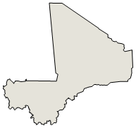
interior Western Africa, southwest of Algeria, north of Guinea, Cote d'Ivoire, and Burkina Faso, west of Niger
Geographic coordinates: This entry includes rounded latitude and longitude figures for the centroid or center point of a country expressed in degrees and minutes; it is based on the locations provided in the Geographic Names Server (GNS), maintained by the National Geospatial-Intelligence Agency on behalf of the US Board on Geographic Names. Geographic coordinates field listing
17 00 N, 4 00 W
Map references: This entry includes the name of the Factbook reference map on which a country may be found. Note that boundary representations on these maps are not necessarily authoritative. The entry on Geographic coordinates may be helpful in finding some smaller countries. Map references field listing
Africa
Area: This entry includes three subfields. Total area is the sum of all land and water areas delimited by international boundaries and/or coastlines. Land area is the aggregate of all surfaces delimited by international boundaries and/or coastlines, excluding inland water bodies (lakes, reservoirs, rivers). Water area is the sum of the surfaces of all inland water bodies, such as lakes, reservoirs, or rivers, as delimited by international boundaries and/or coastlines. Area field listing
total: 1,240,192 sq km
land: 1,220,190 sq km
water: 20,002 sq km
country comparison to the world: 25
Area - comparative: This entry provides an area comparison based on total area equivalents. Most entities are compared with the entire US or one of the 50 states based on area measurements (1990 revised) provided by the US Bureau of the Census. The smaller entities are compared with Washington, DC (178 sq km, 69 sq mi) or The Mall in Washington, DC (0.59 sq km, 0.23 sq mi, 146 acres). Area - comparative field listing
slightly less than twice the size of Texas
Land boundaries: This entry contains the total length of all land boundaries and the individual lengths for each of the contiguous border countries. When available, official lengths published by national statistical agencies are used. Because surveying methods may differ, country border lengths reported by contiguous countries may differ. Land boundaries field listing
total: 7,908 km
border countries (7): Algeria 1359 km, Burkina Faso 1325 km, Cote d'Ivoire 599 km, Guinea 1062 km, Mauritania 2236 km, Niger 838 km, Senegal 489 km
Coastline: This entry gives the total length of the boundary between the land area (including islands) and the sea. Coastline field listing
0 km (landlocked)
Maritime claims: This entry includes the following claims, the definitions of which are excerpted from the United Nations Convention on the Law of the Sea (UNCLOS), which alone contains the full and definitive descriptions: territorial sea - the sovereignty of a coastal state extends beyond its land territory and internal waters to an adjacent belt of sea, described as the territorial sea in the UNCLOS (Part II); this sovereignty extends to the air space over the territorial sea as well as its underlying s . . . more Maritime claims field listing
none (landlocked)
Climate: This entry includes a brief description of typical weather regimes throughout the year; in the Word entry only, it includes four subfields that describe climate extremes:ten driest places on earth (average annual precipitation) describes the annual average precipitation measured in both millimeters and inches for selected countries with climate extremes. ten wettest places on earth (average annual precipitation) describes the annual average precipitation measured in both millimeters and i . . . more Climate field listing
subtropical to arid; hot and dry (February to June); rainy, humid, and mild (June to November); cool and dry (November to February)
Terrain: This entry contains a brief description of the topography. Terrain field listing
mostly flat to rolling northern plains covered by sand; savanna in south, rugged hills in northeast
Elevation: This entry includes the mean elevation and elevation extremes, lowest point and highest point. Elevation field listing
mean elevation: 343 m
lowest point: Senegal River 23 m
highest point: Hombori Tondo 1,155 m
Natural resources: This entry lists a country's mineral, petroleum, hydropower, and other resources of commercial importance, such as rare earth elements (REEs). In general, products appear only if they make a significant contribution to the economy, or are likely to do so in the future. Natural resources field listing
gold, phosphates, kaolin, salt, limestone, uranium, gypsum, granite, hydropower, note, bauxite, iron ore, manganese, tin, and copper deposits are known but not exploited
Land use: This entry contains the percentage shares of total land area for three different types of land use: agricultural land, forest, and other; agricultural land is further divided into arable land - land cultivated for crops like wheat, maize, and rice that are replanted after each harvest, permanent crops - land cultivated for crops like citrus, coffee, and rubber that are not replanted after each harvest, and includes land under flowering shrubs, fruit trees, nut trees, and vines, and permane . . . more Land use field listing
agricultural land: 34.1% (2011 est.)
arable land: 5.6% (2011 est.) / permanent crops: 0.1% (2011 est.) / permanent pasture: 28.4% (2011 est.)
forest: 10.2% (2011 est.)
other: 55.7% (2011 est.)
Irrigated land: This entry gives the number of square kilometers of land area that is artificially supplied with water. Irrigated land field listing
3,780 sq km (2012)
Population distribution: This entry provides a summary description of the population dispersion within a country. While it may suggest population density, it does not provide density figures. Population distribution field listing
the overwhelming majority of the population lives in the southern half of the country, with greater density along the border with Burkina Faso
Natural hazards: This entry lists potential natural disasters. For countries where volcanic activity is common, a volcanism subfield highlights historically active volcanoes. Natural hazards field listing
hot, dust-laden harmattan haze common during dry seasons; recurring droughts; occasional Niger River flooding
Environment - current issues: This entry lists the most pressing and important environmental problems. The following terms and abbreviations are used throughout the entry: Acidification - the lowering of soil and water pH due to acid precipitation and deposition usually through precipitation; this process disrupts ecosystem nutrient flows and may kill freshwater fish and plants dependent on more neutral or alkaline conditions (see acid rain). Acid rain - characterized as containing harmful levels of sulfur dioxi . . . more Environment - current issues field listing
deforestation; soil erosion; desertification; loss of pasture land; inadequate supplies of potable water
Environment - international agreements: This entry separates country participation in international environmental agreements into two levels - party to and signed, but not ratified. Agreements are listed in alphabetical order by the abbreviated form of the full name. Environment - international agreements field listing
party to: Biodiversity, Climate Change, Climate Change-Kyoto Protocol, Desertification, Endangered Species, Hazardous Wastes, Law of the Sea, Ozone Layer Protection, Wetlands, Whaling
signed, but not ratified: none of the selected agreements
Geography - note: This entry includes miscellaneous geographic information of significance not included elsewhere. Geography - note field listing
landlocked; divided into three natural zones: the southern, cultivated Sudanese; the central, semiarid Sahelian; and the northern, arid Saharan
People and Society :: Mali
Population: This entry gives an estimate from the US Bureau of the Census based on statistics from population censuses, vital statistics registration systems, or sample surveys pertaining to the recent past and on assumptions about future trends. The total population presents one overall measure of the potential impact of the country on the world and within its region. Note: Starting with the 1993 Factbook, demographic estimates for some countries (mostly African) have explicitly taken into account t . . . more Population field listing
19,553,397 (July 2020 est.)
country comparison to the world: 62
Nationality: This entry provides the identifying terms for citizens - noun and adjective. Nationality field listing
noun: Malian(s)
adjective: Malian
Ethnic groups: This entry provides an ordered listing of ethnic groups starting with the largest and normally includes the percent of total population. Ethnic groups field listing
Bambara 33.3%, Fulani (Peuhl) 13.3%, Sarakole/Soninke/Marka 9.8%, Senufo/Manianka 9.6%, Malinke 8.8%, Dogon 8.7%, Sonrai 5.9%, Bobo 2.1%, Tuareg/Bella 1.7%, other Malian 6%, from member of Economic Community of West Africa .4%, other .3% (2018 est.)
Languages: This entry provides a listing of languages spoken in each country and specifies any that are official national or regional languages. When data is available, the languages spoken in each country are broken down according to the percent of the total population speaking each language as a first language. For those countries without available data, languages are listed in rank order based on prevalence, starting with the most-spoken language. Languages field listing
French (official), Bambara 46.3%, Peuhl/Foulfoulbe 9.4%, Dogon 7.2%, Maraka/Soninke 6.4%, Malinke 5.6%, Sonrhai/Djerma 5.6%, Minianka 4.3%, Tamacheq 3.5%, Senoufo 2.6%, Bobo 2.1%, unspecified 0.7%, other 6.3% (2009 est.)
note: Mali has 13 national languages in addition to its official language
Religions: This entry is an ordered listing of religions by adherents starting with the largest group and sometimes includes the percent of total population. The core characteristics and beliefs of the world's major religions are described below. Baha'i - Founded by Mirza Husayn-Ali (known as Baha'u'llah) in Iran in 1852, Baha'i faith emphasizes monotheism and believes in one eternal transcendent God. Its guiding focus is to encourage the unity of all peoples on the earth so that justice and peace m . . . more Religions field listing
Muslim 93.9%, Christian 2.8%, animist .7%, none 2.5% (2018 est.)
Demographic profile: This entry describes a country’s key demographic features and trends and how they vary among regional, ethnic, and socioeconomic sub-populations. Some of the topics addressed are population age structure, fertility, health, mortality, poverty, education, and migration. Demographic profile field listing
Mali’s total population is expected to double by 2035; its capital Bamako is one of the fastest-growing cities in Africa. A young age structure, a declining mortality rate, and a sustained high total fertility rate of 6 children per woman – the third highest in the world – ensure continued rapid population growth for the foreseeable future. Significant outmigration only marginally tempers this growth. Despite decreases, Mali’s infant, child, and maternal mortality rates remain among the highest in Sub-Saharan Africa because of limited access to and adoption of family planning, early childbearing, short birth intervals, the prevalence of female genital cutting, infrequent use of skilled birth attendants, and a lack of emergency obstetrical and neonatal care.
Mali’s high total fertility rate has been virtually unchanged for decades, as a result of the ongoing preference for large families, early childbearing, the lack of female education and empowerment, poverty, and extremely low contraceptive use. Slowing Mali’s population growth by lowering its birth rate will be essential for poverty reduction, improving food security, and developing human capital and the economy.
Mali has a long history of seasonal migration and emigration driven by poverty, conflict, demographic pressure, unemployment, food insecurity, and droughts. Many Malians from rural areas migrate during the dry period to nearby villages and towns to do odd jobs or to adjoining countries to work in agriculture or mining. Pastoralists and nomads move seasonally to southern Mali or nearby coastal states. Others migrate long term to Mali’s urban areas, Cote d’Ivoire, other neighboring countries, and in smaller numbers to France, Mali’s former colonial ruler. Since the early 1990s, Mali’s role has grown as a transit country for regional migration flows and illegal migration to Europe. Human smugglers and traffickers exploit the same regional routes used for moving contraband drugs, arms, and cigarettes.
Between early 2012 and 2013, renewed fighting in northern Mali between government forces and Tuareg secessionists and their Islamist allies, a French-led international military intervention, as well as chronic food shortages, caused the displacement of hundreds of thousands of Malians. Most of those displaced domestically sought shelter in urban areas of southern Mali, except for pastoralist and nomadic groups, who abandoned their traditional routes, gave away or sold their livestock, and dispersed into the deserts of northern Mali or crossed into neighboring countries. Almost all Malians who took refuge abroad (mostly Tuareg and Maure pastoralists) stayed in the region, largely in Mauritania, Niger, and Burkina Faso.
Age structure: This entry provides the distribution of the population according to age. Information is included by sex and age group as follows: 0-14 years (children), 15-24 years (early working age), 25-54 years (prime working age), 55-64 years (mature working age), 65 years and over (elderly). The age structure of a population affects a nation's key socioeconomic issues. Countries with young populations (high percentage under age 15) need to invest more in schools, while countries with older population . . . more Age structure field listing
0-14 years: 47.69% (male 4,689,121/female 4,636,685)
15-24 years: 19% (male 1,768,772/female 1,945,582)
25-54 years: 26.61% (male 2,395,566/female 2,806,830)
55-64 years: 3.68% (male 367,710/female 352,170)
65 years and over: 3.02% (male 293,560/female 297,401) (2020 est.)
population pyramid: population pyramid
Dependency ratios: Dependency ratios are a measure of the age structure of a population. They relate the number of individuals that are likely to be economically "dependent" on the support of others. Dependency ratios contrast the ratio of youths (ages 0-14) and the elderly (ages 65+) to the number of those in the working-age group (ages 15-64). Changes in the dependency ratio provide an indication of potential social support requirements resulting from changes in population age structures. As fertility leve . . . more Dependency ratios field listing
total dependency ratio: 98
youth dependency ratio: 93.1
elderly dependency ratio: 4.9
potential support ratio: 20.4 (2020 est.)
Median age: This entry is the age that divides a population into two numerically equal groups; that is, half the people are younger than this age and half are older. It is a single index that summarizes the age distribution of a population. Currently, the median age ranges from a low of about 15 in Niger and Uganda to 40 or more in several European countries and Japan. See the entry for "Age structure" for the importance of a young versus an older age structure and, by implication, a low versus a high . . . more Median age field listing
total: 16 years
male: 15.3 years
female: 16.7 years (2020 est.)
country comparison to the world: 225
Population growth rate: The average annual percent change in the population, resulting from a surplus (or deficit) of births over deaths and the balance of migrants entering and leaving a country. The rate may be positive or negative. The growth rate is a factor in determining how great a burden would be imposed on a country by the changing needs of its people for infrastructure (e.g., schools, hospitals, housing, roads), resources (e.g., food, water, electricity), and jobs. Rapid population growth can be seen as . . . more Population growth rate field listing
2.95% (2020 est.)
country comparison to the world: 9
Birth rate: This entry gives the average annual number of births during a year per 1,000 persons in the population at midyear; also known as crude birth rate. The birth rate is usually the dominant factor in determining the rate of population growth. It depends on both the level of fertility and the age structure of the population. Birth rate field listing
42.2 births/1,000 population (2020 est.)
country comparison to the world: 4
Death rate: This entry gives the average annual number of deaths during a year per 1,000 population at midyear; also known as crude death rate. The death rate, while only a rough indicator of the mortality situation in a country, accurately indicates the current mortality impact on population growth. This indicator is significantly affected by age distribution, and most countries will eventually show a rise in the overall death rate, in spite of continued decline in mortality at all ages, as declining . . . more Death rate field listing
9 deaths/1,000 population (2020 est.)
country comparison to the world: 63
Net migration rate: This entry includes the figure for the difference between the number of persons entering and leaving a country during the year per 1,000 persons (based on midyear population). An excess of persons entering the country is referred to as net immigration (e.g., 3.56 migrants/1,000 population); an excess of persons leaving the country as net emigration (e.g., -9.26 migrants/1,000 population). The net migration rate indicates the contribution of migration to the overall level of population chan . . . more Net migration rate field listing
-3.9 migrant(s)/1,000 population (2020 est.)
country comparison to the world: 188
Population distribution: This entry provides a summary description of the population dispersion within a country. While it may suggest population density, it does not provide density figures. Population distribution field listing
the overwhelming majority of the population lives in the southern half of the country, with greater density along the border with Burkina Faso
Urbanization: This entry provides two measures of the degree of urbanization of a population. The first, urban population, describes the percentage of the total population living in urban areas, as defined by the country. The second, rate of urbanization, describes the projected average rate of change of the size of the urban population over the given period of time. It is possible for a country with a 100% urban population to still display a change in the rate of urbanization (up or down). For example . . . more Urbanization field listing
urban population: 43.9% of total population (2020)
rate of urbanization: 4.86% annual rate of change (2015-20 est.)
Major urban areas - population: This entry provides the population of the capital and up to six major cities defined as urban agglomerations with populations of at least 750,000 people. An urban agglomeration is defined as comprising the city or town proper and also the suburban fringe or thickly settled territory lying outside of, but adjacent to, the boundaries of the city. For smaller countries, lacking urban centers of 750,000 or more, only the population of the capital is presented. Major urban areas - population field listing
2.618 million BAMAKO (capital) (2020)
Sex ratio: This entry includes the number of males for each female in five age groups - at birth, under 15 years, 15-64 years, 65 years and over, and for the total population. Sex ratio at birth has recently emerged as an indicator of certain kinds of sex discrimination in some countries. For instance, high sex ratios at birth in some Asian countries are now attributed to sex-selective abortion and infanticide due to a strong preference for sons. This will affect future marriage patterns and fertilit . . . more Sex ratio field listing
at birth: 1.03 male(s)/female
0-14 years: 1.01 male(s)/female
15-24 years: 0.91 male(s)/female
25-54 years: 0.85 male(s)/female
55-64 years: 1.04 male(s)/female
65 years and over: 0.99 male(s)/female
total population: 0.95 male(s)/female (2020 est.)
Mother's mean age at first birth: This entry provides the mean (average) age of mothers at the birth of their first child. It is a useful indicator for gauging the success of family planning programs aiming to reduce maternal mortality, increase contraceptive use – particularly among married and unmarried adolescents – delay age at first marriage, and improve the health of newborns. Mother's mean age at first birth field listing
18.9 years (2018 est.)
note: median age at first birth among women 25-29
Maternal mortality rate: The maternal mortality rate (MMR) is the annual number of female deaths per 100,000 live births from any cause related to or aggravated by pregnancy or its management (excluding accidental or incidental causes). The MMR includes deaths during pregnancy, childbirth, or within 42 days of termination of pregnancy, irrespective of the duration and site of the pregnancy, for a specified year. Maternal mortality rate field listing
562 deaths/100,000 live births (2017 est.)
country comparison to the world: 15
Infant mortality rate: This entry gives the number of deaths of infants under one year old in a given year per 1,000 live births in the same year. This rate is often used as an indicator of the level of health in a country. Infant mortality rate field listing
total: 64 deaths/1,000 live births
male: 69.6 deaths/1,000 live births
female: 58.3 deaths/1,000 live births (2020 est.)
country comparison to the world: 9
Life expectancy at birth: This entry contains the average number of years to be lived by a group of people born in the same year, if mortality at each age remains constant in the future. Life expectancy at birth is also a measure of overall quality of life in a country and summarizes the mortality at all ages. It can also be thought of as indicating the potential return on investment in human capital and is necessary for the calculation of various actuarial measures. Life expectancy at birth field listing
total population: 61.6 years
male: 59.4 years
female: 63.9 years (2020 est.)
country comparison to the world: 211
Total fertility rate: This entry gives a figure for the average number of children that would be born per woman if all women lived to the end of their childbearing years and bore children according to a given fertility rate at each age. The total fertility rate (TFR) is a more direct measure of the level of fertility than the crude birth rate, since it refers to births per woman. This indicator shows the potential for population change in the country. A rate of two children per woman is considered the replaceme . . . more Total fertility rate field listing
5.72 children born/woman (2020 est.)
country comparison to the world: 4
Contraceptive prevalence rate: This field gives the percent of women of reproductive age (15-49) who are married or in union and are using, or whose sexual partner is using, a method of contraception according to the date of the most recent available data. The contraceptive prevalence rate is an indicator of health services, development, and women’s empowerment. It is also useful in understanding, past, present, and future fertility trends, especially in developing countries. Contraceptive prevalence rate field listing
15.6% (2015)
Drinking water source: This entry provides information about access to improved or unimproved drinking water sources available to segments of the population of a country. Improved drinking water - use of any of the following sources: piped water into dwelling, yard, or plot; public tap or standpipe; tubewell or borehole; protected dug well; protected spring; or rainwater collection. Unimproved drinking water - use of any of the following sources: unprotected dug well; unprotected spring; cart with small tank or . . . more Drinking water source field listing
improved: urban: 96.5% of population
rural: 64.1% of population
total: 77% of population
unimproved: urban: 3.5% of population
rural: 35.9% of population
total: 23% of population (2015 est.)
Current Health Expenditure: Current Health Expenditure (CHE) describes the share of spending on health in each country relative to the size of its economy. It includes expenditures corresponding to the final consumption of health care goods and services and excludes investment, exports, and intermediate consumption. CHE shows the importance of the health sector in the economy and indicates the priority given to health in monetary terms. Note: Current Health Expenditure replaces the former Health Expenditures field . . . more Current Health Expenditure field listing
3.8% (2017)
Physicians density: This entry gives the number of medical doctors (physicians), including generalist and specialist medical practitioners, per 1,000 of the population. Medical doctors are defined as doctors that study, diagnose, treat, and prevent illness, disease, injury, and other physical and mental impairments in humans through the application of modern medicine. They also plan, supervise, and evaluate care and treatment plans by other health care providers. The World Health Organization estimates that f . . . more Physicians density field listing
0.14 physicians/1,000 population (2016)
Hospital bed density: This entry provides the number of hospital beds per 1,000 people; it serves as a general measure of inpatient service availability. Hospital beds include inpatient beds available in public, private, general, and specialized hospitals and rehabilitation centers. In most cases, beds for both acute and chronic care are included. Because the level of inpatient services required for individual countries depends on several factors - such as demographic issues and the burden of disease - there is . . . more Hospital bed density field listing
0.1 beds/1,000 population (2010)
Sanitation facility access: This entry provides information about access to improved or unimproved sanitation facilities available to segments of the population of a country. Improved sanitation - use of any of the following facilities: flush or pour-flush to a piped sewer system, septic tank or pit latrine; ventilated improved pit (VIP) latrine; pit latrine with slab; or a composting toilet. Unimproved sanitation - use of any of the following facilities: flush or pour-flush not piped to a sewer system, septic tank . . . more Sanitation facility access field listing
improved: urban: 37.5% of population (2015 est.)
rural: 16.1% of population (2015 est.)
total: 24.7% of population (2015 est.)
unimproved: urban: 62.5% of population (2015 est.)
rural: 83.9% of population (2015 est.)
total: 75.3% of population (2015 est.)
HIV/AIDS - adult prevalence rate: This entry gives an estimate of the percentage of adults (aged 15-49) living with HIV/AIDS. The adult prevalence rate is calculated by dividing the estimated number of adults living with HIV/AIDS at yearend by the total adult population at yearend. HIV/AIDS - adult prevalence rate field listing
1.4% (2018 est.)
country comparison to the world: 36
HIV/AIDS - people living with HIV/AIDS: This entry gives an estimate of all people (adults and children) alive at yearend with HIV infection, whether or not they have developed symptoms of AIDS. HIV/AIDS - people living with HIV/AIDS field listing
150,000 (2018 est.)
country comparison to the world: 35
HIV/AIDS - deaths: This entry gives an estimate of the number of adults and children who died of AIDS during a given calendar year. HIV/AIDS - deaths field listing
6,500 (2018 est.)
country comparison to the world: 22
Major infectious diseases: This entry lists major infectious diseases likely to be encountered in countries where the risk of such diseases is assessed to be very high as compared to the United States. These infectious diseases represent risks to US government personnel traveling to the specified country for a period of less than three years. The degree of risk is assessed by considering the foreign nature of these infectious diseases, their severity, and the probability of being affected by the diseases present. Th . . . more Major infectious diseases field listing
degree of risk: very high (2020)
food or waterborne diseases: bacterial and protozoal diarrhea, hepatitis A, and typhoid fever
vectorborne diseases: malaria and dengue fever
water contact diseases: schistosomiasis
animal contact diseases: rabies
respiratory diseases: meningococcal meningitis
Obesity - adult prevalence rate: This entry gives the percent of a country's population considered to be obese. Obesity is defined as an adult having a Body Mass Index (BMI) greater to or equal to 30.0. BMI is calculated by taking a person's weight in kg and dividing it by the person's squared height in meters. Obesity - adult prevalence rate field listing
8.6% (2016)
country comparison to the world: 149
Children under the age of 5 years underweight: This entry gives the percent of children under five considered to be underweight. Underweight means weight-for-age is approximately 2 kg below for standard at age one, 3 kg below standard for ages two and three, and 4 kg below standard for ages four and five. This statistic is an indicator of the nutritional status of a community. Children who suffer from growth retardation as a result of poor diets and/or recurrent infections tend to have a greater risk of suffering illness and death. Children under the age of 5 years underweight field listing
25% (2015)
country comparison to the world: 18
Education expenditures: This entry provides the public expenditure on education as a percent of GDP. Education expenditures field listing
3.1% of GDP (2016)
country comparison to the world: 134
Literacy: This entry includes a definition of literacy and UNESCO's percentage estimates for populations aged 15 years and over, including total population, males, and females. There are no universal definitions and standards of literacy. Unless otherwise specified, all rates are based on the most common definition - the ability to read and write at a specified age. Detailing the standards that individual countries use to assess the ability to read and write is beyond the scope of the Factbook. Info . . . more Literacy field listing
definition: age 15 and over can read and write
total population: 35.5%
male: 46.2%
female: 25.7% (2018)
School life expectancy (primary to tertiary education): School life expectancy (SLE) is the total number of years of schooling (primary to tertiary) that a child can expect to receive, assuming that the probability of his or her being enrolled in school at any particular future age is equal to the current enrollment ratio at that age. Caution must be maintained when utilizing this indicator in international comparisons. For example, a year or grade completed in one country is not necessarily the same in terms of educational content or qualit . . . more School life expectancy (primary to tertiary education) field listing
total: 7 years
male: 8 years
female: 7 years (2015)
Unemployment, youth ages 15-24: This entry gives the percent of the total labor force ages 15-24 unemployed during a specified year. Unemployment, youth ages 15-24 field listing
total: 16.9%
male: 15.3%
female: 18.8% (2018 est.)
country comparison to the world: 79
Government :: Mali
Country name: This entry includes all forms of the country's name approved by the US Board on Geographic Names (Italy is used as an example): conventional long form (Italian Republic), conventional short form (Italy), local long form (Repubblica Italiana), local short form (Italia), former (Kingdom of Italy), as well as the abbreviation. Also see the Terminology note. Country name field listing
conventional long form: Republic of Mali
conventional short form: Mali
local long form: Republique de Mali
local short form: Mali
former: French Sudan and Sudanese Republic
etymology: name derives from the West African Mali Empire of the 13th to 16th centuries A.D.
Government type: This entry gives the basic form of government. Definitions of the major governmental terms are as follows. (Note that for some countries more than one definition applies.): Absolute monarchy - a form of government where the monarch rules unhindered, i.e., without any laws, constitution, or legally organized opposition. Anarchy - a condition of lawlessness or political disorder brought about by the absence of governmental authority. Authoritarian - a form of government in whic . . . more Government type field listing
semi-presidential republic
Capital: This entry gives the name of the seat of government, its geographic coordinates, the time difference relative to Coordinated Universal Time (UTC) and the time observed in Washington, DC, and, if applicable, information on daylight saving time (DST). Where appropriate, a special note has been added to highlight those countries that have multiple time zones. Capital field listing
name: Bamako
geographic coordinates: 12 39 N, 8 00 W
time difference: UTC 0 (5 hours ahead of Washington, DC, during Standard Time)
etymology: the name in the Bambara language can mean either "crocodile tail" or "crocodile river" and three crocodiles appear on the city seal
Administrative divisions: This entry generally gives the numbers, designatory terms, and first-order administrative divisions as approved by the US Board on Geographic Names (BGN). Changes that have been reported but not yet acted on by the BGN are noted. Geographic names conform to spellings approved by the BGN with the exception of the omission of diacritical marks and special characters. Administrative divisions field listing
10 regions (regions, singular - region), 1 district*; District de Bamako*, Gao, Kayes, Kidal, Koulikoro, Menaka, Mopti, Segou, Sikasso, Taoudenni, Tombouctou (Timbuktu); note - Menaka and Taoudenni were legislated in 2016, but implementation has not been confirmed by the US Board on Geographic Names
Independence: For most countries, this entry gives the date that sovereignty was achieved and from which nation, empire, or trusteeship. For the other countries, the date given may not represent "independence" in the strict sense, but rather some significant nationhood event such as the traditional founding date or the date of unification, federation, confederation, establishment, fundamental change in the form of government, or state succession. For a number of countries, the establishment of statehood . . . more Independence field listing
22 September 1960 (from France)
National holiday: This entry gives the primary national day of celebration - usually independence day. National holiday field listing
Independence Day, 22 September (1960)
Constitution: This entry provides information on a country’s constitution and includes two subfields. The history subfield includes the dates of previous constitutions and the main steps and dates in formulating and implementing the latest constitution. For countries with 1-3 previous constitutions, the years are listed; for those with 4-9 previous, the entry is listed as “several previous,” and for those with 10 or more, the entry is “many previous.” The amendments subfield summarizes the process of am . . . more Constitution field listing
history: several previous; latest drafted August 1991, approved by referendum 12 January 1992, effective 25 February 1992, suspended briefly in 2012
amendments: proposed by the president of the republic or by members of the National Assembly; passage requires two-thirds majority vote by the Assembly and approval in a referendum; constitutional sections on the integrity of the state, its republican and secular form of government, and its multiparty system cannot be amended; amended 1999 (2017)
Legal system: This entry provides the description of a country's legal system. A statement on judicial review of legislative acts is also included for a number of countries. The legal systems of nearly all countries are generally modeled upon elements of five main types: civil law (including French law, the Napoleonic Code, Roman law, Roman-Dutch law, and Spanish law); common law (including United State law); customary law; mixed or pluralistic law; and religious law (including Islamic law). An addition . . . more Legal system field listing
civil law system based on the French civil law model and influenced by customary law; judicial review of legislative acts in the Constitutional Court
International law organization participation: This entry includes information on a country's acceptance of jurisdiction of the International Court of Justice (ICJ) and of the International Criminal Court (ICCt); 59 countries have accepted ICJ jurisdiction with reservations and 11 have accepted ICJ jurisdiction without reservations; 122 countries have accepted ICCt jurisdiction. Appendix B: International Organizations and Groups explains the differing mandates of the ICJ and ICCt. International law organization participation field listing
has not submitted an ICJ jurisdiction declaration; accepts ICCt jurisdiction
Citizenship: This entry provides information related to the acquisition and exercise of citizenship; it includes four subfields: citizenship by birth describes the acquisition of citizenship based on place of birth, known as Jus soli, regardless of the citizenship of parents. citizenship by descent only describes the acquisition of citizenship based on the principle of Jus sanguinis, or by descent, where at least one parent is a citizen of the state and being born within the territorial limits of the s . . . more Citizenship field listing
citizenship by birth: no
citizenship by descent only: at least one parent must be a citizen of Mali
dual citizenship recognized: yes
residency requirement for naturalization: 5 years
Suffrage: This entry gives the age at enfranchisement and whether the right to vote is universal or restricted. Suffrage field listing
18 years of age; universal
Executive branch: This entry includes five subentries: chief of state; head of government; cabinet; elections/appointments; election results. Chief of state includes the name, title, and beginning date in office of the titular leader of the country who represents the state at official and ceremonial functions but may not be involved with the day-to-day activities of the government. Head of government includes the name, title of the top executive designated to manage the executive branch of the government, a . . . more Executive branch field listing
chief of state: President Ibrahim Boubacar KEITA (since 4 September 2013)
head of government: Prime Minister Boubou CISSE (since 23 April 2019)
cabinet: Council of Ministers appointed by the prime minister
elections/appointments: president directly elected by absolute majority popular vote in 2 rounds if needed for a 5-year term (eligible for a second term); election last held on 29 July 2018 with a runoff on 12 August 2018; prime minister appointed by the president
election results: Ibrahim Boubacar KEITA elected president in second round; percent of vote - Ibrahim Boubacar KEITA (RPM) 77.6%, Soumaila CISSE (URD) 22.4%
Legislative branch: This entry has three subfields. The description subfield provides the legislative structure (unicameral – single house; bicameral – an upper and a lower house); formal name(s); number of member seats; types of constituencies or voting districts (single seat, multi-seat, nationwide); electoral voting system(s); and member term of office. The elections subfield includes the dates of the last election and next election. The election results subfield lists percent of vote by party/coalition an . . . more Legislative branch field listing
description: unicameral National Assembly or Assemblee Nationale (147 seats; members directly elected in single and multi-seat constituencies by absolute majority vote in 2 rounds if needed; 13 seats reserved for citizens living abroad; members serve 5-year terms)
elections: last held on 30 March and 19 April 2020 (next to be held in 2025)
election results: percent of vote by party - NA; seats by party - NA composition - NA
Judicial branch: This entry includes three subfields. The highest court(s) subfield includes the name(s) of a country's highest level court(s), the number and titles of the judges, and the types of cases heard by the court, which commonly are based on civil, criminal, administrative, and constitutional law. A number of countries have separate constitutional courts. The judge selection and term of office subfield includes the organizations and associated officials responsible for nominating and appointing j . . . more Judicial branch field listing
highest courts: Supreme Court or Cour Supreme (consists of 19 members organized into 3 civil chambers and a criminal chamber); Constitutional Court (consists of 9 members)
judge selection and term of office: Supreme Court members appointed by the Ministry of Justice to serve 5-year terms; Constitutional Court members selected - 3 each by the president, the National Assembly, and the Supreme Council of the Magistracy; members serve single renewable 7-year terms
subordinate courts: Court of Appeal; High Court of Justice (jurisdiction limited to cases of high treason or criminal offenses by the president or ministers while in office); magistrate courts; first instance courts; labor dispute courts; special court of state security
Political parties and leaders: This entry includes a listing of significant political parties, coalitions, and electoral lists as of each country's last legislative election, unless otherwise noted. Political parties and leaders field listing
African Solidarity for Democracy and Independence or SADI [Oumar MARIKO]
Alliance for Democracy in Mali-Pan-African Party for Liberty, Solidarity, and Justice or ADEMA-PASJ [Tiemoko SANGARE]
Alliance for Democracy and Progress or ADP-Maliba [Amadou THIAM]
Alliance for the Solidarity of Mali-Convergence of Patriotic Forces or ASMA-CFP [Soumeylou Boubeye MAIGA]
Alternative Forces for Renewal and Emergence or FARE [Modibo SIDIBE]
Convergence for the Development of Mali or CODEM [Housseyni Amion GUINDO]
Democratic Alliance for Peace or ADP-Maliba [Aliou Boubacar DIALLO]
Economic and Social Development Party or PDES [Jamille BITTAR]
Front for Democracy and the Republic or FDR (coalition of smaller opposition parties)
National Congress for Democratic Initiative or CNID [Mountaga TALL]
Party for National Renewal or PARENA [Tiebile DRAME]
Patriotic Movement for Renewal or MPR [Choguel Kokalla MAIGA]
Rally for Mali or RPM [Boucary TRETA]
Union for Republic and Democracy or URD [Younoussi TOURE]
International organization participation: This entry lists in alphabetical order by abbreviation those international organizations in which the subject country is a member or participates in some other way. International organization participation field listing
ACP, AfDB, AU, CD, ECOWAS, EITI (compliant country), FAO, FZ, G-77, IAEA, IBRD, ICAO, ICCt, ICRM, IDA, IDB, IFAD, IFC, IFRCS, ILO, IMF, Interpol, IOC, IOM, IPU, ISO, ITSO, ITU, ITUC (NGOs), MIGA, MONUSCO, NAM, OIC, OIF, OPCW, UN, UNAMID, UNCTAD, UNESCO, UNIDO, UNISFA, UNMISS, UNWTO, UPU, WADB (regional), WAEMU, WCO, WFTU (NGOs), WHO, WIPO, WMO, WTO
Diplomatic representation in the US: This entry includes the chief of mission, chancery address, telephone, FAX, consulate general locations, and consulate locations. The use of the annotated title Appointed Ambassador refers to a new ambassador who has presented his/her credentials to the secretary of state but not the US president. Such ambassadors fulfill all diplomatic functions except meeting with or appearing at functions attended by the president until such time as they formally present their credentials at a White Hou . . . more Diplomatic representation in the US field listing
Ambassador Mahamadou NIMAGA (since 22 June 2018)
chancery: 2130 R Street NW, Washington, DC 20008
telephone: [1] (202) 332-2249, 939-8950
FAX: [1] (202) 332-6603
Diplomatic representation from the US: This entry includes the chief of mission, embassy address, mailing address, telephone number, FAX number, branch office locations, consulate general locations, and consulate locations. Diplomatic representation from the US field listing
chief of mission: Ambassador Dennis B. HANKINS (since 15 March 2019)
telephone: [223] 2070-2300
embassy: located off the Roi Bin Fahad Aziz Bridge west of the Bamako central district; ACI 2000, Rue 243, Porte 297
mailing address: ACI 2000, Rue 243, Porte 297, Bamako
FAX: [223] 2070-2479
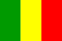
Flag description: This entry provides a written flag description produced from actual flags or the best information available at the time the entry was written. The flags of independent states are used by their dependencies unless there is an officially recognized local flag. Some disputed and other areas do not have flags. Flag description field listing
three equal vertical bands of green (hoist side), yellow, and red
note: uses the popular Pan-African colors of Ethiopia; the colors from left to right are the same as those of neighboring Senegal (which has an additional green central star) and the reverse of those on the flag of neighboring Guinea
National symbol(s): A national symbol is a faunal, floral, or other abstract representation - or some distinctive object - that over time has come to be closely identified with a country or entity. Not all countries have national symbols; a few countries have more than one. National symbol(s) field listing
Great Mosque of Djenne; national colors: green, yellow, red
National anthem: A generally patriotic musical composition - usually in the form of a song or hymn of praise - that evokes and eulogizes the history, traditions, or struggles of a nation or its people. National anthems can be officially recognized as a national song by a country's constitution or by an enacted law, or simply by tradition. Although most anthems contain lyrics, some do not. National anthem field listing
name: "Le Mali" (Mali)
lyrics/music: Seydou Badian KOUYATE/Banzoumana SISSOKO
note: adopted 1962; also known as "Pour L'Afrique et pour toi, Mali" (For Africa and for You, Mali) and "A ton appel Mali" (At Your Call, Mali)
Economy :: Mali
Economy - overview: This entry briefly describes the type of economy, including the degree of market orientation, the level of economic development, the most important natural resources, and the unique areas of specialization. It also characterizes major economic events and policy changes in the most recent 12 months and may include a statement about one or two key future macroeconomic trends. Economy - overview field listing
Among the 25 poorest countries in the world, landlocked Mali depends on gold mining and agricultural exports for revenue. The country's fiscal status fluctuates with gold and agricultural commodity prices and the harvest; cotton and gold exports make up around 80% of export earnings. Mali remains dependent on foreign aid.
Economic activity is largely confined to the riverine area irrigated by the Niger River; about 65% of Mali’s land area is desert or semidesert. About 10% of the population is nomadic and about 80% of the labor force is engaged in farming and fishing. Industrial activity is concentrated on processing farm commodities. The government subsidizes the production of cereals to decrease the country’s dependence on imported foodstuffs and to reduce its vulnerability to food price shocks.
Mali is developing its iron ore extraction industry to diversify foreign exchange earnings away from gold, but the pace will depend on global price trends. Although the political coup in 2012 slowed Mali’s growth, the economy has since bounced back, with GDP growth above 5% in 2014-17, although physical insecurity, high population growth, corruption, weak infrastructure, and low levels of human capital continue to constrain economic development. Higher rainfall helped to boost cotton output in 2017, and the country’s 2017 budget increased spending more than 10%, much of which was devoted to infrastructure and agriculture. Corruption and political turmoil are strong downside risks in 2018 and beyond.
GDP (purchasing power parity): This entry gives the gross domestic product (GDP) or value of all final goods and services produced within a nation in a given year. A nation's GDP at purchasing power parity (PPP) exchange rates is the sum value of all goods and services produced in the country valued at prices prevailing in the United States in the year noted. This is the measure most economists prefer when looking at per-capita welfare and when comparing living conditions or use of resources across countries. The measur . . . more GDP (purchasing power parity) field listing
$41.22 billion (2017 est.)
$39.1 billion (2016 est.)
$36.97 billion (2015 est.)
note: data are in 2017 dollars
country comparison to the world: 117
GDP (official exchange rate): This entry gives the gross domestic product (GDP) or value of all final goods and services produced within a nation in a given year. A nation's GDP at official exchange rates (OER) is the home-currency-denominated annual GDP figure divided by the bilateral average US exchange rate with that country in that year. The measure is simple to compute and gives a precise measure of the value of output. Many economists prefer this measure when gauging the economic power an economy maintains vis- . . . more GDP (official exchange rate) field listing
$15.37 billion (2017 est.)
GDP - real growth rate: This entry gives GDP growth on an annual basis adjusted for inflation and expressed as a percent. The growth rates are year-over-year, and not compounded. GDP - real growth rate field listing
5.4% (2017 est.)
5.8% (2016 est.)
6.2% (2015 est.)
country comparison to the world: 39
GDP - per capita (PPP): This entry shows GDP on a purchasing power parity basis divided by population as of 1 July for the same year. GDP - per capita (PPP) field listing
$2,200 (2017 est.)
$2,100 (2016 est.)
$2,100 (2015 est.)
note: data are in 2017 dollars
country comparison to the world: 206
Gross national saving: Gross national saving is derived by deducting final consumption expenditure (household plus government) from Gross national disposable income, and consists of personal saving, plus business saving (the sum of the capital consumption allowance and retained business profits), plus government saving (the excess of tax revenues over expenditures), but excludes foreign saving (the excess of imports of goods and services over exports). The figures are presented as a percent of GDP. A negative . . . more Gross national saving field listing
16.5% of GDP (2017 est.)
15.5% of GDP (2016 est.)
15.4% of GDP (2015 est.)
country comparison to the world: 126
GDP - composition, by end use: This entry shows who does the spending in an economy: consumers, businesses, government, and foreigners. The distribution gives the percentage contribution to total GDP of household consumption, government consumption, investment in fixed capital, investment in inventories, exports of goods and services, and imports of goods and services, and will total 100 percent of GDP if the data are complete. household consumption consists of expenditures by resident households, and by nonprofit insti . . . more GDP - composition, by end use field listing
household consumption: 82.9% (2017 est.)
government consumption: 17.4% (2017 est.)
investment in fixed capital: 19.3% (2017 est.)
investment in inventories: -0.7% (2017 est.)
exports of goods and services: 22.1% (2017 est.)
imports of goods and services: -41.1% (2017 est.)
GDP - composition, by sector of origin: This entry shows where production takes place in an economy. The distribution gives the percentage contribution of agriculture, industry, and services to total GDP, and will total 100 percent of GDP if the data are complete. Agriculture includes farming, fishing, and forestry. Industry includes mining, manufacturing, energy production, and construction. Services cover government activities, communications, transportation, finance, and all other private economic activities that do not prod . . . more GDP - composition, by sector of origin field listing
agriculture: 41.8% (2017 est.)
industry: 18.1% (2017 est.)
services: 40.5% (2017 est.)
Agriculture - products: This entry is an ordered listing of major crops and products starting with the most important. Agriculture - products field listing
cotton, millet, rice, corn, vegetables, peanuts; cattle, sheep, goats
Industries: This entry provides a rank ordering of industries starting with the largest by value of annual output. Industries field listing
food processing; construction; phosphate and gold mining
Industrial production growth rate: This entry gives the annual percentage increase in industrial production (includes manufacturing, mining, and construction). Industrial production growth rate field listing
6.3% (2017 est.)
country comparison to the world: 37
Labor force: This entry contains the total labor force figure. Labor force field listing
6.447 million (2017 est.)
country comparison to the world: 71
Labor force - by occupation: This entry lists the percentage distribution of the labor force by sector of occupation. Agriculture includes farming, fishing, and forestry. Industry includes mining, manufacturing, energy production, and construction. Services cover government activities, communications, transportation, finance, and all other economic activities that do not produce material goods. The distribution will total less than 100 percent if the data are incomplete and may range from 99-101 percent due to rounding. more Labor force - by occupation field listing
agriculture: 80%
industry and services: 20% (2005 est.)
Unemployment rate: This entry contains the percent of the labor force that is without jobs. Substantial underemployment might be noted. Unemployment rate field listing
7.9% (2017 est.)
7.8% (2016 est.)
country comparison to the world: 114
Population below poverty line: National estimates of the percentage of the population falling below the poverty line are based on surveys of sub-groups, with the results weighted by the number of people in each group. Definitions of poverty vary considerably among nations. For example, rich nations generally employ more generous standards of poverty than poor nations. Population below poverty line field listing
36.1% (2005 est.)
Household income or consumption by percentage share: Data on household income or consumption come from household surveys, the results adjusted for household size. Nations use different standards and procedures in collecting and adjusting the data. Surveys based on income will normally show a more unequal distribution than surveys based on consumption. The quality of surveys is improving with time, yet caution is still necessary in making inter-country comparisons. Household income or consumption by percentage share field listing
lowest 10%: 3.5%
highest 10%: 25.8% (2010 est.)
Budget: This entry includes revenues, expenditures, and capital expenditures. These figures are calculated on an exchange rate basis, i.e., not in purchasing power parity (PPP) terms. Budget field listing
revenues: 3.075 billion (2017 est.)
expenditures: 3.513 billion (2017 est.)
Taxes and other revenues: This entry records total taxes and other revenues received by the national government during the time period indicated, expressed as a percent of GDP. Taxes include personal and corporate income taxes, value added taxes, excise taxes, and tariffs. Other revenues include social contributions - such as payments for social security and hospital insurance - grants, and net revenues from public enterprises. Normalizing the data, by dividing total revenues by GDP, enables easy comparisons acr . . . more Taxes and other revenues field listing
20% (of GDP) (2017 est.)
country comparison to the world: 153
Budget surplus (+) or deficit (-): This entry records the difference between national government revenues and expenditures, expressed as a percent of GDP. A positive (+) number indicates that revenues exceeded expenditures (a budget surplus), while a negative (-) number indicates the reverse (a budget deficit). Normalizing the data, by dividing the budget balance by GDP, enables easy comparisons across countries and indicates whether a national government saves or borrows money. Countries with high budget deficits (relat . . . more Budget surplus (+) or deficit (-) field listing
-2.9% (of GDP) (2017 est.)
country comparison to the world: 128
Public debt: This entry records the cumulative total of all government borrowings less repayments that are denominated in a country's home currency. Public debt should not be confused with external debt, which reflects the foreign currency liabilities of both the private and public sector and must be financed out of foreign exchange earnings. Public debt field listing
35.4% of GDP (2017 est.)
36% of GDP (2016 est.)
country comparison to the world: 150
Fiscal year: This entry identifies the beginning and ending months for a country's accounting period of 12 months, which often is the calendar year but which may begin in any month. All yearly references are for the calendar year (CY) unless indicated as a noncalendar fiscal year (FY). Fiscal year field listing
calendar year
Inflation rate (consumer prices): This entry furnishes the annual percent change in consumer prices compared with the previous year's consumer prices. Inflation rate (consumer prices) field listing
1.8% (2017 est.)
-1.8% (2016 est.)
country comparison to the world: 94
Current account balance: This entry records a country's net trade in goods and services, plus net earnings from rents, interest, profits, and dividends, and net transfer payments (such as pension funds and worker remittances) to and from the rest of the world during the period specified. These figures are calculated on an exchange rate basis, i.e., not in purchasing power parity (PPP) terms. Current account balance field listing
-$886 million (2017 est.)
-$1.015 billion (2016 est.)
country comparison to the world: 138
Exports: This entry provides the total US dollar amount of merchandise exports on an f.o.b. (free on board) basis. These figures are calculated on an exchange rate basis, i.e., not in purchasing power parity (PPP) terms. Exports field listing
$3.06 billion (2017 est.)
$2.803 billion (2016 est.)
country comparison to the world: 129
Exports - partners: This entry provides a rank ordering of trading partners starting with the most important; it sometimes includes the percent of total dollar value. Exports - partners field listing
Switzerland 31.8%, UAE 15.4%, Burkina Faso 7.8%, Cote d'Ivoire 7.3%, South Africa 5%, Bangladesh 4.6% (2017)
Exports - commodities: This entry provides a listing of the highest-valued exported products; it sometimes includes the percent of total dollar value. Exports - commodities field listing
cotton, gold, livestock
Imports: This entry provides the total US dollar amount of merchandise imports on a c.i.f. (cost, insurance, and freight) or f.o.b. (free on board) basis. These figures are calculated on an exchange rate basis, i.e., not in purchasing power parity (PPP) terms. Imports field listing
$3.644 billion (2017 est.)
$3.403 billion (2016 est.)
country comparison to the world: 142
Imports - commodities: This entry provides a listing of the highest-valued imported products; it sometimes includes the percent of total dollar value. Imports - commodities field listing
petroleum, machinery and equipment, construction materials, foodstuffs, textiles
Imports - partners: This entry provides a rank ordering of trading partners starting with the most important; it sometimes includes the percent of total dollar value. Imports - partners field listing
Senegal 24.4%, China 13.2%, Cote d'Ivoire 9%, France 7.3% (2017)
Reserves of foreign exchange and gold: This entry gives the dollar value for the stock of all financial assets that are available to the central monetary authority for use in meeting a country's balance of payments needs as of the end-date of the period specified. This category includes not only foreign currency and gold, but also a country's holdings of Special Drawing Rights in the International Monetary Fund, and its reserve position in the Fund. Reserves of foreign exchange and gold field listing
$647.8 million (31 December 2017 est.)
$395.7 million (31 December 2016 est.)
country comparison to the world: 144
Debt - external: This entry gives the total public and private debt owed to nonresidents repayable in internationally accepted currencies, goods, or services. These figures are calculated on an exchange rate basis, i.e., not in purchasing power parity (PPP) terms. Debt - external field listing
$4.192 billion (31 December 2017 est.)
$3.981 billion (31 December 2016 est.)
country comparison to the world: 137
Exchange rates: This entry provides the average annual price of a country's monetary unit for the time period specified, expressed in units of local currency per US dollar, as determined by international market forces or by official fiat. The International Organization for Standardization (ISO) 4217 alphabetic currency code for the national medium of exchange is presented in parenthesis. Closing daily exchange rates are not presented in The World Factbook, but are used to convert stock values - e.g., the . . . more Exchange rates field listing
Communaute Financiere Africaine francs (XOF) per US dollar -
605.3 (2017 est.)
593.01 (2016 est.)
593.01 (2015 est.)
591.45 (2014 est.)
494.42 (2013 est.)
Energy :: Mali
Electricity access: This entry provides information on access to electricity. Electrification data – collected from industry reports, national surveys, and international sources – consists of four subfields. Population without electricity provides an estimate of the number of citizens that do not have access to electricity. Electrification – total population is the percent of a country’s total population with access to electricity, electrification – urban areas is the percent of a country’s urban population w . . . more Electricity access field listing
population without electricity: 11 million (2017)
electrification - total population: 35.1% (2016)
electrification - urban areas: 83.6% (2016)
electrification - rural areas: 1.8% (2016)
Electricity - production: This entry is the annual electricity generated expressed in kilowatt-hours. The discrepancy between the amount of electricity generated and/or imported and the amount consumed and/or exported is accounted for as loss in transmission and distribution. Electricity - production field listing
2.489 billion kWh (2016 est.)
country comparison to the world: 136
Electricity - consumption: This entry consists of total electricity generated annually plus imports and minus exports, expressed in kilowatt-hours. The discrepancy between the amount of electricity generated and/or imported and the amount consumed and/or exported is accounted for as loss in transmission and distribution. Electricity - consumption field listing
2.982 billion kWh (2016 est.)
country comparison to the world: 136
Electricity - exports: This entry is the total exported electricity in kilowatt-hours. Electricity - exports field listing
0 kWh (2016 est.)
country comparison to the world: 166
Electricity - imports: This entry is the total imported electricity in kilowatt-hours. Electricity - imports field listing
800 million kWh (2016 est.)
country comparison to the world: 73
Electricity - installed generating capacity: This entry is the total capacity of currently installed generators, expressed in kilowatts (kW), to produce electricity. A 10-kilowatt (kW) generator will produce 10 kilowatt hours (kWh) of electricity, if it runs continuously for one hour. Electricity - installed generating capacity field listing
590,000 kW (2016 est.)
country comparison to the world: 140
Electricity - from fossil fuels: This entry measures the capacity of plants that generate electricity by burning fossil fuels (such as coal, petroleum products, and natural gas), expressed as a share of the country's total generating capacity. Electricity - from fossil fuels field listing
68% of total installed capacity (2016 est.)
country comparison to the world: 113
Electricity - from nuclear fuels: This entry measures the capacity of plants that generate electricity through radioactive decay of nuclear fuel, expressed as a share of the country's total generating capacity. Electricity - from nuclear fuels field listing
0% of total installed capacity (2017 est.)
country comparison to the world: 138
Electricity - from hydroelectric plants: This entry measures the capacity of plants that generate electricity by water-driven turbines, expressed as a share of the country's total generating capacity. Electricity - from hydroelectric plants field listing
31% of total installed capacity (2017 est.)
country comparison to the world: 68
Electricity - from other renewable sources: This entry measures the capacity of plants that generate electricity by using renewable energy sources other than hydroelectric (including, for example, wind, waves, solar, and geothermal), expressed as a share of the country's total generating capacity. Electricity - from other renewable sources field listing
1% of total installed capacity (2017 est.)
country comparison to the world: 160
Crude oil - production: This entry is the total amount of crude oil produced, in barrels per day (bbl/day). Crude oil - production field listing
0 bbl/day (2018 est.)
country comparison to the world: 170
Crude oil - exports: This entry is the total amount of crude oil exported, in barrels per day (bbl/day). Crude oil - exports field listing
0 bbl/day (2015 est.)
country comparison to the world: 161
Crude oil - imports: This entry is the total amount of crude oil imported, in barrels per day (bbl/day). Crude oil - imports field listing
0 bbl/day (2015 est.)
country comparison to the world: 161
Crude oil - proved reserves: This entry is the stock of proved reserves of crude oil, in barrels (bbl). Proved reserves are those quantities of petroleum which, by analysis of geological and engineering data, can be estimated with a high degree of confidence to be commercially recoverable from a given date forward, from known reservoirs and under current economic conditions. Crude oil - proved reserves field listing
0 bbl (1 January 2018 est.)
country comparison to the world: 165
Refined petroleum products - production: This entry is the country's total output of refined petroleum products, in barrels per day (bbl/day). The discrepancy between the amount of refined petroleum products produced and/or imported and the amount consumed and/or exported is due to the omission of stock changes, refinery gains, and other complicating factors. Refined petroleum products - production field listing
0 bbl/day (2015 est.)
country comparison to the world: 173
Refined petroleum products - consumption: This entry is the country's total consumption of refined petroleum products, in barrels per day (bbl/day). The discrepancy between the amount of refined petroleum products produced and/or imported and the amount consumed and/or exported is due to the omission of stock changes, refinery gains, and other complicating factors. Refined petroleum products - consumption field listing
22,000 bbl/day (2016 est.)
country comparison to the world: 134
Refined petroleum products - exports: This entry is the country's total exports of refined petroleum products, in barrels per day (bbl/day). Refined petroleum products - exports field listing
0 bbl/day (2015 est.)
country comparison to the world: 178
Refined petroleum products - imports: This entry is the country's total imports of refined petroleum products, in barrels per day (bbl/day). Refined petroleum products - imports field listing
20,610 bbl/day (2015 est.)
country comparison to the world: 119
Natural gas - production: This entry is the total natural gas produced in cubic meters (cu m). The discrepancy between the amount of natural gas produced and/or imported and the amount consumed and/or exported is due to the omission of stock changes and other complicating factors. Natural gas - production field listing
0 cu m (2017 est.)
country comparison to the world: 166
Natural gas - consumption: This entry is the total natural gas consumed in cubic meters (cu m). The discrepancy between the amount of natural gas produced and/or imported and the amount consumed and/or exported is due to the omission of stock changes and other complicating factors. Natural gas - consumption field listing
0 cu m (2017 est.)
country comparison to the world: 172
Natural gas - exports: This entry is the total natural gas exported in cubic meters (cu m). Natural gas - exports field listing
0 cu m (2017 est.)
country comparison to the world: 147
Natural gas - imports: This entry is the total natural gas imported in cubic meters (cu m). Natural gas - imports field listing
0 cu m (2017 est.)
country comparison to the world: 154
Natural gas - proved reserves: This entry is the stock of proved reserves of natural gas in cubic meters (cu m). Proved reserves are those quantities of natural gas, which, by analysis of geological and engineering data, can be estimated with a high degree of confidence to be commercially recoverable from a given date forward, from known reservoirs and under current economic conditions. Natural gas - proved reserves field listing
0 cu m (1 January 2014 est.)
country comparison to the world: 167
Carbon dioxide emissions from consumption of energy: This entry is the total amount of carbon dioxide, measured in metric tons, released by burning fossil fuels in the process of producing and consuming energy. Carbon dioxide emissions from consumption of energy field listing
3.388 million Mt (2017 est.)
country comparison to the world: 143
Communications :: Mali
Telephones - fixed lines: This entry gives the total number of fixed telephone lines in use, as well as the number of subscriptions per 100 inhabitants. Telephones - fixed lines field listing
total subscriptions: 228,097
subscriptions per 100 inhabitants: 1 (2018 est.)
country comparison to the world: 123
Telephones - mobile cellular: This entry gives the total number of mobile cellular telephone subscribers, as well as the number of subscriptions per 100 inhabitants. Note that because of the ubiquity of mobile phone use in developed countries, the number of subscriptions per 100 inhabitants can exceed 100. Telephones - mobile cellular field listing
total subscriptions: 21,955,565
subscriptions per 100 inhabitants: 119 (2018 est.)
country comparison to the world: 54
Telecommunication systems: This entry includes a brief general assessment of the telecommunications system with details on the domestic and international components. The following terms and abbreviations are used throughout the entry: Arabsat - Arab Satellite Communications Organization (Riyadh, Saudi Arabia). Autodin - Automatic Digital Network (US Department of Defense). CB - citizen's band mobile radio communications. Cellular telephone system - the telephones in this system are radio transceivers, with each inst . . . more Telecommunication systems field listing
general assessment: telecoms infrastructure is barely adequate in most town and not available in many areas of the country; geography is a challenge for telecommunications; poverty, security, high illiteracy and low PC use has taken its toll; 4 mobile operators in market; mobile penetration high and potential for mobile broadband service; local plans for Internet Exchange Point; as Mali is landlocked there is hope that neighboring countries will allow use of international bandwidth; G5 Sahel countries adopt free roaming measures; Chinese company Huawei attempts to build a national backbone network but security issues make this difficult (2020)
domestic: fixed-line subscribership 1 per 100 persons; mobile-cellular subscribership has increased sharply to over 119 per 100 persons; increasing use of local radio loops to extend network coverage to remote areas (2018)
international: country code - 223; satellite communications center and fiber-optic links to neighboring countries; satellite earth stations - 2 Intelsat (1 Atlantic Ocean, 1 Indian Ocean)
the COVID-19 outbreak is negatively impacting telecommunications production and supply chains globally; consumer spending on telecom devices and services has also slowed due to the pandemic's effect on economies worldwide; overall progress towards improvements in all facets of the telecom industry - mobile, fixed-line, broadband, submarine cable and satellite - has moderated
Broadcast media: This entry provides information on the approximate number of public and private TV and radio stations in a country, as well as basic information on the availability of satellite and cable TV services. Broadcast media field listing
national public TV broadcaster; 2 privately owned companies provide subscription services to foreign multi-channel TV packages; national public radio broadcaster supplemented by a large number of privately owned and community broadcast stations; transmissions of multiple international broadcasters are available (2019)
Internet country code: This entry includes the two-letter codes maintained by the International Organization for Standardization (ISO) in the ISO 3166 Alpha-2 list and used by the Internet Assigned Numbers Authority (IANA) to establish country-coded top-level domains (ccTLDs). Internet country code field listing
.ml
Internet users: This entry gives the total number of individuals within a country who can access the Internet at home, via any device type (computer or mobile) and connection. The percent of population with Internet access (i.e., the penetration rate) helps gauge how widespread Internet use is within a country. Statistics vary from country to country and may include users who access the Internet at least several times a week to those who access it only once within a period of several months. Internet users field listing
total: 1,940,978
percent of population: 11.1% (July 2016 est.)
country comparison to the world: 114
Broadband - fixed subscriptions: This entry gives the total number of fixed-broadband subscriptions, as well as the number of subscriptions per 100 inhabitants. Fixed broadband is a physical wired connection to the Internet (e.g., coaxial cable, optical fiber) at speeds equal to or greater than 256 kilobits/second (256 kbit/s). Broadband - fixed subscriptions field listing
total: 120,934
subscriptions per 100 inhabitants: 1 less than 1 (2018 est.)
country comparison to the world: 119
Military and Security :: Mali
Military expenditures: This entry gives spending on defense programs for the most recent year available as a percent of gross domestic product (GDP); the GDP is calculated on an exchange rate basis, i.e., not in terms of purchasing power parity (PPP). For countries with no military forces, this figure can include expenditures on public security and police. Military expenditures field listing
2.7% of GDP (2019)
2.87% of GDP (2018)
3.01% of GDP (2017)
2.58% of GDP (2016)
2.36% of GDP (2015)
country comparison to the world: 34
Military and security forces: This entry lists the military and security forces subordinate to defense ministries or the equivalent (typically ground, naval, air, and marine forces), as well as those belonging to interior ministries or the equivalent (typically gendarmeries, border/coast guards, paramilitary police, and other internal security forces). Military and security forces field listing
Malian Armed Forces (FAMa): Army (Armee de Terre), Republic of Mali Air Force (Force Aerienne de la Republique du Mali, FARM); Gendarmerie; National Guard (Garde National du Mali) (2019)
note(s): the Gendarmerie comes under the control of the Ministry of Defense (MoD) for operations, but daily control is exercised by the Ministry of Internal Security and Civil Protection; the National Guard is also under the control of the MoD, but not formally part of the armed forces
Mali planned to establish a border guard force in 2019; the FAMa has conducted joint operations against Islamic extremist groups alongside pro-government militias, such as Plateforme des Mouvements du 14 Juin 2014 d’Alger (the Plateforme) and the Coordination of Azawad Movements (CMA)
Military service age and obligation: This entry gives the required ages for voluntary or conscript military service and the length of service obligation. Military service age and obligation field listing
18 years of age for selective compulsory and voluntary military service (men and women); 2-year conscript service obligation (2014)
Military - note: This entry includes miscellaneous military information of significance not included elsewhere. Military - note field listing
the United Nations Multidimensional Integrated Stabilization Mission in Mali (MINUSMA) has operated in the country since 2013; the Mission's responsibilities include providing security, rebuilding Malian security forces, supporting national political dialogue, and assisting in the reestablishment of Malian government authority; as of October 2019, MINUSMA had more than 16,000 military, police, and civilian personnel deployed (2019)
Transportation :: Mali
National air transport system: This entry includes four subfields describing the air transport system of a given country in terms of both structure and performance. The first subfield, number of registered air carriers, indicates the total number of air carriers registered with the country’s national aviation authority and issued an air operator certificate as required by the Convention on International Civil Aviation. The second subfield, inventory of registered aircraft operated by air carriers, lists the total number . . . more National air transport system field listing
number of registered air carriers: 1 (2015)
inventory of registered aircraft operated by air carriers: 2 (2015)
Civil aircraft registration country code prefix: This entry provides the one- or two-character alphanumeric code indicating the nationality of civil aircraft. Article 20 of the Convention on International Civil Aviation (Chicago Convention), signed in 1944, requires that all aircraft engaged in international air navigation bear appropriate nationality marks. The aircraft registration number consists of two parts: a prefix consisting of a one- or two-character alphanumeric code indicating nationality and a registration suffix of one to fi . . . more Civil aircraft registration country code prefix field listing
TZ, TT (2016)
Airports: This entry gives the total number of airports or airfields recognizable from the air. The runway(s) may be paved (concrete or asphalt surfaces) or unpaved (grass, earth, sand, or gravel surfaces) and may include closed or abandoned installations. Airports or airfields that are no longer recognizable (overgrown, no facilities, etc.) are not included. Note that not all airports have accommodations for refueling, maintenance, or air traffic control. Airports field listing
25 (2013)
country comparison to the world: 128
Airports - with paved runways: This entry gives the total number of airports with paved runways (concrete or asphalt surfaces) by length. For airports with more than one runway, only the longest runway is included according to the following five groups - (1) over 3,047 m (over 10,000 ft), (2) 2,438 to 3,047 m (8,000 to 10,000 ft), (3) 1,524 to 2,437 m (5,000 to 8,000 ft), (4) 914 to 1,523 m (3,000 to 5,000 ft), and (5) under 914 m (under 3,000 ft). Only airports with usable runways are included in this listing. Not all . . . more Airports - with paved runways field listing
total: 8 (2019)
over 3,047 m: 1
2,438 to 3,047 m: 4
1,524 to 2,437 m: 2
914 to 1,523 m: 1
Airports - with unpaved runways: This entry gives the total number of airports with unpaved runways (grass, dirt, sand, or gravel surfaces) by length. For airports with more than one runway, only the longest runway is included according to the following five groups - (1) over 3,047 m (over 10,000 ft), (2) 2,438 to 3,047 m (8,000 to 10,000 ft), (3) 1,524 to 2,437 m (5,000 to 8,000 ft), (4) 914 to 1,523 m (3,000 to 5,000 ft), and (5) under 914 m (under 3,000 ft). Only airports with usable runways are included in this listin . . . more Airports - with unpaved runways field listing
total: 17 (2013)
1,524 to 2,437 m: 3 (2013)
914 to 1,523 m: 9 (2013)
under 914 m: 5 (2013)
Heliports: This entry gives the total number of heliports with hard-surface runways, helipads, or landing areas that support routine sustained helicopter operations exclusively and have support facilities including one or more of the following facilities: lighting, fuel, passenger handling, or maintenance. It includes former airports used exclusively for helicopter operations but excludes heliports limited to day operations and natural clearings that could support helicopter landings and takeoffs. Heliports field listing
2 (2013)
Railways: This entry states the total route length of the railway network and of its component parts by gauge, which is the measure of the distance between the inner sides of the load-bearing rails. The four typical types of gauges are: broad, standard, narrow, and dual. Other gauges are listed under note. Some 60% of the world's railways use the standard gauge of 1.4 m (4.7 ft). Gauges vary by country and sometimes within countries. The choice of gauge during initial construction was mainly in resp . . . more Railways field listing
total: 593 km (2014)
narrow gauge: 593 km 1.000-m gauge (2014)
country comparison to the world: 110
Roadways: This entry gives the total length of the road network and includes the length of the paved and unpaved portions. Roadways field listing
total: 139,107 km (2018)
country comparison to the world: 38
Waterways: This entry gives the total length of navigable rivers, canals, and other inland bodies of water. Waterways field listing
1,800 km (downstream of Koulikoro; low water levels on the River Niger cause problems in dry years; in the months before the rainy season the river is not navigable by commercial vessels) (2011)
country comparison to the world: 43
Ports and terminals: This entry lists major ports and terminals primarily on the basis of the amount of cargo tonnage shipped through the facilities on an annual basis. In some instances, the number of containers handled or ship visits were also considered. Most ports service multiple classes of vessels including bulk carriers (dry and liquid), break bulk cargoes (goods loaded individually in bags, boxes, crates, or drums; sometimes palletized), containers, roll-on/roll-off, and passenger ships. The listing le . . . more Ports and terminals field listing
river port(s): Koulikoro (Niger)
Terrorism :: Mali
Terrorist groups - home based: This entry provides information on the US State Department's designated Foreign Terrorist Organizations headquartered in a specific country, which may or may not be a group's country of origin. Details on each organization's aim(s) and area(s) of operation are provided. Terrorist groups - home based field listing
al-Mulathamun Battalion: aim(s): implement ISIS's strict interpretation of Sharia; replace the Malian Government with an Islamic state
area(s) of operation: headquartered in the north; targets primarily international interests, especially Westerners and Western entities
(2018)
al-Qa'ida-affiliated Jama'at Nusrat al-Islam wal-Muslimin (JNIM): aim(s): establish an Islamic state centered in Mali
area(s) of operation: primarily based in northern and central Mali; targets Western and local interests in West Africa and Sahel; has claimed responsibility for attacks in Mali, Niger and Burkina Faso
note: pledged allegiance to al-Qa'ida and AQIM; holds Western hostages; wages attacks against security and peacekeeping forces in Mali ( 2018)
Islamic State of Iraq and ash-sham networks in the Greater Sahara (ISGS): aim(s): replace regional governments with an Islamic state
area(s) of operation: mostly concentrated along the Mali-Niger border region; targets primarily security forces (2018)
Transnational Issues :: Mali
Disputes - international: This entry includes a wide variety of situations that range from traditional bilateral boundary disputes to unilateral claims of one sort or another. Information regarding disputes over international terrestrial and maritime boundaries has been reviewed by the US Department of State. References to other situations involving borders or frontiers may also be included, such as resource disputes, geopolitical questions, or irredentist issues; however, inclusion does not necessarily constitute . . . more Disputes - international field listing
demarcation is underway with Burkina Faso
Refugees and internally displaced persons: This entry includes those persons residing in a country as refugees, internally displaced persons (IDPs), or stateless persons. Each country's refugee entry includes only countries of origin that are the source of refugee populations of 5,000 or more. The definition of a refugee according to a UN Convention is "a person who is outside his/her country of nationality or habitual residence; has a well-founded fear of persecution because of his/her race, religion, nationality, membership in a . . . more Refugees and internally displaced persons field listing
refugees (country of origin): 15,319 (Mauritania), 8,457 (Burkina Faso) (2019)
IDPs: 199,385 (Tuareg rebellion since 2012) (2019)
Trafficking in persons: Trafficking in persons is modern-day slavery, involving victims who are forced, defrauded, or coerced into labor or sexual exploitation. The International Labor Organization (ILO), the UN agency charged with addressing labor standards, employment, and social protection issues, estimated in 2011 that 20.9 million people worldwide were victims of forced labor, bonded labor, forced child labor, sexual servitude, and involuntary servitude. Human trafficking is a multi-dimensional threat, depri . . . more Trafficking in persons field listing
current situation: Mali is a source, transit, and destination country for men, women, and children subjected to forced labor and sex trafficking; internal trafficking is more prevalent than transnational trafficking, but foreign women and girls are forced into domestic servitude, agricultural labor, and support roles in gold mines, as well as subjected to sex trafficking; Malian boys are forced to work in agricultural settings, gold mines, the informal commercial sector and to beg within Mali and neighboring countries; Malians and other Africans who travel through Mali to Mauritania, Algeria, or Libya in hopes of reaching Europe are particularly at risk of becoming victims of human trafficking; men and boys, primarily of Songhai ethnicity, are subjected to debt bondage in the salt mines of Taoudenni in northern Mali; some members of Mali's Tamachek community are subjected to hereditary slavery-related practices; Malian women and girls are victims of sex trafficking in Gabon, Libya, Lebanon, and Tunisia; the recruitment of child soldiers by armed groups in northern Mali decreased
tier rating: Tier 2 Watch List - Mali does not fully comply with the minimum standards for the elimination of trafficking; however, it is making significant efforts to do so; in 2014, Mali was granted a waiver from an otherwise required downgrade to Tier 3 because its government has a written plan that, if implemented would constitute making significant efforts to bring itself into compliance with the minimum standards for the elimination of trafficking; officials failed to distribute the 2012 anti-trafficking law to judicial and law enforcement personnel, perpetuating a lack of understanding and awareness of the legislation; anti-trafficking law enforcement efforts decreased in 2014, with only one case investigated and no prosecutions or convictions; fewer victims were identified, and the government did not support the privately funded NGOs and international organizations it relied upon to provide victims with services; the government did not conduct any awareness-raising campaigns, workshops, or training sessions (2015)
