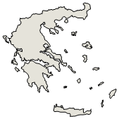
Administrative Region : Epirus
Regional unit : Arta
Vigla (Βίγλα) Arta
Vigla, according to the Kapodistrias Plan, was a Municipal District of the Municipality of Amvrakikos and a former community. The law was in force until the end of 2010, when it was replaced by the new administrative division provided for by the Kallikratis Plan, which was published in the Government Gazette 87/issue A'/2010, as a result of which Vigla was incorporated into the Municipality of Arta and today constitutes a Local Community of the Municipal Unit of Amvrakikos of the enlarged municipality.
Etymology
Vigla took its name from the word vigla, which means observatory. Even today in Mavrovouni one can observe the ruins of the observatories that existed in the area.
Location and Access
Vigla is located on the southwestern edge of the prefecture of Arta, at the foot of Mavrovouni (329 m. a.s.l.). It is located within the Amvrakikos wetland, which is one of the largest in Greece and the most important Ramsar (Natura 2000) at a European and global level[1]. It is connected by road to Arta via the Amvrakikos road (14.5 km). It is also connected to Preveza via the Petra bridge (which is located on the Arta-Preveza National Road at 15 km) and after passing through Petra and Strongyli (40 km from Preveza). It is also connected to Ioannina via the Kalogirou bridge (which is located on the Arta-Ioannina National Road at 11 km) and after passing through Polydrosso and taking the Pasha road to the Kalogirou bridge (76 km from Ioannina).
Nearest Ports in the Amvrakikos Gulf: 1. Preveza (with all facilities) 2. Menidi (only pier) 3. Salaora (only pier) 4. Koronisia (with all facilities except electricity)
Connection with surrounding villages:
North to Polydrosso 1.5 km
South to Koronisia 13.5 km
West to Strongyli 10 km
Nearest Airports: 1. Aktio-Preveza 2. Ioannina
Demographic data
Today the population amounts to 382 permanent residents (2011 census),[2] showing a decrease compared to the 2001 census, where the population amounted to 405 residents.[3]
Historical data
Based on the work of Konstantinos Diamantis entitled "Arta and its surroundings during the times of the revolution", Vigla was a small settlement of 10 families at the time of the outbreak of the Greek Revolution of 1821.[5]
Vigla is mentioned in the "Historical Essay on Arti and Preveza" by Seraphim Xenopoulos of Byzantium (Metropolitan of Arti) published in 1884: Privately owned village of the Monastery of Rodia with 12 families, Church of Saint Nicholas renovated in 1873 and inaugurated on July 7, 1875. The same essay states that the Monastery of Rodia was built in 970 AD, during the Empire of John Tzimiskes and Patriarch of Constantinople Basil, and during the Turkish occupation until 1800 it had numerous estates, as various surviving Ottoman documents state. In Vigla around 1845 there was a literacy school with one teacher and 10 students. Religion, history, brief geography and arithmetic were taught.
In 1910, the Metropolis of Nikopolis and Preveza published the census data that it carried out that same year in the entire ecclesiastical region and informed us that Vigla was part of the Louros department and that 110 people lived in the village.[6]
Economy and products
Oranges, tangerines, lemons, oil, clover as animal feed, corn, wheat are produced in Vigla. Chickens, pigs, cattle and sheep and goats are raised. Fish such as sea bass, sole, mullet, sea bream and eels are caught. It has the Vigla pumping station, to keep the swamp drained, which was drained by Dutch technicians in the 1950s. Two associations are active in Vigla, one Cultural-Cultural and one Pontic.
Sights
Panagia tis Rodias: The church is located on the banks of the homonymous lagoon of Amvrakikos, very close to the village. The current church was built on the ruins of an older church, which was demolished in 1860 and is dedicated to the Assumption of the Virgin Mary. The original date of construction of the church remains unknown, but according to information from the Metropolitan of Arta, Seraphim Xenopoulos, a stauropegian monastery was founded on the site of the current church in 970 AD. According to sources, the current church and the lagoon took their name from "Rodon the Amaranth", the name by which the icon of the Virgin Mary in the original church was known. Inside the church there are frescoes that are preserved in very good condition.[7]
The Cave of Agios Vlasios: It is located in Mavrovouni, very close to the monastery of Panagia tis Rodia and according to tradition, Agios Vlasios, bishop of Sebastia, became a monk.[8]
The Church of Agios Nikolaos on the mountain
The old stone school
The dragon hole (cave with stalactites-stalagmites)
The Lagoons of Rodia-Agios Georgios-Tsoukalio
The "Children's House" with the women's cooperative of weavers and traditional costumes.
Church of the New Martyr Saint Nicholas in Vounenois (newly built)
Birdwatching sites. One in the area of Agios Georgios and one in the lagoon of Agios Georgios
Church of Agia Anna, floating in the lagoon of Constantio next to the lagoon of Rodia. Access only by boat.
The new Vigla bridge (passes over 5 drainage ditches and with the intermediate sections is 2.2 km long.
The Vigla pumping station
The Ivaria in the lagoons
Important people
Antonis Nikopolides, footballer.[9]
Efstratiou Klearchos son of Ioannis (1916-1991), Sergeant of the 3'40th Infantry Regiment, hero of the Greco-Italian War of 1940-1941, as mentioned in the book by Anth/Lgs Papavassiliou War Diary. He was injured in the Battle of Male Spat, promoted to the rank of Sergeant in the Anthragathia. He was born in Vigla, Arta.
References
Ramsar Convention
Greek census 2011.[1] Archived 2013-12-25 at the Wayback Machine.
Population Census of 18 March 2001, Hellenic Statistical Authority (EL.STAT.).[2] Archived 2015-06-28 at the Wayback Machine.
"National Statistical Service of Greece Archives - N.S.Y.E". Archived from the original on 18 July 2012. Retrieved 11 February 2013.
Arta and its surroundings during the times of the revolution, Skoufas Magazine/ Year 5/ 1960 – Volume 2 p.266
The late Giannio Pasaliki: space, administration and population in Turkish-occupied Epirus (1820-1913), Michalis Kokolakis, p.492 [3]
The Virgin Mary of Rodia ( Vigla )
Ai-Vlasi Caves.[4] Archived 2012-02-06 at the Wayback Machine.
The life stories of Antonis Nikopolidis
Municipal unit Amvrakikos |
---|
Community Aneza |
Aneza (Ανέζα, η) |
Apomero (Απόμερο, το) |
Mytikas (Μύτικας, ο) |
Community Vigla |
Vigla (Βίγλα, η) |
Community Gavria |
Gavria (Γαβριά, η) |
Community Kalogeriko |
Kalogeriko (Καλογερικό, το) |
Community Koronisia |
Koronisia (Κορωνησία, η) |
Community Polydroso |
Palaioskamia (Παλαιοσκαμιά, η) |
Polydroso (Πολύδροσο, το) |
Community Rachi |
Rachi (Ράχη, η) |
Community Strongyli |
Strongyli (Στρογγυλή, η) |
Community Psathotopi |
Psathotopi (Ψαθοτόπιον, το) |
Greece :
A - B - C - D - E - F - G - H - I - J - K - L - M -
N - O - P - Q - R - S - T - U - V - W - X - Y - Z
Retrieved from "http://en.wikipedia.org/"
All text is available under the terms of the GNU Free Documentation License
Ancient Greece
Science, Technology , Medicine , Warfare, , Biographies , Life , Cities/Places/Maps , Arts , Literature , Philosophy ,Olympics, Mythology , History , Images Medieval Greece / Byzantine Empire Science, Technology, Arts, , Warfare , Literature, Biographies, Icons, History Modern Greece Cities, Islands, Regions, Fauna/Flora ,Biographies , History , Warfare, Science/Technology, Literature, Music , Arts , Film/Actors , Sport , Fashion --- |