

.
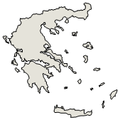
Administrative Region : Ionian Islands
Regional unit : Kefalonia
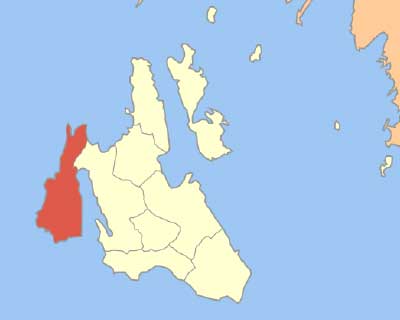
Mantzavinata (Greek: Μαντζαβινάτα) is a village in the southwest of Kefalonia, Greece, where the famous Mantzavino Vine is sold. Mantzavinata is 4 km southwest of Lixouri on the peninsula Paliki. Mantzavinata has three churches and a small square (plateia) called Lemonata. In Mantzavinata takes place the famous wine festival in August.
Geography
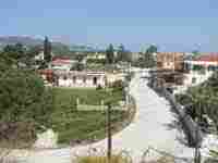
The area around Mantzavinata are surrounded by hills and features groves. Farmlands are around the area which makes agriculture the main industry in Mantzavinata while tourism dominates the beach area. The islet of Vardiani can be seen to the south as well as Akrotiri and the western part of Livathos and western Argostoli and Mount Aenos and its nearest mountains in the rest of the island.
History
The Maspali hill was maybe an ancient acropolis. At Vazza, a Roman mosaic was found and is displayed today at the Archaeological Museum of Kefalonia.
Until the 1940s, Mantzavinata was an important centre of wine and raisin producers. World war II and the complete destruction of the village in the August 1953 earthquake increased emigration. It took until the mid-1950s to rebuilt the village, electricity and communications later arrived in the 1960s. The community of Katogi (Κατωγή) had its seat in Matzaviata.
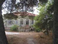
The former farmland around Mantzavinata is popular for house building because of its beautiful landscape and view. Today many families built also their new homes outside of the center near to the beaches Xi and Mania. This new settlement is called after the cape Akrotiri and is also known as Kounopetra.
Name
The name Mantzavinata comes from the Italian words mangiare (eat) and vino (wine), -ata is the typical ending for places in Kefalonia. Mantzavinata had several persons with the surname Mantzaviatos, one of them founded a subdivision in Patras and is known as Mantzavineika, another the Mantzavinateio Hospital in Lixouri.
Subdivisions
Kounopetra, southwest (not listed since there is no municipal offices)
Vardianoi, former Guardiani. Islet south of Kounoupetra owned by the Kipouria monastery
Nearest places
These nearest places are ordered clockwise:
Vouni, west (distance: approximately 1 km)
Soulari, northeast (distance:L approximately 1 km)
Xi beach, south (distance: approximately 1 km)
Kounopetra, southwest (distance: approximately 4 km)
Population
Year Population
1981 309
1991 269
2001 249
| Ancient Greece
Science, Technology , Medicine , Warfare, , Biographies , Life , Cities/Places/Maps , Arts , Literature , Philosophy ,Olympics, Mythology , History , Images Medieval Greece / Byzantine Empire Science, Technology, Arts, , Warfare , Literature, Biographies, Icons, History Modern Greece Cities, Islands, Regions, Fauna/Flora ,Biographies , History , Warfare, Science/Technology, Literature, Music , Arts , Film/Actors , Sport , Fashion --- |
Retrieved from "http://en.wikipedia.org/"
All text is available under the terms of the GNU Free Documentation License
