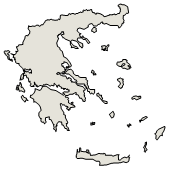

Administrative Region : Crete
Regional unit : Lasithi
Exo Mouliana (Έξω Μουλιανά) Lasithi
The village of Exo Mouliana [1] belongs to the Municipality of Sitia and is located on the road that connects Sitia with Agios Nikolaos and Heraklion. It is built at an altitude of 380 meters. It has 247 inhabitants according to the 2011 census.
Historical data
The history of the village dates back to Byzantine times. Locations called Saracina refer to the conquest of Crete by the Saracens in the 8th and 9th centuries AD. The years of Venetian rule follow with the possible naming of the village by the Mouliani brothers who gave the name to Mesa and Exo Mouliana [a reference is pending]. Another version suggested by Xanthoudidis and followed by Michael Katapotis is the name Mouliana comes from the verb myllo - moullono, which means kypto, slope, because the settlement is located at the bottom of the mountain. [2] In the Venetian census of the 16th century it is referred to as San Zorzi Mouliana, which is due to the church of St. George. In the census of Kastrofylakas in 1583 it had 261 inhabitants (K139). In the Turkish census of 1671 it is referred to as Ayo Yorki Molyana, with 7 excavations. In the Egyptian census of 1834 it is referred to as Kato or Pera Mouliana, with 60 Christian and 8 Turkish families. The 1881 census mentions Oxo Mouliana, with 570 Christians and 108 Muslim residents. [2] During the 1940s it had close to 1000 inhabitants and 120 students in the Primary School which has now been abolished and functions as a cultural and educational center.
The course of the population according to the censuses: [2]
Census 1900 1920 1928 1940 1951 1961 1971 1981 1991 1991 2001 2011
Population 646 790 788 908 823 731 598 508 525 356 247
Sights
In the village inside, the oldest Byzantine church of Agios Georgios in Pano Chorio is preserved with Byzantine icons and inscriptions of the 15th century. The patron saint used to give the name of the village and the inhabitants as Agiorgites. In Pano Chorio, Venetian buildings are also preserved, which due to their good construction were used as a water supply tank of the village after the first drilling in the 50's. A Turkish fountain is also preserved at the site of Gournia with an Arabic inscription which has unfortunately been destroyed. There is also a Latin inscription in Agia Marina in Kato Chorio. According to the stories of the older inhabitants in Exo Mouliana, there was a significant number of inhabitants of Turkish origin. In the village square, called Platia Strata, there were minarets that were demolished after the extermination of the Turks by the Kritsos warlords. The church of Agios Georgios dominates in Kato Chorio.
In the area of the village is the area of Lachanas with the famous stone bridge. From this point begins the descent to the waterfalls of Richtis through a ravine of special natural beauty. The route lasts 3 hours and ends at the waterfalls and the coast of Richtis. The visitor of the village also has access to the beach of Richtis by car.
Economy
The village has a very large agricultural and livestock area that extends from Kefala to Richtis on the northern coastline of Crete. Today it produces an average of 250 tons of olive oil per year. It used to produce wine and raisins, but now the production of raki remains.
References
http://www.exomouliana.gr
Spanakis, Stergios (1993). Cities and villages of Crete over the centuries, volume V. Heraklion: Graphic Arts G. Detorakis. p. 555.
Greece :
A - B - C - D - E - F - G - H - I - J - K - L - M -
N - O - P - Q - R - S - T - U - V - W - X - Y - Z
Retrieved from "http://en.wikipedia.org/"
All text is available under the terms of the GNU Free Documentation License
| Ancient Greece
Science, Technology , Medicine , Warfare, , Biographies , Life , Cities/Places/Maps , Arts , Literature , Philosophy ,Olympics, Mythology , History , Images Medieval Greece / Byzantine Empire Science, Technology, Arts, , Warfare , Literature, Biographies, Icons, History Modern Greece Cities, Islands, Regions, Fauna/Flora ,Biographies , History , Warfare, Science/Technology, Literature, Music , Arts , Film/Actors , Sport , Fashion --- |

