

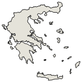

Administrative Region : Thessaly
Regional unit : Karditsa
Drosato (Δροσάτο) Karditsa
Drosato is a settlement in Thessaly in the Regional Unit of Karditsa.[2][3]
Geographical - Historical information
Drosato is located towards the border with the Regional Unit of Arta, on the southern slopes of Mount Karavas at an altitude of 960 meters[4]. It is approximately 60 km. W.-SW. from Karditsa and 30 km. SE. from Anthiro (seat of the municipality) while to the south passes the Platanias (or Petriliotis) stream. Its name is due to the abundant waters of the Goura spring. The few residents (more in the summer) are mainly pensioners while some others are engaged in livestock farming, using stone huts that exist in the "Monoplati" pastures.[3]
Drosato is believed to be a settlement of the late Byzantine era, i.e. it existed before the Ottoman invasion of Western Thessaly (1395/1396). It is mentioned in the Ottoman census of 1454/1455 as Mujlo, being the timario of Hidzir and Muhamedi, who owned it indivisible (they cultivated cereals, maintained vineyards and walnut trees, and raised sheep).[3]
Sights
The church of Agios Athanasios is considered a sight, which has been classified as a historical monument, because "it is a typical example of ecclesiastical architecture of the 18th century in the area. It is a stone-built three-nave, vaulted church with a cross-roofed arch and dome. Inside, the church is recorded with frescoes that date from an inscription to 1737. On the iconostasis are adapted icons of the 18th century."[5]
Southeast, in the direction of the village of Rossi and Petrilo, just before the Vlasiotis torrent ends in Platanias, there is a single-arch bridge (of Drosatos or Mezilos) which has been classified as a historical monument, because "it is a representative example of a domed construction made of adobe in the area"[6][7]
Administrative - Demographic data
It is officially mentioned, after the integration of Thessaly, in 1883 with its old name Mezilo or Mezilo[8] in the Government Gazette 126A - 02/04/1883 to be annexed to the municipality of Argithea. In 1957 with the Government Gazette 119A - 03/07/1957 it was renamed Drosato.[9] According to the "Kallikratis" Program, it constitutes the community of Drosato which falls under the municipal unit of Eastern Argithea of the Municipality of Argithea, while according to the 2011 census, 42 residents were registered.[10]
The population censuses after World War II are:
Census 1951 1961 1971 1981 1991 2001 2011
Population 142[11] 118[12] 69[13] 13[14] 46[15] 106[16] 42
References
GEOnet Names Server. June 11, 2018. -816727.
Papyrus Encyclopedia Britannica. 21. Papyrus Publishing House. 1996. p. 342.
«Drosato». Municipality of Argithea, Karditsa. Retrieved November 19, 2022.
«Destination DROSATO (Village) KARDITSA - Greek Travel Pages». www.gtp.gr. Retrieved November 19, 2022.
«PERMANENT LIST OF DECLARED ARCHAEOLOGICAL PLACES AND MONUMENTS". listedmonuments.culture.gr. Retrieved November 19, 2022.[dead link]
"Arched Bridges". e-argithea.gr. Archived from the original on October 7, 2022. Retrieved November 19, 2022.
"PERMANENT LIST OF DECLARED ARCHAEOLOGICAL SITES AND MONUMENTS / Bridge of Drosato (Mezilos)". listedmonuments.culture.gr. Retrieved November 19, 2022.[dead link]
"The gold book of Argithea - p. 16 of pdf" (PDF).
"EETAA-Administrative Changes to Settlements". www.eetaa.gr. Retrieved November 19, 2022.
"Official Gazette of the results of the PERMANENT population Archived 2017-11-24 at the Wayback Machine, p. 10607 (p. 133 of pdf)
Population of Greece at the census of 7 March 1951, p. 97 of pdf. Archived from the original on 2013-05-14.
Population of Greece at the census of 19 March 1961, p. 96.
Population of Greece at the census of 14 March 1971, p. 95 of pdf. Archived from the original on 2013-05-14. Retrieved 2022-09-11.
Actual population of Greece at the census of 5 April 1981, p. 106 of pdf.
Actual population of Greece according to the census of March 17, 1991, p. 123 of the pdf.
Actual population of Greece - Census 2001, p. 128 of the pdf.
Greece :
A - B - C - D - E - F - G - H - I - J - K - L - M -
N - O - P - Q - R - S - T - U - V - W - X - Y - Z
Retrieved from "http://en.wikipedia.org/"
All text is available under the terms of the GNU Free Documentation License
| Ancient Greece
Science, Technology , Medicine , Warfare, , Biographies , Life , Cities/Places/Maps , Arts , Literature , Philosophy ,Olympics, Mythology , History , Images Medieval Greece / Byzantine Empire Science, Technology, Arts, , Warfare , Literature, Biographies, Icons, History Modern Greece Cities, Islands, Regions, Fauna/Flora ,Biographies , History , Warfare, Science/Technology, Literature, Music , Arts , Film/Actors , Sport , Fashion --- |

