
.
ACROSS COVETED LANDS
OR
A JOURNEY FROM FLUSHING (HOLLAND) TO CALCUTTA, OVERLAND
BY
A. HENRY SAVAGE LANDOR
WITH 175 ILLUSTRATIONS, DIAGRAMS, PLANS AND MAPS
BY AUTHOR
IN TWO VOLUMES
VOL. II
London
MACMILLAN AND CO., Limited
1902
All rights reserved
 |
 |
| Mahommed Hussein. | Sadek. |
| (Author's Servants.) | |
[iv]
Richard Clay and Sons, Limited,
london and bungay
[v]
LIST OF ILLUSTRATIONS
| To face page | |
| Mahommed Hussein and Sadek (Author's Servants) | Frontispiece |
| Kerman and Zeris, the two Kittens who accompanied Author on his wanderings | 6 |
| Author's Caravan and Others Halting in the Desert | 20 |
| Author's Caravan in the Salt Desert | 26 |
| Ali Murat Making Bread | 26 |
| Wolves in Camp | 34 |
| Author's Camel Men in their White Felt Coats | 38 |
| Camel Men saying their Prayers at Sunset | 38 |
| Author's Camels being Fed in the Desert | 48 |
| The Trail we left behind in the Salt Desert | 54 |
| Author's Caravan Descending into River Bed near Darband | 58 |
| Rock Habitations, Naiband | 58 |
| The Village of Naiband, and Rock Dwellings in the Cliff | 60 |
| Young Men of an Oasis in the Desert | 64 |
| Man and Child of the Desert | 64 |
| Naiband Barber Stropping a Razor on his Leg | 68 |
| A Woman of Naiband | 68 |
| Fever Stricken Man at Fedeshk | 86 |
| The Citadel, Birjand | 86 |
| The City of Birjand, showing main street and river bed combined | 90 |
| Women Visiting Graves of Relatives, Birjand. (Ruined Fort can be observed on Hill.) | 110 |
| In the Desert. (Tamarisks in the Foreground.) | 118 |
| Women at Bandan | 142 |
| Dr. Golam Jelami and his Patients | 142[vi] |
| The Main Street, Sher-i-Nasrya (Showing centre of City) | 144 |
| The British Bazar (Husseinabad), Sistan | 150 |
| The Wall of Sher-i-Nasrya at Sunset | 156 |
| The Sar-tip | 162 |
| The Customs Caravanserai, Sher-i-Nasrya, Sistan (Belgian Customs Officer in foreground) | 166 |
| The Sistan Consulate on Christmas Day, 1901 | 174 |
| Major R. E. Benn, British Consul for Sistan, and his Escort of 7th Bombay Lancers | 186 |
| The Citadel of Zaidan, the Great City | 202 |
| The Zaidan West Towers and Modern Village | 204 |
| Towers of the Citadel, Zaidan | 206 |
| S.E. Portion of Zaidan City, showing how it disappears under distant sand accumulations | 208 |
| Double Wall and Circular Unroofed Structures, Zaidan. In the distance high sand accumulations above City | 208 |
| Interior of Zaidan Fortress | 212 |
| Graveyard of Zaidan City | 212 |
| East View of the Zaidan Citadel | 214 |
| The Figure we dug out at Zaidan | 218 |
| Arabic Inscription and marble columns with earthenware lamps upon them. Fragment of water-pipe. Stone implements. Brick wall of the "Tombs of Forty Saints" showing in top corners of photograph. |
218 |
| Arabic Inscription on Marble dug by Author at the City of Zaidan | 220 |
| Transfer of Inscription dated 1282, found in the "Tomb of Forty Saints," Zaidan | 222 |
| Transfer of Ornament above four lines of Koran on Grave Stone | 222 |
| Transfer of Ornamentations on Marble Grave | 222 |
| Presumed Summits of Towers buried in Sand, Zaidan (Notice top of Castellated Wall behind.) | 222 |
| Sketch Plan of Zaidan Citadel, by A. Henry Savage Landor | 228 |
| Sketch Map of Summit of Kuh-i-Kwajah, by A. Henry Savage Landor | 238 |
| Dead Houses and Ziarat on Kuh-i-Kwajah | 240[vii] |
| A Family Tomb (Eight Compartments) on Kuh-i-Kwajah | 240 |
| Kala-i-Kakaha, the "City of Roars of Laughter" | 242 |
| The "Gandun Piran" Ziarat on Kuh-i-Kwajah | 242 |
| A Bird's Eye View of Kala-i-Kakaha, the "City of Roars of Laughter" | 246 |
| Sher-i-Rustam. (Rustam's City) | 260 |
| The Stable of Rustam's Legendary Horse | 260 |
| The Gate of Rustam's City, as seen from Rustam's House | 262 |
| The Remains of the Two Upper Storeys of Rustam's House | 266 |
| Rustam's City, showing Rustam's House in Citadel, also domed roofs blown in from the north | 268 |
| Plan of Sher-i-Rustam | 270 |
| View of Sher-i-Rustam from Rustam's House. (West portion of City under the lee of wall) | 272 |
| View of Sher-i-Rustam from Rustam's House (South-east section of City) | 274 |
| Saïd Khan, Duffadar and Levies at the Perso-Beluch Frontier Post of Robat | 294 |
| Beluch Musicians (at Sibi) | 298 |
| Beluch Dance (at Sibi) | 304 |
| The Beluch-Afghan Boundary Cairn and Malek-Siah Mountains in Background | 306 |
| Rest House at Mahommed Raza Chah overlooking Afghan Desert | 310 |
| Beluch Black Tents at Mahommed Raza Chah | 314 |
| Rock Pillar between Kirtaka and Saindak | 314 |
| Sand Hills | 318 |
| A Caravan of Donkeys in Afghanistan | 320 |
| In Afghanistan. Who are you? | 322 |
| In the Afghan Desert. Afghan Caravan Men | 322 |
| The Thana and New Bungalow at Saindak. (Saindak Mt. in Background.) | 324 |
| Beluch Prisoners at Saindak | 326 |
| Interior of Rest House, Mukak | 332 |
| The Rest House at Sahib Chah | 332 |
| Windmill at Mushki Chah | 350 |
| Three Beluch who would not be Photographed! | 350[viii] |
| Ziarat at Chah Sandan. (Belind Khan Salaaming) | 362 |
| Desert covered with Gypsum, near Sotag | 362 |
| Circular Mesjid, with Tomb and Outer Kneeling Place | 364 |
| Mesjid on the Site where a Man had been Killed between Kishingi and Morad Khan Kella | 364 |
| The Type of Thana and New Bungalow between Nushki and Robat | 368 |
| The Nushki-Robat Track | 372 |
| A Beluch Family | 382 |
| Beluch Huts thatched with Palm Leaves and Tamarisk | 394 |
| Circular Ziarat with Stone, Marble and Horn Offerings | 398 |
| Ziarat with Tomb showing Stone Vessels | 398 |
| Beluch Mesjid and Graveyard at Dalbandin | 402 |
| Kuchaki Chah Rest House | 410 |
| Old Beluch Mud Fort near Nushki | 410 |
| Beluch Huts and Weaving Loom | 416 |
| Cave Dwellers, Nushki | 416 |
| A Badini Sardar | 422 |
| The Salaam of the Beluch Sardars at Nushki | 422 |
| The New City of Nushki (overlooking the Tashil Buildings.) | 426 |
| Jemadar and Levies, Nushki | 428 |
| A Giant Beluch Recruit. (Chaman.) | 428 |
| The Track between Nushki and Kishingi | 432 |
| Taleri (Kanak). The new type of Rest House between Nushki and Quetta | 438 |
| The Horse Fair at Sibi, Beluchistan | 440 |
| Beluch Boys off to the Races—Horse Fair at Sibi | 442 |
| Map at the End of Volume. | 446 |
[1]
ACROSS COVETED LANDS
CHAPTER I
Difficulties of crossing the Great Salt Desert—The trials of arranging a caravan—The ways of camel-men—A quaint man of the Desert—A legal agreement—Preparations for the departure—"Kerman" and "Zeris," my two Persian kittens and travelling companions—Persian cats—The start—The charms of camel riding—Marching among mountains.
My intention was to cross the Salt Desert in an almost easterly direction by the route from Khabis to Neh, which seemed the most direct route from Kerman to the Afghan frontier, but on mentioning my project to the Consul and his Persian assistant, Nasr-el Khan, they dissuaded me from attempting it, declaring it impossible to get across in the autumn. Why it was impossible I could not quite ascertain, each man from whom I inquired giving a different reason, but the fact remained that it was impossible. The Governor of Kerman, all the highest officials in the town, told me that it could not be done till three or four months later, when the Afghan[2] camels would come over, laden with butter, by that route. Even faithful Sadek, whom I had despatched to the bazaar to get camels at all costs, returned with a long face after a whole day's absence, and for the first time since he was in my employ had to change his invariable answer of "Sahib, have got," to a bitterly disappointing "Sahib, no can get."
A delay was predicted on all hands of at least a month or two in Kerman before I could possibly obtain camels to cross the desert in any direction towards the east. The tantalising trials of arranging a caravan were not small.
I offered to purchase camels, but no camel driver could be induced to accompany me. Offers of treble pay and bakshish had no effect, and I found myself in a serious dilemma when a camel man appeared on the scene. His high terms were then and there accepted, everything that he asked for was conceded, when suddenly, probably believing that all this was too good to come true, he backed out of the bargain and positively refused to go. Had I chosen to go by the southern route, skirting the desert via Bam, the difficulty would not have been so great, but that route is very easy, and had been followed by several Europeans at different times, and I declined to go that way.
I was beginning to despair when Sadek, who had spent another day hunting in the various caravanserais, entered my room, and with a broad grin on his generally stolid countenance, proclaimed that he had found some good camels.[3] To corroborate his words a clumsy and heavy-footed camel man, with a face which by association had become like that of the beasts he led, was shoved forward into the room.
He was a striking figure, with an ugly but singularly honest countenance, his eyes staring and abnormally opened, almost strained—the eyes of a man who evidently lived during the night and slept during the day. His mouth stretched, with no exaggeration, from ear to ear, and displayed a double row of powerful white teeth. What was lacking in quantity of nose was made up by a superabundance of malformed, shapeless ears, which projected at the sides of his head like two wings. When his legs were closed—pour façon de parler—they were still some six inches apart, and a similar space was noticeable between each of his arms and his body. Unmistakably this fellow was the very picture of clumsiness.
He seemed so much distracted by the various articles of furniture in the Consul's room that one could get no coherent answer from him, and his apprehension gave way to positive terror when he was addressed in flowing language by the various high officials who were then calling on the Consul. Their ways of persuasion by threats and promises alarmed the camel man to such an extent that his eyes roamed about all over the place, palpably to find a way to effect an escape. He was, however, so clumsy at it, that the consul's servants and soldiers checked him in time, and Sadek broke in with one of[4] his usual flows of words at the top of his voice, which, however, could hardly be heard amid the vigorous eloquence of the Persians present, who all spoke at the same time, and at an equally high pitch.
With a sinking heart I closely watched the camel man, in whom rested my faint and last hope of crossing the Salt Desert. He looked so bewildered—and no wonder—almost terror-stricken, that when he was asked about his camels, the desert, the amount of pay required, he sulkily mumbled that he had no camels, knew nothing whatever about the desert, and did not wish to receive any pay.
"Why, then, did you come here?"
"I did not come here!"
"But you are here."
"I want to go away."
"Yes, sahib," cried the chorus of Persians, "he has the camels, he knows the desert; only he is frightened, as he has never spoken to a sahib before."
Here a young Hindoo merchant, Mul Chan Dilaram, entered the room, and with obsequious salaams to the company, assured me that he had brought this camel man to me, and that when he had got over his first fears I should find him an excellent man. While we were all listening to the Hindoo's assurances the camel man made a bolt for the door, and escaped as fast as he could lay his legs to the ground towards the city.
He was chased by the soldiers, and after some time was dragged back.[5]
"Why did you run away?" he was asked.
"Sahib," he replied, almost crying, "I am only a man of the desert; my only friends are my camels; please have pity on me!"
"Then you have camels, and you do know the desert; you have said so in your own words."
The camel man had to agree, and on being assured that he would be very well paid and treated, and have a new pair of shoes given him, and as much tea brewed for him on the road, with as much sugar in it as his capacity would endure, he at last said he would come. The Hindoo, with great cunning, at once seized the hand of the camel man in his own and made him swear that death should descend upon himself, his camels and his family if he should break his word, or give me any trouble. The camel man swore. An agreement was hastily drawn up before he had time to change his mind, and a handsome advance in solid silver was pressed into his hands to make the agreement good and to allay his feelings. When requested to sign the document the camel man, who had sounded each coin on the doorstep, and to his evident surprise found them all good, gaily dipped his thumb into the inkstand and affixed his natural mark, a fine smudge, upon the valuable paper, and licked up the surplus ink with his tongue. The man undertook to provide the necessary camels and saddles, and to take me across the Salt Desert in a north-easterly direction, the only way by which, he said, it was possible to[6] cross the Lut, the year having been rainless, and nearly all the wells being dry. It would take from twenty-two to twenty-six days to get across, and most of the journey would be waterless or with brackish water. Skins had to be provided to carry our own supply of water.
A whole day was spent in preparing for the journey, and when November 4th came, shortly before midnight my provisions were packed upon my camels, with an extra load of fowls and one of fruit, while on the hump of the last camel of my caravan were perched, in a wooden box made comfortable with straw and cotton-wool, two pretty Persian kittens, aged respectively three weeks and four weeks, which I had purchased in Kerman, and which, as we shall see, lived through a great many adventures and sufferings, and actually reached London safe and sound, proving themselves to be the most wonderful and agreeable little travelling companions imaginable. One was christened "Kerman," the other "Zeris."

Kerman and Zeris, the two Kittens who accompanied Author on his wanderings.
The Persian cat, as everybody knows, possesses a long, soft, silky coat, with a beautiful tail and ruff, similar to the cats known in Europe as Angora, which possess probably longer hair on the body. The Persian cats, too, have a longer pencil of hair on the ears than domestic cats, and have somewhat the appearance and the motions of wild cats, but if properly treated are gentleness itself, and possess the most marvellous intelligence. Unlike cats of most other nationalities, they seem to enjoy moving from place to place,[7] and adapt themselves to fresh localities with the greatest ease. If fed entirely on plenty of raw meat and water they are extremely gentle and affectionate and never wish to leave you; the reason that many Persian cats—who still possess some of the qualities of wild animals—grow savage and leave their homes, being principally because of the lack of raw meat which causes them to go ahunting to procure it for themselves. The cat, it should be remembered, is a carnivorous animal, and is not particularly happy when fed on a vegetable diet, no more than we beef-eating people are when invited to a vegetarian dinner.
Isfahan is the city from which long-haired Persian cats, the burak, are brought down to the Gulf, and from there to India, but the Kerman cats are said by the Persians themselves to be the best. The white ones are the most appreciated by the Persians; then the blue (grey) ones with differently coloured eyes, and the tabby ones. Mine were, one perfectly white, the other tabby.
At midnight I said good-bye to Major Phillott, whose kind hospitality I had enjoyed for four days, and began my slow and dreary march on camel-back. Swung too and fro till one feels that one's spine is breaking in two, we wound our way down from the Consulate at Zeris, skirted the town, now asleep and in a dead silence, and then turned north-east among the barren Kupayeh Mountains.
We had a fine moonlight, and had I been on a horse instead of a camel I should probably[8] have enjoyed looking at the scenery, but what with the abnormal Persian dinner to which I had been treated in the afternoon (see Vol. I.)—what with the unpleasant swing of the camel and the monotonous dingle of the camels' bells—I became so very sleepy that I could not keep my eyes open.
There is very little style to be observed about riding a camel, and one's only aim must be to be comfortable, which is easier said than done, for camels have so many ways of their own, and these ways are so varied, that it is really difficult to strike a happy medium.
Sadek had made a kind of spacious platform on my saddle by piling on it carpets, blankets, and a mattress, and on the high butt of the saddle in front he had fastened a pillow folded in two.
As we wended our way along the foot of one hill and then another, while nothing particularly striking appeared in the scenery, I thought I would utilise what comfort I had within reach, and resting my head on the pillow, through which one still felt the hard wooden frame of the saddle, and with one leg and arm dangling loose on each side of the saddle, I slept soundly all through the night. Every now and then the camel stumbled or gave a sudden jerk, which nearly made one tumble off the high perch, but otherwise this was really a delightful way of passing the long dreary hours of the night.
We marched some nine hours, and having gone over a low pass across the range, halted[9] near a tiny spring of fairly good water. Here we were at the entrance of an extensive valley with a small village in the centre. Our way, however, lay to the south-east of the valley along the mountains. We were at an elevation of 6,300 feet, or 800 feet above Kerman.
The heat of the day was so great that we halted, giving the camels a chance of grazing on what tamarisks they could find during day-light, for indeed camels are troublesome animals. They must not eat after sundown or it makes them ill. They are let loose on arrival at a camp, and they drift away in search of lichens or other shrubs. At sunset they are driven back to camp, where they kneel down and ruminate to their hearts' content until it is time for the caravan to start. The heavy wooden saddles with heavy padding under them are not removed from the camel's hump while the journey lasts, and each camel has, among other neck-ornaments of tassels and shells, one or more brass bells, which are useful in finding the camels again when strayed too far in grazing.
We left at midnight and crossed the wide valley with the village of Sar-es-iap (No. 1) four miles from our last camp. Again we came among mountains and entered a narrow gorge. The night was bitterly cold. We caught up a large caravan, and the din of the camels' bells and the hoarse groans of the camels, who were quite out of breath going up the incline, made the night a lively one, the sounds being magnified and echoed from mountain to mountain.[10]
Every now and then a halt had to be called to give the camels a rest, and the camel men spread their felt overcoats upon the ground and lay down for five or ten minutes to have a sleep. Then the long string of camels would proceed again up the hill, the camels urged by the strange cries and sing-songs of the men.
This part of the journey being mountainous, one came across three little streams of water, and at each the camel man urged me to drink as much as I could, because, he said, the time will come when we shall see no water at all for days at a time.
We were gradually rising, the camels panting dreadfully, and had got up to 7,100 feet when we camped near the village of Kalaoteh—a few small domed hovels, a field or two, and a cluster of trees along a brook. We were still among the Kupayeh Mountains with the Kurus peak towering directly above us.
[11]
CHAPTER II
Fifty miles from Kerman—Camels not made for climbing hills—The Godar Khorassunih Pass—Volcanic formation—Sar-es-iap—A variegated mountain—A castle—Rock dwellings—Personal safety—Quaint natives—Women and their ways—Footgear.
On November 6th we were some fifty miles from Kerman. Again when midnight came and I was slumbering hard with the two kittens, who had made themselves cosy on my blankets, the hoarse grunts of the camels being brought up to take the loads woke me up with a start, and the weird figure of the camel-man stooped over me to say it was time to depart.
"Hrrrr, hrrrr!" spoke the camel-man to each camel, by which the animals understood they must kneel down. The loads were quickly fastened on the saddles, the kittens lazily stretched themselves and yawned as they were removed from their warm nooks, and Sadek in a moment packed up all my bedding on my saddle.
We continued to ascend, much to the evident discomfort of the camels, who were quite unhappy when going up or down hill. It was[12] really ridiculous to see these huge, clumsy brutes quite done up, even on the gentlest incline. The track went up and up in zigzag and curves, the cries of the camel-drivers were constantly urging on the perplexed animals, and the dingle of the smaller bells somewhat enlivened the slow, monotonous ding-dong of the huge cylindrical bell—some two and a half feet high and one foot in diameter—tied to the load of the last camel, and mournfully resounding in the valley down below.
And we swung and swung on the camels' humps, in the beautiful starlight night—the moon had not yet risen—on several occasions going across narrow passages with a drop under us of considerable depth, where one earnestly hoped the quivering legs of the timid camels would not give way or perchance stumble. The higher we got the more the camels panted and roared, and the cries of the drivers were doubled.
One farsakh and a half from our last camp, we reached at 2 a.m. the top of the Godar Khorassunih Pass (8,400 ft.), and we had to halt for a while to let the camels rest. The cold was bitter. Camels and men were trembling all over. Then came the descent.
Camel riding is comfortable at no time. It is passable on the flat; just bearable going up hill, but dreadful going down a fairly steep incline. The wretched beasts assumed a kind of hopping, jerky motion on their front legs, with a good deal of spring in their knees, which bumped the rider to such an extent that it seemed almost as[13] if all the bones in one's body began to get disjointed and rattle. When the camel happened to stumble among the rocks and loose stones the sudden jerk was so painful that it took some seconds to recover from the ache it caused in one's spine.
The moon rose shortly after we had gone over the pass, as we were wending our way from one narrow gorge into another, between high rocks and cliffs and mountains of most fantastic forms. We passed the little village of Huruh, and at dawn the picturesqueness of the scenery increased tenfold when the cold bluish tints of the moon gradually vanished in the landscape, and first the mountains became capped and then lighted all over with warm, brilliant, reddish tints, their edge appearing sharply cut against the clear, glowing, golden sky behind them.
We were now proceeding along a dry, wide river bed, which had on one side a tiny stream, a few inches broad, of crystal-like water dripping along. Evident signs could be noticed that during the torrential storms of the rainy season this bed must occasionally carry large volumes of water. A foot track can be perceived on either side some twelve feet above the bed, which is followed by caravans when the river is in flood.
We now entered a volcanic region with high perpendicular rocks to our right, that seemed as if they had undergone the action of long periods of fire or excessive heat; then we emerged into a large basin in which the vegetation struck one[14] as being quite luxuriant by contrast with the barren country we had come through. There were a few old and healthy trees on the edge of the thread of water, and high tamarisks in profusion. On our left, where the gorge narrowed again between the mountains, was a large flow of solid green lava. In this basin was a quaint little hamlet—Sar-es-iap (No. 2)—actually boasting of a flour-mill, and curious rock dwellings which the natives inhabit.
We continued, and entered a broader valley, also of volcanic formation, with reddish sediments burying a sub-formation of yellowish brown rock which appeared in the section of the mountains some 300 feet above the plain. To the W.N.W. stood a lofty variegated mountain, the higher part of which was of dark brown in a horizontal stratum, while the lower was a slanting layer of deep red.
In the valley there was some cultivation of wheat, and I noticed some plum, apple, fig and pomegranate trees. One particularly ancient tree of enormous proportions stood near the village, and under its refreshing shade I spent the day. The village itself—a quaint castle-like structure with ruined tower—was curiously built in the interior. On the first storey of the large tower were to be found several humble huts, and other similar ones stood behind to the north. These huts were domed and so low as hardly to allow a person to stand erect inside. Some had an opening in the dome, most had only a single aperture, the door. The majority of the in[15]habitants seemed quite derelict and lived in the most abject poverty.
A few yards north-east of the castle were some rock habitations. There were three large chambers dug in the rock side by side, two of one single room and one of two rooms en suite. The largest room measured twenty feet by twelve, and was some six feet high. In the interior were receptacles apparently for storing grain. The doorway was quite low, and the heat inside suffocating. Curiously enough, one or two of these chambers were not quite straight, but formed an elbow into the mountain side.
At the sides of the row of cliff dwellings were two smaller doors giving access to storehouses also dug in the rock. I was told that the natives migrated to this village during the winter months from October till one month after the Persian New Year, while they spend the remainder of the year higher up on the mountains owing to the intense heat. Firewood, which is scarce, is stored piled up on the top of roofs, whence a little at a time is taken down for fuel, and prominent in front of the village was a coarse and well-fortified pen for sheep. Wolves were said to be plentiful in the neighbourhood, and as I was sitting down writing my notes a shepherd boy ran into the tower to say that a wolf had killed one of his sheep.
Both from men and beasts there seemed to be little safety near the village, according to the natives, who invariably took their old-fashioned[16] matchlocks with them when they went to work in their fields, even a few yards away from the castle.
One peculiarity of this village, which stood at an altitude of 6,180 feet, was that nobody seemed to know its name. The people themselves said that it had no name, but whether they were afraid of telling me, in their suspicions that some future evil might come upon them or for other reasons, I cannot say.
The natives were certainly rather original in their appearance, their ways and speech, and as I comfortably sat under the big tree and watched them coming in and out of the castle-village, they interested me much. Donkeys in pairs were taken in and out of the gate to convey manure to the fields, and old men and young came in and out carrying their long-poled spades and matchlocks. Even little boys were armed.
The men reminded one very forcibly, both in features and attire, of the figures in ancient Egyptian sculptures, of which they were the very image. They wore felt skull caps, the side locks of jet black hair cut straight across. They had clean-shaven necks and lumpy black beards. Their tall bodies were slender, with short waists, and their wiry feet showed beneath ample trousers—so ample as almost to approach a divided skirt. The children were pretty, and although miserably clothed looked the very picture of health and suppleness.
The women, of whom a number sat the whole[17] day perched on the domed roofs of their huts to watch the doings of the ferenghi, showed their faces fully, and although professing to be Mussulman made no attempt whatever at concealment. They wore picturesque light blue and red kerchiefs on the head and shoulders, falling into a point behind, and held fast in position round the skull by a small black and blue turban. A pin held the two sides of the kerchief together under the chin. The women were garbed in short, pleated blue skirts reaching just below the knee, and a short loose coat of the same cotton material with side slits and ample sleeves. They had bare legs, well proportioned and straight, with handsome ankles and long, well-formed feet and toes. When working they went about bare-footed, but when their daily occupations were finished put on small slippers.
They were particularly to be admired when they walked, which they did to perfection, looking most attractively picturesque when carrying jugs of water on the head. The head had to be then kept very erect, and gave a becoming curve to the well-modelled neck and a most graceful swing to the waist. A long black cloak, not unlike a chudder, was worn over the head after sunset when the air was turning cold.
The women did all the hard work and seemed to put their whole soul into it. Some gaily spun wool on their wheels, and others worked at small, neat, but primitive weaving looms which were erected on the top storey of the castle.[18]
Affectionate mothers carefully searched the hair of the heads of their children—to remove therefrom all superfluous animal life,—but to my dismay I discovered that their good-nature went so far as not to destroy the captured brutes, which were merely picked up most gently, so as not to injure them, and flung down from the castle-village wall, on the top of which this operation took place. As there were other people sitting quite unconcerned down below, no doubt this provided a good deal of perpetual occupation to the women of the castle, and the parasites were provided with a constant change of abode.
Probably what astonished me most was to see a young damsel climb up a tall tree in the best monkey fashion, with successively superposed arms and legs stiff and straight, not round the tree, mind you, and using her toes for the purpose with almost equal ease as her fingers.
The foot-gear of the men was interesting. They wore wooden-soled clogs, held fast to the foot by a string between the big toe and the next, and another band half way across the foot. Some of the men, however, wore common shoes with wooden soles.
[19]
CHAPTER III
An abandoned caravanserai—Fantastic hill tops—No water—A most impressive mountain—Sediments of salt—A dry river bed—Curious imprints in the rock—A row—Intense heat—Accident to our supply of eggs—The end of a meeting—Misleading maps—Haoz Panch—The camel-man's bread—Lawah.
Again we left camp shortly before midnight, and ascended continually between mountains until we reached a pass 7,250 ft. above the sea, after which we came upon the abandoned caravanserai of Abid (pronounced Obit). On descending, the way was between high vertical rocks, and then we found ourselves among hills of most peculiar formation. The sun was about to rise, and the fantastic hill-tops, in some places not unlike sharp teeth of a gigantic saw, in others recalled Stonehenge and the pillar-like remains of temples of Druids. In this case they were, of course, entirely of natural formation. Although there was no water in the valley into which we had descended, we camped here owing to the camels being very tired, and I took the opportunity of climbing to a neighbouring hill (6,300 ft.) in order to obtain a panoramic view of the surrounding country.
To the South-East, whence we had come, were[20] low and comparatively well-rounded mountains with two narrow valleys separated by a flat-topped, tortuous hill range. To the north-east of my camp was a high and most impressive mountain, the upper portion of which appeared at first almost of a basaltic formation, with vertical quadrangular columns, while the lower portion of the mountain, evidently accumulated at a later period, and slanting at an angle of 45°, displayed distinct strata of light brown, a deep band of grey, then dark brown, light brown, a thin layer of grey, and then a gradation of beautiful warm burnt sienna colour, getting richer and richer in tone towards the base. Here at the bottom, all round the mountain, and in appearance not unlike the waves of a choppy sea in shallow water, rose hundreds of broken-up, pointed hillocks, the point of each hillock being invariably turned in a direction away from the mountain, and these were formed not of sand, but by a much broken-up stratum of black, burnt slate, at an angle of 20° in relation to an imaginary horizontal plane.

Author's Caravan and Others Halting in the Desert.
It was most curious to find these enormous layers of black slate here, for they were quite different in character from the whole country around. About two miles further off, north-east, we had, for instance, a range of mountains of quite a different type, not at all broken up nor with sharp cutting edges, but quite nicely rounded off. Between this range and the high peculiar mountain which I have just described—in the flat stretch—were to be seen some curious hillocks, apparently formed by water.[21]
N.N.E. was the way towards Birjand, first across a long flat plain bounded before us by low greyish hills, beyond which a high mountain-range—the Leker Kuh—towered sublime. Two mountain masses of fair height stood in front of this range, one N.N.E. on the left of the track, the other N.N.W., with a white sediment of salt at its base; while beyond could be distinguished a long flat-topped mountain with a peculiar white horizontal band half way up it, like a huge chalk mark, all along its entire length of several miles. This mountain appeared to be some thirty miles off. The mountain mass to the N.W. showed no picturesque characteristics, but a more broken-up mountain, somewhat similar to the one to our N.E., stood between my camp and the range beyond.
As I have already stated, we had come along a dry river bed, and from my high point of vantage I could see its entire course to the north-west. It ran in a tortuous manner until it absolutely lost itself in the flat desert. The long snake-like hill-range separating the parallel valleys from south-east to north-west appeared to owe its formation to the action of water, the surface pebbles, even at the summit of it, being well rounded and worn quite smooth, many with grooves in them.
Near my camp I came across some very curious imprints in the hard rock, like lava. There were some rocks hollowed out, in a fantastic way, as if the hollows had been formed by some softer matter having been enclosed in the rock[22] and having gradually disappeared, and also a perfect cast of a large tibia bone. On other rocks were footprints of large animals, evidently made when the lava was soft.
On returning to camp I found a general row going on between Sadek and the camel men—my own and those of the other caravan who had asked permission to travel with me. There was no water at this camp, and only salt water could be procured in small quantities some distance away. The intense heat had played havoc with some of my fresh provisions, and we unfortunately had an accident to the load of eggs which were all destroyed. A great many of the chickens, too, had gone bad, and we were running rather short of fresh food. The caravan men said that it was impossible to go on, because, this being such a dry year, even the few brackish wells across the desert would be dry, and they refused to come on.
The greater part of the evening was spent in arguing—everybody except myself shouting himself hoarse. At midnight, the usual hour of our departure, the camel men refused to pack the loads and continue across the desert. At 1 a.m. they were preparing to leave me to return to Kerman. At 1.30, my patience being on the verge of being exhausted, they most of them received a good pounding with the butt of my rifle. At 1.45, they having come back to their senses, I duly entertained each of them to a cup of tea, brewed with what salt water we had got, on a fire of camel dung, and at 2 a.m. we pro[23]ceeded on our course as quietly as possible as if nothing had happened.
We still followed the dry river bed among hills getting lower and lower for about three miles on either side of us, and at last we entered a vast plain. We went N.N.W. for some twelve miles, when by the side of some low hillocks of sand and pebbles we came upon a caravanserai, and an older and smaller structure, a large covered tank of rain water (almost empty) which is conveyed here from the hills twelve miles off by means of a small canal.
To the S.S.E. we could still see the flat-topped mountain under which we had camped the previous day, and all around us were distant mountains. The flat plain stretching for miles on every side had deep grooves cut into it by water flowing down from the mountain-side during the torrential rains and eventually losing themselves in the sand.
On the English and some of the German maps these dry grooves are marked as large and important rivers, but this is a mistake. There is not a drop of water in any of them at any time of the year except during heavy storms, when the drainage of the mountains is immediately carried down by these channels and lost in the desert. It is no more right to mark these channels as rivers than it would be to see Piccadilly marked on a map of London as a foaming torrent because during a heavy shower the surplus water not absorbed by the wood pavement had run down it half an inch deep until the rain stopped.[24]
To the N.E. we saw much more clearly than the day before the extensive salt deposits at the base of the mountains, and to the N.N.E. a grey mountain with a fluted top. A high mountain mass stretched from the South to the North-West and then there was a wide opening into another flat sandy plain. Far, far beyond this a distant range of high mountains could hardly be distinguished, for a sand-storm was raging in that direction and veiled the view with a curtain of dirty yellowish grey.
This caravanserai, called Haoz Panch (or "Fifth water") altitude 5,050 feet—was built by some charitable person to protect caravans during sand-storms, and also to supply them with water, which was quite drinkable, if one were not too particular, and if one did not look at it. The caravanserai, very solidly built, was left to take care of itself, there being no one in charge of it. The kilns erected to bake the bricks with which the caravanserai had been built, still stood near it.
It is rather curious to notice what effect a drink of fair water has on the temper of one's men. My camel man, Ali Murat, for that was his name, was in high spirits and came to fetch me to show me how he made his bread, for he was keen to know whether camel men(!) in my country made it the same way! I reserved my answer until I had seen his process.
The hands having been carefully washed first, flour and water, with great lumps of salt, were duly mixed together in a bowl until reduced into[25] fairly solid paste. A clean cloth was then spread upon the ground and the paste punched hard upon it with the knuckles, care having been taken to sprinkle some dry flour first so that the paste should not stick to the cloth. When this had gone on for a considerable time the paste was balanced upon the knuckles and brought gaily bounding to where the hot cinders remained from a fire of camel dung which had previously been lighted. The flattened paste was carefully laid upon the hot ashes, with which it was then covered, and left to bake for an hour or so.
When ready, Ali Murat brought me a piece of the bread to try—which I reluctantly did so as not to offend his feelings.
"Do camel men in your country, Sahib, make as good bread as this when they cross the lut (desert)?" inquired Ali Murat, with an expectant grin from ear to ear.
"We have no camel men in my country, and no camels, and no lut! How could we then get as good bread as yours?" (Really, when one tried to forget the process of making it, which did not quite appeal to one, the bread was not bad.)
"You have no camels, sahib,—no lut—in your country?" exclaimed Ali, with his eyes fast expanding with surprise; "Why, then, did you come here?"
"We have so much scenery in my country that I thought I would come here for a change."[26]

Author's Caravan in the Salt Desert.

Ali Murat Making Bread.
We left the caravanserai at 11.30 p.m. on November 9th and travelled across the plain all through the night. About 4 miles from Haoz Panch we found an ancient mud caravanserai abandoned and partly ruined. We had the hills quite close on our right and we came across a good many dry channels cut by water. We travelled on the flat all the time, but we passed on either side a great many low mounds of sand and gravel. There was absolutely nothing worth noticing in the night's journey until we came to the small villages of Heirabad and Shoshabad, eighteen miles from our last camp. Two miles further we found ourselves at Lawah (Rawar)—altitude 4,430 feet—a very large oasis with a small town of some three thousand mud huts and ten thousand inhabitants, according to native accounts.
[27]
CHAPTER IV
Lawah or Rawar—A way to Yezd—The bazaar—Trade—Ruined forts—Opium smoking and its effects—Beggar's ingenious device—In a local gentleman's home—The Tokrajie—Buying fresh provisions—Water skins—An unhealthy climate—A fight—When fever is contracted—Wolves in camp—Fever stricken—A third cat purchased.
Lawah or Rawar is, in a way, quite an important centre. It is the last place one passes before entering the Salt Desert proper, on the border of which it is situated, and is, therefore, the last spot where provisions and good water can be obtained. It has a certain amount of local trade and is connected with Yezd by a very tortuous track via Bafk-Kuh-Benan. It has no possible resting place, and we therefore camped just outside the town. The natives were not particularly friendly and seemed inclined to give trouble. There was considerable excitement when we crossed the town in the morning on our arrival, and even more when I went to inspect the city alone in the afternoon.
There was nothing to see, the bazaar in the place being one of the most miserable looking in Persia. It was not domed over like those of other Persian cities, but the streets were merely[28] covered with rafters supporting brush wood and rotten mats. There were no shops proper, but various merchants, and brass-smiths, fruit-sellers, or sellers of articles for caravans, had a certain amount of cheap goods within their habitation doors.
More quaintly interesting were the commercial caravanserais, or small squares with receptacles all round for travelling merchants to display their goods upon. Lawah's trade is principally a transit trade, the caravans which occasionally come through the desert taking an opportunity of selling off some of their goods here, as also, of course, do those that come from Yezd or Kerman.
There is some cultivation of wheat and cotton in the immediate neighbourhood, and of fruit, which is quite excellent. The water is not very plentiful, as can be seen by the hundreds of borings for water and disused kanats to the north of the city, where most fields are to be found, while the majority of fruit gardens and trees are to the east.
Here, as everywhere else in Persia, a great portion of the town is uninhabited and in ruins, and to the south-west, outside the inhabited part, can be seen an interesting ruined quadrangular castle with a double wall and moat with an outer watch tower besides the corner turrets. Inside this castle was formerly a village. Another smaller fort, also in ruins, is situated to the S.S.W.
There are a great many palm trees within[29] the place, and they produce good dates. The climate is most unhealthy, fever of the desert being rampant. Great use is made of opium, which is smoked to excess by the natives and has very disastrous effects in such an unhealthy climate. Personally, I have ever believed, and believe still, that opium used in moderation has no worse effects upon the light-headed human beings who choose to make themselves slaves to it than whisky or tobacco, but under these particular circumstances and in this particular climate it had undoubtedly most evil effects in just the same way that whisky, which is certainly the best drink for damp Scotland, is most injurious to those who make use of it in similar doses in India.
Although I have visited opium dens, merely for the purpose of observing, in almost every Asiatic country where opium smoking is practised, I have never seen cases quite so depressing as here. A great proportion of the population suffered from fever, to allay the sufferings of which opium was used.
There was, of course, the usual contingent of sick people visiting my camp to obtain medicine for their various troubles—one fever-stricken man, with cadaverous face and skeleton-like limbs, collapsing altogether when reaching me and remaining senseless for a considerable time. As I never carry medicine of any kind in my travels I was unable to satisfy them, but I gave them some little present each, which did them just as much good.[30]
Beggars, too, visited the camp in appalling numbers, and their ways were quite interesting; but none was so ingenious as that of an old woman, who waited till there was a goodish crowd of visitors in my camp, and then rushed at me and made a violent scene, saying that I must pay her 50 tomans—about £10.
"But I have never seen you before! What have you done to earn such a sum?"
"Oh, Sahib, you have ruined me!" and she yelled as only an angry old woman can! She plumped herself on my best carpet and proceeded to explain. She said that she had buried the above stated sum in solid silver within a pile of straw, which she had sold the day before to a man to feed his camels upon. She was therefore—according to a reasoning of her own, since I had not yet arrived here the day before, nor could she identify the man with any of my party—certain that my camels had devoured the sum, and I, therefore, must pay the sum back! She was, nevertheless, sure that I was not to blame in the matter, and was willing to waive the claim on the immediate payment of two shais—about a half-penny!
Although it is well to be as kind as one can to the natives, it is never right to allow them to go unpunished for playing tricks. Of all the people—and they were many—who applied for charity that day, she was the only one who received nothing. This punishment, I was glad to see, was approved of by the many natives who had collected round.[31]
A gentlemanly-looking fellow came forward and asked me to visit his house, where he was manufacturing a huge carpet—very handsome in design, but somewhat coarse in texture—ordered for Turkestan. Three women in his house had uncovered faces, and were very good-looking. They brought us tea in the garden, and sweets and water melon, but did not, of course, join in the conversation, and modestly kept apart in a corner. They wore white chudders over the head and long petticoats—quite a becoming attire—while the men, too, were most artistic in appearance, with smart zouave yellow jackets trimmed with fur, with short sleeves not reaching quite to the elbow, leaving the arm quite free in its movements, and displaying the loose sleeve of the shirt underneath.
A couple of newly-born babies were swung in hammocks in the garden, and were remarkably quiet when asleep!
On going for a walk on the outskirts of the city one found a great many fairly high mud hillocks to the east, averaging 400 feet. East-south-east there stood hundreds more of these hillocks, with taller brown hills (the Leker Kuh) behind them, and to the west a high peak, rising to an estimated 11,000 feet, in the Kuh-Benan mountains. The Tokrajie Mountains, south-west of Lawah, did not seem to rise to more than 9,000 or 10,000 feet, and extended in a south-south-east direction. South-east we could still see the Kuh Legav Mountain, at the foot of which we had camped on November 8th. To the north[32] was a long mountain, with a white stratum like a horizontal stripe half-way up it, and the summit was in regular teeth like those of a saw. Another similar but more pointed mountain was to the east-south-east, the white stratum being less horizontal in this portion. This curious white stripe in the hills extended over an arc of a circle from 70° (east-north-east) to 320° (north-west).
We made great purchases of provisions in Lawah—sheep, chickens, eggs, vegetables and fruit, the slaughtered chickens being carefully prepared in layers of salt to make them last as long as possible. Then we purchased a number of sheep skins to carry a further supply of drinking water, for from this place, we were told, we should be several days without finding any. Sadek was busy all day smearing these skins with molten butter to make them absolutely water tight, and I, on my part, was glad to see all the butter go in this operation, for with the intense heat of the day it was impossible to touch it with one's food. Sadek's idea of good cooking was intense richness—everything floating in grease and butter; so these skins, which absorbed all the butter we had, were really a godsend to me—as far as the cuisine of the future was concerned.
There was something in the climate of Lawah that made one feverish and irritable. In the afternoon some of the camel men had a fight with a number of Lawah people, and later the camel men in a body attacked Sadek. He was very plucky and quick—they were heavy but[33] clumsy—so that Sadek succeeded with a heavy mallet in giving them several cracks on the head, but as they were eight to one and closed in upon him and were about to give him a good hammering, I had to rush to his assistance and with the butt of my rifle scattered the lot about. For a moment they seemed as if they were going to turn on me; they were very excited and seized whatever they could lay their hands upon in the shape of sticks and stones, but I casually put a few cartridges in the magazine of my rifle and sat down again on my carpets to continue writing my diary. They came to beg pardon for the trouble they had given, and embraced my feet, professing great humility.
Four camels of the combined caravans had been taken ill with fever and had to be left behind. Their cries from pain were pitiful. Owing to the abundant dinner we got here, with lavish supplies of meat, fruit—most delicious figs, pomegranates and water melons—of which we partook more copiously than wisely, all the men got attacks of indigestion, and so did my poor little kittens, who had stuffed themselves to their hearts' content with milk and the insides of chickens; so that when night came, everybody being ill, we were unable to make a start.
At sunset, with the sudden change in the temperature, and the revulsion from intense dryness to the sudden moisture of the dew, a peculiar feeling took possession of me, and I could feel that I was fast inhaling the miasma of[34] fever. The natives shut themselves up inside their houses—for sunset, they say, and sunrise are the times when fever is contracted,—but we were out in the open and had no protection against it. It seems to seize one violently from the very beginning and sends up one's temperature extremely high, which produces a fearful exhaustion, with pains in the ribs, arms and spinal column.

Wolves in Camp.
The altitude of Lawah is 4,420 ft. and therefore the nights are terribly cold in contrast to the stifling heat of the day. I had wrapped myself up in my blankets, shivering with the fever that had seized me quite violently, and the kittens were playing about near my bed. My men were all sound asleep and only the occasional hoarse roar of the squatted camels all round our camp broke the silence of the night. I eventually fell asleep with my hat over my face screening it from the heavy fall of dew.
Suddenly I woke up, startled by the kittens dashing under my blankets and sticking their claws into me and making a fearful racket, and also by some other animals sniffing my face. I jumped up, rifle in hand, for indeed there were some wolves visiting our camp. One—a most impudent rascal—was standing on one of my boxes, and another had evidently made a dash for the white cat; hence the commotion.
The wolves bolted when I got up—I could not fire owing to the camels and people being all round—but the kittens did not stir from their hiding place until the next morning, when in[35] broad day-light they cautiously peeped out to see that the danger had passed.
With the coming day the gruesome reality had to be faced, that one and all of my party had contracted fever of the desert in more or less violent form, even the kittens, who sneezed and trembled the whole day. Some of the camels, too, were unwell and lay with their long necks resting upon the ground and refused to eat. The prospects of crossing the most difficult part of the desert with such a sorry party were not very bright, but we made everything ready, and at ten o'clock in the evening we were to make a start.
I purchased here a third and most beautiful cat—a weird animal, and so wild that when let out of the bag in which it had been brought to me, he covered us all over with scratches. He was three months old, and had quite a will of his own. When introduced to Master Kerman and Miss Zeris, there were reciprocal growls and arched backs, and when asked to share their travelling home for the night there was evident objection and some exchange of spitting. But as there were four corners in the wooden box and only three cats, they eventually settled down, one in each, watching the new comer with wide expanded eyes and fully outstretched claws, merely for defensive emergencies, but otherwise quite peacefully inclined.
[36]
CHAPTER V
Salt sediments as white as snow—Brilliant stars—Plaintive songs of the camel men—An improvisatore—Unpleasant odour of camels—A large salt deposit—No water and no fuel—A device to protect oneself against great heat—Amazing intelligence of cats—Nature's ways and men's ways—A hot climb—A brilliantly coloured range—Sea shells and huge fossils.
On November 11th at ten o'clock p.m. we gladly left poisonous Lawah and spent the night (November 12th) traversing a mountain region by a flattish and low pass, and then travelling due north entered the actual Dasht-i-lut—the sandy Salt Desert, the sediment of surface salt being in some places so thick and white as to resemble snow. Here and there some hillocks of sand relieved the monotony of the dreary journey, otherwise flat sand and surface salt extended as far as the eye could see.
The nights, even when there was no moonlight, were so clear, and the stars and planets so brilliant, that with a little practice one could, for general purposes, see almost as well as by day.
The night was terribly cold, which I felt all the more owing to the fever, as I hung resting my head on the padded pommel of the saddle[37] and my legs and arms dangling at the sides. A howling, cutting wind blew and made it impossible to cover one's self up with blankets, as they were constantly being blown away, no matter how well one tucked one's self in them.
There was a certain picturesque weirdness in these night marches in the desert—when one could dissociate one's self from the discomforts. The camel men had some sad, plaintive songs of their own—quite melodious and in good tune with the accompaniment of dingling bells hanging from the camels' necks. There was a musician in our party—Ali Murat's young brother—who carried a flute in his girdle during the day, but played upon the instrument the whole night—some doleful tunes of his own composition, which were not bad. True, when one had listened to the same tune, not only scores but hundreds of times during one night, one rather felt the need of a change, but still even the sound of his flute was a great relief in the dreary night marches. Occasionally, when the fancy took him, and he made some variations in the airs, the camel men, who slept while mechanically walking, would join in to sing in a chorus.
Overhead the stars gleamed with a brightness that we can never dream of seeing in Europe, and in the distance we now began to perceive some phantom-like hills rising from the whitish-grey surface of the desert. A good deal of the poetry of the desert is, nevertheless, lost each time that the camel on which you ride breathes.[38] Behold! one is brought to earth very soon! The rancid smell which comes in regular whiffs is sickening. So is the powerful stench of his hump when it gets heated by the pads of the never-removed saddle.
About every two miles a few minutes' rest is given to the camels, then on again they slowly swing forward, the nose of one being attached by a long string to the tail rope of the preceding animal.

Author's Camel Men in their White Felt Coats.

Camel Men saying their Prayers at Sunset.
Twenty miles from Lawah, mud-hills covering underlying rock were reached, and closed us in on either side. Two miles further, when it got too hot to proceed—thermometer 148° in the sun and not a thread of shade—we halted on a white salt deposit of considerable extent. There was no water and no fuel, and the heat was well-nigh unbearable in the middle of the day. It was useless to pitch my tent, for in such stifling heat it is not possible to remain under it, nor could one breathe at all if one tried to get a little shade by screening one's self against a wall of loads which impeded the air moving.
My camel men showed me a device which by the ignorant may be ridiculed, but to the sensible is a great blessing when exposed to abnormally high temperatures. The only way to protect one's self against the broiling air is to cover one's self, head and all, leaving space to breathe, with one or two thick blankets of wool or thick felt, of a white or light colour preferably, white being a non-absorbent of the hot sun's rays. The thickness of the cloth keeps the body at an enveloping[39] temperature slightly above the temperature of the body itself (even when with high fever seldom more than 104°), and therefore a cooler temperature than outside the blankets, when it is frequently 148° sometimes 150° and even more. By contrast this seems quite cool. It is, in other words, a similar process to that used by us in summer to maintain ice from melting.
In Morocco, Algeria, Egypt, Arabia, the people who are much exposed to the rays of the hot sun in deserts always wear extremely thick woollen clothing, or bernouses; and in Persia the camel men of the desert, as we have seen, possess thick white felt coats in which they wrap themselves, head and all, during the hot hours of the day. The Italians, too, seem to have been fully aware of this, for in Naples and Southern Italy they have an ancient proverb in the Neapolitan dialect:—Quel che para lo freddo para lo caldo—"What is protection against cold is protection against heat."
I know one Englishman in Southern Persia who, when crossing the broiling plains of Arabistan, wears a thick overcoat and plenty of woollen underwear—a method which he learnt from the nomad tribes of Arabistan—but he is generally laughed at by his countrymen who do not know any better. This cooling device, naturally, only applies to tropical climates when the temperature of the air is greatly above the actual temperature of the blood.
I had arranged with the caravan that accompanied mine to carry fodder for my camels,[40] as there was no grazing for the animals here. Large cloths were spread on which straw and cotton-seeds were mixed together, and then the camels were made to kneel round and have a meal.
On this occasion I was much struck by the really marvellous intelligence of cats. We hear a lot about dogs finding their way home from long distances by using their sense of scent (how far this explanation is correct we have no time to discuss), but of cats the general belief is that if they are taken away from home they seldom find their way back. This may be the case with cats that have always been shut up in some particular house, but it is not that they do not possess the intellect to do so in their natural state. Here is an instance.
On letting the cats loose when we halted, the newly-purchased one attempted to make his escape. I was watching him carefully. He did not do this in a haphazard manner, running here and there as a dog would, but jumped out of the box, took his bearings with great calm and precision and in a most scientific manner, first by looking at the sun, and then at his own shadow, evidently to discover whether when shut up in the box he had travelled east or west, north or south, or to some intermediate point. He repeated this operation several times with a wonderful expression of intelligence and reflection on his little face, and then dashed away with astounding accuracy in the direction of Lawah town. Mind you, he did not at all follow the track that we had come by, which was somewhat[41] circuitous, but went in a bee line for his native place and not a second to the left or right of the direct bearings which I took with my prismatic compass to check his direction. Sadek and the camel men went in pursuit of him and he was brought back.
This seemed so marvellous that I thought it might be a chance. We were then only twenty-two miles from Lawah. I repeated the experiment for three or four days from subsequent camps, until the cat reconciled himself to his new position and declined to run away. I took the trouble to revolve him round himself several times to mislead him in his bearings, but each time he found his correct position by the sun and his own shadow, and never made a mistake in the absolutely correct bearings of his route.
A remarkable fact in connection with this is that the most ignorant natives of Persia, men who have never seen or heard of a compass, can tell you the exact direction of places by a very similar method, so that there is more in the process than we think.
It is rather humiliating when we reflect that what we highly civilised people can only do with difficulty with the assistance of elaborate theodolites, sextants, artificial horizons, compasses and lengthy computations, an ignorant camel man, or a kitten, can do practically and simply and always correctly in a few seconds by drawing conclusions on facts of nature which speak for themselves better than all the scientific instruments we can manufacture.[42]
There was a high mountain north-east of camp, the Darband, 8,200 feet, and as my fever seemed to be getting worse, and I had no quinine with which to put a sudden stop to it, I thought I would climb to the top of the mountain to sweat the fever out, and also to obtain a view of the surrounding country.
After having slept some three hours and having partaken of a meal—we had the greatest difficulty in raising enough animal fuel for a fire—I started off about one in the afternoon under a broiling sun. The camp was at an altitude of 4,350 feet and the ascent not difficult but very steep and rocky, and involving therefore a good deal of violent exertion. The dark rocks were so hot with the sun that had been shining upon them that they nearly burned one's fingers when one touched them. Still, the view from the top well repaid one for the trouble of getting there.
A general survey showed that the highest mountain to be seen around was to the south-south-east (150° bearings magnetic), and a couple of almost conical hills, exactly alike in shape, but not in size, stood one in front of the other on a line with 160° b.m. Between them both to east and west were a number of misshapen mountains. Were it not for a low confused heap of grey mud and sand the desert would be an absolutely flat stretch from the distant mountains enclosing the plain on the south to the others on the north. A long high mud barrier runs diagonally at the northern end, in a direction from east to west, and another extending from south-[43]east to north-west meets it, forming a slightly acute angle. The latter range is of a most peculiar formation, extremely brilliant in colour, the ground being a vivid red, regularly fluted and striped across so straight with friezes and bands formed by strata of different tones of colour, that from a distance it almost resembles the patient work of a skilful artisan instead of the results of the corrosive action of water. Another parallel and similar range stands exactly opposite on the east.
The mountain itself to which I had climbed was most interesting. Imbedded in the rock were quantities of fossil white and black sea-shells, and about half way up the mountain a huge fossil, much damaged, resembling a gigantic turtle. Near it on the rock were impressions of enormous paws.
[44]
CHAPTER VI
A long detour—Mount Darband—A water-cut gorge—Abandoned watch towers—Passes into the desert—A wall-like mountain range—The tower and fortified caravanserai at camp Darband—Brackish water—Terrific heat—Compensating laws of nature better than absurd patents—Weird rocks—Cairns—Chel-payeh salt well—Loss of half our supply of fresh water—Camels and men overcome by the heat.
When we left camp soon after midnight on November 13th, we had to make quite a long detour to take the caravan around the Darband Mountain, which barred our way directly on the course we were to follow. On foot one could have taken a short cut in a more direct line by climbing up to a certain height on the western mountain slope, but it was out of the question to take camels up by it. We had to go some distance due north, through very broken country with numerous hillocks, after which we followed a narrow gorge cut deep by the action of water. The sides of this gorge were like high mud and gravel walls, occasionally rocks worn smooth, averaging from 60 to 100 feet apart.
The river bed, now absolutely dry, evidently carried into the desert during the torrential rain all the drainage of the mountainous country we had[45] traversed, practically that from Abid, the Leker Mountains, and the combined flow of the Lawah plain from the mountains to the west of it, to which, of course, may be added the western watershed of the Darband Mountain itself. A glance at the natural walls, between which we were travelling, and the way in which hard rocks had been partly eaten away and deeply grooved, or huge hollows bored into them, was sufficient to show the observer with what terrific force the water must dash its way through this deep-cut channel. The highest water-mark noticeable on the sides was twenty-five feet above the bed. The impetus with which the rain water must flow down the almost vertical fluted mountain sides must be very great, and immense also must be the body of water carried, for the mountain sides, being rocky, absorb very little of the rain falling upon them and let it flow down to increase the foaming stream—when it is a stream.
Some sixteen miles from our last camp we came across a circular tower, very solidly built, standing on the edge of a river cliff, and higher up on a ridge of hills in a commanding position stood the remains of two quadrangular towers in a tumbling-down condition. Of one, in fact, there remained but a portion of the base; of the other three walls were still standing to a good height. The circular tower below, however, which seemed of later date, was in good preservation. According to the camel men, none of these towers were very ancient and had been put up to protect that passage from the robber[46] bands which occasionally came over westward from Sistan and Afghanistan. It had, however, proved impossible to maintain a guard in such a desolate position, hence the abandonment of these outposts.
This is one of the three principal passages by which the mountains can be crossed with animals from Kerman towards the east (north of the latitude of Kerman 30° 17′ 30″). The other two passages are: one to Khabis over a pass (north-east of Kerman) in the Husseinabad Mountains; the second between the Derun Mountain and the Leker Kuh from Abid, also to Khabis. From the latter place it is also possible to cross the Desert to Birjiand, but the lack of water even at the best of times makes it a very dangerous track to follow both for men and animals. Barring these passages there are high mountains protecting Kerman and continuously extending, roughly, from N.N.W. to S.S.E.
We travelled partly above the high cliffs, then, near the circular tower, we descended to the dry river-bed of well-rounded pebbles and sand. Our course had gradually swerved to the south-east, then we left the river bed once more and went due east, over confused masses of mud hillocks from twenty to a hundred feet high. To the north we had a wall-like mountain range formed of superposed triangles of semi-solidified rock, the upper point of each triangle forming either an angle of 45° or a slightly acute angle; and to the south also[47] another wall-like range, quite low, but of a similar character to the northern ones. Beyond it, to the south-west, twenty miles back (by the way followed) lay the Darband Mountain, on the other side of which we had made our previous camp.
The camp at which we halted bore the name of Darband, and from this point the desert again opened into a wide flat expanse. The mountains to the north suddenly ended in a crowded succession of low mud-hills, descending for about a mile into the flat. The desert in all its dignified grandeur, spread before us almost uninterruptedly from due north to south-east, as far as the eye could see. North, a long way off, one could perceive a low range of hills extending in an easterly direction, and beyond at 30° bearings magnetic (about N.N.E.) rose a very high mountain and yet another very far north-east, with some isolated conical hills of fair height standing before it in the same direction; otherwise everything else in front of us was as flat and as barren as could be.
At Darband halting place there is an interesting old circular tower, much battered, as if it had seen some fighting. The attacks on it seem to have taken place mostly from the south-westerly side, which aspect bears evident marks of violent assaults. The tower is most cleverly loopholed, so as to protect the inmates while firing on the enemy, and has a look-out house on the top. For additional protection the entrance door is about twenty feet above the[48] ground and can only be reached by a ladder, which was drawn up in cases of emergency.
A large dilapidated and filthy caravanserai—a regular fortress with a watch tower of its own and loop-holes all round—is erected in the vicinity in another commanding position. In the gully below there is a small oasis of palm trees and a few square yards of vegetation alongside a small spring of brackish water—the only water there is—with a reservoir. Next to this, west of the caravanserai, are the remains of a few mud huts in ruins.
We were here only 3,780 feet above the sea. The heat was terrific.

Author's Camels being Fed in the Desert.
Brackish water is not pleasant to drink, but it is not necessarily unhealthy. Personally, I am a great believer in the compensating laws of Nature in preference to the ill-balanced habits of civilised men, and am certain that the best thing one can drink in the desert, under the abnormal conditions of heat, dust and dryness, is salt water, which stimulates digestion and keeps the system clean. Of filters, condensing apparatuses, soda-water cartridges, and other such appliances for difficult land travelling, the less said the better. They are very pretty toys, the glowing advertisements of which may add to the profits of geographical magazines, but they are really more useful in cities in Europe than practical in the desert. Possibly they may be a consolation to a certain class of half-reasoning people. But anything else, it might be argued would serve equally well. One sees them advertised as preventatives[49] of malarial fever, but no sensible person who has ever had fever or seen it in others would ever believe that it comes from drinking water. Fever is in the atmosphere—one breathes fever; one does not necessarily drink it. When the water is corrupted, the air is also corrupted, and to filter the one and not the other is an operation the sense of which I personally cannot see.
It has ever been my experience, and that also of others, that the fewer precautions one takes, the more one relies on Nature to take care of one instead of on impracticable devices—the better for one's health in the end. I do not mean by this that one should go and drink dirty water to avoid fever,—far from it,—but if the water is dirty the best plan is not to drink it at all, whether filtered—or, to be accurate, passed through a filter—or not, or made into soda-water!
One fact is certain, that if one goes through a fever district one can take all the precautions in the world, but if one's system is so inclined one is sure to contract it; only the more the precautions, the more violent the fever.
But to return to our specific case, brackish water is not necessarily dirty, and as I have said, is to my mind one of Nature's protections against fever of the desert. In my own case, when I partook of it freely, it decidedly kept the fever down.
We made a much earlier start, at 8 p.m., on November 13th, and I had to walk part of the way as it was too steep for the camels. We had great trouble in taking them down to the dry[50] river-bed—which we were to follow, being quite flat and therefore easier for the animals. We went along between low hills, getting lower and lower, and some two miles from the Darband tower we emerged into the open, the river-bed losing itself here in the desert.
During the night of the 13th-14th we travelled 28 miles on the flat until we came to more low hills, which we entered by another river-bed, also dry. We had come in a north-north-east direction so far, but we now turned due east among high, flat-topped hills which resembled a mass of ruined Persian houses of a quadrangular shape, so strangely had they been carved out by the corrosive action of water. They were of solid rock, and eaten into holes here and there, which from a distance gave the appearance of windows and doors, and of caves.
The river-bed on which we travelled was of soft sand—very troublesome—and minute gravel strewn here and there with large boulders fallen from the cliffs at the sides. Cairns had been erected in various prominent points by caravan men, to show future travellers the way to Naiband for Birjiand and Meshed.
Following this in an easterly direction we came to a large basin, and then further on to another. We continued in zig-zag for a short distance, when we arrived at a place where the river-bed makes an elbow, turning to the north. At this spot a caravanserai was in course of construction, built at the expense of some charitable person.[51] There was only one well of brackish water, and very little of that, too. The workmen would not let us partake of it. Everything, of course, had to be brought, as nothing could be obtained there, and the few workmen complained bitterly of the hardships they had to endure in going on with their work. They feared they would soon run short even of water. They were all fever-stricken, and two quite in a pitiable condition. They had little food left; most of their animals had died, and they were unable to leave. Chel-Payeh was the name of this well (altitude 4,420 feet).
We were thirty-two miles from our last camp, and reached here at 8 a.m. On taking the loads down we had a great disappointment. Sadek, who was not accustomed to ride camels, was suffering considerably, and in order to make himself comfortable he had contrived a clever device to avoid coming in immediate contact with the wooden frame of his saddle. He had fastened the two largest skins we had with our supply of good water on the top of his saddle, and having covered them over with blankets and carpets, on them, he sat and slept through the whole night. Alas! the weight of his body burst both skins during the night and squeezed all the water out!
So here we were, with only two small skins of fresh water left, which would have to last the whole party several days. But we were to have a further misfortune on the following march.
The heat was intense—146° in the sun—not an inch of shade in the middle of the day, and[52] the river-bed being cut into the plain, and therefore lower than the surface of the remainder of the desert, the lack of a current of air made this spot quite suffocating; so much so that both camels and men were getting quite overcome by the heat, and we had to start off early in the afternoon at 4 o'clock.
[53]
CHAPTER VII
Fortress-like cliffs—A long troublesome march—Sixteen hours on the saddle—All our fresh-water supply gone!—Fever—Electricity of the desert—Troublesome camel men—A small oasis—An ancient battered tower—A giant—Naiband mountain and village—Rock habitations—A landmark in the desert.
Fortress-like, vertical rocky cliffs rose to our left and enormous boulders tumbled down to our right. Our direction was due north. On our right, as we were again entering the flat desert, a quadrangular fort of natural formation stood on the mountain-side.
We did not halt for dinner as we could find no fuel to do the cooking with, and we marched all night (November 15th)—a most painful march, for the camels were all more or less sick and tired, and they dragged themselves jerkily, grunting and making the most awful noises all night.
My fever got very bad and I was seized with bad pains in my ribs and spine. Sadek and the camel men complained of feeling very ill, and the cats remonstrated from their high perch at not being let out of their box at the customary hour. To add to our happiness, one of my camels, carrying some air-tight cases with sharp[54] brass corners, collided with the camel conveying the precious load of the two remaining water-skins which hung on its sides, and, of course, as fate would have it, the brass corners wrenched the skin and out flowed every drop of water, which was avidly absorbed by the dry sand.

The Trail we left behind in the Salt Desert.
The character of the country was the same as on the previous day, a long stretch of flat, then undulations, after which we entered another dry canal cut deep, with vertical rocky sides, very similar to the Chel-Payeh except that in the bed of the gorge itself there were now enormous flat slabs of stone instead of sand and gravel, as the day before. Further on we were surrounded by low hills, which we crossed by a pass, and after having been on the saddle continuously for sixteen hours we halted at eight o'clock a.m. in the middle of a broiling, barren stretch of sand, gravel and shingle.
After so long a march, and under such unpleasant conditions, our throats and tongues were parched with thirst. Fortunately, we still had one skin of water left, I thought, so my first impulse was to hasten to have it taken off the saddle that we might all have a sip. But misfortune pursued us. On approaching the camel that carried it, the animal was all wet on one side, and I fully realised what to expect. Sadek, with a long face of dismay, took down the flabby empty skin; the water had all dripped out of it, and here we were, in the middle of the desert, no well, whether salt or otherwise, and not a thimbleful of water![55]
The very thought that we could get nothing to drink made us ten times more thirsty, and we seemed to be positively roasting under the fierce sun. The camel men threw themselves down upon their felt coats and moaned and groaned, and the camels, who had drunk or eaten nothing for three days, appeared most unhappy and grunted pitifully.
For want of better remedy we sucked pebbles, which stimulated salivation and allayed the thirst to a certain extent, but with the high fever, which brought about fearful exhaustion and severe aches, and the unpleasant, abundant electricity in the air caused by the intense dryness—which has a most peculiar effect on one's skin—we none of us felt particularly happy. The three cats were the only philosophers of the party and were quite sympathetic. They amused themselves by climbing up the camel's long necks, just as they would up a tree, to the evident discomfort of the larger animals. They had a particular fancy for sitting on the camels' bushy heads.
The electricity with which the air of the desert is absolutely saturated is gradually absorbed by the human body and stored as in an accumulator. On touching the barrel of a rifle or any other good conductor of electricity, one would discharge an electric spark of some length. By rubbing one's woollen blankets with one's hands one could always generate sufficient electricity to produce a spark; and as for the cats, if one touched them they always gave out a good[56] many sparks. At night, if one caressed them, there was quite a luminous greenish glow under one's fingers as they came into contact with the hair. Quite a brilliant flash ensued when the cats were rubbed with a woollen blanket.
We had only risen about 100 feet to 4,520 feet from our last camp, and we steered N.N.E. for the high Naiband Mountain.
The camel men, taking advantage of my being ill, were very troublesome and attempted some of their tricks; but although I was absolutely at their mercy I screwed up what little strength I had and brought them back to their senses. The camels, they said, were very ill, and we could not possibly go on. We certainly could not stop where we were, and I most decidedly would not go back, so, when night came, on we went leaving camp at 10 p.m. and travelling first over a great flat stretch, then among low hills and through several ravines cut by water. We travelled some ten hours at a good pace, and when nearing the Naiband Mountain the country became quite undulating.
On November 16th we arrived in a small oasis of high palm trees, with a streamlet of salt water forming a pool or two, dirty to a degree owing to the bad habits of camels when drinking. Our camels, who had drunk nothing for several days, on perceiving these pools made a dash for them and sucked to their hearts' content gallons of water of a ghastly reddish-green tint, almost as thick as syrup with mud and organic[57] matter, but which they seemed to enjoy all the same.
There was here a much battered tower, attributed, to Beluch, who are said to have fought here most bravely in times gone by, but more probably of Afghan origin—or at least erected during the time of the Afghan invasion. It is said to be some centuries old, but here again it is well to have one's doubts upon the matter.
As I was examining the tower, which has undoubtedly seen some terrific fighting, a giant man emerged from the palm trees and came towards us. He was some 6 feet 6 inches in height, and being slender, with a small head, appeared to be even taller than he really was. He strode disjointedly towards us and was somewhat peculiar in manner and speech. He examined us very closely and then ran away up to the village—a quaint old place perched high on the mountain side and with eight picturesque towers. Most of these towers were round, but a large quadrangular one stood apart on a separate hill.
There were innumerable holes in the rock, which were at one time habitations, but are used now as stables mostly for donkeys, of which there were a great number in the place. The rock on which the village stood is very rugged and difficult of access, as can be seen by the photograph which I took, and the architecture of the buildings had a character peculiar to itself and differed very considerably from any[58] other houses we had met in Persia. They were flat-roofed, with very high walls, and four circular apertures to answer the purpose of windows about half-way up the wall. The roof was plastered and made a kind of verandah, where the natives spread fruit and vegetables to dry and the women had their small weaving looms. On one side of the rock, where the greater number of habitations were to be found, they actually appeared one on the top of the other, the front door of one being on the level with the roof of the underlying one.

Author's Caravan Descending into River Bed near Darband.

Rock Habitations, Naiband.
The path to the village was very steep, tortuous and narrow. The village extended from south-west to north-east on the top of the mountain, and the separate quadrangular tower occupied a prominent position to its eastern extremity. There were palm trees and fields both to the south and east at the foot of the rocky mountain on which the village stood, and to the W.N.W. (300° bearings magnetic) of it towered the majestic Naiband Mountain mass, very high, one of the great landmarks of the Dasht-i-Lut, the Salt Desert.
Directly above the village of Naiband was a peak from which, although of no great altitude—4,500 ft.—one got a beautiful bird's-eye view both of the village and the surrounding country. An immense stretch of desert spread below us, uninterrupted from north-east to south except by a small cluster of hillocks directly under us, and by the continuation towards the south-west of the Naiband mountainous mass; a high mountain[59] lay to (170° bearings magnetic) S.S.E. The highest peak of the Naiband was to the north of the village, and the mountainous region extended also in a direction further north beyond the mountain that gives its name to the whole mass. S.S.E. (150° b.m.) of the village down in the plain rose an island of hills and also a few more to the east.
The desert was rather more undulating in the eastern portion, but absolutely flat towards the south-west and to the south, while north-east of the village stood a weird collection of picturesquely confused brown-red and whitish mountains.
Most of the cultivation—only a few patches—was visible to the S.W. and E.N.E. of the village. Palm trees were numerous. A spring of fresh water ran down the mountain side, through the main street of the village, and down into the fields, in the irrigation of which it lost itself.
[60]
CHAPTER VIII
A visit to the eight-towered village—A hostile demonstration—Quaint houses—Stoned—Brigand villagers—A device—Peculiar characteristics of natives—Picturesque features—Constant intermarriage and its effects—Nature's freaks—Children—Elongating influence of the desert—Violent women—Beasts of burden—Photography under difficulty—Admirable teeth of the natives—Men's weak chests—Clothing—A farewell demonstration—Fired at.
I climbed up to the village, accompanied by one of my camel men, but our friend the giant had preceded us and given the warning that a ferenghi had arrived, and we were met on the road by a number of boys and men who were running down the hill to see the new arrival. The people were not particularly respectful, and freely passed remarks, not always complimentary—in fact, most offensive; but as I was bent on seeing all that there was to be seen, I paid no heed and continued to go up.

The Village of Naiband, and Rock Dwellings in the Cliff.
The camel man, who was getting quite alarmed—especially when a stone or two were flung at us—begged me to return to camp, but I would not, and as I had my rifle with me I thought I could hold my own, and certainly did not wish the natives to think that an Englishman feared them.[61]
It appears that a European had visited this spot some time previously, and they had some grievance against him, but although it seemed rather hard that I should come in for the punishment which should have been meted to my predecessor, I well knew that the only way out of the scrape was to face the music. To run away would have been fatal.
So we entered the village by a narrow path, while men, women and children collected on the house-tops and in the doorways and gesticulated and spouted away as fine a collection of insults as one may expect to listen to in one's life. The Naiband people may certainly be congratulated on the possession of a most extensive and complete vocabulary of swear words.
Pretending unconcern, but keeping a watchful eye on what was taking place all round, I stopped here and there to examine the small water-skins hanging in couples or more outside each doorway, and halted in the small square of the village to admire the wretched buildings all round.
The lower portion of the houses was of mud, the upper of stone. Down the side of the main street gurgled the limpid little stream. Each house had a sort of walled recess outside the front door, reached by a step or two, where tilling tools rested against the wall, and where the women's spinning wheels were worked during the day. The wheels, however, were now idle, for the women had joined the men in the demonstration.
It was most evident that ferenghis were not[62] popular at Naiband, but, come what might, here I was, and here I would stay as long as it suited me. A stone flung with considerable force hit me in the knee—stones always have a way of striking you in the most sensitive spots—and it took me some minutes before I could recover from the pain and move on; but I never let the natives suspect what agony I was enduring, or they would have done worse.
The slow march through the village up to the highest point was decidedly not pleasant, missiles flying pretty plentifully all round. Fortunately, no more hit me quite as badly again. The camel man had warned me that the population of Naiband was a mixture of robbers and cut-throats, and the facts fully proved his words, so I was rather glad that I had taken not only my rifle with me but a pocketful of cartridges as well.
Things were getting rather hot, and it was only when, having reached a high point of vantage, I stopped and, in full view of the crowd, inserted a five cartridge clip in the magazine of my Mannlicher, that most anxious inquiries were made from the camel man as to what I was about to do. The camel man, amid a sudden silence and eager attention, explained the terrific powers of a ferenghi's rifle which, he said, never misses and ever kills, even ten miles off; and to add more humour to his words he explained that shots could be fired so quick that one had not time to count them.
At this point of the lecture I casually produced a handful of cartridges from my coat pocket, and[63] having counted them aloud, proceeded to count the people, who watched, somewhat flabbergasted. The device answered perfectly. They dropped the stones which, during the short armistice, they had carefully nursed in their hands, and some thought they had better return to their homes, the bolder ones only remaining, who put a grin of friendship on their faces, and made signs that they would try to do no further harm.
Peace being proclaimed, and after making them pay their salaams, which seemed the most unusual thing they ever had to do in their lifetime, I spoke to them in a friendly way and patted them on the back. They were much impressed with the rifle and wanted me to let them see it in their own hands, which, of course, I did not do. They showed me some of their houses, which were very dirty—people, fowls, and in some cases a donkey or a goat, occupying the same room.
These brigand villagers were most interesting as a type. They were quite unlike the Persians of the West, and they certainly had nothing in common with the Afghan; nor did they resemble the people of the northern part of Persia. The Beluch type came nearer. It would be curious to trace exactly where they came from—although undoubtedly their features must have been greatly modified, even altogether altered, by the climatic conditions of the spot they live in.
One was struck by the abnormal length, thinness and disjointedness of their limbs, and by the long, well-chiselled faces, with handsome aquiline[64] noses, broad and high foreheads, well-defined eyebrows in a straight line across the brow, piercing eyes well protected by the brow and drooping at the outer corners, with quite a hollow under the lower eyelid; very firm mouths full of expression and power, also drooping slightly at the corners, and high cheek bones.

Young Men of an Oasis in the Desert.

Man and Child of the Desert.
Their appearance was certainly most picturesque, and they possessed the cat-like manner and general ways of feline animals which made them appear rather unreliable but in a way quite attractive. They were evidently people accustomed to high-handed ways, and they needed very careful handling. They were frank and resolute enough in their speech—ever talking at the top of their voices, which, however, sounded quite musical and not grating.
They possessed dirty but very beautifully-formed hands and feet, the thumb only being somewhat short and stumpy, but the fingers supple, long and tapering. The few lines which they possessed in the palms of their hands were very strongly marked. There was a good deal of refinement about their facial features and hands which made me think that these people came from a good stock, and even the ears—which were generally malformed with all the natives of Persia which had so far come under my observation—were in this case much more delicately modelled and infinitely better shaped. The chins were beautifully chiselled, even when somewhat slanting backwards.
I give here a photograph which I took of two[65] typical young men, and which I think bears out my remarks.
There was an extraordinary family resemblance in nearly all the heads one saw, which made one suspect constant intermarriage among relations in the small community. In fact, on asking, they professed to be all related to one another.
Another very curious point about the faces of the male members of Naiband village, which contrasted with other natives of Persia, was that, whereas the latter can grow heavy beards from a comparatively very tender age, the Naiband young men were quite hairless on the face, almost like Mongolians—even at twenty or twenty-two years of age. When they had reached a fairly advanced age, however, some forty years, they seemed to grow quite a good black beard and heavy moustache, somewhat curly, never very long, and of a finer texture than with modern Persians. The hair of the skull was perfectly straight, and was worn long, parted in the middle, with an occasional fringe on the forehead.
Nature's freaks are many and varied. While the men had invariably long aquiline noses, elongated faces, and eyes well protected by the brow, the children, until the age of ten or twelve, had rather stumpy faces with noses actually turned up, and most beautiful large eyes softened by abnormally long eyelashes, the eyes themselves, strangely enough, being quite à fleur de tête. I noticed this curious phenomenon in members of the same family, and the older ones[66] told me that when they were young their faces were also stubby and their noses turned up.
The inference I drew was that it must be the climatic conditions of the desert that have the elongating effect, not only upon the facial features, but on all the limbs of the people. The people were not naturally born elongated. The climate certainly has an elongating effect on plants, or leaves, which all tend to come to a point, such as the leaves of the elongated palm trees, for instance, or any of the other spiky plants one finds in parts of the desert.
There was a good deal of the demon about the women of the place, a superabundance of fire in their movements and in the expression of their flashing eyes, which was a great contrast to the slow, dignified manner of the men, when seen under normal circumstances. Their frame was much more powerfully built than that of the men. The ladies seemed to be in a perpetual state of anger. That they were industrious there could be no mistake, and one could but be amazed at their muscular strength in lifting heavy loads; but, taking things all round, one was rather glad to have no friends among the Naiband fair sex when one saw how their men, relations or otherwise, were pulled about by them. The men positively feared them, and the women seemed to have it all their own way.
They were so violent that it was most difficult to approach them, but with some careful coaxing I succeeded in persuading the wildest and most typical of the lot to sit for her photograph,[67] which I look upon as quite an achievement, considering that it might have cost her life or mine or both. As it was it went pretty well, and when I gave her a few silver pieces, she screamed with delight and sounded them on a stone to make sure they were good.
Women blackened their eyes underneath artificially, which gave them a languid but ardent appearance. Their long, wild, curly hair hung loose at the side of the head, over which they wore a kerchief fastened into a knot under the chin. Their costume was simple, a mere short blue cotton skirt reaching below the knee, and a little red loose shirt with ample sleeves. Various silver ornaments and charms, mainly old coins, hung round their necks from leather cords.
The arms and legs, quite bare, were well-shaped in most cases, and showed abnormal muscular development, due, no doubt, to the hard work the women were made to endure. They were positively used as beasts of burden—which occupation they seemed to like—while the men, I presume, lazily sat about smoking their tobacco or opium. But the body—very likely owing to the same reason—is, from a European point of view, quite shapeless, even in comparatively young women hardly above twenty. Their little blouses, generally torn or carelessly left open, display repulsively pendent breasts and overlapping waists, while the abdominal region, draped by a thin skirt, appeared much deformed by undue development.[68]
These facts are given as they were typical of the majority of women in the place. The diet and the strain of lifting and carrying huge weights on the head may, to a certain extent, account for these evils. I also saw one or two cases of varicose veins.
The children seemed very pale and anaemic, a condition which has been mainly brought about, I think, by the constant intermarriage among relations.

Naiband Barber Stropping a Razor on his Leg.

A Woman of Naiband.
Men, women and children possessed admirable teeth, of a slightly yellowish tint, very thick, powerful and regular enough, although the front teeth were rather too long, especially in adults. They were, however, generally well protected and covered by the lips, almost invariably tightly closed.
The people, I noticed, had a tendency to breathe mostly through the nose. Their nostrils were wide, well-cut and healthy looking. They all possessed very keen eyesight, but not good hearing.
The want of expansion of the men's chests was a striking feature of masculine anatomy at Naiband, and, in fact, the profile silhouette of members of the Naiband strong sex was not unlike that of a phonograph trumpet resting on the ground, for they wore trousers of enormous size, divided skirts of the largest pattern, pure and simple, and little jackets over them with broad sleeves and buttoned over on the right shoulder. It seemed almost that the further we got into the desert the larger the trousers of the men in the oases. Some of the men had several yards[69] of material draped round their legs, in Hindoo fashion, instead of trousers.
The colours of their clothes were white and dark blue, while their headgear consisted of a double skull cap, a thin, coloured one underneath and a light brown, thick felt one over it. The men were either barefooted or wore sandals.
Things went fairly well while we remained talking in the village, but in the meantime the entire population had turned out, and for some reason of their own again became rather boisterous. Having seen all there was to be seen I made my way down to camp as slowly as possible, followed by a howling mob. The moment one had one's back turned stones flew in abundance. The camel man and I went down the steep incline, and when we reached the last houses of the village a great number of people were congregated on the roofs, who gesticulated frantically and yelled something or other at me as I passed. One or two of them had long matchlocks. We had gone but a few yards when a shot was fired at us, and a minute or so later another, but no damage was inflicted.
We went on with assumed calm and stopped, apparently to look at the scenery all round, but really to watch what the howling mob behind were doing, and eventually, when we reached the foot of the mountain and were out in the open instead of among rocks, the mob, taken by panic, bolted, and we saw them scrambling with great speed up the rocky path to the village like so many rabbits.
[70]
CHAPTER IX
Misfortunes—Suffocating heat—An expected attack—Electricity—Strayed camels—A barber and his ways—A track to Meshed—Pilgrim husband and wife across the desert—Another long march—A salt stream—Brackish well.
Many misfortunes befel us at this place. We had made our camp in the oasis of palm trees at the foot of the mountain, and as the camels were much worn out we were unable to proceed on our journey the same evening. The heat during the night under the palm trees was quite suffocating, and I had to remove my bedding into the open where one could breathe a little better.
The camel men feared that during the night we might be attacked by the villagers and we made ready for any emergency, but nobody came.
There was so much electricity in the air that it gave quite an unpleasant feeling, and had a curious effect upon one's skin. The cats on coming in contact with the woollen blankets discharged sparks all over, and sparks also snapped from one's fingers on touching anything that was a good conductor of electricity.[71]
A wild animal came into our camp during the night and carried away some newly-purchased hens. We had been told that there were many wolves and foxes in the neighbourhood.
In the morning we were confronted with what seemed a disaster. Eleven camels of our combined caravans had disappeared. Had they been stolen or had they run away? The camel men were in tears, and, instead of going to look for them, sat on the loads sobbing bitterly and wiping the tears from their eyes with the skirts of their long coats. A ray of hope arose when we discovered their tracks. They had made for some hot water springs, some miles to the east, and judging from their footprints were evidently travelling at a great pace. Two men on other camels were despatched after them, and we had to resign ourselves to a delay of another day.
Curiously enough, there was a sudden change in the temperature, and the thermometer in the sun only registered 105°, which made us feel quite chilly after the 140° and 150° of previous days. Our camp was at an altitude of 3,810 ft. (at the foot of the Naiband Mountain).
Sadek took the opportunity of the delay to set everything tidy, and we had a great washing day. He sent for a barber in the village to trim his hair and beard. The Naiband Figaro was an extraordinary creature, a most bare-faced rascal, who had plenty to say for himself, and whose peculiar ways and roaming eyes made us conceal away out of his sight all small articles, for fear[72] that he should walk away with them. He carried all the tools of his trade around his waist in a belt, and ground his razor first on a stone which he licked with his tongue, then using his bare arms and legs for stropping purposes, as snapshotted in the accompanying photograph.
The camel men—on whom he was first requested to experiment—he shaved, splashing their faces with salt water during the process, but Sadek, the next victim, produced a cake of soap with which he luxuriously lathered his own face, and which the barber scraped gradually from the chin and cheeks and every now and then deposited the razor's wipings on his patient's head.
We were able to buy some fresh water skins, and this time they were really water tight. The natives, naturally, took every advantage of us in the bargains, but we were able to purchase a lot of fresh provisions, which we needed badly, and men and beasts felt none the worse for our compulsory halt.
In the middle of the second night we were waked up by some distant grunts, and the camel men jumped up in great glee as they had recognised the beloved voices of some of their strayed camels. A few minutes later, in fact, the whole eleven were brought back by the two men who had gone in search of them. They had found them some twenty miles off.
From Lawah to Naiband we had come practically due north, but from this camp to[73] Birjand the way lay due east for the first portion of the journey. At 160° b.m. (S.S.E.) in the desert rose a high mountain.
We had everything ready for our departure, but the camel men were in a dreadful state as some villager had told them that the news had spread that the strong boxes which the ferenghi had were full of silver and gold—as a matter of fact there was hardly any left of either—and that a raid was being arranged for that night to kill us and rob our baggage when we were starting. The camel men spent the whole day polishing up the old rifles they possessed and, much to my concern for their safety, loaded them.
To allay their fears we made a sudden start at 5 p.m. instead of at the hour of 10 p.m. which had been previously arranged.
One mile beyond Naiband a track branches to the north-east for Meshed, and here we bade good-bye to a Persian husband and wife—he aged twenty-eight, she aged twelve—who in the company of a donkey, were on a pilgrimage from Yezd to the Sacred Shrine. We had picked them up in a sorry plight in the desert, the husband riding the lame donkey, the girl on foot and shoving both from behind. I could not help admiring their enterprise. All the provisions they had carried were a few cucumbers, figs, and a load of bread, nearly all of which were exhausted when we found them. On remonstrating with the strapping youth for riding the donkey while he made his poor wife walk, he replied that they had been newly married and it would not do for[74] a man to show consideration for a wife so soon!
She, being a city girl, was a bundle of clothing and we could not see her face, but she seemed a nice meek little thing, with pretty hands and feet. On being asked whether she was tired, a thread of voice from under her chudder said she was, and on being invited to ride one of my camels on the top of a load, there was a giggle which meant "yes."
The selected camel was brought down on his knees, and Sadek and Ali Murat hauled her up in the most approved style; she having an evident joke at her selfish husband for having a better mount than he after all. Unfortunately, the poor child was so exhausted that after she had gone some distance, with the swaying of the camel she became fast asleep, lost her balance and fell on her head. Nobody delighted in the misfortune more than her lord and master, who did not fail to impress upon her that this was evidently Allah's punishment for her vanity in trying to be superior to her better half! Rubbing her aching skull, and much concerned at the chudder having got torn, the bride thought she had better resign herself to walk after all.
Here, too, as in other parts of the desert, near mountainous regions we found the usual deep, cut channels carrying into the desert the overflow of rain water from the Naiband Mountain, and the many little hills at its foot; otherwise in the thirty-six miles which we covered during the night there was absolutely nothing of interest.[75]
When we had gone some ten miles from Naiband the camel men, tired of carrying their matchlocks, slung them to the saddles and professed the danger of an attack over. We were in the open again. I was much troubled by my fever, which had seized me violently and brought on aches all over my body.
We camped at 3,480 feet, having descended 330 feet in thirty-six miles, an almost perfectly flat stretch except a hillock or undulation here and there. My fever continued so fierce the whole day that I had not the strength to stand up nor the inclination to eat, the exhaustion caused by the very high temperature being indescribable.
We left at 7 p.m., meaning to make another long march. The night was intensely cold, with a terrific wind sweeping from the north-east. Several times during the night, when we came across a tamarisk shrub or two, we halted for a few minutes to make a bonfire and warm our frozen hands and toes. We actually came across a stream of brackish water—four feet broad, and about two to three inches deep—the largest stream we had seen since entering the desert, and having been twelve hours on the saddle to cover only twenty-four miles, camels and men shivering pitifully from the cold, and the latter also from fever, we made camp in a spot where there was an abundance of tamarisks and a deep well, the water of which was fully twenty feet below the earth's surface.
A small basin had been excavated next to the[76] well. We filled it with water by means of a bucket, and it was a real pleasure to see the camels crowding round it and satisfying their thirst of two days. We did not allow them to drink the water of the brackish stream.
The elevation of this camp was 3,890 feet.
[77]
CHAPTER X
Intense cold—Dulled sense of taste—Characteristics of the country—Beautiful stones—Clouds of the desert—A salt stream—Icicles on the moustache and eyelashes—Longing for sunrise—Prayers of the camel men—Fedeshk—Ali Murat meets his wife—Opium dens and opium smokers—Effects of smoking opium in excess—Fever-stricken people—Dwellings—An official visitor—Science reduced to practice—Sadek's idea of sunset and sunrise—"Keshk" cheese—Arrival in Birjand.
We left camp at 8 p.m. on the night of November 20th-21st, and by midnight the cold grew intense. The camel men lighted big bonfires all through the night wherever they found a few shrubs, but I was so ill with fever that I had not the strength and energy to dismount from my camel, on which I was shivering with cold although well wrapped up in blankets.
After marching eight miles from our last camp we came to a brackish well where the camel men replenished their water-skins. I was rather interested to see what dulled sense of taste these men of the desert possessed. When I saw them making a rush for this well I thought that probably we had come to fresh water, and on asking them they said this was a well of excellent "sweet water." When I tasted it, it was[78] so salt that it quite made one's inflamed gums and palate smart with pain. I noticed some days later that when we did actually get fairly sweet water they could detect no difference between it and the most brackish water.
We had come through hilly and broken country, over low passes and narrow gorges flanking dry river-beds. Then we had entered another immense flat stretch of lut, quite level except an occasional solitary hillock breaking the monotonous line of the horizon here and there. From one of these hillocks (4,300 feet) near our camp of November 21st one got quite an interesting panorama all round.
The highest mountain in sight was still the Naiband peak to the south-west of us. A range which seemed about 50 miles off spread to the north-west, and before it—about 20 miles distant from us—a very long low hill range. In an arc from our west to our north were distinguishable several high pointed peaks. A blackish brown, handsomely cut hill stood prominent a mile or so from us in the middle of the plain.
To the north the country was much broken up and low. There was a stream of salt water running from east to west with thick salt deposits on each side of the water edge. To the north-east the hills showed no peculiar characteristics but to the east and south-east could be observed two short hill-ranges, much indented, of broken up and corroded rock, similar to the many we had already found across the desert. To the[79] north and to the south of the hill range which stood to the east of us there were low passes, and behind them again the flat lut.
The only thing of real interest in the absolutely bare parts of the desert is the geological formation of the soil and the only amusement is to examine the different beautifully coloured stones that can be picked up, such as handsome agates, bits of malachite, crystals, beautiful marbles, and flints. These are all the more interesting when one thinks that most of them may have travelled hundreds, some, thousands of miles to get there, either brought by the water when the country was submerged or shifted on and on by the wind. They all bear marks of travel, and even the hardest are polished smooth, the original natural angles of crystals being in many cases actually worn down and quite rounded. Sand-polished pebbles of red jasper, jasper-conglomerates, chalcedony, quartz and agatescent quartz, pink and brown corroded limestone, and calcite were the most frequently met with.
A desert is, in England, always associated with glorious sunsets. Why this should be so is rather difficult to be understood by anybody reasoning in the right way, because the magnificent tints of a sunset are caused by moisture in the air and not by abnormal dryness. All the time that I was in the desert itself I never saw a sunset that really had half the picturesqueness of one of our most modest sunsets in Europe. The sun disappeared very fast, leaving a slightly[80] yellow glow above the horizon, which soon became greenish by blending with the blue sky and then black with night. The twilight was extremely short.
We seldom saw clouds at all in the desert and when we did they were scrubby, little, patchy, angular lumps at enormous heights above the earth's surface. They were generally white or light grey. Occasionally they were of the fish-bone pattern, in long successive ridges, resembling the waves formed on the sand surface when shifted by wind. Soon after the sun had disappeared behind the horizon, these clouds generally changed their colour from white into black and made long lines stretching for great distances across the sky, but adding no beauty to it.
Naturally, the play of shifting lights and shadows upon the desert when the sun shone above the clouds was quite weird, especially when the last formation of clouds referred to cast long bluish shadows slowly moving upon the brilliantly-lighted, whitish tint of the ground. Lower upon the horizon line a curtain of a dirty brownish tint was generally to be seen, due to particles of sand in the air, otherwise in almost all cases that came under my observation the clouds formed well-defined, thin, clean, horizontal lines, or else when very high up patchy small skiffs.
One missed greatly the fat, rolling, globular clouds which are so common to Europe, and which fill the sky with fantastic forms. There[81] is such a thing as getting tired of an everlasting spread of blue sky and the glow of a roasting sun.
A strong westerly gale swept low over the surface of the desert. It was very cold after sunset, but fortunately we had plenty of tamarisk shrubs at hand and camel dung with which to make big fires.
The river bed below our camp was very wide, but the salt stream itself not more than three to four feet across. It eventually lost itself to the north-west in the desert. The camels had been let loose to graze and had a good feed of tamarisk, which they seemed to enjoy much after their long diet on reduced rations of straw and cotton seeds.
We left this camp (4,120 feet) soon after dinner at 7 p.m., and during the night passed several ranges of hills, we travelling all the time on the flat. In the middle of the night the cold was bitter, so cold that I had icicles hanging on my moustache and eyelashes. It was impossible to remain on the camels, and ill as we all felt we had to walk—drag ourselves would be a more suitable expression—to keep ourselves from freezing. On these cold nights we simply longed for the sun to come out. The dark hours seemed interminable. One began slightly to revive when the first glimmering of yellowish light began to tinge the dark blue sky, and the dazzling stars gradually lost their brilliancy and eventually disappeared altogether from the heaven above us.
On the first ray of sun appearing the devout[82] camel men stopped the caravan, spread a small cloth upon the ground, and, having picked up a small stone, placed it in front of them. They duly turned towards sacred Mecca and lifted their arms, then, muttering their prayers, knelt and placed their heads upon the ground, as we have already seen others do, in the usual Mussulman manner. They were most diligent in this respect, and one could not help admiring the intent fervour of their appeals to Allah. At sunset, too, their prayers never failed to be recited—no matter what they were busy doing at the time, all being interrupted for the purpose.
At 5.30 a.m. we arrived at a village called Fedeshk—quite a large place, situated in a flat oblong plain ten miles long and a mile and a half wide, surrounded by low hills on all sides.
On being asked why he had made the camels go so fast on this march, Ali Murat, my camel man, blushingly confessed that in this village was his home and his wife, whom he had not seen for eight months. The anxiety to see his better half, who lived only a stone-throw from where we made camp, did not, however, prevent him looking carefully after his camels, whom he placed first of all in his affection, and smoking Sadek's cigarettes, and a pipe with the other camel men, and waiting till my tea had been brewed to receive his customary six cups. After all this had been gone through, which took the best part of two hours, he disappeared and we did not see him again for the remainder of the morning.[83]
The people of Fedeshk were striking for two reasons, first for being sadly fever-stricken, secondly because they were addicted to opium smoking to a disastrous degree. There were a number of opium dens in the place, and I went to see them. They were dreadful places, in which one would suspect opium smoking was not the only vice indulged in by the natives.
As I entered one of these houses, after a considerable knocking at the door and a great rustling of people running about the small courtyard inside, we were admitted into a room so dark that I at first could discern nothing at all. The pungent, sickening odour of the opium pipes gave one quite a turn, and I lighted up a match to see where I was.
There were men lying about on mats in a semi-stupefied state, and men attendants refilling the pipes—similar to those used in China, a cane holder with earthenware pipe in which tiny pills of opium were inserted and consumed over the flame of a small lamp. Several of the men were in such a torpid state that they mechanically inhaled the opium smoke when the pipes were pressed to their lips, but were hardly cognizant of what went about around them. The opium-den keeper in the meantime did a roaring business, and had a little scale on which he weighed the opium that he served out.
It seemed evident, as I lighted match after match, by certain articles of ladies' attire which in the hurried departure had been left behind in the room, that the usual attendants of the smokers[84] were women, but they had stampeded away on our arrival. One heard them chuckle in the adjoining rooms, and in their haste, they had left behind a great many pairs of slippers at the entrance of the room.
I had two men conveyed out into the sun where I wanted to examine them. The pupils of their eyes had contracted to a most abnormal extent, even before they were exposed to the sunlight, and seemed to have almost lost the power of expanding and contracting in various lights, and although the eyes were wide opened and staring they did not seem to discern what was placed before them. The eye-ball had a yellowish tinge and the iris was not well-defined but seemed to have undergone discoloration and faded away into the white of the eye. They seemed affected by a kind of temporary atrophy.
The pulse beat extremely slow and faintly; the lips were drawn tight; the hearing so dulled that even loud noises seemed to have no effect upon them. The body was flabby and almost lifeless. It was not possible to obtain an answer to anything one asked them. They had quite a cadaverous appearance, with yellowish, pallid skins, sunken eyes, and teeth showing fully under the drawn lips.
Only now and then, as one watched them, a sigh, followed by a shiver or a grunt, came forth to show us that they were still alive. The fingers and toes displayed some muscular contraction, but not the other joints, which were[85] quite loose. The heart beat so feebly that one could hardly feel it.
They remained spread out in the yard in the positions we had placed them, and were indeed most pitiful objects. The den-keeper told me that these two men were most inveterate smokers, and were at it the whole time until they became quite unconscious.
There were other men in a slightly better condition, but all more or less showing the same symptoms of stupefaction. Those that could mutter words said that it was an irresistible passion that they could never stop. The opium gave them no dreams, they told me, but a delicious feeling of absolute contentment and happiness, which they could never experience when not indulging in this disastrous vice.
On looking upon things impartially, however, one came to the conclusion that, bad as it was, opium-smoking had certainly more peaceful and less disgusting effects upon those unfortunates addicted to it than whiskey or absinthe, or votka drunkenness, for instance.
The entire population of this village was, unfortunately, given to this bad habit, and it was quite pitiable to look upon their haggard, staring faces, and idiotic expression.
Malarial fever is very prevalent at Fedeshk, and some of the corpse-like people affected by it came to my camp for medicine. They were not unlike walking skeletons, with stringy hands and feet and a skin of ghastly yellow colour. They had parched, bloodless ears, curled forward, and[86] sunken cheeks, with deep sunk-in eyes. In the more virulent cases fever was accompanied by rheumatic pains so strong as practically to paralyse the legs and arms, which were reduced to a positive minimum of flesh.
The dwellings of Fedeshk were not impressive. Mud hovels as usual, with domes over the rooms, as everywhere in Persia, only the familiar aperture, instead of being directly in the centre of the dome itself, had a kind of hood over it to screen it from the terrific winds of the West.

Fever Stricken Man at Fedeshk.

The Citadel, Birjand.
It is to be noticed in connection with these winds that to the west of Fedeshk there are rather high mountains, and even winds originally not coming from the west may be turned back or switched in that direction by this chain of mountains.
A large ice store-house is met with at the end of the village, which testifies to the intense cold that can be experienced here in the winter months.
An official residing in the place sent word that he would call upon me, and we made a grand display of all the carpets we possessed to receive him. He arrived with a number of servants, and we had a very pleasant interview, with great consumption of tea. He was extremely civil; inquired whether he could be of any assistance, which was politely declined, and showed intense interest in my firearms and scientific instruments. He and his people were amazed when I told them that their village stood at an elevation of 4,620 ft. above sea level, and explained[87] to them how I had measured the height by means of aneroids and the hypsometrical apparatus.
"These are wonderful!" he said, with a salaam, as he handed me back the instruments which had been eagerly examined by all present. "And," he added, "can you also measure the length of cloth with them?"
A compass, too, he had never set eyes upon; and he at first thought that it was constructed to point towards Mecca! Had not one long ago got accustomed to similar questions often asked one by London people, the innocence of the Persian official might have taken one's breath away, but this was nothing to what happened later.
The Persians showed great curiosity to learn everything in connection with whatever foreign articles I possessed and the respective prices I had paid for them. Then Sadek was closely examined as to the amount of food I ate every day, the salary I paid him, and why I had come across the desert. Was I a Russian or an Englishman? The officer had never seen either, but heard both well spoken of. He had understood that all Englishmen had yellow hair; why had I dark hair? London, he, like most Persians, believed to be a suburb of Bombay, connected with Russia by means of a "machine road,"—a railway!
Why on earth did the ferenghi want to know how high mountains were? Did the ferenghi know how to find gold in the earth? and so on, were the queries which Sadek had to answer.
With repeated salaams, preceded by a thousand[88] other questions, the official departed; but Sadek, who was much excited, was still bent on a highly scientific conversation to the following effect:—
"Sahib," he said, "you have travelled in many countries, have you not?"
"Yes."
"Sahib, have you been to the country where the sun 'goes to sleep' in a hole in the earth every evening?"
That was Sadek's idea of a sunset! His idea of a sunrise was that a brand-new sun was sent up every day, and this explained how it was that it rose from the opposite side to that on which it had "gone to sleep."
Ali Murat, looking somewhat washed out and absent minded, came back to camp at noon, garbed in a very handsome new coat which his wife had woven and embroidered for him during his absence. He was very proud of it.
We left Fedeshk an hour later, as I was very anxious to reach the city of Birjand the same day if possible. We were now again in fairly inhabited country, and on our hurried march passed a great many villages, large and small, such as Shahzileh, Mazumabad, Tagot, Siaguih, Shamzabad. Further, at Ossenabad, is to be seen a ruined country-house of the Governor of Birjand, then the last two villages of Khelatekhan and Khelatehajih.
Ali Murat seemed rather dazzled on this last march, and was so worn out that he threw himself down upon the ground several times, regardless of spoiling his smart new coat. In a[89] moment he became fast asleep, and it took some rousing to make him get up again. His wife had given him a bag of keshk—a kind of cheese, which looked like hardened curdled milk—and of this he partook freely to try and regain his former strength. Keshk cheese was very hard stuff to eat and took a lot of chewing. To prevent it getting too hard it had to be soaked in water every few days.
We had a nasty wind against us, but the way was flat and good; our direction, due east across the long narrow valley of sand, nowhere broader than a couple of miles. To the north were a number of low hills shaped like so many tents, white, grey, and light-red in colour, and also to the south, where there was an additional irregular and somewhat higher rocky mountain.
In the evening of November 24th we had crossed the entire Salt Desert and arrived at the large city of Birjand, after Meshed the most important city of Khorassan, the journey having occupied twenty days, which was considered a very fast crossing.
There was a beautiful new caravanserai here, with clean spacious rooms, and with a most attentive and obliging keeper in charge of it.
[90]
CHAPTER XI
My caravan disbanded—Birjand—Ruined fortress—The city—Number of houses—Population—The citadel—Artillery—Trade routes—Birjand as a strategical position—A trading centre—No fresh water—The Amir—Indian pilgrims—Birjand carpets—Industries—A pioneer British trader—Imports and exports—How business is transacted—Russian and British goods—Long credit—A picturesque caravanserai—Afghan soldiers—Beluch camel men.
At Birjand, my camels being utterly exhausted, I disbanded my caravan, paid up Ali Murat, and attempted to make up a fresh caravan to proceed to Sistan. This would take two or three days at least, so I employed my time at first by seeing all that there was to be seen in the place, then by receiving various official callers, and last in trying to shake off the fever, which I partially did by very violent but effective methods.

The City of Birjand, showing main street and river bed combined.
We entered Birjand from the west by a wide, dry river bed which formed the main street of the city. A ruined fortress which seemed at one time to have been of great strength, was to be seen on the western extremity of the town on a low hillock. The interior was quite interesting, with several tiers showing how the walls had been manned for defensive purposes.
The general view of Birjand reproduced in[91] the illustration was taken from the fort and gives a better idea of the place than any description. It can be seen that the city is unequally divided by the combined river-bed and main street, the northern portion (to the left of observer in the photograph) having merely an extensive graveyard, a few houses, the large caravanserai at which I had halted, and a row of shops; whereas, on the southern side was the bulk of the houses, two, three and some even four storied, all of a monotonous greyish colour, the buildings being mostly of sun-dried mud bricks. The little windows in sets of threes and fives, with brown wooden shutters, relieved to a certain extent the dulness of the architecture, while a certain relief to the eye was afforded by a dome and another building, both painted white, in marked contrast to the mud walls. Many houses had long verandahs and balconies, on which the women spread their washing.
As the city was built in terraces upon undulating ground and two higher hills, it covered a greater area than it at first appeared to do. The streets were very tortuous and narrow, arched over in some places, forming long dark tunnels, many of the dwellings having rooms over them directly above the roadway.
Making a rough guess, there were, I daresay, some 3,500 to 4,000 houses in Birjand and its suburbs, with a population of not over 30,000 souls. These figures, the natives said, were about correct, but no exact statistics existed.
The higher point of Birjand was at its south-[92]east portion, and at the most extreme south-east point of the town at the bottom of the hill was the high, square, fortress-like enclosure with bastions and a high tower, as represented in the illustration. It was in a dilapidated condition, but was, nevertheless, the only structure in Birjand which had a claim to some picturesqueness. It was the old citadel, inhabited at one time by the Amir. The wall of the citadel facing south had a large window with musharabeah woodwork, and a lower building to the side. The adjacent building also had quaint balconies.
A good view of the whole city was obtained from a high, isolated building to the south of the town, in the centre of a large but somewhat untidy fruit garden, an official residence, but now very little used except in cases of emergency to accommodate passing officials or distinguished people.
There were some Persian military officers staying there and they most kindly showed me all that there was to be seen, after having entertained me to some refreshments. They conveyed me inside the citadel where they proudly showed me a battery of six nine-pounder guns of obsolete Austrian manufacture; an eighteen pounder bronze gun and another gun of a somewhat smaller calibre, both of Persian make. They were very carelessly kept, there being apparently only a ragged boy or two to look after them.
The officer told me that the garrison of[93] Birjand consisted of one thousand men, about one hundred of whom were stationed in Birjand itself, the rest being scattered in the villages around and at one or two posts along the Afghan frontier. For the accuracy of this statement, however, I leave the entire responsibility to the officer.
He was much distressed when I inquired whether the soldiers were ever drilled in artillery practice, and he said it could not be done because they had not sufficient ammunition, but they possessed some gunpowder. He agreed with me that artillery would be of little use if there was no one who knew how to use it, and no ammunition at hand!
Birjand being so near the Afghan frontier and having direct roads to Meshed, Herat, Sabzawar, Anardar, Farah, Lash, Sistan, Beluchistan, Bandar Abbas, Kerman, Yezd, Isfahan, and Teheran, is a place of interest from a strategic point of view. In its present condition it could not possibly offer any resistance. The city and citadel can be commanded from many points on the hills to the north-east and east, and the citadel—even allowing that it were strong enough to make a resistance—could be shelled with the greatest ease at close range from the hill on which now stands the ruined fortress west of the city. This point could be reached in perfect safety and would afford absolute cover under fire from the citadel, but with modern artillery even of moderate calibre would prove fatal to the citadel itself.
Birjand is probably the greatest commercial[94] centre in Eastern Persia, its transit trade at various seasons of the year being very extensive from all the routes above-mentioned. Agriculturally, Birjand could not even support its own population, for the water supply is scanty and bad. There is no fresh water obtainable in the city, but brackish water is a little more plentiful. A small spring of good water is, however, to be found some two miles from the city, and there I daily sent a man to bring us a supply.
In war time, therefore, the city could not support nor aid an army, which would fare badly if locked up here. Possibly in some seasons it might supply some camels, horses and mules, but no food.
That the Persians themselves believe this an untenable place in time of war is evident, as this is one of the few large cities in Persia which is not surrounded by a wall.
The Amir, or Governor, does not live in Birjand itself but half a farsakh, or two miles, across the plains to the S.S.E., where he has a handsome residence in a pretty garden. Much to my regret I was too unwell to go and pay my respects to him, although I carried an introduction to him from H.R.H. Zil-es-Sultan, the Shah's brother. He very kindly sent to inquire after my health several times during my stay, and the Karghazar was deputed to come and convey these messages to me.
One cannot speak too highly of the extreme civility of Persian officials if one travels in their country properly accredited and in the right way.[95] If one does not, naturally one only has to blame one's self for the consequences.
One hears a good deal about the advantages of being a Britisher in any country, and one could not help being amused at the natives of Birjand who could not distinguish a European from the blackest Bengalese. They were all Inglis to them. Some natives came to announce that a caravan of twenty of my own countrymen had just arrived—which gave me quite a pleasant surprise, although I could hardly credit its truth. On rushing out of my room to greet them, I found myself confronted with a crowd of black-faced, impudent, untidy Indian pilgrims from Bengal, on their way to the Sacred Shrine of Meshed. Most of them were fever-stricken; others, they told me, had died on the way.
These caravans have caused a good deal of friction both with the Persian and Russian authorities, for fear that they should bring plague into Persia and Transcaspia. When one saw these fanatics—religious people can be so dirty—one could not with any fairness blame the authorities for making a fuss and taking stringent measures to protect their own countries and people from probable infection. True, it should be remembered that the journey of 600 miles across the hot Baluchistan desert to Sistan, and the 500 more miles to Meshed, ought to have been a sufficient disinfectant as far as the plague went, but their wretched appearance was decidedly against them.
These pilgrims were a great nuisance; they[96] traded on the fact that they were under British protection; they lived in the most abject fashion, continually haggling and quarrelling with the natives, and decidedly did not add to our popularity in Eastern Persia, to say nothing of the endless trouble and worry they gave to our officials at the Consulates and on the route.
As I have said, the natives do not know the difference between these men and Englishmen, and believe that all British subjects are of the same stamp—by which one cannot quite feel flattered. If these pilgrimages could be gradually restricted and eventually stopped, I think everybody all round would benefit,—even the pilgrims themselves, who might possibly not feel so holy, but whose health would not be impaired by the fearful sufferings they have to endure to gain—and often obtain very prematurely—a claim to a seat in heaven.
The opening up of the Nushki route from Quetta to Sistan and Meshed is responsible for the great influx of pilgrims, who have been attracted by the glowing reports of how easy it is to travel by this route. And so it is very easy, for men accustomed to that particular kind of travelling, like myself or like traders or Government officials, who can travel with all they want, and just as they please, but not for people who have to live from hand to mouth and who are destitute of everything. Those fellows have no idea whatever, when they start, of what they will have to endure on the road.
There is not much local trade in Birjand, but[97] quite a brisk transit trade. The industries are practically confined to carpet-weaving, the carpets being renowned all over Persia for their softness, smooth texture, and colours, which are said never to fade, but the designs upon them are not always very graceful nor the colours always artistically matched. The most curious and durable are the camel-hair ones, but the design, usually with a very large medallion in the centre, does not seem to appeal to European eyes. Even the smallest rugs fetch very large sums. Although called Birjand carpets they are mostly manufactured in some of the villages north of Birjand, especially at Darakush.
Among the shops there are a few silversmiths', some blacksmiths', and some sword and gunsmiths'. The latter manufacture fairly good blades and picturesque matchlocks.
The trade caravanserais in the town are quaint, but to me most interesting of all was the one approached by a sharp incline—a very old one—where an Indian British trader had started business, attempting to further British trade in these regions. This man, by name Umar-al-din Khan, of the firm of Mahommed Ali of Quetta, was really a remarkable fellow. If Russian trade has not yet succeeded in getting a fair hold in Birjand, if British trade has it so far almost altogether its own way, we have only to thank the tact, energy, patience, and talent of this man. The patriotism, enterprise, and hard labour of Umar-al-din and his firm deserve indeed the greatest credit and gratitude.[98]
Birjand is a most interesting point commercially because it will be here that Russian and British competition in Eastern Persia will eventually come into collision.
The main imports of the province of Kain, of which Birjand is the capital, are now English and Russian made merchandise. English goods are so far preferred and realize higher prices, because of their better quality. The articles principally required, and for which in retail the natives are ready to pay well, are ordinary cotton, woollen and silk cloths, household iron, copper, brass vessels, loaf-sugar, glass-ware and crockery, especially of shapes suitable for Persian uses. Indian tea sold very well at first, but the market is greatly overstocked at present and great caution should be exercised by Indian exporters.
Russian sugar, being of a much cheaper quality, is rapidly driving out of the place French and Indian sugars, but the quality of Russian sugar is so bad that of late there has been rather a reaction in favour of Shahjahanpur Rosa (Indian) sugar.
There are in Birjand several native merchants having fair amounts of capital at their disposal, but it appears that the prices which they are willing to pay are so low and the credit required so long, that it is most difficult to do business with them. The retail business is, therefore, more profitable than the wholesale.
The competition in Russian-made cotton cloths and tea is getting very keen and the[99] Russians can sell these things so cheaply that it is not possible for Indian traders to sell at their prices. Also the Russians have learnt to manufacture the stuff exactly as required by the natives.
The glass ware and fancy goods are chiefly sold to the better class people, but no very great profits, especially to passing trading caravans, can be assured on such articles.
The exports consist of wool and skins to Russia, and to Bandar Abbas for India; carpets to Russia, Europe and India; Barak, a kind of woollen cloth, to various parts of Persia; opium to China via Bandar Abbas; saffron, caraway seeds, onaabs, etc., to India, also via Bandar Abbas, and some English and Russian merchandize to Herat.
Birjand is the commercial pivot, not only of the trade of North-eastern Persia, but also of Western Afghanistan. The commercial supremacy of this town will decide whether we are able in the future to hold our own in the south or not; but once driven back from this centre we may as well—commercially—say good-bye altogether to the northern and central Persian markets; while even the southern markets will be very seriously attacked, as far as goods coming overland are concerned.
Umar-al-din has made a most careful and serious study of the trade of Eastern Persia, and I am certain that if we were to encourage a number of other Indian traders of the same type to establish themselves in Birjand, with possible[100] branches in Meshed, England could make rapid headway against any foreign competition. Being an Asiatic himself, although Umar-al-din has travelled, I believe, in Australia, England, etc., and speaks Hindustani, Persian and English perfectly, he is able to deal with the Persians in a way in which a European would not be so successful. He is on most friendly terms with H. E. Shan-kal-el-Mulk, the Governor, and all the local officials, by whom he is held in much respect and who have at various times made most extensive purchases in his shop to the amount of several thousand tomans' (dollars) worth of British goods.
On one occasion he imported for the Amir and his son a first-class double barrel English gun of the latest type, some revolvers, a bicycle, with a lot of European furniture for which he received immediate payment in cash of 4,000 rupees.
Umar-al-din was the first Indian trader to open a shop in Birjand. By this means he has exercised great influence over the Persian merchants of the place, and has induced the leading ones to trade with India, in preference to Russia, by the Nushki-Quetta route. His good work has been reported to Government by Major Chevenix Trench, then H. B. M. Consul in Sistan, now Consul in Meshed, by Lieutenant-Colonel Temple, Major Benn, and others.
On his arrival in Birjand he acted as Agent for the British Government, and was for ten months in charge of the Consular postal arrangements from Sistan to Meshed, while advising the Government[101] on the best ways of promoting trade in those regions, a work which he did mostly for love and out of loyalty.
He has experimented a great deal, and his experience is that indigo is the article which commands the greatest sale at present, then plain white and indigo dyed cottons of two qualities, a superior kind with shiny surface for the better classes, and one rather inferior with no gloss for the lower people. Fancy articles find no sale.
One of the greatest difficulties that a trader has to contend with is the impossibility of selling anything for ready money, and thus making small but quick profits. Credit has to be given generally for one year, eighteen months, and even as long as two years. Even in the few cases where credit has been allowed for one or two months the greatest difficulty is experienced in obtaining payment for the goods supplied, threats and applications to the Amir being often necessary. Delays are constant, although the money is always paid in the end.
This necessitates keeping the prices very high to compensate for the loss, but by careful handling good profits can be made, if sufficient capital is at hand to keep the concern going.
The caravanserai in which Umar-al-din had hired several rooms which he had turned into a shop was now known by the name of the English Caravanserai, and nearly all the caravans with Indian and Afghan goods halted there. When I went to visit the place there were a number of Afghan soldiers who had conveyed some prisoners,[102] who had escaped into Afghan territory, back from Herat to Birjand. Their rifles, with bayonets fixed, were stacked on the platform outside, and they loitered about, no two soldiers dressed alike. Some had old English military uniforms which they wore over their ample white or blue cotton trousers. These fellows looked very fierce and treacherous, with cruel mouths and unsteady eyes. They wore pointed embroidered peaks inside their turbans, and curly hair flowed upon their shoulders. At a distance they were most picturesque but extremely dirty.
A number of Beluch mari, or running camels, were being fed with huge balls of paste which were stuffed down their mouths by their owners. These camel men were the first Beluch I had come across, and although they wore huge white flowing robes, long hair, and pointed turbans not unlike the Afghans, the difference in the features and expression of the faces was quite marked. One could see that they were fighting people, but they had nice, honest faces; they looked straight in one's eyes, and had not the sneakish countenance of their northern neighbours.
[103]
CHAPTER XII
A loud explosion—Persian military officers—Dr. Abbas Ali Khan, British Agent in Birjand—His excellent work—Gratefulness of the natives—A quaint letter—The Russian Agent—A Russian temporary score—More British Consulates needed—Visits returned—Altitude and temperature of Birjand—Cossacks and their houses—A bright scene in a graveyard—Departure of Indian pilgrims for Meshed—British Consular postal service—Russian post—Making up a second caravan.
Early in the morning of the 26th I was awakened by a fearful explosion that shook the caravanserai and made everything in the room rattle. A few minutes later there was a second report and then a third and fourth, twelve altogether, but these fortunately not quite so loud. Evidently my military friends of the previous day were firing off their artillery.
Shortly after this, in their gaudy uniforms and with a guard of soldiers, the officers came to call upon me at the caravanserai.
"Have you heard the guns being fired?" was their first anxious question. Indeed I had. It appears that to make sure that I should hear them a double charge of powder was placed in the first gun. When it was let off in the very small court of the citadel the concussion had most[104] disastrous effects upon the mud walls all round, as well as upon some of the spectators who were close at hand and who were nearly stunned by the fearful report.
The officers were extremely civil, intelligent and full of humour. Intense astonishment and interest was shown in my repeating rifles. They had never set their eyes upon, nor ever heard that there was such a thing as, a repeating rifle! I was, nevertheless, much struck by their quickness compared with that of the average European, in grasping the mechanism and the way to use the weapons.
They seemed fully to realize that it would be of little practical use to defend Birjand city in case of an attack, because it could be commanded from several excellent positions close at hand to the north-east, north and north-west. Furthermore, the water supply could easily be cut off. They told me, if I remember right, that it was the intention of the Persian Government to strengthen this place and that some more pieces of artillery were expected.
We have in Birjand an Indian doctor, by name Abbas Ali Khan, who acts as British Agent. He is a young fellow of uncommon ability and education, a capital doctor, and a most gentlemanly man, who has had great experience of the world, having travelled with several political missions in various parts of Asia, including the Pekin Syndicate Survey expedition under command of J. W. Purvis, Captain R. E., where not only did he look after the medical necessities of[105] a large party of Europeans, Indians and Chinese, but helped to manage a large transport of mule carts. Captain Purvis testifies to Abbas Ali having performed his professional duties with zeal, and extraneous duties cheerfully, during a journey of some 2,000 miles through China.
It was in April, 1897, that Abbas Ali Khan, at twenty-four hours' notice, accompanied Major Brazier Creagh's Mission to Sistan, when British influence in that part of Persia was non-existent. The Mission returned to India in October of the same year, but Abbas Ali was sent on a second journey to Sistan in charge of a small party from December, 1897, to July, 1898, when he was entrusted with political business which required great discretion and tact.
It is greatly to his credit that he managed—in spite of many difficulties and obstacles—to win the confidence and friendship of officials of a district where all British subjects were regarded with undisguised suspicion and distrust. No better proof of this could be furnished than by reproducing here a literal translation of a quaint document, dated May, 1898, given him, unsolicited, by Mir Masum Sar-tip, Deputy Governor of Sistan, whose official seal it bears:—
"God is acquainted with what is in the minds of men. Beyond doubt and without hesitation it is rightly and justly stated that Military Doctor Mirza Abbas Ali Khan has during the period of his stay in Sistan displayed his personal tact and natural ability. He has treated with great civility and politeness any person who has applied to him for medical attendance and[106] treatment of diseases, and has in no case whatever demanded payment or anything from anybody. He has never hesitated to give gratuitous medical aid with medicines or personal attendance, and all the natives from the highest to the lowest are well satisfied and under great obligation to him. It is hoped that the trouble taken and the pecuniary loss suffered by him will be appreciated by his Government. I have personally greatly benefited by his treatment of my personal diseases and ailments and I trust that he will receive great favour from his Government."
Naturally the medicines are supplied to him by the Government, but it would be becoming if the Government saw its way to reward men of this type for the "soul" which they put into their work, for this it is after all that wins the esteem of the natives more than the actual cost of the medicines. A few grains of quinine, or a few ounces of castor oil have often been the means of obtaining information and advantages for the British Government, which, if properly used, may be worth millions of pounds sterling.
It is to these pioneers that the nation should be grateful, to these people who build sound foundations on which the Empire can spread without fear of collapsing we are indebted far more than to the folks who stop at home and reap with little trouble the credit of the work which has been done by others.
Abbas Ali has gained a most intimate knowledge of the country and people, which gives him enormous influence, and he has been the means of smoothing the way to a considerable[107] extent for the new trade route to Quetta. Major Chevenix Trench, Consul at Meshed, fully testifies to this, and speaks very highly of Abbas Ali's political work, and so does Captain Webb-Ware, in charge of the Nushki-Sistan road, who writes that in his belief the growth of British influence in Sistan and Birjand is due in no small degree to the tact, discretion, and conscientious discharge of duties of Abbas Ali.
Abbas Ali was ordered again to Persia in August, 1899, and has remained there since, stationed at Birjand.
The Russians have established a rival agent to look after their own interests, in the person of Veziroff Gazumbek, a Perso-Russian subject and a Mussulman. This man very politely called upon me in great state, wearing a decoration of the third class which had just been bestowed upon him by the Shah, and accompanied by four Cossacks who were on their way to the Russian Consulate at Sistan to relieve the escort there. He and Abbas Ali were socially and outwardly on excellent terms, but great rivalry necessarily existed in their work.
The Russian had gained a temporary advantage in the eyes of the natives by the honour conferred upon him by the Shah, and it was a pity that an exception to the general rule could not be made and a similar or higher honour obtained for Abbas Ali, whose work certainly deserves—one would think—some consideration. Matters of that sort, although of absolutely no significance in themselves, are of great import[108]ance in a country like Persia, where appearances cannot altogether be neglected.
The British Government, one feels, makes a primary and most palpable mistake in not being represented by more English Consular officials, not necessarily sent by the London Foreign Office, but rather of that most excellent type, the military Political servants, such as those who are now found in some few Persian cities. The establishment of a vice-Consulate here at Birjand instead of a Medical Political Agency would, I think, also, be of very great help at the present moment and would increase British prestige there.
The afternoon of that day was spent in returning the visits of Abbas Ali Khan, the Russian Agent, and the Karghazar. Everywhere I met with extreme civility. Both the British and the Russian Agent lived in nice houses, handsomely carpeted and furnished, only Abbas Ali's place had a more business-like appearance than that of the Russian because of the many books, the red cross trunks of medicine and surgical instruments and folding camp furniture. The house of the Russian was practically in Persian style, with handsome carpets and cushions, but with hardly any European chairs or furniture.
Birjand is very high up, 5,310 ft. above sea level, and we did not feel any too warm. The thermometer was seldom more than 60° in the shade during the day, and from 40° to 50° at night.
In the evenings the four Cossacks of the Sistan Consular escort, who had been detained here, and[109] occupied one of the rooms of the caravanserai, sat out in the open singing with melodious voices in a chorus the weird songs of their country. These men were really wonderful. They had come down from Turkestan, a journey of close upon five hundred miles, riding their own horses, with only a few roubles in their pockets, and little more than the clothing they wore, their rifles, and bandoliers of cartridges. The affection for their horses was quite touching, and it was fully reciprocated by the animals. One or two of the men slept by the horses so that no one should steal them, and the animals were constantly and tenderly looked after.
There was a bright scene in the graveyard behind the caravanserai, the day that all the women went to visit the graves and to lay offerings of food, rice and dried fruit upon the tombs of their dead. Little conical white tents were pitched by hawkers, and dozens of women in their white chudders prowled about like so many ghosts, or else squatted down in rows beside or upon the graves. The doleful voices of blind beggars sang mournful tunes, and cripples of all kinds howled for charity.
A Persian crowd is always almost colourless, and hardly relieved by an occasional touch of green in the men's kamarbands or a bright spot of vermilion in the children's clothes. The illustration representing the scene, shows on the left-hand side of the observer, the ruined fortress at the western end of the city of Birjand, and the near range of hills to the north-west which, as[110] I mentioned, would afford most excellent positions for artillery for commanding Birjand. The domed building in the centre of the photograph is one of the dead-houses adjoining every cemetery in Persia, to which the bodies are conveyed and prepared previous to interment.
The Persian Government have a Belgian Customs official in Birjand, but he generally spends much of his time travelling along the Afghan frontier. He had left Birjand when I arrived.
")
Women Visiting Graves of Relatives, Birjand. (Ruined Fort can be observed on Hill.)
With more pity than regret I watched at the caravanserai the departure of the Indian pilgrims for the Shrine at Meshed. They had obtained a number of donkeys and mules, and were having endless rows with the natives about payment. Eventually, however, the caravanserai court having been a pandemonium for several hours, all was settled, their rags were packed in bundles upon the saddles, and the skeleton-like pilgrims, shivering with fever, were shoved upon the top of the loads. There was more fanaticism than life left in them.
The four Cossacks, also, who were at the caravanserai received orders to leave at once for their post at Sistan, and gaily departed in charge of the British Consular courier who was to show them the way.
This courier travels from Meshed to Sistan with relays of two horses each, in connection with the Quetta-Sistan postal service. The service is worked entirely by the Consuls and by the Agent at Birjand, and is remarkably good and punctual[111] considering the difficulties encountered. There is also a Persian postal service of some sort, but unfortunate is the person who rashly entrusts letters to it. Even the Persian officials themselves prefer to use the English post. The Russians have established a similar service from their frontier to Sistan, but it does not run so frequently.
The making up a second caravan in a hurry was no easy matter, but eventually I was able to persuade one of the men who had accompanied me across the Salt Desert to procure fresh camels and convey me there. This he did, and after a halt of three days we were on the road again to cross our third desert between Birjand and Sistan, a distance of some 210 miles.
[112]
CHAPTER XIII
Departure from Birjand—A cloud like a skeleton hand—A downpour—The village of Muht—A ruined fortress—A beautiful sunset—A pass—Besieged by native callers—Two towers at Golandeh—Strayed—Curious pits—Sahlabad—The impression of a foreign bed—Fujiama's twin.
A large and most respectful crowd collected in and out of the caravanserai to watch the departure of my caravan at five o'clock in the evening on November 27th. We were soon out of Birjand and, steering a south-easterly course, passed one or two large mud enclosures with a few fruit-trees, but otherwise there was hardly any vegetation visible anywhere—even in the immediate neighbourhood of Birjand. Everything was as barren as barren could be.
Overhead the sky after sunset was most peculiarly marked by a weird, black, skeleton-like hand of perfect but gigantic proportions, spreading its long bony fingers over us. As night came on, it grew very cold and the skeleton hand of mist compressed itself into a nasty black cloud. A few minutes later a regular downpour drenched us to the skin and the camels experienced great difficulty in walking on the slippery mud.[113]
This was the first rain we had seen, or rather felt, since leaving Teheran. Our long-unused macintoshes had been applied to such usages as wrapping up cases of photographic plates and enveloping notebooks, so that we could not very well get at them, now that we needed them, without taking all the loads down. So we went on until our clothes were perfectly saturated, when at least we had the satisfaction of knowing that we could not get wetter than we were.
The rain came down in bucketfuls for over an hour, then luckily stopped, and in a few moments, with a howling wind rising, the sky was clear again and the myriads of stars shone bright like so many diamonds. The cutting wind and our wet clothes made this march rather a chilly one, although one felt some relief at the sensation of moisture after so many months of intense dryness.
There was nothing whatever to see on any side, and I have never thanked my stars so much as when, after marching thirteen hours, we reached the village of Muht, a place of fair size in a picturesque little valley with nice hills on all sides.
To the north-east of the village was an interesting demolished fortress standing on a low hill. It had a very deep well in the centre within its walls, which were of stone, with twelve turrets round it. At the foot of the hill was a haoz, or water tank, now dry, which the natives said was very ancient and which they attributed to the Hindoos. To the west a lake[114] was said to exist called Kiemarakalah, by the side of a mountain not unlike a Swiss roof in shape; while to the north-east of the fortress were rugged rocks and low sand-hills. The elevation of this village was 6,520 feet.
We left Muht at noon of the same day and passed a small village on our way, then we gradually ascended to a pass 7,050 feet high, on the other side of which was a plain—green not from vegetation, but because the clayish soil was of that colour—with hills to the east and west.
It was hardly possible to imagine more dreary, desolate scenery than that through which we were going. There was not a living soul beyond ourselves anywhere in sight. The camels, which had caught cold in the shower of the previous night, had to be given a rest, and we halted again after a five hours' march. The cold was intense. Whether owing to the moisture in the atmosphere, or to some other cause, we had on the evening of the 28th a really beautiful sunset. The sky was dazzling with brilliant gold and vermilion tints.
At midnight we were again under way, first across flat, then over undulating country, after which we got among the mountains and between precipitous gorges. This was quite a welcome change, but not for the camels, the way being somewhat rough and stony.
We had some little difficulty in going up the steep pass, 7,200 feet, the camels panting terribly. We suffered from the cold and the heavy dew which positively drenched men,[115] camels, and baggage. It was quite as bad as having been out in the rain, we were so soaked. I, unfortunately, became ill again, fever attacking me afresh more fiercely than ever; Sadek, too, and Abbas Ali, the camel man, were also taken very sick.
On the other side of the pass we went through a steep, narrow, and most fantastically picturesque defile of rocks, and eventually passed the little hamlet of Golandeh which boasts of no less than half-a-dozen mud huts and as many fruit trees.
We had descended to precisely the altitude of Muht, or 6,520 feet. From this village the Sistan track descends for a few hundred yards and then proceeds in a south by south-east direction over a flat stretch with some hills. A very high mountain could be seen to the south by south-west and another quite pointed to the south by south-east (at 170° b.m.). To the east-south-east some twenty miles from Muht, was another tiny hamlet built against the foot of the mountain along which we had come. A large plain opened before us to the south-west.
At Golandeh we were besieged by natives applying for medicine, as there seemed to be hardly a soul in the place who was not affected by some complaint or other. Affections of the eyes were most common. Those who wanted no medicine begged for money or lumps of sugar,—which latter there is apparently some difficulty in obtaining here and for which they seemed to have a perfect craving. Men,[116] women, and children implored to be given some.
There were two towers at Golandeh, the lower one quadrangular in shape and two-storied. The upper floor had recesses in all the rooms for storing grain and provisions.
We left camp at 5.45 p.m. and all went well until about ten o'clock, when Sadek took it into his head that we were travelling in the wrong direction and proceeded to put us right, I being fast asleep on my camel. The camel man, having never been on this route, did not know the way and depended a great deal on the bearings I gave him daily by my compass. When I awoke we had got sadly mixed up among big boulders and sharp broken-up rocks, from which the camels had the greatest difficulty in extricating themselves, and we wasted a good deal of time in helping the animals to get on to better ground as they continually stumbled and fell among the loose stones. The loads got undone several times and we were all three so ill that we had not the strength to tie them up again properly on the saddles.
In the course of time I put the party on the right track again, and for more than one hour we went up and down steep but not high passes, through defiles, and across a small stream. We were following the dry river-bed among rocks in a gorge, and we arrived at a spot where there was a rock barrier several feet high beneath us, which made it impossible for camels to get[117] down; so Abbas Ali was despatched to try and find an easier way while Sadek and I were left to freeze in a cutting south-west wind.
The camel man returned and led the camels back a long distance until we came to a faint track along a streamlet, which we tried to follow, but it went along such precipitous places that we had to abandon it for fear the camels, who could not get a proper foot-hold, might come to grief. In Birjand I had only succeeded in obtaining just sufficient animals to carry my loads, Sadek, and myself, and so was not very anxious to run the risk of losing any and becoming stranded in such an inhospitable place.
We eventually contrived to take the camels down to the flat without any serious mishaps, and wandered and wandered about and went over another pass—my compass being all we had to go by.
Sadek, whose high fever had affected his vision, now swore that we were going back towards Birjand instead of going on, and said he was certain my compass was wrong; but I paid no heed to his remarks, and by carefully steering our course with the compass—which involved a reckless waste of matches owing to the high wind—I eventually got the party into the open, upon a wide plain of sand and gravel. Here, having shown Abbas Ali the right bearings to follow, I got upon my camel, again wrapped myself well in my blankets and went fast asleep.[118]
So unfortunately did Abbas Ali, who was tired out after his exertions among the rocks, and at 3 a.m. I woke up to find the camels going as and where they pleased, and the camel man, buried under his thick felt coat, snoring so soundly upon his camel that it took a good deal of shouting to wake him up. I had no idea where we had drifted while I had been asleep, and the night being an unusually dark one we could not well see what was ahead of us, so we decided to halt until sunrise.
")
In the Desert. (Tamarisks in the Foreground.)
When it grew light in the morning I was much interested in some curious circular and quadrangular pits only a few yards from where we had stopped, which were used as shelters for men and sheep but were now deserted. These pits were from four to six feet deep below the level of the ground, and from ten to thirty feet in diameter (when circular), a section being partitioned for sheep by a fence of thick but soft cane that grows in the neighbourhood of water. In the part reserved for human beings there was a circular fireplace of stones, and some holes in the earth at the sides for storing foodstuff. The lower portion of the inside wall all round the pit was of beaten earth up to a height of two feet, above which a wall of stones carefully fitted one upon the other was constructed from two to four feet high, up to the level of the earth. Here a projecting screen of cane was erected all round at an angle converging towards the centre of the pit, for the double purpose of preventing the sheep escaping, and of sheltering the inmates[119] during the fearful sand and windstorms that sweep with great force along the earth's surface. The entrance was cut on one side with an incline to afford easy access to the pit.
At this particular place there were altogether some fifteen of these pits, and in one of them we lighted a big fire with some shrubs we collected, and rested for some three hours to give Sadek time to cook my breakfast.
The difference in the temperature between the interior of these pits and the open ground was extraordinary. They were comfortably warm, even when it was unpleasantly cold as one peeped out of them.
While Sadek was busy with his culinary work, and the camel man chewed dried pieces of bread and keshk cheese, I proceeded to find our right way. It lay about one mile to the east of the pits.
On resuming our march, five farsakhs (twenty miles) from Golandeh, we reached Sahlabad, an unimportant village. South there was to be seen an extensive white salt deposit, which at first had all the appearance of a large lake, and a stream of salt water flowed across the large valley and through the village from north-east to south-west.
To the east there was a long range of multi-coloured mountains, all with high sand accumulations at their base; greys in several beautiful tones, were prevalent, and there were stretches of black, brown, burnt sienna, and a pale cadmium yellow. To the north-west, whence we had[120] come, low hills were visible, and to the south-west fairly high ones.
Sahlabad was a depressing place. The natives were in abject poverty and their habitations dismal, to say the least. The huts were partly underground, and the top aperture of the domed roof was screened by a hood with an opening to the north-east. No firewood was obtainable at this place, and the only water the natives had to drink was the salt water from the stream. At Sahlabad we had descended to an elevation of 5,050 ft., which made a considerable change in the temperature.
We encountered here a large caravan in charge of Beluch drivers, and among other curious articles one of the camels carried a beautiful new enamelled iron bedstead. The reader may suppose that, after several months of sleeping on the ground, I wished it had been mine,—but I did not. On the contrary, I was particularly struck on that occasion by what an elaborate, clumsy, useless thing it seemed, although, as bedsteads go, it was one of the best!
To the south stood a high mountain, very closely resembling in shape the world-renowned Fujiama of Japan, only this one had a somewhat wider angle. Beyond the white expanse of salt to the south-east there was low, flattish country, but to the west, north-west and south-west, rose fairly high hills. The valley itself in which we were was some two and a half miles broad, and covered with grey sand.[121]
In the centre of the village in the neighbourhood of which we camped was a tumbled-down circular tower, and an octangular tower in two tiers, also partly ruined. The latter stood at the corner of an enclosure which at one time must have been the beginning of the village wall.
[122]
CHAPTER XIV
Suspicious characters—A trap—Held up—No water—The haunt of robbers—Fierce daily winds—Volcanic formation—A crater—Wall-like barriers—A salt stream—A caravan from Quetta.
We remained at Sahlabad the whole afternoon, and we were visited in camp by a number of suspicious-looking people, who were most inquisitive to know what I possessed and how much money I carried, and other such pertinent questions which they put to Sadek and my camel man. Also a peculiar lot of fellows, with very ugly countenances and armed to their teeth, passed by. They were mounted on fine horses with gaudy saddles, and on coming suddenly and unexpectedly upon us seemed quite upset. Instead of salaaming us, as had been usual with the few well-to-do people we had so far met, they whipped their horses and galloped away.
Sadek said they must be Sawars—mounted soldiers. Abbas Ali said they were robbers from Afghanistan. We shall see later what they were.
At 6.30 p.m. we left—it was quite dark—and we had gone but two miles when a distant voice called upon us to stop. By his speech the[123] stranger seemed very excited when he reached us, and said we must keep the track, to the left and not follow the one to the right where two trails branched off. We could not see his face, for he kept some twenty or thirty yards off, and besides, his face was wrapped all round in the tail of his turban. We professed to be thankful for the information, but continued on the track to the right, which seemed greatly to disturb him—at least, judging by the number of times he entreated us to follow his advice.
Both Sadek and Abbas Ali corroborated my conviction that this was a trap laid for us. The man, on seeing us go a different way from the one he advised us, ran away, and presently we heard some shrill whistles which were no doubt signals to his companions.
We had gone but another mile when suddenly a figure with a gun in hand sprang before us and seized the camel man by the chest.
"Whose caravan is this?" he shouted.
"It is the ferenghi's," hastily replied the camel man.
There was a short pause in the conversation when our interlocutor, looking up at my camel which had got close upon him, perceived himself covered by my rifle.
Sadek had leapt off his camel as quick as lightning and shoved the muzzle of his Winchester in the man's face. As the stranger's demeanour was most peculiar and his answers incoherent as well as flippant, Sadek first disarmed his adversary, then turned his own rifle[124] the round way about and gave the man a good pounding for his impertinence in holding up my camel man. We heard a number of voices of people hidden all around. When the fellow managed to effect an escape he gave an alarm signal, and we saw a lot of black figures jump up and stampede for their lives.
This furnished a little variation in our dreary night marches, and we proceeded briskly, Sadek, Abbas Ali and I being most grateful to our unknown friends for the amusement they had provided us.
Some three miles further we came upon several caravans that had halted and were hiding, for they were aware of robbers being about—they had seen fresh tracks of their horses during the day and were in fear of being attacked. At first when we appeared on the scene they mistook us for brigands, and as we discovered them hidden we also mistook them for robbers, so that the beginning of our interview did not lack in humour.
We had a hearty laugh over it all when their identity and ours were established, and after a few minutes' halt we continued our journey on soft sand, rather undulating, with frequent depressions in places. We travelled the whole night of December 1st, passing to the right of the salt deposits—which looked like a big stretch of country covered with snow and threw out a certain luminosity, possibly because the salt crystals reflected and condensed what light there was from the stars. As the hours of the night[125] went by we gradually left the salt stretch behind us to the north, and proceeded on the flat for some distance.
In the morning we passed a small village right up on the mountain side, one mile and a half to the west of our course. We then entered a dry river-bed between high sand hills, and having marched nineteen hours continuously camels and men were rather in need of a rest.
At one p.m. on December 1st we pitched our camp in the middle of the river-bed—80 feet broad here—the only place where we could get a draught of air,—but the heat was suffocating, the thermometer registering 112°—the altitude being 5,010 feet.
As we expected to find water of some kind we had omitted to fill up the skins and load the camels unnecessarily, but, unluckily, there was no water anywhere at hand. Abbas Ali was sent to the village we had passed—now some four miles back—to get some, but being too tired to carry the heavy skin down to us again he entrusted it to a boy, giving him full directions where our camp was. The boy did not find where we were, and in the meantime Sadek and I had our throats parched with thirst. Abbas Ali returned at seven o'clock and had to be despatched back to the village in search of the lost boy and the water skin. It was ten o'clock when he returned, and after twenty-eight hours of dryness we had our first drink of water. It was brackish but it tasted delicious.
We were compelled to remain here for the[126] night. Several caravans passed through going north, and also a lot of suspicious people, whose manner was so peculiar that we were compelled to sit up the greater part of the night and keep watch on my property. Some of the caravan men who had gone through had warned us that we had encamped in a regular nest of robbers, and that three men had been robbed and murdered at this spot only a few days before.
The high sand hills afford excellent hiding places for these gentry. It appears that the men on horseback whom we had seen at Sahlabad, and who had bolted on coming suddenly upon us, were the high chief of the robber band and some of his confederates,—very likely on their way to Birjand to dispose of booty. Being so near the Afghan border these fellows enjoy practical safety by merely going from one country into the other to suit their plans and to evade search parties occasionally sent out for their capture.
We had come forty miles from Sahlabad, and Abbas Ali brought us the news from the village that we should find no water on our course for fifteen miles more and no habitations for forty-eight more miles. Unluckily, we had hardly enough provisions to last one day, and we perceived a fair prospect before us of having to go one day without food, when Abbas Ali was despatched for a third time for another eight miles' walk to the village and back to see what he could get in the way of edibles.
He returned, riding a cow, in company with[127] another man, and a third fellow on a mule carrying a fat sheep. The latter was there and then purchased and killed, and we had a copious breakfast before starting along the winding dry bed of the river at 11.30 a.m. on December 2nd.
Before us to the south by south-west (190° b.m.) was a lofty flat-topped mountain which appeared about fifteen miles off, and directly in front of our course was also another and more extensive long, flat-topped mountain stretching from north-east to south-west, three miles off, with precipitous sides towards the north-west and north. The sides were padded with sand accumulations which reached almost to the summit of the lower portions of the mountain barrier. To the south-west, approximately twenty miles off, stood a high range.
West and north-westerly winds blew every day in a fierce manner, usually from sunset till about ten or eleven o'clock the following morning, at which hour they somewhat abated. They are, no doubt, due to the great jumps in the temperature at sunset and sunrise. On December 1st, for instance, from 112° in the sun during the day the thermometer dropped to 20° at night, or 12° of frost. On December 2nd at noon it was up again as high as 114°.
We traversed a plain twelve miles long and at its south-east course, where the mountain ranges met, there occurred a curious spectacle—evidently of volcanic formation. On the top of the black hills of gravel and sand lying in a confused mass, as if left so by an upheaval, rose a pinnacle of[128] bright yellow and red stone, with patches of reddish earth and of a dissimilar texture to the underlying surface of the hill. There seemed little doubt that both the rocky pinnacle and the red earth had been thrown there by some force—and under the projecting rocks and masses of soft earth one could, in fact, find a different formation altogether, bearing the same characteristics as the remainder of the hill surface.
This was on the northern slope of that hill. As the track turned here due east, and rounded, as it were, this curious mount, we found in reality on the other side a large, crater-like basin with lips of confused masses of earth both vermilion and of vivid burnt sienna colour, as well as most peculiar mud-heaps in a spiral formation all round the crater, looking as if worn into that shape by some boiling liquid substance. To the south-east, on the very top of a hill of older formation, was perched at a dangerous angle another great yellow boulder like the one we had seen on the north side of the crater. For a diameter of several hundred yards the earth was much disturbed.
One mile further south-east, in traversing a basin a mile broad, it was impossible not to notice a curious range of hills with some strange enormous baked boulders—(they had evidently been exposed to terrific heat)—standing upright or at different angles to the east side of the hills, stuck partly in the sand and salt with which the ground was here covered.
Irregular and unsystematic heaps of rock, on[129] which sand had accumulated up to a certain height, were to be seen to the south, and huge boulders of rich colour lay scattered here and there; whereas near the mountains which enclosed the basin both to south and east there were thousands of little hillocks of rock and sand in the most disconnected order.
As we went on, two perpendicular flat-topped barriers were before us to the east—like gigantic walls—one somewhat higher than the other, and of a picturesque dark burnt sienna colour in horizontal strata.
The whole country about here seemed to have been much deranged at different periods. We passed hillocks in vertical strata of slate-like brittle stone, in long quadrangular prisms, but evidently these strata had solidified in a horizontal position and had been turned over by a sudden commotion of the earth. This conclusion was strengthened by the fact that the same formation in a horizontal position was noticeable all along, the strata in one or two places showing strange distortions, with actual bends, continuing in curves not unlike the letter S. In the dry river bed there were large rocks cut into the shape of tables on a single pillar stand, but these were, of course, made by the erosion of water, and at a subsequent date.
Further on we found a tiny stream of salt water in the picturesque gorge—as weird and puzzling a bit of scenery as can be found in Persia, if one carefully examined each hill, each rock, and tried to speculate on their formation.[130]
From the rocks—a hundred feet or so above the salt stream,—we came to a spring—if one could call it by that name—of delicious sweet water. The water dripped at the rate of about a tumbler-full an hour, but a gallon or two had collected in a pool directly under the rock, with a refreshing border of green grass round it. We gladly and carefully transferred the liquid into one of the skins by means of a cup judiciously handled so as not to take up the deep sediment of mud in the shallow pool.
We came across a very large caravan from Quetta in charge of some Beluch drivers, and—after one's experience of how things are packed by Persian caravans—one was greatly struck by the neat wooden packing boxes, duly marked and numbered. I inquired whose caravan it was, and the Beluch said it belonged to two English Sahibs who were ten miles behind, and were expected to catch it up during the night. The names of the two sahibs were so mispronounced by the Beluch that I could not, to save my life, understand what they were.
We halted in the gorge at four o'clock, having come only sixteen miles from my last camp. Altitude, 4,440 feet.
[131]
CHAPTER XV
Sadek's wastefulness—Meeting two enterprising English traders—Another circular crater—Wind and electricity in the air—Their effects—A fortress—Soldiers and brigandage—Zemahlabad—Windmills—Bandan—Ancient tombs—Picturesque women—Lost our way—A welcome messenger—Nasirabad—"Ruski" or "Inglis"—Several miles of villages and houses—English maps and foreign names—Greeted by Major Benn.
We intended continuing our journey after dinner. This camp being well screened on all sides, Sadek gave way to his ambition to have the camp lighted up by a number of candles, with which he was always most wasteful. He had two candles alight where he was doing his cooking, I had two more to do my writing by, Abbas Ali had also two to do nothing by. Luckily, there was not a breath of wind to disturb the illumination.
Towards nine o'clock we heard noises of camels' and horses' hoofs stumbling against the rocks down the gorge, and my ears caught the welcome sound of English voices.
"What can all those lights be?" said one.
"They look like candles," replied the other.
"They are candles!" I intervened. "Will you not get off your horses and have some dinner with me by the light of them?"[132]
"Who in the world is that?" queried one of the riders of the other, evidently taken aback at being addressed in English in such a queer place and at such a time of the night.
"My name is Henry Savage Landor."
"What? not Tibet Landor? Our names are Clemenson and Marsh—but what in the world are you doing here? Have you not some companions?"
"Yes, I have. Here they are: three Persian kittens!"
As Mr. Clemenson had some big dogs with him, the moment the cats were let out of the box to be introduced there was a chase, but the kittens climbed in due haste up the side of the cliff and left the disappointed dogs below to bark. On this high point of vantage they squatted down and watched our proceedings below with the greatest interest.
It was a real delight to meet countrymen of one's own after so many weeks of loneliness. These two enterprising English traders had brought over a very large caravan from Quetta, and were on their way to Meshed, having done good business in Sistan. They had with them every possible article they could think of, from tea to phonographs, lamps, razors, music boxes, magic lanterns, bedsteads, cottons, silks, cloths, chairs, glass-ware, clocks, watches, and I do not know what else. I believe that it was the largest caravan of that kind that had ever come over to Persia from Beluchistan.
After a pleasant interview of an hour or so,[133] and what humble refreshments I could offer, they were compelled to continue their journey to the north. The kittens, having anxiously watched the departure of Mr. Clemenson's dogs, leapt back from rock to rock and down on to my carpet, all three sitting as usual in a row in front of my plate while I was having my dinner, with their greedy eyes on the meat, and occasionally also one of their paws.
We did not make a start till 2.30 a.m., when there was moonlight, as the way was very bad among stones and boulders. For a short distance we travelled between high cliffs and boulders, then between low hills much further apart. On our left we came to a most peculiar formation of rock which seemed almost like a castle, and from this point we got into a long and wide plain, most uninteresting and swarming with a troublesome kind of small fly.
A rugged mountain to the north, being higher and more vividly coloured than the rest, attracted the eye, as one tried hard to find something to admire in the scenery; and to the south-west we saw the back view of the flat-topped plateau we had skirted the day before. To the S.S.W. lay another flat-topped high mountain like the section of a cone which we had noticed on our previous march.
We were now marching due east, and after some sixteen miles' journey from our last camp we again entered a hilly portion of country. We made a halt of three hours, from 8 a.m. to 11 a.m., to have our breakfast. Then we[134] entered the hills by one of the usual dry channels formed by the water washing down with great force in rainy weather from the hillsides. After half a mile we emerged again into another plain, three miles long and about equally wide, with very broken, low rocky mountains to the east, and low sand hills to the south. To the south-east, in the direction we were following, stood a massive-looking mountain, which, however, possessed no very beautiful lines.
More interesting and quaint was the circular crater in a conical mountain to the north-east of the long dreary plain we were now traversing. The mouth of this large crater was much lower on the south-west side than on the north-east, thus exposing to the full view of the traveller the entire opening in the centre of the mountain, reddish-brown in colour.
Having gone some twelve miles more, we stopped, at four in the afternoon, in a bitterly penetrating cold wind, which seemed to have a most uncomfortable effect upon one's nervous system. Whether it was that the intense dryness caused an excess of electricity, or what, I do not know, but one ached all over in a frightful manner, and experienced the same tendon-contracting feeling as when exposed to an electric current.
One farsakh before reaching camp we had passed the camping ground of Angiloh, where a tiny drip of fresh water exists. We happily found here a quantity of wood, abandoned by the Clemenson caravan, which we put on our[135] camels and carried further down into the plain, where, having found a depression in the ground affording some shelter from the fearful wind, we halted to wait until the moon rose.
My fever seized me violently on that night, and I experienced intense pain in my spine, my legs and arms, more especially in places where I had received wounds on previous journeys.
We left again in the middle of the night at 3 a.m., and a great effort it was, too, to get out of one's warm blankets and scramble on the camel, aching as I was all over, and with the indescribable exhaustion that fever of the desert brings on. Luckily, with the rising of the moon, the wind had somewhat abated, but the electricity in the air was as unpleasant as it was extraordinary. One was absolutely saturated with it, and discharged sparks from one's finger-tips when one touched anything that was a good conductor.
In the morning at the foot of the mountains we passed a large fortress where, they told me, twenty soldiers had been stationed the previous year in order to suppress brigandage that had been rampant here. Both Afghan and Sistan robbers seemed to be most partial to this spot, probably because it is that at which all the caravans from Birjand and Meshed converge on their way to Sistan.
We actually perceived some trees in the distance, and at last we arrived at Zemahlabad, a quadrangular fort, with two such peculiar structures at the sides that I really could not at first guess what they were. Sadek, called upon to[136] explain, was no wiser, and we had to find a solution to our speculation from one of the local authorities. They were windmills, and most ingenious and simple they were, too, when once one had grasped the mechanism of them. Only in their case the large opening to the east and west, to let in and out the wind, had been screened with elaborate wood-work, and it was not easy to understand the principle of the device until one visited the interior. We shall come later in our journey to some quite superior ones, which I will endeavour to describe.
There were many palm trees at this place and some few patches of vegetation. A great many mat-sheds had been erected, and hundreds of cows were to be seen; the land, being marshy, provided fair pasturages. (Altitude 2,700 ft.)
To the extreme east of the long valley we had traversed the Bandan mountains, converged into an acute angle with those on the opposite side of the valley, and on the north-east side we had again the same formation of rock in horizontal strata with some contortions at its western end. A salt stream flowed here through a narrow gorge, between the picturesque, wall-like barrier to the north and the handsome hills to the south-west. A great number of palm trees gave quite a tropical appearance to this gorge, although the whitish sand mixed with salt impressed one like dirty snow, and the sky was also whitish and promising real snow. It was none too hot—thermometer 34°.
Just before reaching Bandan—also called Dar[137]ban by some natives (2,870 ft.)—we noticed on the precipitous slopes of the mountain to the south-west several buildings in ruins, said to be ancient tombs. They were domed. At the foot of the mountain were the remains of a village.
Bandan consisted of a quadrangular walled village with five high towers and two more partly collapsed. The lower part of the village wall—a regular fortress—was of stone and mud, the upper portion of sun-dried mud bricks. It appeared to have been built at different epochs, the south-west half especially seeming more modern than the north-east portion. Holes about three feet above the ground in the wall served the purpose of windows to the houses adjoining the wall inside the castle, and a stone of suitable size shoved into the aperture was the shutter.
The village wall had two entrances on the south-east side, where outside the wall could be seen fifteen small domed ovens, of the usual Persian type, for baking bread, the paste of which is plastered on the inside of the dome when sufficiently heated.
The highest tower was on the south-west side, and all of these structures had a foundation of stone, but the remainder was of mud.
We saw here a string of picturesque women. They were carrying loads of wood and heavy bags of wheat on their heads. On perceiving me unexpectedly they tried to run away, and did so, but not before I had got the good snap[138]shot of them here reproduced. It can be seen by this photograph what long steps these women took, and how those that carried heavier loads swung their arms about to diminish the effort and balance themselves. They walked with a good deal of spring in their knees.
These women had much stronger features than the Persian generally have, and resembled—in fact, were practically—Afghan women. One or two only had the Hindoo type, with large, soft, drooping eyes, large hook noses, and over-developed lips, with small receding chins. The younger ones were strikingly handsome.
On our last march we had come from north to south, but now, after a short halt, we went on towards the south-east on what we thought would be our last two marches before reaching Sher-i-Nasrya, the capital city of Sistan, only some sixty miles off. Soon after leaving Bandan we found ourselves in an open plain with gradually vanishing mountains to the south-west. To the north-east the wall-like barrier, about one mile from Bandan, suddenly ceased in a gentle slope. East and E.S.E., now that the plain became of immense breadth, one could see two isolated low hill ranges, barring which, in the arc of a circle between north-east and south, we had nothing before us except a flat, dreary stretch of sand and stones meeting the sky on the horizon line.
On getting nearer the Hamun-i-Halmund (swamp), formed by the Halmund river and others losing themselves into the sand and flooding part of that region, the whole country[139] was covered with high reeds and small water channels, which constantly made us deviate from our course. In the middle of the night we got so mixed up that we were unable to go on. It is most dangerous to make camels get into water channels, especially if muddy, without being certain of their depth. The brutes, if sinking, are seized with panic and collapse, or, in trying to get out quickly, often slip sideways and get split in two, which necessitates their being killed.
In the morning we passed two Cossacks from the Sistan Consulate escort, who, having been relieved, were now on their way back to Russia. They gave us a hearty greeting, and shortly after a messenger from the British Consul in Sistan handed me a letter, a most kind invitation from Major Benn to go and stay with him at the Consulate.
Towards noon we reached Nasirabad (altitude 2,050 ft.), a very old village founded by one Malik Nasir Khan Kayani—the Kayani, as is well known, being the former rulers of Sistan, and every big Kayani being called "Malik." We stopped for a couple of hours for lunch, the principal house in the village being vacated by the courteous inmates for my use. The arrival of a ferenghi excited considerable attention, and numerous and anxious inquiries were made whether I was a "Ruski" or "Inglis." On learning that I was "Inglis," they expressed their unsolicited conviction that all Inglis were good people and Ruski all bad, and no doubt if[140] I had been a Ruski the reverse conviction would have been expressed with similar eagerness.
The natives were polite, but extremely noisy, shouting and yelling at the top of their voices when they spoke. The men wore large white turbans over their white skull caps, long blue shirts, opened and buttoned on the left side, reaching to below their knees, and the enormous Afghan trousers.
From Nasirabad we came across a long uninterrupted row of ruined villages and towns, stretching in a line for some eight miles from north to south. The most northern one had the appearance of a fortress with a very high wall, still in fair preservation, and several more of these fortresses were to be seen along the line of houses, the majority of dwellings being outside these forts. The domed houses—some of which were in perfect preservation—showed the identical architecture and characteristics of Persian houses of to-day.
We were benighted again. Curiously enough, even within a mile or so from Sher-i-Nasrya, on asking some natives where the city of Nasirabad or Nasratabad, as it is marked in capital letters on English maps (even those of the Indian Trigonometrical Survey), nobody could tell me, and everybody protested that no such city existed. (The real name of it, Sher-i-Nasrya, of course, I only learnt later.)
This was puzzling, but not astonishing, for there is a deal of fancy nomenclature on English maps.[141]
Eventually, when I had almost despaired of reaching the place that night, although I could not have been more than a stone-throw from it, I appealed to another passer-by, riding briskly on a donkey.
"How far are we from Nasratabad?"
"Never heard the name."
"Is there a town here called Nasirabad?"
"No, there is no such town—but you must have come through a small village by that name, two farsakhs off."
"Yes, I have. Do you happen to know where the English Consulate is?"
"Oh, yes, everybody knows the English Consulate. I will take you there. It is only a short distance from here, near the city of Sher-i-Nasrya!"
Thanks to this fellow, a few minutes later I found myself greeted most effusively by Major and Mrs. Benn in their charming mud Consulate. This was on the evening of December 6th.
[142]
CHAPTER XVI
English fancy geographical names—Sher-i-Nasrya—The main street—The centre of the city—Reverence of the natives for Major Benn—A splendid type of British official—Indian and Russian goods—The Shikin Maghut cloth—Steadily increasing trade of the Nushki route—Khorassan horses for remounts—Husseinabad—Russian Vice-Consulate—Mr. Miller—Characteristic windmills—"The wind of 120 days"—Benn Bazaar.
Disappointing as it may seem that the natives themselves should be barefaced enough not to call their city by the fancy name given it by certain British geographers, we might as well explain why the natives call the capital of Sistan by its real name, Sher-i-Nasrya. The three words mean the "City of Nasr," Nasr being an abbreviation of Nasr-ed-din Shah, in honour of whom the city was named. In Sistan itself the city goes by the shortened name of mere "Sher" or "city," but letters sent by Persians from other parts of the Shah's dominions are generally addressed Sher-i-Nasrya, or simply Sher-i-Sistan.

Women at Bandan.

Dr. Golam Jelami and his Patients.
When the place was first conquered by the father of the present Amir, Mir-Alam-Khan, it was spoken of as Nusratabad, or the "City or Victory," just the same as we speak of the "City of the Commune," or the "Eternal City," or the[143] "City of Fogs." The name "Nusratabad" only applied to the victory and not to the city. We should certainly not wish to see the names of the three above illustrations given on maps for Paris, Rome, or London.
As for calling the city Nasirabad, as the Trigonometrical Survey maps do, there is no excuse whatever for this, which is a mere blunder—not the only one, unfortunately—and attributes to the city the name of a small village some eight miles off.
The present Sher-i-Nasrya is not more than twenty years old. It has a double wall all round, a higher one with semicircular castellated towers, and a lower on a mud bank with outwardly projecting semicircular protected platforms, the walls of which, eight feet high, are loopholed in a primitive fashion. On the inner side of the lower wall there is a platform all along the wall for soldiers to stand upon. The city wall, forty feet high, is separated from this outer defence by a road all round the city, and outside of all there is a moat, but with very little water in it.
The wall on the south side (really S.S.W.) has ten towers, the two central ones being close together and larger than the others, between which is the principal city gate, reached by an earthen bridge and a tortuous way, as the entrance of the outer wall is not in a line with the inner. The east and west side have only eight towers, including the corner ones, the double towers being the fourth and fifth. Every[144] tower is semicircular, with loopholes pointing towards the sky—very useful in case of defence—and a large opening for pieces of artillery. The corner towers have two of these apertures, one under the other.
A kind of bastion or battlement has been formed by piling up the earth removed from the moat round the lower wall. The moat is forty feet broad and thirty feet deep.
A large road was made not long ago round three sides of the city by Colonel Trench, then our Consul there, so that the Amir could drive to his garden, a quarter of a mile outside the north city gate, the residence of the Amir's son, the Sar-tip. On the west side of Sher-i-Nasrya there is merely a sheep track.
")
The Main Street, Sher-i-Nasrya. (Showing centre of City.)
In the north-west corner of the city is a higher wall enclosing a large space and forming the citadel and Anderun, in which the Amir and part of his family reside. There are three large towers to each side of the quadrangle, the centre tower to the south being of much larger proportions than the others. A lower outer wall surrounds the higher one, and in the large tower is the entrance gate to the Governor's citadel.
The inside of the city of Sher-i-Nasrya is neither beautiful nor interesting from a pictorial point of view. There is a main street with some mud buildings standing up, others tumbled down. The full-page illustration shows the most attractive and interesting point of the city, the centre of the quadrangle where the two streets,[145] one from south to north, the other from east to west, intersect at right angles. A dome of mud bricks has been erected over the street, and under its shade a number of the Amir's soldiers were generally to be seen with their rifles resting idle against the wall.
The type of Sistan residence can be seen in the two hovels to the right of the observer in this photograph. The two hoods on the highest point of the dome are two typical ventilators. To the left the large doorways are mere shops, with a kind of narrow verandah on which the purchasers squat when buying goods. The main street is very narrow and has a small platform almost all along its sides, on which the natives sit smoking their kalians or conversing.
I was really very much impressed, each time that I visited the city in the Consul's company, by the intense respect shown by these people to our representative. There was not a single man who did not rise and salaam when we rode through the bazaar, while many also came forward to seize the Consul's hand and pay him the customary compliments. Major Benn modestly put down this civility of the natives to the popularity of his predecessor, Major Trench, and the good manners which he had taught these men; but Major Benn himself, with his most affable manner, his unsophisticated ways, absolutely devoid of nonsensical red-tape or false pride, is to my mind also to be held responsible for the reverence which he inspires among the masses.[146]
To me personally, I must confess, it was a very great pleasure indeed to see an English gentleman held in such respect, and that solely on account of his tact and savoir faire. It is not a common sight.
Of course, a certain amount of show has also to be made to impress the natives, but "show" alone, as some believe, will be of little good unless there is something more attractive behind it. Major Benn seemed to be everybody's welcomed friend; everybody, whether rich or poor, whether in smart clothes or rags, gleamed with delight as they saw him come; and Major Benn stopped his horse, now to say a kind word to a merchant, then to shake hands with a native friend, further on to talk to a little child who had run to the door of his parents' mud hut to say "salameleko" to the Consul.
It is men with sound common sense, civil manners, and human sympathy, of Benn's type, that we want to represent England everywhere, and these men, as I have ever maintained, can do Great Britain more good in foreign countries in a day than all the official red-tape in a year. It is a mistake to believe that Persians or other Asiatics are only impressed by gold braiding and by a large retinue of servants. The natives have a wonderful intuitive way of correctly gauging people, as we civilised folk do not seem able to do, and it is the man himself, and his doings, that they judge and criticise, and not so much the amount of gold braiding on a man's coat or trousers, or the cut of a resplendent uniform.[147]
In the northern portion of the main street are the few shops with English and Russian goods. Most of the articles I saw in the couple of Indian shops were of Indian or English importation—many of the articles appeared to me of German manufacture, like the usual cheap goods one sees in the Indian bazaars.
On the opposite side of the road was the rival merchant who dealt in Russian goods, and he seemed to be doing quite a brisk business. He appeared to deal mostly in clothes. There is a kind of moleskin Russian cloth called the shikin maghut, of various shades, colours and qualities, which commands a ready sale both in Khorassan and Sistan, although its price is high and its quality and dye not particularly good. With a little enterprise Indian manufacturers could certainly make a similar and better cloth and easily undersell the Russian material.
It is most satisfactory to find from Captain Webb-Ware's statement that Indian trade by the Nushki-Sistan route, which was absolutely nil in the year 1895-96, and only amounted to some 64,000 rupees in 1896-97, made a sudden jump to 589,929 rupees in the following twelve months, 1897-98. It has since been steadily on the increase, as can be seen by the following figures:—
| 1898-99 | Rupees | 728,082 |
| 1899-1900 | " | 1,235,411 |
| 1900-01 | " | 1,534,452 |
These figures are the total amount of imports[148] and exports by the Nushki route, beginning from 1st of April each year. In 1900-01 the imports were Rs. 748,021; the exports Rs. 786,431.
When the route comes to be better known the returns will inevitably be greatly increased, but of course only a railway—or a well-conducted service of motor vans—can make this route a really practical one for trade on a large scale. The cost of transport at present is too great.
A point which should be noted in connection with the railway is that every year a great number of horses are brought from Meshed to India via Quetta for remount purposes. In 1900-01 the number of horses brought by dealers to Quetta amounted to 408, and as the Khorassan horses are most excellent, they were promptly sold at very remunerative prices. The average price for a capital horse in Persia is from 80 to 100 rupees (15 rupees to £1). I understand that these horses when in Quetta are sold by dealers to Government at an average of 300 rupees each, leaving a very large profit indeed. As horses are very plentiful in Khorassan, if a railway existed the Government could remount its cavalry at one-third of the present cost.
Adjoining Sher-i-Nasrya to the south is the partly ruined village of Husseinabad. It has a wall, now collapsed, and a moat which forms an obtuse angle with the east wall of Sher-i-Nasrya. There are in this village some miserable little mud houses still standing up and inhabited, and the high-walled, gloomy mud building of the[149] Russian Vice-Consulate which has lately been erected, opposite to an extensive graveyard.
The site and the outward appearance of the Russian Vice-Consulate, which one can only reach by jumping over various drain channels or treading over graves, was decidedly not one's ideal spot for a residence, but once inside the dwelling, both house and host were really charming. Mr. Miller, the Consul, was a very intelligent and able man indeed, a most wonderful linguist, and undoubtedly a very efficient officer for his country. There is also in Husseinabad a round tower where the Beluch Sirdar fought the Amir some nine years ago, and one or two windmills characteristic of Sistan and Beluchistan.
These windmills are not worked by sails in a vertical position like ours, but are indeed the simplest and most ingenious contrivance of its kind I have ever seen. The motive wheel, which revolves in a horizontal position, is encased in high walls on three sides, leaving a slit on the north side, from whence the prevalent winds of Sistan blow. The wind entering with great force by this vertical slit—the walls being so cut as to catch as much wind as possible—sets the wheel in motion—a wheel which, although made coarsely of reeds tied in six bundles fastened together by means of cross-arms of wood, revolves easily on a long iron pivot, and once set in motion attains a high speed.
The flour mill has two stories, the motive wheel occupying the entire second floor, while attached to its pivot on the ground floor is the[150] actual grinding stone. The wheat to be ground flows into a central aperture in this stone from a suspended vessel, a simple system of strings and ropes acting as an efficient brake on the axle of the upper wheel to control its speed, and others allowing the grain to fall uniformly and, when necessary, preventing its flow.
 Sistan.")
The British Bazar (Husseinabad) Sistan.
There sweeps over Sistan in the hot weather what is called the Bad-i-sud-o-bist-roz, or wind of the 120 days, which blows from the north-north-west, and, although this may seem unpleasant to the inhabitants, it has a most undoubtedly salubrious effect upon the climate of the province, which, owing to the great quantity of channels and stagnant water, would otherwise be most unhealthy. As it is the climate is now extremely healthy. The water of the Halmund is delicious to drink.
The suburb of Husseinabad stretches for about one mile towards the south, and contains among other places of importance the buildings of the Customs, with a caravanserai—very modest and unsafe—a picture of which is here given. What is called "Benn Bazaar," or the British Bazaar, is also found at the south-east portion of Husseinabad and facing the Consulate Hospital.
[151]
CHAPTER XVII
The British Bazaar—The pioneer traders of Sistan—Sistan a half-way house and not the terminus of the route—Comfortable route—Protection and redress—Indian tea in Persia—Persian market overstocked—Enterprise of Indian tea traders—Which are the markets worth cultivating—Articles mostly wanted in Sistan and Meshed—Exports—A problem to be faced—Ways of communication needed to cities of central Persia.
The entire British bazaar—a modest one so far—can be taken in at a glance. The snapshot reproduced in the illustration gives a very good idea of it. Besides this, one or two Indian British merchants are established in the main street of Sher-i-Nasrya, where, as we have seen, they have opened nice shops.
The pioneer merchants of Sistan were the firm of Mahommed Ali Brothers, of Quetta, established in 1900, and represented by a very intelligent man called Seth Suliman.
The firm has branches in Birjand and Meshed. They have done good business both in Sistan, Birjand and Meshed, and have been followed in Sistan by Tek-Chand, of the wealthy firm of Chaman Singh from Shikarpur—at one time the trade-centre of Asia. This firm holds[152] to-day the opium contract of the whole of the Sind district, and is a most enterprising concern.
Mahommed Azim Khan Brothers, of Lahore, have also opened a shop in Sistan, and so has Mahommed Hayab, agent for Shek Fars Mahommed, the biggest British firm in Meshed. It is probable that in the near future a number of other Indian firms may be induced to open branches in Sistan and Khorassan; but, if they are to avoid disappointment, they should remember that the Sistan market is merely a retail one, and there is very little wholesale trade to be transacted so far. In time to come no doubt a wholesale trade will eventually be developed.
A point which is seldom grasped, or at any rate is frequently overlooked, is that Sistan (Sher-i-Nasrya) is a mere half-way house between Quetta and Meshed, and not, as is supposed by many people, the terminus of the route. Considerable loss and disappointment have been sustained by some rash British traders, who, notwithstanding the exceptional opportunities given them to obtain accurate official information, set out with large caravans, apparently without the most rudimentary geographical knowledge, as well as without sound commercial foresight.
Another mistake is frequent. Somehow or other the idea seems to prevail among some Indian traders that Persia, or Eastern Persia, forms part of the Indian Empire, and they forget that the protection and unusual facilities which they enjoy from Quetta to Robat (the Beluch[153] frontier) and, to a certain extent, as far as Sistan, cannot possibly be given on Persian territory beyond Sistan as far as Meshed.
Although practically across a desert, the journey from Quetta-Nushki to Sistan is—for travelling of that kind—extremely comfortable and easy; the real difficulty begins for traders when they are perforce left to look after themselves on Persian soil, where there are no more clean rest-houses and where a Britisher—if travelling as a trader—is no more thought of than if he were an Asiatic trader. He is no longer the salaamed "Sahib" of the Indian cities, but becomes a mere ferenghi, a stranger, and is at the mercy of everybody.
Moreover, it should be well understood that the protection and redress obtainable under English law, cease on crossing the Persian frontier. Very little, if any, redress is to be obtained from Persian officials except at great cost and infinite worry, waste of time and patience.
Indian tea traders have probably been the greatest sufferers in consequence of their rash ventures, and they will probably suffer even more in the future if they do not exercise greater caution in ascertaining beforehand the suitable markets for their teas and the actual cost of transport to the markets selected. Several traders have brought very large caravans of Indian tea to Sistan on various occasions, believing that they had arrived at the end of their journey, and, after having paid the heavy[154] duty imposed upon goods introduced into the country, have found before them the option of going the 600 miles back to Quetta or continuing at great expense, via Bam to Kerman, a long journey with doubtful results at the end; or of going to Birjand, Meshed, Teheran, where they have eventually been compelled to sell at a loss or to pay the additional Russian duty and send the tea on to Moscow.
The Persian market is at present very much blocked up with Indian teas, and great caution should be exercised by intending exporters from India. In time to come, when good roads have been made in every direction, or railways constructed, and cost of transport greatly minimised, Persia will be, I think, a considerable buyer of Indian teas; but as matters are to-day the expense of conveying the tea to the various Persian markets, especially by the land route, is too great to make any profit possible at the very low prices paid by the Persians for tea.
Tea exported overland to the Meshed market (not to Sistan) realised, before the market became overstocked, better prices than the sea-borne tea via Bandar Abbas. It is certain that the delicate aroma of tea is not improved by being exposed to the warm sea air, no matter how carefully it has been packed. And as Major Webb-Ware, the political agent at Chagai, points out, tea despatched by the land route direct from the gardens or from Calcutta is not liable to the numerous incidental charges, commissions and transhipments which are a matter of course upon[155] teas sent via Bandar Abbas or other Persian Gulf ports.
The demand for unspoiled teas brought overland is considerable in Russia and all over Europe, even more than in Persia, and when a sensible understanding has been arrived at with Russia to let Indian teas proceed in transit through that country, there is no reason why the better Indian teas should not favourably compete all over Europe with the China caravan teas.
The Persian market, to my mind, speaking generally, will only be able to purchase the inferior teas, the Persians as individuals being comparatively poor. Superior teas in small quantities, however, may find a sale at good prices among the official classes and the few richer folks, but not in sufficient quantities to guarantee a large import. The same remarks, I think, would apply to teas finding their way into Western Afghanistan from various points on the Sistan-Meshed route.
The Indian tea-traders have shown very commendable enterprise in attempting to push their teas by the overland route, and trying to exploit the new markets which the Nushki-Meshed route has thrown open to them, but their beginning has been made too suddenly and on too large a scale, which I fear will cause a temporary loss to some of them. A gradual, steady development of the tea trade is wanted in Persia, not a rush and violent competition flooding the market with tea that has to be sold at a loss. When the natives all over Persia have by degrees[156] got accustomed to Indian tea, and when it is brought in at a cheap price, Indian teas are likely to be popular in Persia.

The Wall of Sher-i-Nasrya at Sunset.
I may be wrong, but, to my mind, the greater profits on Indian teas brought by this route will in the future be made not in Persia itself, but in Transcaspia, Turkestan, Russia and Central Europe, where people can pay well for a good article. Great credit should be given to the Indian and Dehra Dun Tea Associations for despatching representatives to study the requirements of the Persian market on the spot; but, as Captain Webb-Ware suggests in the Gazette of India, the tea associations would do well to turn their attention to the sale of Indian teas in Russia, and to send some experimental consignments of their teas to Moscow by the overland route. The same remarks might also apply to a great many other English or Indian manufactured goods.
We complain a great deal that the Russian protective tariff is high, but it is mild when compared with the murderous protectionism of the United States or of our beloved friend Germany. And, after all, does this protection keep out our goods from those countries? By no means. Russia's industries are indeed fast developing, but they are far from sufficient to supply her own wants. English, German, and American goods find their way even to the most remote spots of Siberia. It is, then, a problem worth considering whether "free trade Persia," with her English and Indian imports amounting[157] to one million four hundred thousand pounds sterling (£1,400,000), is a customer so well worth cultivating as protectionist Russia, which buys from us nearly twenty-two millions' (£21,974,952) worth yearly.
In regard to the Quetta-Meshed route, it would strike a casual observer that from our geographical situation we might, without much difficulty, kill two birds with one stone by a happy combination—Persia being dealt with en passant, as it were, while aiming for quicker, sounder, and more extensive markets further north.
Persia is a good market for Indian indigo, which has, so far, commanded a ready sale.
In Sistan itself—which, it cannot be too emphatically repeated, is to-day only a comparatively poor and sparsely-populated district—the articles which have, so far, found a quick retail sale, have been Indian assorted spices, second-hand apparel, sugar, tea, boots, cheap cotton cloths, matches, kerosene oil, thread, needles, cheap cutlery, scissors, small looking glasses.
The Amir and the Sardars have at different times made purchases of boots, shoes, saddlery, silk, woollen and cotton cloths, rugs, shawls, crockery, and enamel ware, watches, chains, and knives, and have also bought a considerable number of English-made fancy goods, furniture, stationery, cigarettes, cigars and tobacco, &c. The humbler Sistanis purchase very freely from the Indian British shops, but cannot afford to pay very high prices; but the high officials pay cash and give a good price for all they buy.[158]
Speaking generally, the articles which are mostly wanted at present are those mentioned in the official report. For these commodities there is a steady demand in the markets of Sistan and Khorassan, but the supply, it should be remembered, should be in proportion to the size of the population. Sistan, Birjand, Meshed, are not London nor Paris nor Berlin.
The articles wanted are:—
- Woollen stuffs, flannels, muslins, mulls, sheetings, chintzes, cottons, &c.
- Velvets, satins, silks, brocades.
- Indigo of medium and good quality. (Oudh indigo is principally in demand in Bushire.)
- Iron, brass and copper sheets.
- Sulphur matches.
- Spices, including cinnamon, cardamums, cloves, pepper, turmeric, &c.
- Rice (for Sistan).
- Tea, black for Persia, and green for Afghanistan and Transcaspia.
- Coffee (in berry).
- Refined sugar, loaf.
- Ginger preserve (in jars).
- Sal-ammoniac.
- Baizes (specially of high class), Khinkhabs and gold cloth.
- Cotton turbans (lungis) of all qualities, including those with pure gold fringes.
- Leather goods.
- Boots (Cawnpore and English).[159]
- Saddlery (Cawnpore, as the English is too expensive).
- Glass-ware.
- Enamel-ware.
- Cutlery.
- Ironmongery of every description. Cheap padlocks find a ready sale.
- Watches (cheap).
- Jewellery.
- Kalai (for tinning copper vessels).
Fire-arms would command a very ready sale, but their importation is strictly forbidden.
The articles of export from Khorassan and Sistan are wool, ghi, saffron, dried fruit of various kinds, hides, jujubes, assafoetida, pistachio-nuts, barak, kurak, gum, valuable carpets, and some turquoises.
In Sistan itself wheat and oats are plentiful, but their export to foreign countries is not permitted. Opium finds its way out of the country via Bandar Abbas, and wool, ghi, feathers, carpets, and assafoetida are conveyed principally to Kerman, Birjand, Meshed, Yezd, the Gulf, and Quetta.
One of the principal problems of the new land route to India is not only how to induce British traders to go to Persia, but how to solve the more difficult point of persuading the big Persian traders to cross the bridge and venture into India. They seem at present too indolent and suspicious to undertake such a long journey, and would rather pay for luxuries to be brought to their doors than go and get them themselves.
With the assistance, both moral and financial, of the enterprising Major Sykes, a large caravan[160] was sent from Kerman to Quetta with Persian goods, and paid satisfactorily, but others that followed seem to have had a good many disasters on the road (on Persian territory) and fared less well. Major Sykes's effort was most praiseworthy, for indeed, as regards purely Persian trade, I think Kerman or Yezd must in future be the aiming points of British caravans rather than Meshed. These places have comparatively large populations and the field of operations is practically unoccupied, whereas in Meshed Russian competition is very strong.
With the present ways of communication across the Salt Desert, it is most difficult and costly to attempt remunerative commercial communication with these towns. Small caravans could not possibly pay expenses, and large caravans might fare badly owing to lack of water, while the circuitous road via Bam is too expensive.
When more direct tracks, with wells at each stage, after the style of the Nushki-Sistan route, have been constructed between Robat and Kerman, and also between Sher-i-Nasrya and Kerman, and Sher-i-Nasrya and Yezd, matters will be immensely facilitated.
[161]
CHAPTER XVIII
Sistan's state of transition—British Consul's tact—Advancing Russian influence—Safety—A fight between Sistanis and Afghans—The Sar-tip—Major Benn's pluck and personal influence—Five Afghans seriously wounded—The city gates closed—The Customs caravanserai—A British caravanserai needed—Misstatements—Customs officials—Fair and just treatment to all—Versatile Major Benn—A much needed assistant—More Consulates wanted—Excellent British officials—Telegraph line necessary—A much-talked-of railway—The salutary effect of a garrison at Robat frontier post.
Sistan is in a state of rapid transition, and it is doubtful whether the position of the three or four Europeans on duty there is one of perfect safety. The natives are so far undoubtedly and absolutely favourable to British influence in preference to Russian, a state of affairs mainly due to the personal tact of Majors Trench and Benn rather than to instructions from home, but great caution should be exercised in the future if this prestige, now at its highest point, is to be maintained.
The Russians are advancing very fast, and their influence is already beginning to be felt in no slight degree. The Sistanis may or may not be relied upon. They are not perfectly Europeanised like peoples of certain parts of Western[162] Persia, nor are they quite so amenable to reason as could be wished. They can easily be led, or misled, and bribed, and are by no means easy folks to deal with. For a few tomans one can have people assassinated, the Afghan frontier so close at hand being a guarantee of impunity for murderers, and fights between the townspeople and the Afghans or Beluch, in which many people are injured and killed, are not uncommon.

The Sar-tip.
One of these fights, between Sistanis and Afghans (under British protection), took place when I was in Sistan, and I think it is only right that it should be related, as it proves very forcibly that, as I have continually urged in this book, calm and tact, gentleness and fairness, have a greater and more lasting control over Persians than outward pomp and red-tape.
The Consul and I, after calling on the Amir, proceeded to visit the Sar-tip, the Amir's first son by his legal wife. The Sar-tip is the head of a force of cavalry, and inhabits a country house, the Chahar Bagh, in a garden to the north outside the city. He is a bright and intelligent youth, who had travelled with Dr. Golam Jelami to India—from which country he had recently returned, and where he had gone to consult specialists about his sadly-failing eyesight.
The Sar-tip, of whom a portrait is here given, received us most kindly and detained us till dark. Being Ramzam-time we then bade him good-bye, and were riding home when, as we neared the Consulate gate, a man who seemed much excited rushed to the Consul and handed him[163] a note from the Belgian Customs officer. As I was still convalescent—this was my first outing—and not allowed out after dusk, Major Benn asked me to go back to the Consulate as he was called to the Customs caravanserai on business. I suspected nothing until a messenger came to the Consulate with news. A crowd of some 300 Sistanis had attacked some fifteen Afghan camel men, who had come over with a caravan of tea from Quetta. These camel drivers had been paid several thousand rupees for their services on being dismissed, and some money quarrel had arisen.
On the arrival of the Consul the fight was in full swing, and he found a crowd of howling Sistanis throwing stones and bricks at the Afghans. At Major Benn's appearance, notwithstanding that their blood was up and their temper, one would think, beyond control, the Sistanis immediately opened a way for him, some even temporarily stopping fighting to make a courteous salaam. This will show in what respect our Consul is held.
The Afghans, having by this time realised that they had been insulted, and having, furthermore, discovered the loss of some money—which they only detected when they went for their rifles and swords, which they kept together in a safe place with their treasure—formed up in line and, with drawn swords, made a rush on the Sistanis.
Major Benn with considerable pluck dashed between the fighting men, seizing with his left[164] hand the rifle of the leader—who had knelt down and was on the point of firing—and with his right hand got hold of the blade—fortunately blunt—of another Afghan's sword, who was slashing away at the Sistanis near him. The force of the blow caused quite a wound in the gallant Major's hand, but suddenly, as by magic owing to the respect he commanded on both sides, his action put a stop to the fight.
Seizing this opportunity he talked to them calmly in his usual quiet, jocular manner, and told the Afghans how, by behaving in this fashion, while under his protection, they were doing him harm in the eyes of the Persians in whose country they were guests, and that if they had any claim they must apply to him and not take the law into their own hands. With his keen sense of humour he even succeeded with some joke or other in raising a laugh from both belligerent parties, and requested them to sit down and give up their arms into his custody, which they willingly did.
The Afghans seated themselves at the further end of the caravanserai, while the Sistanis, whom he next addressed in the kindest way, were persuaded to desist from using further violence. He managed to turn the whole thing into a joke, and eventually the Sistanis dispersed laughing and retired within the wall of their city; but, indeed, there were five Afghans left on the ground severely wounded,—one with a fractured skull being carried to the Consulate Hospital in a dying condition.[165]
The Afghans possessed some excellent Russian rifles, a great many of which find their way into Afghanistan from the north.
The Consul, when the row was over, proceeded to the Amir, who had the gates of the city instantly closed and promised the Consul that they should not be opened again until the Consul could go the next day to identify the ringleaders of the attacking Sistanis. The Amir received the Consul with more than usually marked respect, and showed himself greatly disturbed at the occurrence. He took personal charge of the keys of the city and undertook to mete out severe punishment upon the offenders.
The city gates, which are daily opened at sunrise, remained closed the greater portion of the day at the Consul's request, but for a consideration the doorkeepers let out occasional citizens,—in all probability those very ones that should have been kept in.
Unfortunately, being Ramzam-time, when Mussulmans sit up feasting the greater part of the night, as they are compelled to fast when the sun is above the horizon, his Excellency the Amir was unable to attend to even this important matter, which was left to slide from day to day. The Consul, however, although extremely patient, was the last man to let things go to the wall, and no doubt in the end the leaders were duly punished and compensation paid.
The illustration shows the Customs caravanserai, in front of which the fight took place. Two of the domed rooms shown in the picture[166] are occupied by Mr. Miletor, the Belgian Customs officer, in Persian employ. The others are occupied by camel-men or native travellers, there being no other caravanserai of the kind in Sher-i-Nasrya.
")
The Customs Caravanserai, Sher-i-Nasrya, Sistan. (Belgian Customs Officer in foreground.)
It would be a very great addition to the British Consulate, now that so many Beluch and Afghans, all under British protection, travel through Sistan, if a British caravanserai could be built in which they, their goods and their camels, might enjoy comparative safety. The expense of putting it up would be very small, and it would avoid the constant friction which is bound to exist at present in a country where honesty is not the chief forte of the lower people, and where quarrels are ever rampant. Even during the short stay of Messrs. Clemenson and Marsh's caravan, several articles were stolen under their very eyes in the Consulate shelter, and at the time of my visit caravans, British or otherwise, were absolutely at the mercy of the natives. The goods were left out in the open in front of the caravanserai, and the Customs people had not sufficient men to protect them from interference at the hands of the lower people.
I have seen it stated by correspondents in leading London papers that "Russian" Customs officials were stationed in Sistan, and interfered greatly with British caravans. That is mere fiction from beginning to end. As I have already stated, there is not a single Russian in the Customs anywhere in Persia. In Sistan the only official—a Belgian—far from interfering[167] with the caravans, is of great help to them and does all in his power within the limits of his duty to be of assistance to them. The Consul himself was full of praise of the extreme fairness and justice to all alike of the Belgian official. There never was the slightest trouble or hitch so long as traders were prepared to comply with Persian laws, and so long as people paid the duty on the goods entering the country no bother of any kind was given to anybody, either British or others.
On April 3rd, 1901, the Persian Government introduced a law abolishing all inland Customs Houses and transit dues, and substituting instead a rahdari tax of 6 annas per 240 pounds. This tax is payable on crossing the frontier, and is levied in addition to the 5 per cent. ad valorem duty to which the Persian Government is entitled under the existing International Customs Convention. The rate of duty levied (5 per cent.), is calculated on the actual value of goods, plus the cost of transport.
The Sistan Consul, as well as the officials of the Nushki Sistan route in Beluchistan, go to an immense deal of trouble to be of use to British traders and travellers, and everything is made as easy for them as is compatible with the nature of the country and existing laws.
A great deal of extra heavy work was thrown upon the shoulders of Major Benn, who acted in no less than three official capacities—Consul, Postmaster, and Banker—as well as, unofficially, as architect, house-builder, and general reference[168] officer. It is very satisfactory to learn that this autumn (1902) an assistant is to be sent out to him from India, for the work seemed indeed too heavy for one man. Day and night's incessant work would in time have certainly told on even the cheerful disposition and abnormally wiry constitution of Major Benn, who, besides being a most loyal and careful official, takes a great deal of personal pride in fighting hard to win the severe race which will result in our eventually acquiring or losing Sistan and Eastern Persia commercially. Major Benn is most decidedly very far ahead in the race at present, and owing to him British prestige happens to be at its zenith, but greater support will be needed in the future if this advantageous race is to be continued up to the winning post.
Were a Vice-Consulate established at Birjand, as I have said before, the Sistan Consular work would be relieved of much unnecessary strain, the distance from Birjand to Sistan being too great under present conditions to allow the Consul to visit the place even yearly. The medical British Agent whom we have there at present is excellent, but the powers at his disposal are small, and a Consulate with an English officer in charge would most decidedly enhance British prestige in that important city, as well as being a useful connecting link between Sistan and Meshed, a distance of close upon 500 miles.
It was a most excellent step to select for the Consular work in Eastern and Southern Persia men from the Military Political Service, instead[169] of the usual Foreign Office men, who are probably better adapted for countries already developed. The Political Service is a most perfect body of gentlemanly, sensible, active-minded, well-educated men of versatile talents, the pick of the healthiest and cleverest Englishmen in our Indian Service. They cannot help doing good wherever they are sent. Captain Trench, Major Benn, Major Phillott, Captain White, have all answered perfectly, and have all done and are doing excellent work.
What is most needed at present in Sistan is a telegraph line to Nushki. Should everybody in the Sistan Consulate be murdered, it would be the best part of a fortnight or three weeks before the news could reach India at the present rate of post going. If assistance were needed it could not reach Sistan from Quetta in less than a couple of months, by which time, I think, it would be of little use to those in danger. And the danger, mind you, does exist. It seems rather hard that we should leave men who work, and work hard and well, for their country absolutely at the mercy of destiny.
The next most important point would be to join Sistan, or at least Robat, on the Perso-Beluch frontier, with the long-talked-of railway to Quetta, but of this we shall have occasion to speak later. So far the line has been sanctioned to Nushki, but that point, it must be remembered, is still 500 miles distant from Sistan, a considerable distance across, what is for practical purposes, desert country.[170]
The third point—the easiest of all, which would involve little expense, but would have a most salutary effect—would be to maintain a small garrison at the Perso-Beluch-Afghan frontier post of Robat. This, to my mind, would at the present moment strengthen the hands of our officials in Persia to a most extraordinary extent.
Something tangible, which the natives themselves could see and talk about, together with the knowledge that a smart body of soldiers could soon be on the spot if required, would not only assure the so far doubtful safety of the few but precious English lives in those parts, but would add enormously to our prestige and make us not only revered but feared.
[171]
CHAPTER XIX
The history of the Sistan Vice-Consulate—Major Chevenix Trench—Laying the foundation of the Consulate—Hoisting the British flag—Major Benn—A terrible journey—A plucky Englishwoman—The mud Consulate—Its evolution—The new buildings—Ka-khanas—Gardening under difficulties—How horses are kept—The enclosing wall—The legend of Trenchabad city—The Consulate Mosque—Dr. Golam Jelami—The hospital—Successful operations—Prevalent complaints of Sistan—The Sistan Sore.
The history of the Sistan Vice-Consulate does not go back very far, but is, nevertheless, very interesting. We will recapitulate it in a few words.
Major Brazier-Creagh was sent to Sistan on a special mission; as has already been said, and Captain F. C. Webb-Ware, C. I. E., Political Assistant at Chagai, visited the place every year at the end of his annual trip along the new route in North Beluchistan from Quetta to Robat, the most Eastern station of the route prior to entering Persian territory. Major Sykes visited Sistan in 1896 in connection with the Perso-Beluch Boundary Commission and again in 1899, when he travelled here from Kerman by the easier southern route via Bam.[172]
It was on February 15th, 1900, that a Russian Vice-Consul for that important Province was appointed to Sistan to take the place of a Persian who was a news-writer in Russian employ. Major G. Chevenix Trench was then specially selected by the Viceroy of India as a suitable person to look after British interests in that region—and indeed no better man could have been chosen.
Having given up his appointment in India this officer left Quetta on March 7th, 1900, and arrived at Sher-i-Nasrya on the 18th of April, accompanied by Major R. E. Benn, who was on a year's furlough, and can be said, I believe, to be the first European who has travelled all the way from India to England by this overland route, via Meshed-Transcaspia.
Major Trench, prior to leaving for Meshed to take up his appointment of Consul-General for Khorassan, being unable to stand the fierce heat of the sun, laid the foundation stone—it was a "sun-dried mud brick," to be accurate—of the present temporary buildings of the Consulate. A domed mud hut à la Persane was built, with an additional spacious window, but no framework and no glass.
The great difficulty of hoisting the British flag, which seems to have been strongly objected to during the Perso-Afghan Commission when Sir Frederic Goldsmid passed through Sistan in 1872, was overcome mainly owing to the great tact shown by Major Trench. The Union Jack flew daily, gaily and undisturbed,[173] over the mud hovel which will probably be during the next few years one of the most important consular posts we possess in Asia.
Major Benn, who had hastily proceeded to London on a long expected holiday, was immediately recalled to replace Major Trench. Major Benn, accompanied by his plucky and devoted wife and child, journeyed a second time across the Beluchistan desert to reach his post.
The journey was terrible, owing to torrential rains and snowstorms. When already several marches out they were compelled to return to Quetta as their child had become very ill. But they were despatched again on their duty. They encountered severe storms; the country was practically flooded; some of their camels died, and for days at a time they were in the desert unable to move, the country being in many places inundated. In a blizzard two of their men lost themselves and died from exposure, but the party advanced slowly but surely, the plucky little English lady standing all the hardships without a murmur.
Major Benn having been ordered to make a detour, they went down into the Sarhad, south of the Kuh-i-Malek-Siah, and it was not till February 15th, 1901, that they eventually reached Sher-i-Nasrya, and were received by Trench in his mud-hut Consulate, he having moved into a tent. Major Trench, on the arrival of Major Benn, proceeded to Meshed.
During Major Benn's time the Consulate buildings went through a marvellous evolution.[174] It may be recollected that I reached Sistan in December, 1901, or only ten months after his arrival, but there were already several additional mud-rooms built and connected so as to form a suite of a spacious office, sitting-room, dining-room, two bedrooms and a storeroom. There were doors, made locally by imported Indian carpenters, but no glass to the windows,—muslin nailed to the wall answering the purpose of blinds. Famished dogs, attracted by the odour of dinner, would occasionally jump through this flimsy protection, much to the despair of Mrs. Benn—but those were only small troubles. Thieves found their way into the rooms, and even succeeded in stealing Mrs. Benn's jewellery. There was no protection whatever against an attack in force, and the natives were at first most impudent in their curiosity.

The Sistan Consulate on Christmas Day, 1901.
Being a Mussulman country, things were at first very uncomfortable for Mrs. Benn until the natives got accustomed to the sight of an English lady, she being the first they had ever seen, or who had ever travelled so far.
The temporary mud-rooms were gradually furnished and decorated with so much taste that they became simply charming, but a new Consulate is now being built, which, by comparison in size and style, seems quite palatial. It is being constructed of real baked bricks, Major Benn having put up a serviceable kiln for the purpose, and the handsome structure is so sensibly built after a design by the versatile Consul, that when finished it will fully combine[175] English comfort with the exigencies of the climate, the incessant northerly winds of the summer months—from June to the end of August—rendering life unbearable unless suitable arrangements to mitigate their effects are provided.
Into the northern wall ka khanas or "camel thorn compartments" are being built some four feet deep, filled with camel thorn. To make them effective two coolies are employed all day long to swish buckets of water on to them. The wind forcing its way through causes rapid evaporation and consequent cooling of the air in the rooms. When the wind stops the heat is, however, unbearable. The rooms are also provided with badjirs, or wind-catchers, on the domed roof, but these can only be used before the heat becomes too great.
An attempt had been made to start a garden, both for vegetables and flowers, but the hot winds burnt up everything. Only four cabbages out of hundreds that were planted had survived, and these were carefully nursed by Mrs. Benn for our Christmas dinner. Unluckily, on Christmas Eve a cow entered the enclosure and made a meal of the lot!
Another garden is being started, but great difficulty is experienced in making anything grow owing to the quantity of salt in the ground and the terrific winds. Poplars have come up fairly well under shelter of a wall, but no tree can hope to stand upright when it attains a height where the wind can reach it. In fact,[176] what few trees one sees about near Sher-i-Nasrya are stooping southward in a pitiful manner.
The Consul's horses and those of the escort are kept out in the open. They are tethered and left well wrapped up, wearing nearly double the amount of covering to protect them from the heat during the hot summer months that they do in winter, on the principle explained in previous chapters. It is not possible to keep them in stables, owing to the terrible white fly, which has a poisonous sting. When out in the open the flies and mosquitoes are blown away by the wind.
It was satisfactory to find that, although the Government did not see its way to furnish the Consulate with a wall for the protection of the Consul and his wife, whose personal property was constantly being stolen, an allowance was at once granted with instructions to build at once a high wall all round the Consulate when one of the Government horses was stolen!
This wall, a wonderful bit of work, was put up in a fortnight, while I was in bed with fever, and on my getting up from bed I had the surprise of finding the Consulate, which, when I had arrived, stood—a few lonely buildings—in the middle of a sandy plain, now surrounded by a handsome mud wall with a most elaborate castellated, fortress-like gate of Major Benn's own design. The wall encloses a good many acres of land; it would be rash to say how many! This has given rise among the natives to the report that a new city is rising near[177] Sher-i-Nasrya, called Trenchabad, or Trench's city.
Major Benn is to be complimented on the wonderful work he succeeds in getting done with comparatively little expenditure for the Government, and there is no doubt that he manages to impress the natives and to keep England's prestige high. He imported from Quetta a flagstaff, in pieces, which when erected measured no less than 45 feet, and on this, the highest flagstaff in Persia, flies from sunrise to sunset the Union Jack. Except on grand occasions only a small flag can be used in summer, owing to the fierce winds which tear the larger flags to pieces the moment they are put up.
Major Benn scored heavily in the esteem of Sistanis when he had the bright idea of erecting a handsome little mosque within the Consulate boundary, wherein any traveller, whether Persian or Beluch or Afghan or any other Mussulman, can find shelter and a meal at the private expense of the Consul. People devoid of a house, too, or beggars when in real need are always helped.
The erection of this mosque has greatly impressed the Persians with the respect of England for the Mahommedan religion. On the religious festival day of the "sheep eat" the place is crowded with Beluch and Persians alike, the Mahommedan members of the British Consulate having raised a fund to feed all worshippers at the mosque during the day.
Major Benn, who has really the energy of half-a-dozen men taken together, has organised[178] some weekly gymkhanas, with the double object of giving his Indian escort of fourteen men of the 7th Bombay Lancers and a Duffadar (non-commissioned native officer) a little recreation, and of providing some amusement to the town folks; exhibitions of horsemanship, tent-pegging and sword exercises are given, in which some of the Persian gentlemen occasionally also take part.
The Sistanis of all classes turn out in great force to witness these displays, and—for a Persian crowd—I was really amazed at their extraordinarily quiet and respectful demeanour. Each man who entered the grounds courteously salaamed the Consul before sitting down, and there was unstinted clapping of hands—a way of applauding which they have learnt from Benn—and great enthusiasm as the Lancers displayed their skill at the various feats.
The phonograph was also invariably brought out on these occasions, and set working near the flagstaff, much to the delight and astonishment of the Sistanis, who, I believe, are still at a loss to discover where the voices they hear come from. To study the puzzled expressions on the awe-stricken faces of the natives, as they intently listened to the music, was intensely amusing, especially when the machine called out such words as "mamma," which they understood, or when it reproduced the whistling of a nightingale, which sent them raving with delight.
Perhaps the most touching part of these performances was when loyal Major Benn[179] wound up with "God save the King," scraped on the record by a tired and blunted needle—phonograph needles are scarce in Sistan and could not be renewed for the sake of only one and last tune—and we Britishers removed our hats. Now, to the natives of Persia removing one's hat seems as ludicrous a thing as can be done, just as their equivalent discarding of shoes seems very ridiculous to us; but the natives, to whom the meaning we attach to our National Anthem had been explained, behaved with the utmost reverence notwithstanding the trying circumstances, and many actually placed their right hands to their foreheads in sign of salaam until the anthem was over.
Another department in the Consulate of great interest is the spacious hospital containing a well-supplied dispensary, where an average of forty daily patients are treated gratis by Dr. Golam Jelami and a compounder.
Patients came on in their turn with various complaints, and they were disposed of with due speed, undergoing the necessary treatment with various degrees of grace.
The hospital contains besides the dispensary, an in-patients' and an accident ward, office, operating room and doctor's quarters, the whole place being kept beautifully clean by Indian attendants—Dr. Golam Jelami taking great pride in his work and in the success and efficacy of the establishment.
Being himself a Mussulman Dr. Golam Jelami has a great advantage over a Christian doctor in[180] attending the natives, and, in fact, he has become the medical adviser to the Amir and his entire family, and a favourite with all the Darbaris or people at the Amir's court owing to his extreme tact, skill and charm of manner.
He has performed some quite extraordinary operations. One day when the Consul and Mrs. Benn were about to sit down to lunch, a huge tumour, which had just been excised from the back of a man's neck, was sent round on a tray for the Consul's inspection; and lenses of the eye from successful cataract operations are frequently sent in for the Consul's approval.
The climate of Sistan is very healthy generally, and the Halmund water delicious—by some it is said to be an actual tonic—but the hot winds of the summer and the salt sand cause severe injury to the eyes. Cataract is a most common complaint, even in comparatively young persons. Also ophthalmia in its two forms. Confusion of vision is frequent even among children, and myopia, but not so common as the opacity of the cornea.
The most common complaint is the "Sistan Sore," which affects people on the face or any other part of the body. It is known by the local name of Dana-i-daghi. It begins with irregularly-shaped pustules—very seldom circular—that come to suppuration and burst, and if not checked in time last for several months, extending on the skin surface, above which they hardly rise.
The digestion of Sistanis, although naturally good, is interfered with by the abuse of bad food,[181] such as krut, or dried curd—most rancid, indigestible stuff.
Venereal complaints are also most common, the most terrible form of all, curiously enough, being treated even by Persian doctors with mercury—a treatment called the Kalyan Shingrif—but administered in such quantities that its effects are often worse than the ailment itself.
Partly owing to this complaint and stomach troubles and the chewing of tobacco, the teeth are usually bad, black and decayed even in young people, nor have the Sistanis themselves any way of saving the teeth.
Siphylitic tonsilitis is almost the only throat complaint noticeable in Sistan, but inflammation of the palate is not rare. Heart disease is practically unknown in Sistan, and there are but very few lung affections.
The bones of the skeleton are extremely hard and possess abnormal elasticity of texture, and are, therefore, not easily fractured.
There are several kinds of hair diseases caused by climatic conditions and dirt, as well as cutaneous affections of the scalp.
The nails both of fingers and toes are healthy, not brittle, with well-marked fibre showing through their smooth surface, and of good shape.
The tape worm, so common in many other parts of Persia, is absolutely unknown in Sistan, and this is probably due to the excellent water obtainable.[182]
Lunacy is also scarcely ever met with in Sistan in any violent form, but cases of hypochondria are not unusual, produced principally by indigestion—at least, judging by the symptoms shown.
The women are much healthier than the men, as they lead a more rational life, but neither possess the power of producing large families. One or two is the average number of children in healthy families. Twins and triplets are unknown in Sistan, or so I was assured.
The mode of life of Sistan men of the better classes is not conducive to large families, the men not returning to their wives till midnight or later, having spent the greater part of the day in orgies with their friends, when, what with opium smoking and what with being stuffed with food and saturated with gallons of tea, they are dead tired.
Abortion seldom occurs naturally, and is never artificially procured, owing to the local laws. Women do not experience any difficulty during labour and operations are unheard of.
The umbilicus of children, here, too, as in Western Persia, is tied at birth in two or three places with a common string, and the remainder cut with a pair of scissors or a knife. A mid-wife, called daya, is requested to perform this operation. Abnormalities of any kind are extremely uncommon.
[183]
CHAPTER XX
Laid up with fever—Christmas Day—A visit to the Amir—Hashmat-ul-Mulk—An ancient city over eighty miles long—Extreme civility of Persian officials—An unusual compliment—Prisoners—Personal revenge—"An eye for an eye, a tooth for a tooth"—Punishments and crime—Fines—Bastinado—Disfigurement—Imprisonment—Blowing criminals from a gun—Strangling and decapitation.
It was my intention to remain in Sistan only four or five days, but unluckily my fever got so bad—temperature above 104°—that, notwithstanding my desire to continue the journey, Major Benn most kindly would not allow me. I was placed in bed where, covered up with every available blanket, I remained close upon three weeks. The tender care of Major and Mrs. Benn, to whom my gratitude cannot be expressed in words, the skilful treatment of Dr. Golam Jelami, the Consulate doctor,—not to speak of the unstinted doses of quinine, phenacetin, castor-oil, and other such delightful fare, to which may also be added some gallons of the really delicious water of the Halmund river,—at last told upon me and eventually, after twenty-one days of sweating I began to pull up again and was able to get up.[184]
The fever was shaken off altogether, but strange to say, whether it was that I was unaccustomed to medicine, or whether it was due to the counter-effects of the violent fever, my temperature suddenly went down and remained for several months varying from two to three degrees below normal. Medical men tell me that this should mean physical collapse, but on this point I can only say that I have never in my life felt stronger nor better.
I was just out of bed on Christmas Day, when the Consulate was decorated with flags, and Major Benn in his uniform had his escort of Bombay Lancers on parade. There was an official Christmas dinner in good old English style, with a fine plum pudding and real sixpences in it, followed by fire-crackers; while illuminations were burning bright on the Consulate wall and roofs. Official visitors were received, the doctor of the Russian Vice-Consulate and the Belgian Customs Officer forming the whole European community of Sher-i-Nasrya.
Sadek, who was great on charity, especially when it went to my account, in order to thank Providence for my recovery sacrificed two sheep, and their meat was distributed to the clamouring poor. Such an expedient was necessary, Sadek said, or I should certainly get fever again!
Owing to the Russian calendar being in disagreement with ours, the Consul, Mrs. Benn and I were most cordially entertained to a second Christmas dinner by the Russian Consul,[185] who had just returned from Meshed, and we had a most delightful evening. For a convalescent, I could not help thinking so many Christmas dinners coming together might have been fatal, but fortunately, owing entirely to the charming and thoughtful kindness of my hosts, both English and Russian, I managed to pull through with no very ill effects. The Consular escort of Cossacks looked very business-like and smart as they paraded in the yard which had been duly illuminated for the occasion.
The Amir expressed a wish to see me, and as I was just able to get on a horse the Consul and I paid an official visit to the Governor in the citadel. We rode in full state with the escort of Lancers, and traversed the town along the main street, entering from the South gate.
I was again much struck by the intense respect shown by the natives towards Major Benn, all rising as we passed and making a profound salaam. We traversed the greater portion of the city by the main street, and then arrived at the gate of the citadel in the north-west part of Sher-i-Nasrya.
The door was so low that we had some difficulty in entering without dismounting, and just as we were squeezing in, as it were, through this low passage, one of the disreputable-looking soldiers on guard fired his gun—in sign of salute—which somewhat startled our horses and set them a-kicking.
In the small court where we dismounted was a crowd of soldiers and servants, and here[186] another salute was fired by the sentry. Through winding, dilapidated passages and broken-down courts we were conveyed to the Amir's room—a very modest chamber, whitewashed, and with humble carpets on the floor. A huge wood fire was burning in the chimney, and the furniture consisted of a table and six chairs, three folding ones and three Vienna cane ones, arranged symmetrically on either side of the table.

Major R. E. Benn, British Consul for Sistan, and his Escort of 7th Bombay Lancers.
The Amir sat on a folding chair on one side of the table, and the Consul, Ghul Khan and myself in a row on the opposite side. We were most cordially received by Hashmat-ul-Mulk, the Amir, who—this being Ramzam or fasting time—showed ample evidence of mis-spent nights. He had all the semblance of a person addicted to opium smoking. His Excellency was unshaven and unwashed, and seemed somewhat dazed, as if still under the effects of opium. His discoloured eyes stared vaguely, now at the Consul, now at Ghul Khan, now at me, and he occasionally muttered some compliment or other at which we all bowed.
Presently, however, his conversation became most interesting, when, having gone through all these tedious preliminary formalities, he began to describe to me the many ruined cities of Sistan. He told me how at one time, centuries and centuries gone by, Sistan was the centre of the world, and that a city existed some twenty miles off, named Zaidan, the length of which was uninterrupted for some eighty or ninety miles.[187]
"The remains of this city," he said, "are still to be seen, and if you do not believe my words you can go and see for yourself. In fact," added the Amir, "you should not leave Sistan without going to inspect the ruins. The city had flat roofs in a continuous line, the houses being built on both sides of a main road. A goat or a sheep could practically have gone along the whole length of the city," went on the Amir, to enforce proof of the continuity of buildings of Zaidan. "But the city had no great breadth. It was long and narrow, the dwellings being along the course of an arm of the Halmund river, which in those days, before its course was shifted by moving sands, flowed there. The ruined city lies partly in Afghan, partly in Sistan territory. In many parts it is covered altogether by sand, but, by digging, houses, and in them jewellery and implements, are to be found all along."
I promised the Amir that I would go and visit Zaidan city the very next day.
When we had once begun talking, the Amir spoke most interestingly, and I was glad to obtain from him very valuable and instructive information. One hears accounts in some quarters of the Persian officials being absolutely pro-Russian and showing incivility to British subjects, but on the contrary the Amir positively went out of his way to show extreme civility. He repeatedly inquired after my health and expressed his fervent wishes that fever should no more attack me.[188]
"What do you think of my beloved city, Sher-i-Nasrya?" he exclaimed. I prudently answered that in my travels all over the world I had never seen a city like it, which was quite true.
"But you look very young to have travelled so much?" queried the Amir.
"It is merely the great pleasure of coming to pay your Excellency a visit that makes me look young!" I replied with my very best, temporarily adopted, Persian manner, at which the Amir made a deep bow and placed his hand upon his heart to show the full appreciation of the compliment.
He, too, like all Persian officials, displayed the keenest interest in the Chinese war of 1900 and the eventual end of China. He spoke bitterly of the recluse Buddhists of Tibet, and I fully endorsed his views. Then again, he told me more of historical interest about his province, and of the medical qualities of the Halmund water—which cures all evils. More elaborate compliments flowed on all sides, and numberless cups of steaming tea were gradually sipped.
Then we took our leave. As a most unusual courtesy, the Consul told me, and one meant as a great honour, the Amir came to escort us and bid us good-bye right up to the door,—the usual custom being that he rises, but does not go beyond the table at which he sits.
Out we went again through the same narrow passages, stooping so as not to knock our heads against the low door-way, and came to our horses.[189] The soldier on guard fired another salute with his gun, and Ghul-Khan, who happened to be near at the time, nearly had his eye put out by it.
As we rode through the gate a number of prisoners—seven or eight—laden with chains round the neck and wrists and all bound together, were being led in. They salaamed us and implored for our protection, but we could do nothing. I could not help feeling very sorry for the poor devils, for the way justice is administered in Sistan, as in most parts of Persia, is not particularly attractive. The tendons of the hands or feet are cut even for small offences, hot irons are thrust into the criminal's limbs, and other such trifling punishments are inflicted if sufficient money is not forthcoming from the accused or their relations to buy them out.
Here is an example of Persian justice. While I was in bed with fever, one day Major and Mrs. Benn went for a ride along the wall of the city, with their usual escort. On reaching the city gate they saw several people come out, and they were startled by a shot being fired close by them, and a dead body was laid flat across the road. The dead man, it appeared, had been himself a murderer and had been kept in chains in the Amir's custody, pending trial. The verdict might have possibly turned in his favour had he been willing to grease the palms of the jailors, in accordance with old Persian custom; but although the man was very well off, he refused to disburse[190] a single shai. He was therefore there and then handed over to the relations of the murdered man so that they should mete out to him what punishment they thought fit.
The man was instantly dragged through the streets of the city, and on arriving outside the city gate they shot him in the back. The body was then left in the road, the Persian crowd which had assembled round looking upon the occurrence as a great joke, and informing Major Benn that the corpse would remain there until some of his relations came to fetch it away. On referring the matter to the Governor the following day, he smilingly exclaimed: "An eye for an eye, a tooth for a tooth!"—a quotation from the Koran that quite cleared his conscience.
This is a very common way of disposing of criminals in Persia by allowing personal revenge to take its course. Although such ways of administering justice may not commend themselves to one, the moral of it as looked upon by Persian eyes is not as bad as it might at first appear. The honest, the well-to-do man, they reason, has nothing whatever to fear from anybody, and if a man chooses to be a criminal, he must take the consequences of it. The more severe the punishment the less crime there will be in the country. Persian law prevents crime.
In a province like Sistan, where the people are not quite up-to-date as in other parts of Persia, naturally, ways which to us may seem very cruel[191] have to be applied by the Amir to impress the people. If fines to the maximum of the prisoner's purse are excepted, the usual way of satisfying the law for almost any offence, the next most common punishment is the bastinado applied on the bare soles of the feet. When an option is left to the prisoner of undergoing the bastinado or paying a fine, he generally selects the sticks, which he feels much less than the anguish of disbursing the smallest sum in cash. Minor crimes only are so punished—it is considered the lightest punishment. Occasionally it is used to obtain confessions. People are seldom known to die under it.
Disfigurement, or deprivation of essential limbs, such as one or more phalanges of fingers, or the ears or nose, is also much in vogue for thieves, house-breakers and highwaymen. For second offences of criminals so branded the whole hand or foot is cut off. Blinding, or rather, atrophizing the eyes by the application of a hot iron in front, but not touching them, such as is common all over Central Asia, is occasionally resorted to in the less civilised parts of Persia, but is not frequent now. I only saw one case of a man who had been so punished, but many are those who have the tendons of arms and legs cut—a favourite punishment which gives the most dreadfully painful appearance to those who have undergone it.
Imprisonment is considered too expensive for the Government, and is generally avoided except in the bigger cities. The prisoners have a very[192] poor time of it, a number of them being chained close together.
To burn people or to bury them alive are severe punishments which are very seldom heard of now-a-days, but which occasionally take place in some remote districts and unknown to his Majesty the Shah, who has ever shown a tender heart and has done all in his power to suppress barbarous ways in his country; but cases or crucifixion and stoning to death have been known to have occurred not many years ago—if not as a direct punishment from officials, yet with their indirect sanction.
Strangling and decapitation are still in use, and I am told—but cannot guarantee its accuracy—that blowing criminals from guns is rarely practised now, although at one time this was a favourite Persian way of disposing of violent criminals.
A Persian official was telling me that, since these terrible punishments have been to a great extent abolished, crimes are more frequent in Persia than they were before. The same man—a very enlightened person, who had travelled in Europe—also remarked to me that had we to-day similar punishments in Europe instead of keeping criminals on the fat of the land—(I am only repeating his words)—we should not have so much crime in the country. "Your laws," he added, "protect criminals; our ways deter men and women from crime. To prevent crime, no matter in how cruel a way it is done, is surely less cruel than to show[193] leniency and kindness to the persons who do commit crimes!"
That was one way of looking at it. Taking things all round, if blood feuds and cases of personal revenge are excepted, there is certainly less crime in Persia than in many European countries.
[194]
CHAPTER XXI
The London of the East—A city eighty-six miles long—The village of Bunjar—An ancient tower—Iskil—The Kalantar of Sistan—Collection of ancient jewellery from the buried city—Interesting objects—A romantic life and tragic death—A treacherous Afghan—Strained relations between the Sistan and Afghan Governors—Sand-barchans—Flat roofs and gable roofs—The pillar of Mil-i-Zaidan—A conical ice-house—The imposing fort of Zaidan—A neighbouring modern village.
The Consul, Mrs. Benn and I, started off early one morning on horseback to inspect the ruins of the ancient London of the East, the great city of Zaidan, which in the days of its glory measured no less than eighty-six miles—from Lash Yuwain on the north to Kala-i-Fath on the South—ruins of the city being traceable the whole distance to this day, except in the portion which has been covered by the waters of the Hamun Halmund.
On the way there was little to be seen for the first four miles until we reached the village of Bunjar, the biggest trading village in Sistan and the residence of the Iman Jumeh, the next holiest man to the head priest of Sher-i-Nasrya. This village and neighbourhood supply Sher-i-Nasrya entirely with wood and very largely with food. There are many stunted trees about, all curved[195] southwards by the wind, and much cultivated land, the ground being intersected by numerous natural and artificial water channels.
A very curious ancient tower, split in two, and the portion of another very much corroded at its base, and looking like a big mushroom, are to be seen on the south near this village. We cut across, almost due east, to Iskil, wading through several canals and channels into which our horses dived up to their saddles.
On approaching Iskil from the west one was impressed by the unusual height of some of its buildings, most of which were two-storied and had domed roofs, the domes being of much larger proportions than usual. A quadrangular tower of considerable loftiness stood prominent above the height of all the other buildings. For a Persian village Iskil had quite a clean, fresh appearance, even from a short distance. On getting near we entered the main road—one might more accurately call it a canal—walled in on both sides and filled with water some eight or ten inches deep. Our horses waded through, and having rounded another large pond of dirty green water—such as is always found in the more prosperous villages of Persia—we came to a high wall enclosing a garden and an Andarun near the residence of the Kalantar of Sistan (Kalantar means the "bigger one"), the title taken by the head of the tribe who in by-gone days were the masters of the whole of Sistan.
The Kalantar is a large landowner, and has the contract for all the grazing tax of East Sistan.[196] Among the villages owned by him are Iskil, Bunjar, and Kas-im-abad, the three richest in Sistan. The name of Kalantar is taken by each of the family as he succeeds to the possession of these villages, lands, and rights.
The Kalantar, previous to the one now in possession, was a man of most commanding presence, very tall and very stout—the biggest man in Sistan—and much respected by everybody. He was extremely friendly towards the English. He had planted an entire garden of English flowers and fruit at Iskil, and took the keenest interest in horticulture and agriculture. Above all, however, he was renowned for a magnificent collection of ancient seals, coins, jewellery, implements, beads, and other curiosities, of which he had amassed chests and chests full that had been dug up from the great city of Zaidan and neighbourhood. Some of the cameos were very delicately cut in hard stone, and reminded one of ancient Greek work. Symbolic representations in a circle, probably to suggest eternity, were favourite subjects of these ornamentations, such designs as a serpent biting its own tail, or three fishes biting one another's tails and forming a circle, being of frequent occurrence. So also were series of triangles and simple circles. The gold rings were most beautifully delicate and simple in design, and so were all the other ornaments, showing that the people of Zaidan had a most refined civilisation which is not to be found in Persian art of to-day. Personally, I have certainly never seen modern[197] Persian work which in any way approached in beauty of line and execution to the articles excavated from the great city of Zaidan.
A great profusion of beads of amber, jasper, crystal, turquoise, malachite, agate, had been found in Zaidan and some that we saw were handsomely polished and cut, some were ornamented, others were made of some composition like very hard enamel. All—even the hardest crystal ones—had clean holes drilled through them.
The Kalantar had built himself a fine residence at Iskil, with huge rooms and lofty domes, and here he kept these collections. His generous nature had caused him to build a handsome guest house in front of his dwelling in order to put up and entertain his friends, native or foreign.
It was on the steps of his guest house that the last act of a terrible tragedy took place only a short time before we visited Iskil. About ten years ago, in 1891, a man called Mahommed Hussein Khan, an Afghan refugee, came to live in Bunjar, bringing with him a sigah wife (concubine), her mother and a child. Shortly after his arrival he left his family in Bunjar and went on a pilgrimage to Meshed. No news was received of him for a very long time, and the wife wrote to him—when her money and patience were exhausted—that if he did not return on a certain date or answer her letter she should consider herself divorced from him. He replied that she might consider herself free from the date of receipt of his letter, and requested[198] her to send her mother in charge of his child to Meshed.
During Mahommed Hussein's absence rumour says that Kalantar Mir-Abbas had an intrigue with the lady, and on receipt of her husband's letter from Meshed he forcibly removed her from Bunjar and compelled her to marry him, Mir-Abbas, at Iskil.
Unluckily, the lady was a Suni and Kalantar Mir-Abbas was a Shia, which made it difficult to overcome certain religious obstacles. Such a union would anyhow be greatly resented by relations on both sides. In fact, about a year ago, 1900, the lady's brother, a native of Girisk, near Kandahar, enraged at his sister marrying a man who was not an Afghan, and of a different persuasion, came to Iskil with characteristically treacherous Afghan ways and sought service with the Kalantar, assuring him of the great affection and devotion he entertained towards him. The good-hearted Kalantar immediately gave him employment and treated him most generously.
On the night of September 19th, 1901, the Kalantar had been entertaining some friends in the Durbar building opposite his residence, among whom was the Afghan, who left the room before Mir-Abbas and went to conceal himself in the darkness at the entrance. When the Kalantar was joyfully descending the steps after the pleasant night assembly, the treacherous Afghan attacked him and, placing his rifle to Mir-Abbas' head, shot him dead. The assassin then endeavoured to enter the Andarun to kill[199] his sister, but the lady, having her suspicions, had barricaded herself in, and an alarm being given he had to make his escape across the Afghan frontier only a few miles distant from Iskil.
It was rumoured that the murderer had been sheltered by the Afghan Governor of the Chikansur district, who goes by the grand name of Akhunzada, or "The great man of a high family." The Governor of Sistan, angered at the infamous deed, demanded the extradition of the assassin, but it was refused, with the result that the Afghan official was next accused of screening the murderer. There was much interchange of furious correspondence and threats between the Persian and Afghan Governors, and their relations became so strained that a fight seemed imminent.
The shrewd Afghan then offered to allow five Persian soldiers, accompanied by twenty Afghans, to search his district—an offer which was very prudently declined. Persian and Afghan soldiers were posted in some force on both sides of the river—forming the frontier—and devoted their time to insulting one another; but when I left Sistan in January, 1902, although the relations were still much strained, the affair of the Kalantar, which seemed at one time likely to turn into a national quarrel, was gradually being settled on somewhat less martial lines.
The death of such a good, honest man has been much regretted in Sistan, and great hopes are now built on his son and successor, a young fellow much resembling his father both in[200] personal appearance and kindliness towards his neighbours.
We next came to a second and smaller village four miles further on—after having waded through numberless water-channels, ponds and pools and our horses having performed some feats of balancing on bridges two feet wide or even less. Some of these structures were so shaky that the horses were not inclined to go over them except after considerable urging.
The country between was flat and uninteresting, except that here and there some low mounds had formed where the sand blown by the N.N.W. wind had been arrested by some obstacle, such as a shrub of camel-thorn or tamarisk. Most of these sand-barchans had a striking peculiarity. They were semi-spherical except to the S.S.E., where a section of the sphere was missing, which left a vacuum in the shape of a perfect crescent.
By the numberless waves on the sand surface it seemed evident that the sand had accumulated from the N.N.W. side.
The village was small and miserable, with a few scraggy trees bowing low, like all trees of Sistan, towards the S.S.E., owing to the severe, N.N.W. winds. Here instead of the everlasting domes, flat roofs were again visible—wood being, no doubt, available close at hand. More curious, however, were actual gable roofs, the first I had noticed in Persia in purely native houses. The ventilating apertures were not in the roof itself, as in the domed houses, but in[201] the walls, which were of a much greater height than in the domed habitations. The doors and windows were invariably on the south wall, but to the north at the lower portion of the roof in each house one could observe a triangular, projecting structure, usually in the centre of the upper wall. This was a different type of wind-catcher, but in winter blocked up with sun-dried bricks and mud.
Between this village and Zaidan there was again a good deal of water to be crossed, and in some spots it was so deep that our horses sank into it up to their chests and we had to lie flat, with our legs resting on the animals' backs, to escape a ducking.
To our left—to the north—could be seen in the distance a high tower, which is said to have a spiral staircase inside, and must be of very great height, as even from where we were—eight miles away—it rose very high above the horizon, some 70 feet, as we guessed, and looked very big. This tower stood alone several miles to the North of the principal Zaidan ruins for which we were steering, and I had not therefore time to visit it.
The pillar is locally called Mil-i-Zaidan, and is circular in shape, made of kiln-baked bricks cemented together by clay. On the summit, above a broad band with ornamentations and a much worn inscription can be seen the fragments of two smaller structures, also cylindrical, which may have been the supports of the dome of the minaret. There is said to be another[202] illegible inscription about thirty feet from the ground.
According to Goldsmid, who visited this place in 1872, the tower then stood on a square foundation, and its circumference was 55 feet at the base and only 28 feet at the summit. The lower portion of the tower, as seen through powerful glasses, seemed very much corroded, and it will not be long before it collapses. There are various theories regarding this tower, which now rises directly above the flat desert. It is said by some to be one of a number of isolated watch towers, but this, I think, is incorrect.

The Citadel of Zaidan, the Great City.
According to Major Sykes, who quotes from the Seljuk history: "Every three hundred paces a pillar twice the height of a man was built and two minars between Gurz and Fahraj, one forty gaz high, the other twenty-five, and under each minar a caravanserai and a tank." By the word "under" the historian evidently meant directly underneath the tower—which was the customary way of constructing such buildings. The minars seldom rose from the ground, but were and are generally constructed on the roofs of buildings. A proof that this was the case in this particular instance was that when Goldsmid visited it in 1872, he stated that it "was built on a square foundation."
The caravanserai underneath this tower and the tank are evidently buried by the sand, as is the case with a great portion of the City of Zaidan. That there is underneath the sand a city connecting the southern portion of Zaidan[203]—still partly above ground—with the northern portion of Zaidan, and that this minar rises above buried habitations, there can be little doubt, for all along the several miles of intervening sandy stretch the earth is covered with debris, ruins and fragments of tiles, bricks, &c., &c., showing the remains of a great city.
As we went along, leaving the pillar to the north and steering south-east for the main ruins of Zaidan, we saw close by on the north a very large structure forming the section of a cone—the lower portion buried in sand and the upper portion having collapsed,—which a Sistani who accompanied us said was an ancient ice-house. This theory may be correct, for it is probable that the climate of Sistan may have greatly changed; but it is also possible that the structure may have been a large flour-mill, for to this day mills are built in Persia on similar exterior lines to the ice-houses. Structures of the same kind are also to be observed as far south as Kala-i-Fath, the southern terminus of the great city.
No ice to speak of can be collected nowadays, either in Sistan or within a very large radius of country, and snow is seldom, almost never seen.
Near this mill or ice-house, whichever it was, another high building in ruins was to be observed, but I could not afford the time to deviate from my route and inspect it. It appeared like a watch-tower, and was not dissimilar to two other round towers we had seen before on the south,—very likely they were all outer fire-signalling stations, so common all over Asia.[204]

The Zaidan West Towers and Modern Village.
After a brisk ride of some four hours we arrived at the main portion of the ruins of Zaidan—an imposing fort on a clay hill, which must have formed the citadel. At the foot of the hill was the modern village of Zaidan—about fifty houses, some with flat, others with gabled, roofs, such as we had seen at the previous villages, and a few with domed roofs. There were a few cultivated fields in which wheat was raised.
[205]
CHAPTER XXII
An ancient city as big as London—The citadel—Towers—Small rooms—The walls—Immensity of the city—Sand drifts—Why some parts are buried and some are not—An extensive wall—Great length of the city—Evidence that the habitations were continuous—The so-called Rud-i-Nasru—Its position—A double outer wall—A protected road—Interesting structures—An immense graveyard—Tombs—Sand drifts explained—A former gate of the city—The Chil-pir or tomb of forty saints—Interesting objects found—Beautiful inscriptions on marble and slate—Marble columns—Graceful lamps—Exciting digging—A tablet—Heptagonal tower—A ghastly figure.
As we approached the ruins we could not help being impressed by their grandeur. They were certainly the most imposing I had so far come across in Persia. The high walls and towers of the fort could be seen from a great distance, and for the benefit of my readers a photograph is reproduced in this book to show how the citadel of this great city appeared as one drew near it from the west. The photograph was taken half a mile away from the fortress.
We entered the citadel by a short incline on the northern side of the main fort and found ourselves in a huge court, the sides of which were much blocked towards the wall by sand drifts. Contrary to what has been stated by others, the[206] citadel is not inhabited to-day, nor are there any signs of its having been inhabited probably for a great many years. There is nothing whatever to be seen in the centre of this yard, which is covered with accumulated sand far above its original level, and at the sides, too, of the court, where buildings would have very likely been, everything is smothered in sand up to a great height of the wall. In other places the wall has collapsed altogether.

Towers of the Citadel, Zaidan.
Remains of small rooms high up near the top of the wall can be seen. The inside of the inner fort enclosed by the highest wall is quadrangular, and has ten towers round it, eight of which are still in wonderful preservation considering their age. Those at the angles of the quadrangle had large, somewhat elongated, windows ending in a point cut into them in two tiers, as may be seen in the illustration. Curiously enough, while the windows were six feet in height, the doors were never more than five feet. There were rooms in all the towers, but all were extremely small. The largest averaged eight feet square. The walls of the towers were of mud bricks with layers of kiln-baked bricks, and were three to four feet deep and of very great strength.
As can be seen by the illustration, a fragment of an archway was to be found on the summit of the wall and there were often signs that a covered passage, such as may be found in other northern forts of this great city, must have been in existence when the place was in all its glory.
As one stood on the highest point of the wall[207] and looked around one got a fair idea of the former immensity of the city. It evidently stretched from south-east to north, forming an obtuse angle at the citadel on which I stood. To the south-east of the fortress, where sheltered from the terrific north winds and from the sand drifts, the ruins were in better preservation and less covered with sand, which here indeed made quite a depression, while the northern aspect now displays a continuous mass of fine sand interrupted only by some of the higher buildings projecting above it.
One could distinguish quite plainly where the wall of the city continued for a long distance to the south-east with occasional towers, but this portion of the wall, as seen in the illustration facing page 208, is now in a sad state of decay and fast being covered with sand. The first three hundred yards of it, which are the best preserved, however, will show what a place of great strength Zaidan must have been. The towers appear to have been enormous, as shown by the base of the nearer one in the foreground of the photograph, and also by the second one, a portion of which still remained standing.
The city boundary made a detour to the south-east at the third tower, all the buildings visible being on the east of the wall and none to the west. The modern village of Zaidan should, of course, be excepted.
There seems to have been a great space intervening between this wall and the nearest habitations, but why that was would now be[208] difficult to ascertain except by digging to a considerable depth. It seems hardly likely that a moat with water should have been constructed on the inside of the fortress, although at first sight one might be led to conclude that this was the case.

S.E. Portion of Zaidan City, showing how it disappears under distant sand accumulations.

Double Wall and Circular Unroofed Structures, Zaidan. In the distance high sand accumulations above City.
The city does not seem to have had a great general breadth, and is mostly remarkable for its enormous length, although at several of the most important points it has indeed considerable width. It extended mostly like a long line, and one could still perceive, as far as the eye could see, partially destroyed domed roofs, fragments of walls, and in some cases entire structures still standing and bearing roofs. The ice-house, which we had passed on the way, stood prominent to the north by north-west and also the pillar, the minar of Mil-i-Zaidan.
Major Sykes makes a very quaint statement in the Geographical Journal for February, 1902. He says: "I have seen it stated by previous travellers" (presumably Sir F. Goldsmid and Bellew) "that the ruins of Zaidan extend for fourteen miles, but the fact is that there were villages lining the Rud-i-Nasru throughout its length (a length of 30 miles according to Major Sykes's maps), and these have been mistaken for suburbs of the capital of Sistan."
It seems to me that Major Sykes has only strengthened the contention of previous travellers and that, whether one calls them suburbs or a continuity of habitations, villages, or by any other name, the fact is that continuous[209] miles of buildings can be traced. The Rud-i-Nasru canal, according to Major Sykes's own maps as given in the Geographical Society's Journal, is over 30 miles in length, and if the 30 miles are lined throughout by villages surely that fact further establishes the continuity of the city.
Personally, however, I have my doubts whether Major Sykes is correct in placing the Rud-i-Nasru to the west of the city in Zaidan's days of glory. There are signs of a canal, but to the east of the city. The Hamun, too, I think, no more stretched across from east to west in the northern portion than it does to-day, but rather formed two separate lakes—the eastern one fed by the surplus water of the Halmund; the western filled by the Farah Rud. The space between is liable to be occasionally flooded by the excess of water in these two lakes, but that is all.
All the evidence goes to show that the great city, under different local names, extended continuously northwards as far as Lash Yuwain, passing between the two marshy lakes. In the next chapter I have brought undoubted evidence pointing to that conclusion, and if any one is still sceptical about it, all he has to do is to go there and see for himself. In such a dry climate the ruins, although gradually being covered over with sand, will remain long enough for any one wishing to spend some time there and to make a thorough study of them.
To the east of the Zaidan fort, about 100 yards[210] and 200 yards respectively, are the remains, still fairly well preserved, of a high double wall, castellated and with loop-holes half-way up the wall. These two walls, where free from sand, stand some 40 feet high, but in most portions the sand has accumulated to a height of 15 to 20 feet.
These parallel walls were somewhat puzzling. They were only a few feet apart and protected a road between them which went from north-west to south-east. Each wall was constructed very strongly of two brick walls filled between with beaten earth. The lower portion of the wall was much corroded by the wind and sand, but the upper part where it had not collapsed, was in good preservation. There were rows of holes at the bottom on the east side, where there appeared to have been extensive stables with mangers for horses. The lower portion of the wall was of kiln-baked bricks, and the upper part in horizontal layers of baked bricks every four feet and mud bricks between.
Of the two parallel walls the eastern one was not castellated, but the western or inner had a castellated summit. There was an outer moat or canal.
Only a comparatively small portion of this double wall stood up to its former height—merely a few hundred feet of it—but traces could be seen that it must have extended for a very long distance. It appeared to be tortuous and not in a straight line, its direction being plainly traceable even in the photograph reproduced in the illustration facing page 208. Only[211] one tower of a quadrangular shape could be seen along this wall, and the apertures in the wall were at regular intervals of four feet. The doorway in these walls appeared to have been next to the quadrangular tower, which was very likely constructed in order to guard the gate.
There were small circular unroofed structures between the fort itself and this double wall, but they appeared more like the upper sections of towers than actual habitations. Though much smaller and lower they bore all the architectural characteristics of the towers of the greater fort, and possessed windows, one above the other, similar to those we had found in the larger towers of the main fort. In the illustration the reader can see for himself. That a considerable portion of this structure is buried is shown by the fact that the upper portion of a window is just visible above the sand in the circular building to the left of the observer. These structures had in the interior some elaborately moulded recesses, and ornamented windows in pointed arches. The circular building had three rooms on the floor still above ground and six small recesses. One window was in most excellent preservation.
Further on, beyond the double wall to the south-east, was a most extensive graveyard, a portion of which had been freed from sand by the natives of the modern village of Zaidan. There were hundreds and hundreds of tombs, some in quite good preservation, as can be seen by the two photographs facing pages 212 and 214.[212]
The photograph facing page 212 shows the eastern portion of the graveyard where some of the tombs were altogether free from sand, and in a splendid state of preservation. They were made of kiln-burnt bricks plastered over with mud, the body, it may be remarked, being enclosed in these rectangular brick cases and entirely above ground. They were mostly single tombs, not compound graves, like some which we shall inspect later on (Mount) Kuh-i-Kwajah. Their measurements were about 7 feet by 4 feet by 3½ feet, and they were extremely simple, except that the upper face was ornamented by a series of superposed rectangles diminishing in size upwards and each of the thickness of one brick, and the last surmounted generally by a prism.

Interior of Zaidan Fortress.

Graveyard of Zaidan City.
The photograph facing page 214 shows the north-western portion of the graveyard, with the entire eastern aspect of the Zaidan fortress. I took this photograph for the special purpose of proving how high the sand has accumulated over many portions of the graveyard, as well as over a great portion of the city. The particular spot where I took the photograph was somewhat protected from the north, hence the low depression, slightly more free from sand than further back where the sand, as can be seen, was able to settle down to a great height. The upper portions of several graves can be noticed mostly buried in sand, and by the ripples on the sand and the casting of the shadows (the photograph was taken in the afternoon when the sun was west)[213] it can be seen plainly that the sand has accumulated from the north.
Under the immediate lee of the fortress and of the outer walls, similar depressions in the sand were found, and it is owing to these that some portion of the city was still uncovered by sand.
In the photograph facing page 214 it may be noticed that where the lee of the high fortress no longer protects the buildings from the drifting sand, the city gradually disappears, as it were, under fairly high accumulations.
We shall find later, on our journey to the Beluchistan frontier, how these sand accumulations, in their turn, forming themselves into barriers against the sands which came from the north, allowed further southerly portions of the city to escape unburied, which portions can be seen extending in and out of these transverse sand ridges as far south as Kala-i-Fath. North of the Zaidan fortress the sand, finding no high obstacles, has accumulated to a much greater height, only very lofty buildings remaining visible above the surface.
In the photograph facing page 206 this high cushion, as it were, of sand can plainly be seen over the north of the city beyond the tower of the castle; also a portion of the small canal at the foot of the tower, which some will have it was the Rud-i-Nasru.
In the distance towards the south-east, two quadrangular towers could be seen, which the Katkhuda of Zaidan village told us formed part of one of the former gates of the city. These[214] two towers can be seen in the background of the photograph facing page 212.
Some distance beyond the graveyard we came to a section of a tower, heptagonal in form, which had just been dug out to a depth of 4 feet by the natives of the village of Zaidan. The Katkhuda—who could have given points to an Irishman—told us that this was the tomb of the renowned legendary "Forty Saints of Zaidan," and added, that they numbered forty-four! On being asked why it was called the tomb of the forty saints if their number was forty-four, he did not lose his presence of mind, but explained that four had been added afterwards when this sacred spot had already received its legendary name.

East View of the Zaidan Citadel.
For a very long time the Zaidan people had searched for this sacred spot, and they seemed very proud to have discovered it. It is called by them Chil-pir, or the "forty saints." As the tower is not large enough to contain them all, a number of them are said to be buried in the immediate neighbourhood to the south and west of the structure, and the Katkhuda, to prove his words, showed us some three graves, more elaborate than the rest. There were also others that were anxiously searched for, but had not been located yet.
The graves which I was shown were entirely of kiln-burnt bricks, and so was the wall of the tower itself, as can be seen by a portion of it showing in the illustration facing page 218, behind the marble inscription and columns.[215]
Since its discovery the natives had made this into a Ziarat or shrine, and on its western side (towards Mecca) had adorned it with a bundle of sticks, horns, and a number of rags, or pieces of ribbon, white, red or blue. Every Mussulman visiting it leaves an offering of a piece of cloth generally from his coat or turban, if a man, or from the chudder or other feminine wearing apparel if a woman.
The Katkhuda told us that a great many things had been found in digging near here, but the more valuable ones had disappeared, sold to officials or rich people of Sistan. A great many seals, coins, stone weapons, lamps and pottery had been found, the latter often glazed. Innumerable fragments of earthenware were strewn everywhere round about these ruins, some with interesting ornamentations, generally blue on white ground. The "parallel lines" and "heart pattern" were common, while on some fragments of tiles could be seen quotations from the Koran in ancient Arabic. Some pieces of tiles exhibited a very handsome blue glaze, and on some plates the three leaf pattern, almost like a fleur-de-lis, was attempted, in company with the two-leaf and some unidentified flower.
Most interesting of all were the beautiful inscriptions on stone and marble, recently been found in the tomb of the Forty Saints. Some had already been covered again by the sand, but we dug them out afresh and I photographed them. They were in fair preservation. They bore Arabic characters, and were apparently[216] dedicated in most laudatory terms, one to "the Pomp of the country, Sun of righteousness and religion, and the founder of a mosque"; the other commemorated the death of a great Amir. As, however, there appears to be some difficulty in deciphering some of the very ancient characters I will refrain from giving any translation of them for fear of being inaccurate. The photographs given of them facing pages 218, 220, 222, are, however, quite clear enough for any one interested in the matter to decipher them for himself.
These tablets were most artistic and beautifully carved, and one had a most charming ornamentation of two sprays of flowers in each of the two upper corners. The second inscription had much more minute writing on it, and was of a finer design and cut, but was, unfortunately, rather worn. It had evidently been subjected to a long period of friction—apparently by sand. The natives had made a sort of altar with this last inscription and some cylindrical sections of columns carved out of beautiful marble, white or most delicately variegated.
There were also various other large pieces of marble and stone, which had evidently formed part of a very fine and rich building, as well as a very ancient fragment of a red baked earthenware water-pipe. Many of the pieces of marble in the heap contained ornamentations such as successions of the heart pattern, graceful curve scrolls suggesting leaves, and also regular leaf patterns. One stone was absolutely spherical, like a cannon ball, and quite smooth; and some stone imple[217]ments, such as a conical brown hammer and a pestle, were very interesting.
On the white marble columns stood two charming little oil lamps, of a most graceful shape, in green earthenware, and in digging we were fortunate enough to find a third, which is now in my possession. They can be seen in the illustration (facing page 218), although I fear not at their best, being so small. They were not unlike the old Pompeian lamps in shape, and certainly quite as graceful. The wick used to be lighted at the spout.
Among other fragments was the capital of a pillar, and portions of Koran inscriptions. As we dug excitedly with our hands in the sand we found other inscriptions on slate and on grey-stone, of one of which I took an impression on paper. It seemed much more ancient than the others and had a most beautiful design on it of curves and flowers.
A tablet at the entrance of the tomb of the Forty Saints was not of marble but of slate carved. It bore the following date: ۱۲۸۲ which I believe corresponds to 1282. The heptagonal tower had two entrances, one to the north, the other to the south, but was, unfortunately, getting smothered in sand again.
We became greatly excited on discovering the inscriptions, and pulled up our sleeves and proceeded in due haste to dig again in the sand—a process which, although much dryer, reminded one very forcibly of one's younger days at the seaside. Our efforts were somewhat cooled by a[218] ghastly white marble figure which we dug up, and which had such a sneering expression on its countenance that it set the natives all round shrieking with laughter.

The Figure we dug out at Zaidan.

Arabic Inscription and marble columns with earthenware lamps upon them. Fragment of water-pipe. Stone implements. Brick wall of the "Tombs of Forty Saints" showing in top corners of photograph.
We thought we had better leave off. Moreover, the natives who had accompanied us seemed rather upset at my photographing and digging, and now that I had got what I wanted I did not care to make them feel more uneasy than was necessary. I had exhausted all the photographic plates I had brought out with me, night was coming on fast, and we had twenty miles to ride back. On my last plate I photographed our last find, which is reproduced for the benefit of my readers facing page 218.
This ugly head, with a very elongated and much expanded nose and a vicious mouth full of teeth, had been carved at the end of a piece of marble one and a half feet high. The head, with its oblique eyes, was well polished, but the remainder of the marble beyond the ears, which were just indicated by the artist, was roughly cut and appeared to have been made with the intention of being inserted into a wall, leaving the head to project outside. Its flat forehead, too, would lead to the conclusion that it had been so shaped to act as a support, very likely to some tablet, or moulding of the mosque.
The Katkhuda said that it was a very ancient god, but its age was not easy to ascertain on so short an acquaintance. It certainly seemed very much more ancient than anything else we had found and inspected at Zaidan.
[219]
CHAPTER XXIII
A short historical sketch of Zaidan city—How it was pillaged and destroyed—Fortresses and citadels—Taimur Lang—Shah Rukh—Revolutions—The Safavi dynasty—Peshawaran, Pulki, Deshtak—Sir F. Goldsmid's and Bellew's impressions—The extent of the Peshawaran ruins—Arabic inscriptions—A curious ornamentation—Mosques and mihrab—Tomb of Saiyid Ikbal—The Farah Rud and Harut Rud—The "Band" of the Halmund—Canals and channels old and new of the Halmund delta—The Rud-i-Nasru and the Rud-i-Perian—Strange temporary graves—Ancient prosperity of Eastern Persia.
It is not for me to go fully into the history of this great city of Zaidan, for so much of it rests on speculation and confused traditions that I would rather leave this work to some scientist of a more gambling disposition than my own; but now that I have described what I myself saw I will add a few historical details which seem correct, and the opinions of one or two other travellers in that region which add interest to the place as well as strengthen my statements. With the many photographs which I took and which are reproduced in this book, I hope that a fair idea of the place will be conveyed to the reader.
The following short historical notes were[220] furnished to me by the Katkhuda (or head village man) of the present village near the Zaidan ruins. I reproduce them verbatim, without assuming any responsibility for the accuracy of the historical dates, but the information about the great city itself I found to be correct.

Arabic Inscription on Marble dug by Author at the City of Zaidan.
When Shah Rukh Shah was ruler of Turkistan, and one Malek Kutuh-ud-din was ruler of Sistan and Kain, Shah Rukh Shah was engaged in settling disturbances in the northern part of his dominions, and Malek Kutuh-ud-din, taking advantage of it, attacked Herat and plundered it. Shah Rukh Shah, hearing of this, collected an army and marched on Sistan. During this march he devastated the country, which was then very fertile and wealthy, and captured and dispersed the inhabitants of the endless city of Zaidan—which extended from Kala-i-Fath, to the south (now in Afghan territory on the present bank of the Halmund), to Lash Yuwain on the north (also in Afghan territory on the bank of the Farah Rud), a distance, according to the Trigonometrical Survey Maps, of 86 miles as the crow flies. This would agree with the account given me by the Amir of the extent of the city.
The city of Zaidan was protected by a large fortress at every six farsakhs (24 miles). Each fortress was said to be strongly garrisoned with troops, and had a high watch tower in the centre similar to that which I saw at a distance on the north-east of Iskil, and which has been described in previous pages.[221]
Another historical version attributes the destruction of Zaidan and adjoining cities to Taimur Lang (Tamerlane) or Taimur the lame (a.h. 736-785), father of Shah Rukh whose barbarous soldiery, as some traditions will have it, were alone responsible for the pillage of Zaidan city and the devastation of all Sistan. The name of Taimur Lang is to this day held in terror by the natives of Sistan.
But whether Zaidan was devastated twice, or whether the two accounts apply to the same disaster, it is not easy to ascertain at so distant a date. There are obvious signs all over Eastern Sistan that the country must have undergone great trouble and changes—probably under the rule of Shah Rukh and his successors (a.h. 853-873), after which revolutions seem to have been rampant for some sixty years, until Shah Ismail Safavi conquered Khorassan and the neighbouring countries, founding a powerful dynasty which reigned up to the year a.h. 1135.
Under the Safavi dynasty Sistan seems to have been vested in the Kayani Maliks, who are believed to be descendants of the royal house of Kai. (I came across a village chief claiming to be the descendant of these Kayani rulers.)
To return to the Zaidan ruins, as seen to-day from the highest point of the citadel wall, the ruined city stretches in a curve from north to south-east. It is to the south-east that the ruins are less covered with sand and in better preservation, the citadel standing about half way between its former north and southern termini. There is[222] every evidence to show that the present extensive ruins of Peshawaran to the north, Pulki, Deshtak (Doshak described by Bellew) and Nad-i-Ali were at one epoch merely a continuation of Zaidan the great city, just as Westminster, South Kensington, Hammersmith, &c., are the continuation of London, and make it to-day the largest conglomeration of houses in the world. It was evidently necessary to subdivide such an enormous place into districts.

Transfer of Inscription dated 1282, found in the "Tomb of Forty Saints," Zaidan.

Transfer of Ornament above four lines of Koran on Grave Stone.

Transfer of Ornamentations on Marble Grave.

Presumed Summits of Towers buried in Sand, Zaidan.
Notice top of Castellated Wall behind.
Bellew, who visited the ruins in 1872, speaks of Zaidan as "extending as far as the eye can reach to the north-east, and said to be continuous with the ruins of Doshak (Deshtak), about nine miles from the Helmund. These ruins, with those of Pulki, Nadali and Peshawaran, are the most extensive in Sistan, and mark the sites of populous cities, the like of which are not to be found at this present day in all this region between the Indus and the Tigris."
Doshak or Deshtak is situated about fourteen miles south by south-east of Sher-i-Nasrya, on the right bank of the main canal which extended from the Halmund towards the west. It was a large walled town, with towers and a square fort in the centre. Deshtak is said to have been the residence and capital of the first member of the Safavi dynasty in Sistan, which, like all other cities of Sistan, was pillaged and razed to the ground by the terrible Taimur Lang. On its ruins rose the smaller city of some 500 houses which we have mentioned—also called Jalalabad—and which eventually became the seat of[223] Bahram Khan, the last of the Kayani chiefs. The city was built by him for his son Jalaludin, after whom it was named. Jalaludin, however, was expelled from the throne, and from that date the Kayani family ceased to reign in Sistan.
Pulki was also located on this main canal, east of Deshtak, and Peshawaran was situated due north of Zaidan. They consist of an immense extent of ruins. Both Sir F. Goldsmid and Bellew, who travelled in that part testify to the whole country between Jalalabad, Buri-i-Afghan and Peshawaran being covered with ruins.
The ruins at Peshawaran I was not able to visit, they being in Afghan territory—now forbidden to Englishmen—and, being the guest of the British Consul, I did not wish to cause trouble. Sir F. Goldsmid, who visited them during the Perso-Afghan Frontier Mission, describes them as covering a great area and being strongly built of alternate layers of sun-burnt and baked brick. The ruins of a madrassah, with a mosque and a mihrab, were most extensive, and had traces of ornamentations, and an inscription, said to be Kufic. The walls of the citadel were (in 1872) in fairly good repair. "The citadel," Sir F. Goldsmid relates, "was of a circular form, somewhat irregular in shape, with a diameter of from two to three hundred yards. The walls are about fifty feet high, built strongly of baked brick, with a species of arched covered gallery, five feet high and five feet wide, running round the summit of the ramparts."
A very similar arrangement was to be seen on[224] the Zaidan fort, as can be noticed in the photograph which I took and which is reproduced in the full page illustration (facing page 206).
"Two massive round towers guard the gateway approached by a narrow steep ascent. In the centre of the fort on a mound stood a superior house, probably the residence of the Governor. To the south,[6] dense drifts of sand run to the summits of the ramparts."
If these drifts can rise so high on the high wall of the citadel, it is certain that a great many of the smaller buildings must be rather deep under the sand level by now, but that they are there, there can be little doubt, for fragments of tiles, bricks, vases, &c., strew the ground. No doubt the usual critic will wonder how it is that, if the houses are buried, these fragments are not buried also. The wind principally is responsible for their keeping on the surface of the sand. They are constantly shifted and are blown from place to place, until arrested by some obstacle such as a wall, where a great number of these fragments can generally be found collected by the wind.
"The great characteristic of these ruins"—continues Sir F. Goldsmid—"is the number of accurately constructed arches which still remain, and which are seen in almost every house, and the remains of strongly built windmills, with a vertical axis, as is usually the case in Sistan."
[225]
This again, as we have seen, is also one of the characteristics of the Zaidan buildings.
The ruins of Peshawaran are subdivided into several groups, such as the Kol Marut, Saliyan, three miles east of the fort, Khushabad, Kalah-i-Mallahun, Nikara-Khanah, &c.
Bellew, who camped at Saliyan, describes this section of the ruins "which cover many square miles of country, with readily distinguishable mosques and colleges (madrassahs), and the Arabic inscriptions traceable on the façades of some of the principal buildings clearly refer their date to the period of the Arab conquest, and further, as is evidenced by the domes and arches forming the roofs of the houses, that then, as now, the country was devoid of timber fit for building purposes. The most remarkable characteristic of these ruins is their vast extent and excellent preservation."
I, too, am of Bellew's opinion about these points. The several inscriptions I found at Zaidan, photographs of which I have given in this book, were, as we have seen, in Arabic; the ornamentations of which I took tracings were Arabic in character.
Bellew reckons the great extent of the Peshawaran section of the ruins as covering an area of about six miles by eight. He states that they were the outgrowths of successive cities rising on the ruins of their predecessors upon the same spot, and, like the other few travellers who have intelligently examined the ruins, came to the conclusion that in point of architecture[226] and age the whole length from Lash Yuwain to the north to Kala-i-Fath to the south, and including Peshawaran, Zaidan and Kali-i-Fath were absolutely identical.
Goldsmid supplies information similar to Bellew's regarding the Peshawaran ruins, and he writes that on his march north to Lash Yuwain he had to go three or four miles to the west on account of the ruins. He speaks of seeing a place of worship with a mihrab, and, curiously enough, on the wall above it he found "the masonic star of five points surrounded by a circle and with a round cup between each of the points and another in the centre." He also saw the tomb of Saiyid Ikbal, also mentioned by another traveller, Christie.
Eight miles west by north-west from the ruins rises a flat-topped plateau-like hill, called the Kuh-i-Kuchah, not dissimilar in shape to the Kuh-i-Kwajah to the south-west of Sher-i-Nasrya. Four villages are found near it. To the east of it is found the Farah Rud, and to its west the Harut Rud,—two rivers losing themselves (when they have any water in them) into the lagoon. The Harut is not always flowing. To the south is the Naizar lagoon forming part of the Hamun-Halmund. (This lagoon was mostly dry when I went through.) It has formed a huge lake at various epochs, but now only the northern portion, skirting the southern edge of the Peshawaran ruins, has any permanent water in it, and is principally fed by the delta of canals and by the overflow[227] of the Halmund, over the Band, a kind of barrage.
Some explanation is necessary to make things clear.
On the present Afghan-Perso boundary, at a place called the "Band-i-Sistan," is the great dam across the Halmund, completely turning the waters of the stream, by means of semi-artificial canals, for the irrigation of Sistan. Hence the fertility of that district. The dam, "the Band," as it is called by the natives, is a barrier slightly over 700 feet long, constructed of upright wooden stakes holding in position horizontal fascines of tamarisk interwoven, strengthened by stones and plastered with mud to form a semi-solid wall. In olden days the Band was so feebly constructed that it was generally carried away every year at the spring floods, but now greater attention is given to its construction and it is kept in fairly good repair, although portions of it usually collapse or are carried away by the force of the current during the floods. The height of the Band is not more than eighteen or twenty feet. Practically the actual river course comes to an end at this Band, and from this point its waters are spread into a delta of canals, large and small, subdivided into hundreds other tortuous channels. The Hussein Ki Canal is one of the most important, and feeds Zaidan, Iskil, Bunjar and Sher-i-Nasrya, Husseinabad, and other places, and is subdivided into minor channels during its course. It flows roughly in a north-west direction.[228]
In 1896, according to Major Sykes (Royal Geographical Society's Journal), a new canal, known as the Rud-i-Perian, was formed, and destroyed Jahanabad, Ibrahimabad and Jalalabad. This canal, he says, is not far from the Rud-i-Nasru, which he seems to think was at one time the main stream and flowed in a natural bed past Zaidan to the west of it, but personally I have my doubts about the accuracy of this statement. I believe that the Rud-i-Nasru was merely a shallow canal that passed to the west of Zaidan, but that the river course of the Halmund itself was always to the east of Zaidan as well as of the other adjoining cities north of Zaidan. The Canal to the east of Nad-i-Ali is no doubt a naturally cut channel, the obvious continuation under natural circumstances of the river course. The same remark might apply to the small channel self-cut to the west of that place. There are other important channels, such as the Madar-Ab, which supplies water to Chiling, Pulki and Sekhuka; the Kimak canal and the Kasimabad. Before the present dam was constructed some eighty years ago, a previous "Band" existed, as we shall see, further up the course of the Halmund to the south, and secured the irrigation of the southern portion of Sistan, which is now absolutely dry and barren. Dried up canal beds of great length are still to be found in southern Sistan.

Sketch Plan of "Zaidan Citadel"
by
A. Henry Savage Landor.
It would be a great undertaking to describe accurately all these canals and the various positions they have occupied at different epochs,[229] and the task would at best be most thankless and useless, for, with the exception of the larger ones, the minor ones keep constantly changing their course by cutting themselves new beds in the soft soil. Anybody who has visited eastern Sistan, even in a very dry season, as I did, knows too well how the ground is intersected in all directions by myriads of natural water channels, all fed by the Halmund, so that, unless one had months of time at one's disposal, it would hardly be possible to map them all out exactly.
During flood time the water flows over the Band and into its natural channel due north up into the Hamun, where it loses itself.
There is a good deal of verdure, trees, and high reeds near the banks of the river at the Band, with many snakes, while fish is plentiful in the water and myriads of wild fowl are to be seen.
Curious conical temporary graves of mud can occasionally be seen, some six feet high, the body being, it is said, buried standing within these cones previous to proper interment with due ceremony. On the outside, clear imprints made while the mud was still soft of several sized hands—presumably of the deceased's relations or friends—were left on the surface of the cone, the imprints being one above the other in a line.
Among the ruins of Peshawaran, Bellew found traces of several canals, now dry, one of which, however, had been restored by the chief of[230] Hokat and brought a stream of good water up to the Silyan ruins for irrigation purposes.
As for the southern end of the great city at Kala-i-Fath, we have very good accounts from Ferrier, Goldsmid, and Bellew, all testifying to its great extent. Here, too, there is a strong citadel standing on an artificial mound, and seeming to have been repaired some twenty-five or thirty years ago. Bellew says that the ruins extend over several miles of country, and Goldsmid speaks of a circumference of ruins of some two and a half miles at Kala-i-Fath, with a large citadel and fine arched buildings within. He mentions spacious courtyards and the remains of reservoirs, caravanserais, and large buildings in abundance, but no vestige of anything approaching magnificence.
This, however, is the case with everything Persian, whether ancient or modern, especially in regard to architecture, and a great deal of the humbleness of the buildings is, I think, due to the facts that the inhabitants of Persia are nomads by nature; that the shifting sands drive people from their homes; that rivers constantly alter their courses, and that the water supply is a constant source of difficulty in most parts of Iran; moreover the terrible wars and invasions made the natives disinclined to construct themselves very elaborate houses which they might at any moment have to abandon.
These reasons account for the extraordinary number of abandoned villages, towns, fortresses, and whole ruined suburbs of towns all over Persia,[231] a sight which I think cannot be seen on such a large scale in any other country in the world.
At Kala-i-Fath the question of the water may not have been the principal one, but the fear of constant attacks must have deterred the natives from erecting magnificent buildings. Or else how could we account for these enormous fortresses which are found all along to protect the great city?
Goldsmid describes a fine caravanserai at Kala-i-Fath, built of large baked bricks, each brick eleven inches square, and displaying a nicety of design foreign to Sistan. The caravanserai seems to have been domed over a large central courtyard, with wings for rooms and stabling; and an adjoining ice-house of mud bricks. In the graveyard fragments of alabaster and tiles were found.
The wall round the city which Goldsmid describes—six feet at the base tapering to one foot at the summit—is somewhat different in character from that of Zaidan, and is, to my mind, of much later construction, as are many of the buildings.
"Some of the streets," he says, "which all run from east to west, are in excellent preservation and as if they were of recent construction."
It is quite possible, in fact, very probable, that this portion of the great city—which, by the bye, is said to have been the last capital of the Kayani Kings, and was deserted by them when attacked by Nadir Shah—has, owing to its favourable geographical position on the east[232] bank of the Halmund, been inhabited to a certain extent until a much later date. The local accounts, at least, would point to that conclusion.
A dry canal exists, which we shall cross on our way to the Beluchistan frontier; it is fed by the Halmund, north of Kala-i-Fath, and strikes across the plain in a westerly direction.
If all the accounts given by people who have been there are taken into consideration, together with the photographs here given, which seem to me to show that the place was one of unusual grandeur; if the fact is grasped that, whether considered as a single city or a conglomeration of adjoining successive cities, Zaidan was undoubtedly a continuous and uninterrupted row of houses of no less than eighty-six miles; I think that whatever theories may be expounded by the usual scientific speculator at home, the fact must remain that this ancient London of Asia marks a period of astounding prosperity in the history of Eastern Persia.
[233]
CHAPTER XXIV
Departure from Sistan—Dadi—Not one's idea of a pasture—The Kuh-i-Kwajah—Its altitude—The "City of roars of laughter"—Interesting ascent to the summit—A water reservoir—Family graves—Dead-houses—A grave with thirty-eight compartments—The Gandun Piran Ziarat—Scrolls and inscriptions—Priest's house—Modern graves—Skulls and their characteristics—A smaller Ziarat—The Kuk fort—A bird's-eye view of Kala-i-Kakaha city—Strange legends about the city—Why Kala-i-Kakaha is famous.
Owing to the tender care of Major and Mrs. Benn I was, at the beginning of 1902, in a fair condition of strength to undertake the journey of 600 miles on camels across Northern Beluchistan to Quetta. With the help of Major Benn I made up a fresh caravan entirely of running camels, and expected therefore to be able to travel very fast. The camels selected were excellent, and the two Beluch drivers who came with me most faithful, considerate and excellent servants. Sadek also accompanied me.
Everything was made ready to start by January 2nd, but some hitch or other occurred daily, and it was not till January 10th that I was able to take my departure—sorry indeed to say[234] good-bye to my new good friends, Major and Mrs. Benn, to whose charmingly thoughtful care I altogether owed it that I was now able to proceed in good health.
The hour of our departure was fixed for 5 o'clock a.m., but my three cats, suspecting that we were going to move from our comfortable quarters, disappeared during the night, and some hours were wasted by Sadek and all the servants of the Consulate in trying to find them again. I was determined not to start without them. Sadek was furious, the camel men impatient, the guard of Lancers sent by the Consul to accompany me for some distance had been ready on their horses for a long time, and everybody at hand was calling out "Puss, puss, puss!" in the most endearing tones of voice, and searching every possible nook.
After four hours of expressive language in Persian, Hindustani, Beluchi and English, at nine o'clock the cats were eventually discovered. One had hidden under a huge pile of wood, all of which we had to remove to get him out; the second had found a most comfortable sanctum in Mrs. Benn's room, and the third, having ascertained that his companions had been discovered, walked out unconcerned and entered the travelling box of his own accord.
I was sorry to leave Sistan too, with its ancient ruins, its peculiar inhabitants, a mixture of all kinds, its quaint city, so strikingly picturesque especially at sunset, when, owing to the moisture in the air, beautiful warm colours appeared in[235] the sky, and the thousands of camels, and sheep, moving like so many phantoms in clouds of dust, returned to their homes. The sad dingling of their bells sounded musical enough in the distance, and one saw horsemen dashing full gallop towards the city before the gates were closed, every man carrying a gun. Far to the west in the background stood the Kuh-i-Kwajah mountain, so famous in the history of Sistan. All this after the dreary, long Salt Desert journey had seemed heavenly to me, and I was more than sorry to leave the place.
Had I been a Russian instead of an Englishman I would not have continued my journey on the morning of my departure, for on coming out of the Consulate gate the first thing I saw was a dead body being washed and prepared for interment by relatives in the dead-house adjoining the Consulate wall. The Russians believe the sight of a dead body an ill-omen at the beginning of a journey.
Gul Khan, the Consul's assistant, accompanied me as far as the Kuh-i-Kwajah mountain, to inspect which I had to make a detour.
We passed south of Sher-i-Nasrya, and, after wading through numberless water channels and skirting large pools of water, crossed a tiny anonymous village of six domed huts, and then came to a very large one rejoicing in the name of Dadi. My fast camels carrying loads had gone ahead, and we, who had started later on horses, caught them up some sixteen miles onward, where there was a third little village, the[236] inhabitants of which were wild-looking and unkempt. The women and children stampeded at our approach. The houses were flat-topped and were no taller than seven feet, except the house of the head village man which was two-storeyed and had a domed roof.
When the Hamun Halmund extended as far south as Kandak the Kuh-i-Kwajah mountain was an island, but now the whole country around it is dry except some small swamps and pools, on the edges of which thousands of sheep could be seen grazing. It took a very powerful sight indeed to see what the animals were grazing on. One's idea of a pasture—we always picture a pasture for sheep as green—was certainly not fulfilled, and after a minute inspection one saw the poor brutes feeding on tiny stumps of dried grass, yellowish in colour and hardly distinguishable from the sand on which it grew in clusters not more than half an inch high.
Where the Hamun had been its bed was now of a whitish colour from salt deposits.
The Kuh-i-Kwajah (mountain), occasionally also called Kuh-i-Rustam, rising as it does directly from the flat, is most attractive and interesting, more particularly because of its elongated shape and its flat top, which gives it quite a unique appearance. Seen from the east, it stretches for about three miles and a half or even four at its base, is 900 feet high, and about three miles on top of the plateau. The summit, even when the beholder is only half a mile away from it, appears like a flat straight line against[237] the sky-line, a great boulder that stands up higher on the south-west being the only interruption to this uniformity. The black rocky sides of the mountain are very precipitous—in fact, almost perpendicular at the upper portion, but the lower part has accumulations of clay, mud and sand extending in a gentle slope. In fact, roughly speaking, the silhouette of the mountain has the appearance of the section of an inverted soup-plate.

silhouette of kuh-i-kwajah.
Major Sykes, in the Royal Geographical Society's Journal, describes this mountain as resembling in shape "an apple," but surely if there ever was anything in the world that had no resemblance whatever to "an apple" it was this mountain. It would be curious to know what Major Sykes calls "an apple."
The diagram here appended of the outline of the mountain, and indeed the photograph given by Major Sykes in the Royal Geographical Society's Journal, February, 1902, page 143, will, I think, be sufficient to convince the least observant on this point. Major Sykes is also no less than 500 feet out in his estimate of the height of the hill. The summit is 900 feet above the plain—not 400 feet as stated by him.
The altitude at the base is 2,050 feet, and at[238] the summit 2,950 feet. As we rounded the mountain to the southward to find a place at which we could climb to the top, we saw a very ancient fort perched on the summit of the mountain commanding the ruins of Kala-i-Kakaha, or the "city of roars of laughter,"—a quaint and picturesque city built on the steep slope of the south escarpment of the mountain.

Sketch Map
of Summit of Kuh-i-Kwajah
by A. Henry Savage Landor.
In the centre of this city was a large and high quadrangular wall like a citadel, and it had houses all round it, as can be seen by the bird's-eye view photograph I took of it from the fort above, a view from which high point of vantage will be described at the end of this chapter.
We went along the outer wall of the city on a level with the plain at the hill's base, but we abandoned it as this wall went up the mountain side to the north. Some high columns could be seen, which appeared to have formed part of a high tower. The sides of the hill on which the city was built were very precipitous, but a steep tortuous track existed, leading to the city on the east side, the two gates of the city being situated—one north-east, the other north-west—in the rear of the city, and, as it were, facing the mountain side behind. On the south-west side high accumulations of sand formed an extensive tongue projecting very far out into the plain.
The rocky upper portion of the Kuh-i-Kwajah mountain was black towards the east, but getting[239] yellowish in the southern part, where there were high sand accumulations up to about three-quarters of the height of the mountain, with deep channels cut into them by water.
We came to a narrow gorge which divides the mountain in two, and by which along a very stony path between high vertical rocks the summit of the table mountain could be reached. We left our horses in charge of a lancer and Mahommed Azin, the head village man of Deh-i-Husena—a man who said he was a descendant of the Kayani family, and who professed to know everything about everything,—Gul Khan and I gradually climbed to the higher part of the mountain. I say "gradually" because there was a great deal to interest and puzzle one on the way up.
This path to the summit had been formerly strongly fortified. Shortly after entering the gorge, where we had dismounted, was a strange wall cut in the hard, flint-like rock by a very sharp, pointed instrument. One could still distinctly see the narrow grooves made by it. Then there were curious heads of the same rock with side hollows that looked as if caused by the constant friction or some horizontal wooden or stone implement. I was much puzzled by these and could not come to a definite conclusion of what could have been their use. Even our guide's universal knowledge ran short; he offered no explanation beyond telling me that they had been made by man, which I had long before discovered for myself.[240]
A small reservoir for rain-water was found near this spot, and nearly at the top of the hillock a ditch had been excavated near the easiest point of access, and another ditch could be seen all round. The low land round the mountain has most certainly been inundated at various epochs, forming a shallow, temporary swamp, but not a permanent lake as has been asserted by some, and from what one saw one was tempted to believe that the plain around Kuh-i-Kwajah must have been dryer in the days of its glory than it has been in this century.

Dead Houses and Ziarat on Kuh-i-Kwajah.
 on Kuh-i-Kwajah.")
A Family Tomb (Eight Compartments) on Kuh-i-Kwajah.
On reaching the summit we found ourselves on an undulating plateau covered with graves, but these graves, unlike all others which I had seen in Persia, had not only the characteristic points of the Zaidan ones in which the body was encased in the tomb above the level of the ground, but were in compartments and contained whole families. The first grave we examined was made of huge boulders and was six yards long, four yards wide and had four sections, each occupied by a skeleton and covered over with flat slabs of stone. Each compartment was about 1½ feet high, 2½ feet broad, and 6 feet long. Near this family grave was a quarry of good stone from which stones for grinding wheat, hand-mortars, &c., had been cut. At the foot was a reservoir for rain-water.
One was rather surprised on reaching the summit of Kuh-i-Kwajah to find it so undulating, for on approaching the mountain from the plain[241] one was specially impressed by its straight upper outlines against the sky. The summit is actually concave, like a basin, with numerous hillocks all round, and one portion, judging by sediments left, would appear to have contained a lake. In the centre of the plateau are two extensive artificial camps dug into the earth and rock, and having stone sides. On a hillock to the west of one of these ponds stands a tomb with no less than ten graves side by side.
From this point eastwards, however, is the most interesting portion of this curious plateau. Numerous groups of graves are to be seen at every few yards, and two dead-houses, one with a large dome partly collapsed on the north side, the other still in the most perfect state of preservation. The photograph facing page 240 gives a good idea of them. The larger and more important dead-house had a central hall 4½ yards square, and each side of the square had an outer wing, each with one door and one window above it. Each wing projected three yards from the central hall. To the east in the central hall there was a very greasy stone, that looked as if some oily substance had been deposited on it, possibly something used in preparing the dead. Next to it was a vessel for water.
Outside, all round the walls of this dead-house, and radiating in all directions, were graves, all above ground and as close together as was possible to construct them, while on the hillocks to the south of the dead-houses were hundreds of[242] compartments for the dead, some in perfect condition, others fallen through; some showing evident signs of having been broken through by sacrilegious hands—very likely in search of treasure.

Kala-i-Kakaha, the "City of Roars of Laughter."

The "Gandun Piran" Ziarat on Kuh-i-Kwajah.
On the top of a hillock higher than the others was a tomb of thirty-eight sections, all occupied. A lot of large stones were heaped on the top of this important spot, and surmounting all and planted firmly in them was a slender upright stone pillar 6½ feet high. It had no inscription upon it nor any sign of any kind, and had been roughly chipped off into an elongated shape. Near this grave, which was the most extensive of its kind that I had observed on the plateau, was a very peculiar ruined house with four rooms, each four yards square, and each room with two doors, and all the rooms communicating. It was badly damaged. Its shape was most unusual.
We then proceeded to the Ziarat, a pilgrimage place famous all over Persia and south-western Afghanistan. I was fortunate enough to take a good photograph of its exterior (see opposite), which will represent its appearance to the reader better than a description. A high rectangular building plastered all over with mud, a front arch or alcove giving access to a small door, and two domed low stone buildings, one on either side, and another ruined building with a wall around it behind the Ziarat. A few yards to the left of the entrance as one looked at it was a coarse upright stone pillar.[243]
The inside of the Ziarat was more interesting than the outside. It was a very large whitewashed single room, with high vaulted ceiling, and in the centre rose from the floor to a height of three feet a gigantic tomb, six yards in length, with a gabled top. It measured one yard and a half across at the head, and one yard at its foot, and had two stone pillars some five feet high standing one at each extremity. To these two end pillars was tied a rope, from which hung numberless rags, strips of cloth and hair. Behind the head of the tomb along the wall stretched a platform four and a half feet wide, on which rested two brass candlesticks of primitive shape, a much-used kalyan, and a great number of rags of all sizes, ages, and degrees of dirt.
The scrolls and inscriptions on the wall were very quaint, primitive representations of animals in couples, male and female, being the most indulged in by the pilgrims. Goats and dogs seemed favourite subjects for portrayal.

male and female goats. dog.
A lock of human hair and another of goat's hair hung on the wall to the right of the entrance, and on two sticks laid across, another mass of rags, white, blue, yellow and red. Hundreds more were strewn upon the ground, and the cross bars of the four windows of the Ziarat were also choke-full of these cloth[244] offerings. Among other curious things noticeable on the altar platform were a number of stones scooped into water-vessels.
This Ziarat goes by the name of Gandun Piran, and is said to be some centuries old. In the spring equinox pilgrimages are made to this Ziarat from the neighbouring city and villages, when offerings of wheat are contributed that the donor may be at peace with the gods and expect plentiful crops. These pilgrimages take very much the form of our "day's outing on a Bank Holiday," and sports of various kinds are indulged in by the horsemen. It is the custom of devout people when visiting these Ziarats to place a stone on the tomb, a white one, if obtainable, and we shall find this curious custom extending all over Beluchistan and, I believe, into a great portion of Afghanistan.
Directly in front of the Ziarat was the priests' house, with massive, broad stone walls and nine rooms. The ceilings, fallen through in most rooms, were not semi-spherical as usual but semi-cylindrical, as could still be seen very plainly in the better-preserved one of the central room. This house had a separate building behind for stables and an outer oven for baking bread. The dwelling was secluded by a wall.
The top of Kuh-i-Kwajah is even now a favourite spot for people to be laid to their eternal rest, and near this Ziarat were to be found a great many graves which were quite modern. These modern tombs, more elaborate than the old ones, rose to about five feet above the[245] ground, had a mud and stone perforated balustrade above them all round, and three steps by which the upper part could be reached. They seldom, however, had more than three bodies in each tomb.
We found on the ground a very curious large hollowed stone like a big mortar, which seemed very ancient. Then further were more old graves in rows of five, six, eight, and more. When one peeped into the broken ones, the temptation to take home some of the bleached skulls to add to the collection of one's national museum, and to let scientists speculate on their exact age, was great. But I have a horror of desecrating graves. I took one out—a most beautifully preserved specimen—meaning to overcome my scruples, but after going some distance with it wrapped up in my handkerchief I was seized with remorse, and I had to go and lay it back again in the same spot where it had for centuries lain undisturbed.
I examined several skulls that were in good condition, and the following were their principal characteristics. They possessed abnormally broad cheek-bones, and the forehead was very slanting backwards and was extremely narrow across the temples and broad at its highest portion. The back portion of the skull, in which the animal qualities of the brain are said by phrenologists to reside, was also abnormally developed, when compared to European skulls. The top section (above an imaginary plane intersecting it horizontally above the ear) was[246] well formed, except that in the back part there was a strange deep depression on the right side of the skull, and an abnormal development on the left side. This peculiarity was common to a great many skulls, and was their most marked characteristic. Evidently the brains of the people who owned them must have constantly been working on a particular line which caused this development more than that of other portions of the skull.

A Bird's Eye View of Kala-i-Kakaha, the "City of Roars of Laughter."
The upper jaw was rather contracted and mean as compared to the remaining characteristics of the skull, slanting very far forwards where it ended into quite a small curve in which the front teeth were set. The teeth themselves were extremely powerful and healthy. The bumps behind the ear channels were well marked.
The whole skull, however, as seen from above, was more fully developed on its right side than on the left; also the same abnormal development on the right side could be noticed under the skull at the sides, where it joins the spinal column. In a general way these skulls reminded one of the formation of the skulls of the present Beluch.
Another smaller Ziarat partly ruined was to be found south of the one we had inspected, the tomb itself being of less gigantic proportions, and now almost entirely buried in sand. The two end pillars, however, remained standing upright, the northern one being, nevertheless, broken in half. The door of this Ziarat was to the south of the building, and had a window[247] above it. The walls had a stone foundation, some 2 feet high, above which the remainder of the wall was entirely of mud, with a perforated window to the west. The tomb itself was 8 feet long by 4 feet wide. A small square receptacle was cut in the northern wall.
We had now come to the Kuk fort above the city of Kala-i-Kakaha on the south of the mountain. With the exception of a large round tower, 40 feet in diameter at the base, there remained very little to be seen of this strong-hold. Sections of other minor towers and a wall existed, but all was a confused mass of debris, sand and mud.
From this point a splendid view was obtained of the city of Kala-i-Kakaha just below, of which a photograph from this bird's eye aspect will be found facing p. 246 of this volume. There was an extensive courtyard in the centre enclosed by a high wall, and having a tower in the centre of each of the two sides of the quadrangle. A belt of buildings was enclosed between this high wall and a second wall, which had two towers, one at each angle looking north towards the cliff of the mountain from which we observed. Outside this wall two rows of what, from our high point of vantage, appeared to be graves could be seen, while to the east were other buildings and cliff dwellings extending almost to the bottom of the hill, where a tower marked the limit of the city.
From this point a tortuous track could be seen along the gorge winding its way to the city gate, the only opening in the high third wall,[248] most irregularly built along the precipice of the ravine. At the foot of the mountain this wall turned a sharp corner, and describing roughly a semicircle protected the city also to the west.
At the most north-westerly point there seemed to be the principal gate of the city, with a massive high tower and with a road encased between two high walls leading to it. The semicircle formed by the mountain behind, which was of a most precipitous nature, was enclosed at its mouth by a fourth outer wall, with an inner ditch, making the fortress of Kala-i-Kakaha practically impregnable.
The legend about Kala-i-Kakaha city furnished me by the Sar-tip, through Gul Khan, was very interesting.
In ancient days there was in that city a deep well, the abode of certain godly virgins, to whom people went from far and near for blessings. Visitors used to stand listening near the well, and if their prayers were accepted the virgins laughed heartily, whereby the city gained the name of Kaka-ha (roar of laughter). Silence on the part of the sanctimonious maidens was a sign that the prayers were not granted.
The Sistan historical authorities seem to think this origin of the name plausible. There were, however, other amusing, if less reliable legends, such as the one our friend Mahommed Azin gave me, which is too quaint to be omitted.
"In the time of Alexander the Great," he told us, "Aristotles the famous had produced an animal which he had placed in a fort" (which[249] fort Mahommed Azin seemed rather vague about). "Whoever gazed upon the animal was seized with such convulsions of laughter that he could not stop until he died.
"When Alexander was 'in the West' (i.e. maghreb zemin)" continued Mahommed Azin, "he had seen this wonderful 'animal of laughter' produced by Aristotles, and some seventy or eighty thousand soldiers had actually died of laughter which they could not repress on seeing it. Plato only, who was a wise man, devised a ruse to overcome the terrible effects of looking at the animal. He brought with him a looking-glass which he placed in front of the brute, and, sure enough, the demon, which had caused the hilarious death of many others, in its turn was seized by hysterical laughing at itself, and of course could not stop and died too."
Mahommed Azin was somewhat uncertain whether the animal itself had resided in the fortress of the Kuh-i-Kwajah mountain, or whether the owner of the animal had visited the place, or whether the place had been named merely in honour of the legend of the "animal of laughter." All I can say is that when Mahommed, with a grave face, had finished his inimitable story, Gul Khan and I were also seized with such uncontrollable fits of hilarity that, notwithstanding our mournful surroundings of graves and dead-houses, we, too, very nearly went to swell the number of victims of Mahommed Azin's "animal of laughter," although without the pleasure of having made its personal acquaintance.[250]
Mahommed Azin positively finished us up when he gravely added that it was most dangerous to recount the legend he had told us for he had known people die of laughter by merely listening to it. There was some truth in that. We nearly did, not only at the story but at the story-teller himself!
Kala-i-Kakaha is a famous spot in Persian history, for it is said that the great Persian hero Rustam's first exploit was to capture this city and slay its king Kuk, after whom the fort standing above Kakaha is named. In more modern days Kakaha, which, from ancient times, had been a place of shelter for retreating princes hard driven by the enemy, has become noteworthy for its seven years' resistance to the attacks of Nadir's troops, when the Kayani King Malik-Fath, having abandoned his capital, Kala-i-Fath had taken refuge in the impregnable city of Kala-i-Kakaha.
[251]
CHAPTER XXV
Villages between Sher-i-Nasrya and Kuh-i-Kwajah—The last of the Kayani—Husena Baba—Thousands of sheep—The Patang Kuh—Protecting black walls—A marsh—Sand dunes—Warmal—Quaint terraces—How roofs are built—A spacious residence built for nine shillings—Facial characteristics of natives—Bread making—Semi-spherical sand mounts—Natural protections against the northerly winds.
We were benighted on the mountain and did not reach the village of Deh-i-Husena till nearly nine o'clock, our friend and guide having lost his way in the dark and having taken us round the country for a good many more miles than was necessary. It is true the night was rather black and it was not easy to see where the low mud-houses of his village were.
The distance in a direct line from Deh-i-Husena to the foot of the Kuh-i-Kwajah mountain was 4 miles, and the village of Deh-i-Husena was about 15 miles from Sher-i-Nasrya, the village of Dadi we had passed being 9 miles off, and Sanchuli 14¾ miles from the city and only a quarter of a mile from Deh-i-Husena. To the south of the latter village was Deh-i-Ali-Akabar.
We spent the night at Deh-i-Husena,[252] Mahommed Azin, the head village man and guide, being so entertaining in his conversation that he kept us up till all hours of the morning. He professed to be one of the only two surviving members of the Kayani family which formerly reigned over Sistan, his cousin being the other. According to his words—which, however, could not always claim to be models of accuracy—his family had a good deal of power in Sistan up to about forty years ago (1860). They were now very poor.
Mahommed Azin had well-cut features and bore himself like a man of superior birth, but he was very bitter in his speech against fate and things in general. It was, nevertheless, wonderful how a man, living in a small village secluded from everybody and everywhere, had heard of flying machines, of submarine boats, of balloons that ferenghis made. His ideas of them were rather amusing, but he was very intelligent and quick at grasping how they worked when I explained to him. Surgery interested him intensely, and after that politics. The Ruski and Inglis he was sure would have a great deal of trouble over Sistan. He could not quite make up his mind as to which was the bigger nation. When he heard Ruski's accounts of themselves he certainly thought the Ruski were the greater people, but when he listened to the Inglis and what they could do he really believed they must be stronger.
"Who do you think is the most powerful?" he inquired of me.[253]
"Of course, the Inglis, without doubt."
"Then do you think that your king will grant me a pension, so that I can live in luxury and without working to the end of my days?"
"The king does not usually grant pensions to lazy people. Pensions are granted to people who have done work for the country."
"Well then, you see," exclaimed Mahommed Azin, in thorough unreasonable Persian fashion, "you say your king is greater than the Ruski king, and he would not grant me a pension, I the last of the Kayanis!" He was sure the Ruski potentate would at once if he knew!
I left Husena at 9.30 a.m. on January 11th, striking south for Warmal. There were a good many wretched villages in succession half a mile or so apart from one another, such as Dubna, Hasan-Jafa, Luftulla and Husena Baba. The ground was covered with white salt which resembled snow.
Husena Baba was quite a large and important village. The inhabitants came out in great force to greet us. Although wood was extremely scarce at this village, nearly all the houses had flat roofs supported on rough rafters. Matting on a layer of reeds prevented the upper coating of mud from falling through. I came across several horses laden with bundles of long reeds which they dragged behind them, and which they had carried, probably from the Naizar, where they were plentiful.
We had altered our course from south to east, and here I parted with useful Gul Khan and the[254] escort, who had to return to the Consulate. I mounted my riding camel and started off, this time south-east, on my way to Warmal.
Again we saw thousands of sheep grazing on the flat desert of dried mud and salt cracked in innumerable places by the sun. Here and there a close examination showed tiny tufts of dried grass, some two inches in circumference, and not more than half an inch tall, and at an average distance of about ten feet from one another. It was astounding to me that so many animals could find sufficient nourishment for subsistence on so scanty a diet, but although not very fat the sheep seemed to be in pretty good condition.
To the west we had a high ridge of mountains—the Patang Kuh—and between these mountains and our track in the distance an extensive marsh could be distinguished, with high reeds in profusion near its humid banks.
To the east some miles off were Dolehtabad (village), then Tuti and Sakawa, near Lutok.
South-east before us, and stretching for several miles, a flat-topped plateau rose to no very great height above the horizon, otherwise everything was flat and uninteresting all around us. Some very curious walls of black mud mixed with organic matter, built to shelter sheep from the fierce north winds while proceeding from one village to another, can be seen in the lut. These black dashes on the white expanse of salt and sand have about the same effect on the picturesqueness of the scenery as coarse scrawls with a blunt pen on a fine page of calligraphy.[255] You see them here and there, scattered about, all facing north, like so many black dashes in the otherwise delicate tones of grey and white of the soil.
When we had gone some miles on this flat, hard stretch of ground, where the heat was terrible, we had to make a detour round a large marsh. Then beyond it stood five parallel banks of sand, 25 feet high, with horizontal layers of half-formed stone up to half the height of the dunes. The dunes were about 200 yards apart.
In the afternoon we arrived at Warmal, where water seemed plentiful and good. Here too, as in the centre of most villages and towns of Persia, a pond of stagnant filthy water could be seen. The pond at Warmal was of unusually ample proportions and extended through the whole length of the village, which was built on both sides of this dirty pond. Numerous canals branched off from this main reservoir, and in fact, had one had a little imagination, one might have named this place the Venice of Sistan. At sunset swarms of mosquitoes rose buzzing from the putrid water, but from a picturesque point of view the effect of the buildings reflected in the yellow-greenish water was quite pretty.
To facilitate transit from one side of the village to the other, a primitive bridge of earth had been constructed across the pond, but as the central portion of it was under water it was necessary to remove one's foot-gear in order to make use of the convenience.
Characteristic of Warmal were the quaint[256] balconies or terraces, in shape either quadrangular or rectangular, that were attached to or in close proximity of each house. They were raised platforms of mud from 2 to 4 feet above the ground, with a balustrade of sun-burnt bricks. On these terraces the natives seek refuge during the summer nights to avoid being suffocated by the stifling heat inside their houses.
A difference in the construction and architecture of some of the roofs of the houses could be noted here. The roofs were oblong instead of perfectly circular, and when one examined how the bricks were laid it seemed extraordinary that the vaults stood up at all. These were the only roofs in Persia I had seen constructed on this particular principle.
The bricks were laid round the vaults for two-thirds of the roof at an angle of 45° and the other third in a vertical position. There was the usual upper central aperture and occasionally one or two side ones.
The natives were very civil and obliging, and as usual they all crowded round to converse.
"Sahib," said one old man, "you must come to settle here."
"Why should I settle here?"
"It is very cheap to build houses at Warmal."
"How much does it cost to build a house?"
"Come and see and you will tell me whether you can build a house cheaper in your country."
He took me to a spacious new residence, 14 feet by 14 feet inside, and 18 feet high.
"It is a fine house, is it not, Sahib?"[257]
"Yes, very fine."
"It cost me exactly two tomans, four krans (about nine shillings) to build it, as it stands."
Enumerating the various items of expenditure on the tips of his fingers:—"Sun-baked bricks 1 kran (5d.) per thousand," he continued; "carpenter 1 kran a day for 5 days, and mason 1 kran a day. The people who helped were not paid as they were relations!"
The dome of this house was very scientifically constructed, as can be seen by the diagram, and formed a very strong vault. To make these vaults, four workmen begin at the four corners of the quadrangular base to lay bricks in successively enlarging concentric arcs of a circle, each higher than the previous one, till each section meets the two side ones. The small portion that remains above is filled in with bricks, laid transversely, and these vaults are really of remarkable strength.

Vault, shewing how Bricks are laid.

Semi-Spherical Roof, shewing how Bricks are laid.
I have seen some built on this principle, and several centuries old, standing in good preservation and as good as new.
The type of natives was quite different again from that in other places already visited, and was most interesting. The men, like most[258] men of the desert, had elongated faces, with long, regular noses, slightly convex and somewhat drooping. The nostrils were rather swollen and lacking character, and not sharply cut. At the bridge the nose was very narrow, but broad in its lower portion and quite rounded, which looked better in profile than full face. The nostrils drooped considerably towards the point of the nose and were high up where joining the cheek. The faces of these fellows formed a long smooth oval with no marked cheek-bones and vivid, dark, intelligent eyes, small but well-open, showing the entire iris. The lips were the most defective part of their faces, being unduly prominent, thick and coarsely-shaped.
The hair grew in a very normal way on their faces, and they possessed very good arched eyebrows, slightly coarse but well-defined, and in most cases meeting at the root of the nose. In fully-formed men the beard was thick and curly, but did not grow to any great length. On the skull the hair was jet-black and was soaked in oil, so that it had the appearance or being perfectly straight.
Ample trousers, the usual long shirt and Afghan boots (which are not unlike European military boots), made up the attire of the masculine members of the community.
The women had, on a smaller scale, very similar features to those of the men, and at a distance their oval faces appeared quite handsome, but on a closer inspection the lineaments were much too elongated to be attractive. They[259] had a somewhat pulled appearance. Both men and women were tall, slender and of very wiry build.
After sunset the women, with their heads wrapped up in a sort of white chudder, thrown gracefully behind the shoulders and reaching down to the feet, began to prowl about in a great state of excitement, carrying big balls of flour paste and small wicker work plates, like shields, covered over by a cloth. They lighted a big fire in one of the small domed ovens, and after beating the paste on the wicker shields till it had spread into a thin layer, they quickly took it up with their hands and, kneeling over the blazing furnace, stuck the paste against the roof of the oven. They used long leather gloves for the purpose. While being baked the bread was constantly sprinkled with water from a bowl close at hand.
Nearly each house has its own outer oven, but the one I was near seemed to be used by several families, judging by a string of clamouring women who impatiently—and did they not let the others know how impatiently!—waited with all necessaries in hand to bake bread for their men. The respective husbands and sons squatted around on their heels, languidly smoking their pipes and urging their women to be quick. A deal of good-natured chaff seemed to take place during this daily operation, but the women were quite in earnest and took themselves and the process very seriously. They seemed much concerned if one piece got too much burnt or another not enough.[260]
To the east by south-east of Warmal, about a mile and a half off, were four semi-spherical sand mounts standing prominent against the sky-line, and a great number of sand hills of confused formation. The several sand-banks which I had observed in the morning on our march to this place extended to a great length towards the east, and were a great protection to Warmal against the periodic northerly winds of the summer. Hence the lack here of the familiar wind-catchers and wind-protectors, found further north, the sight of which one missed on the roof tops after having become accustomed to Sher-i-Nasrya and adjoining villages where no roof was without one. Here there were only one or two wind-catchers visible on the roofs of the few two-storeyed houses of the richer folks.
")
Sher-i-Rustam. (Rustam's City.)

The Stable of Rustam's Legendary Horse.
Another characteristic of dwellings in Warmal was that over each front door there was a neat little fowl-house, subdivided into a number of square compartments. The place was simply swarming with chickens.
[261]
CHAPTER XXVI
Sand accumulations—A round tower—Mahommed Raza Chah—A burial ground—Rustam's city—An ancient canal—Rustam's house—The Persian hero's favourite room—A store room—Reception hall—The city wall—Where Rustam's son was impaled—The stable of Rustam's gigantic horse—More dry canals—An immense graveyard—Sand and its ways—A probable buried city—A land-mark—Sadek's ways—A glorious sunset—Girdi—Beluch greeting.
Warmal (altitude 2,100 feet) was left at 8 a.m. on the 12th. We skirted extensive sand accumulations, high to the north, lower towards the south. The under portion of these deposits had become semi-petrified up to a height varying from 20 feet to 50 feet in proportion to the loftiness of the hills themselves. We were travelling in a south-east direction along these sand banks cut abruptly vertically, and when we left them and turned due south across a flat bay in the desert there were sand-hills to the east and west about one mile apart.
At the most northern end of the western range a round tower could be seen on the summit of a hillock. Having crossed over the low hill range before us we descended into a long, flat, sandy stretch with tamarisk shrubs in abundance. In an arc of a circle from north[262] to south there extended sand accumulations in various guises, the highest being some lofty conical hills due east of our course. To the west in the distance we were encircled by the Patang Kuh and the Mukh Surk ranges, which also extended from north to south.

The Gate of Rustam's City, as seen from Rustam's House.
Two farsakhs (eight miles) brought us to the British Consular Postal Station of Mahommed Raza Chah, a mud structure of two rooms and an ante-room between. One room was full of provisions, the other accommodated the three postal sawars (riders). Twelve holes had been dug in search of water, but only two had been successful. One of the sawars, a Beluch, on a jumbaz camel, was just coming in with the post, and he was a very picturesque figure in his white flowing robes and turban over the curly long hair hanging upon his shoulders. One mile off, six or seven more deep holes had been bored for water, but with no success. Tamarisk was plentiful.
We were now getting near the ruins of Sher-i-Rustam or Sher-i-Sukhta, the city of Rustam, the Persian hero. North-east of it one came first to a ruined tower, then to a burial ground with single graves and graves in sets of two and three, very similar in shape to those we had seen on the Kuh-i-Kwajah. These, too, were above ground, but were made of mud instead of stone. Most of the graves had been broken through. The graveyard was situated on a sand hillock.
In the distance, to the east and south-east of[263] Rustam's city, there spread from the north a long stretch of ruins, which probably were part of the continuation of the great Zaidan. A number of towers—as many as six being counted in a line—and a high wall could be perceived still standing. This must evidently have been a fort, and had what appeared to be the wall of a tower at its north-west end. Other extensive ruins could just be observed further south-east, and also to the south-west, where a high tower stood prominent against the sky.
When close to Rustam's city we went through a walled oblique-angled parallelogram enclosing a tower. A great portion of the wall had collapsed, but it appeared to have been an outpost north of the city.
The next thing was an ancient dry canal which came from the east by south-east, and we then found ourselves before Rustam's abode. The photograph given in the illustration was taken as we approached the city and gives a good idea of the place as it appeared beyond the foreground of sand and salt. The place was in most wonderful preservation considering its age. There were four high towers to the north, the two central towers which protected the city gate being close together and more massive than the corner ones, which were circular and tapering towards the summit. The wall of the city was castellated and stood some 30 feet high. The city gate, protected by an outer screen, was to the east, and was two-storeyed. It led directly into the main street of the city.[264]
I cannot do better than enumerate the characteristics of the city in the order in which I noticed them on my visit to it. A path, like a narrow platform, was visible all round half-way up inside the wall, as well as another on the top which gave access from one tower to another. There were no steps to reach the summit of the towers, but merely inclined planes.
On entering the city gate—the only one—one came at once upon Rustam's palace—a three-tiered domed structure with a great many lower annexes on its western and southern sides. A wall adjoining the city gate enclosed Rustam's quarters, and had a large entrance cut into it leading to the dwelling. The various floors were reached by a series of tunnelled passages on inclined planes. Rustam's favourite room was said to have been the top one, represented in the photograph facing page 266, where the outside of the two top storeys of the building can be seen.
The domed room was well preserved, and had a sort of raised portion to sit upon. The ceiling was nicely ornamented with a frieze and a design of inverted angles. The room had four windows, and a number of slits in the north wall for ventilating purposes. It was a regular look-out house, commanding a fine view all round above the city wall of the great expanse of desert with its ancient cities to the east, and distant blue mountains to the west. There were a number of receptacles, some of which had been used for burning lights, and five doors leading into other rooms. These rooms, however, were not so well[265] preserved—in fact, they had mostly collapsed, their side walls alone remaining. No wood had been used in the construction of the building and all the ceilings were vaulted.
Rustam's "compound," to use the handy word of the east, occupied about one-quarter of the area of the town and filled the entire south-east corner. Besides the higher building it contained a great many side structures, with domes, unfortunately, only half-standing, and showing the same peculiarity as all the other domes in the city, i.e., they had all collapsed on the north side while the southern part was preserved. In the photograph facing page 268 this is shown very clearly. This was, of course, due to the potent northerly winds. Rustam's tall house and high walled enclosures can be seen in this photograph, some semi-collapsed domes of great proportions showing just above the high enclosing wall.
A spacious court commanded by a raised passage from north to south—evidently for soldiers to patrol upon—was within the enclosure, and, in fact, Rustam's premises formed a regular strong citadel within the city.
On the ground floor, now considerably below the level of the street outside, was a long room, like a store-room. In the north wall it had a most wonderful arrangement of ventilating chambers, which made the room deliciously cool. These contrivances were like slits in the wall, with boxed-in channels, where a great draught was set up by the natural inflow and outflow of[266] cooler and hotter air from above and under ground, and from in and out of the sun. A great many receptacles could be noticed in the lower portion of the wall, and also some low mangers, as if sheep had been kept here to supply meat for the inmates of the citadel in time of siege.
Next to this, with an entrance on the main street, was Rustam's reception hall—a great big room with domes no less than 18 feet high inside, but now fallen through in two places. There were doors on the south and north, and eleven receptacles specially constructed for lamps. These receptacles were rather quaint in their simple design.

receptacle for light.
All round Rustam's palace the city wall was double, and strengthened with outside battlements. The same thing was noticeable in two portions of the city wall to the west and south sides. The city wall was irregular in shape, and impressed one as having been built at various epochs, and the city had the appearance of having been enlarged in comparatively recent times. There was a moat outside the wall, but in many places it had got filled up with sand. A glance at the plan which I drew of the city will give an idea of its shape.

The Remains of the Two Upper Storeys of Rustam's House.
On the north side of the main street, opposite Rustam's house, was a large stable, unroofed, and showing in the wall a number of mangers, which[267] appeared as if a large number of horses had been kept.
Besides these there were in the western portion of the city quantities of domed roofs, very small, a few still perfect, but mostly fallen in on the northern side. The houses directly under the shelter of the northern wall were in the best preservation, and many of them were still almost entirely above ground. They were quadrangular or rectangular in shape, made of mud, and with a low door on the south side. The larger ones had ventilating channels with perforated slits in the north wall, like those in Rustam's store-room, but all the houses were extremely small—an average of 12 feet by 12 feet.
In the southern portion of the city, where exposed to the wind, the dwellings were deep-buried in sand, and hardly more than the domes remained above ground. There were, however, one or two higher buildings, presumably some of the better dwellings inhabited by Rustam's officers. A portion of the south walls, which, curiously enough, had quadrangular towers instead of tapering circular ones, had collapsed, and so had the corresponding portion of the north wall.
The city wall was of great interest, and even on the west side, where it was of less strength, was constructed in successive tiers, each of less than a man's height, and each with a path extending all along so that it could be remanned continuously in time of attack. When one man of the higher platform fell another could replace him immediately from the platform directly[268] below. The towers were much higher than the wall.
The city gate was of great strength the two front towers being strengthened inwardly by a third quadrangular tower. A raised block under the gateway was said to be the execution place.
This city, historians declare, was destroyed by Bahram, who caused it to be burnt, but there is no evidence whatever in the buildings to show that a conflagration ever occurred in this place at all. In fact, it is rather difficult to understand how buildings entirely of mud could be burned. The city, it is said, was abandoned only about a century ago, when the Sarbandi entered it by treachery and drove out the Rais tribe.

Rustam's City, showing Rustam's House in Citadel, also domed roofs blown in from the North.
A few hundred feet to the south outside the city wall are the remains of the stable of Rustam's legendary gigantic horse. Part of the high wall still stands up on the top of the section of a vault, but the greater portion of the building, which was evidently of great proportions, is now buried in sand. The exact spot is pointed out where the manger stood, and so is the point where the heel ropes of this famous horse were tied. This circumstance misled one traveller into stating in 1872 that "two hills, one mile apart to the south-west, denoted the places where the manger and the spot where the head of this famous horse were tied." This error has been copied faithfully by subsequent travellers, including very recent ones (see Journal of the Royal Geographical Society, February, 1902, page 142).[269]
There seemed little doubt that the huge building, of which the wall reproduced in the illustration made part, was a stable, and that it must have been of special importance could be seen by the elaborate cross pattern decorations on its outer face. The fragment of the wall stands over 50 feet high, and to all appearance some twenty more feet of it are underground, buried by the sand. It had strong supports at its base.

The stable was most peculiarly shaped, ending in a sharp point at one end.
Another dry canal was noticeable to the west of the ruins which went from south to north, with a branch canal going due west. North-west and west were to be seen other ruined cities, one of which, with two high quadrangular towers, was approximately three miles distant. To the west on two hills were fortresses, but between these and Rustam's city lay an immense graveyard (about one mile from Sher-i-Rustam), with graves above ground—mainly single ones, but also a few family ones in adjoining compartments.
As we went along due west another ruined[270] city was pointed out, Zorap, a very ancient place, where Bahram is said to have impaled the body of Firamurz, Rustam's son.
We crossed two more dry canals of some magnitude, running parallel, which showed that in former days this now barren part of Sistan must have been under flourishing cultivation. In fact, further on we came upon traces of houses and of extensive irrigation, the soil having quite a different appearance to the usual lut where left untouched by human tools.

Plan of Sher-i-Rustam.
We then came across what at first seemed a confused commotion of sand and mud, but its formation was very curious, and looked as if it covered an underlying city of great size. The surface sand seemed to reproduce to a certain extent the form of the structures that were down below, such as quadrangular buildings, walls, domes, etc. It was not the natural formation of sand on a natural ground. In one particular place a whole city wall with towers could be traced, just showing above ground, so perfectly rectangular that although covered by sand it would seem certain that a fortress must be buried under this spot.
All around these particular suspected buried cities the sand is absolutely flat, and there would be no other plausible reason for this most extraordinary irregular accumulation of sand reproducing forms of walls, domes and towers against all the general rules of local sand accumulations, unless such obstacles existed below to compel the sand to accumulate in resemblance to them.[271] This theory is strengthened too by the fact that, here and there, some of the higher buildings actually may be seen to project above ground. The sand mixed with salt had, on getting wet, become solid mud, baked hard by the sun.
Anybody interested in sand and its movements, its ways and process of accumulation, could not do better than take a trip to this part of Sistan. Little as one may care about sand, one is bound to get interested in its ways, and one point in its favour is that with a certain amount of logic and observation one can always understand why it has assumed a certain formation rather than another—a pleasing feature not always existing in all geological formations of the scenery one goes through.
The great expanse of irregular surface soil, with its innumerable obstacles and undulations, was, of course, bound to give curious results in the sand accumulations south of it, where the sand could deposit itself in a more undisturbed fashion and was affected by purely natural causes. Of course, sand hills do not accumulate in the flat desert unless some obstacle—a mere pebble, a tamarisk shrub, a ridge, or a stone, is the primary cause of the accumulation. In the present case, I think the greater number of sand hills had been caused by tamarisk shrubs arresting the sand along its flight southwards.
To enumerate and analyse each sand hill—there were thousands and thousands—would take volumes. I will limit myself to the various most characteristic types of which I[272] give diagrams. The absolutely conical type was here less noticeable, being too much exposed to the wind, which gradually corroded one side of each hill more than the other.
Whatever their shape, the highest point of the sand hills was in any case always to the north-east, the lower to the south-west. As can be seen by the diagram there were single hills and composite ones; there were well-rounded hills, semi-spherical hills, and then came the sand dunes, such as those on the right of our track, like long parallel walls of sand extending for great distances from east to west.
")
View of Sher-i-Rustam from Rustam's House. (West portion of City under the lee of wall.)
One sand hill, 80 feet high, quite semi-spherical, and with a solitary tamarisk tree on its top, rising some 40 feet above all the others, was quite a landmark along this route. It marked a point from which to the east of our track we found more uniformity in the shape of the sand mounds, which were lower and all semi-spherical. To the west of the track, curiously enough, there were hardly any sand hills at all,—but this was due, I think, to the fact that tamarisk shrubs did not seem to flourish on the latter side, and therefore did not cause the sand to accumulate.
Several miles further, however, at a spot protected by high sand dunes, tamarisk trees were found growing, some being 4 to 6 feet high, and seeming quite luxuriant after the usual desert shrubs which hardly ever rise above two to three feet.
Sadek had purchased at Warmal two big bottles of milk for my use, but as we had found[273] no good water on the way and the heat of the sun was great, he could not resist the temptation, and had drunk it all. When I claimed it he professed that my cats had stolen it. A long jolting ride on the jumbaz camel produced the marvellous result that, although the cats had drunk the milk, Sadek himself was attacked by indigestion caused by it. He seemed to suffer internal agony, and lay on his camel's hump doubled up with pain. He felt so very ill that he requested me to take him on my camel, and to let him exchange places with my driver. To my sorrow I consented.
In a moment of temporary relief from the aching of his digestive organs he entered into one of his favourite geographical discussions. Having for the twentieth time eradicated from his brain the notion that London and Russia were not suburbs of Bombay, he now wanted to know whether Yanki-dunia (by which glorified name the Persians call the United States of America) were inside the "walls" of London city or outside!
He had an idea that the earth was flat, and that London, Bombay and Russia were together on the extreme edge of it. The stars he believed to be lighted up nightly, as one would candles or paraffin lamps. Fortunately, while explaining to me his extraordinary theory of how it was that the moon never appeared alike on two successive nights, he was again seized with another fearful attack, and tumbled off the camel.[274]
Sadek was most unfortunate with animals. He was hated by them all. When he went near horses they would kick, buck and neigh as if a wolf had been at hand; mules stampeded at his sight; cats bolted as if he were about to beat them; and camels were restless and made most fearful noises of disapproval and distress at his approach. When he tried to get on and off, the kneeling camel would suddenly spring up again, causing him to fall, and when he did get on the saddle the vicious brutes would assume a most unusual and uncomfortable jerky motion, which bumped him to such an extent that he could not stand it long, and had to get off. The animals evidently did it purposely to get rid of him, for when I got on any of them they went beautifully. Hence, whenever Sadek wished to ride comfortably he always requested to change seats with my driver, who occupied the front seat on the hump of my camel.
")
View of Sher-i-Rustam from Rustam's House. (South-east section of City.)
We had a glorious sunset on that evening, not unlike an aurora borealis, in brilliant rays of light radiating from a central point. The sun had already disappeared behind the blue mountain chain, and each bright vermilion ray had like a fish bone or like a peacock's feather, myriads of cross off-shoots in the shape of lighter sprays of light. There was a brilliant yellow glow which tinted the blue sky and made it appear of various gradations, from bright yellow at the lower portion to various delicate shades of green in the centre, blending again into a pure deep cobalt blue high up in the sky, and on this glorious[275] background the feathery vermilion sprays shot up to half way across the celestial vault. Other smaller sprays of vivid yellow light flared up in a crescent nearer the mountain edge.
It was quite a glorious sight, unimpeded by the grand spread of sand in the foreground and a patch or two of humble tamarisks.
The rapidity with which night descends upon the desert, is, as we noticed several times, quite amazing. There was hardly any twilight at all. In a few seconds this beautiful spectacle vanished as by enchantment, and was converted into a most mournful sight. The vermilion feathery sprays, now deprived of the sun's light upon them, were converted into so many gigantic black feathers—of rather funereal appearance—and the emerald green sky became of a dead leaden white. The deep blue, fringed with red and yellow, of the radiant mountains had now turned into a sombre, blackish-grey.
About four miles before reaching Girdi a track branches off, which avoids that place altogether, and rejoins the track again one mile south of Girdi, thus saving a considerable detour.
Our march that day had been from Warmal to Mahommed Raza-Chah (altitude 2,100 feet), eight miles, and from that place to Girdi-chah, twenty-eight miles. The track between the two latter stations was perfectly level, and on jumbaz camels going at a good pace the journey had occupied eight hours and a half.
On arriving at Girdi (altitude 2,200 feet), the Beluch sawar whom I had taken as guide from[276] Mahommed Raza Chah, and my Beluch driver had a most touching scene on meeting some Beluch of a caravan travelling in the opposite direction to mine and camping at Girdi for the night.
The men hastily dismounted from their camels, put their heads together and pressed each the other's right hand, holding it on the heart.
"It is my brother!" cried my camel man, and then followed another outburst of effusion on the brother's part, who seized my hand in both his and shook it heartily for a considerable time. The others followed suit.
There is nothing that an Afghan or a Beluch likes better than a good hearty hand-shake.
[277]
CHAPTER XXVII
Girdi-chah, a desolate spot—Its renowned water—Post-houses and Persian Customs soldiers—Nawar-chah and its well—The salt river Shela—Its course—Beautiful colours in salt crystals—Tamarisks—The Kuh-i-Malek-Siah—The loftiest mountain—Afghans—Hormak, a picturesquely situated post station—A natural pyramid of rock—Natural fortresses—The Malek-Siah Ziarat—Where three coveted countries meet—The hermit—The evolution of a sand hill—Parallel sand dunes—In Beluchistan—Robat, the most north-easterly British post.
Girdi-chah (altitude 2,200 feet), a desolate spot in a desolate region, remains impressed in the minds of visitors merely and only for the vileness of its water. Sadek brought me a glass of it for inspection, and it was so thick with salt and dirt that it resembled in colour and density a mixture of milk and coffee. In flavour I do not know what it was like because I would not drink it, but I induced Sadek to try it and let me know, and he said that it tasted like salt, sand, and bad eggs mixed together. Unluckily, Sadek had omitted to fill the skins with good water at Warmal, and after our long march of 36 miles we should have been in a bad plight, had not the Beluch men in charge of the other caravan[278] offered us some good water from their supply to drink and cook with.
The post station at Girdi has a high wall round it, with two rooms for sawars, and one adjoining for their families, and grain shop. There are four watch towers at the corners of the wall of sun-dried bricks, and a path on the top to go from one tower to the other. A canal has been cut to drain as much rain water (the only water obtainable here) as possible into a small pond, but the pond was nearly dry and only had in it some filthy salt water densely mixed with camel refuse. It was of a ghastly green with patches of brown, and some spots of putrefaction in circular crowns of a whitish colour. The surface was coated with a deposit of sand, dirt and salt.
A few yards from the British Consular post-house stood a small hut in which two Persian Customs soldiers were stationed. They were picturesquely attired in peaked white turbans, long yellow coats, leather belts with powder and bullet pouches, and various other adjuncts. They were armed with long, old-fashioned matchlocks.
These men and the postal sawars complained of the terrible water—and no wonder!—but although they seemed painfully worn and thin it had not actually caused them any special illness so far. They generally laid in a small supply of better water from the well six miles off.
On our way in that direction when we left the next morning we again saw in the distance to the[279] east and south-east four or five ruined cities. Tamarisk was plentiful and grew to quite a good height.
We passed the post-house of Nawar-chah with its well of fairly good water. The well was some three feet in diameter and water had been struck fifteen feet below the surface. The shelter, with a low mud enclosure round it, was very similar to the one at Mahommed Raza-chah.
At each post-house one was generally greeted by a Beluch cat with pointed ears, who came out in the hopes of getting a meal, then by picturesque, bronzed-faced Beluch sawars, with luxuriant black hair and beard, and white turbans and cloaks. This being a minor station, there were only two sawars and no animals, whereas at stations like Girdi there were a duffadar in charge, four sawars, two attendants, two camels and two horses.
Some three miles south-east of Nawar more ruins could be seen, a small tower and three large square towers with north and south walls in great part blown down, but with eastern and western walls standing up to a great height. A separate domed building could also be observed a little way off.
Perhaps one of the most interesting natural sights on the journey to the Beluchistan frontier was the great salt river—the Shela—which we struck on that march, six miles from Nawar. It was by far the largest river I had seen in Persia, its channel being some 100 yards wide in places. It came from the mountains to the south-west,[280] where thick salt deposits are said to exist, and at the point where we crossed it its course was tortuous and the river made a sharp detour to the south-east. All along the watercourse extensive sediments of salt lined the edge of the water, and higher up, near the mountains, the water is said to be actually bridged over by salt deposits several inches thick.
Most interesting incrustations of salt were visible under the water, especially at the side of the stream, where, with the reverberation of the sun's rays, most beautiful effects of colour were obtained in the salt crystals. The following were the colours as they appeared from the edges of the stream downwards:—light brown, light green, emerald green, dark green, yellow, warm yellow, deep yellow, then the deep green of the limpid water.
The river banks on which we travelled were about 60 feet high above the actual stream, and owing to a huge diagonal crack across our track we had to deviate nearly half a mile in order to find a way where my camels could get across. The Shela proceeds along a tortuous channel in a south-easterly direction, enters Afghan territory, and loses itself, as we shall see, in the south-west Afghan desert.
It is said that when, which is now but rarely, the Hamun-Halmund is inundated, the overflow of water from the lake so formed finds its way by a natural channel into the Shela, which it swells, and the joint waters flow as far as and fill the Shela Hamun or Zirreh in Afghanistan, which[281] is at a lower level than the Hamun-Halmund. When I saw the lake in Afghanistan, however, it was absolutely dry.
The Shela river had very large pools of deep water almost all along that part of it which is in Sistan territory, but there was hardly any water flowing at all, so that nowadays in dry weather it loses itself in the sand long before reaching the depression in Afghan territory, where, by the great salt deposits, it is evident that a lake may have formerly existed, but not now.
After leaving the Shela we were travelling again on the sandy lut, and not a blade of vegetation of any kind could be seen. We came to two tracks, one going south-west, the other due south. We followed the latter. As we got some miles further south a region of tamarisks began, and they got bigger and bigger as we went along. Where some shelter existed from the north winds, the shrubs had developed into quite big trees, some measuring as much as 20 feet in height. For a desert, this seemed to us quite a forest. Near the well of salt water, half way (12 miles) between the two postal stations, the tamarisks were quite thick.
Sixteen miles from Nawar, however, some great sand dunes, like waves of a sea, extending from east to west, were again found, together with undulations of sand and gravel, and here tamarisks again became scarce. The track had been marked with cairns of stones at the sides. Where the wind had full sway, the long sand banks, parallel to one another and very regular[282] in their formation, appeared exactly like the waves of a stormy ocean.
The track went towards the south-west, where one has to get round the point of Afghanistan, which, projects west as far as the Kuh-i-Malek-Siah (Mountains). We were steering into what appeared at first a double row of mountains in a mountain mass generally called the Malek-Siah. To the west, however, on getting nearer we could count as many as four different ranges and two more to the east of us. The last range, beyond all of the four western ones, had in its S.S.W. some very high peaks which I should roughly estimate at about eight to ten thousand feet above the plain. Due west there were also some high points rising approximately from six to seven thousand feet, and in front of these and nearest to the observer, a low hill range. A high even-topped range, like a whale's back, and not above 3,000 feet above the plain, had a conical hill on the highest part of its summit. The loftiest mountains were observed from south to south-west, and they, too, had a low hill barrier before them. Many of the peaks were very sharply pointed, and highest of all stood a strange looking three-humped mountain (280° W.) with a deep cut on its westerly side, and a pointed peak standing by it.
The sand under foot had given place here to gravel and large pebbles, yellow, red, grey, white and green, all well rounded as if they had been rolled by water for many a mile. The[283] underlying sand was cut into many channels by the action of water. We were some four miles off the mountainous mass. Tamarisk was scarce and undersized.
We were gradually rising on a slightly inclined plain, and on examining the ground one could not help thinking with what terrific force the torrents must come down—when they do come down—from the mountain sides which they drain before losing themselves in the sand. During abnormally rainy weather, no doubt, a good deal of this drainage forms an actual stream which goes to swell the river Shela. Its channel comes from Hormak and flows first in a north-easterly then in an almost due easterly direction.
We had intended stopping at Hormak, thirty-two miles from Girdi, our previous halting place, and we had been on the saddle from 9 in the morning till 8.30 p.m., when we came across a lot of Afghans with their camels, and they told us that we were on the wrong track for the post-house and well. It was very dark and we could not see where we were going, as the sand had covered up the track. We were among a lot of confused sand hills, and the high mountains stood directly in front like a formidable black barrier, their contour line just distinguishable against the sky.
The camel driver, who had made me discharge the postal sawar guide, because he was certain he knew the road well himself, was now at a loss. The Afghans collected round us[284] and yelled at the top of their voices that Hormak was to the west of us, and the camel man insisted that the post house must surely be on the high track, on which we certainly seemed to have got again.
I had ridden ahead, and after an anxious hour Sadek, with all the luggage, and the second camel man arrived, and we decided to leave the track and try our luck among the mountains to the west.
Now, to find a little mud house, hidden in some sheltered spot among rocks and hills, on a dark night is not the easiest of matters. The camels stumbled among the big boulders when once we had got off the track, and we had to dismount and walk. As luck would have it, after going about half an hour we came to a nice spring of water, of which in the stillness of the night we could plainly hear the gurgling. Guided by it, and a few feet above it in a sheltered position, we struck the post-house.
The post-house has, of course, been built here (one mile away from the high track) because of this spring. There is a direct track to it which branches off the main track, about 3 miles north, but we had missed this.
The night was a very cold one—we were at 3,380 feet above sea level—and we lighted a big fire in the middle of the small mud room. As there was no outlet for the smoke except the door, in a few minutes the place got unbearably hot, and I had to clear out, but Sadek and my camel men, who were regular salamanders, seemed to enjoy it and found it quite comfortable.[285]
There were two rooms, one occupied by the four postal sawars, the other by five Persian Customs employees. The two camels and two horses for the postal service were kept in the mud walled enclosure.
Hormak, when the sun rose, proved to be one of the most picturesquely situated stations on the entire route between Sher-i-Nasrya and Nushki. It stood on a hill of sand and gravel in the centre of a basin of high reddish-brown mountains which screened it all round. There was an opening to the east which gave a glimpse of the desert extending into Afghanistan, this station being not far from the border.
Our track was to the south-west, and wound round between handsome mountains. A strange high pyramid of rock stood on our way, and the sides of the mountains, where cut by the water, showed the interesting process of petrification in its various stages in the strata of the mountains. In hills of conical formation the centre was the first to become solidified, and where subsequent rain storms had washed away the coating around that had not yet become petrified curious rocky pillars were left standing bare on the landscape.
We altered our course to due south along a river bed, and had high sand hills to our right. Now that we were approaching Beluchistan the track was well defined, and about 16 feet broad, with sides marked by a row of stones. To the west of the track were a series of high sand walls (facing west) 300 feet high, and some most[286] peculiar red, pointed, conical hills rose above them on the east side of these walls. It was after reaching these peculiarly coloured hills that the track began a gradual descent. The highest point on the track was 3,670 feet.
We passed a strange mount shaped like a mushroom, and the same formation could be noticed on a smaller scale in many other smaller hills, the lower portion of which had been corroded by wind or water or both, until the petrified centre of the hill remained like a stem supporting a rounded cap of semi-petrified earth above it.
From the west there descended another water channel, quite dry. We next found ourselves in a large basin one mile across and with an outlet to the north-east, at which spot a square castle-shaped mountain stared us in the face. A similar fortress, also of natural formation, was to the south-south-west, and between these two the Robat track was traced. Another outlet existed to the south-east. To the west, north, east and south-east there were a great many sand-hills, and to the south-south-west high rugged mountains.
A strong south-westerly gale was blowing and the sky was black and leaden with heavy clouds. We were caught in several heavy showers as we proceeded along a broad flat valley amid high and much broken-up black mountains (north-west) the innumerable sharp pointed peaks of which resembled the teeth of a saw. At their foot between them and our track stretched a long[287] screen of sand accumulations—in this case facing north-west instead of west, the alteration in the direction being undoubtedly due to the effect of the mountains on the direction of the wind.
To the east there were rocks of a bright cadmium yellow colour, some 45 feet high, with deposits of sand and gravel on them as thick again (45 feet). The mountains behind these rocks showed a similar formation, the yellow rock, however, rising to 120 feet with rock above it of a blackish-violet colour, getting greenish towards the top where more exposed to the wind.
The valley along which we were travelling averaged about 200 yards wide, from the sand hills on one side to those on the other, and was at an incline, the eastern portion being much lower than the western. The yellow rocks at the side bore marks of having been subjected to the corrosive action of water, which must occasionally fill this gully to a great height during torrential rains.
We came to a most interesting point—the Malek Siah Ziarat, which in theory marks the point where the three coveted countries, i.e., Persia, Afghanistan and Beluchistan, meet. The actual frontier, however, is on the summit of the watershed, a short distance to the east of the Ziarat.
This Ziarat was a fine one, of the Beluch pattern, not covered over by a building such as those, for instance, that we had found on Kuh-i-Kwajah. There seemed to be a fate against pho[288]tographing these Ziarats. It was only under the greatest disadvantages that I was ever able to photograph them. On this particular occasion I had hardly time to produce my camera before a downpour, such as I had seldom experienced, made it impossible to take a decent picture of it.
There was a central tomb 15 feet long, of big round white stones, supported on upright pillars of brown and green stone, and a white marble pillar at each end. Circular white marble slabs were resting on the tomb itself, and a few feet from this tomb all round was a wall, 3 feet high, of upright pillars, of brown and green stone, forming an oblong that measured 20 feet by 8 feet, with a walled entrance at its south-eastern extremity. An additional wall like a crescent protected the south-eastern end of the oblong, and due east in a line were three stone cairns with bundles of upright sticks fixed into them, on which hung rags of all colours.

Plan of Kuh-i-Malek Siah Ziarat.
To the west of the tomb, between it and the enclosing wall, was a great collection of long sticks and tree branches—which must have been brought here from a great distance—and at their[289] foot offerings of all sorts, such as goat-horns, ropes, leather bags, hair, stones, marble vessels, and numberless pieces of cloth.
In the spring of each year, I am told, the Beluch make a pilgrimage to this Ziarat, and deposit some very quaint little dolls made with much symbolic anatomical detail.
Extending west, in the direction of Mecca, from the main Ziarat, were nine more stone cairns, most of them having a panache of sticks and being divided into sets of three each, with a higher wall in the shape of crescents between. A second wall of round stones protected the north-west side of the Ziarat. Where it met the entrance way into the inner wall there was a much used sacrificial slab where sheep were beheaded.
To the north-east of the Ziarat were a number of cairns, and a small stone shelter in which lived a hermit. This old fanatic came out to greet us with unintelligible howls, carrying his vessel for alms, and a long stick to which a rag was attached. He touched us all on the head with it, which was meant as a blessing, and we gave him some silver pieces, which he said he did not want for himself, but for the Ziarat. He wore chains like a prisoner. He appeared to be in an advanced stage of idiocy and abrutissement, caused by his lonely life in his 5 feet cubic stone cabin among the desolate Malek-Siah mountains.
Having at this place rounded the most westerly point of the Afghan frontier we turned due east on a tortuous but well defined track. At this[290] point began the actual British road, and being from this point under British supervision it was well kept, and made extremely easy for camel and horse traffic.
Three miles from the Ziarat the sand hills began to get smaller and smaller to the west, but still remained high to the east. One was particularly struck by the peculiar formation of the mountains. To the west they formed a continuous rugged, irregularly topped chain, with sharp pointed peaks, whereas to the east we had isolated, single domed hills all well rounded and smooth.
Where the track turns sharply south-east we entered a vast basin with picturesque high mountains to the south and north, and a series of single well-rounded mounds in front of them, rising from one to two thousand feet above the plain.
On nearing Robat one finds the scenery plainly illustrating the entire evolution of a small sand hill into a high mountain. We have the tiny mounds of sand, only a few inches high, clogged round tamarisk shrubs, then further higher and higher mounds, until they spread out so far that two, three, or more blend together, forming a low bank, and then banks increase to high dunes 40 feet, 50 feet, 100 feet high. These grow higher and higher still; the sand below is compressed by the weight above; water exercises its petrifying influence from the base upward, and from the centre outward, and more sand accumulates on the upper surface until they become actual hill ranges of a compact shale-like[291] formation in horizontal strata, each stratum being slightly less hardened than the underlying, and each showing plainly defined the actions of water and sun to which they were exposed when uppermost. Then, above these hills, further accumulations have formed, which solidifying in turn have in the course of centuries become high mountains. They have, however, never lost the characteristics of the little primary accumulation against the humble tamarisk, to which they still bear, on a large scale, the closest resemblance.
We passed a great many parallel sand dunes, 100 feet high, east and west of our track, and went through a cut in one of these sand banks, beyond which the sand hills had accumulated in a somewhat confused fashion upon a crescent-shaped area. They seemed of a more ancient formation than those to the west of the track, and had a great quantity of shingle upon them, which gave them a black and greenish appearance, while those to the west were of a light brown colour. The shingle in this case, I think, had not formed on the hillocks themselves, but had been washed and blown down from the high mountains to the east.
We were now in the territory of Beluchistan, and with a bounding heart—after the experience of Persian rest-houses—we saw a nice clean square whitewashed bungalow standing on a high prominence under the shelter of a rugged mountain. This was Robat, the furthermost British post in West Beluchistan.[292]
Although still some 463 miles from the nearest railway I looked upon this spot as the end of my difficult travelling, and, taking into consideration the fact that most of that distance had to be performed across barren and practically uninhabited country, I found that I was not far wrong in my opinion.
[293]
CHAPTER XXVIII
The Lahr Kuh—Robat thana and bungalow—Saïd Khan—Persian and Beluch music, songs and dancing—Beluch musical instruments—Beluch melodies, love and war songs—Comic songs—Beluch voices—Persian melodies—Solo songs—Ululations—Persian instruments—Castanets—Persian and Beluch dancing—The chap.
South-west of Robat (at 210° bearings magnetic) stands a fine mountain, the Lahr Kuh, and from it descends a little stream flowing towards the north-east. There is a large thana (fortified post-house) at Robat of eight rooms and a spacious court for horses. A shop with grain and provisions is found here, and a post office with the familiar black board outside on which one was rather amused to read the usual postal notices in the English language stuck upon it—announcing Queen Victoria's death, notifying that the office would be closed on such and such bank holidays, and other public news.
The quarters of the Jemadar and his seven levies, of the Duffadar and the postmaster, were enclosed in the high-walled thana with its imposing entrance gate and four towers at the corners. Beyond the thana was the old resting[294] place built of stone, with six rooms, but now rather in a tumbling-down condition.
Then last, but not least, of the buildings was the new bungalow, with a nice portico all round. It contained four spacious, lofty rooms with well-drawing chimneys. There were windows, but not yet with glass in them, and this was rather an advantage, because the air of the mountains was pure and better than would have been the shut-in atmosphere of a room. Each room had a bathroom attached to it—but of course the bath had to be brought by the traveller himself.

Saïd Khan, Duffadar and Levies at the Perso-Beluch Frontier Port of Robat.
This was one of two types of rest-houses which are being built by the British Government for travellers on the Nushki-Robat route. The other kind was of similar architecture but with only two rooms instead of four. These bungalows were solidly built, well ventilated and excellent in every way—of course in relation to the country they were in. It was not proposed when they were put up to compete in comfort and cuisine with the Carlton Hotel in London, that of Ritz in Paris, or the Waldorf-Astoria of New York. They were mere rest-houses for traders and travellers accustomed to that particular kind of travelling, and the British Government ought to be greatly thanked for building these shelters at the principal halting-places on the route. Only a few are completed yet between Robat and Nushki, but their construction is going ahead fast, and within the next year or so, if I understood right, they would all be ready to accommodate travellers. They were a great[295] improvement on the old thanas, which, although comfortable enough, were not always quite so clean on account of natives using them.
After travelling in Persia, where one climbs down a good deal in one's ideas of luxury and comfort and is glad to put up even in the most modest hovels, it seemed to me quite the zenith of luxury and comfort to set foot inside a real whitewashed rest-house, with mats on the floor and a fire blazing in a real chimney. News had come that I should arrive that afternoon, and the levies with the Jemadar in their best clothes all turned out to receive me, which involved considerable hand-shaking and elaborate compliments, after which I was led into the room that had been prepared for me.
Saïd Khan, who has been employed by the Government to look after the postal arrangements and other political work on the Persian side of the frontier, was also here parading with the others, as can be seen in the illustration.
Saïd Khan was a tall, intelligent, black-bearded, fearless person, wearing a handsome black frock-coat, a mass of gold embroidery on the chest, and a beautiful silver-mounted sword—which, by the way, he wore in a sensible fashion slung across his shoulder; with his well-cut features, strong, almost fierce mouth, finely chiselled nostrils and eagle eyes he was quite a striking figure.
The Duffadar, who stood on his right hand, had a most honest and good-natured face, and he, too, looked very smart in his uniform, cartridge bandolier, silver-handled sword and Enfield rifle.[296] His men were also armed with this rifle which, although of old pattern, is very serviceable.
With the exception of Saïd Khan, the people represented in the illustration formed the entire stationary male population of Robat, but some small black tents could be seen in a gully a little way off inhabited by nomad Beluch.
On hearing that I was much interested in music, the Duffadar, who was a bit of a musician himself, arranged a concert in which all the local talent took part. On this and many other later occasions I heard Beluch music and singing and saw their dancing, and as I also heard a good deal of Persian music while in Persia I daresay a few words upon the music and dancing of the two countries will not be out of place. In many ways they are akin.
A large instrument called the Dumbirah or Dambura—something like an Italian mandola—was produced which was handsomely carved and inlaid in silver. It had three strings, two of which were played as bass; on the third the air was twanged in double notes, as the thumb and first finger are held together, the first finger slightly forward, and an oscillation is given from the wrist to the hand in order to sound the note twice as it catches first in the thumb then in the first finger. The effect obtained is similar to that of the Occalilli of Honolulu, or not unlike a mandoline, only with the Beluch instrument the oscillations are slower.
The movement of the favourite Beluch melodies resembles that of a Neapolitan tarantella, and[297] these airs are generally more lively than melodies of most other Asiatic people. Endless variations are made on the same air according to the ability and temperament of the musician. The notes of the two bass strings of the instrument are never altered, but always give the same accompaniment on being twanged together with the violin string on which only the actual melody is picked out.
There is then the Soroz, a kind of violin made of a half pumpkin, which forms the sounding board, and a handle to it with four keys and four strings. It is played with a bow of horsehair.
The other instruments in use are the Seranghi, a kind of superior violin such as the two central ones represented in the full page illustration. It has no less than fourteen keys, is hollow and uncovered in its upper portion, but has a skin stretched in the lower half of its sounding case. It is also perforated underneath and is played with a bow called gazer.
The Rabab is a larger wooden instrument of a somewhat elongated shape, and its lower portion is also covered by a tight sheepskin—the remainder of the uncovered wood being prettily inlaid with silver and bone. This instrument is twanged with the fingers and has eighteen killi or keys, twelve with metal strings and six with gut strings.
The Surna, or flute, is made of bamboo with a brass funnel. The mouthpiece is very ingenious, made of crushed cane fastened into[298] a cup which is firmly applied to the lips, thus preventing any wind escaping at the sides. It certainly gives a very piercing sound when played loud.
The Dohl, or drum, was also of wood with sheepskins drawn tight at the two ends while wet, rolled up all round the rims of the apertures, and kept in position by leather strips.
")
Beluch Musicians (at Sibi.)
Besides these the Beluch shows much ingenuity in improvising musical instruments to accompany his songs, out of any article which will give some sound, such as his rifle rod, which he balances on a bit of string and taps upon with the blade of his knife, or two pieces of wood which he uses as castanets, and, failing all these, snapping his fingers and keeping time with the melody.
There is a certain weird, barbaric charm in Beluch melodies, and, unlike the Persian, the Beluch possesses a very keen ear, in fact, a thorough musical ear, even according to our rules of harmony. To an unthoughtful European there may indeed be a certain monotony in Beluch melodies, but never a grating discord which will set one's teeth on edge.
Monotony in music, or rather, a repetition of the same melody until it becomes monotonous, is, rather than otherwise—if one comes to think of it—a fault on the right side, for if a melody is repeated time after time it means that the people themselves like it and appreciate it. There is no doubt that anybody with an unspoilt musical ear rather fancies listening over[299] and over again to a melody which appeals to him—and we need not go as far as Beluchistan to be convinced of this—for we ourselves have been known to take fancies to songs of so high a standard as Ta-ra-ra-boom-de-ay, The Honeysuckle and the Bee, &c., and we hum them while soaking in our morning tub, we whistle them as we go down to breakfast, we strum them on the piano after breakfast, we hear them rattled outside by a barrel organ, as many times as there are forthcoming pennies from windows, while we are having lunch, we hear them pathetically sung at afternoon parties by hired entertainers, bands play them in the restaurants during dinner, and we hear them in the theatres, in music halls, and everywhere,—so that we cannot very well blame others for the monotony of their melodies since we largely follow the same course as theirs.
The Beluch plays and sings because it gives him real pleasure, and he is quite carried away by his music. Certain notes and combinations of notes, especially such as are very high and shrill, but in good tune, seem to go straight to his heart, and he revels in them. When singing, therefore, he prefers to sing in falsetto—as high as the furthest strain of his voice permits—and having worked himself into a semi-dazed state gradually descends to low deep notes, which by contrast appeal to him and not only give balance and character to his melody but produce quite a good harmonious effect. The low notes, however, are never ejaculated,[300] but hummed, almost buzzed, with a vibration in the voice which is most melodious. The sound is like an indefinite letter U.
The beginning of a song is somewhat sudden and startling, and usually too loud, as if the singer had not properly gauged the extent of his voice in relation to the instrumental accompaniment, but he soon manages to get in most perfect unison with the melody of the dambura and the violin or other instruments, except in cases of singers endowed with extra musical genius, when they will go on improvising by the hour, using the theme as a guide. They generally sing in a minor key, with pretty refrains at the end of each bar.

The most common and favourite air is the above on which elaborate variations are added.
The Beluch singer seldom changes from minor into major or from one key into another, but he is very fond of repeating the same melody in all the octaves within the utmost limits of the compass of his voice. It is considered a feat in singing to hold a note for an interminable time, as also to go through the greater portion of the melody without taking breath, and it really seemed extraordinary that some of the singers did not break a blood vessel in the process. The eyes of the performers got so swollen and almost shooting out of the head with holding the notes so long, and the veins of the temples and arteries in[301] the neck swelled to such an extent as to cause serious apprehension.
On one occasion I heard an improvised song with the accompaniment of the soroz (violin) only. This time—an exception in my experience—the song was given in a deep, low, nasal voice, each note being tremulous and held on for several minutes in a most plaintive manner.
Some of the love songs were quite pathetic and touching, and in the war songs, the grievances were poured forth very plaintively with an accompaniment of strings and drums and burst out suddenly into fire and anger. At this point, when the musicians were carried away by the martial words of the song, the instrumental accompaniment became next to diabolical. It was very inspiriting, no doubt, and made them feel very war-like. The din was certainly such as might have turned any man into a fighter.
Love songs, in which the singer imitated women's voices to perfection, were really most graceful and sad, and quite interesting were the musical recitatives with violin accompaniments which the Beluch render in quite a masterly way.
Then there was the comic song—quick-timed and full of life—much too full and too comic to appeal to a European, and so fully illustrated that personally, I infinitely preferred the more melancholic ones which had more music in them.
Duets and trios were occasionally attempted with quite good results, except that there always[302] seemed to be a competition as to who should start highest, and this had occasionally a grating effect.
The Beluch possess most soft musical voices, well-rounded and graceful, quite a contrast even in mere conversation to those of their neighbours the Persians or the Afghans; but the character of the Beluch songs and music is not dissimilar from the Persian, and both betray a markedly Arab origin. In Persian songs, too, an andante movement with chorus joining in every few bars frequently occurs, but in the Persian chorus we generally find a liking for chromatic diminuendos and crescendos, which are not so frequent in Beluch music.
Persian music is inspiriting. There are certain musical notes the vibrations of which seem to go to the heart more than others, and on these notes the Persian musician will work his melody. Sad love songs in a falsetto voice are prevalent, and are sung so high that, as with the Beluch, it makes one really quite anxious for the safety of the singer. The notes are kept on so long and the melody repeated so often, that the artery and veins in the singer's neck and temples bulge out in a most abnormal manner.
There is no actual end to a Persian melody, which terminates with the exhaustion of the singer, or abruptly by the sign of the hearers who get tired of it. The musicians every now and then join in the chorus and repeat the refrain.
Tenor solo songs by boys are much ap[303]preciated, and these, too, are very plaintive with frequent scales in them and certain notes held long at the end of each bar where the chorus join in. These sustained notes have modulations in them with infinitesimal fractions of tones. Ululations with long, nasal, interminable notes and capricious variations at the fancy of the singer, but based on some popular theme are also much liked by Persians.
More than in anything else, however, the Persian, like the Beluch, delights in tremulous notes, of which he makes ample use in his melodies.
The rhythm of Persian and Beluch music is much alike, although as far as instrumental execution goes the Persian surpasses the Beluch, having a greater variety in his orchestra and the instruments being more perfectly constructed.
The Santurie, for instance, a kind of zither, with eighteen sets of three strings each, is a most harmonious instrument from which beautiful effects can be obtained by the player.
The thar> a sort of guitar, has four keys and is played with a plectrum, and the Kermanche, Cynthour, Tchogor, the Tchaminioho—the latter, a circular instrument covered by a skin, with one metal and two gut strings, on a long metal stand, is played with a bow;—the dumbuk (drum), with only one skin pasted round its single aperture, the lower part being solid; the flute pure and proper, with five apertures on one side and one on the other, on which very low[304] clear notes are obtained, and a pretty tremolo,—and other instruments of minor importance, are all employed in Persia.
The Persians are masters at playing the drum. Most marvellous effects are obtained by them. They hold the drum on the left leg with the left arm resting on it, and tap it with the tips of their fingers round its edge. For broader notes it is struck with the palm of the hand. Soft, gentle notes as well as the rumbling sound in good time with the air they accompany, are extracted from the instrument, so fast in its vibrations as to produce a continuous sound that one would never believe came from a drum.
")
Beluch Dance (at Sibi.)
Metallic castanets are used both by the Persian and Beluch in the dancing, and it is usually the dancers—one or more boys—who play them.
Many of the songs and melodies I heard in Persia reminded me very forcibly of Spanish melodies, which, like these, are undoubtedly of Arab origin.
Whatever fault one may find with Persian or Beluch music, one cannot say that the performers do not play with an immense deal of feeling and entrain—a quality (the primary one, to my mind,) in music often lacking in musicians nearer home, but never in Orientals.
The dancing, both Persian and Beluch, is not so interesting. It is usually executed by effeminate long-haired boys generally dressed in a long pleated coat with a tight belt, and wearing a number of metal bells attached to the ankles.[305] The Persian is probably the more lascivious of the two in his movements, and, having begun by throwing his long shock of hair backwards twirls round gracefully enough, keeping good time with the music. This is merely a feat of endurance, resembling the dancing or spinning dervishes of Egypt, and generally ends by the dancer suddenly squatting down upon the floor with his flowing gown fully expanded in a circle around him. The skill of the dancer is shown most in successive dances, such as the slow progression by merely twisting the feet to right and left, occasionally varied by raising one foot directly above the other, then throwing the head far back and the body in a strained curve, with arms raised fluttering like a flying bird, while the song to which he dances imitates a nightingale.
Contortions and suggestive waist movements are much indulged in Persian dancing, as well as throwing the body backwards with the hands almost touching the ground behind and walking while in this position—not unlike an exaggerated form of the "cake-walk" of our American cousins.
Each dance is closed by the dancer throwing himself down upon his knees in front of the musicians, or in turn before each of the spectators.
Beluch dancing was very similar, although much simpler. The two photographs, reproduced in the illustrations, which I took at Sibi, show one a row of Beluch musicians, the other[306] a Beluch boy in the act of dancing a sort of toe-and-heel dance, in which with extended arms he gradually fluttered round, keeping time with the music. In some of the quicker movements he either snapped his fingers or used wooden castanets, or held the pleated skirt of his coat fully extended like butterfly wings. There was very little variation to his dancing which, like the Persian was more a feat of endurance and speed than a graceful performance. The ankle did most of the work.

The Beluch-Afghan Boundary Cairn and Malek-Siah Mountains in Background.
Somewhat more wild and primitive was the chap which I witnessed at a camp in north-west Beluchistan. It consisted in swinging the body from right to left, lifting up now one leg and then the other, and waving the head to and fro in a most violent manner. The Beluch get much excited over this dance, which requires some degree of stubborn tenacity, and the spectators urge the dancer to continue when he shows signs of getting tired. All superfluous clothing is discarded in a most alarming manner at various stages of this performance, and the arms are flapped vigorously against the naked body which is made to sound like a drum. The performance is not allowed to stop until the dancer is quite exhausted, when he simply collapses in the arms of one of his friends. The musical accompaniment to this dance verges on the diabolical, the rhythm of what melody there is being interspersed with abundant howls, yells and snapping of fingers from the enthusiastic crowd all round.
[307]
CHAPTER XXIX
An excellent track—A quaint rock—A salt rivulet—Laskerisha—Mahommed Raza-chah—Beluch encampment—The horrors of photography—Maternal love—A track to Mirjawa—Kirtaka—Direct track to Sher-i-Nasrya—Track to Cabul—Sand-hills—A wide river bed—A high yellow pillar—Undulating track—Ten sharp-pointed peaks.
From Robat (altitude 3,480 feet) we took the capital road which followed a dry river bed until we got quite away from the hills. When the track turned south-east a beautiful view of the Afghan desert south of the Halmund, was obtained to the north-east, while south-south-east (180°, bearings magnetic) stood a high peak, the Saindak Mount. We first skirted very rugged mountains to the south-west which were brilliant in colour and had many peaks fluted by water erosion. Sand-hills gradually dwindled away, leaving long, flat-topped sand-banks invariably facing north. To the south was quite a high sand mountain.
A quaint rock resembling a huge camel's head could be seen to our left above a hill. Then, six miles from Robat, sand-hills began again. The track here lay only a few yards from the Afghan boundary which was marked by stone[308] cairns, six feet high, painted white. To the south was a rugged chain of mountains with low sand-hills before it, and to the north across the Afghan border could now be plainly seen the interesting salt deposit of God-i-Zirreh, and another whose name I do not know. I crossed into Afghan territory with the object of visiting them, and a description will be found in the next chapter.
I returned into Beluchistan to the spot, 14 miles from Robat, where a small salt rivulet swelled by tributaries, descends from the mountains to the south and west. When in flood this stream, which must be enormously enlarged, carries down a great quantity of tamarisk wood, much of which could be seen deposited a long distance from the water's normal banks.
The road stretched in front of us in a perfectly straight line, with neat stone borders on either side, and one got so tired of seeing that line in front of one's nose that one welcomed the smallest change—even a slight ascent or a curve—in its endless, monotonous straightness. We came by and by to a little ascent—quite steep enough for camels. We could have easily avoided it by leaving the road and making a detour at the foot of the hill close to the Afghan boundary. Some caravans do.
From the highest point of the road as we looked back to the north-north-west we saw behind us sand hills, that showed traces of being still much at the mercy of the wind. Further behind, still north-north-west, was a[309] high pointed peak, and then a long blue chain extending from south-west to north-east just rising out of the sand mist. The highest peaks were at the most extreme north-east point. Then the mountains became lower and lower, and the horizon met the flat long line of the desert.
A fine view of the Afghan desert, with its two extensive salt deposits, can be obtained from Laskerisha, a name given to a brackish well on the hill side (3,590 feet) with a ditch and hollow next to it for the convenience of camels. A triangular unroofed shelter has been erected some 80 feet below the well on the hill slope, and other wells have been bored close by, the water of which is undrinkable. This was the highest point of the road 3,590 feet, on that march. Before reaching it we saw a castle-like structure surmounting a peak of the mountain that we had been following to the south; there appeared to be actual windows in it, showing the light through, and a track leading up to it. Unfortunately, the sun—quite blinding—was just behind it when I passed it, and I could not well ascertain with my telescope whether it was a natural formation of rock or a real ancient fortress, nor could I get any information on the subject from the natives, and it was too far out of my track for me to go and visit it.
On our descent on the south-east side of the hill we came across semi-spherical sand mounds in great numbers; the mountains on our right were apparently of volcanic formation. They[310] were very highly coloured, generally bright red with green summits; then there were mountains deep red all over, and further on stood one green from top to bottom, although there was not a thread of vegetation upon it. At the foot of the mountains on the edge of the desert were a few dried up tamarisks.
We stopped at Mahommed Raza-chah, where there are five wells, three of good water and two brackish ones. There was a mere mud thana at this place, but wood and bricks were being brought up to construct a bungalow.

Rest House at Mahommed Raza Chah overlooking Afghan Desert.
A number of Beluch were encamped here in their little black tents, hardly five feet high, and with one side of the tent raised up on two sticks. The interior of the tents seemed to be a mass of rags and dirt, among which some primitive implements, such as a wooden pestle and mortar, for pounding wheat, and a bowl or two, could be detected. Otherwise they were most miserable. The tents seemed mostly in the possession of women, children and decrepit old men, the younger folks seeking a livelier life further afield. It is often in the most humble places, however, that one finds unexpected charms.
On the alarm being given that an intruding stranger was at hand the women hastily shut up all the tents, and a picturesque old fellow stalked me about, seeming to become extremely anxious when I was photographing, a proceeding which he did not quite understand. A young man on a camel was coming towards us singing, and inside one of the tents I heard a great commotion[311] evidently caused by the approaching voice. An old woman, in fact, peeped out from a fissure and gave a powerful squeak. She leapt out excitedly, nearly tearing down the whole tent in the process, and, crying bitter tears, rushed with extended arms towards the camel man.
The young fellow having hastily dismounted, a most touching scene of motherly affection ensued, for, as the old man explained to me, he was her son. The poor shrivelled creature threw her arms around his neck and kissed him fondly, first on one cheek and then upon the other, after which, having affectionately taken his face between her hands, she impressed another long, long kiss in the middle of his forehead. She caressed him to her heart's content, the boy looking quite pathetically graceful and reverent under the circumstances. A similar treatment was meted out to him by his sisters, and they all shed tears of delight at seeing one another. Family affection, as well as affection among tribesmen, is indeed extraordinarily effusive and genuine among Beluch of all classes.
The women I saw at this camp wore a sort of long shirt with a sash, and had broad bead and shell bracelets round their wrists.
Mahommed Raza-chah was 3,820 feet above sea level, and the track from this point went south east (to 110° bearings magnetic). There was a duffadar in charge of two stations with four sawars and four camels. It was all one could do upon this road to find anything of some interest, barring the geological formation[312] of the country and the movement of the sand, which rather began to pall upon one after months of nothing else, and when one came across a patch of tamarisk trees a little taller than usual one could not take one's eyes off them, they seemed such interesting objects in the monotonous marches.
Twelve miles from Mahommed Raza, tamarisks seemed to flourish, for water was to be found some twenty feet below the surface. A well had been bored for the use of caravans, and the water was quite good. The track was somewhat undulating in this portion of the journey, rising, however, to no greater elevation than 100 feet, but quite steep enough for camels.
About eleven miles from Mahommed Raza-chah, a track diverged to Mirjawa. One noticed on the mountains to our right (south-west) a superabundance of tamarisk, the cause of this abnormal vegetation being undoubtedly long streaks of moisture filtering through the sand. No actual water, however, was visible flowing, not even along a deep channel which bore the marks of having been cut by it, and in which salt deposits were to be seen on the surface soil.
Kirtaka, the next rest-house, was by no means an attractive place, but was interesting, inasmuch as, besides the track over the mountains leading to Mirjawa, a direct route went from this point to Sher-i-Nasrya in Sistan, which city could be reached in three days, by crossing Afghan territory, and cutting off the long westerly detour[313] via Robat—the Malek-Siah; and yet another track to Cabul, the capital of Afghanistan, which could be reached in twenty days. The latter track was said to be absolutely waterless for the first three days' march, no wells and therefore no villages being found, but after three days, on striking the Halmund, plenty of water, fuel, and food could be obtained, and plenty of people were to be met with.
South-east of the old towered enclosure, which had five rooms, a new bungalow of two rooms and bathrooms, with kitchen buildings apart behind, was being built. It was sheltered by a rugged background of mountains of no great height, but picturesque enough and highly coloured when the sun shone upon them. Being, however, well rounded and looking like petrified accumulations of sand, they did not quite compare in interest with the fantastic cutting edges of the Malek-Siah and neighbouring ranges. They formed the southern barrier to the Beluchistan extension of the Afghan desert.
The altitude of Kirtaka was 3,710 feet.
There was a curious Beluch grave here made of white stones with an edge of grey pebbles, and a circle round it, with a smaller outer kneeling place, such as may be seen in the numerous Mesjids so common all over the country, the various styles of which will be duly described in a subsequent chapter.
Innumerable sand hills and, in fact, a long hill range some 350 feet high stood to the west in front of the rocky mountains behind. These[314] caused a great many ups and downs on the track, the principal heights I measured being: 3,800 feet, 3,700 feet, 3,420 feet (8 miles from Kirtaka), this latter altitude where the road lay close to the mountains. Beyond this point the track was south-east (125° bearings magnetic) with picturesque mountains on the east-south-east and high red sand hills in the east, one isolated high black hill lying in the desert beyond. A very pointed conical hill was noticeable, and another like a small replica of Fujisan of Japan fame. This latter hill was in Afghan territory. A number of great rocky pillars stood upright above the hill tops. Twelve miles from Kirtaka we crossed a river bed 150 feet wide, which lost itself in the Afghan desert. Then a mile further we came to another river bed.

Beluch Black Tents at Mahommed Raza Chah.

Rock Pillar between Kirtaka and Saindak.
The track here (about 13 miles from Kirtaka) turned south-west following the river bed, then due south, where among the mountains we saw a huge pillar of a brilliant yellow colour and over 50 feet high, standing up by the roadside. The illustration gives a fair idea of it. To the south-east in the direction of our track, which for a change was quite tortuous, were mounds of sand and debris. The red rock of the mountains seemed crumbling towards the east, whereas the hills to the west were well rounded and padded with sand and gravel.
We went over a low pass 3,810 feet, and then along a flat basin with hills to the south-east, and outlets both to the south-east and east. We had descended to 3,680 feet, but had to go up another[315] pass 4,060 feet, the highest we had so far encountered. Innumerable yellow sand hills were before us to the north-north-east, and here we were on a sort of flat sandy plateau, three-quarters of a mile wide and a mile and a half long. Ten sharp-pointed peaks could be counted to the south-south-east, high mountains were before us to the south-east, and a long range beyond them east-south-east. Sand dunes, shaped like the back of a whale were to the east, and a remarkable spherical mount south-south-east directly in front of the ten peaks. We arrived at Saindak.
[316]
CHAPTER XXX
An excursion into Afghanistan—The salt deposits of God-i-Zirreh—Sand hills—Curious formation of hill range—Barchans and how they are formed—Alexander's march through the country—The water of Godar-i-Chah—Afghans and their looks.
The excursion which I made into Afghan territory to the salt deposit of Gaud- or God-i-Zirreh, and a lower depression to the east of it, was of great interest to me.
There are a great many theories regarding these former salt lakes, and it is not easy to say which is right and which is wrong. The general belief is that these lakes were formed by the overflow of the Halmund swamp into the Shela (river) which carried sufficient water not only to fill up the God-i-Zirreh, but to overflow when this was full into the next depression east of the Zirreh.
There is no doubt that to a great extent this was the case, but these lakes were, I think, also fed more directly by several small streams descending from the mountains to the south and west of the Zirreh, which form the watershed—and very probably also from the north by the Halmund River itself. Both lakes were dry and[317] seemed to have been so for some time. The God-i-Zirreh, forming now a great expanse of solid salt some 26 miles long by 5 or 6 wide, extends in a long oval from west to east. The other lake was somewhat smaller.
To the south of these salt deposits in the zones between them and the present Afghan boundary, and forming the southern fringe of the Afghan desert, the soil is covered with gravel and stones washed down from the mountain sides. Very stony indeed is the desert towards the Malek-Siah end, then further north-east appear brown earth, shale, and sand. To the north of the lakes was a long line of bright yellow sand extending from west to east and broad enough towards the north to reach the bank of the river Halmund. Another shiny patch, which at first, from a distance, I had mistaken for another smaller lake, turned out on examination to be a stretch of polished shale which shone in the sun, and appeared like bluish water.
Stunted tamarisk grows in some parts but not in the immediate neighbourhood of the salt deposits. We have here instead a belt of myriads of small conical sand-hills, also spreading from west to east, quite low to the west and getting higher for several miles towards the east. In the south-west part of the desert, curiously enough, between the zone of conical hills and the salt deposits, and parallel to both, lies a row of semi-spherical sand and salt mounds of a whitish colour.[318]
To the east-south-east of the lakes the sand-hills rise to a great height and eventually form a high ridge, which for some reason or other is cut perpendicularly on its western side, possibly as the result of a volcanic commotion. Of similar origin probably was the gigantic crack caused by an earthquake which we shall examine later on near Nushki. In fact, both the crack at Nushki and the collapse of the west side of this hill range, as well as a great portion of that deep crack in the earth's crest in which the Shela flows, have very likely been formed by the same cause. They are within the same zone of volcanic formation. In the particular case of this hill range in Afghanistan the collapse did not appear to me to be due to the action of water, but to a sudden crumbling which had caused a very sharp vertical cut.

Sand Hills.
To the north of the salt wastes was another long belt of yellow sand extending for some 40 miles, upon which there was absolutely no vegetation, while intervening between the salt and this sand flat were numerous sand barchans, like horseshoes, with a gradual slope on the windward side (north) and a crescent hollow with a steep but not quite vertical bank on the lee side.
I noticed all over Persia, and in Beluchistan as well as here, that these sand barchans, or barchanes, will only form on level ground—generally on extensive plains. All single sand hills, however, whether barchans, conical, semi-spherical, or of more irregular shapes, are invariably caused by a[319] primary obstacle, however small, arresting the sand. Various are the theories with regard to the formation of these barchans, and especially with regard to the formation of the hollow on the lee side.

The explanation from my own observation has—if no other—at least the merit of simplicity. The wind, on meeting the semi-circular back of the barchan, is diverted on the two sides of it; these two currents come into violent collision again on the lee-side, where, the air being more or less still, a considerable portion of the wind is forcibly driven back towards the barchan, corroding its side in a double rotatory way, each such circle having for a diameter the radius of the barchan crescent containing them. In fact in many barchans the sand ripples on the windward slopes cross the direction of the wind at right angles. A line of sand formed in the centre of the barchan crescent in the opposite direction to the wind is often to be seen during wind storms or soon after. I have also seen barchans, the inner crescent of which showed beyond[320] doubt that when there is a prevalent wind from one side only, the above explanation, although less scientifically obscure and elaborate than most, applies, and, I think, it may eventually be found quite the most probable.
The diagram here given will illustrate and, I hope, make quite clear the meaning of my words. In the centre of the crescent can be noticed the action of the parting wind currents.

A Caravan of Donkeys in Afghanistan.
North of Kirtaka was a very pointed high conical hill, and not far from it a small replica of Fujisan in Japan, so much were the lines like those of the Japanese mountain. A great many of the drain channels from the mountains to the south extended very far into the desert and some as far as the God-i-Zirreh.
It is also very probable that in the days when Sistan was a most populous region, with uninterrupted towns and villages along and near the Halmund, numerous canals may have intersected the Zirreh region and rendered it a very fertile plain. History would indeed point forcibly towards such a hypothesis. Ample proof that the plain was inhabited still remains in the ruins of Godar-i-Chah, situated at the western limit of the Zirreh salt deposits, Chah-i-Mardan, where a ruined fort and a Ziarat are said to exist, Gumbaz-i-Chah, and others. All these places are now deserted and are being fast buried by the sand. They are mostly along the Shela (river) banks, and the natives of Sistan say that they have heard from their ancestors that when the Shela did flow freely its water was quite drinkable.[321]
There was a well at Godar-i-Chah—hence its name, "the well of Godar"—almost entirely dried up and of water so foul that it was not possible to drink it, and another just as bad was said to exist at Gumbaz.
It would be most interesting if one could get at the actual history of this part of the world and gain an insight into its former prosperity and civilisation. It is quite probable that Alexander, in his progress through Beluchistan and Sistan, must have come through this country. No army—not even with a new Craterus at its head—could, of course, march elephants, camels and horses through that country to-day, and this has led some critics to doubt that Alexander could have done so, or to believe that, if he did so, he must have been deceived by his guides who tried to bring him as far as possible from water. But those critics forget that in Alexander's days this portion of country was extremely civilised, fertile, and supplied with plenty of water—or else how can we account for the innumerable ruins we find there, and for the many canals for irrigation?
Sir Charles McGregor, Goldsmid, Bellew, Major MacMahon, Napier, and one or two others who have visited the country north of the Zirreh, can fully testify to the amazing remains of former prosperity in Sistan and south-west Afghanistan.
Sir Charles McGregor gives an amusing receipt for those who wish to know what the water at Godar-i-Chah is like without having the trouble of going there. "Take the first nasty-[322]looking water you can find. Mix salt with it until it tastes as nasty as it looks, then impregnate it with gas from a London street lamp, and add a little bilge-water, shake vigorously and it is ready for use." Major McMahon also testifies to the accuracy of the above receipt, but, he adds, "it was not nearly so bad as much we found elsewhere."

In Afghanistan. Who are you?

In the Afghan Desert. Afghan Caravan Men.
The Zirreh seemed just like a great stretch of country under snow, the thick salt sediment was so beautifully white. It formed a deep depression in the centre. The second deposits to the east of the Zirreh were of a similar shape, with salt extremely thick, but not quite so extensive as in the Zirreh. Near the edge of both dry lakes there was absolutely no vegetation, but most beautifully coloured stones could be found, such as red and brown jasper and agatescent quartz, chalcedony, white and brown limestone.
As I was returning towards the Beluchistan boundary among the sand hills I came upon about a dozen Afghans, who looked as suspiciously at me as I did at them. At first I thought they were soldiers, and as I did not much care to be caught by them and have my goods confiscated—no Englishmen being allowed in their territory—I requested them to stop some way off and explain what they wanted, while I was snapshotting them. They had a great big white fluffy dog with them who seemed very anxious to have a go at the Sahib. One man was asked to come forward alone, which he did with his[323] turban right over his eyes, while the others formed a line behind and appeared most puzzled as to what was going to happen. He said they were glad to see me in their country and that they were "good people," and would not injure nor trouble me in any way; so I gave them a small present, which seemed to please them much, and they became quite friendly. They seemed to have some coarse humour about them and were rather boisterous. Their faces, however, did not quite appeal to me.
The Afghan invariably has a slippery, treacherous look about his countenance which he cannot disguise, and which, personally, I do not much admire. He seldom looks at one straight in the face, can be very sullen when he is not boisterous, and I should think would easily seek cause of offence and pick a quarrel with any one weaker than himself in order to have a fight. These fellows were, for instance, most unlike the gentlemanly Beluch. They shouted at the top of their voices when they spoke, and were uncouth in speech and manner. I was rather glad when they departed.
Further on I came upon more people and animals, but they, too, were quite peaceful.
Having accomplished my object I again crossed over into Beluchistan.
[324]
CHAPTER XXXI
Saindak—Beluch prisoners—Thana and Bungalow—Beluch bread—The Saindak mountain and its mineral resources—The Daftan volcano—Surmah and lead—Mukak and its strong man—A sick camel—Gypsum—Regheth—Where the track will deviate in future—Difficulty in obtaining drinkable water—Wells made attractive—Sahib chah—A well ventilated rest-house.
Saindak had an imposing thana, the elaborate gateway of which was decorated with heads of wild sheep and dumbahs. There were nine rooms—some boasting of wooden doors—at the end of the large court, but all were occupied by the seven sawars, the postal moonshee, the three kassildars and the havildar, one duffadar, and one jemadar.
")
The Thana and New Bungalow at Saindak. (Saindak Mt. in background.)
On my arrival they proceeded to clear one of the chambers for me, and to my astonishment out of it came four wretched men chained together by the hands and feet and in a pitiable condition. Not that their countenances, when one examined their faces, called for much pity. More palpably criminal types could be found nowhere, but somehow or other to see these poor devils stumbling along, with the iron rings round their bruised and sore ankles showing through the torn rags which covered their[325] skeleton legs, and the agonized expressions on their worn, repulsively cruel faces, was not an edifying sight. They had been brought down here to work and, for prisoners, were treated considerately enough, I suppose. But they seemed very ill and suffering. Two were robbers, the other two—father and son—had murdered a man and stolen 400 sheep. They were condemned to captivity for life.
I declined to put up in that room, especially when I happened to peep in and was nearly choked by the foul odour that emanated from inside, and preferred—although it was very cold—to inhabit the unroofed new two-roomed bungalow in course of construction, which I found really very comfortable.
As can be seen by the photograph the thana and bungalow of Saindak are built on rather an attractive site under the shelter of the Saindak Mountain. Whenever I see a mountain I cannot resist the temptation to go up it, and now, after all the thousands of miles of flat country I had traversed, I felt this desire more strongly than ever. The ascent of the mountain presented no difficulty except that its rocky sides were somewhat steep. I resolved to go up early the next morning before making a start with my camels.
In the meantime during the evening I was instructed by Mahommed Hussein, my camel man, in the Beluch fashion of making bread—really a most ingenious device. A stone of moderate size, say 4 inches in diameter and as[326] round as can be found, is made red hot on the fire, and upon it a coating of paste—flour, water, and salt—is deposited evenly so as to make an envelope of paste one inch thick all over. Three, four, five, or as many of these balls as required being made, they are placed in a circle near a blazing fire, so that the outside may get baked as well as the inside. When ready for consumption the balls are split open and the stones removed. The bread is really most excellent and resembles a biscuit.

Beluch Prisoners at Saindak.
At Saindak (altitude 3,810 feet) there are a number of wells, mostly very salt, but one has quite fair water, only slightly brackish. The water, however, had a peculiar taste of its own, as if it had gone through lead deposits, and, on mentioning this to some Beluch they told me that lead was, in fact, found on the mountains just above this camp. Having drunk two glasses of this water I was taken with bad internal pains, but I must in fairness own that I do not know whether to attribute this entirely to the water or to indiscreet consumption of an irresistible, extra rich plum-cake which the wonderful Sadek now produced, much to my surprise and delight, from among my provisions.
Travellers, however, would do well to bring their own supply of water from Kirtaka, if they are coming from Robat, or from Mukak, if travelling from Quetta.
The ascent to the summit of the Saindak mountain well repays the traveller for the exertion of getting there, and that not only on[327] account of its geological formation. Looking over the lower mountains one obtained a magnificent view of the Afghan desert as far as the eye could see, to the north-west and north-east, while to the west lay a mountain mass, the Mirjawa mountains, and innumerable sand hills. To the south-south-west towered above everything the double-humped active volcano of Kuh-i-Daftan, with its snow-capped crater. It was smoking, notwithstanding the ridiculous theory entertained by some F.R.G.S. that volcanoes cannot exist so far south in the Northern Hemisphere! We saw this volcano for several days and it threw up considerable volumes of smoke. At night it occasionally had quite a glow above its crater.
The volcano, I need not say, is in Persian territory, and is some 60 miles distant, as the crow flies, from Saindak, although in the clear atmosphere it does not appear more than a few miles off. It is a most impressive mountain.
Parallel ridges of sand hills, facing east, were to be seen to the south-west of the Saindak mountain, and then a wide flat plain, beyond which four successive mountain ranges, formed a powerful barrier. To the south-east also were high mountains.
On the top of the mountain we came upon some of the holes that contain lead and Surmah or Surf—a substance much used by women in Persia, Afghanistan, Beluchistan and India for blackening the lashes and lower eyelids. Surmah was plentiful enough, especially between two[328] layers of perpendicular rock, and also in surface pebbles when split open. Calcareous rock with galena was to be found, besides fragments of calcite, gypsum, and slag.
It appeared that the natives must at some time have tried to exploit these mines in a primitive manner, for there were many holes bored all over the top of the mountain, and near them bits of coal embedded in slag. These excavations were generally bored in mounds of yellow earth, or, rather, the mounds were of that colour because of the earth which had been extracted from the borings, the colour of the surrounding earth and rock being grey and black. Lead filaments in brittle layers were also noticeable mixed with the earth. Two inches below the ground one found, on digging, a thick deposit of salt and gypsum.
My camels with loads had made an early start, and on my returning to camp some three hours after their departure I proceeded to catch them up on my excellent mari. There was very little of interest on the march. We rose over a gentle incline, travelling due south upon undulating ground to an altitude of 3,870 feet, beyond which we descended into a flat basin with a broad outlet to the south-south-east, and another south-west by a narrow defile in the mountain range. We then crossed a broader plain, about two miles broad, with good grazing for camels, and here again, being well out in the open, we got a magnificent view of the Daftan volcano (south-west) in all its splendour.
We reached Mukak (3,580 feet) in the after[329]noon, the distance from Saindak being 13 miles, 880 yards, and, owing to my camels being tired, and the small beady plant called regheth—much cherished by camels—plentiful, we halted for the remainder of the day.
At this place we found the usual jemadar, a duffadar, and four men, and were cordially received by the palawan's moonshee, a nice fellow who wore a peaked turban of gigantic size, and a brown coat beautifully embroidered on the back and sleeves with violet-coloured silk. The embroidery, he informed me, took six years to make—it was not fully completed yet—and, on inquiring the cost of it, he said that it would certainly fetch as much as 10 rupees (13s. 4d.) when quite finished! The pattern on it was most cleverly designed and produced a graceful effect. On the middle of the sleeves were a number of superposed T's made of ribbon bands and with delicate ornamentations round them, such as little squares with radiating threads, a frieze going all round the arm, and parallel lines. On the back was a large triangle upside down, the base at the neck and the point downwards, joining at its lower end a square the inside of which was most elaborately embroidered.
The palawan, or strong man, in charge of this station, was a man with a romantic history of his own, and perhaps the British Government were very wise to employ him. He is said to possess enormous muscular strength, being able to perform such amazing feats as reducing to dust between his first finger and thumb a silver[330] rupee by merely rubbing it once, or breaking any coin in two in his hands with the same ease that one would a biscuit. Aïd Mahommed, that was his name, was unfortunately absent on the day I passed through, so I was not able to witness his marvellous feats—of strength or palming(?)—and the accounts of his native admirers were not to be taken au pied de la lettre.
Mukak had six mud rooms, three roofed over and the others unroofed. Water was plentiful but slightly brackish, and a salt rivulet, a few inches broad, irrigated a patch or two of cultivation below the rest house.
Among low hills, we rode away first due east from Mukak, the track at a mile's distance rising to 3,620 feet, and we remained at this altitude for five miles. Again on this march we obtained a glorious view (at 200° b.m.) of the Daftan volcano, with its two imposing white domes on the crater sides. We had then gone north-east for 6½ miles, when, after rounding some sand hills, our track proceeded again due east.
We had crossed a plain one mile broad and four and a half miles long, where there was good grazing (regheth) for camels, but no tamarisk. At the termination of the plateau, which rose some 50 feet higher than the remainder of it, we commenced to descend by a gentle incline, having high hills to our left (north) and low hills to our right (south), the track being due east. To the north-east we had another long, straight, monotonous spread of fine sand and gravel in slight undulations, and to the south-west very[331] low ranges of sand hills varying in height from 20 feet to 100 feet. Before us on our left to 100 bearings magnetic (E.E.S.E.) stood above the plain a pillar-shaped mound of enormous height resembling, from a distance, a semi-ruined tower, and south-south-east (150° b.m.) another isolated red mountain with a sharp, needle-like point. Other smaller rocks, of sugar-loaf form, were scattered about on our left.
By the roadside an enormous boulder weighing several tons could be seen, the presence of which could not easily be accounted for unless it had been shot out by volcanic action. It was most unlike the formation of the rock in the immediate neighbourhood of it, and had all the appearance of having dropped at this place.
The track again changed its course and now went to east-south-east, (120° b.m.). My riding camel was taken very ill, and even Mahommed's most affectionate language, and the caresses he bestowed on him as if the animal had been his dearest relation, had no appreciable effect upon his health. The animal evidently had a colic, caused, no doubt, by excessive eating of regheth the previous day. He seemed to have the greatest trouble in dragging his legs along, and every now and then he languidly swung his head round and gave me a reproachful look, which undoubtedly meant "Can't you see I am ill? I wish you would get off."
Well, I did get off, although walking in the desert is not a pleasure at any time, and when we arrived at the next well, after a dreadfully[332] slow march, we proceeded to doctor up our long-necked patient.
Now, doctoring a camel is not an easy matter, for one cannot work on his imagination as doctors do on human beings. When a camel is ill, he is really ill. There was no mistake about the symptoms of his complaint, and after a consultation Sadek, Mahommed and I agreed that a strong solution of salt and water should be administered, which was easier said than done. While the poor brute lay with his long neck stretched upon the sand, moaning, groaning and breathing heavily, we mixed a bag of salt—all we had—with half a bucket of water, and after endless trouble—for our patient was most recalcitrant—poured the contents down his throat.

Interior of Rest House, Mukak.

The Rest House at Sahib Chah.
We had some moments of great anxiety, for the animal was taken with a fit. He fell on his side, his legs quivered three or four times, and for one moment we really thought our remedy had killed him. The medicine, however, had the desired effect, and about an hour later the camel was again as lively as a cricket, and we were able to continue.
The reader may perhaps gauge what the loss of a camel would have been when he is told that between Sher-i-Nasrya, Sistan, and Nushki—a journey of some 500 miles—neither camels nor any other mode of conveyance are, under ordinary circumstances, to be procured.
We passed a conical hill, by the roadside, which had thick deposits of gypsum on the[333] south-east side of its base, while on the north-west side the process of petrification of the sand was fully illustrated. The thin surface layer when moist gets baked by the sun, and thus begins its process of solidification; then another layer of sand is deposited on it by the wind and undergoes the same process, forming the thin, horizontal strata so common in the section of all these hills. The lower strata get gradually harder and harder, but those nearer the surface can be easily crumbled into sand again by pressure between one's fingers.
These were the main altitudes registered on the day's march: Plain, 3,220 feet; 16 miles from Mukak, 3,200 feet; while a mile and a half further we had gone as low as 2,500 feet on a wide plain with undulations. The rocky mountain, when seen edgewise from a distance, had appeared like a tower; now, on approaching it on its broad side, its silhouette altered its semblance into that of an elongated crouching lion.
Great quantities of gypsum could be seen in layers under the sand and fragments that covered the surface. In places the ground was quite white as if with snow. The track, until we had passed the isolated "lion" mountain (about 20 miles from Mukak), maintained a direction of east, east-south-east, and south-east, but about a mile further, it turned sharply northwards in a bed of soft sand, between sand mounds to the north-east and a sand bank facing north, the top of which, full of humps, was not unlike a crocodile's back.[334]
To the right we had an open space where one got a view of the desert and mountains to the south, and then we wended our way, in zig-zag, among sand hills bearing no unusual characteristics, and travelled across a very sandy plain with clusters of regheth here and there.
This was one of the worst bits of the Robat-Nushki road. The sand was troublesome and the track absolutely obliterated by it in this portion. Twenty-three miles, 660 yards from Mukak we arrived at Sahib Chah, a spot which no traveller is ever likely to forget, especially if a few drops of water from one of the wells are tasted. When the road was made it was very difficult to find drinkable water in this part, and this well—renowned all over Beluchistan and Sistan for its magic powers—has up to the present time been the only successful attempt; but I understand from Captain Webb-Ware, who is in charge of the road, that he hopes to find or has found water further north, on the other side of the hill range, and that in future the traveller will be spared the good fortune of visiting this heavenly spot.
Most attractive iron troughs had been brought here and placed near the four wells, and up-to-date wooden windlasses had been erected on the edge of each well—conveniences that were not quite so common at the stations we had already passed. This may lead the unwary traveller to believe that the water of these wells must have some special charm.
One well was, fortunately, absolutely dry.[335] The water of two was so powerful in its lightning effects that unfortunate was the wretch who succumbed to the temptation of tasting it; while the water of the fourth well, one was told, was of a quite good drinking kind. I had been warned not to touch it, but my men and camels drank some and it had equally disastrous effects on men and beasts. Sadek, who was requested to experiment and report on such occasions, thought his last hour had come, and he and the camel men moaned and groaned the greater part of the night. The water seemed not only saturated with salt, but tasted of lead and phosphorus, and was a most violent purgative.
The rest-house could not be called luxurious; the reader is referred to the photograph I took of it facing page 332. It was roofless—which, personally, I did not mind—and the walls just high enough to screen one from the wind and sand. It was in two compartments, the wall of one being 4½ feet high, and of the other about 7 feet high, while 15 feet by 8 feet, and 10 feet by 8 feet were the respective dimensions of each section.
The place lies in the middle of a valley amid hills of chalk or gypsum and deep soft sand, and is screened by a low hill range to the north-east and north, while a low flat-topped sand dune protects it on the south-west. The new track, I believe, will go north of the north-east range.
[336]
CHAPTER XXXII
Sick men and camels—What came of photographing Sahib Chah—Losing the track—Divided opinions—Allah versus the compass—Sadek's way of locating positions—Picked up hungry and thirsty by sensible Mahommed who had come in search—Curious scenery—Trouble at Mirjawa—Mythical Perso-Beluch frontier—Gypsum and limestone—Mushki Chah.
As all my camels as well as my men had been very sick during the night; as we had a long march before us the following day, and as I wished to take a photograph of the place, I resolved not to leave until the sun had risen, and in order to avoid delay I despatched all the camels and loads, except my camera, at four o'clock in the morning, meaning to walk some ten or fifteen miles, and thus give my own camel a rest. Sadek, who said it was not right for a servant to ride when his master walked, refused to go on with the caravan and insisted on remaining with me.
When the camels left—there was a cutting northerly wind blowing raising clouds of sand—I retreated to the shelter to wait for the sun to rise, and had a few hours' sleep in a solitary blanket I had retained. The track had so far been so well[337] defined that I never thought of asking Mahommed which way it led out of these hills.
The sun having risen, and the photograph of Sahib Chah shelter duly taken, we proceeded to catch up the camels, but a few yards from the shelter all signs of the track ceased, and even the footprints of my camels had been absolutely obliterated by the high wind of the morning. To the east-south-east were rather high rocky hills and two passes, one going round to the north-north-east (which apparently would take us away from our direction), and another east-south-east, which seemed more likely to be the right one. To mislead us more we saw what we believed to be faint camel tracks smothered in sand in this direction, so on we went, sinking in fine sand, which kept filling our shoes and made walking most uncomfortable.
I climbed to the top of the rocky hill to reconnoitre, but higher hills stood all round barring the view, and I was none the wiser. On we went—certain that we were going wrong, but unable to find where the track was. Among hundreds of sand hills, dunes, and high parallel hill ranges it was not easy to discover it.
There were flat stretches of sand and parallel dunes several hundred feet high stretching from north by north-west to south by south-east, and as I knew the way must be east we had to go over them, down on the other side, only to be confronted with others before us like the waves of a stormy sea.
The sun was scorching, and when the sand got[338] hot, too, walking was most unpleasant. When we were not on sand while ascending the hill slopes and tops we were on cutting shale. Sadek, who had not yet recovered from his previous night's experience at Sahib Chah, was still sick, and with the extra exertion somehow or other lost his head altogether.
After having gone up and down, I should not like to say how many times, we were confronted by a flat valley to the south-west and more mountains to be crossed in the direction we were going, to the north-east. Sadek thereupon maintained that the track must perforce be along the valley, to which I would not agree, and I insisted on keeping east, which I knew would bring us right in the end. As we climbed hill after hill, Sadek dragged himself behind me with a discontented face, every few minutes glancing back at the distant flat valley to the south-west, to which he pointed, sighing: "Good master, that's road!"
But up and down we continued, away from it, eastwards, range after range of hills being left behind and more ranges standing in front of us. Sadek, who was sweating under the weight of the rifle and camera, grumbled that he was ill and tired, hungry and thirsty, and it was very little consolation to think that from this spot, the two nearest wells of drinkable water were distant one about twenty-eight miles, the other over forty miles. We had nothing whatever with us to eat or drink.
After some three hours of uncertainty—and I[339] must confess that it was somewhat trying each time we had reached the top of a range, which we climbed with anxious enthusiasm, expecting to get a glimpse of the track, to find our view obstructed by yet another range, generally higher than the one on which we stood,—after hours of toiling, as I was saying, we now came to a rocky range about double the height of any we had climbed so far.
Sadek, on looking at it, declined to climb any more. He said he knew the track must be in the opposite direction and we should only have to climb all these hills back again. He sat down and puffed away at cigarettes to allay his hunger and thirst and soothe his temper, while I climbed to the highest point, some 480 feet, above the point where I had left Sadek. Behold! on reaching the summit, beyond another range lower to the north, along a wide undulating plain I did discern a whitish streak like a chalk line stretching from west to east,—unmistakably the road.
I signalled the news to Sadek, and shouted to him to come up, which he most reluctantly did. When panting half-way up the hill, he still turned round to the south-west and disconsolately exclaimed, "No can be road, my good master. That is road!" (to the south-west). I ordered him to hurry up to my point of vantage and see for himself.
"May be road, may be not road," was his obstinate verdict, when the white streak across the plain was triumphantly pointed out to him.
"But, Sadek, can you not see the white[340] perfectly straight line stretching along, straighter than anything else around you?"
"I can see plenty white lines, master. Up-stairs mountains, down-stairs mountains"—(by which he meant gypsum strata on the top and foot of hills). "May be," he added, sarcastically, "all roads to Shalkot (Quetta)!"
"Can you not see that the white track leads exactly in the direction where my compass says we must go?"
"Pfff! Compass no good!" he exclaimed with an air of amusing superiority, and he stooped to pick two pebbles of different colours. "Take one of these in one hand, and one in the other," he asked of me. "Now throw one towards the east and one towards the west."
I having for curiosity's sake complied with his request, he gravely examined the discarded stones.
"Yes, Sahib, your compass speaks truth! Allah says yours is the right road!"
On requesting an explanation of this novel method of locating positions, Sadek looked very solemn, and with a pause, as if he were about to pour forth words of great wisdom, and disregarding altogether the fact that my efforts solely and simply were responsible for discovering the track, "You see, my master," he said, "one stone I called good road, the other I called no road. Whichever stone you throw first is Allah's wish. Allah is more right than compass."
At any rate the method was simple enough, and it fortunately happened that Allah and my[341] compass seemed in agreement on that occasion; so adding these circumstances to the more substantial fact that we could see the track plainly before us, we gaily descended from our lofty pinnacle, and with renewed vigour climbed the lower and last hill range, the last obstacle before us.
In the trough between the two ranges, however, the fine sand was extremely nasty, almost as bad as quicksand, and we had some trouble in extricating ourselves. We sank into it almost up to the waist. We then crossed the broad plain in a diagonal for nearly four miles, and at last, after some seven hours of anxiety, not to speak of hunger and thirst, we struck the road again.
Sadek, who, notwithstanding Allah's patent method, my compass bearings, and our combined eyesight, was not at all certain in his own heart that we should find the road that day, was so overcome with joy when he actually recognised my camel's footprints upon the sand, where not obliterated by the wind, that he collapsed upon the ground from fatigue and strain, and slept snoring sonorously for nearly two hours.
As luck would have it, a Beluch horseman travelling towards Mushki-Chah had overtaken my camels, and much to Mahommed's astonishment, informed him that he had not seen the Sahib on the road, so Mahommed, fearing that something had happened, had the sense to turn back with two camels to try and find us. We were very glad of a lift when he arrived, and[342] even more glad to partake of a hearty lunch, and a long, long drink of water, which although brackish tasted quite delicious, from one of the skins.
The track was like a whitish streak on a sombre grey valley, with black hills scattered here and there, and a most peculiar dome-like hill on our left (10° b.m.) towards the north. Eastwards we could see a long flat high table mountain, not unlike Kuh-i-Kwajah of Sistan. On our right were low, much broken-up hills; to the west, low sand hillocks, and facing us, north-east-east (80° b.m.) a low black hill range standing in front of some high and very pointed peaks. To the south-east there was an open space.
We made a diagonal crossing over several sand dunes that stood from 50 to 80 feet high, and extended to a great length southwards. Then we approached the curious-domed hill. It was of a warm reddish-brown colour, with a yellow belt of sand at its base, and half-a-dozen sugar-loaf sand hills to the west of it. To the east of it rose the flat-topped plateau, yellowish at the two extremities, as one looked at it from this point, and black in the centre. On the north-east (at 70° b.m.) was a pointed peak, perfectly conical.
It was a very long march to Mushki-Chah, and we had a few mild excitements on the road. We came across some picturesque Beluch, clothed in flowing white robes, and carrying long matchlocks with a fuse wound round the stock. They[343] were extremely civil, all insisting on shaking hands in a most hearty fashion, and seeming very jolly after they had gravely gone through the elaborate salutation which always occupies a considerable time.
Further on we met a cavalcade, which included the Naib Tashildar of Mirjawa, an Afghan in British employ, and the duffadar of Dalbandin, the latter a most striking figure with long curly hair hanging over his shoulders. They were with some levies hastening to Mirjawa, an important place, which, owing to the ridiculous fashion in which the Perso-Beluch Commission under Sir T. Holdich had marked out the frontier, was now claimed both by Persia and Beluchistan as making part of their respective territories.
When I was at the Perso-Beluch frontier there was much ado about this matter, and some trouble may be expected sooner or later. Anybody who happens to know a few facts about the way in which the frontier line was drawn must regret that England should not employ upon such important missions sensible and capable men whose knowledge of the country is thorough.
It would, no doubt, be very interesting to the public to be told in detail exactly how the frontier was fixed, and whether Sir T. Holdich, who was in charge, ever visited the whole frontier line. The Government maps which existed at the time of the frontier demarcation were too inaccurate to be of any use, as has been proved over and over again to our sorrow. It would also be[344] interesting to know whether the astronomical positions of some of the supposed principal points of the boundary have been accurately tested, and whether some points which had been corrected by really efficient officers have been omitted, if not suppressed, in order to cover certain discrepancies. And if so whether it was an expedient to avoid showing the weakness of the maps (on which certain names figure prominently) which were taken as a basis for the delineation?
The facts are too commonly known by all the officers in Beluchistan and by the Foreign Office in Calcutta, as well as by Persians, to be kept a secret. It is painful to have to register facts of this kind, but I most certainly think it is the duty of any Englishman to expose the deeds of men who obtain high sounding posts and can only manage to keep them by intrigue and by suppressing the straightforward work of really able officers (which does not agree with theirs) to the eventual expense and loss of the country at large.
As we went along, leaving the plain which we had crossed for some fifteen miles, we saw to the south-west large white patches like snow. These were made of gypsum and white limestone covering the ground. A curious long, low, flat hill, with hundreds of vertical black streaks at its base and a black summit, resembled a gigantic centipede crawling on the flat desert. At the eastern end of the long plain were mud-hills on the left side of the track, and black, isolated, rounded mounds on the right. To the south-east a very[345] curious mountain could be seen, one side of which was of beautiful white and yellow marble, and from this spot we crossed hills of sand and gravel, and the track was more tortuous, but still travelling in a general direction of east-south-east (110° b.m.)
Other mountains there were, entirely of white marble, and a great many beautifully tinted fragments of marble, as well as yellow alabaster, were strewn about abundantly upon the ground. We travelled among hillocks for about seven and a half miles, then emerged again into a plain with a hill range to our left, but nothing near us on the south. At the entrance of the valley on our left stood a curious high natural stone pillar.
By moonlight, but with clouds fast gathering and threatening rain, we eventually reached Mushki-Chah at about ten in the evening, having travelled some 36 miles. The distance by road from Sahib Chah would have been 28 miles 660 yards. Here we found the remainder of my caravan which had arrived some hours previously.
[346]
CHAPTER XXXIII
Mushki-Chah—A Ziarat—Beluch dwellings—The Beluch and the camera—Characteristics of Beluch—Three wells of good water at Kundi—The Kuh-i-Sultan and the "Spear of the Sultan"—A big Ziarat at Kundi—Nineteen hours on the saddle—Tretoh—Cold wind—Parallel rows of sand barchans—Startling effect of mirage—Chah Sandan—Brahui salutation—Belind Khan and his good points—A respected officer—Praying at the Ziarat.
Mushki-Chah (3,570 feet) is rather more interesting than other stations we had passed, because of the greater number of Beluch one saw about. Here, too, however, one's sojourning had to be curtailed, for unluckily the water was not only brackish—to which one does not object so much—but had a sulphurous taste, with a sickening smell—not dissimilar from that of an old-fashioned hospital ward, when the windows have not been opened for several days. Otherwise it had no drawback.
There were four filthy pools from which water was obtainable and which reminded us of a previous experience at Girdi in Sistan. The water of one well had a nasty green coating on the surface; the second was of a deep yellow colour. The other two wells were slightly[347] cleaner but they, too, were of a suspicious colour—that of strong tea. A cluster of a dozen palm trees or so had grown near this water, and a little way beyond on a sand and gravel bank was a Ziarat with a low surrounding wall of black stones.
The Ziarat was of an ovoid shape, it just missed being circular, about 18 feet long and 16 feet broad. An entrance had been made to the east and a sort of altar constructed to the west by north west—which is about the accurate direction of Mecca from this spot. A high pole on which flew red, white, and blue rags was fixed into the altar. The altar—if one may call it so—was a mass of blocks of beautifully coloured marble. Some pieces resembled the best Sienna marble, others were capriciously streaked in white and dark brown; other large pieces were quite transparent and resembled large blocks of camphor or ice. Others were more granular, like lumps of frozen snow. Then there were some lovely bits of a greenish yellow marble and some brown. These beautiful stones and pieces of marble were brought to these Ziarats from great distances by devotees. Stones reduced by nature into queer shapes, hollowed for instance by the action of sand or water, perfectly spherical, or strikingly coloured were favourite offerings.
At this particular Ziarat, a small marble mortar with pestle and a marble hammer, occupied the most prominent place. A flint arrow head was also in evidence. Further was perched a curious doll with a string and charm round its neck, and some chips of beautiful transparent streaked[348] yellow marble like bits of lemon. From the pole hung a circle of wood and horns, as well as coarse wooden imitations of horned animals' skulls. Offerings of palm leaves had also been deposited.
West of the Ziarat was a small semicircular Mesjid of brown stone, with a few white marble pieces to the north by north-west, and, further, long heaps of stones extending in a north by north-west direction. The last one was in the shape of a grave with a high white stone pillar to the south.
The new bungalow, of which the foundations were just being laid, will be erected near this Ziarat.
Quite a number of Beluch were settled at Mushki-Chah, and some lived in small quadrangular mud houses, with a black tent stretched over the walls to act as roof; or else they had put up coarse huts made of branches of tamarisk and thatched with palm tree leaves and tamarisk, in which they lived—apparently in the most abject poverty. Yet, although these residences were often not higher than five or six feet, their owners did not lack pride. In Beluchistan as in England, the home of a man is his castle. The Beluch, however—most unlike the English—would not let anybody who did not belong to his creed go into it.
The occupations of the stay-at-home people did not seem to have an excess of variety, and consisted mainly of plaiting fuses for their matchlocks, keeping the threads tightly stretched[349] by means of a wooden bow. There were but few coarse implements inside their huts, and a bag or two with grain. A long matchlock and a sword or two lay in a corner in most dwellings, and that was about all.
The house of the chief was somewhat more elaborate, having trunks of palm trees inserted vertically into the stone wall to strengthen it. It had a mud and stone enclosing wall, and trophies of heads of dumbahs near the flat roof. In one room of this dwelling lived the family, in the other the animals. An out-of-door enclosure for horses was also noticeable. Two mud huts were next to it.
The thatched semispherical huts of palm tree leaves and tamarisk were also interesting, as was the windmill, identical with those already seen in Sistan.
On my arrival at Mushki-Chah two large tents had been placed at my disposal—the first time I had been under a tent on this journey—and I received a great many callers. A very amusing incident occurred when I asked an old Beluch and his two sons to sit for their photographs. They put on a sarcastic smile and said they would rather die a natural death than be taken. The old man, who said he had heard all about "the black boxes," as he styled cameras, and all the mischief they could do, complained that since one or two sahibs had passed along the route carrying "black boxes" a great many Beluch had been taken ill, had misfortunes of all kinds, and those who actually had the camera[350] pointed at them had died from the effects. One sahib had offered him, personally, a bag of silver if he would only sit for his picture, but "No, sir, not I!" said the father, as he shook his head and scratched his beard; and "No, sir, not we!" echoed the grinning youths, "never shall we be taken!"
Before they knew where they were, and without any suspicion on their part, I had, by a dodge of my own, taken three photographs of them, the best of which is reproduced facing page 350.
They were rather characteristic types of the lower class Beluch of northern Beluchistan. They possessed very quick, bright, shining eyes, dark complexions and long noses, very broad at the base. The mouth was generally the worst feature in their faces, the upper lip being drawn very tight over the teeth and giving rather a brutal expression to their countenances. The men were very powerfully built, thick-set, with ribs well covered with muscle and fat, powerful, coarse wrists and ankles, and square-shaped hands with short stumpy thumbs.

Windmill at Mushki Chah.

Three Beluch who would not be Photographed!
Their attire was simple; a sort of long white cotton blouse buttoned over the right shoulder and ample trousers of the same material. Many, however, wore a felt "overcoat"—or rather, "overskin," for there was no other garment underneath. A white turban was worn wound round the head.
A duffadar, six sawars and six camels were stationed at Mushki-Chah.[351]
I left Mushki-Chah on January 21st at 3.30 a.m., my camels with loads having started some hours previously, and our way lay for eight miles due east, first over sand hills and undulations, then on a perfectly straight and level track. To the south we had a barren waste of flat desert. We then veered east-south-east (110° b.m.), and fifteen miles off turned slightly further to the south-east (120° b.m.). To the north-north-east we had a mountain range.
On nearing Kundi we found tamarisk plentiful and good grazing for camels. Some of the tamarisk trees were 10 feet high. The march was a very cold one, a north-north-west gale blowing fiercely and penetrating right through our clothes and flesh to the marrow of our bones.
Three wells of good water were found 1¼ miles before reaching Kundi. The rest-house was uninhabited and fast tumbling down. In 21 miles 1,100 yards we had slightly risen to 3,660 feet, and this point is one which remains well impressed on one's mind, partly on account of the splendid view obtained of the Sultan Mountains to the north-east—a gloomy black mass with the highest peak of a light red colour. The Kuh-i-Sultan is a most weirdly fantastic mountain range. Sir Charles McGregor, who saw these mountains from a distance, speaks of them as the "oddest-looking mountains he had ever seen."
But the best description is that given by Major A. H. MacMahon, who was, I believe,[352] the first European to explore the range. Approaching it from the north he, too, was struck by the grotesque shape of its numerous sharp peaks; above all by the Neza-i-Sultan—"the spear of the Sultan"—an enormous rocky pillar of hard conglomerate, roughly resembling a slender sugar-loaf with tapering summit, and precipitous sides, that rise on the crest line of the range.
"The fissures," MacMahon says, "made by rain and weather action down its sides give it a fluted appearance from a distance. We expected to find a high natural pillar, but were not prepared for the stupendous size of the reality. Judging from its width at the base, which is over 100 yards in diameter, the height must be no less than from 500 to 800 feet. The Sultan, in whose honour this range is named, is an ancient mythical celebrity, who is said to be buried in the vicinity of the mountains. His full name is Sultan-i-Pir-Khaisar, and he is the patron saint of Beluch robbers. Hence these mountains have a reputation as a robber resort. The Sultan Mountains abound in the assafoetida plant, and in the summer months traders come in numbers from Afghanistan to collect it."
I was in a great hurry to return to England, and could not afford the detour entailed by going near enough to photograph the "Spear." Besides, Major MacMahon gives a capital photograph of it in the Royal Geographical Society's Journal.
At Kundi, a big Ziarat, with many trunks of[353] tamarisk trees, some 10 feet high, supporting bleached horns, has been erected to the Kuh-i-Sultan. Hundreds of beautiful pieces of marble and alabaster of all sizes, colours and shapes have been deposited here, as usual, but the sand is fast covering the whole Ziarat.
From Kundi the track, which has come in a south-east-east (120° b.m.) direction, now turned sharply to north-east (60° b.m.). Ten high mud and stone neshans—or Tejia (cairns) as they are called by the Beluch—have been erected to warn the traveller. Four curious mounds with tufts of high tamarisk trees upon them are to be seen at Kundi. There is fair grazing for camels all along. One is specially attracted by the peculiar stones corroded into all sorts of shapes, strewn all over the ground.
We made a double march on that day, and—barring the quaint Sultan Mountains which we saw all along—had but a very flat uninteresting country all round.
We arrived during the evening at Tretoh, having been nineteen hours on the saddle. It was bitterly cold at night, the drop in the temperature being very great immediately after the sun went down. At this station, too, the water tasted very bad—almost undrinkable—but was not necessarily unwholesome. We were glad to get into the thana and light up a big fire in the centre of one of the mud rooms, but no sooner had we done this than it got so hot that I had to find a cooler abode in the new bungalow in course of construction, which had not yet a roof.[354]
It was always a marvel to me how the natives could stand the great heat in the rooms with no draught for the smoke and heat to get away. It positively roasted one alive, but my men seemed to revel in it. On the other hand they suffered from the cold to a degree that was also unaccountable to me. On many occasions I have heard my camel-driver moan from pain in his frozen toes and fingers, but, true enough, when out in the open desert the wind was rather penetrating, and his clothes, barring a waistcoat, consisted of thin white cotton garments. Personally, I never had occasion to make a change in my tropical clothing (I could not if I had wanted to), nor did I ever once have to use an overcoat. But—I seldom know what it is to feel cold.
We delayed our departure the next morning to see if the gale would abate, but at 10 a.m. we had to venture out. One was rather at the mercy of the wind on the hump of the camel. It did blow! The wind hampered the camels greatly and was a nuisance all round, as one could only by an effort remain on the saddle. The flying sand filled one's eyes and ears, and the wind catching the brim of one's hat made such a hissing noise that one had to find a more comfortable headgear by wrapping up one's head in a blanket.
The desert was here absolutely flat, with some grazing for camels (kirri). We were going north-east-east (70° b.m.) amid low sand hillocks and sand banks, and the Sultan Mountain still on our left in all its glory. To the north-east (55° b.m.)[355] we had another mountain mass lower than the Sultan and not nearly so picturesque, and before us, on going over a gentle incline some 35 ft. above the level of the plain (about 13 miles from Tretoh), three long rows of bright yellow, flat-topped, crescent-shaped sand-hills stretching for several miles from north to south were disclosed. These three rows of barchans were parallel, and at intervals of about from 300 yards to 500 yards from one another. The barchans averaged from 50 ft. to 100 ft. in height. Another row of them stretched along the foot of the mountain range to the north and extended from north-west to south-east.
The cause of these extensive parallel rows of barchans was to be found in gaps in the hills to the north between the Sultan, the next range, and two intervening obstacles in the shape of a low mound and a great rock, the sand being blown through the interstices and gradually accumulating in the plain on the south.
On that march we saw a most extraordinary effect of mirage. To the east (100° b.m.) the peculiar flat-topped Gat (or Gut) Mountain, which looked like a gigantic lamp-shade, could be seen apparently suspended in the air. The illusion was perfect, and most startling to any one with teetotal habits. Of course the optical illusion was caused by the different temperatures in the layers of air directly over the earth's surface and the one above it. Where the two layers met they deviated at an angle, or practically interrupted what would, under ordinary circum[356]stances, be direct rays of vision. (The same effect, in other words, as produced by placing a stick vertically in water.) The real horizon was obliterated, as well as the lower part of the mountain, by the white haze caused by the warm lower layer of air.
Some nineteen miles from Tretoh, where the hill range to the north became low, a few sand hills were to be seen, then where another gap existed in the range yet another long row of barchans stretched southwards. A mile or so beyond this spot a long sand and gravel bank stretched across the plain from north-north-east to south-south-west and near Chah Sandan another similar bank existed, fifty feet high, parallel to the first.
At Chah Sandan (altitude 3,380 ft.) we were most enthusiastically received by the duffadar, who was politeness itself. The Beluch salutation is somewhat lengthy. In the Ba-roh-iya or Brahui language, as spoken in north Beluchistan where I was travelling, it sounds thus:—"Shar joroz druakha joroz haire meretus me murev huaja khana," after which the persons greeting seize each other's hands and raise them to the forehead, bowing low. Inquiries follow about the mulk or countries one has crossed on one's journey, and whether the people have treated one kindly.
The duffadar at Chah Sandan was an Afghan, Belind Khan by name, and had the following good points about him. He was a most sportsmanlike fellow; was very bright, civil and[357] intelligent, and owned chickens that laid delicious eggs. He possessed a beautiful dog to which he was passionately attached, and he and his brother had a greater capacity for tea than almost any men I have known. Above all, Belind Khan had intense admiration for the British and what they did, and as for Captain Webb-Ware, his superior officer, he pronounced him to be the greatest "Bahadur" that ever lived. "Even in my own country (Afghanistan)," he exclaimed, raising his right hand in the air, "there is no 'Bahadur' like him!"
This was not pure flattery but it was truly meant, and it was most pleasant to find that such was the opinion, not only of Belind Khan, but of every one of Captain Webb-Ware's subordinates on the entire length of the road from the frontier to Quetta.
There is a thana of three rooms at Chah Sandan and a Ziarat to the Sultan Mountain. I took a photograph of Belind Khan making his salaams in the Ziarat, the altar of which was made of a pile of white marble pieces and rounded stones with sticks on which horns and a red rag had been fixed.
Chah Sandan possessed three wells of excellent water. The distance from Tretoh to Chah Sandan was 23 miles 760 yards.
[358]
CHAPTER XXXIV
The picturesque Gat mountain—Strange-looking mountains—Mirui—White covered country—Sotag—Desolate shed at Chakal—The Karenghi rirri deadly plant—The Mesjid or Masit—Their characteristics—The religion of Beluch—Sects—Superstitions—The symbol of evil—A knife "possessed"—A Beluch's idea of a filter.
Due east of Chah Sandan was the Gat mountain, this time, as there was no mirage, duly resting upon the desert. It was a most attractive looking mountain, and quite one of the most striking sights in the scenery upon the Nushki-Robat road.
Five miles from Chah Sandan we again struck high, flat-topped sandbanks, and a great many conical sand hills. Ten miles off we went through a cut in the hills near which are to be found a well of brackish water and a great many palm trees, of two kinds (Pish and Metah). Big tamarisks (kirri) were also abundant, and there was good grazing for camels, regheth being plentiful. Near the salt well stood a gigantic palm tree.
We had come east-north-east (70° b.m.) from Chah Sandan, and from this, our nearest point to the Gat mountain, the track turned east-south-east[359] (110° b.m.). One really had to halt to look at the Gat, it was so impressive. Two enormous blocks of rock several hundred feet high, one, roughly speaking, of a quadrangular shape (to the north) and one rectangular (to the south), were joined on the east side by a perpendicular wall of solid rock. Up to about two-thirds of the height of the mountain these huge blocks had accumulations of debris and sand, forming a slanting pad all round except on the west side, where there was a sort of hollow recess.
There was a large plain with good camel grazing to the east-south-east, bounded from east to south by a semicircle of low hills.
After leaving Gat there was nothing of interest on the march. Another extensive sand bank, 50 feet high, forming the eastern part of the hilly semicircle above mentioned, was crossed, then we were in a barren valley. Further on, however, after going over yet another sand dune (extending from north to south) we entered one more plain, this time absolutely covered with low palm trees. From this plain we began to rise in order to cross the hill range that stood before us, and here there were innumerable sand hills and sand banks, the latter facing north.
Near Mirui one found one's self among strange-looking mountains, some like huge waves of sand, debris, and shale; one to the left, a huge flat-topped mass in horizontal well-marked strata, while further on was a third, a most perfect cone. Behind this to the south lay a mass of lower pointed conical sand hills.[360]
Mirui being one of the more important stages on the road, a most comfortable large bungalow has been erected here, like the one at Robat, with four rooms and four bath rooms, kitchens, etc. The water is very good at this place; there is a shop with the usual supplies for caravans, and a staff consisting of a jemadar, a duffadar, one postal moonshee, seven sawars, four hasildars, one havildar. The bungalow at Mirui is most picturesquely situated among the quaint mountains, and the six-roomed thana some little distance below, against the mountain side, looks quite formidable. It not only has high towers at the corners of the wall, but possesses an additional watch tower erected on the top of the mountain, commanding a fine view of the country around. Before it, surrounded by hills, spreads a valley from north to south, which the track crosses in a south-south-west direction among palms and plentiful high tamarisks.
The bungalow stood at an altitude of 3,500 feet, the valley where the thana was situated was one hundred feet lower (3,400 feet), and the steep although not high pass by which we left the valley 3,550 feet.
A short zig-zag led us into a second valley with a sand bank barring our way directly in front to the south-east (125° b.m.), the direction of the track. For a change we had high precipitous cliffs on the north and a low range of sand hills extending from north-north-east to south-south-west. Two very lofty isolated peaks[361] broke the monotony of the horizon line to the north-east (to 70° and 80° respectively). Having crossed a third and a fourth plain, two barren, the other at the foot of a sandbank with plenty of tamarisk, the track, which for a short distance went east, turned suddenly to the north-east (70° b.m.).
We had now a great expanse of open country before us with abundant tamarisk, palm trees, and eshwark, which made capital grazing for camels. Three high red mounds stood respectively to the south-east, south, and south-west, while almost north (350°) the two high pointed conical peaks we had observed on the previous march were again visible. On the south-east there was quite a high mountain range.
This was a region of sand banks, all facing north, only one out of the lot spreading in a south-south-west direction, and of semi-spherical sand hills which were also numerous.
On getting near Sotag the sandy ground was so covered with gypsum that for some distance it looked just as if it had snowed. The photograph reproduced in the illustration gives a good idea of the scenery in that part.
Some three and a half miles from Sotag a gap in the hills afforded a view of an extensive plain to the south, with innumerable reddish-yellow sand hills, and a range of high mountains far away beyond. From this point the track rises gently over an undulation about 88 feet higher than the plain, and on the other side undulations continue, and nothing whatever is to be seen[362] except the same range of hills to the south, with its peaks assuming pyramidical shapes toward the eastern portion.
")
Ziarat at Chah Sandan. (Belind Khan Salaaming.)

Desert covered with Gypsum, near Sotag.
We passed the salt well of Jujiki about half way between the two stations, and arrived at the desolate shed of Chakal at nine in the evening, where the thatched roofs of two out of three of the rooms had been torn down to supply fuel to travellers. There is only a salt well at this place, but some two miles off the road a well of good water has been dug, near which a new bungalow has been erected.
But as we arrived late, having done a double march—
| Mirui to Sotag | 12 | miles | 1,320 | yards |
| Sotag to Chakal | 14 | " | 220 | " |
| —————————— | ||||
| Total | 26 | miles | 1,540 | yards |
—and as I intended moreover continuing to Dalbandin after three hours' rest, I did not avail myself of the convenience. We had carried a supply of good water with us. There was no wood here nor grazing for camels, but both fuel and food for the animals can be obtained at the Bungalow.
Chakal was at the identical altitude of Mirui, 3,600 feet.
My camels with loads left at midnight, and some two hours later I followed. This was a most uninteresting march in a north-east by east (70°) direction with sand hills on either side of the track, and high distant mountains to the[363] south—a red stretch of flat sand between extending all along from north-east to south-west. When there were no more sand hills we came to sand banks, which made the track undulating like a switchback railway.
Our attention was drawn to a curious plant with a fruit resembling small oranges lying upon the ground and called by the natives karenghi rirri. There were hundreds of these fruit about, but Mahommed, who had great local botanical knowledge, advised me not to eat them because their poison was deadly, and we did not care to experiment in order to test the accuracy of his statement.
All along this Robat-Nushki route one finds a great many Mesjids (or Masit, as the word is pronounced by the Beluch). The Mesjid or Masit is a sort of temporary praying spot where good Mussulmans say their prayers at sunrise or sunset, and answers the purpose—if one may be allowed the expression—of an open-air mosque! The Mesjid may be simple or elaborate, small or big, according to devoutness, patience and materials at hand, but its most frequent shape is circular, or at least more or less regularly curved, and its material, stones, or if stones are not obtainable, sand or mud banked up. Looking to the west towards Mecca is a stone higher than the others, and in the more elaborate Mesjids, such as the one shown in the illustration, a proper kneeling-place to fit the knees is made on the western side, with a stone in the centre to mark the exact direction of Mecca. A "revered[364] tomb" is duly placed in the centre of the larger Mesjids, and an entrance way into them bordered with stones is always present. To enter the Mesjid by stepping over the ledge from any other side would be considered irreverent. The interior is always cleared of all stones and made as smooth as practicable.
There are Mesjids just big enough for one man, these being frequently made by caravan men to say their prayers; and there are large ones for the use of several people. The praying spot to the west is, however, generally only big enough for one at a time.

Circular Mesjid, with Tomb and Outer Kneeling Place.

Mesjid on the Site where a Man had been Killed.
(Between Kishingi and Morad Khan Kella.)
Then there are the more ornamental constructions which had a neatly made wall of white marble enclosed in a case of black stones, a high black pillar to the west and two small white marble ones by its side. The entrance in this case was to the east with a stone slab across it which was raised when entering the Mesjid.
One Mesjid, or more, are generally to be found near burial places. Occasionally I have seen large square or rectangular ones, but they are not quite so common as those of a rounded shape. In some cases the Mesjid consists of a mere semicircle facing towards the west.
The Beluch, as every one knows, is a Suni Mussulman and nourishes a hatred for the Shia sect, but although very observant of certain rites pertaining to the religion of Mahommed, the Beluch is not bigoted in religious matters, and this is probably due to the fact that mullahs, saiyads, fakirs or other such religious officials and[365] fanatics are seldom to be encountered among the Beluch in Northern Beluchistan.
Far south in Makran matters are different; the people are more fanatical, and several religious sects, such as the Rafais—a sect which proves its faith in the prophet by self-inflicted tortures—the Khwajah and the Zikris are found, as well as the "Biadhiah," who are despised as heretics by both Suni and Shia Mussulmans, and who fully reciprocate the hatred. Unlike other true Mussulmans, these Biadhiahs indulge in intoxicants and are very slack in religious observances.
But the Brahuis—with whom I mostly came in contact in the North—although not very strict, are certainly most reverent and generally not intemperate. They have no actual mosques wherein to go and pray, but worship in the improvised Mesjids which I have described. In fact, the word Mesjid merely means "a place of worship."
Superstition is generally rampant in people leading a somewhat wild life of adventure. Some of the legends of the good and evil gins, or spirits and peris, fairies, are very quaint. The belief in the magic power of spells and charms is also deeply rooted.
Captain Webb-Ware told me two rather amusing instances of superstition. One day he was out stalking in the hills near Dalbandin, when he came across a snake (ekis carinata). The Beluch shikars who were with him refused to go on and sat down for half an hour waiting for the evil influences—of which the snake was a palpable symbol—to vanish.[366]
On another occasion one of his men dropped his knife—a knife which, by the way, he had found on the road. The Beluch got off his camel and stalked the knife as it lay on the ground, and when within a few feet of it he let fly a stone at it—or as near it as he could. This was, he explained, to hit and hurt the "pal" which was in the knife, by which he meant that the knife was "possessed," and a positive proof of it lay in the fact that he had dropped it on no less than three separate occasions.
There was a certain humour in the remark made by a Beluch at Isa Tahir to Captain Webb-Ware when he saw the captain's servant, with an efficient filter, reduce the filthily slimy water of the only local pool into water as clear as crystal. He rushed to the captain in a state of great concern and anxiety.
"Sahib," he said, "do you know what your servant is doing? He is taking all the colour, all the strength, and all the smell out of the water that you are going to drink!"
[367]
CHAPTER XXXV
Captain Webb-Ware, C.I.E.—The Nushki route—An excellent track—Bungalows built and in course of construction—The water—Postal service—Important Government concession—The Nushki route and the railways—Hints to traders—Quaint official formalities—Pilgrims and their ways—An amusing incident.
We arrived very early at Dalbandin, the march from Chakal being very short (18 miles, 190 yards) and easy. Here I had the pleasure of meeting Captain F. C. Webb-Ware, C.I.E., Political Assistant at Chagai, and officer in charge of the Nushki-Robat road. Not only has this officer devoted all his time and energy to making the road, but, being a man of means, he has personally gone to considerable expense to "push" the road and make it a success. It would not have been easy to find a more practical and sensible man to do the work, and, considering the difficulties he had to encounter, it is marvellous with what little expenditure he has obtained such excellent results.
It is all very well for the usual newspaper critic—who generally does not know what he is writing about—to complain of this and complain[368] of that, and declare that something should have been done in exactly the contrary way to the way in which it is done. In regard to this road, any one with any common sense must see that all that could have been done has been, or is being, done—and done well.

The Type of Thana and New Bungalow between Nushki and Robat.
The road itself—for a desert road—is excellent in every way as far as the frontier, and some sort of shelter is to be found at every stage. Of course the road has only just been opened and all the arrangements for the accommodation of travellers are not quite completed, but large comfortable bungalows had already been erected—as we have seen—at Robat, Mirui, and Dalbandin, while smaller buildings of the same type will shortly be completed at Mall, Kuchaki Chah, Yadgar Chah, Sotag, and Chah Sandan. In addition to these, the erection of bungalows has been taken in hand at Chakal, Tretoh, Mushki-Chah, Saindak, Kirtaka, and Mahommed Raza Chah, and it was anticipated that all these rest houses would be finished before the close of 1902.
Owing to the great increase in the traffic upon the route, the accommodation at Mall, Yadgar Chah, and Karodak, has been nearly doubled, and two rooms added to the already extensive thana at Dalbandin, while the Tretoh, Mushki-Chah, and Mukak posts have been much enlarged and strengthened.
On the Persian territory the Vice-Consul in Sistan has erected small shelters, which, although necessarily not quite so luxurious as those under[369] the direct control of the British authorities, are yet quite good enough for any one to spend a a night in. We have thus a complete belt of rest-houses extending from Quetta to Sher-i-Nasrya in Sistan.
Every effort has been made to improve the water supply upon the road, and new wells are constantly being sunk. True, the water, all along the route, is not of the best, but one does not generally expect to find delicious sweet spring water in a desert. One thing is, nevertheless, certain, that the best has been made of given circumstances. Barring the most trying section of the route (in Beluchistan territory) between Mukak and Mushki-Chah, where the water is really foul, the majority of wells may be more or less brackish, but, as I have said before, not necessarily unwholesome. In fact, I have a firm belief that brackish water is the water one should drink in the desert to keep healthy, and is the remedy provided by nature for the purpose of balancing other ill-effects produced by travelling over hot, sandy, dry, barren land. Brackish water, however, should not be confounded nor classified with dirty water.
There are post offices at the principal stations, such as Robat, Saindak, Mirui, Dalbandin and Nushki, and a bi-weekly service links Robat with Quetta, the time taken to convey letters being now reduced to 100 hours. A Consular postal service in connection with this continues from Robat, via Sher-i-Nasrya, Birjand to Meshed. There is a parcel-post service, on the[370] very convenient "Value payable parcel system," as far as Robat and Sistan; but from England the Post Office will not take the responsibility of insured parcels beyond Robat.
The Government has granted a most important concession—of great value to traders—by which money can be remitted to or received from either Sher-i-Nasrya (Sistan) or Birjand, through the Consular Treasury, under the charge of the Vice-Consul for Sistan.
Messrs. McIver, Mackenzie, & Co., of Karachi, and Mr. Duncan MacBean, of the Punjab Bank, Quetta, are prepared to act as forwarding agents for Indian and Persian firms, and the Quetta Branch of the Punjab Bank is further in business communication with the Imperial Bank of Persia, which, as we have seen, has agencies in the principal cities of West Persia and also in Meshed.
Another concession, most important to the stimulation of trade by this overland route, has been granted by the North Western Railway in regard to goods despatched from Karachi to Quetta for export to Persia by the Nushki-Robat route. From the 1st of April, 1901, a rebate, equal to one-third of the freight paid, was given on all goods, such as tea, spices, piece-goods, iron, kerosene oil, sugar, brass and copper, etc., booked and carried from Karachi to Quetta for export to Persia by the Sistan route. The usual charges are to be paid on forwarding the goods, but on producing a certificate from the Agency Office at Quetta that the goods have actually been[371] despatched to Persia, via Sistan, the amount of the rebate is refunded.
From the 1st of May, 1901, another concession came into effect, allowing a similar rebate of one-third of the actual freight paid on all goods received at Quetta from Persia by the Sistan route (a certificate from the Agency Office at Quetta being required to prove the fact), and despatched thence to Karachi or Kiamari, or to North-western Railway stations in the Punjab and North-west Province, or to stations on connected lines.
Merchants despatching goods to Persia by the Nushki-route should be careful to have each of the original invoices of their goods attested by some qualified officer at the place from which the goods are despatched. By doing this they will find that their goods will be passed through the Persian Customs at the frontier with no trouble and no delay. The invoices should be clearly written in the English or French languages.
The number of travellers along the Nushki-Sistan route is gradually increasing, several officers returning to England travelling by it; but I was assured that I was the first European who had travelled on that route in the opposite direction, viz, from England to Quetta.
Only British subjects and Persians, it is stated, are allowed to travel on this route, and some quaint instances of inconceivable official formality on the part of the Government of India are cited. For instance, a German was allowed to travel[372] by the route from Quetta to Sistan, but another German who wished at the same time to travel from Sistan to Quetta was arrested at the frontier, detained some two months in Sistan, and permission refused.
I myself had quite an amusing experience at a certain station with a travelling police officer, who was not aware of my coming, and seemed in a great state of mind, fearing that I should prove to be a Russian spy!

The Nushki-Robat Track.
The only thing to be regretted along this route, and one which I think will be a perpetual cause of friction and annoyance with the Persians and Russians—as I am sure it would be to us were we in their case—is that we should allow pilgrims to use this trade route in order to visit the sacred shrine of Imam Raza in Meshed. The number is so fast increasing that it is proposed, I believe, to provide special accommodation for pilgrims at every stage between Quetta and Robat.
Now, there are pilgrims and pilgrims. Some are no doubt well-to-do people and deserve to be looked after; but the greater number are decrepit, sickly fanatics, burdened with all sorts of ailments, whose wish it is to go and die and be buried in the vicinity of the sacred shrine. Furthermore, not only do the living ones go and breathe their last in Meshed (or more frequently upon the road), but among their personal luggage they try to bring over corpses of relations for interment in the holy burial place. The passage of corpses to Persia through Beluchistan is not[373] permitted by the local government, but occasional attempts are made to smuggle them through, and it is not a very easy matter to detect them, not even by the smell of the corpses, which can be no worse than that of the living pilgrims. Even at best these parties of pilgrims are a miserable, half-decomposed lot, with bundles of filthy rags. When anybody dies on the road, attempts—generally successful—are invariably made to bring the bodies along.
That we have had, and still have, the plague in India is a matter we cannot very well hide; that the passage across the Beluchistan and Persian deserts should be a sufficient disinfectant as far as individuals go is also theoretically probable; but I am not certain that the theory would apply to the filthy rags and bedding. I would not speak so feelingly had I not seen these pilgrims myself.
Now, if we choose to allow these creatures to bring infection into other countries—and it must be remembered that if they do go to the shrine it is generally because they are infected with some complaint or other, or actually for the purpose of dying there—we ought not to grumble if the Russians, who see their thickly populated territories of Transcaspia threatened, enforce upon the Persian officials the necessity of hampering the progress of such parties towards Meshed. Nor can we blame them if, when the Persian authorities are unable to enforce stringent measures, they take matters into their own hands, whether in a strictly legal way or otherwise, in[374] order to prevent these sickly hordes from coming towards their frontier.
I am sure that if the sacred shrine were in British territory, and ailing Russian pilgrims came over bringing bundles of badly-packed dead relations with them, the outcry in this country would be general, and we should soon put a stop to it.
As it is, the provocation to hinder them is very great, while the benefit that we reap by letting these wretches through is rather difficult to detect; they are an expense to the Government rather than otherwise, not to speak of the endless bother and annoyance they give our various officials on the road, for indeed, religious people, whether Mussulman or Christian or Buddhist, can make themselves a nuisance for religion's sake. Moreover, our caravans, following directly after these funereal parties, have occasionally fared badly at the hands of the alarmed natives.
In Sistan, Major Benn was telling me an amusing incident: one or two members of one of these fanatical parties died at the Consulate; the local Persian doctor pronounced it—or them—cases of plague, and the natives were scared to death for fear that the infection should spread; and one day when Major and Mrs. Benn were peacefully riding along the city wall, a number of people with rifles collected upon the ramparts and fired a volley with actual bullets over their heads. It was explained afterwards that the intention was not to cause the riders any harm[375] but merely to drive away the "spirits of infection" which hung over the Consul, who had been with the pilgrims.
There seems to be a belief that the intense cold of the winter, the terrific heat of the summer, and the torrential rains of the autumn, make the Nushki route impracticable during the greater part of the year, but nothing could be further from the truth. One can travel on this route comfortably at almost any time of the year, except during the heavy rains, when the desert becomes a swamp and makes it impossible for camels to go on. In summer, of course, one has to travel at night, and in winter it is pleasanter travelling during the day.
[376]
CHAPTER XXXVI
The Beluch-Afghan boundary—Substantial advantages obtained—The Afghans driven from Chagai—Who owns Beluchistan?—How Beluchistan is subdivided—Treaties and engagements with the Kahn of Kelat—The Brahui and Nhauri—When British political connection with Kelat began—Intrigue—The treaty of 1839—The treaty stolen—Kelat stormed by the British—A revolution—Protection of caravans—Treaty of 1841—At the death of Nasir Khan—Boundary matters settled in 1887—A Brahui rebellion—British mediation—A state of chaos—The Marris and Bugtis—Reconciliation of the Sardars with the Khan of Kelat—Treaty of 1876—British agents at the Khan's court—Railways and telegraphs—Subsidies—British troops stationed in the country—Major Sandeman, agent to the Governor-General—The agreement of 1883—Transfer of dues and tolls—The chiefship of Kharan—The chief of Las Bela—Troublesome Marris—British Beluchistan—The occupants of Zhob.
A few details of how the British Government came to make the Nushki-Robat road may interest the reader.
After the Afghan war was over, it was supposed that our boundary extended as far north as the river Halmund, but we let things slide for many years and took no steps to extend our influence so far, and the result was that the Amir of Afghanistan—who very rightly regarded Chagai as a most[377] important strategical position, in fact, almost the key to the Halmund—took possession of the place. In 1896 a commission was sent out to define the Perso-Beluch frontier properly, and Major MacMahon, a most thorough and conscientious officer, was placed in charge of the mission.
On looking at the map, one might, if unaware of certain important circumstances, be led rashly to believe that the natural geographical boundary between Beluchistan and Afghanistan is along the course of the river Halmund, or else that it should follow the watershed of the chain of mountains extending, from west to east, from the Malek Siah, the Lahr Kuh, the Kacha Kuh, Mirjawa or Saindak Mountains, to the mountain mass extending as far as the Sultan Mountain. One cannot at first grasp why, when two such excellent natural boundaries exist, the boundary has been drawn right across the desert between the Halmund and these ranges—where there is nothing to mark a division except the whitewashed pillar-posts put up by the boundary commission.
This is what would appear, but here is what really happened. While we were taking no trouble to spread our influence in that portion of the country, the Afghans claimed as theirs a considerable portion of what to-day makes part of N. Beluchistan. A point which it is well not to lose sight of is that, after the Sistan Mission of 1872, when General Sir Frederick Goldsmid, assisted by General Sir Richard Pollock, acted as[378] arbitrators between the Persian and Afghan Governments, it was agreed that the Kuh-i-Malek-Siah (mountains), close to where the Ziarat has been erected, should mark the most south-westerly point common to the two countries. This point being given, when the Beluch-Afghan Boundary Commission began its work in March, 1894, they found that the Afghans claimed a great deal more land as theirs than was expected.
The line of boundary to be defined from Gomal to the Persian frontier was some 800 miles, and during the two years which it took to complete the laying down of the boundary line the Mission is said to have had very great trouble with the Afghan Commissioners.
And here one can hardly forbear comparing the magnificently thorough manner in which this frontier was fixed, with the shoddy, confused method in which the Perso-Beluch frontier was "demarcated"—if the word can be used in this case—by Sir Thomas Holdich at the same epoch.
In the case of the Afghan-Beluch frontier, 800 miles of frontier line was carefully laid down under the direction of Captain (now Major) A. H. MacMahon, to whom Great Britain may be grateful for possessing to-day several hundred square miles of land more than she would have done; and, mark you, these additional square miles are—in a way—strategically the most important portion to us of Beluchistan. I am referring to that zone of flat territory, north of[379] the Mirjawa, Saindak and Sultan Mountains, which forms a southern barrier to the Afghan desert, and along a portion of which we have now built the Nushki-Robat route.
Strategically, more particularly if a railway is to be constructed, the advantages in gaining that strip of land on the north side of the mountainous region cannot be over-estimated, and only a fearless, but extremely tactful, well-informed and, above all, able officer like MacMahon could have scored such an unexpected success against the very shrewd Afghan Commissioners. The latter well knew the political value of the concession, and so did the Amir at Cabul—who, angered at hearing of the advantages gained by the British Commissioners for their own country, is said to have treated his representatives in a summary way on their return to the Afghan capital.
But the line of boundary was laid in an unmistakable manner. The final agreements and really accurately drawn maps were signed on May 14th, 1896, by both the Afghan and British Commissioners, and there was no going back on what had been done.
One of the important results of this Boundary Commission was that we definitely drove the Afghans out of Chagai, north of which place the frontier now extends eastwards to the Sarlat Mountains. The first thing that directed attention to these remote regions was Nushki, a little district some 90 miles from Quetta—a place most conveniently situated for strategical and[380] trade purposes. This was an outlying portion of the Khan of Kelat's territory.
As a matter of fact these people were always fighting among themselves; they had a bitter enmity with one another, and their feuds had accumulated on an ever increasing scale for centuries. They merely acknowledged the Khan's authority when it suited their ends.
The Government first requested the Khan or Kelat to keep the district in order, being a frontier district, not far from the Afghan boundary, and notified him that trouble there might involve trouble with the British Government. The Khan, however, was helpless, and the ultimate result was that the Government came to terms with the Khan and agreed to give him a quit rent of 9,000 rupees a year—a sum much larger than he ever got out of it for himself—and took over Nushki from him.
One question frequently asked is: "Who owns Beluchistan?" To which one might almost answer: "Yes, who does?"
Like Afghanistan, Nepal, and other such buffer states, Beluchistan is going through a somewhat slow but sure process of absorption. Beluchistan is a mere expression of political geography, and the country called by that name has on the west a semi-mythical boundary with Persia; on the north a real boundary with Afghanistan; to the south the Arabian Sea, and to the west, the Brahuic and Lukhi Mountains, bordering with Sindh and the lower Dejarath.[381]
Beluchistan may be subdivided as follows:—
British Beluchistan, with the assigned districts of Quetta and the Bolan; territories under the immediate rule of the Khan of Kelat.
Sarawan and Thalawan, the lands belonging to the two leading Brahui clans.
The Chiefship of Las Bela.
Makran, Kharan, and the country of the Beluch tribes, such as the Marris and Bugtis, along the Punjab and Sind borders.
Bori and Zhob.
We have certain treaties, engagements and Sanads with the Khan of Kelat and the other chiefs, and the country—again I have to use a paradoxical expression—may be regarded as a sort of "dependent independent" state. I can find no better way of describing it. We have bought up all the rights held by the chiefs that were worth buying for our purposes, and while, theoretically, the country is supposed to be merely under our "sphere of influence," we might with our fast-absorbing qualities practically consider it absolutely our own.
The Brahui Khan of Kelat is the most powerful ruler in Beluchistan, and the city of Kelat may be looked upon as the Beluch capital of Beluchistan. Quetta, of course, is the capital of British Beluchistan.
The Beluch may be roughly divided into two great classes, the Brahui and the Nharui, the[382] latter to be subdivided again into the Rinds and the Numris. These classes, however, are again to be split up into a great many tribes of different names.

A Beluch Family.
The meaning of the word Brahui is said to be "inhabitants of the desert," and of Nharui "men of the plains." The Nharui profess to be of Arab origin, and to have come from the west; and they despise the idea that they are akin to the Afghans or the Turkomans. Their features and habits would support this view, and their language undoubtedly bears traces of strong western influence if not of actual western origin. Their being such much finer specimens of men than the average Persians, may be accounted for by the fact that during the Arab invasion only the fittest and finest survived to get as far as this, and that of these men the Beluch are the present descendants.
Like all nomads the Beluch are most wonderful linguists. I met a great many men who knew three, four or five languages, such as Brahui, Nharui, Persian, Afghan, and even Hindustani, and on experiment they showed remarkable facility for picking up and correctly retaining words of any foreign language.
The theory that the Brahui—the most numerous class in Beluchistan—are Tartar mountaineers is, to my mind, incorrect. They believe themselves to be the aboriginal people of Beluchistan, and this, I think, is more likely the case. Their language is quite different from any of the Nharui dialects. The Nharui tribes[383] are much given to raids and warfare, and even last year, when I was going through Beluchistan, a small war had just been settled by a British force, sent to suppress the rebels, in conjunction with a Persian force from Kerman on the other side.
I cannot speak of the southern tribes as I did not visit them, but the Brahui with whom I came in contact, although very fond of a life of adventure, I invariably found extremely gentlemanly, hospitable and dignified in every way. They were men of a splendid type who, combined determined bravery with the quietest, softest, most considerate and graceful manner.
The Khan of Kelat is the most powerful ruler, and with him we have several important treaties. From the time of Abdullah Khan, in the eighteenth century, Kelat had been a state independent of the Delhi Empire, and had incorporated several provinces. To understand fully the evolution of Beluchistan into its present condition I will give a hasty historical review of the most important occurrences.
The political connection of the British Government with Kelat commenced during the time of the grandson of Nasir Khan, Mehrab Khan, a weak ruler who became Khan in 1819. He was disliked by the chiefs of the various tribes for being under the influence of a man of low extraction called Daud Mahommed, for whom Fateh Mahommed, the hereditary Minister, was sacrificed. Fateh's son, Naib Mulla Mahommed Hasan, however, murdered[384] the intruder and was himself placed in the position his father should have occupied, but his hatred for the Khan never ceased to crave for revenge. In 1838 this treacherous Minister, in the Khan's name, but without his knowledge, incited the tribes to rise and harm the British troops in their march to restore Shah Shujia to his dominions.
Sir Alexander Burns had to be deputed to Kalat to prevent hostility and attempt to negotiate a treaty. The treaty contained the following stipulations.[7]
"(Art. 1.) The descendants of Nasir Khan, as well as his tribe and sons, shall continue in future to be masters of the country of Kelat, Kachki, Khorstan, Makran, Kej, Bela and the port of Soumiani, as in the time of the lamented Ahmad Shah Durani.
"(Art. 2.) The English Government will never interfere between the Khan, his dependants and subjects, and particularly lend no assistance to Shah Nawaz Fateh Khan, and the descendants of the Mahabbatzai branch of the family, but always exert itself to put away evil from his house. In case of H. M. the Shah's displeasure with the Khan of Kelat, the English Government will exert itself to the utmost to remove the same in a manner which may be agreeable to the Shah and according to the rights of the Khan.
"(Art. 3.) As long as the British Army[385] continues in the country of Khorasan, the British Government agrees to pay to Mehrab Khan the sum of 150,000 of Company's rupees from the date of this engagement by half yearly instalments.
"(Art. 4.) In return for this sum the Khan, while he pays homage to the Shah and continues in friendship with the British nation, agrees to use his best endeavours to procure supplies, carriage and guards to protect provisions and stores going and coming from Shikarpur by the route of Rozan Dadar, the Bolan pass, through Shal to Kuchlak from one frontier to another."
With assurances of fidelity to the Saddozai family and friendship to the British Government—and stipulation that all supplies and carriage obtained from the Khan must be paid for "without hesitation"—the treaty was duly concluded on March 28th, 1839.
Everything seemed satisfactory and the Khan promised to visit Quetta to pay his salaams to Shah Shujia. Sir Alexander Burnes, who had preceded him, was robbed on the way of the draft of the treaty signed by the Khan. Treacherous Mulla Mahommed Hasan did not fail to impress upon the British that the Khan had given directions to have the treaty stolen, and had, furthermore, prevented Mehrab from proceeding to Quetta. The hostility of the Khan being evident, it was resolved to send a punitive expedition to Kelat to give the Khan a lesson.
On the 13th of November, 1839, the town[386] was stormed and taken by a detachment of General Wiltshire's brigade, Mehrab Khan was killed and his son fled, while the Khan's Minister was made prisoner and his treachery proved.
Shah Nawaz Khan—a youth of fourteen, a direct descendant in the male line from Mahabat Khan—was set up by the British as the future Khan of Kelat. The provinces of Sarawan and Kach Gandava were annexed to the dominions of the Amir of Afghanistan.
Mehrab's son, Nasir Khan, the rightful successor to the rule of Kelat, headed a revolution; Shah Nawaz was deposed, the British representative at Kelat was killed, and Nasir Khan was eventually established in power by the British, the two provinces restored to him, and a new treaty concluded with him on October 6th, 1841.
This treaty acknowledged Nasir Khan and his descendants the vassals of the King of Cabul; allowed if necessary, the Honourable Company's or Shah Shujia's troops to be stationed in any positions they deemed advisable in any part of his territory; and declared that a British resident officer's advice should always be followed. Caravans into Afghanistan from the Indus as well as from Soumiani port were to be protected from attacks, and no undue exactions imposed on them; the British Government undertook to afford Nasir Khan protection in case of attack; while Nasir Khan bound himself to provide for the support of Shah Nawaz whom he had deposed.[387]
This treaty became useless after the retirement from Cabul, and it was found necessary to negotiate a new agreement dated 4th of May, 1854, which annulled the treaty of October 6th, 1841, enjoined perpetual friendship between the British Government and the Khan of Kelat, his heirs and successors, and bound Nasir Khan and successive Khans "to oppose to their utmost all enemies of the British Government with whom he must act in subordinate co-operation, and not enter, without consent, into negotiations with foreign States."
British troops might occupy, if necessary, any position they thought advisable in the Kelat territory, and British subjects and merchants from Sindh or the coast to Afghanistan were to be protected against outrage, plunder and exactions. A transit duty, however, was to be imposed at the rate of six rupees on each camel-load from the coast to the northern frontier, and 5 rupees from Shikarpur to the same frontier.
To aid Nasir Khan, his heirs and successors, in the fulfilment of these obligations, and on condition of faithful performance of them, the British Government bound itself to pay to Mir Nasir Khan, his heirs and successors, an annual subsidy of 50,000 Company's rupees. If, however, the conditions required were not fulfilled year by year the Government would stop the payment of the annual subsidy.
When Nasir Khan died in 1857, his brother, his son, and his half-brother claimed the succession, and the latter, Khudadad Khan, a boy[388] of ten, was elected by the chiefs; but had it not been for the support given him by the British Government, who for four successive years paid him an additional 50,000 rupees besides the 50,000 stipulated in the agreement, in order to help him to suppress the rebellious Marris tribe, he could not have maintained his position.
The leading Kelat chiefs, dissatisfied with their ruler, elected Sherdil Khan, Khudadad's cousin, as Khan of Kelat, but he was murdered the following year, 1864, and the banished ruler reinstated in his former position. Previous to his banishment, in 1862, a proper agreement was signed defining the boundary line between British India and the Khan's territory, but it was not till 1887 that matters regarding it were absolutely settled.
One thing may be said for the Beluch, and that is that, barring a few squabbles, they have in the main been friendly and faithful towards the British.
On February 20th and March 23rd, 1863, a convention was entered into with the Khan containing an additional clause for the extension of a telegraph line through such of his dominions as lie between the western boundary of the province of Mekran under the feudatory rule of the Jam of Beyla and the eastern boundary of the territory of Gwadur, for the protection (only) of which line, and those employed upon it, the Khan was to receive an annual payment of 5,000 rupees, the whole sum to be expended among the chiefs and people[389] through whose country the line passed. It was particularly stipulated that the sites on which British Government buildings were to be erected should remain the property of the Khan.
Constant risings took place during the rule of Khudadad, and the Brahui chiefs combined in an open rebellion in 1871. The Khan, being unable to suppress the rising, demanded aid of the British. A mediation took place in Jacobabad, their confiscated lands were restored to the Sardars, the allowances which they customarily received in the time of Mir Nasir Khan the younger were again granted, and the Sardars on their side had to return all the property plundered.
A state of chaos followed this arrangement, the Khan ceased to take an interest in the administration of his country, caravans were constantly attacked and robbed, raids were frequent, and no compensation was ever paid for losses sustained. The Political Agent had to withdraw from Kelat, and in 1854 the payment of the subsidy was withheld until the Khan should stand by his agreement and restore order.
An attempt was made to keep quiet the Marris and Bugtis frontier tribes by additional payments to the chiefs in the name of the Khan, but their attitude was uncertain. Constant attacks occurred on the frontier and a state or absolute anarchy reigned in the Khan's country, when Captain Sandeman was despatched in 1875 as a special Agent for the Government to attempt to bring about a reconciliation between[390] the Khan and the Sardars. At a Darbar held at Mastung in July, 1876, an official reconciliation actually took place between the Khan and the leading Brahui chiefs. On the 8th of December of that same year the Khan was received by the Viceroy of India at Jacobabad, and a new treaty was concluded, which was the actual foundation of the Beluchistan Agency.
The new treaty renewed and reaffirmed the treaty of 1854, and while the Khan of Kelat and his successors and Sardars bound themselves faithfully to observe the provisions of Article 3 of that treaty, viz., "to oppose all enemies of the British Government, and in all cases to act in subordinate co-operation with the British Government; the British Government on its part engaged to respect the independence of Kelat and to aid the Khan, in case of need, in the maintenance of a just authority and the protection of his territories from external attacks."
British Agents with suitable escorts were in future to reside permanently at the Court of the Khan and elsewhere in the Khan's dominions, and a representative of the Khan would in future be accredited to the Government of India.
The British Agent at the Court of the Khan would, in case of dispute with the Sardars, use his influence to bring about an amicable settlement, and if unsuccessful, the dispute was to be submitted to arbitration. At the request of the Khan and of the Sardars, and "in recognition of the intimate relations existing between the two countries, the British Government (by Article 6[391] of Treaty) assented to the request of H.H. the Khan for the presence of a detachment of British troops in his country, on condition that the troops should be stationed in such positions as the British Government might deem expedient and be withdrawn at the pleasure of the Government."
The agreement further provided for the construction of railways and telegraphs through the territories of the Khan, and for free trade between the State of Kelat and British territory, subject to certain conditions for the mutual protection of fiscal interests.
The annual subsidy of the Khan's successor was increased by this treaty to 100,000 rupees, plus 20,500 rupees annually for the establishment of posts and development of traffic along the trade routes in a manner agreeable to the British Government.
In compliance with the agreement, British troops were stationed at Shalkot (Quetta) and Mittri, and on February 21st, 1877, Major Sandeman was appointed Agent to the Governor-General, with three assistants, the headquarters to be in Quetta. Afterwards the territories, under the political control of the Agent, were subdivided into distinct Agencies of which Kelat was one. During the Afghan war the Khan behaved most loyally towards the British.
Further developments necessitated a fresh agreement signed on June 8th, 1883, by which the Khan of Kelat made over the entire management of the Quetta district and Niabat absolutely,[392] and with all the rights and privileges, as well as full revenue, civil and criminal jurisdiction, and all other powers of administration, to the British Government, the agreement to take effect from April 1st, 1883, on condition that, in lieu of the annual surplus of revenue hitherto paid to the Khan, the British Government should from March 31st, 1884, pay a fixed annual rent of Rs.25,000, without deductions for cost of administration.
The Khan transferred all his rights to levy dues or tolls on the trade in either direction through the Bolan Pass, as well as from Kachi to Khorassan, and to and from British India and the districts of Sibi, Quetta and Pishin.
For the latter concession the British Government paid the Khan the annual sum of Rs.30,000 net, plus a fixed yearly sum to be paid by the Viceroy of India to the Sarawan and Kurd Sardars for their services in the Pass. The full civil, criminal jurisdiction, and all other powers of administration within the limits of the said Pass, and within the land purchased by the British, were also ceded to the British Government.
The population of the State of Kelat, including Kharan and Makran, was estimated by Aitchison at about 220,500 souls—the area at 106,000 square miles.
The Chiefship of Kharan lies along the northern border of the State of Kelat, roughly from near Nushki, west-south-west to Panjur. The principal tribes are the Naushirwanis, and their Chiefs have at various epochs acknowledged the suze[393]rainty of the Khan of Kelat, and the rulers of Persia and Afghanistan respectively. In 1884 Sardar Azad Khan acknowledged allegiance to the Khan of Kelat, and in 1885 a settlement was made with him by which he undertook to do certain tribal services in consideration of an annual payment of Rs.6,000. Besides Kharan the Sardar holds lands in Panjgur, and lays claim to Jalk, Dizak, and Kohak, the two first being within the Persian boundary.
We have other important agreements, such as the one (1861) with the Chief of Las Bela for the protection of the telegraph, for which he receives a subsidy of Rs.8,400 a year; and a number of agreements with the various chiefs of Makran, mostly relating also to the protection of the telegraph line with subsidies or allowances to each chief.
To the troublesome Marris, a tribe occupying the country from the Nari river and the outskirts of the Bolan as far as the plain of Sham near the Punjab boundary to the east, allowances are paid directly for tribal services and for good behaviour. These people have given considerable trouble on several occasions, but are now friendly.
A petroleum concession was ceded by Sardar Mehrulla Khan to the British Government for an annual cash payment.
The affairs of British Beluchistan (Pishin, Sibi and dependencies) are too well known for me to refer to them again beyond what I have already mentioned in these pages. Till 1878 British Beluchistan formed part of the territories of[394] Afghanistan, and was occupied by British troops during the Afghan war. By the treaty of Gandamak its administration was put into the hands of British officers, but the surplus revenue was paid to the Amir at Cabul. The control of the Khyber and Michui Passes was also retained. In 1887, however, the district was incorporated with British India, and is now known as the province of British Beluchistan.

Beluch Huts thatched with Palm Leaves and Tamarisk.
An agreement of submission and allegiance was made by the Maliks of Zhob, Bori and the Muza Khal, and Sardar Shahbaz Khan, on November 22nd, 1884, and they further undertook to pay a fine of Rs.22,000, to put a stop to further raiding in British territory, and raise no opposition to British troops being stationed in Zhob and Bori. The occupation of Zhob took place in 1889-90, when the Somal Pass was opened up, and the tribes intervening between the Zhob and the Punjab in the Suliman range were subsequently added to the district.
FOOTNOTES:
[7] See Treaties, Engagements and Sanads. Aitchison, Office Superintendent Government Printing, Calcutta.
[395]
CHAPTER XXXVII
The evolution of Nushki—The Zagar Mengal tribe—Tribal feuds—Competition in trade—Venturesome caravans—Pasand Khan—Dalbandin and its geographical situation—Game big and small—Dates—A famous Ziarat—A Beluch burial ground—Preparing corpses for interment—How graves are cut into the ground—Beluch marriages—Beluch thoughtfulness towards newly married couples—A mark of respect.
Having given a general sketch of the agreements with the principal chiefs we will now return to matters relating to the most important point, the pivot, as it were, of our route—Nushki.
When Nushki was taken over by the British Government, the leading tribe in the district was the Zagar Mengal, a Brahui tribe. They had settled in Nushki approximately a century or 150 years ago, and were a most powerful tribe, supposed to number about 9,000, a large proportion of whom lived in Registan (country of sand), to the north and mostly north-east of Nushki across the Afghan frontier. The Zagar Mengal Sardar was in Nushki itself, and he had a right of levying what is termed in Beluch, Sunge (a transit due) on all merchandise passing through Nushki. Foreseeing how such a right would interfere with trade, the British Government came to terms[396] with the Sardar, by which, instead of his transit dues, he undertook what is called in Beluchistan a noukri or service (old custom by which a man supplies a number of sawars and is responsible for them).
The next thing was to settle all the tribal feuds. Three or four tribes were at war. Cases were carefully inquired into and settled according to Beluch law, through the medium of a tribal jirga, a council of elders. One case led to another and eventually all were settled up to everybody's satisfaction.
In the meantime traders from Shikarpur, from Quetta, and Kelat, began to be attracted to Nushki; a bazaar was started and is fast growing from year to year. One hundred thousand rupees have already been spent on it, with the result that a number of competing traders came in. Competition resulted in good prices, which further attracted trade, first from the districts to the north in the immediate vicinity of Nushki, and later from further and further afield.
The name of Nushki—practically unknown a few years ago—is at present well known everywhere, and the place has, indeed, become quite an important trade centre. From Nushki, as we have seen, a chain of posts, manned by local Beluch levies, was pushed west as far as Robat on the Persian frontier. Even as late as 1897 trade in these parts was limited to a few articles of local consumption, and Persian trade was represented by a stray caravan from Sistan that had forced its way to Nushki and frequently lost men,[397] camels and goods on the way. The venturesome caravans seldom numbered more than one or two a year, and were at the mercy of a Mamasani Beluch called Pasand Khan, who lived in Sistan and levied blackmail on such caravans as came through. This man was well acquainted with all the marauders who haunted the stretch of country south of the Halmund between Sistan and Chagai. Pasand Khan levied at the rate of twenty krans (about 8s. 4d.) per camel, and saw the caravans in comparative safety as far as Chagai, from which point they were left to their own devices and had to force their way through to Quetta as best they could.
Next to Nushki along the route, Dalbandin—owing to its geographical situation, its ample supply of good water and good grazing—is probably the most important spot, and may one day become quite a big place. There is direct communication from this spot to Chagai (and Afghanistan), Robat, Ladis, Bampur, Kharan, the Arabian Sea, Charbar, Gwadur, Ormarah, Soumiani and Quetta. Even as things are now, Dalbandin is a somewhat more important place than any we had met on coming from Robat, with a very large thana and a couple of well-provided shops. Captain Webb-Ware's large camp made it appear to us men of the desert quite a populous district. There was excellent water here and good grazing for camels, while on the hills close by ibex shooting was said to be good. Gazelles (Chinkara and Persian gazelle), both called ask in Beluch, are to be found in the[398] neighbourhood of this place, and wild asses (ghorkhar) nearer Sahib Chah. Katunga (sand grouse), sisi, chickor, a few small bustards (habara), and occasionally ducks are to be seen near the water, but taking things all round there is little on the road to repay the sportsman who is merely in search of game.

Circular Ziarat With Stone, Marble and Horn Offerings.

Ziarat with Tomb showing Stone Vessels.
The spacious rest-house at Dalbandin was quite palatial, with actual panes of glass in all the windows, mats on the floor, folding chairs to sit upon, tables and Indian bedsteads. Thanks to the kind hospitality of Captain Webb-Ware, I had a most pleasant and instructive day's rest here, and nearly made myself sick by greedily eating irresistible Beluch dates, the most delicious it has ever been my luck to taste. These dates are very carefully prepared in earthen jars with honey, and they say that only one date—the best—is picked from each tree. No description could ever come up to their delicate flavour.
There is a famous Ziarat a couple of miles from Dalbandin which well repays a visit. The larger Ziarat itself is circular, 25 feet in diameter, with a mud and stone wall 4 feet high round it. It has a door to the east and a tomb to the west. A bundle of sticks is laid outside the wall, and another much larger, with red and white rags upon it, at the head of the tomb, the latter being covered as usual with pieces of white marble and round stones. At the head of the grave near the upright sticks was a large stone with holes in the centre, and also a number of wooden drinking cups, masses of horns, sticks,[399] whips, ends of broken bottles, bits of rope, etc. These fragments of civilization hardly added to its picturesqueness. The tomb lay from north to south—a very curious fact, for, as a rule, the head of the tomb in other Ziarats was to the west. The tomb, however, lay in the western portion of the Ziarat circle. The enclosing wall was adorned with horns of sacrificed goats, and, in fact, outside to the south was the sacrificial spot with some large slabs of stone smeared with blood, and the usual upright sticks, but no rags appended to them. It had, nevertheless, some decoration of horns.
A second Ziarat was to be found on the top of the hill—generally these Ziarats go in couples, the principal one on the summit of a hill, the other at the foot, the latter for the convenience of travellers who have not the time or the energy to climb to the higher sacred spot,—and this Ziarat was 45 feet long also with a tomb—this time of black rounded stones—with an upright white slab of marble. The wall of black stones was 1½ feet high. Below this, to the south, was a third smaller oval Ziarat, 20 feet long, 12 feet wide, with many offerings of horns perched on poles to the west, and a heap of fancy stones, together with some implements such as a mortar, pestle, and cups. A fourth Ziarat, very small, with a mud tomb on which two mill stones had been deposited, was a little further on and had a solitary rag flying.
Near these Ziarats was an extensive Beluch[400] burial-ground, to which bodies were brought from very great distances for interment. There was a large rectangular Mesjid, the first I had seen of that shape, at the western point of the graveyard, and three smaller ones at the other corners, and the graves were very nice and tidy, formed generally of fragments of yellow marble, a high stone pillar at the head and one at the foot, and little chips of marble along the upper centre of the grave. Others more elaborate had a neat edge and centre line of black stones and coloured end pillars, while some consisted of a pile of horizontal sticks with an upright one at each end.
The bodies of more important people, such as chiefs, were given larger tombs, often very gaudy and of a prismatic shape, made of myriads of bits of crystal within a black border of stones. Occasionally a trench was dug round the graves.
It was interesting to note that here, too, as on the Kuh-i-Kwajah, one saw "family graves" which, although not in actual compartments like those on the Sistan mountain, were, nevertheless, secluded from the others within a low boundary stone wall. The prismatic graves seldom rose more than 1½ feet above ground, but the semi-spherical tumuli which marked some of the more important burial places were from 3½ to 4 feet high. These tumuli were either of mud or of large smooth pebbles, and generally had no pillars. One or two, however, had a pillar to the west.
To the east of the graveyard the graves which[401] seemed of a more recent date had sticks at each end instead of stone pillars, and these were connected by a string to which, halfway between the sticks, hung a piece of wood, a ribbon, or a rag. The meaning of this I could not well ascertain, and the versions I heard were many and conflicting. Some said these were graves of people who had been recently buried, it being customary to erect the stone pillars some months after burial, and that the string with dangling rag or piece of wood was merely to keep wolves from digging up dead bodies. Others said it was to keep evil spirits away, but each man gave a different explanation, and I really could not say which was the true origin of the custom. The pillars over a man's grave, some say, signify that the man died without leaving issue, but I think this is incorrect, for it would then appear by most graves that the Beluch are the most unprolific people on earth, which I believe is not the case.
Children's graves were usually covered with pieces of white marble or light coloured stone, and those of women were generally smaller and less elaborate and with lower pillars than men's graves.
The preparing of corpses for interment is rather interesting. With men, the lower jaw is set so that the mouth is closed tight, and is kept in this position by the man's own turban which is wound round the chin and over the head. The eyes are also gently closed by some relative, and the hands placed straight by the sides. As[402] soon as life is pronounced extinct the body is covered over with a sheet and the dead man's relations go and procure new clothes, after which the body is removed from the tent or house and is taken towards a well or a stream, according to circumstances. Here the body is laid down and carefully washed, after which it is wrapped up quite tight in sheets—so tight that the outline can plainly be distinguished. In most cases, a pillar is put up, a few stones laid round, or the outline of a grave drawn on the spot where the body has lain to undergo this operation. The body is then removed to the burial ground and laid most reverently in the grave.

Beluch Mesjid and Graveyard at Dalbandin.
Beluch graves are most peculiarly cut into the ground. Instead of being vertical, like ours, they are in three sections. The higher is vertical, and leads to an inclined side channel giving access to a lower last chamber, in which the body is actually deposited. The origin of this, I was told, is to prevent hyenas and wolves digging up the bodies.

Section of Beluch Grave.
[403]
When once the body is laid in its place of rest, dried sweet-scented rose leaves are spread over it in profusion, and then the grave is filled up with stones and plastered with mud. The channel between the two chambers is filled entirely with stones, and the upper chamber entirely with earth.
Some few of the graves I saw had fallen through, but most were in excellent preservation and appeared to be well looked after by the people. That the Beluch are provident people we had palpable proof in this cemetery, where one saw several graves ready for likely future occupants.
Another Mesjid, a circular one seven feet in diameter, was further to be noticed to the north-east of the graveyard. It had yellow marble pillars of sugar-loaf and cylindrical shapes and was enclosed by a neat stone wall.
A Beluch marriage is a practical business transaction by which a girl fetches more or less money, camels or horses, according to her personal charms, beauty, and social position. Beluch women, when young, are not at all bad-looking with well-cut features and languid eyes full of animal magnetism like the Persian, and they seem shy and modest enough. The Beluch men have great respect for them, and treat them with consideration, although—like all Orientals—they let women do all the hard work, which keeps the women happy.
A marriage ceremony in Beluchistan bears, of[404] course, much resemblance to the usual Mussulman form, such as we have seen in Persia, with variations and adaptations to suit the customs and circumstances of the people.
A good wife costs a lot of money in Beluchistan, although occasionally, in such cases as when a man has been murdered, a wife can be obtained on the cheap. The murderer, instead of paying a lump sum in cash, settles his account by handing over his daughter as a wife to the murdered man's son. Bad debts and no assets can also be settled in a similar manner if the debtor has sufficient daughters to make the balance right.
Under normal circumstances, however, the girl is actually bought up, the sum becoming her property in case of divorce. When the marriage ceremony takes place and the relations and friends have collected, the first step is for the bridegroom to hand over the purchase sum, either in cash, camels, or sheep. A great meal is then prepared, when the men sit in a semicircle with the bridegroom in the centre. Enormous quantities of food are consumed, such as rice saturated with ghi (butter), piles of chapatis (bread) and sheep meat. A man who pays four or five hundred rupees for a wife is expected to kill at least twenty or thirty sheep for his guests at this entertainment, and there is a prevailing custom that the bridegroom on this occasion makes a gift to the lori or blacksmith of the clothes he has been wearing since his betrothal to the girl.[405]
The women on their side have a similar sort of entertainment by themselves, stuff themselves with food to their hearts' content, and wash it down with water or tea. At the end of the meal a bowl is passed round and each man and woman rinses mouth and hands.
The Sung, or betrothal, is regarded as most sacred, and much rejoicing is gone through for several days with music and dancing and firing of guns, and this is called the nikkar, just preceding the urus, or actual marriage ceremony, which is performed by a Mullah. The bridegroom, having ridden with his friends to a neighbouring Ziarat to implore Allah's protection, returns and sits down in the centre of the circle formed by the men. Two of his friends are sent to fetch the girl's father, who is led down to the assembly.
The bridegroom again assures him in front of all these witnesses that should he from any fault of his own divorce his wife he will forfeit the premium paid for her, whereupon the father replies that he will settle a sum on the girl as a "mehr" or dowry. The father then departs, and returns, bringing the bride wrapped up in her best clothing and chudder.
A slightly modified Mussulman form of marriage is then gone through, and the Mullah asks the woman three times if she agrees to marry the man. Everything having passed off satisfactorily, the happy couple depart to a hut or tent placed at their disposal, and very discreetly, nobody goes near them for some considerable length of time.[406]
It is said that the thoughtfulness of the Beluch towards a newly-married couple will go so far that, even if the tribe were stalked by the enemy, no one would go and warn the happy couple for fear of disturbing them!
The bridegroom stays with his bride for several days, and if he belongs to some other village or encampment, will then return to his home, and leave his wife behind for months at a time.
Beluch wives are said to be quite faithful, and at the death of the husband go for a considerable time without washing. This mark of respect for the husband is, however, extensively indulged in even before the wife becomes a widow—at least, judging by appearances.
[407]
CHAPTER XXXVIII
A long march—Karodak—Sandstorm—A salt plain—Yadgar—Padag—Beluch huts—Fierce wind—Plants—Kuchaki chah—Another double march—Mall—Two tracks—Peculiar cracks—A gigantic geological fault—An old Beluch fort—Nushki.
Captain Webb-Ware having most kindly arranged to "dak" camels for me, I was enabled to remain here one day by sending my own camels with loads ahead, I proposing to catch them up by going three marches on January 27th. The distance was 54 miles 980 yards, and I covered it in nine hours, which was quite good going.
"Sand mounts and high hill ranges were to the north and south, and the track lay east-north-east (70° b.m.) with parallel sand ridges to the north. Three long sand banks from 30 to 50 feet high, facing north, accumulated by wind coming through gaps in the hills. To south, high mountains as one approaches Karodak."
That is the only entry I find in my note-book for the march between Dalbandin and Karodak (16 miles 380 yards). Here the camel that had been sent ahead for me to ride to the next post-[408]house had unluckily bolted, and after wasting nearly an hour the Beluch were unable to capture him. I bade good-bye to the jemadar and his men, who had politely escorted me thus far, and had to continue upon the same camel.
At Karodak (3,220 feet) there was a small thana surrounded by sand hills, with high tamarisks and good grazing for camels, but the water of the wells was salt.
We trotted along in a terrific wind storm, with yellowish dust obscuring everything like a fog, and went over numerous big stretches of mud and salt, cracked by the sun in semicircles like the scales of a fish. Low hills could now be perceived to north, south and east, when the wind slightly abated and the dust settled down.
After crossing a sand ridge extending from north to south, we still going east-north-east (70° b.m.), another large salt plain disclosed itself before us. The old track went from this point towards the south, but the new one was in a perfectly straight line. For the first time since entering Beluchistan one began to see some little vegetation on the hill sides, and a few high tamarisks could be noticed in the plain itself.
At Yadgar (altitude 3,100 feet) we found a four-towered thana, with one duffadar, four sepoys, five mari camels, and three wells of good water, as well as a new bungalow, but I only remained just a few minutes to change my[409] belongings from Captain Webb-Ware's camel to mine, which was waiting here for me, and speedily proceeded for Padag where, in a terrible wind which had risen again after sunset, I arrived at eight o'clock in the evening.
At Padag (3,080 feet) a number of semi-spherical Beluch huts, 4 to 5 feet high, with domes thatched with tamarisk and palm leaves, were to be seen. Most dwellings were in couples, enclosed in a circular wall for protection against the wind as well as from the observation of intruders. Although a cold wind was blowing fiercely at the time, and the thermometer was only four degrees above freezing point, there were some twenty children playing about perfectly naked, and they seemed quite happy and comfortable.
From Padag we went across another plain of salt and mud, with sorag grass and drog, two plants much cherished by camels. To the north of our track was an extensive surface of salt deposits, extending from west to east, which looked just as if the country were covered by snow. Quantities of eshwerk—very pretty to look at when in flower, but most poisonous—were now found, and brug, good for horses. There were three parallel ranges of broken-up mountains on our south, and lots of tamarisks on the south edge of the salt deposits. It was rather curious that to the north of our track the vegetation consisted entirely of drog grass, whereas to the south there was only eshwerk.
A few yards from the track to the south we[410] came upon a graveyard (a Kabistan) with some fifteen or twenty graves. Water we had seen flowing in two or three channels from the mountain to supply villages and forming pools here and there. We passed between two mountains into another plain with dried up karankosh bushes, much liked by camels. Good grazing for horses was to be found north, and extended as far as the foot of the mountains.

Kuchaki Chah Rest House.

Old Beluch Mud Fort near Nushki.
Kuchaki Chah, an unroofed rest-house a few feet square—a photograph of which can be seen in the illustration here appended—lies between two high ranges of rocky mountains with high accumulations of sand to the south-west and north-east respectively. The rugged mountains to the south were called Bajin. Another shrub, trat, also much cherished by camels, was plentiful here. Black precipitous rocks in vertical strata, splitting into long slabs and blocks, were to be seen along the mountain range to the South.
We had made another double march on that day, and reached Mall in the middle of the night. Padag to Kuchaki Chah, 13 miles, 756 yards; Kuchaki Chah to Mall, 15 miles, 1,154 yards. Total, 29 miles, 150 yards.
It was freezing hard, thermometer 28° Fahrenheit, and the wind bitterly cold. My men felt it very much and so did my camels, which all became ill.
We left Mall again very early the following morning, as I intended to proceed direct to Nushki. There were two tracks here to Nushki, the old and the new. The old track[411] went in a straight line and was in consequence some miles shorter; the new track more or less follows the foot of the mountain range, probably taking this course for the convenience of the several Beluch villages to be found in the Nushki plain.
The rocky mountain range to the south got lower as we approached Nushki, and was then crossed by another low range extending from north to south while the longer and higher range stretched from north-north-east to south-south-west. A few miles from Nushki we came across some most peculiar and very deep cracks in the earth's crust. One could plainly see that they were not caused by the erosion of water, but by a commotion such as an earthquake. In fact, we came, soon after, to a place where the whole sandy plateau had actually collapsed, and when we stood on the edge of the portion which still remained unchanged, we could see it end abruptly in perpendicular cliffs. What was the evident continuation of the valley lay now some hundred or more feet below its former level. In this lower valley there were a number of Beluch villages.
This crack and depression extends for no less than 120 miles, according to Major MacMahon, who in 1896 went, I believe, along its entire length into Afghan territory, and he describes it as "a well-defined, broad line of deep indentations, in places as clearly defined as a deep railway cutting. Springs of water are to be found along its course.[412] The crack extends north from Nushki along the foot of the Sarlat range, and then diagonally across the Khwajah Amran range, cutting the crest of the main range near its highest peak and crossing the Lora River. A well-marked indentation was traceable at the edge of the plain near Murghachaman, some 18 miles north of Chaman."
MacMahon states that the Beluch themselves attribute it to three different earthquakes, of which accounts have been handed down by their fathers, and at the time of which deep fissures appeared that have subsequently extended. Major MacMahon adds that this crack marks the line of a gigantic geological fault, with sedimentary rocks to the east of it and igneous rocks to the west, and he believes, rightly, I think, that the length of this fault line exceeds that of any other fault line yet discovered.
On the upper plateau on which we travelled tamarisks altogether disappeared for the last twenty miles or so, and tagaz shrubs, varying from one to six feet high, were practically the only plant we saw. In the underlying plain tamarisk was most plentiful. Facing us on the mountain side a white cliff could be seen from a a long distance, with a most regular row of double black marks which looked exactly like windows.
On approaching Nushki we saw some patches of cultivation (wheat)—quite a novelty to us, being the first crops of any extent we had seen since leaving Sistan—and near at hand an old Beluch[413] fort, of which a photograph is given in the illustration. The fort possessed a picturesque composite old tower, partly quadrangular, partly cylindrical.
We reached Nushki at night (31 miles, 1,320 yards from Mall).
[414]
CHAPTER XXXIX
A new city—The Bungalow—Numerous Beluch villages—Nomads—Beluch architecture—Weaving looms—Implements—Beluch diet—Cave dwellers of Nushki—Beluch dress—Children—The salaam of the chiefs—An impressive sight—The Kwajah Mahommed Ziarat—Shah Hussein's Ziarat and its legend—A convenient geographical site.
On arriving at this new city, with actual streets and people moving about in them, shops, etc., it seemed to me at first almost as good as if I had arrived back in London again. The Bungalow, on a prominent hill 75 feet above the plain, was simply and nicely furnished, and was most comfortable in every way. From it one obtained a fine panoramic view of the small town and the neighbouring country with the many Beluch villages scattered about.
North, two miles off, was Mengal, a village of about 300 houses and 1,500 people; west lay Jumaldini (2½ miles distant), 200 houses, 6-700 inhabitants; north-west, Badini in two blocks, one belonging to Alun Khan, the other jointly to Khaian Khan and Adal Khan: 200 houses collectively, 400 to 500 people. Little Badal Khan Karez, with only 30 houses, stood to the south-west. The population of these villages is[415] formed of the tribes called Barechis and Rashkhanis, the people of Badini and Jumaldini being entirely Rashkhanis. The Barechis formerly inhabited Afghanistan, but migrated to the Nushki district three generations ago. Bagag (south-west) is a village generally inhabited by Mandais, a branch of the Jumaldini Rashkhanis.
Two big villages are to be found south, and they are called Batto, which means "mixture," owing to the populations being composed of Rashkhanis, Mingals, Samalaris, Kharanis, and other minor tribes; and south of Batto are two more villages (east and west respectively of each other). The one east is Harunis, a separate tribe from either the Rashkhanis and the Mingals, who follow the head chief Rind. The second village (west) is Ahmed Val, inhabited by Ahmed Zai Mingals. Besides these villages, the remainder of the population is of nomads.
It may have been noticed that regarding the village of Bagag I said that "generally" it was inhabited by Mandais. Certain villages are inhabited by certain tribes during the summer, the people migrating for the winter months, and other tribes come in for the winter and vacate their quarters in the summer. The Beluch is not much burdened with furniture and can do this without inconvenience.
The crops grown consist of wheat, barley and jowari (millet). Where good grazing is obtainable the younger folks are sent out with sheep, horses and camels.
Almost each tribe has a different style of[416] architecture for its dwellings. Those near Nushki are usually rectangular in shape, domed over with matting covered with plaster. The only opening is the door, with a small porch over it. Wooden pillars are necessary to support the central portion of the dome (semi-cylindrical), which is never higher than from five to eight feet. The mangers for the horses, which form an annexe to each dwelling—in fact, these mangers are more prominent than the dwellings themselves—are cylindrical mud structures eight or nine feet high, with a hole cut into them on one side to allow the horse's head to get at the barley contained in the hollowed lower portion.

Beluch Huts and Weaving Loom.

Cave Dwellers, Nushki.
The weaving looms are the largest and principal articles of furniture one notices—not inside, but outside the houses. The illustration shows how the cloth and threads are kept in tension, from every side, in a primitive but most effective manner. The women work with extraordinary rapidity and with no pattern before them, beating each transverse thread home by means of an iron comb held in the hand. The pattern on the cloths is of a primitive kind, generally sets of parallel lines crossing one another at right angles.
In the same photograph two Beluch dwellings can be seen, with matting showing through the thatch. In many villages, however, the walls of the houses are made of sun-dried bricks, and only the roof is made of a mat plastered over with mud. In either case the Beluch seems to have a liking for crawling rather than walking into his house,[417] for the doorway is invariably very low—4½ to 5 feet high.
One is generally sorry to peep into a Beluch dwelling, but I felt it a sort of duty to see what there was to be seen. Nothing! or almost nothing. A large wooden bowl, a stone grinding wheel with a wooden handle to grind wheat into flour, a wooden drinking cup or an occasional tin enamelled one, of foreign importation, a matchlock, and that was all. In some of the smarter dwellings, such as the houses of chiefs, a few additional articles were to be found, such as a badni—a sort of jar for taking water—flat stones which are made red hot for baking bread, some occasional big brass dishes—tash—used on grand occasions—such as wedding dinners; and a deg or two or large brass pots.
Nearly every household, however, possesses one or more khwa or skins for water, and a large kasa, made either of metal or wood, into which broth is poured during meals. Occasionally in a corner of the hut a small table is to be seen, on which are placed all the family's clothing, blankets, darris or carpets, and lihaf or mattresses. These carpets, or rather rugs, are generally spread when receiving an honoured guest.
The Beluch diet is wholesome but simple. They are fond of plenty of meat when they can get it, which is not often, and they generally have to be satisfied with dry bread. The woman who can make the largest and thinnest bread is much honoured among the Beluch. When they do obtain meat it is generally boiled and made[418] into a soup called be-dir, which in the Brahui language really means "salt water," to express "flavoured water." Milk and ghi are dainties seldom indulged in and, being Mussulmans, the Beluch imbibe no intoxicants, but are smokers of strong bitter tobacco.
It is not uncommon for lambs, sheep and calves to share the homes and some of the meals of their masters.
Perhaps the most peculiar folks at Nushki are the cave dwellers, who live in abject misery in holes eroded by water in the cliffs near the river. When I visited them most were half-naked and trembling with cold. A few rags answered the purpose of blankets. The only articles of furniture and comfort were a primitive pipe moulded out of mud—the chilam or the gaddu as it is called by the Kakars—which occupied a prominent place in the dwelling, and a musical instrument placed in a receptacle in the wall of the cave. At the entrance of the cave a wall had been built for protection against the wind and water.
In another dwelling an assah or long iron rod, like a crutch, the emblem of fakirs, was noticeable, and by its side an empty "potted-tongue" tin with a wire attached to it—an article which was made to answer to a great many uses. This cave had a small store place for food, a drinking cup, and the wooden vessel—another emblem of fakirs—in which charitable people deposit money for the support of these poor wretches.
The dress of the better class Beluch men con[419]sists of a khuss, or sort of loose shirt reaching below the knees, and the enormous trousers falling in ample folds, but fitting tight at the ankle. At an angle on the head they wear a conical padded cap, embroidered in gold or silver, inside a great turban of white muslin. They also wear shawls or long scarves thrown over the shoulders in a fashion not unlike our Highlanders. Either shoes with turned-up toes are worn or else sandals. Felt coats or sheep-skins are donned in winter, while the richer people wear handsome coats and waistcoats of cloth embroidered in gold or silver. The chiefs possess most beautiful and expensive clothes.
The women of the poorer classes are garbed in a short petticoat, usually red or blue, and a loose shirt. A long cloth, not unlike a chudder, is thrown over the head, and is kept tight round the forehead by a band. It is fashionable to let it drag on the ground behind. Women generally go about barefooted. Better class ladies wear similar clothes but of better material, and often richly embroidered. Occasionally they put on large trousers like Persian women. The hair is either left to flow loose at the sides of the head, or is tied into a knot behind.
Necklaces, ear-rings, nose-rings, bracelets and armlets are worn; white shells of all sizes from the Persian Gulf, as well as glass beads, playing a very important part in women's ornaments. Bracelets cut out of a large white sea-shell are common.
Beluch children are rather quaint, with little[420] skull caps, much decorated with silver coins, one of which larger than the others hangs directly over the forehead. The poor little mites are further burdened with ear-rings, bracelets and heavy necklaces of glass beads. Mothers seem tenderly fond of their children.
I was much delighted on the morning of January 29th to find that all the chiefs of the neighbouring tribes, garbed in their gaudy robes, had come with their retinues to pay their salaams to me. I heard the buzzing noise of a crowd approaching up the hill, and on looking out of the bungalow window beheld a most picturesque sight. A tall, long-haired figure in a brilliant long gown of red velvet, with gold embroideries in front and back, walked slowly a-head, followed by a cluster of venerable old men, some in long yellow skin poshteens, others in smart waistcoats covered with gold and silver embroidery. All wore huge turbans with gold embroidered conical caps inside. Behind them came a mass of armed men with swords and rifles.
On reaching the bungalow, fearing that I should still be asleep, they became silent, and as I watched them unseen from behind the blinds I do not believe that I have ever in my life gazed upon such a fine, dignified, manly lot of fellows anywhere. They seated themselves in a perfect circle, some twenty yards in diameter, directly outside the bungalow, carpets having been spread where the chiefs were to be accommodated. The chiefs sat together, and the soldiers and followers—over 150—with guns, matchlocks and[421] Snider rifles, squatted down in two semicircles at their sides.
An opening was left large enough for me to enter the ring, and when I approached all respectfully rose and salaamed, and the chiefs, coming forward in turn, shook me heartily by the hand with the usual long Beluch salutation, each bowing low as he did so. Sitting in the centre of the circle on a carpet, which had been spread for me, I addressed them in a few words, which they seemed to appreciate, and each chief answered back in a simple, straightforward and most thoughtful, gentlemanly manner.
Mahommed Ali, the leading chief, in a red velvet coat, was the Mingal Sardar of the three powerful tribes, Jumaldini, Badini, and Mingal, and by his side sat Kaim Khan with his shield and sword, the second Sardar of the neighbourhood and brother of the Jumaldini Sardar. Jan Beg, who sat on the left hand side of the chief Sardar, was a thin tall man, and Alam Khan, a splendid old fellow with a fine inlaid sword, can be seen standing in the photograph reproduced in the illustration.
The last of the principal five Badini chiefs was a comparatively young man of black complexion, long jet black curly hair, and garbed in a gaudy poshteen, sword and belt. His name was Kasin Khan.
Then there was Kadar Bakhsh, uncle of the present Mingal Sardar, a man most useful to the British Government, and beside him his brother, Attar Khan.[422]
Gauher Khan, nephew of the Mingal Sardar, was a picturesque young man with heavily embroidered black coat and a black turban. He carried his sword in his hand.
As one looked round the circle it was really a most impressive and picturesque sight—colours of all sorts dazzling in the sunlight. Among the other most important men were Adal Khan (cousin of the Badini chief), a very old fellow, curved from age; and Bai Khan, his cousin, who looked somewhat stronger; Kaiser Khan, a smart young fellow with curly hair, black coat and trousers, was the son of the Jumaldini chief, and a young fellow of weak constitution, by name Abdullah Aziz, was son and heir of the Badini Sardar.

A Badini Sardar.

The Salaam of the Beluch Sardars at Nushki.
(Sardar Alam Khan standing.)
Sherdil and Mehrullah Khan, with elaborately embroidered coats and Snider rifles, sat among the elect, and the others were soldiers and followers, but a fine lot of fellows indeed, all the same.
When the formal reception broke up I showed them my repeating rifles, revolvers and various instruments, which interested them greatly; and the leading chiefs having been entertained to tea, they eventually departed after repeated salaams.
Although the Beluch and the Afghan shake hands on arrival, they seldom do so on departing, the handshake being for them an outward sign to express the joy of seeing a friend.
On surveying the neighbourhood from our high point of vantage at the bungalow, we found plenty to interest the observer. To the north[423] and north-west directly below the hill could be seen a graveyard in two sections, the tombs being very high above ground, with prismatic tops of white stones, whereas the bases were of black pebbles. The tombs in the graveyard to the north-west were in bad preservation. There was at this spot a well known Ziarat called Kwajah Mahommed, and the British Government has given much pleasure to the natives by sanctioning a "mufi" or remission of revenue for ever of all the land belonging to this Ziarat in order to provide for the support of it.
The people of the district are extremely religious, and they have erected Mesjids and Ziarats on every possible hill in the neighbourhood. The most interesting is the Shah-Hussein Ziarat, which has a curious legend of its own. They say, that when the Arabs attacked Shah-Hussein, he killed all his enemies by merely praying to God. With their heads, which suddenly turned into solid stone, he built the Ziarat. The tomb is made, in fact, of round stones, some of enormous size, evidently worn into that shape by water, but the natives firmly believe that they are petrified heads of Arabs!
Nushki is most conveniently situated in a large valley with mountains sheltering it from the north, north-east, east, south-east, south, south-south-west, but from south-south-west to north there is a stretch of open flat desert (the Registan, or "country of sand") as far as the eye can see. To the south of the bungalow is a hill range stretching from north-north-east to south-south-[424]west, and suddenly broken by the valley, through which runs the stream which, then proceeding along the Nushki plain from east to west, turns in a graceful curve round the western side of the hill on which the bungalow is situated, and proceeds across the desert in a north-north-west direction, where, having supplied several villages and irrigated their fields, it eventually exhausts itself in the desert. A broad river bed can be noticed on the east side of and parallel with the above hill range. The east side of these hills has been much worn by water action; so much so that actual holes and caves in the soft strata of sand and gravel have been corroded by the water, and these holes, as we have seen, are now inhabited by destitute Beluch.
[425]
CHAPTER XL
The fast growing city of Nushki—The Tashil—the Tashildar—Beluch law—Hospital—Pneumonia and consumption—Lawn tennis—The Nushki Bazaar—Satisfactory trade returns—The projected Quetta-Nushki Railway—A great future for Nushki—An extension to Sistan necessary—Also a telegraph—Preferable routes for a railway to Sistan—From Nushki to Kishingi—A curious Mesjid—Mudonek Ateng Mountain—A fast of twenty-five days—The Chiltan and Takatu Mts.—The Gurghena tribe—Huts and tents—Beluch hospitality—Villages.
Let us take a walk through the fast growing city of Nushki. Half a dozen years ago there was next to nothing here, but now we have a beautiful Tashil—a large walled enclosure, with a portico all round inside and circular towers at the four corners. The actual Tashil office, occupying the north-east corner, has a most business-like appearance, with handsome iron despatch-boxes, clocks that mark each a different time, but look most imposing all the same, and folio-documents folded in two and carefully arranged in piles upon the floor by the side of wise-looking clerks squatting in their midst. The Tashildar himself, Sardar Mahommed Yuzaf Khan Popalzai, is a much respected man of Afghan birth, of the Bamezi Popalzai Durranis, or descendants of the tribe[426] reigning in Cabul before Mahommed Zeis took the throne, when his ancestors and the Saddo Zeis were forcibly banished from the country.
")
The New City of Nushki. (overlooking the Tashil Buildings.)
The Tashildar, a most intelligent officer, seems to understand the Beluch chiefs thoroughly, treats them with extreme consideration—in private life dealing with them as honoured guests, and politically as Government subjects who must adhere to their loyalty to the King.
There are also within the Tashil wall a post and telegraph office and a treasury, a neat little red brick building, with strong iron gates and huge padlocks. Prisons are on either side of the treasury, so that one single sentry may keep an eye on both the prisoners and the local Government funds.
When I visited the place an old man in chains was squatting in the sun outside his cell. I inquired what crime he had committed. His daughter, they said, was betrothed to a young man, and at the time appointed for the marriage the old man did not bring the girl to the bridegroom as stipulated. He had consequently already been here in prison for two months to pay for his folly, and would possibly have to remain some months longer, for, according to Beluch law—which is in force here—such a crime deserves severe punishment.
Another prisoner—a cattle lifter—had a most hideously criminal head. Prisoners were very well cared for, had nice clean cells given them, and were provided with plenty of food and blankets.[427]
The Tashil establishment consisted of one Tashildar, one Sarishtedar (clerk who reads papers), one Judicial Moharrir, one Kanungo (revenue clerk), three patwaris, one accountant in treasury and one treasurer, one chaprassi, one petition writer, one levy moonshee, one post and telegraph master, one postman, one hospital assistant, one compounder, three servants.
Next to the Tashil was the thana and Police-station, with a police thanedar, one sergeant and nine (Punjab) constables, as well as a levy jemadar with one duffadar and ten sawars.
There is a practical little hospital at Nushki, with eight beds and a dispensary, but the health of the place seemed very good, and there were no patients when I visited it. Moreover, it seems that the Beluch prefer to be given medicine and remain in their dwellings, except in cases of very severe illness. The principal ailments from which they suffer are small-pox, measles, and scurvy, which in various stages is most prevalent among the Beluch. Chest complaints are unknown among them while they live out in the open air, but when they are forcibly confined to rooms, for instance as prisoners, they generally die of pneumonia or develop consumption.
Two caravanserais are found at Nushki, one for traders from Sistan, and one for caravans from Quetta, and a mosque, so that the place is quite a self-contained little town.
In front of the hospital one is rather staggered by finding an actual tennis court laid down according to the most precise rules, and no doubt[428] in course of time we may expect golf links and ping-pong tournaments which will mark further steps towards the Anglicisation of that district. But personally I was more interested in the local bazaar, counting already 150 shops.
The Nushki bazaar is along a wide road kept tidy and clean, and the place boasts of butcher-shops, a washerman, one tailor marked by smallpox and one who is not; ghi merchants with large round casks outside their doors; cloth merchants; blacksmiths and grain shops. In a back street—for, indeed, Nushki boasts already of two streets parallel with the main thoroughfare—under a red flag hoisted over the premises is an eating house—a restaurant for natives. The merchants are mostly Hindoos from Sind.

Jemadar and Levies, Nushki.
")
A Giant Beluch Recruit. (Chaman.)
The land on which the shops have been built has practically been given free by the Government on condition that, if required back again at a future date, the builder of the house upon the land reclaimed is entitled, as an indemnity, only to the restitution of the wood employed in the construction of the house—the chief item of expense in Nushki constructions.
Cotton goods, blue, red and white, seem to command the greatest sale of any articles in Nushki, after which the local trade consists of wheat, almonds, barley, carpets (from Sistan), wool, kanawes (cloth from Meshed), and cloths imported from England, mostly cheap cottons; camels, dates, etc.
The transit trade of Nushki is, however, very considerable. The Government returns of the[429] trade that passed through Nushki during the year from April, 1900, to April, 1901, showed an aggregate of Rs.1,534,452, against Rs.1,235,411 for the preceding twelve months, while two years before (1898-1899) the returns barely amounted to Rs.728,082. Last year, 1901, the trade returns made a further jump upwards in the nine months from April to the end of December, 1901, the imports amounting to Rs.680,615, and the exports Rs.925,190, or an aggregate of Rs.1,605,805, which is very satisfactory indeed.
So much has been written of late about Nushki, especially in connection with the new railway, that I have very little to add. I most certainly think that, strategically and commercially, Nushki is bound to become a very important centre, and, as far as trade goes, eventually to supplant Quetta altogether, owing to its more convenient position. The projected railway from Quetta to Nushki will be a great boon to caravans, both from Afghanistan and Persia, because the severe cold of Quetta makes it very difficult for camels to proceed there in winter, and camel drivers have a great objection to taking their animals there.
For any one looking ahead at the future and not so much at the present, it seems, however, almost a pity that the newly sanctioned railway should not join Nushki with Shikarpur or Sibi instead of Quetta, which would have avoided a great and apparently almost useless detour. Nushki will be found to develop so fast and so[430] greatly that, sooner or later, it will have to be connected in a more direct line with more important trading centres than Quetta. Quetta is not a trading centre of any importance, and is merely a military station leading nowhere into British territory in a direct line.
However, even the Quetta-Nushki railway is better than nothing, and will certainly have a beneficial effect upon the country it will pass through. From a military point of view the railway as far as Nushki only is practically useless. It is only a distance of some ninety odd miles, through good country with plenty of water and some grazing.
In England one reads in the papers and hears people talk of this railway as the Quetta-Sistan Railway, and people seem to be under the impression that Nushki is on the Persian border. It should be clearly understood that from Nushki to Sistan (Sher-i-Nasrya) the distance, through practically desert country and scanty water, is over 500 miles. To my mind it is in the Robat-Nushki portion of that distance, where travelling is difficult, and for troops almost impossible, that a railway is mostly needed. I have gone to much trouble, and risked boring the reader, to give all the differential altitudes upon the portion of the road between Robat and Nushki, and it will be seen that hardly anywhere does the track rise suddenly to more than 50 or 100 feet at most. The ground could easily be made solid enough to lay a line upon; tanks for the water supply might be established at various stations,[431] and a railway could be built with no trouble and comparatively small expense.
Again, for the trade of Southern Persia, Robat would, I think, be a fairly good terminus on the Perso-Beluch frontier; but, in order to compete with Russia in Sistan and Khorassan, it would be a very good thing if the Government could enter into an arrangement with Afghanistan, so that if such a railway were built it should strike from Dalbandin across the desert up to the Southern bank of the Halmund, and have Sher-i-Nasrya in Sistan for its terminus. This would do away almost altogether—except in a small section—with the difficulty of the water, and would shorten the distance by at least one quarter.
The idea one often hears that it would be dangerous to construct such a railway, because it would be to open a passage for Russia into India, is too ridiculous to be argued about. It might be pointed out that the Russians on their side seem not to reciprocate the fear of our invading their country, for they are pushing their railways from the north as far as they can towards the Persian frontier, and it is stated that a concession has been obtained by them for a railway line to Meshed.
But, either via Robat or the Halmund, the principal point is that if we do not wish to lose Southern Persia we must push the railway with the utmost speed, at least as far as the frontier. Anything, in such a case, is better than nothing, and most undoubtedly a telegraph line should be established without delay—possibly as far as the[432] Sher-i-Nasrya Consulate. Matters are much more urgent than we in England think, and if warning is not taken we shall only have ourselves to blame for the consequences.
From Nushki I went to a great extent along the line which is to be followed by the future railway. It seemed very sensibly traced, avoiding expensive difficulties, such as tunnels, as much as possible, but of course this railway has to go over a good portion of mountainous country and cannot be built on the cheap.

The Track between Nushki and Kishingi.
I left Nushki on the 31st, following a limpid stream of water, and we began a zig-zag ascent of the mountains before us to the east, leaving behind to the north-east in a valley a large camp of railway engineers and surveyors. After some two miles we reached a broad valley, and we continued to rise until we had reached the pass, 4,820 feet. On the other side we descended only 75 feet to a plain—a plateau, with hill ranges rising on it, and a barrier of higher mountains behind. The vegetation here was quite different from anything we had met in the desert, and kotor was plentiful—a plant, the Beluch say, eaten by no animal. Tamarisk seemed to flourish—it is a wonderful plant that flourishes almost everywhere.
The plain was subdivided into three. In the first portion, four miles wide, and one broad, the monguli shrub was abundant, and, like the kotor, was pronounced a useless plant, despised by all beasts. In the second plain we found more kotor, and in the last—very sandy—a lot of tamarisk. The ground was cut about by numerous dry[433] water-channels, and after a very easy march of some eleven miles we came to the bungalow of Kishingi, having ascended from 3,745 feet at the Nushki Tashil to 4,720 feet at the Kishingi rest-house. We had seen a great many white pillar posts indicating the line of the future railroad.
We had now quite a different type of rest-houses—two-storied, and very nice too, the two rooms being comfortably enough furnished. A caravanserai was attached to the bungalow.
Still going east we crossed another narrow valley, through which the railway was traced, and after going over a pass 5,250 feet we were in a valley with a lot of johr growing upon it—a plant which the Beluch say is deadly to man and beast alike. On the top of the pass we saw a Mesjid, and several more were found on descending on the other side as well as a graveyard.
A curious white Mesjid was to be seen here shaped like an 8, and erected on the site where a Beluch had been killed. A conical mountain to the south, the Mudonek Ateng, was famous, my camel driver told me, because a Beluch fakir is said to have remained on the top of it for 25 days without food or water. A small stone shelter could be seen on the top of the mountain, which, they say, had been the fakir's abode during his long fast.
There is very little of special interest on this well-known part of the route near Quetta. We rose for several miles to a higher pass (5,700 feet), and were then on a higher flat plateau with a high range stretching half-way across[434] it from south-south-east to north-north-west. One's attention was at once drawn to the north-east by two renowned peaks in British Beluchistan, the Chiltan, and further off the Takatu Mount. At their foot on the other side lay Quetta. In front of these we had the Hilti range stretching north-west to south-east, ending in Mount Barag on the north, and the two Askhan hills.
This part seemed more populated, and we left to the east the tribe of Gurghena, comprising four villages at intervals of about one mile from one another. The last was situated in the wide valley to the west of the Hilti range. Other villages could be seen further in the valley extending towards the south, which were supplied with water by a river flowing along the valley. A few ghedan, or low grass huts, were scattered about the valley, and some black tents 5½ feet high, with one side raised like an awning by means of sticks. A pen for sheep was erected near them with tamarisk branches and sticks.
We were very thirsty and went to one of these tents. The woman who occupied it gave us some water, but, although in abject poverty, angrily refused to accept a silver coin in payment, saying that Beluch cannot be paid for hospitality. Water costs nothing. God gives water for all the people alike, and, if they were to accept payment, misfortune would fall upon them.
Further on we passed the village of Paden, with cultivation all round and plenty of water. The chief had quite an imposing residence, with[435] a tower and castellated entrance gate, and the characteristic cylindrical mangers for horses in front of his dwelling. But although more elaborate, even this house—the largest I had seen—was absolutely devoid of windows, except for a loop-hole to the east of the tower, which I think was more for defensive purposes than for ventilation's sake.
The village of Kardegap was seen next, and we arrived at Morad Khan Kella (5,500 feet) twenty-four miles from our last camp.
[436]
CHAPTER XLI
Morad Khan Kella—The horrors of a camera—Seven high dunes—Three tracks—Where the railway will be laid—A fine old tamarisk turned into a Ziarat—Pagoda-like rest-houses—Science versus comfort—Kanak—Afghan women—The Kandahar road—How we butcher foreign names—Quetta and Chaman—The horse fair and Durbar at Sibi—Arrival in Calcutta—The first mishap—The death of faithful Lawah—The end.
There was a ruined fort at Morad Khan Kella, and half a mile off a Beluch village with two towers. Each house had a separating wall extending outwardly. The Beluch is wretched if he is not secluded. The first thing he ever wants to know is the exact extent of his property, then he is quite happy and can live at peace with his neighbours. As folks live more outside their houses than indoors, I suppose such a demarcation of property is necessary. Moreover, people and beasts live in friendly intercourse, and no doubt the beasts, which may be the cherished pets of one man, may be just the reverse to his neighbours. The houses were rectangular and plastered over with mud.
The people here were not quite so friendly as in other villages, and one began to feel the effects[437] of nearing civilisation. Somebody, too, had been at this people with a camera before, for I hardly had time to take mine out of its case before the whole population, which had collected around, stampeded in all directions in the utmost confusion. Only a little child—whom the mother dropped in the hurry-scurry—was left behind, and he was a quaint little fellow clad in a long coloured gown and a picturesque red hood.
We left Morad Khan Kella (5,430 feet) again on February 2nd, along the vast plain which is to be crossed by the future railway from north to south (190°). On nearing the Killi range we came again to some high sand dunes rising in a gentle gradient to 250 feet, their lowest point being to the north, the highest to the south. The plain itself on which we were travelling (stretching from south-west to north-east) rose gradually to 5,650 feet on undulating ground with a number of sand hills, seven high long dunes, and some minor ones.
We then came to a flat plain slanting northwards and with high sand accumulations to the south near the hill range. A rivulet of salt water losing itself in the sand was found next, and then we had to cross a pass 6,020 feet. One obtained a beautiful view of the Mustang Mountains to the south-east with two plains, intersected by a high mountain range between us and them. There were three tracks from this pass. One south-east, called the Mustang track, the other (north-east) the Tiri Road, and one, on which[438] we were travelling, north-north-east (50°) to Kanak. The very high Kuh-i-Maran peak could be seen in the distance to the south-east.
The railway will here follow the river which, coming from Mustang, flows south-west to Panchepoy. Then the line will proceed through the gorge in the mountains to the west. Some few miles from Kanak at the entrance of this gorge were curious cuts in the sand, evidently caused by water. Tamarisk was most luxuriant here.
. The new type of Rest House between Nushki and Quetta.")
Taleri (Kanak). The new type of Rest House between Nushki and Quetta.
A small graveyard and a semi-natural Ziarat, formed by a much contorted centenarian tamarisk tree of abnormal proportions, were also to be seen here. The branches had been twisted to form a low doorway leading to a huge grave in the centre of the enclosing oval formed by the old tree and some other smaller ones. Large round stones, as well as palm leaves, brooms, and various implements had been deposited on the grave; while suspended to the tree branches over the doorway hung brass camel-bells and tassels from camel collars.
During that day we had come across a great many Mesjids, either single or in sets of three, and several other Ziarats of no special importance. In the valley of Kanak there were a number of Beluch towns and villages, two at the foot of the Shalkot Mountain and one in each valley to the south of the track.
We made our last halt at the pagoda-like Bungalow of Kanak, a comfortable large, black wood verandah with a tiny dwelling in the centre,[439] whitewashed walls, and a corrugated iron roof. The man who built it was apparently more of a mechanical engineer than an architect, and every detail is carried out on some highly scientific principle which impressed one much after the less elaborate but very practical abodes we had inhabited further east.
Here there was a gate suspended on long iron rods besides the usual hinges, each screw had a bolt at the end, and on proceeding inside, the ceiling was supported on very neat but most insecure-looking wooden bars no thicker than three inches. A most ingenious theory of angles kept up the heavy roof—why it did, Heaven only knows! In contrast to the other bungalows, where we had no glass at all, here we had glass everywhere. One's bedroom door was two-thirds made of the most transparent panes of glass that could be got, and so were the two doors of the bath-room—one leading directly on to the outside verandah. The boards of the floor had shrunk, and between the interstices one got a bird's-eye view of what went on in the underlying room.
A great deal of space and expense has been devoted to outer show and scientific detail, whereas the rooms were small, and unfortunate was the man who tried to occupy the upper room when a fire had been lighted in the chimney of the room below. The bungalow was, however, comfortably furnished, and from its spacious verandah afforded a most magnificent view all round.[440]
The high Chiltan Mountains above Shalkot were on one side, and various picturesque hill ranges stretched across the large plane dotted with a Beluch village here and there.
In front of the entrance gate at the bungalow a nice pool of water reflected in its more or less limpid waters the images of over-leaning leafless trees.

The Horse Fair at Sibi, Beluchistan.
Whatever remarks one may make about the construction of the bungalow it must be confessed that it photographed well. (See illustration facing page 438).
The altitude of Kanak was 5,730 feet.
We made an early start on this our last march, steering between the handsome Takatu Mountain and the Chiltan, between which Quetta lies. We met a number of Afghan women in long, loose black gowns from neck to foot, and silver ornaments round the neck and arms. They had austere but handsome features with expressive eyes.
About six miles from Quetta we struck the wide Kandahar Road at the foot of the Takatu Mountain. From this point we got the first glimpse of Shalkot or Quetta. "Quetta" is the English corruption, abbreviation, or adaptation, if you please, of the word "Shalkot!" One almost wished one could have trembled when one stopped for a moment to read the first notice in English on approaching the town, warning new-comers of the dreadful things that would happen to any one entering the town carrying a camera or found sketching or taking notes![441]
It came on to snow as we approached the place, and shortly after sunset my caravan entered the neat, beautifully-kept roads of Quetta, and behold, joy!—I heard for the first time since August last the whistle of a railway engine. This was on February 3rd, 1902.
I met with unbounded civility and hospitality from everybody in Quetta as well as at Chaman, our most north-westerly point on the Afghan boundary. For those who believe in the unpreparedness of England, it may be stated that, from this point, we could with ease lay a railroad to Kandahar in less than three weeks.
A most charming invitation from the Honourable the Agent to the Governor-General and Chief Commissioner in Beluchistan, Col. C. E. Yate, C.S.I., C.M.G., etc., took me almost directly to Sibi, where the annual horse show and Beluch Durbar were to take place. A great many locally-bred animals were exhibited, some very good indeed. Camel, horse, and cow races enlivened the show, and a very weird representation of a Beluch raid was performed with much entrain. At the Durbar, the leading Chiefs were presented by Col. Yate with handsome gold and silver embroidered coats, waistcoats, scarves and turbans, and the scene was very impressive.
One could not help again being struck by the dignified, manly behaviour of the Beluch on one side, and their frank respect for the British officers,—a respect indeed well-deserved, for a finer set of men in every way than our Political[442] Service Officers can be found nowhere. It is a pity we have not similar men all over India.
From Sibi I travelled by rail across country to Calcutta, where I arrived at the beginning of March, having completed my journey overland—if the short crossing from Baku to Enzeli be excepted—from Flushing (Holland).

Beluch Boys off to the Races—Horse Fair at Sibi.
It never does to boast. I was feeling somewhat proud to have travelled such a long distance with no serious mishaps or accidents, when, much to my sorrow, Sadek, my Persian servant, returned one evening to the hotel dreadfully smashed up. He had been attacked in the bazaar by three Englishmen of Calcutta, two of whom had held him down on the ground while the third kicked him badly in the head, body and legs. It appears that these three ruffians had a grievance against Persians in general, hence their heroic deed against a man who had done them no harm.
It was indeed too bad to have to register that, in a journey of over 10,000 miles, the only people who had shown any barbarity were—in a sort of way—my own countrymen!
Much as I love Beluchistan, I like India less and less each time I go there. Maybe it is because I always have misfortunes while in the country. Indeed, I received a last and severe blow while proceeding by train from Calcutta to Bombay to catch a homeward steamer. My faithful cat Lawah died, suffocated by the intense moist heat in the carriage. The other two cats[443] I just managed to keep alive by constant rubbing with ice.
From Bombay I despatched Sadek back to Teheran via the Gulf and Bushire, and the two surviving cats and I sailed by P. & O. for England, where we all three arrived happy, safe, and sound.[445]
[444]
APPENDIX
Tables Showing the Distance From Quetta To Meshed via Robat, Sher-i-Nasrya (Sistan), Birjand.
| Distances from Quetta to Persian frontier. | ||
|---|---|---|
| Name of Stage. | Distance. | |
| Miles. | Yards. | |
| Quetta to Girdi Talab | 16 | — |
| Girdi to Kanak (Taleri) | 16 | — |
| Kanak to Morad Khan Kella | 24 | — |
| Morad Khan Kella to Kishingi | 24 | — |
| Kishingi to Nushki | 12 | — |
| Nushki to Mall | 31 | 1,320 |
| Mall to Kuchaki Chah | 15 | 1,154 |
| Kuchaki Chah to Padag | 13 | 756 |
| Padag to Yadgar | 22 | 1,390 |
| Yadgar to Karodak | 15 | 970 |
| Karodak to Dalbandin | 16 | 380 |
| Dalbandin to Chakal | 18 | 190 |
| Chakal to Sotag | 14 | 220 |
| Sotag to Mirui | 12 | 1,320 |
| Mirui to Chah Sandan | 20 | 220 |
| Chah Sandan to Tretoh | 23 | 760 |
| Tretoh to Noh Kundi | 21 | 1,660 |
| Noh Kundi to Mashki Chah | 21 | 1,100 |
| Mashki Chah to Sahib Chah | 28 | 660 |
| Sahib Chah to Mukak | 23 | 660 |
| Mukak to Saindak | 13 | 880 |
| Saindak to Kirtaka | 18 | 750 |
| Kirtaka to Chah Mahommed | 16 | 1,107 |
| Chah Mahommed Raza to Raza Kuh-i-Malek-Siah | 24 | 368 |
[446]
Distances from Robat (Beluchistan) to Sher-i-Nasrya (Sistan).
| Robat to Hormak | 18 | miles. |
| Hormak to Girdi-Chah | 32 | " |
| Girdi-Chah to Mahommed Raza Chah | 28 | " |
| Mahommed Raza Chah to Lutak | 12 | " |
| Lutak to Baghak | 16 | " |
| Baghak to Sher-i-Nasrya (Sistan) | 8 | " |
| Sher-i-Nasrya to Birjand, about 12 stages | 210 | miles. |
| Birjand to Meshed, via Turbat-i-Haidari | 277 | " |
Botanical Specimens Collected by Author in North Beluchistan. (Presented to the British Museum of Natural History.)
| Native Name. | |
| Agat | Lornia spinosa. Sch. Bip. |
| Buju | Stipa (grass). |
| Eshwerk | Rhazya stricta Dec. |
| Jirri × Jerr | Artemisia Herba-Alva Asso. |
| Karkar | Fagonia Aucheri Boiss. |
| Kesankur | Peganum Harmala L. |
| Kanderi | (?) Salsola. |
| Kirri | Tamarix articulata vahl. |
| Kul } | Phragmites communis Trin. (A reed.) |
| Drug } | |
| Kulich' nell | Cressa cretica L. |
| Lara | { Anabasis sp. |
| { Tamarix sp. | |
| Pish | Nannorhops Ritchieana Wendl. (Palm.) |
| Sachdonne | Astragalus sp. |
| —— | Moricandia sp. |
| —— | Alyssum. |
| —— | Cichorium (?). |
| —— | Nerium Oleander L. |
| —— | Convolvulus sp. |
| —— | Salicornia fruticosa L. |
| —— | Suæda monoica Forsk. |
 to Quetta (Beluchistan) giving detailed survey of Sistan-Nushki Route by Author.")
Sketch Map of A. Henry Savage Landor's Journey from Kerman (Persia) to Quetta (Beluchistan) giving detailed survey of Sistan-Nushki Route by Author.
[447]
INDEX
i. == Vol. I.
ii. == Vol. II.
- Abal Kassem Khan, i. 40
- Abbas Ali, Camel man, ii. 117
- Abbas Ali Khan, British Agent in Birjand, ii. 104
- Abdulabad, i. 79
- Abid, ii. 19
- Accumulations of wealth, i. 120
- Across the Salt Desert, ii. 1-89
- Afghan-Beluch Boundary, the, ii. 377
- Afghan
- Afghanistan, ii. 316
- Afghans, ii. 283, 322
- African black, an, i. 80
- Agdah, i. 371
- Agha
- Agha Mahommed's invasion of Persia, i. 449, 450
- Ahwaz, i. 340
- Ahwaz-Isfahan track, i. 340
- Alabaster throne, i. 225
- Ala-el-Mulk, Governor of Kerman, i. 317, 433
- Alamut Mt., i. 69
- Alexandrovo, i. 3
- Aliabad, i. 250
- Ali Murat, ii. 24
- Alliance Française, i. 171
- Alliance Israelite, i. 172
- Ambition, i. 126
- American interests, i. 95
- Amir of
- Anar, i. 419
- Ardakan Mts., i. 372
- Ardeshir Meheban Irani, i. 405
- Armenian
- Armenians, i. 282
- emigration of, i. 284
- Artillery, ii. 92
- Assiabo Gordoneh, i. 374
- Astara, i. 27
- Astrabad, i. 29, 185
- Azerbaijan, i. 185
- Azizawad, i. 249
- Backhtiaris, i. 341
- Badjirs, (Ventilating Shafts), i. 380, 408
- Baghih, i. 428
- Baku, i. 5, 21
- native city, i. 23
- Bambis, i. 365
- Bandan, ii. 136
- Bandan Mts., ii. 136
- Bandar Abbas, i. 332
- trade of, i. 334
- Band-i-Sistan, ii. 227
- Banking in Persia, i. 139
- Bank-notes, i. 129, 147[448]
- Banks, i. 135
- Banque
- Barbers, i. 309; ii. 71
- Baths, i. 376
- Bazaar, i. 35, 245, 267, 296-312; ii. 27
- Beetroot Sugar Company, the, i. 118
- Beggars, ii. 30
- Behai sect, the, i. 391
- Belgian Customs Officers, i. 155, 337
- Bellew, ii. 321
- Bellows, i. 255
- Beluch, ii. 102, 120
- Beluch-Afghan Boundary, ii. 308
- Beluch
- bread, ii. 325
- chiefs, ii. 420-422
- dancing, ii. 305
- diet, ii. 417
- dress, ii. 418
- Durbar, ii. 441
- dwellings, ii. 415
- fakir, ii. 433
- fort, ii. 413
- graves, ii. 313, 410, 422
- graves, section of, ii. 402
- graveyard, ii. 400, 438
- greeting, ii. 276
- hospitality, ii. 434
- huts, ii. 434
- implements, ii. 417
- love and war songs, ii. 301
- marriages, ii. 403
- maternal love, ii. 311
- Mesjids (or Mazit), ii. 363
- music, ii. 296
- ornaments, ii. 419
- prisoners, ii. 324
- religion, ii. 364, 423
- rugs, i. 318
- salutations, ii. 356
- tents, ii. 310
- types, ii. 350
- weaving looms, ii. 416
- Beluchistan, i. 98
- Benn, Major, R. E., British Consul, Sistan, ii. 145, 163, 168, 169, 172
- Benn, Bazaar, ii. 150
- Biddeh, i. 375
- Biddeshk, i. 277
- Birjand, ii. 90
- Biwarzin Yarak range, i. 69
- Blackmail, i. 93
- Bohemian glass, i. 307
- Bokhara, Amir of, i. 25
- Bombay Amelioration Society of the Parsees, i. 404
- Brahui, ii. 365, 382
- Bread, i. 310
- British
- Britishers, i. 143
- in Persia, i. 84
- Bunjar, ii. 194
- Buried city, seemingly, ii. 270
- Bushire Company, i. 147
- Business principles, i. 120
- Cairns, ii. 50, 353
- Camel
- Camels, ii. 70, 331, 336
- Canals, ii. 255, 320
- Capital, i. 120, 140[449]
- Customs soldiers, ii. 278
- Caravan from Kerman to Quetta, ii. 159
- Caravan men, i. 334, 341
- Caravans, i. 71
- Caravanserais, i. 269, 310, 375; ii. 48, 91
- Carriage fares (Resht Teheran), i. 54
- Carpet factories, i. 313
- Carpets, i. 153, 314
- Caspian Sea,
- Catacombs, i. 14
- Cats,
- intelligence of, ii. 40
- Cave dwellers of Nushki, ii. 418
- Chagai, ii. 379
- Chah-herizek, i. 246
- Chah-i-Mardan, ii. 320
- Chah Sandan, ii. 356
- Chakal, ii. 362
- Chaman, ii. 441
- Chaman Singh, ii. 150
- Chanoh, i. 370
- Chap, a Beluch dance, the, ii. 306
- Chappar or post-horses, i. 259
- Charity, i. 89
- Chel-Payeh, ii. 51
- Chiltan Mt., ii. 434, 440
- Chinese Turkestan, i. 129
- Chinese War, the, i. 107
- Christianisation, i. 391
- Church Missionary Society, i. 390
- Churches, i. 17
- Churchill, Mr., acting H.B.M. Consul, Resht, i. 61
- Civilising agents, i. 167
- Clemenson and Marsh, Messrs., ii. 132
- Clouds, ii. 112
- above the desert, ii. 80
- Coachmen, i. 57, 63
- Cocoon trade, i. 60
- Coin, old and new, i. 133
- Coins, i. 237
- Cold, ii. 77, 81, 410
- Colleges and schools, i. 294
- Communication, i. 139
- ways of, ii. 160
- Compagnie d'Assurance et de Transport en Perse, i. 48
- Company promoters, i. 122
- Compensating laws of nature, ii. 48
- Competition in
- Confidence in foreigners, i. 123
- Conical temporary graves, ii. 229
- Consular postal service, ii. 110
- Consulate
- Consulates, i. 162
- British, i. 39
- Consuls, ii. 108
- Copper, i. 276
- Cossacks, i. 6, 18, 349; ii. 108, 139
- Crater, ii. 134
- Credit, ii. 101
- Criminals, i. 89
- Currency, i. 127
- Customs caravanserai, Sistan, ii. 150
- officials, ii. 166
- Dadi, ii. 235
- Dalbandin, ii. 367, 397
- routes from, ii. 397
- Damovend Mt., i. 243, 255
- Dancing, i. 198
- Darband, ii. 47
- Daria-i-Nimak (Salt Lake), i. 250
- Dearth of coins, i. 130
- Deawat, i. 374
- Deformities, i. 208, 245
- Deh-i-Husena, ii. 251
- Dentistry, i. 210
- Deschambe bazaar, i. 60
- Difficulties of traders, ii. 101
- Diseases, ii. 115[450]
- Distances from Teheran to Isfahan, i. 280
- Drog, ii. 409
- Dry river beds, ii. 21, 44, 78, 125
- Dunes, i. 355, 373; ii. 255, 281
- Duties, i. 156
- Ears of Persians, i. 208
- Education, i. 143, 386
- of Persians, i. 169
- Electricity of the Desert, ii. 55, 70, 134
- Elongating effects of the desert, ii. 66
- England and Russia, i. 162
- English
- Englishman as a linguist, the, i. 177
- Enzeli, i. 26, 29
- bay, i. 30
- Eshwark, ii. 361
- Eshwerk, ii. 409
- Eternal fires, i. 22
- Euphrates Valley Railway, i. 163
- European commercial houses, i. 152
- Europeans, i. 90
- European women, i. 298, 391
- Exchange, i. 138
- Family graves, ii. 400
- Famine, i. 75
- Fanatic, ii. 289
- Farah Rud, ii. 209
- Farmitan, ruins of, i. 447
- Farming system, i. 155
- Fars Trading Company, i. 147
- Farsakh, the, i. 409
- Fatabad, i. 456
- Fedeshk, the village of, ii. 82
- Fever, ii. 32, 48, 53, 85, 115, 117, 135, 183
- Fever-stricken, ii. 95
- people, ii. 83
- Fezahbad, i. 360
- Fight between Afghans and Sistanis, ii. 162
- Fin Palace, i. 265
- Fire
- Food for camels, ii. 40
- Foreign
- Foreigners in Persian employ, i. 155
- Fort, ii. 28
- Fortress, ii. 135
- in ruins, ii. 113
- Fossils, ii. 43
- Foxes, ii. 71
- Fraud, i. 113, 116
- Friction, ii. 95
- Friday, the day of rest, i. 311
- Fruit trees, i. 76
- Fuel, i. 377
- Garland, James Loraine, i. 286, 288
- Gas Company, the, i. 116
- Gat Mt., ii. 355, 358
- Geographical frauds, i. 332
- Geological fault, ii. 411
- Georgians, i. 20
- German
- Germany, i. 95, 161, 163
- Ghiez, i. 279
- Ghilan, i. 184
- Ghilan's trade, i. 36
- Ghul Khan, ii. 235
- Gigantic rock inscription, i. 453
- Girdi, ii. 275, 277
- Glass, i. 255
- Godar-i-Chah,
- Godar-Khorassunih Pass, ii. 12
- God-i-Zirreh, ii. 322
- salt deposits (Afghanistan), ii. 316
- Golahek, i. 99
- Golam Jelami, Dr., ii. 179
- Golandeh, ii. 115
- Gold, i. 127[451]
- coins, i. 132
- Goldsmid, Sir F., ii. 321
- Goldsmiths, i. 122
- Government
- Grapes, i. 35
- Graveyards, ii. 109
- Grube, Mr., i. 144
- Gullahbad, i. 354
- Gurghena tribe, ii. 434
- Gyabrabat, i. 269
- Gypsum, ii. 332, 333
- Hallucination, i. 65
- Halmund water, ii. 150
- Hamadan, i. 188
- Hammam (baths), i. 386, 440
- Hamun-i-Halmund, ii. 138, 280
- Hand of prophet Nazareth Abbas, the, i. 264
- Haoz Panch Caravanserai, ii. 24
- Hardinge, Sir Arthur, i. 96, 221
- Head Mullah, death of, i. 115
- Heat, ii. 38, 39, 51
- Hindoo Caravanserai, Kerman, i. 442
- Hindoo merchants, i. 426
- Hoarding, i. 139
- Hodjatabad, i. 377
- Holy city, i. 253
- Horjins (saddle-bags), i. 303
- Hormak, ii. 283, 285
- Horse fair, i. 18
- Hotels, i. 38, 40, 80, 81, 112
- Hotz and Son, i. 135, 152, 154
- House of Commons, i. 161
- Houses, i. 93, 365; ii. 86, 145, 256
- Husena Baba, ii. 253
- Husseinabad, ii. 148
- Ice store-houses, i. 266, 433
- Illuminations, i. 216
- Imperial Bank of Persia, i. 43, 90, 127, 135
- Importation of arms, i. 320
- Imprints, ii. 21
- Incorrect maps, i. 331; ii. 23, 140, 142
- India, the invasion of, i. 159
- Indian
- Indo-European Telegraphs, i. 73, 90, 254, 263, 284
- Infanticide, i. 208
- Infantry soldiers, i. 115
- Inscriptions and ornamentations on Chappar-Khana walls, i. 415
- Intermarriage, ii. 65
- Investments, i. 124
- Iron, i. 276
- Isfahan, i. 74, 285
- Iskil, ii. 195
- Isphandiar Khan, i. 343
- Itinerary of Journey,
- London to Baku, i. 1-20
- Baku to Enzeli, i. 26-28
- Enzeli to Resht, i. 29-43
- Resht to Teheran, i. 57-80
- Teheran to Isfahan, i. 241-280
- Isfahan to Yezd, i. 351-380
- Yezd to Kerman, i. 408-430
- Kerman to Birjand, ii. 1-89
- Birjand to Sher-i-Nasrya (Sistan) ii. 112-141
- Sher-i-Nasrya to Zaidan, ii. 194-232
- Zaidan to Kuh-i-Kwajah, ii. 233-250
- Kuh-i-Kwajah to Robat, ii. 251-292
- Robat to Saindak viâ God-i-Zirreh (Afghanistan), ii. 307-323
- Saindak to Quetta, ii. 324-441
- Quetta to Calcutta, ii. 441-442
- Calcutta to London, ii. 442-443
[452]
- Jaffarabad, i. 377
- Jamsetsji N. Tata, Mr., i. 407
- Janja Mt., i. 69
- "Jazia" tax, the, i. 403
- Jewellers, i. 319
- Jews, i. 116, 286, 290, 384
- of Isfahan, features of the, i. 292
- Jubareh, i. 286
- Julfa, i. 282
- Kajar dynasty, i. 88
- Kajars, i. 221
- Kala Ardeshir (fort), i. 445
- Kala-i-Dukhtar or Virgin Fort, i. 443
- Kalantar of Sistan, the, ii. 195, 197
- Kalaoteh, ii. 10
- Kanak, ii. 438
- Kanats, i. 75, 353, 355, 371, 379; ii. 28
- Kandahar road, ii. 440
- Karenghi rirri, ii. 363
- Karodak, ii. 408
- Karun River, navigation of, i. 340
- Kashan, i. 262, 263
- Kasvin, i. 48, 51, 73
- Kavkas and Mercury Steam Navigation Company, i. 26
- Kawam-ed-douleh, i. 113
- Kayani, the, ii. 139
- Kehriz Natenz peak, i. 277
- Kerbas cloth, i. 77
- Kerjawa (litters), i. 247
- Kerman, i. 431
- Keshk (cheese), ii. 119
- Kevir, the, i. 370
- Khafe-Khanas, i. 65
- Khale Mandelha, i. 250
- Khan of Kelat, ii. 380, 383-394
- Kharkoff, i. 18
- Kharzan Pass, i. 50
- Khorassan, i. 134, 185
- Khupah, i. 357
- Khuzistan, i. 190
- Kiafteh, i. 372
- Kiev, i. 12
- Kievo-Petcherskaya monastery, i. 14
- Killi range, ii. 437
- Kirtaka, ii. 312
- routes from, ii. 312
- Kishingi, ii. 433
- Kohrut, i. 271
- Dam, i. 270
- Kort, i. 72
- Kotor, ii. 432
- Kran, i. 134, 139
- Kuchaki Chah, ii. 410
- Kudum, i. 51, 63
- Kuh-Benan Mts., ii. 31
- Kuh Djupahr, i. 429
- peaks, i. 428
- Kuh-i-buhlan Pass, i. 272
- Kuh-i-Daftan (Volcano), ii. 327
- Kuh-i-Kwajah, ii. 235-250
- Kuh-i-Malek-Siah, ii. 282
- Kuh-i-Maran, ii. 438
- Kum, i. 89, 242, 252
- Kundi, ii. 351
- Kupayeh Mountains, ii. 7
- Kurdistan, i. 189
- rugs, i. 317
- Kurus peak, ii. 10
- Kushkuhyeh, i. 423
[453]
- Lahr Kuh, ii. 293
- Lalun mines, i. 117, 119
- Langherut, i. 256
- Languages, i. 175
- Lascelles, Sir Frank, i. 151
- Laskerisha, ii. 309
- Lawah, ii. 27
- cat, ii. 442
- Lawah, tracks from, ii. 27
- Lawah's trade, ii. 28
- Lead, ii. 327
- Leather tanneries, i. 254
- Legation guards, i. 100
- Legations, i. 95
- Leker Kuh range, ii. 21
- Lenkoran, i. 27
- Levantines, i. 61
- Lingah, i. 337
- Loaf-sugar, i. 37
- Loan, six per cent., i. 152
- London
- Luft-Ali-Khan, i. 450
- Luristan, i. 190
- Lynch Brothers, i. 342
- Maclean incident, the, i. 156
- MacMahon, Major A. H., ii. 321, 351, 378, 412
- McGregor, Sir Charles, ii. 321, 351
- Mahala-Giabr, i. 449
- Mahommed
- Mahommed
- Mahommerah, i. 339
- trade of, i. 344
- Maiden's Tower, Baku, i. 23
- Maladministration, i. 131
- Malayer and Borujird districts, i. 189
- Malcolm, Rev. Napier, i. 389
- Malek-Siah, Ziarat, (where three countries meet), ii. 287
- Mall, ii. 410
- Marble, ii. 345
- Market worth cultivating, ii. 157
- Massacre of Jews, i. 291
- Matsuma Fatima, i. 253
- Mazanderan, i. 185
- Meftah-el-Mulk, i. 103
- Meftah-es-Sultaneh, i. 102
- Meh-rab Shrine, i. 264
- Meiboh, i. 375
- Menzil, i. 68, 69
- bridge, i. 51
- Meshed horses for remounts, ii. 148
- Meshed-i-Sher, i. 29
- Meshed,
- Mesjids, ii. 403, 433, 438
- Miletor, Mr., Belgian Customs Officer, Sistan, ii. 166
- Military
- Miller, Mr., Russian Vice-Consul for Sistan, ii. 149
- Minerals, i. 188
- Mint, the, i. 128
- Mirage, i. 260, 355, 373; ii. 356
- Mirjawa, track to, ii. 312
- Mirui, ii. 359
- Mirza Hassan Ashtiani, i. 150
- Mirza-Taki-Khan, Assassination of, i. 265
- Missionaries, i. 85, 281
- Missionary work, i. 389
- Misstatements, ii. 166
- Model farm, i. 118
- Moisture, i. 59
- Mol-Ali, i. 70
- Money, i. 124
- Morad-Khan Kella, ii. 435, 436
- Mosques, i. 93, 253, 264, 266, 267, 285, 296
- Motor cars, i. 239
- Mount Sofia, i. 284
- Moving pictures, i. 233
- Mudir School, i. 387[454]
- Mudonek Ateng Mt., ii. 433
- Muht, ii. 113
- Mukak, ii. 328
- Mullahs, i. 44, 89, 92, 124, 150, 170, 253, 285
- Murchikhar, i. 278
- Murd-ap, i. 31, 50
- Mushir-ed-Doulet, Minister of Foreign Affairs, i. 104, 106
- Mushki-Chah, ii. 345
- Mushroom-shaped Mount, ii. 286
- Music, i. 435
- Mustang track, ii. 437
- Muzaffer-ed-din Shah, i. 138
- Naiband
- Nao Gombes, i. 369
- Naphtha, i. 190
- Napier, ii. 321
- Nasirabad, ii. 139
- Nassirabad, i. 261
- Native Merchants in Birjand, ii. 98
- Natives, troublesome, ii. 61
- Naus, Mr., i. 155
- Nawar-Chah, ii. 279
- New Consulate buildings, ii. 174
- Nharui, ii. 382
- Nickel coins, i. 131
- Nihilists, i. 18
- Northern Persia, i. 53, 145, 161
- Nose of Persians, i. 210
- Nushki, ii. 395, 414-432
- Bazaar, ii. 428
- Beluch durbar at, ii. 420
- Beluch tribes near, ii. 414
- Caravanserais, ii. 427
- health of, ii. 427
- hospital, ii. 427
- projected Railway, ii. 429
- Tashil, ii. 425
- Tashildar, ii. 425
- trade of, ii. 428
- Traders in, ii. 396
- route, ii. 96, 153, 367
- Advice to traders, ii. 371
- concession to traders by the, ii. 370
- evolutions of the, ii. 376
- first to travel from London to Quetta by the, ii. 371
- forwarding agents by the, ii. 370
- game on the, ii. 397
- pilgrims by the, ii. 372
- post offices on the, ii. 369
- railway rebate on freight for goods by the, ii. 370
- Rest houses on the, ii. 368
- trade of the, ii. 147
- traffic on the, ii. 368
- travellers by the, ii. 371
- water supply on the, ii. 369
- Oasis, ii. 56
- Observation, i. 174
- Officials, i. 113; ii. 86
- Oil wells, i. 20, 22
- Opium, i. 435
- Orphans, college for, i. 104
- Padag, ii. 409
- Paichinar, i. 70
- Paintings, i. 229, 236
- Palawan (strong man), the, ii. 329
- Palm-trees, ii. 28, 136
- Parsee,
- Parsees
- Pasand Khan, ii. 397[455]
- Passangun, i. 257
- Passports, i. 31
- Patang Kuh, ii. 254
- Pearls, i. 237
- Persecution, i. 292-295
- Persian
- Army, the, i. 111
- cats, ii. 6
- Cossack regiment, i. 115, 222
- crowds, ii. 110
- Customs duty, ii. 167
- dancing, ii. 304
- dinner, i. 456, 458
- expedition against Beluch, i. 435
- Gulf, i. 164
- Trading Company, i. 135
- Imperial Government, obligations of the, i. 138
- justice, ii. 189
- markets, i. 138, 167
- music, ii. 302
- musical instruments, ii. 303
- officials, i. 102
- Question, the, i. 98
- soldiers, i. 434
- tea market, ii. 154
- telegraphs, i. 352, 363, 371
- the, as a soldier, i. 111
- wedding, i. 193
- women's
- Persia's condition, i. 109
- Perso-Beluch frontier, ii. 343
- Petroleum express, i. 5
- Phillot, Major, H.B.M.'s Consul, Kerman, i. 432; ii. 169
- Phonograph, ii. 178
- Pigeon towers, i. 352
- Pilgrimage for sterile women, i. 455
- Pilgrims, i. 15; ii. 73
- Pilgrims, Indian, ii. 95
- Pipes, i. 308
- Piri
- Pish, ii. 358
- Pits, ii. 118
- Plague, fears of the, ii. 374
- Plucky Englishwoman, ii. 173
- Policy of drift, i. 164, 340
- Political service, ii. 108
- Polygamy, i. 192
- Portraits of sovereigns, i. 235
- Post
- Practical Mission work, i. 289
- Praga, i. 7
- Preece, Mr., British Consul-General, Isfahan, i. 279, 286, 348
- Preparing bodies for interment, ii. 401
- Prime Minister, i. 223
- Princes, i. 67
- Prisoners, ii. 426
- Protection against heat, ii. 38
- Protest, a, i. 150
- Punctuality, i. 125, 242
- Pusht-i-Kuh, i. 190
- Rabino, Mr., i. 130, 136, 144
- Rafsenju, routes from, i. 425
- Rahdari tax, ii. 167
- Railway, i. 91
- Railways needed, ii. 148, 169
- Rain, ii. 112, 286
- Redress, i. 277; ii. 153
- Regheth, ii. 330, 334, 358
- Registan, ii. 395
- Reliability of Sistanis, ii. 161
- Religious education, i. 172
- Removals, i. 100
- Resht, i. 35, 44
- Governor-General of, i. 62
- Respect of natives, ii. 145, 178
- Rest houses, i. 64
- in North Beluchistan, ii. 294
- Rice, i. 61, 77[456]
- Road Concession, the, i. 242
- Robat (Beluchistan)
- Robbers, i. 270, 273, 277, 361, 410; ii. 73, 122, 135, 352
- Rock
- Rostoff, i. 18
- Routes, ii. 73
- across the Salt Desert, ii. 46
- Royal college, Teheran, i. 170
- Rudbar, i. 68
- Ruins, i. 351, 382; ii. 28
- Russia, i. 163
- Russian
- Bank, i. 42, 137, 188
- competition, i. 48
- Custom House, i. 2
- goods, i. 53; ii. 147
- Government, i. 129
- grant, i. 346
- influence, i. 343
- line of steamers, i. 337
- loan, i. 127
- market, i. 167
- protective tariff, ii. 156
- railway travelling, i. 7
- road, the, i. 47, 50
- roads in Persia, i. 162
- tariff, i. 161
- tea market, ii. 155
- the, i. 143
- Vice-Consul, ii. 172
- Vice-Consulate, ii. 149
- Russia's
- Rustamabad, i. 64
- Rustam's house, ii. 264
- Sadek, i. 241, 243; ii. 442
- Sahib Chah, ii. 334, 337
- Sahlabad, ii. 120
- Saïd Khan, ii. 295
- Saigsi, i. 354
- Saindak Mt., ii. 307, 324, 326
- Salaam to Mecca, i. 257
- Salambar Mt., i. 69
- Salare Afkham, H. E., i. 40
- Salt
- Sanctuaries, i. 89
- Sand
- Sand
- Sara Mountains, i. 361
- Sar-es-iap
- Sar-i-Yezd, i. 410
- Sar-tip, the, ii. 162
- Sayids, i. 207, 368
- Sefid-Rud (River), i. 51, 63
- Serde-Kuh (Mts.), i. 414
- Servants, i. 86, 241, 420
- Shah-Abdul-Azim, i. 91, 118, 244
- Shah, an audience of the, i. 219
- Shah Rud (River), i. 70
- Shah's
- Shai, i. 131, 133
- Shehrawat, i. 371
- Shela (the Salt River), ii. 279
- Shemsh, i. 418
- Sher-i-Nasrya (Sistan), ii. 140, 142[457]
- Sher-i-Rustam (Rustam's city), ii. 263-269
- Shiraz wines, i. 191
- Shirkuh Mt., i. 373
- Shops, i. 35
- Siberia, i. 166
- Sibi horse fair, ii. 441
- Silk, i. 60, 77, 409
- carpets, i. 317
- Silver, i. 127
- Sin Sin, i. 260
- Sistan, i. 185
- Sistan's
- Small-pox, i. 70
- Société de
- Soh, i. 276
- Soldiers, i. 222
- Sorag, ii. 409
- Sotag, ii. 361
- "Spear of the Sultan," the, ii. 352
- Speculators, i. 147
- Stable of Rustam's legendary horse, ii. 268
- Stars and planets, ii. 36, 114
- State Bank of St. Petersburg, i. 144
- Statistics, i. 62
- Stern, Dr., i. 287
- Stone pillar, ii. 314
- Stuart, Miss, i. 289
- Sugar, ii. 98
- Sultan Mts., ii. 351
- Summer
- Sunge (transit due), ii. 395
- Sunsets, i. 251; ii. 274
- in the Desert, ii. 79
- Superstition, ii. 365
- Surmah, i. 206; ii. 327
- Sweets, i. 302
- Sykes, Major, ii. 159, 208, 237
- Tabriz, i. 186
- Tadji, i. 213
- Takatu Mts., ii. 434, 440
- Tamarisk (kirri), ii. 262, 312, 353, 359, 361, 438
- Teeth of Persians, i. 209
- Teheran, i. 79, 87, 184
- Tejerish, i. 99
- Tek-chand, ii. 151
- Telegraph needed, ii. 169
- Telegraphs, i. 98, 139
- Temporary consulate, ii. 174
- Territorial rights, i. 168
- Thefts, ii. 166
- Theological college, i. 254, 264
- Thirst, ii. 54
- Time, i. 125, 142
- Tobacco, i. 37
- Tobacco Corporation, the, i. 148
- Tokrajie Mts., ii. 31
- Toman, i. 58, 134
- Tower, ii. 45
- of silence, i. 378
- Trade
- Tramways, i. 91
- Transcaspia, i. 128
- Treasuring of capital, i. 121
- Treaties, sanads and engagements with the Khan of Khelat and other Beluch chiefs, ii. 381-394
- Trench, Major G. Chevenix, ii. 144, 169, 172
- Tretoh, ii. 353
- Tribal feuds, ii. 396
- Twilight, i. 251; ii. 80, 275
- Types of natives, i. 354, 367; ii. 16, 63, 257
[458]
- Vanity, i. 122
- Vegetation, i. 59, 62
- Veziroff Gazumbek, Russian agent, Birjand, ii. 107
- Volcanic
- Votka, i. 19
- Walton, M.P., Mr. Joseph, i. 161
- Warmal, ii. 255
- Warsaw, i. 5
- Water, i. 62, 258, 278, 355, 374, 382; ii. 48, 51, 59, 75, 77, 120, 126, 277, 326, 334, 336, 353, 357, 362, 366, 369
- Water-melons, i. 260
- Water-skins, ii. 72
- Weapons, i. 236, 319
- Weaving-loom, i. 366
- Webb-Ware, C.I.E., Captain F. C., Political Assistant at Chagai, ii. 147, 170, 357, 367
- Well for unfaithful women, i. 202
- Wheat from Arabistan, i. 342
- Whirlwinds, i. 361
- White, Captain, ii. 169
- White, Dr. Henry, i. 392
- Wife, price of a Beluch, ii. 404
- Wind, ii. 75, 81, 408
- Wind of 120 days, the, ii. 150
- Windmills, ii. 136, 149
- Witte, Mr. de, i. 144
- Wolves, ii. 15, 34, 71
- Woman's society, i. 84
- Women, i. 428, 429; ii. 66, 137
- Work of Mission among Jews, i. 288
- Yadgar, ii. 408
- Yate, C.S.I., C.M.G., Colonel C. E., Agent to Governor-General of Beluchistan, ii. 441
- Yezd, i. 381
- Zagar Mengal tribe, ii. 395
- Zaidan, ii. 260
- history of, ii. 219-232
- architecture, ii. 226
- Bellew, ii. 222, 225, 230
- Canals, ii. 227
- Canals dry, ii. 232
- caravanserai at Kala-i-fath, ii. 231
- Deshtak, ii. 222
- devastation of, ii. 220, 221
- Goldsmid, Sir F., ii. 223, 230
- Jalalabad, ii. 222
- Kayani Kings, ii. 231
- Kayani Maliks, ii. 221
- Nad-i-Ali, ii. 222
- Nadir Shah, ii. 231
- Peshawaran, ii. 222, 223, 225
- Pulki, ii. 222
- Rud-i-Perian, ii. 228
- Safavi Dynasty, ii. 221
- Shah Rukh Shah, ii. 220
- Taimur Lang, ii. 221
- the great city, ii. 187, 194-232
- Arabic inscriptions, ii. 215-217, 223
- Chir-pir or tomb of 40 saints, ii. 214
- citadel, ii. 206
- covered passages, ii. 206
- curiosities found at, ii. 196
- extensive graveyard, ii. 211
- Goldsmid, Sir F., ii. 202
- graves, ii. 214
- high wall and towers, ii. 205
- ice store-houses, ii. 203[459]
- imposing citadel, ii. 204
- Kala-i-fath, ii. 194, 213, 220, 226, 230, 231
- Lash Yuwain, ii. 194, 209, 226
- Length and breadth, ii. 208
- length of, ii. 209, 220, 232
- Mil-i-Zaidan pillar, ii. 201
- objects found at, ii. 215
- oil lamps excavated at, ii. 217
- outer towers, ii. 203
- protecting fortresses, ii. 220
- remains of double wall, ii. 210
- Rud-i-Nasru, ii. 213
- Canal, ii. 208
- Sand accumulations, ii. 213
- strange image excavated at, ii. 218
- Sykes, Major, ii. 202, 228
- Tablets, ii. 216
- Unroofed structures, ii. 211
- Wall, continuation of, ii. 207
- history of, ii. 219-232
- Zein-ed-din tower, i. 264
- Zemahlabad fort, ii. 155
- Zen-u-din, i. 413
- Ziarats, ii. 337, 352, 356, 398, 423, 438
- Ziegler & Co., i. 134, 152, 318
- Zil-es-Sultan, i. 323, 349
- an audience of, i. 350
- Zirreh, ii. 280
- Zorap, ii. 270
- Zoroaster, i. 396
- Zoroastrian religion, i. 398

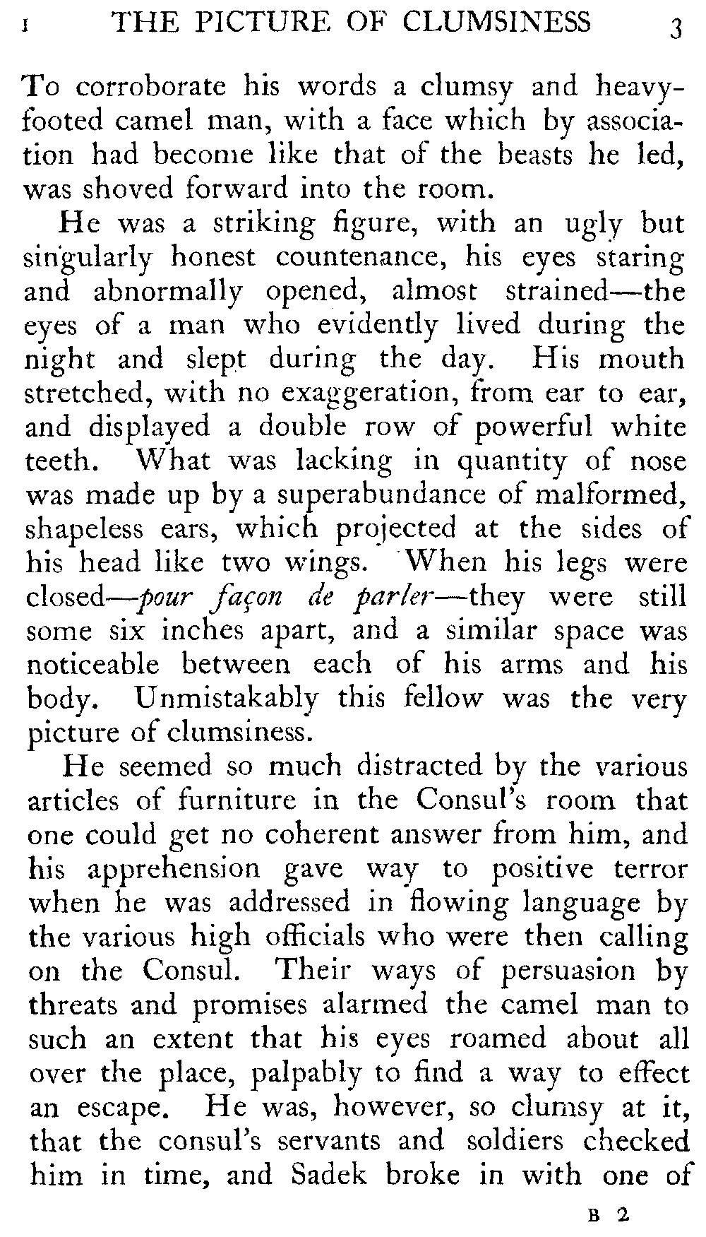
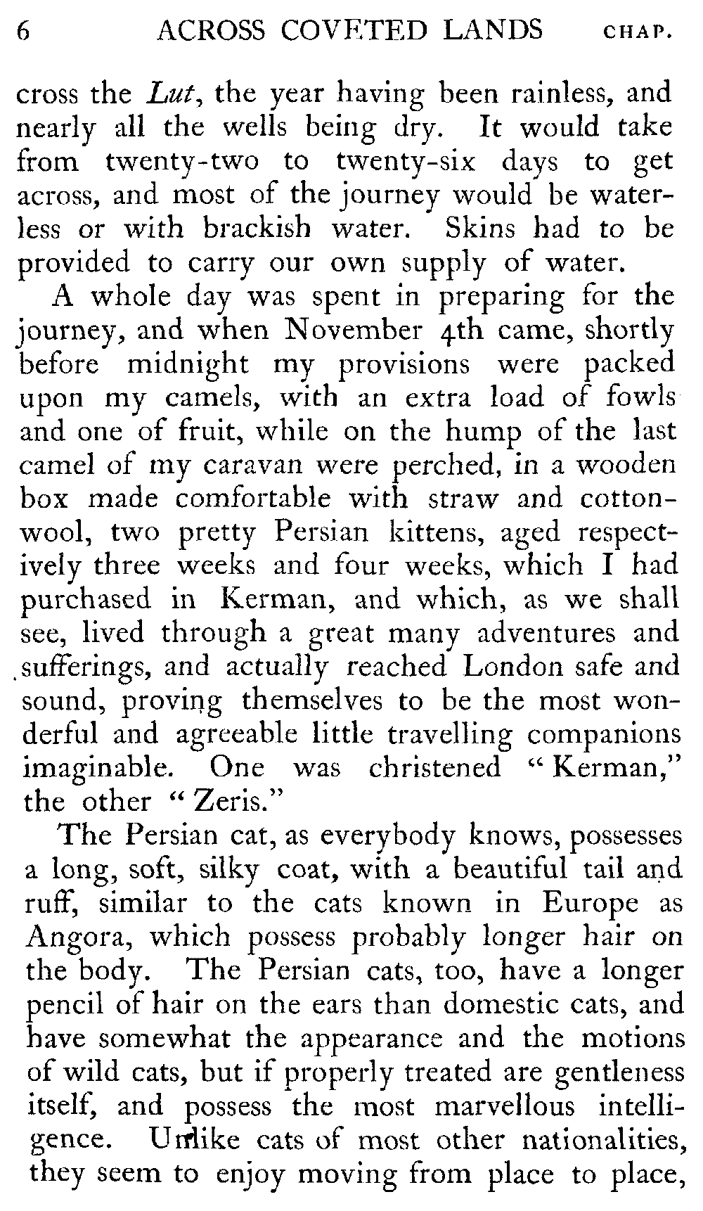
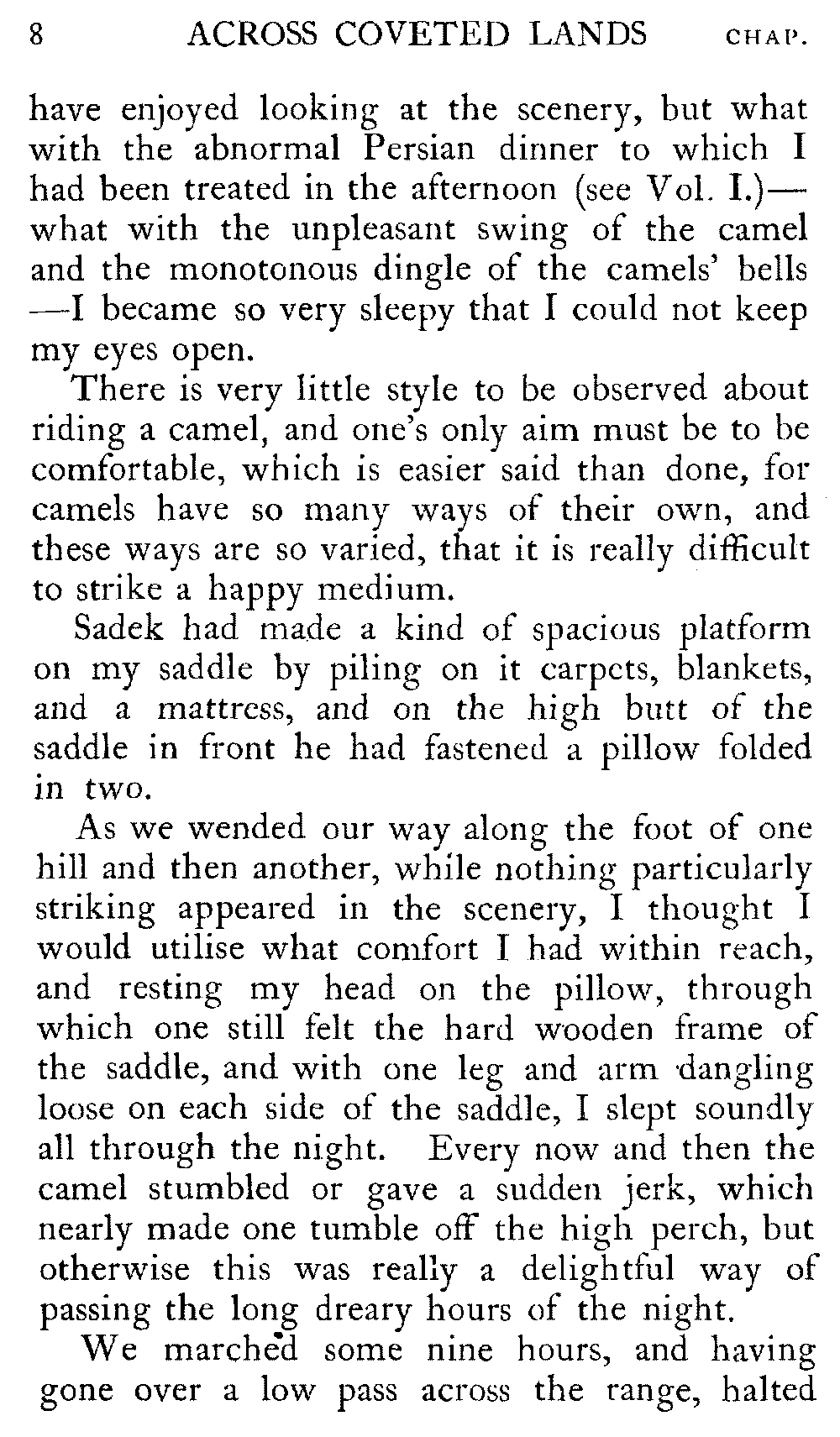
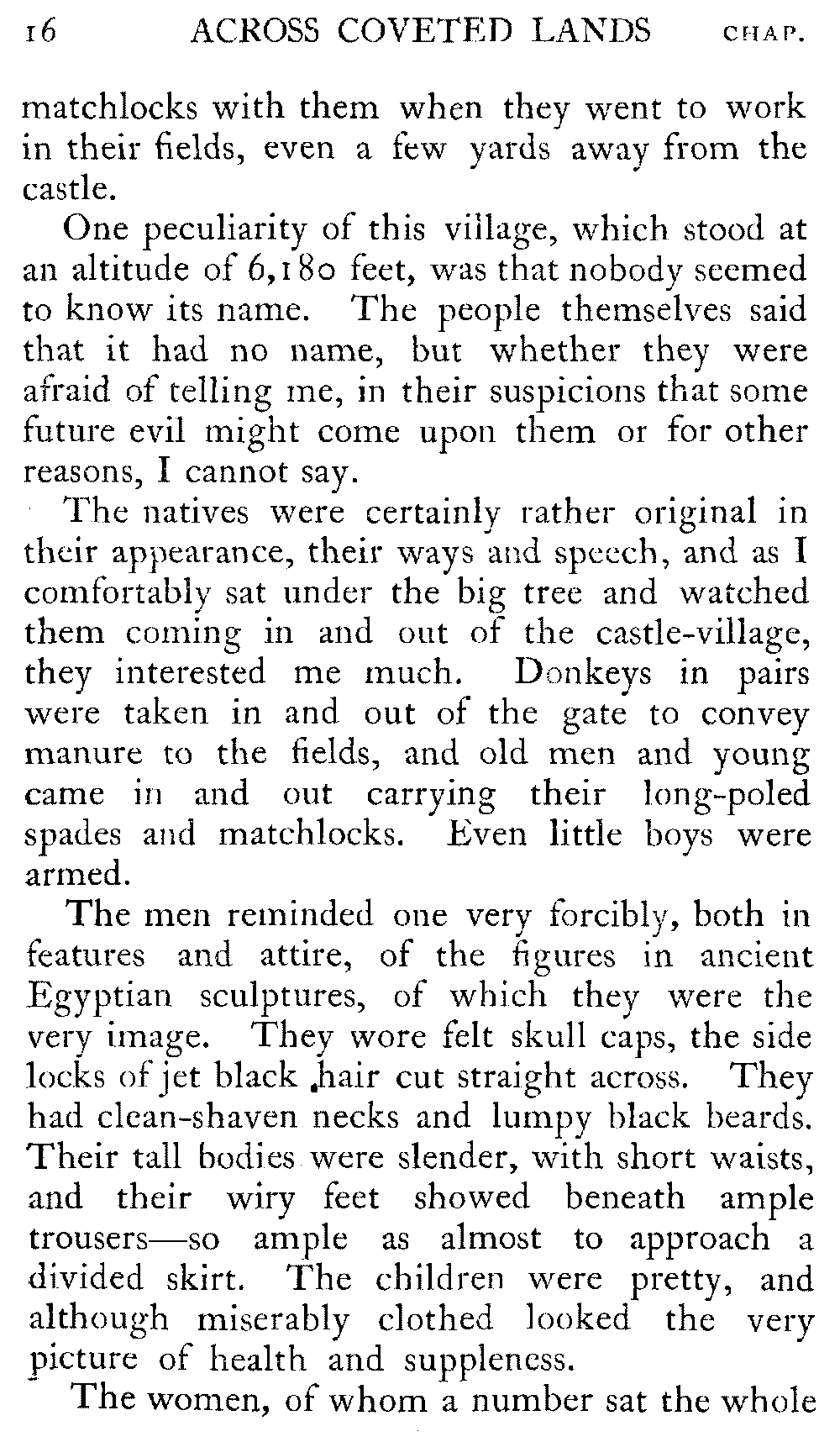
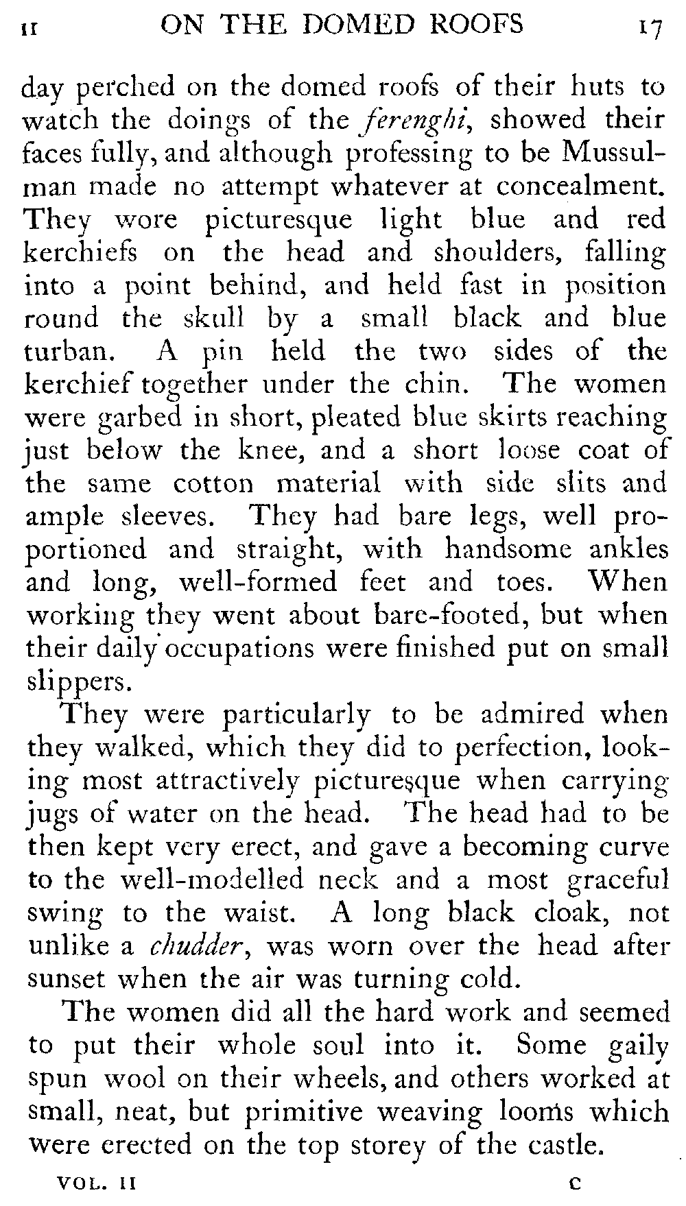
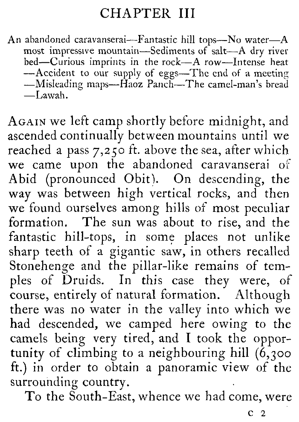
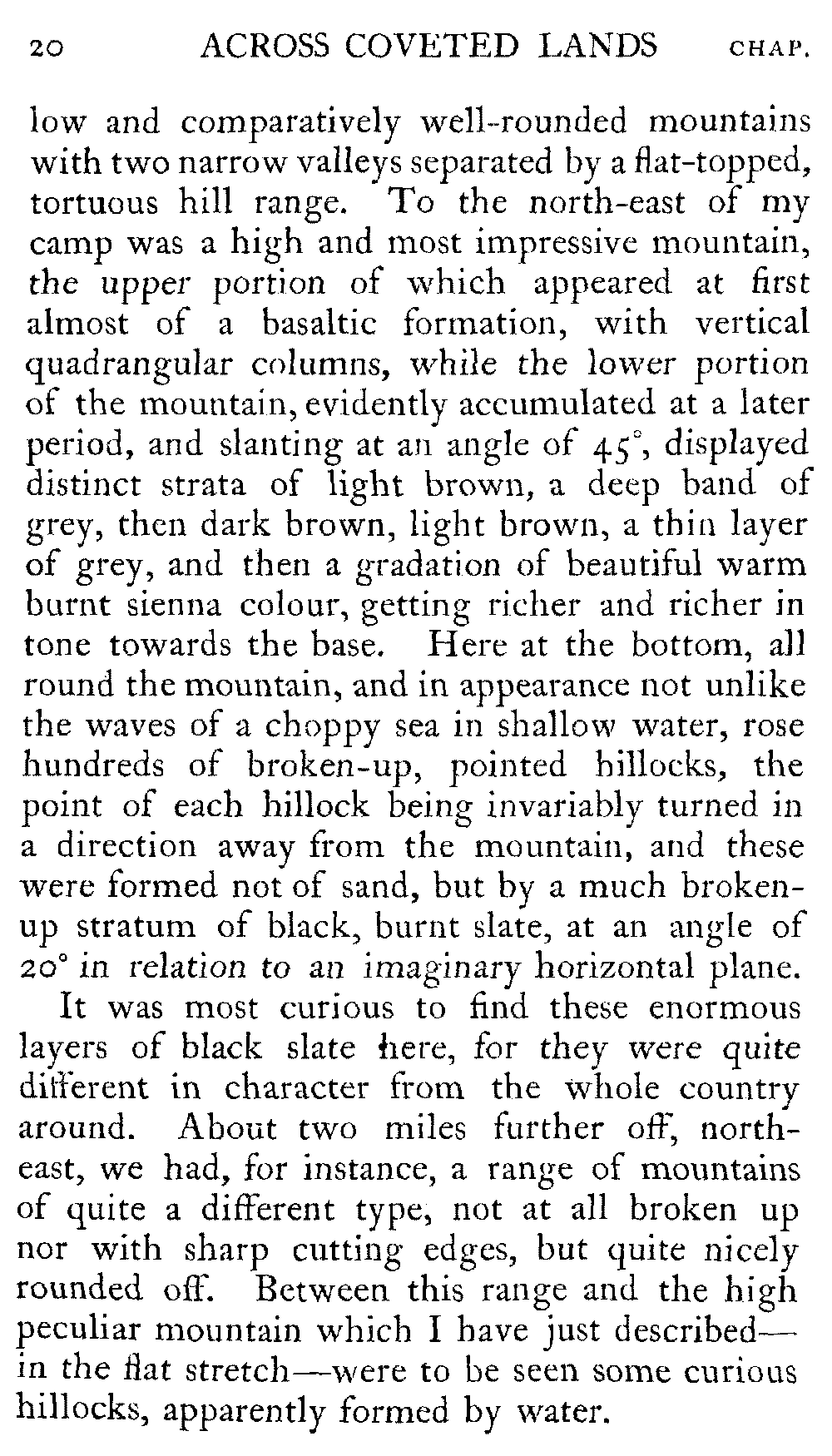
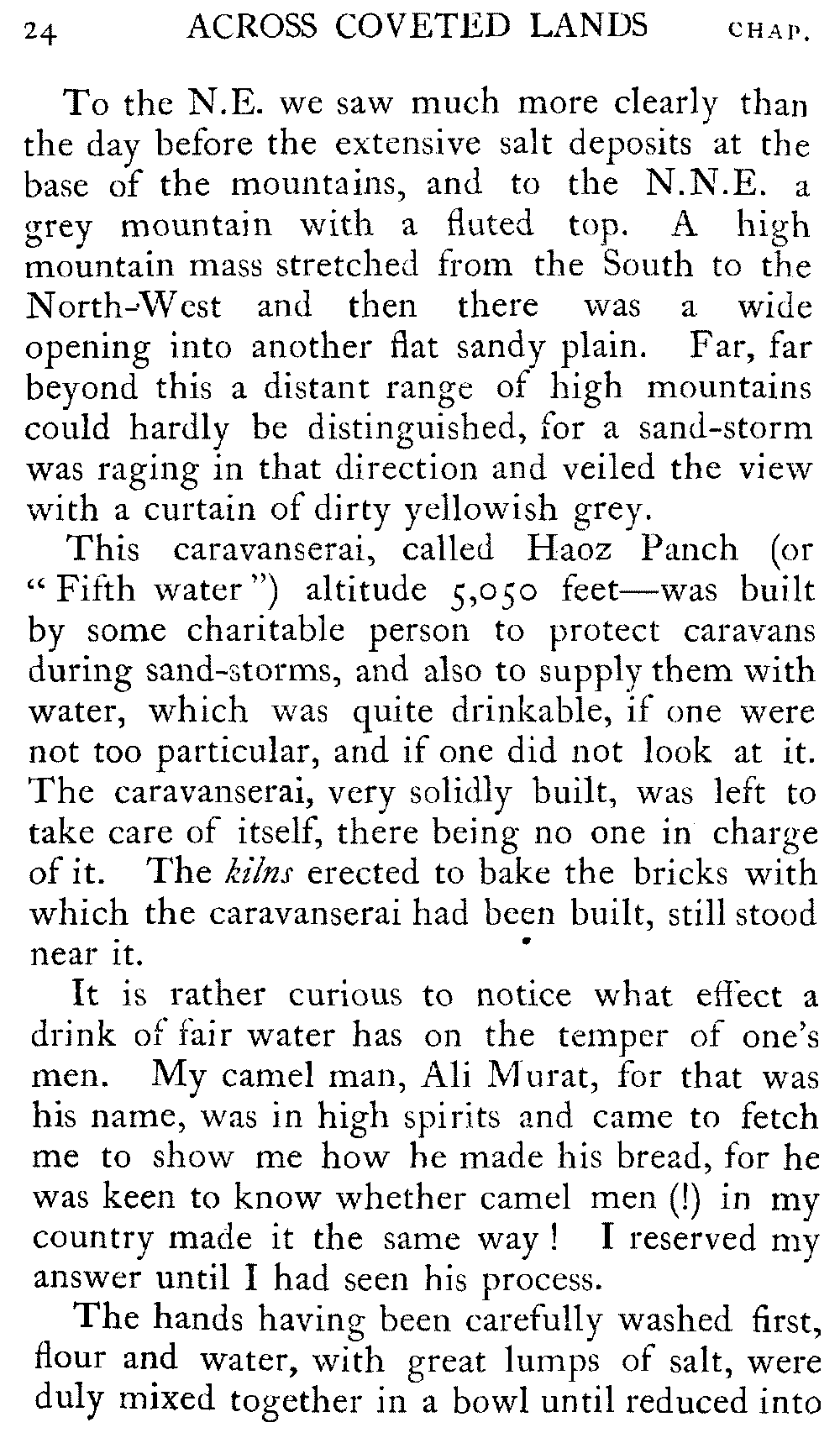
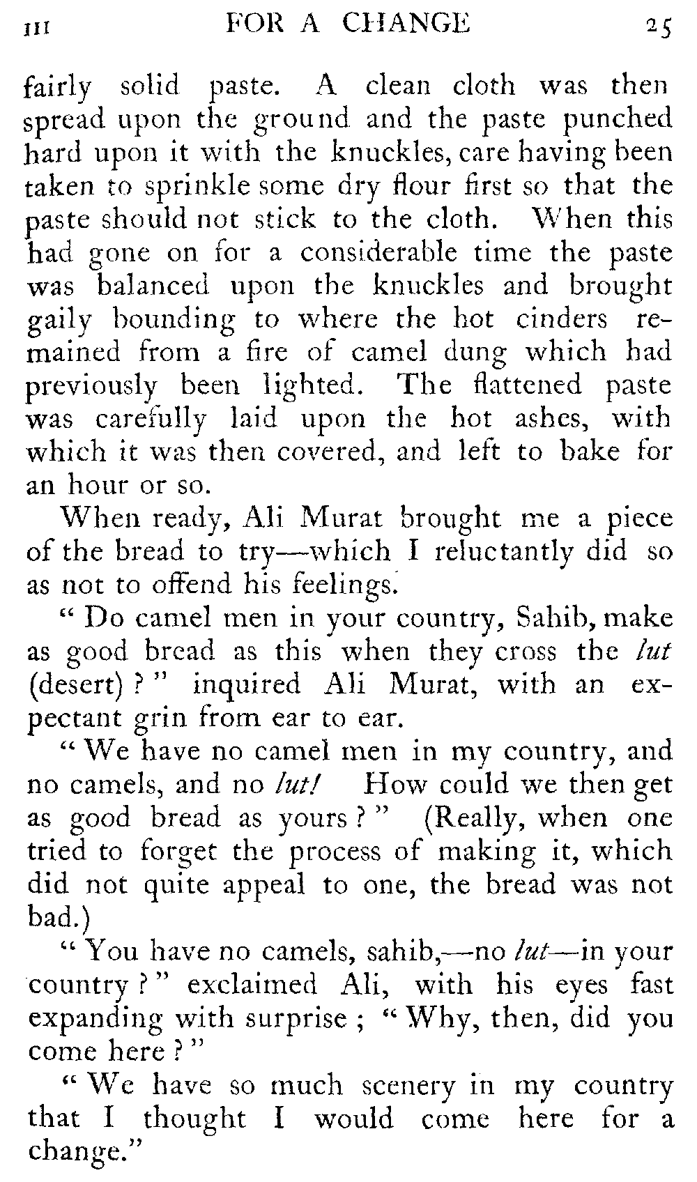
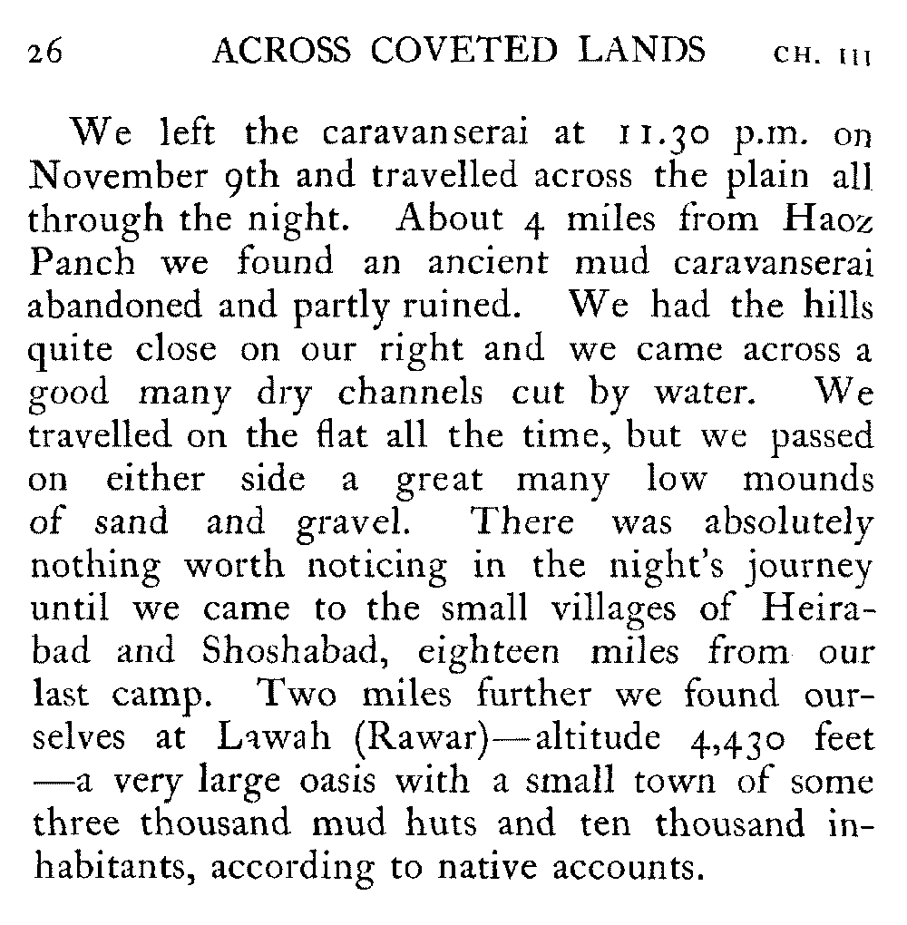
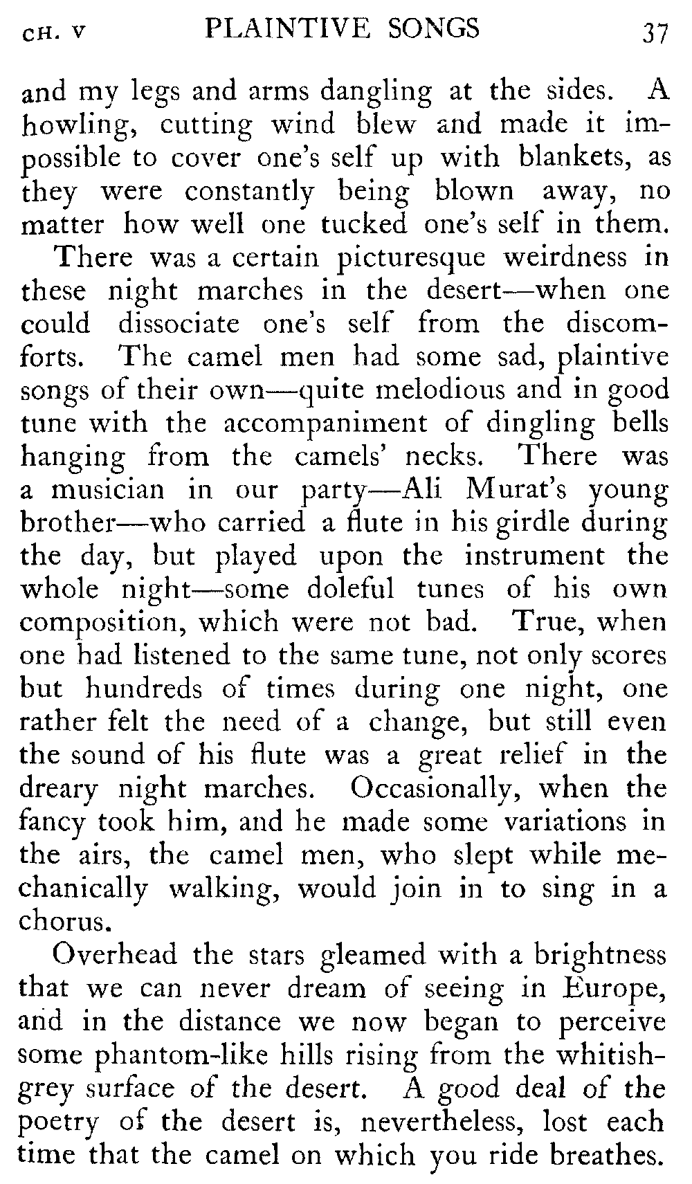
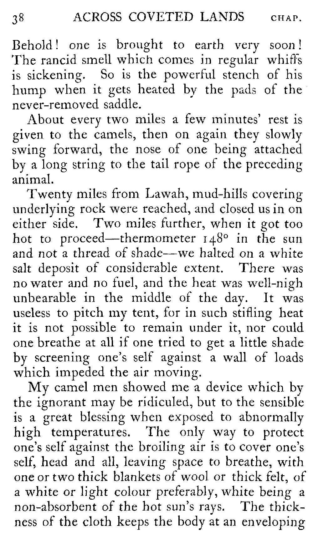
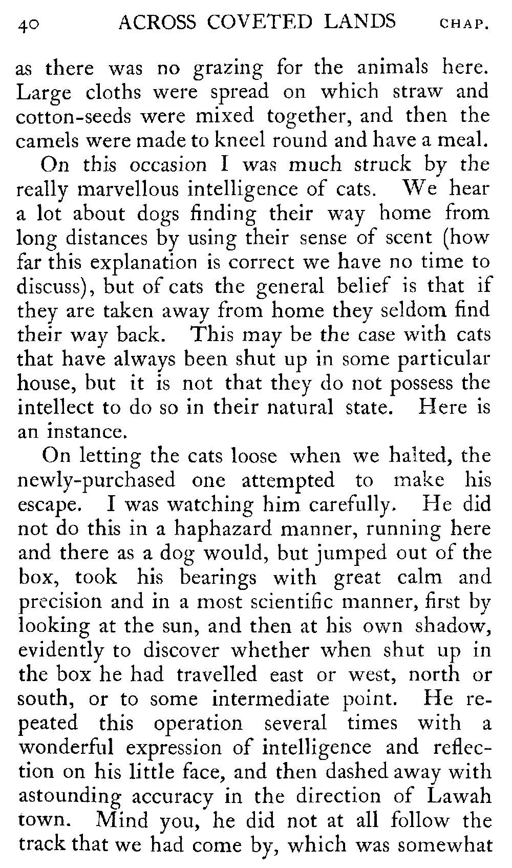
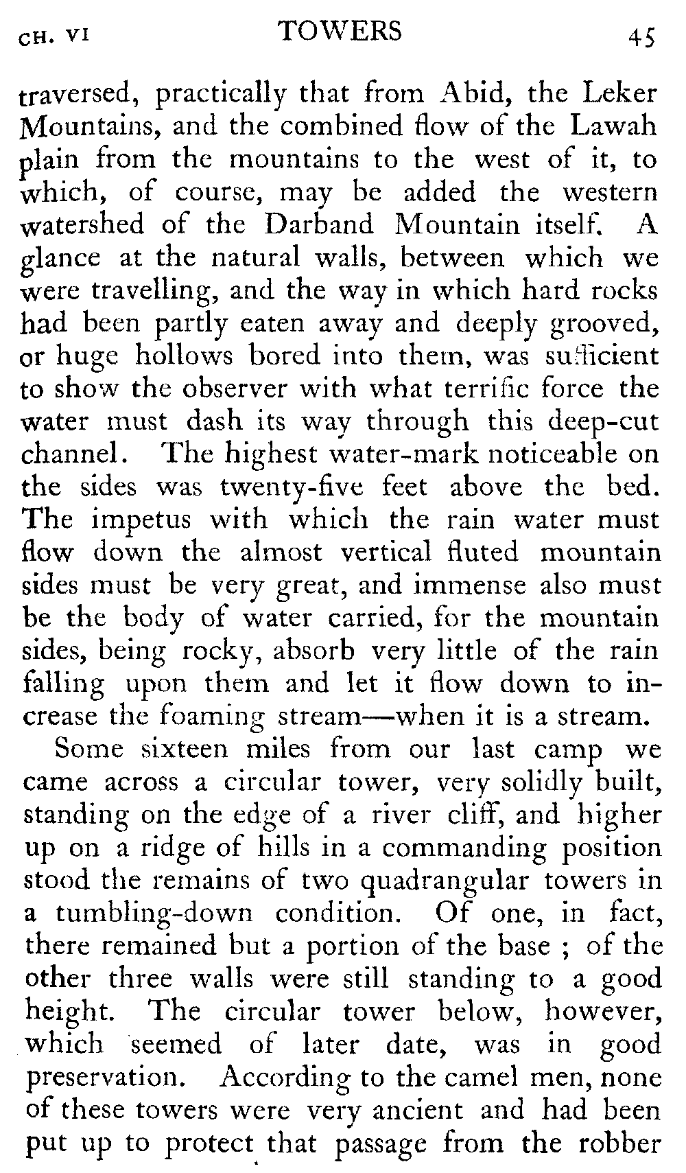
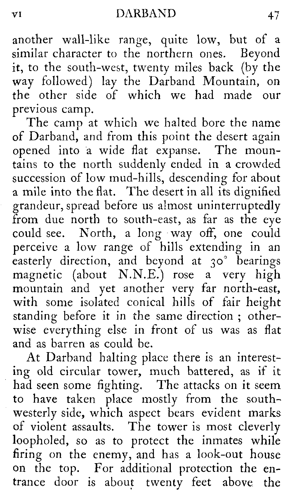
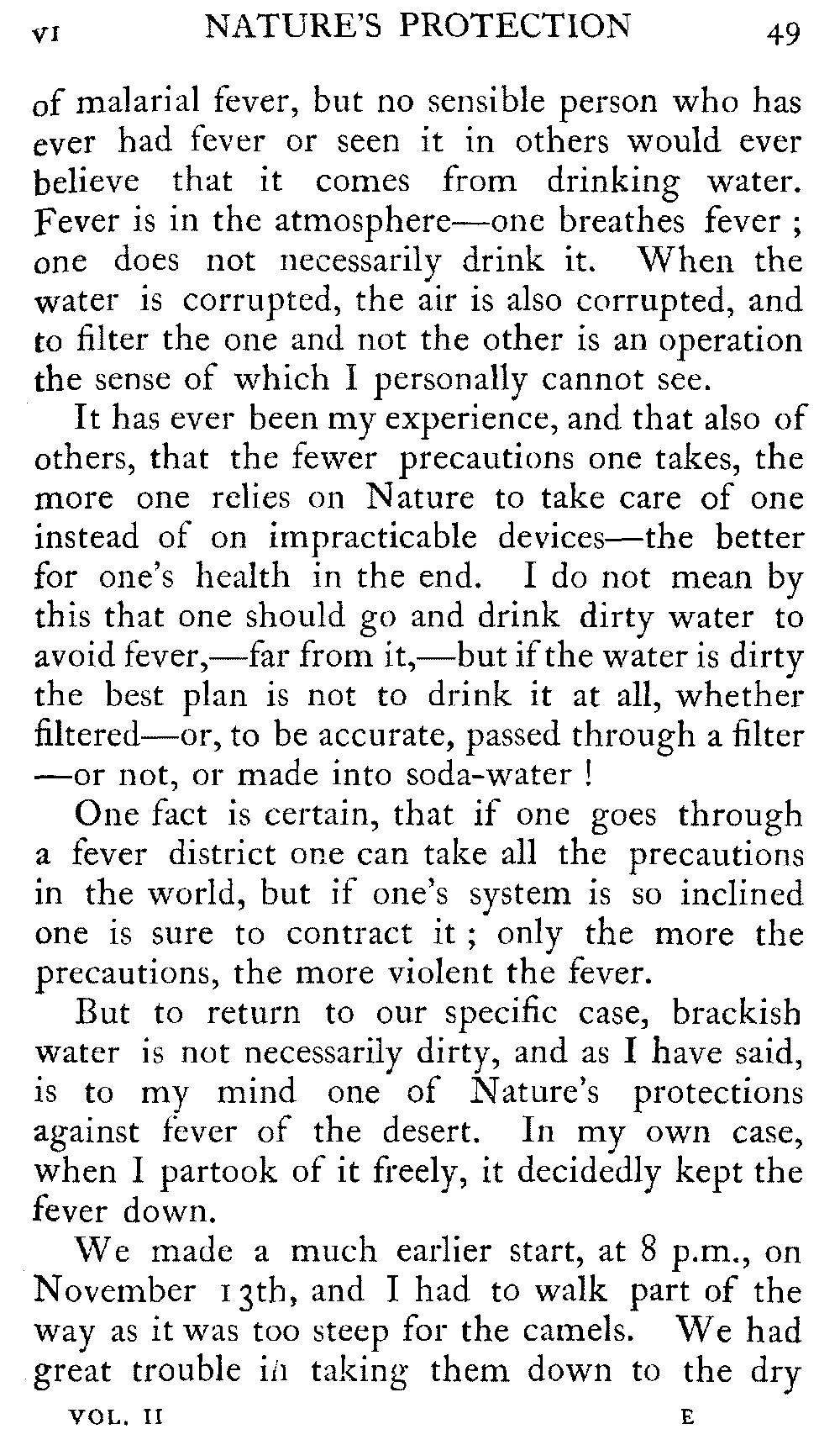
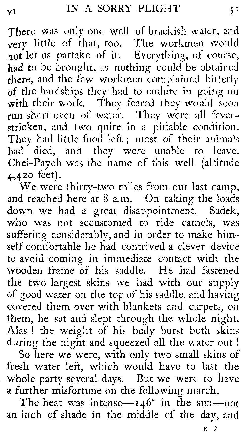
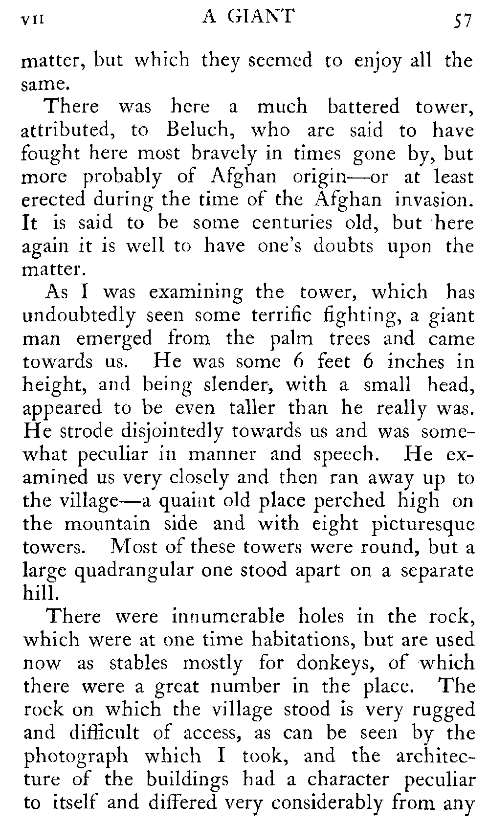
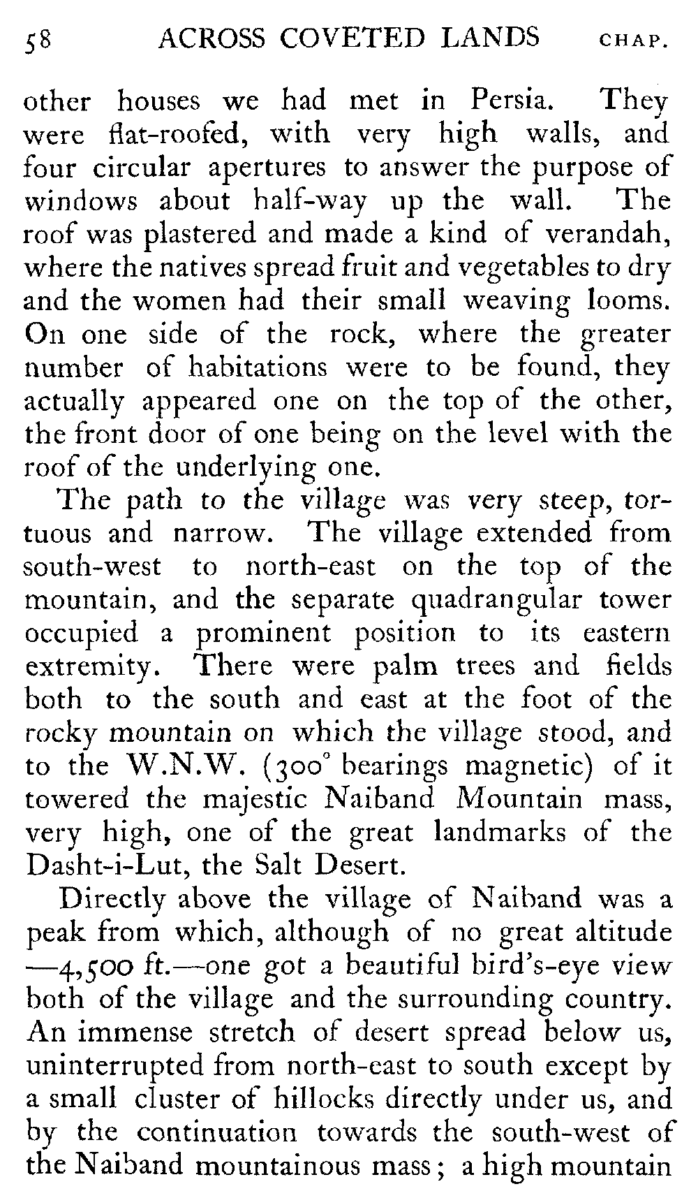
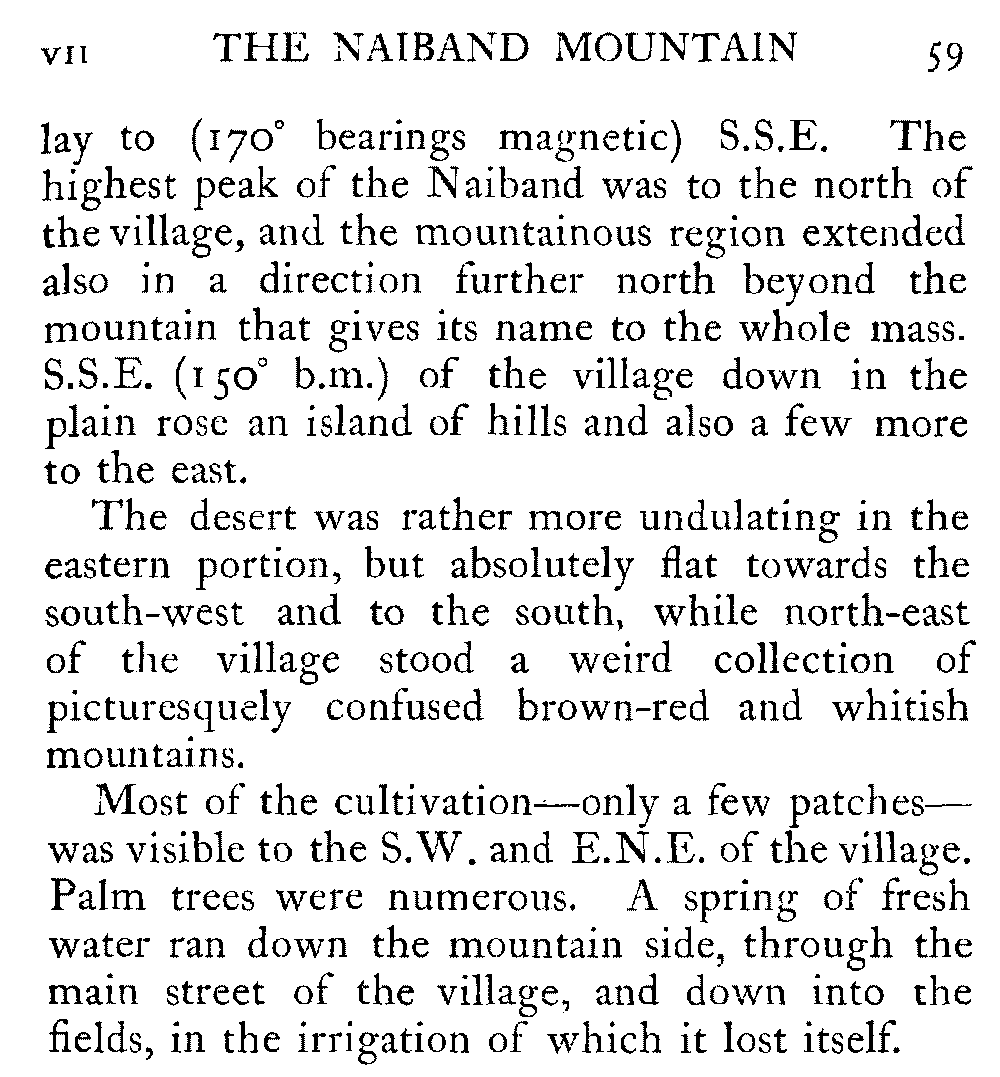
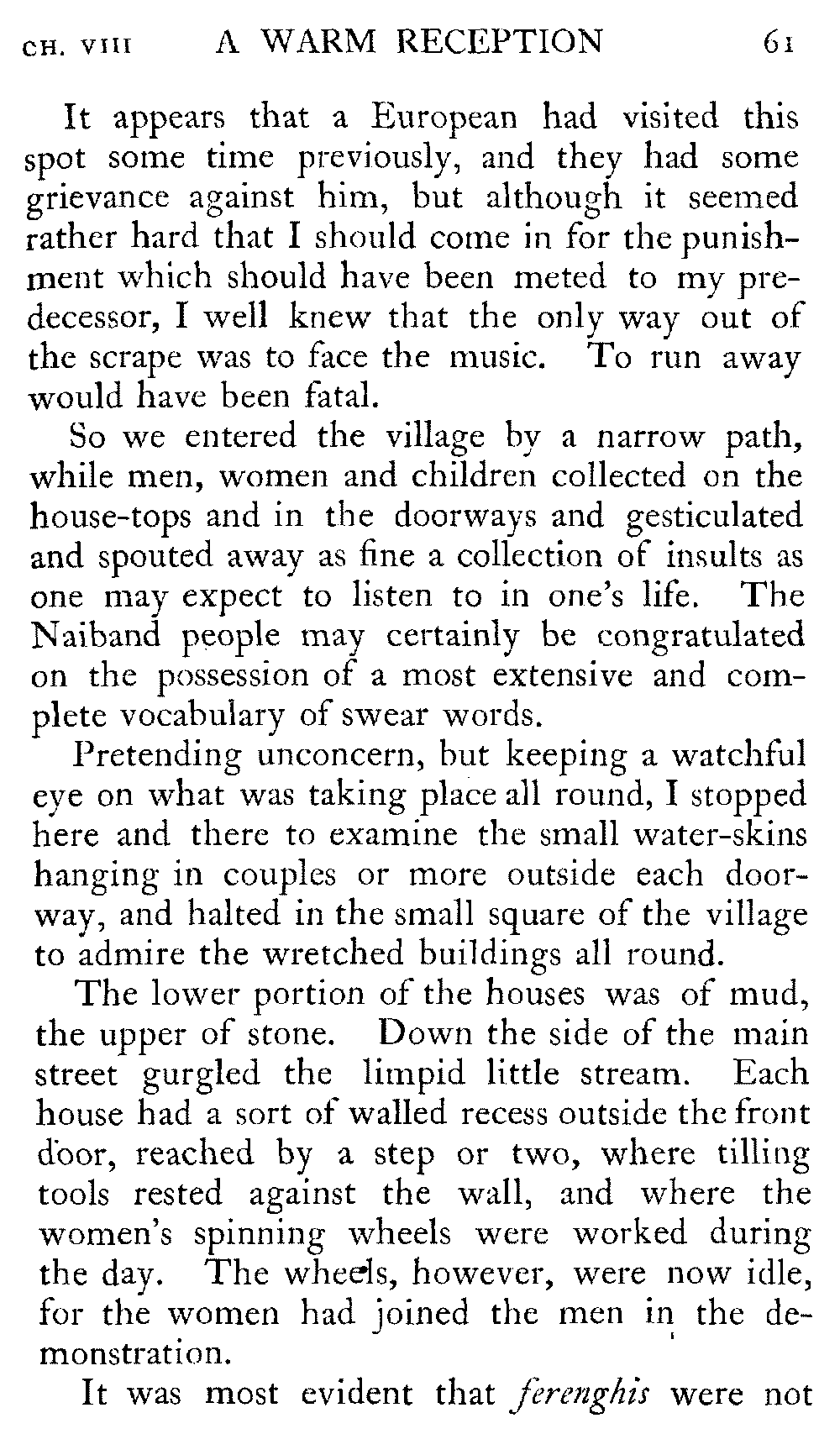
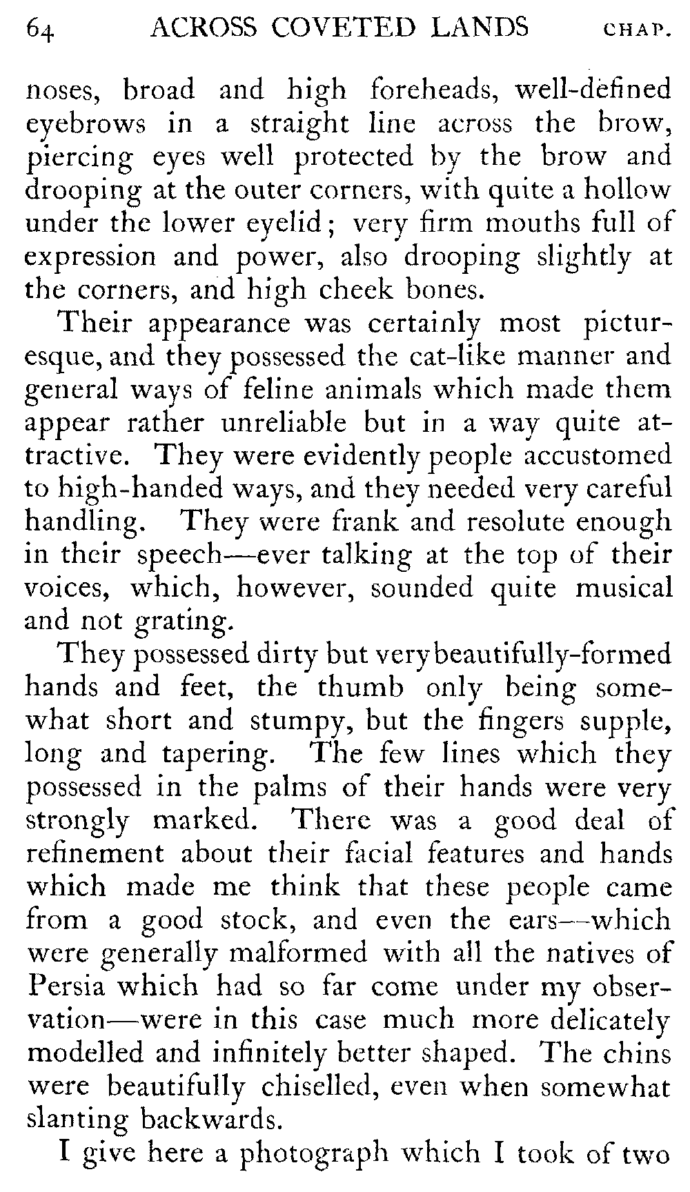
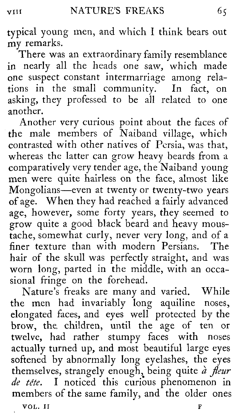
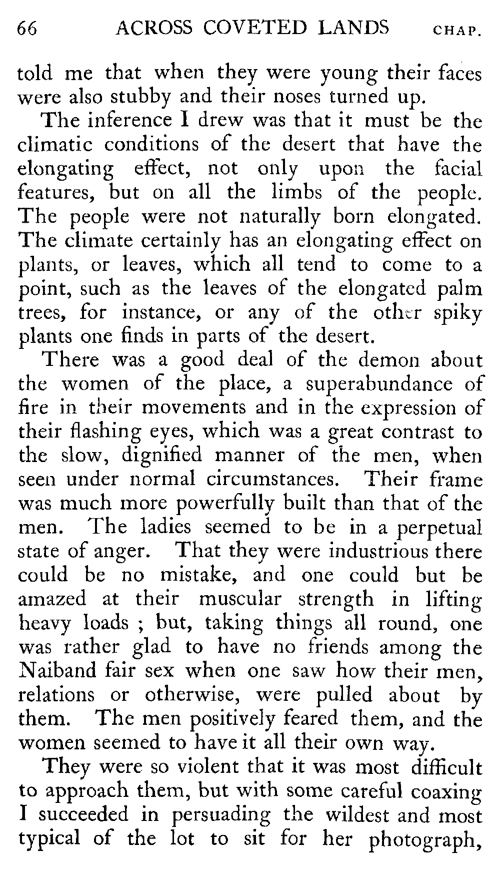
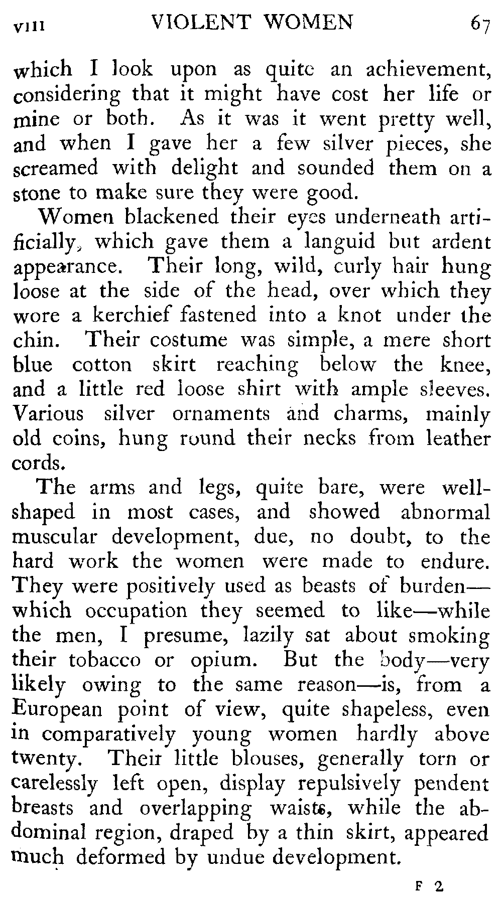
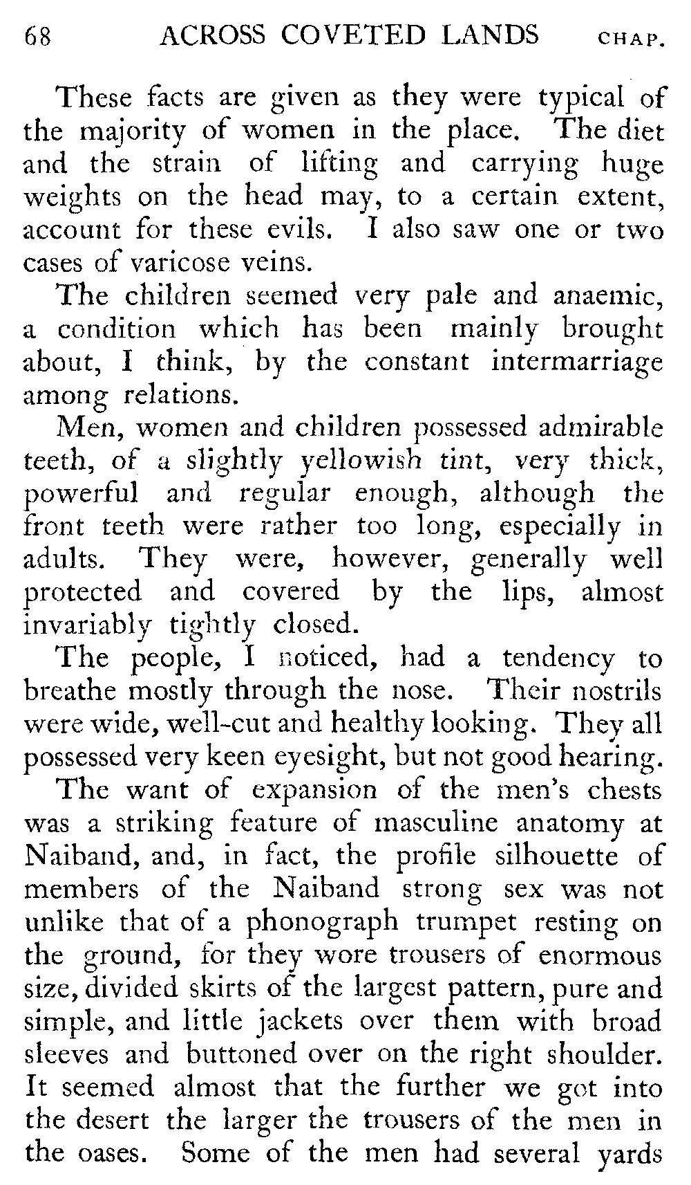
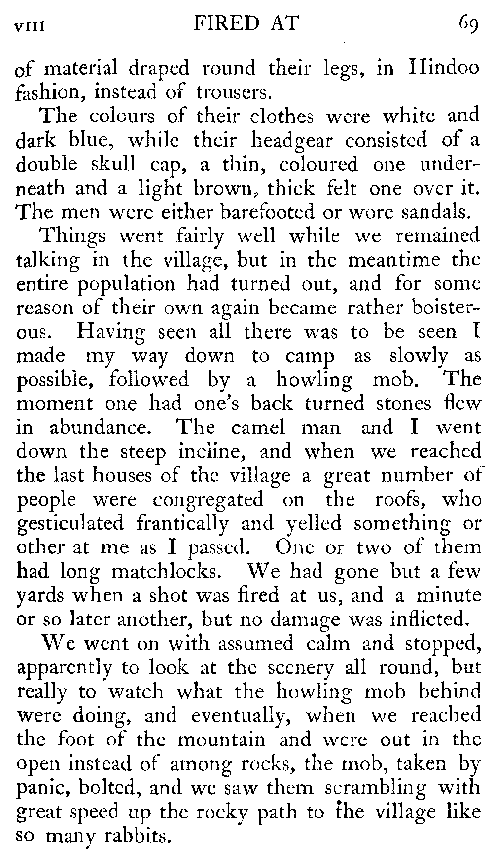
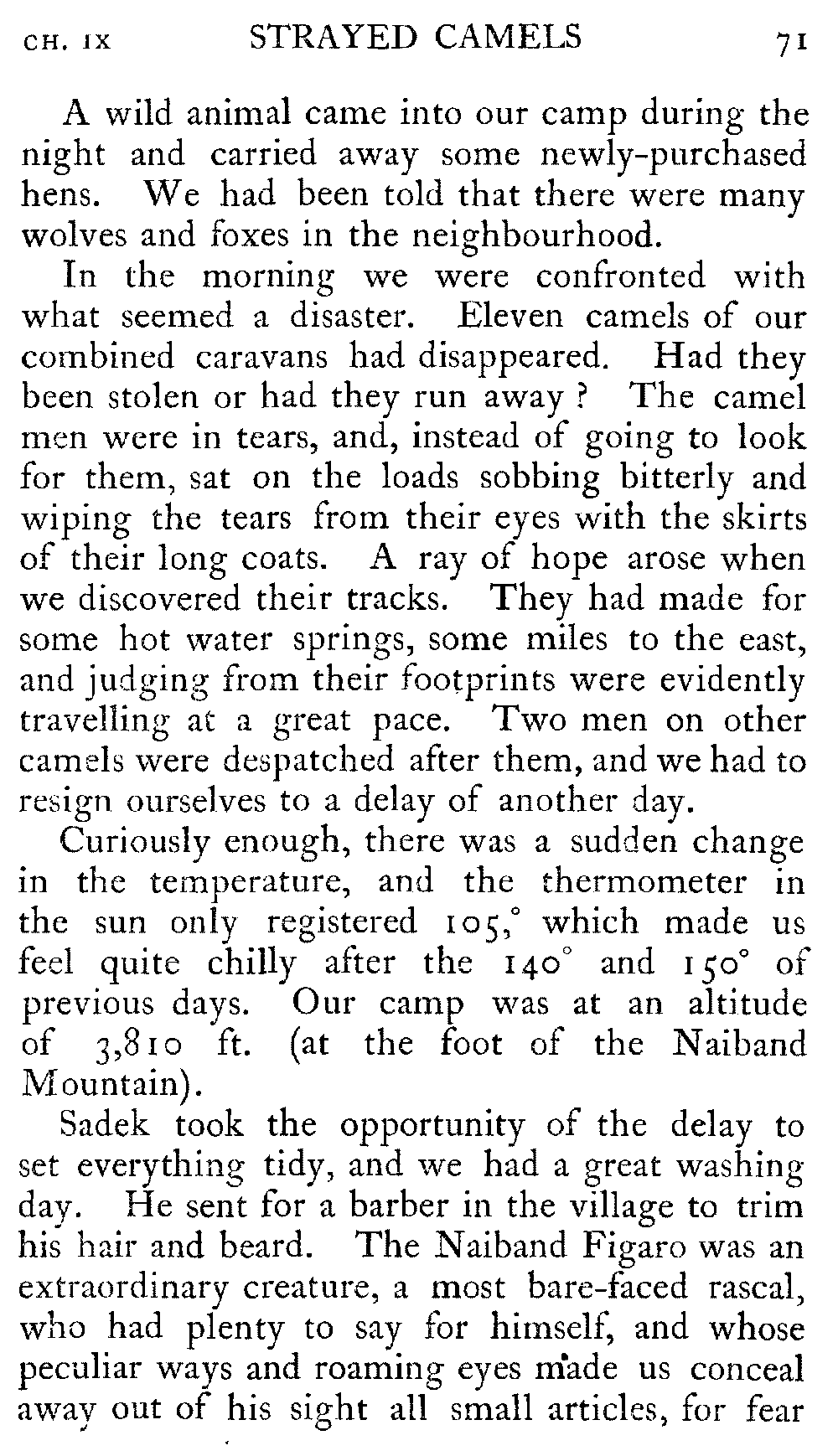
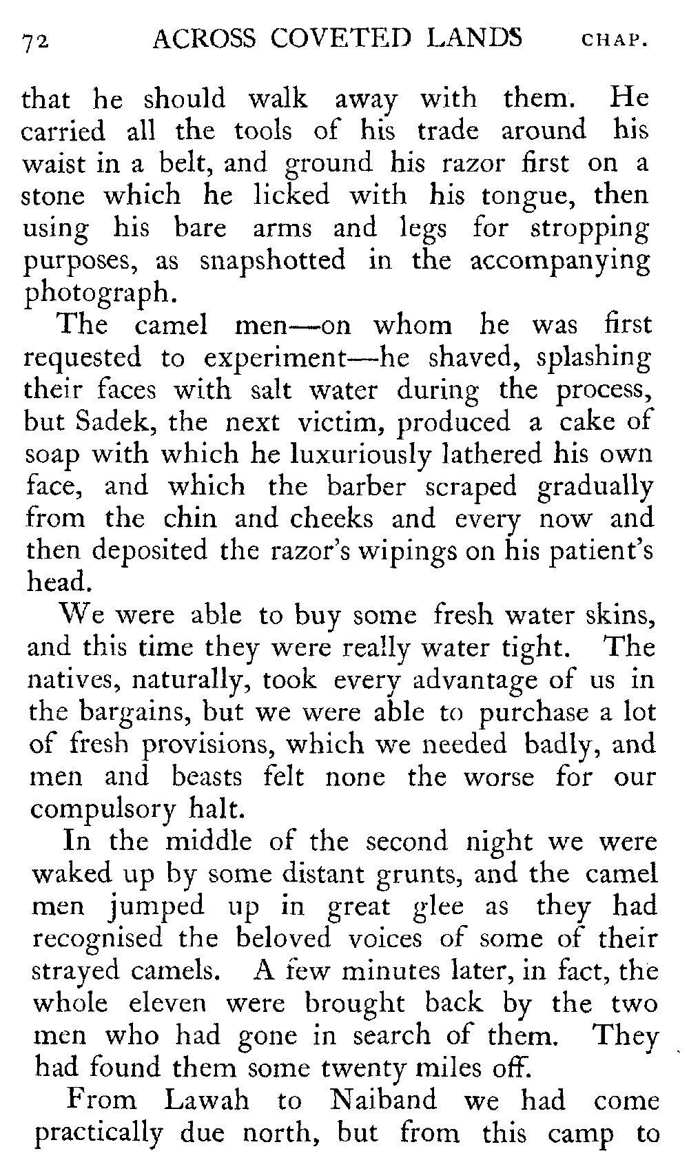
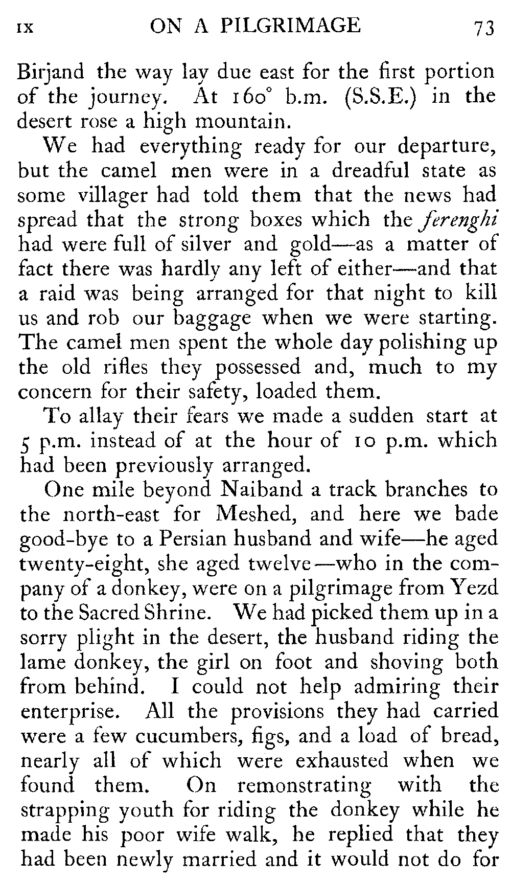
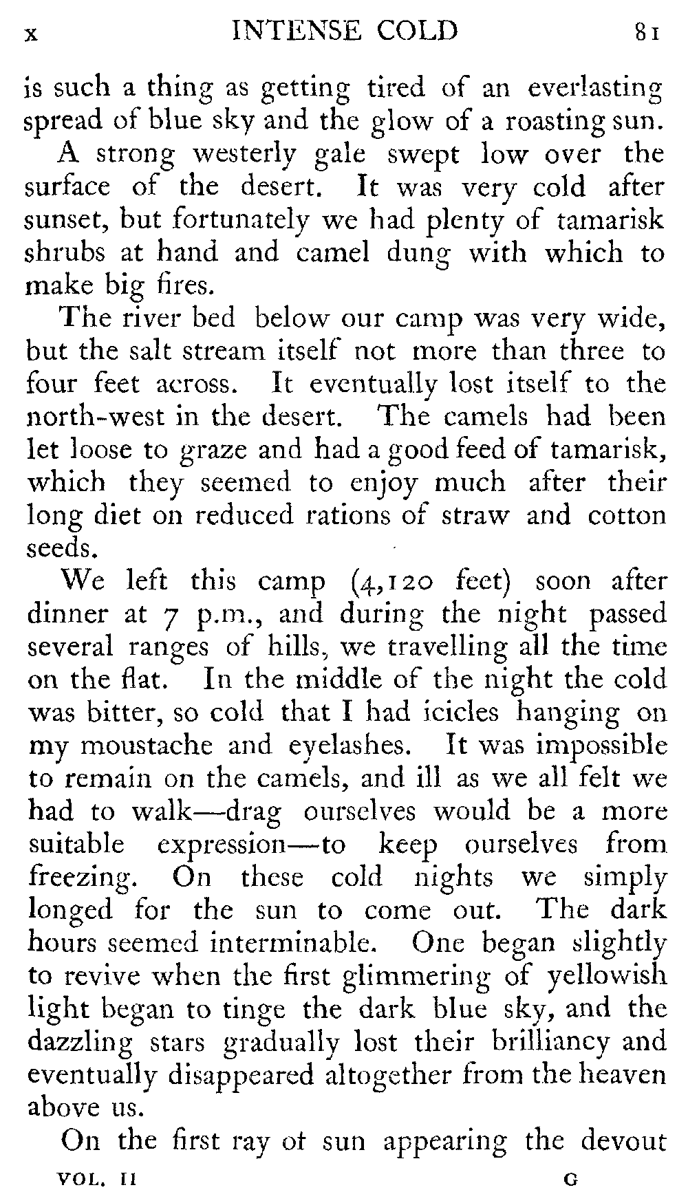
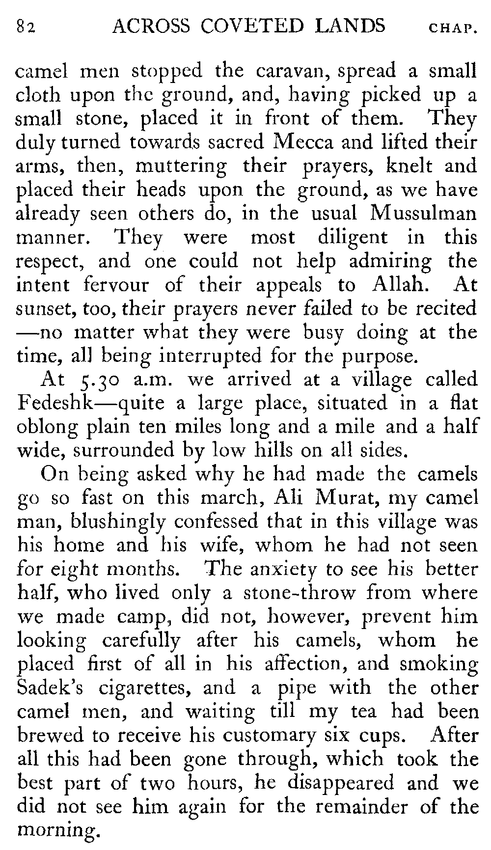
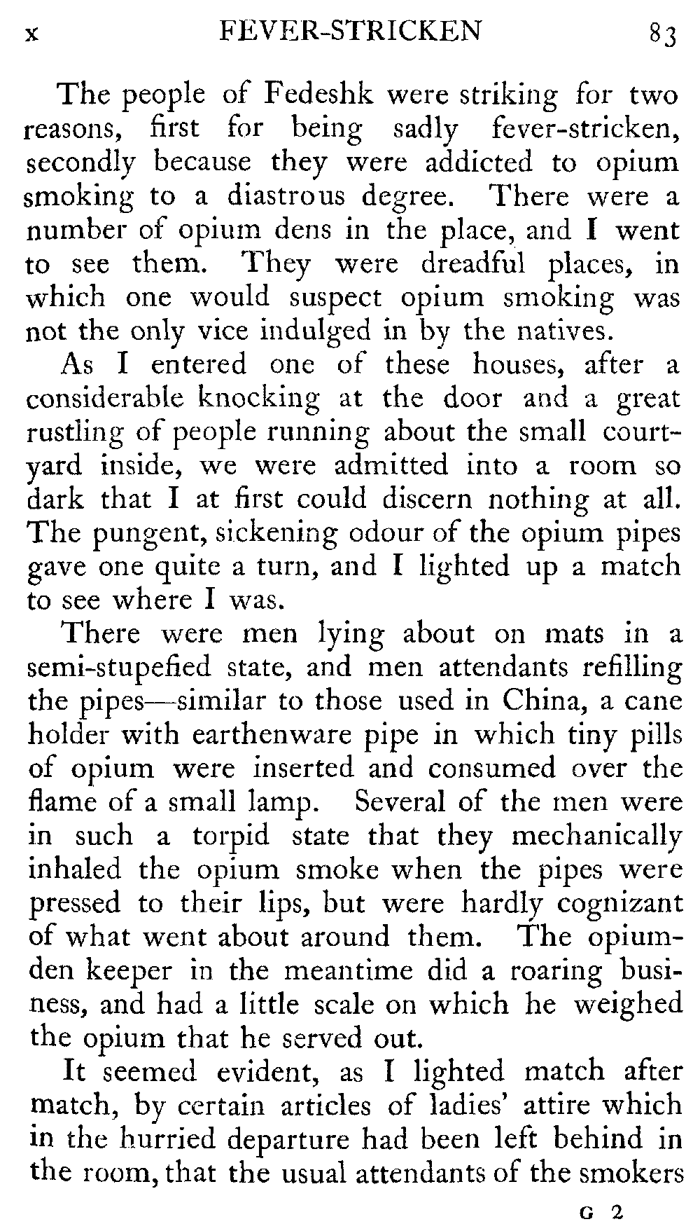
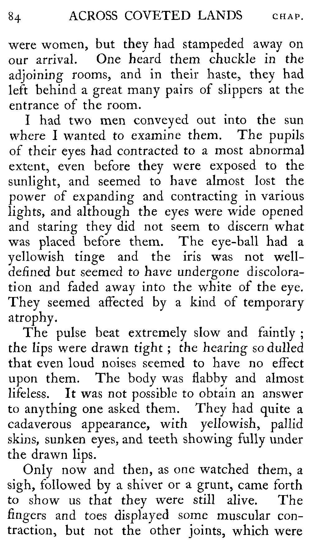
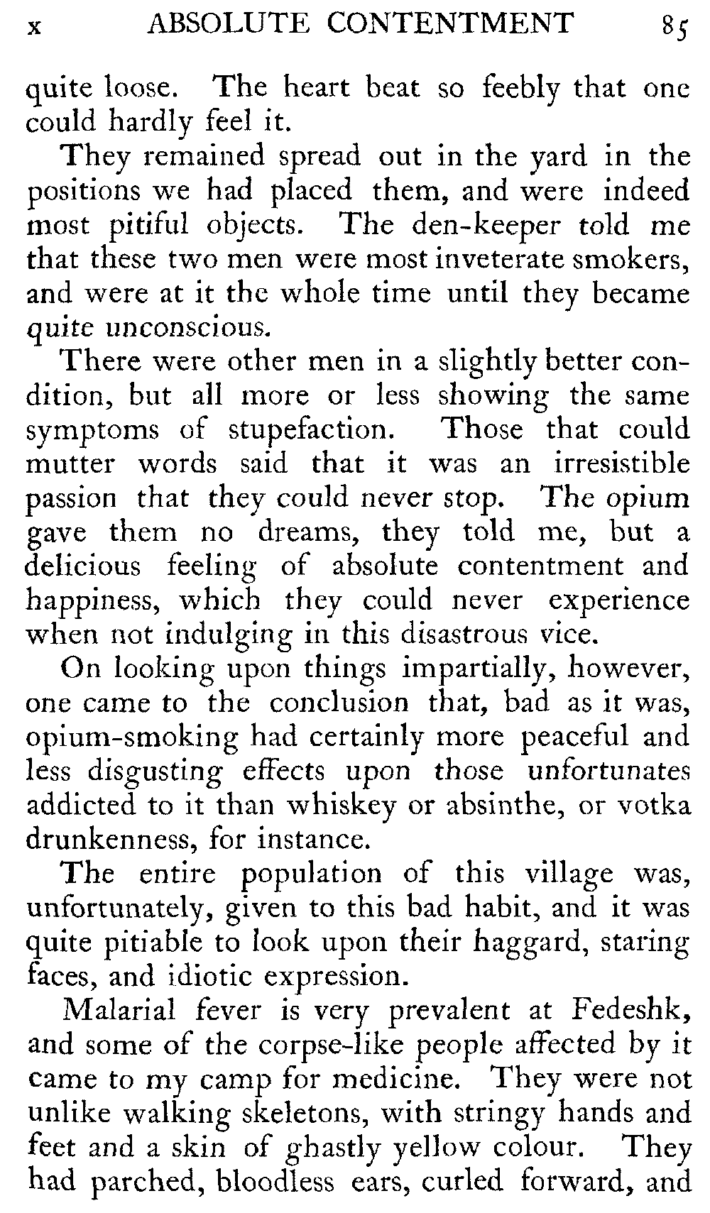
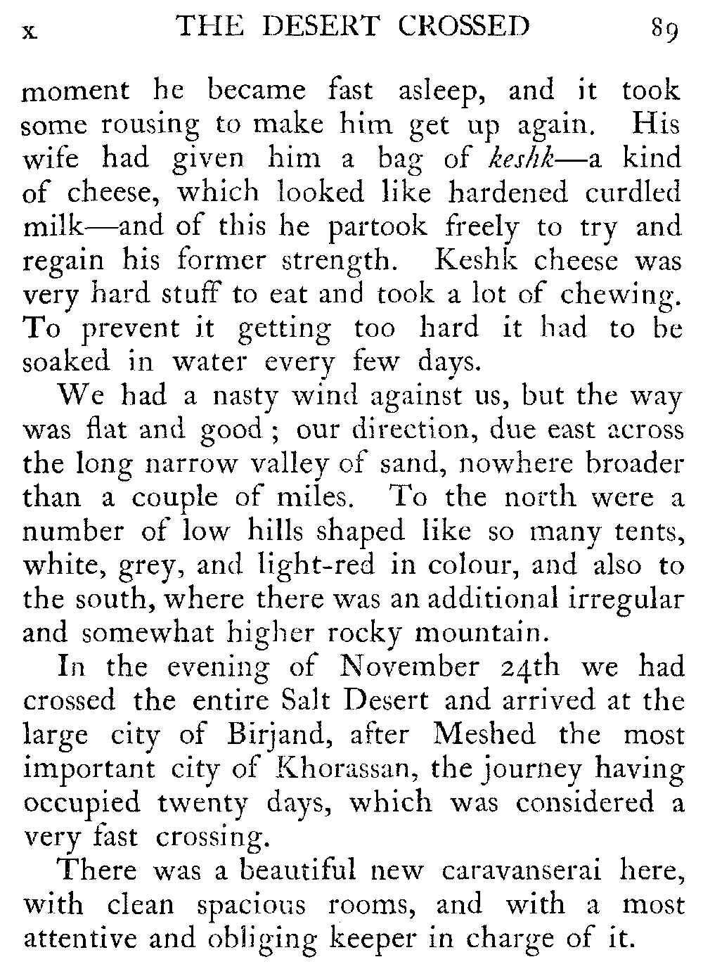
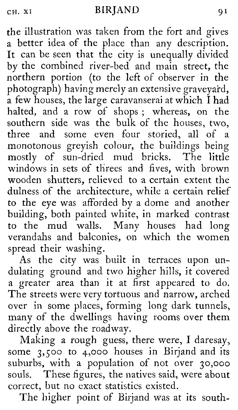
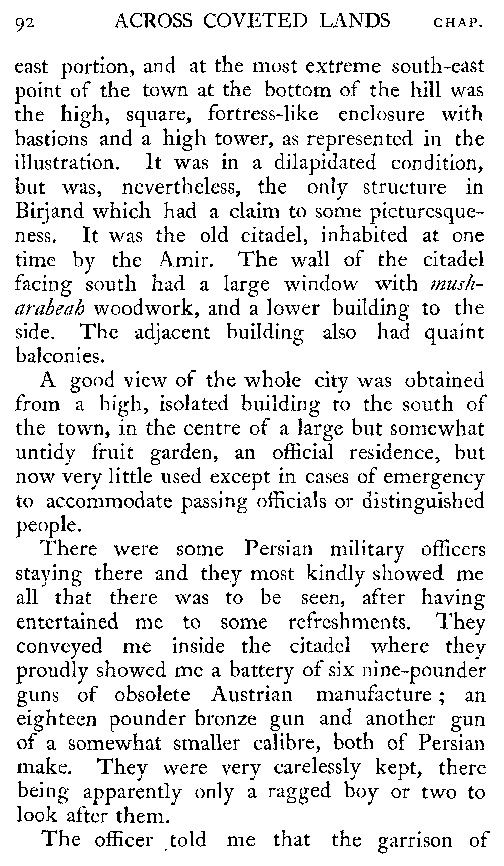
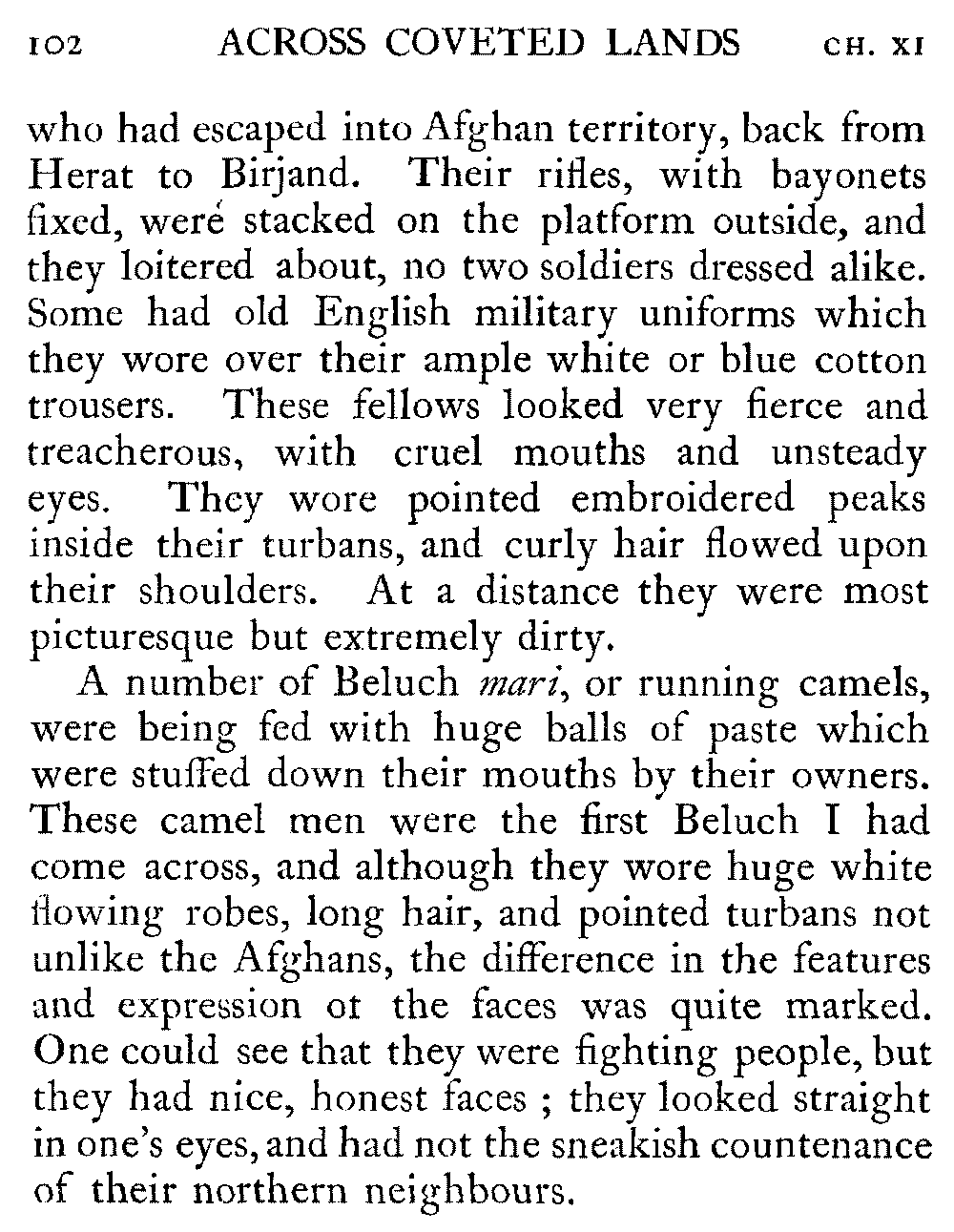
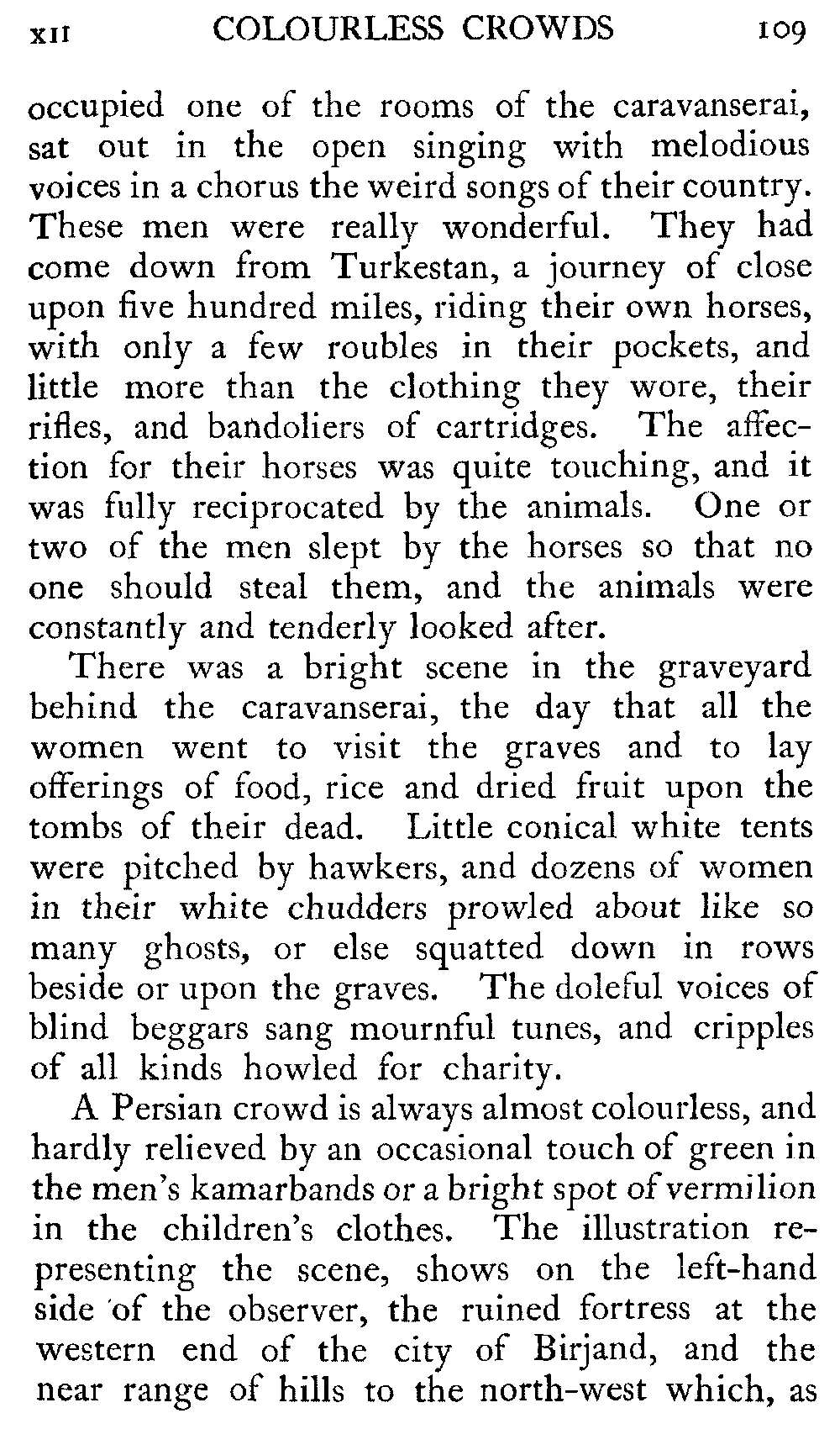
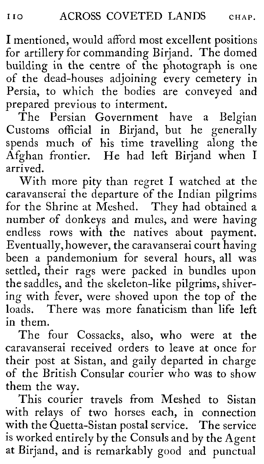
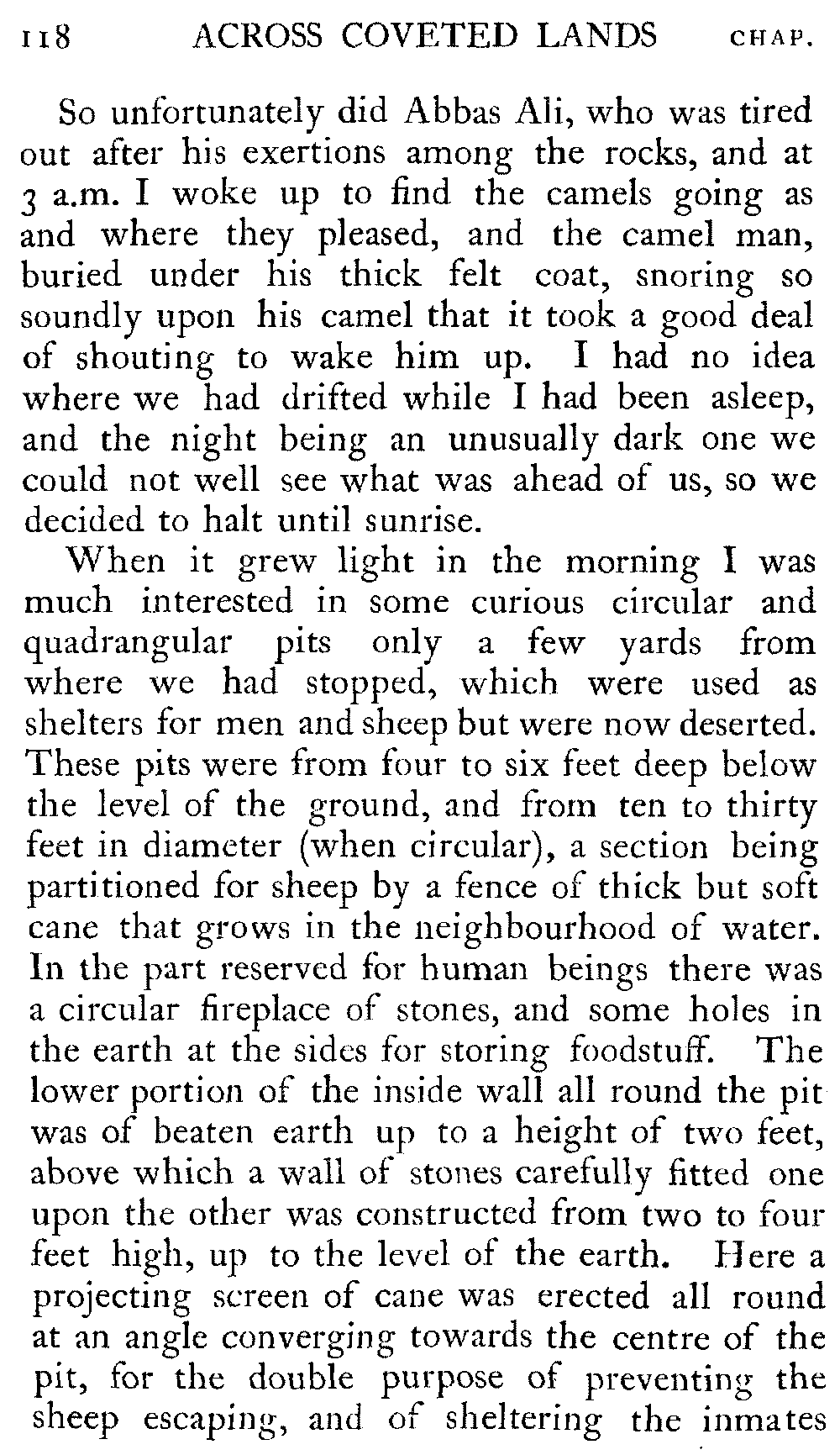
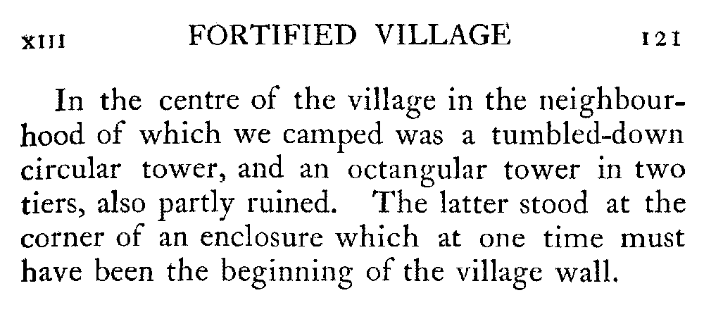
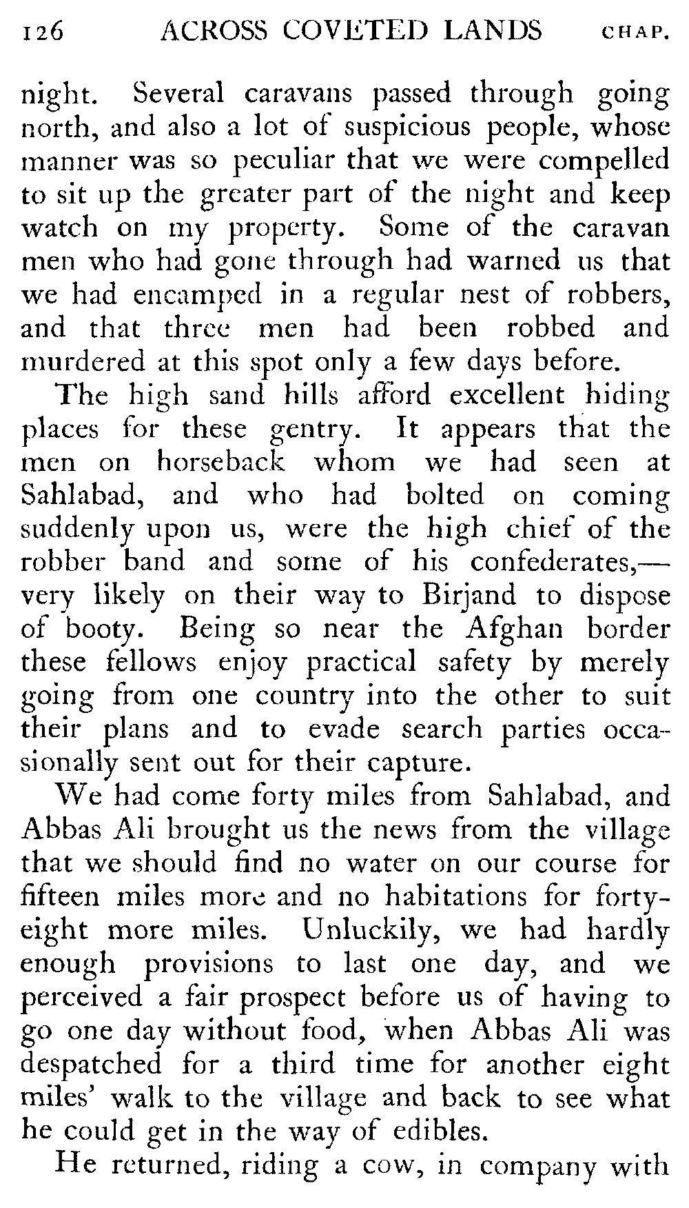
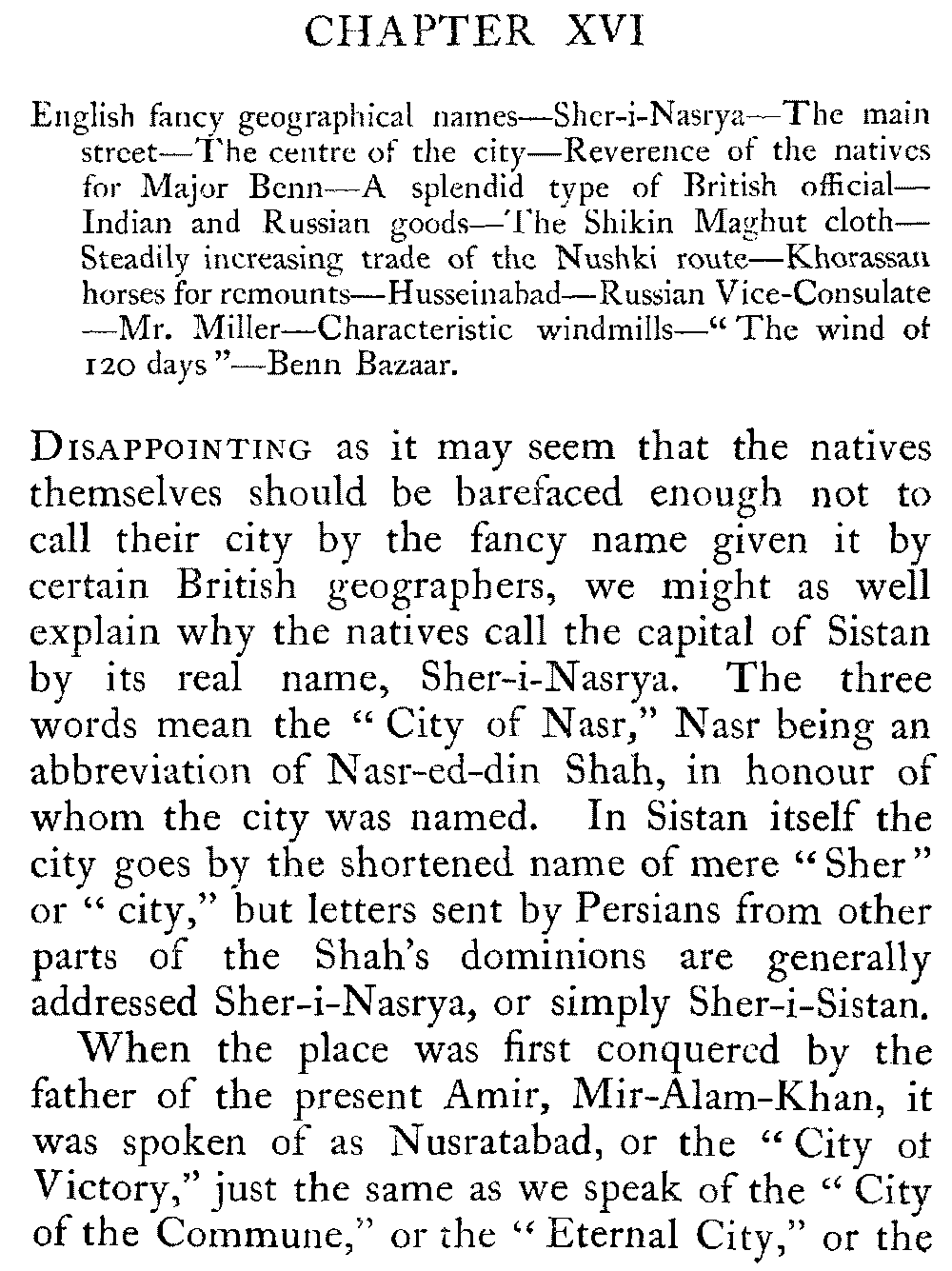
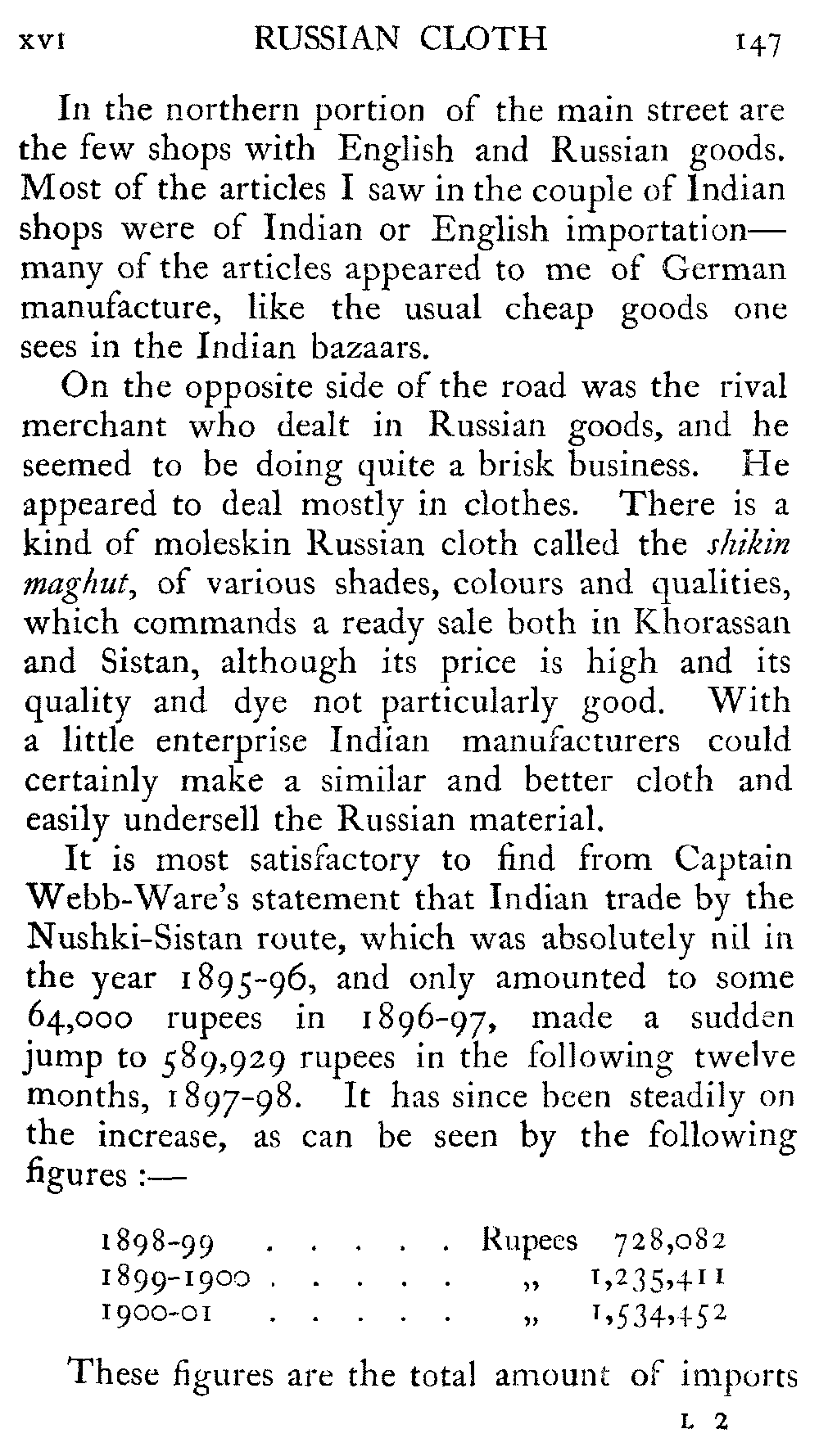
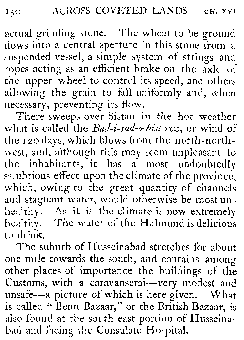
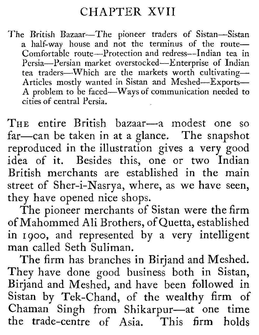
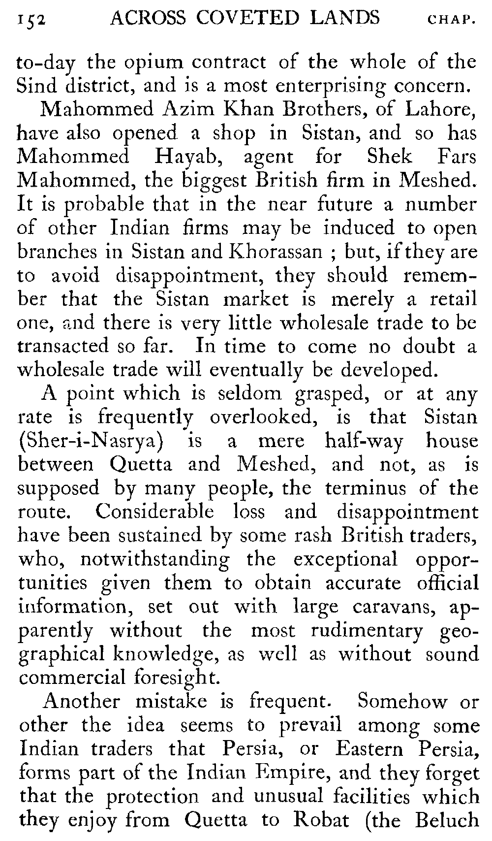
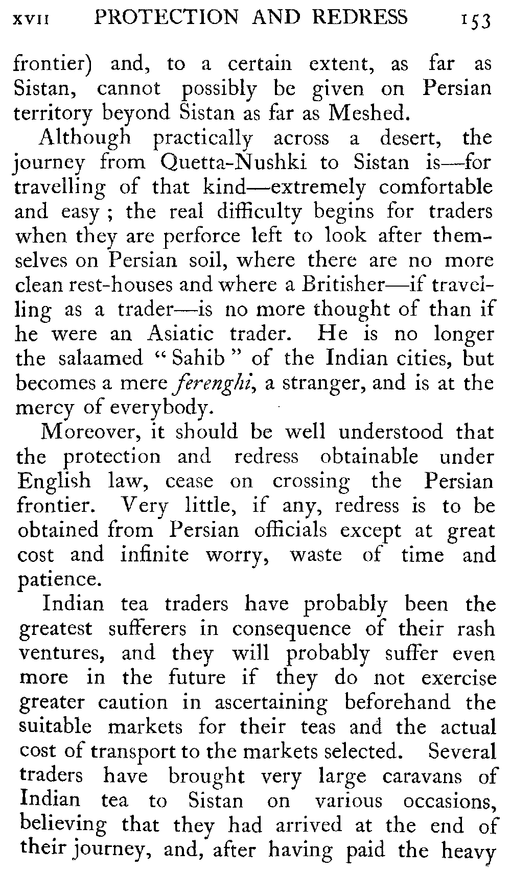
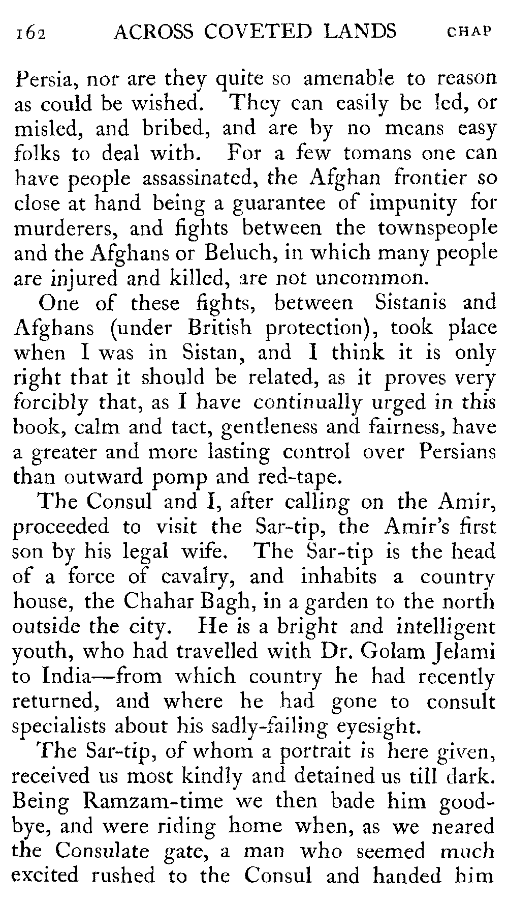
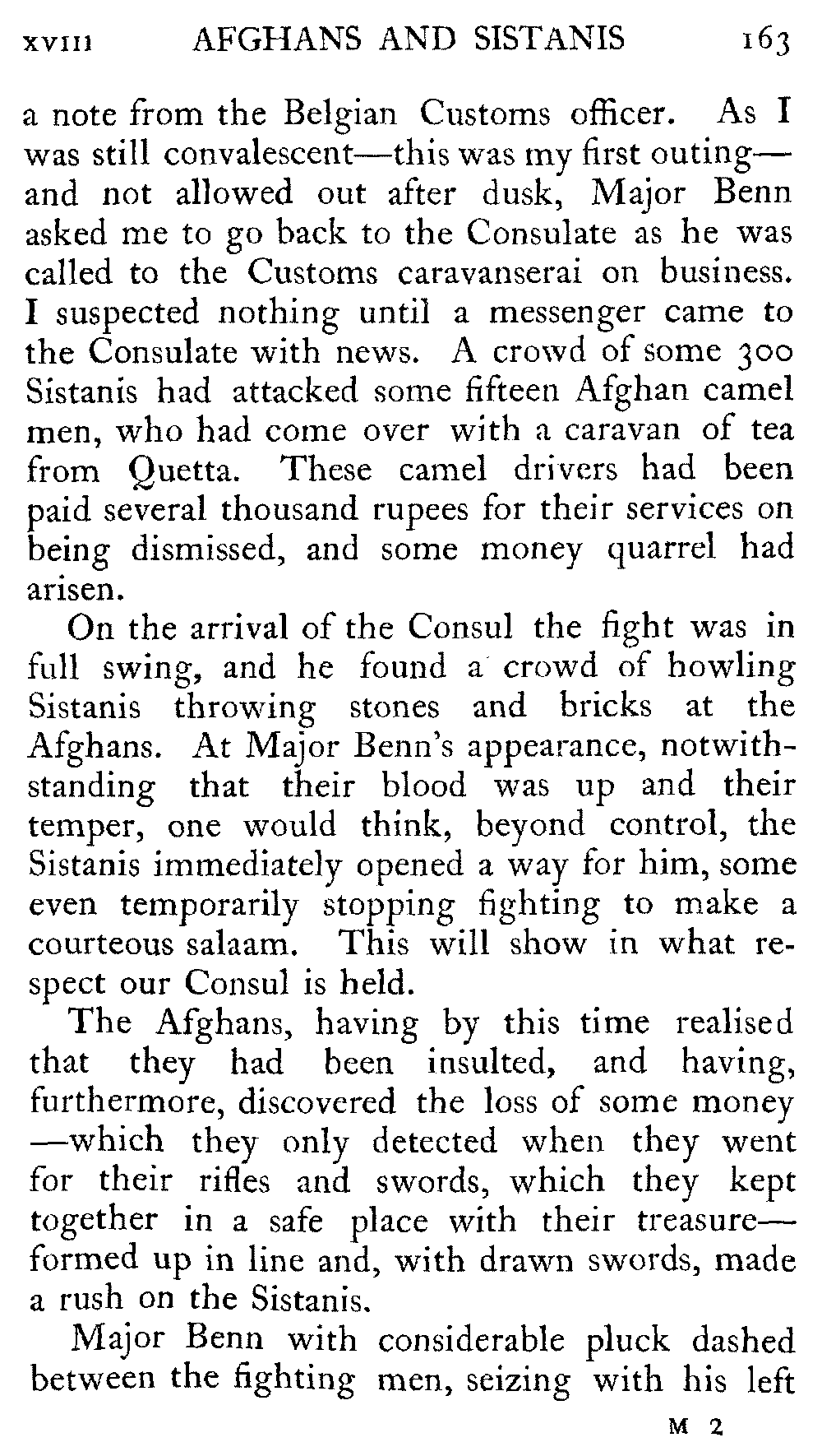
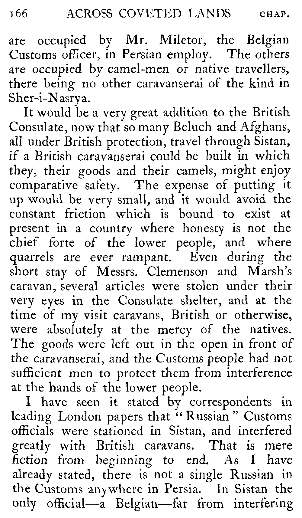
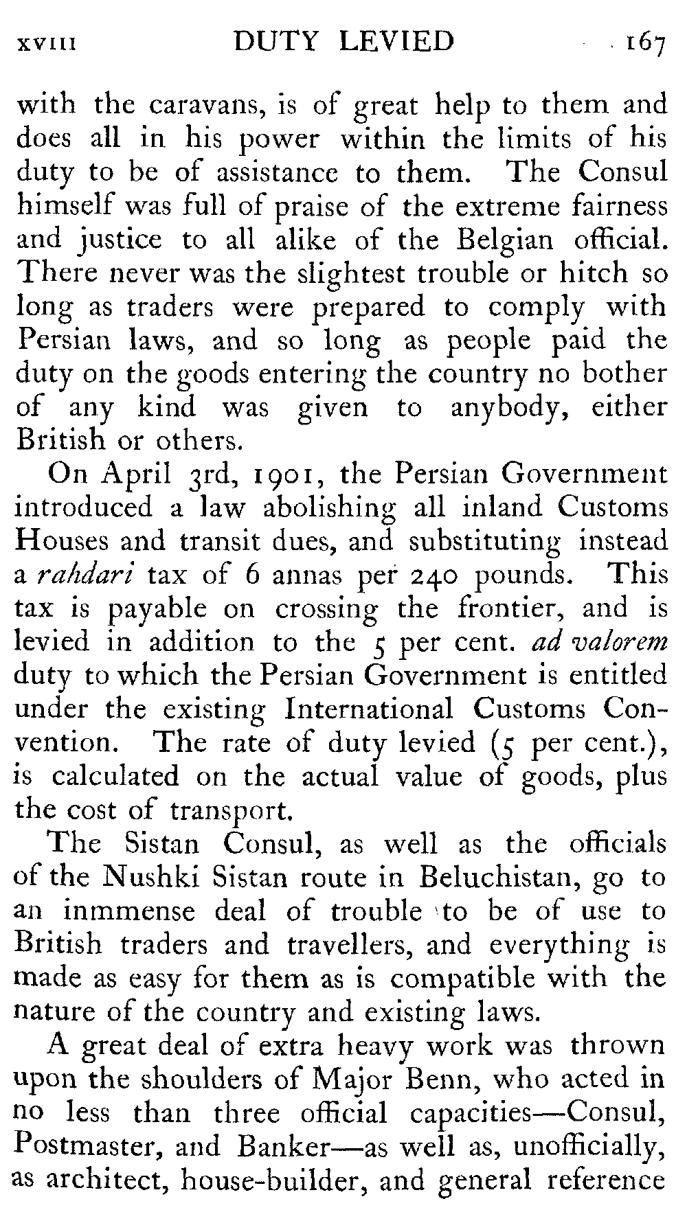
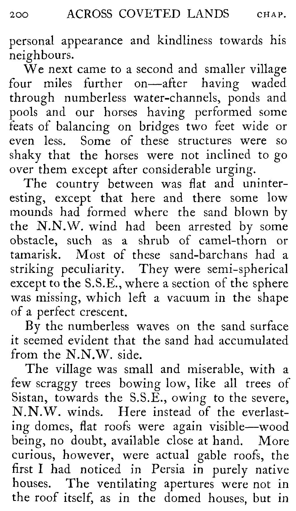
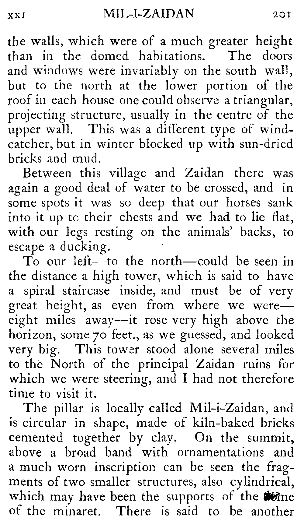
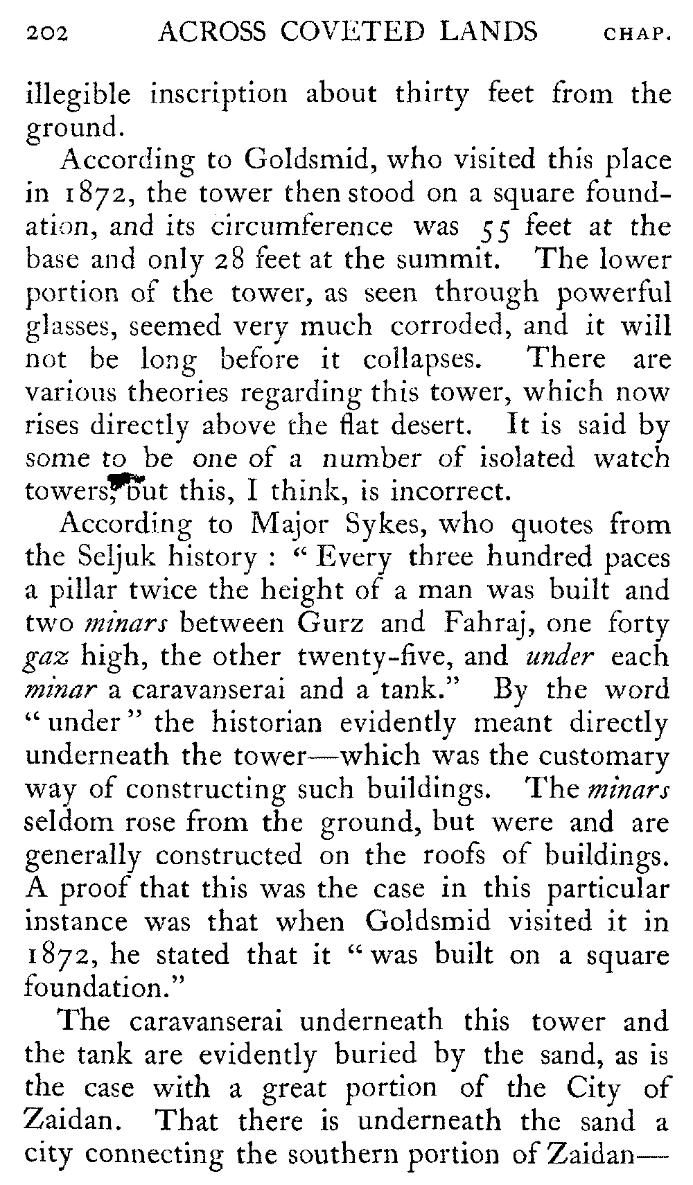
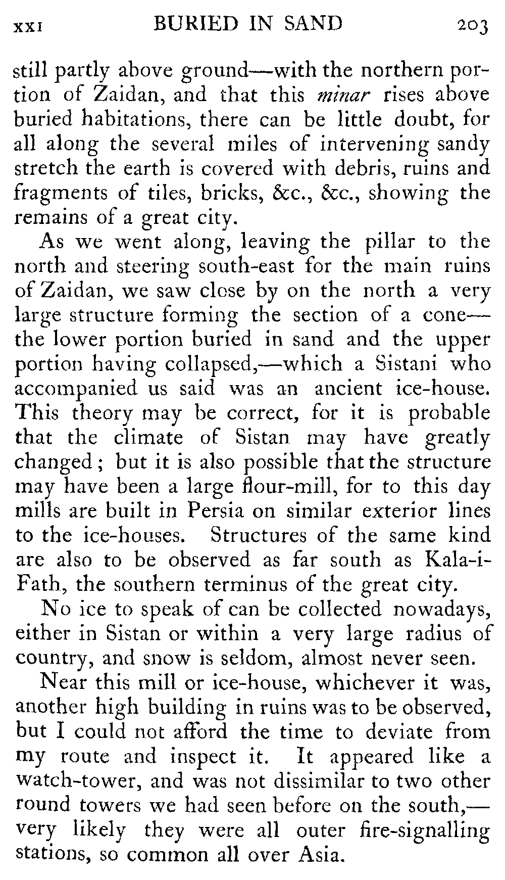
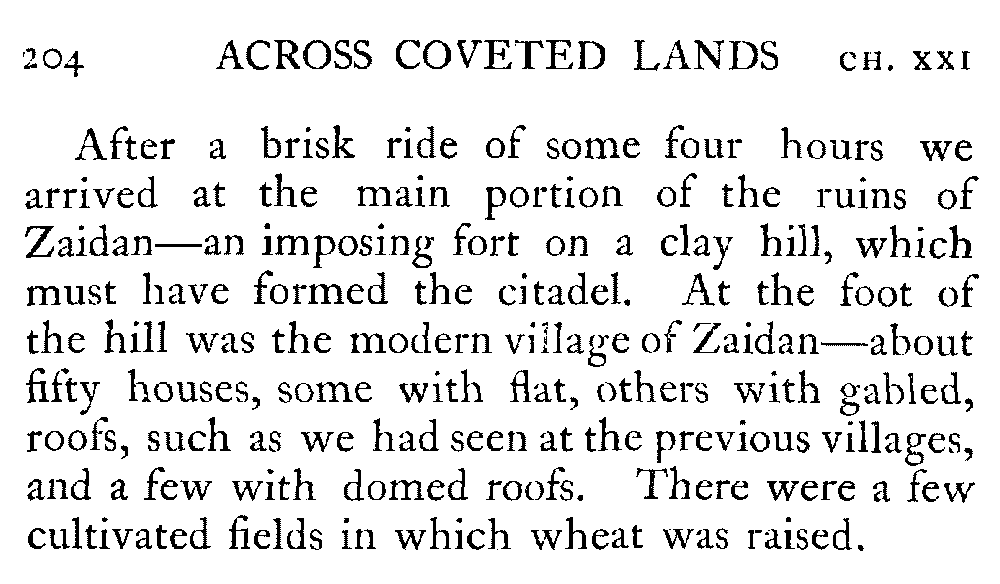
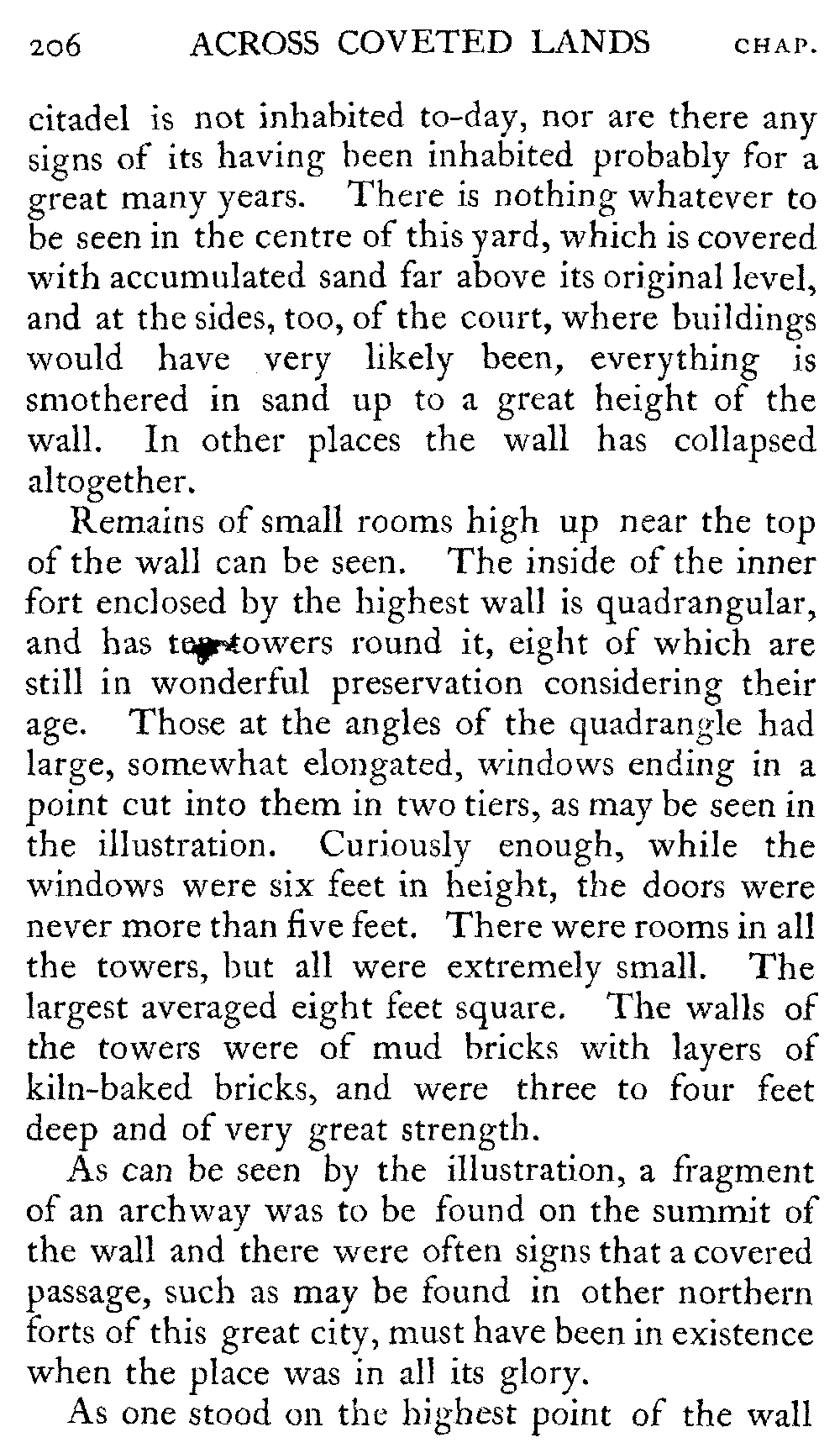
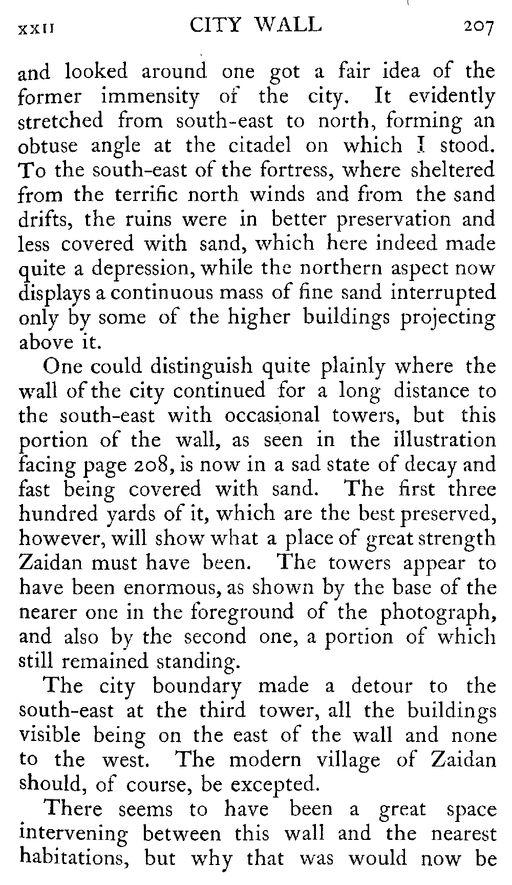
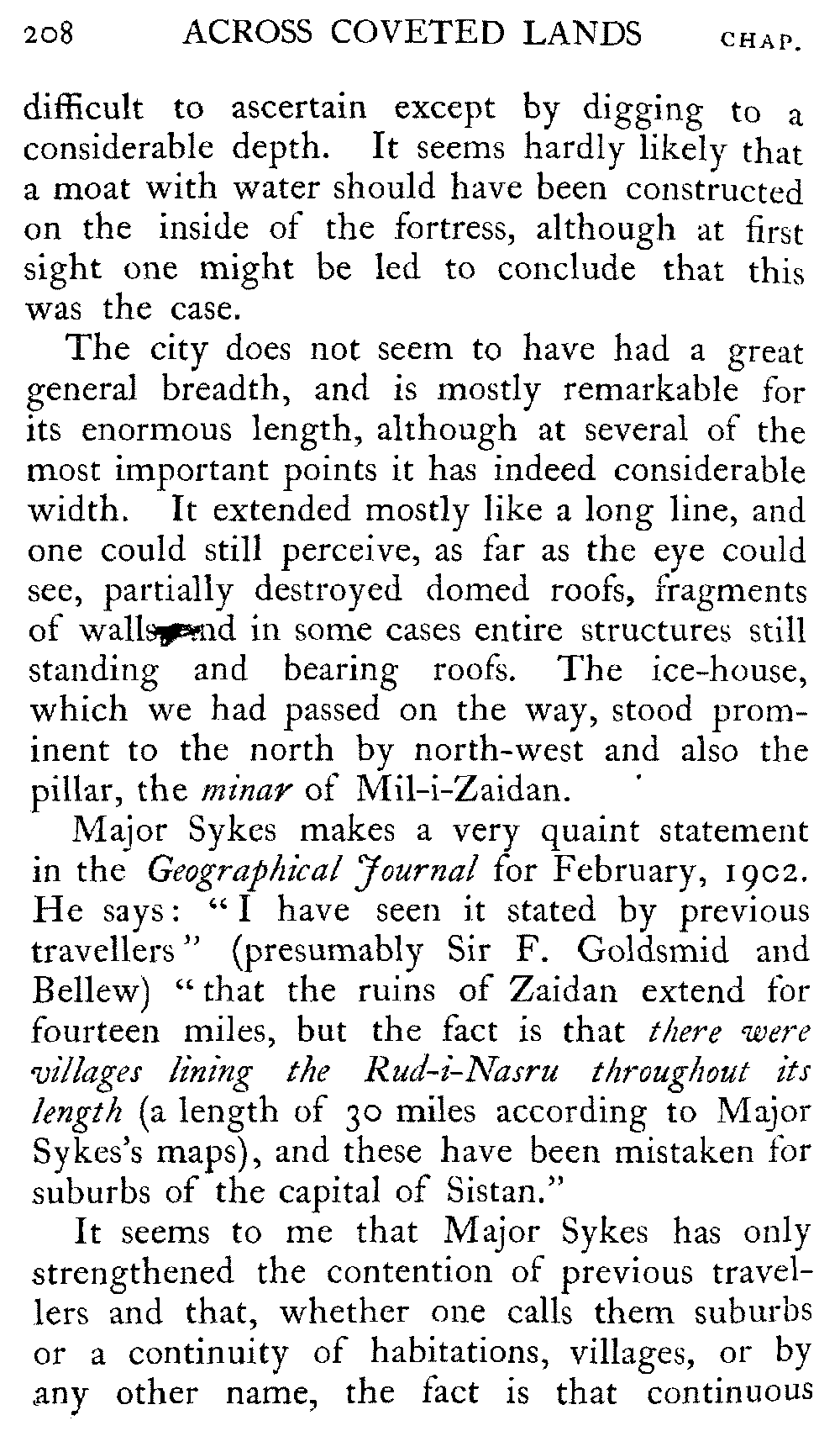
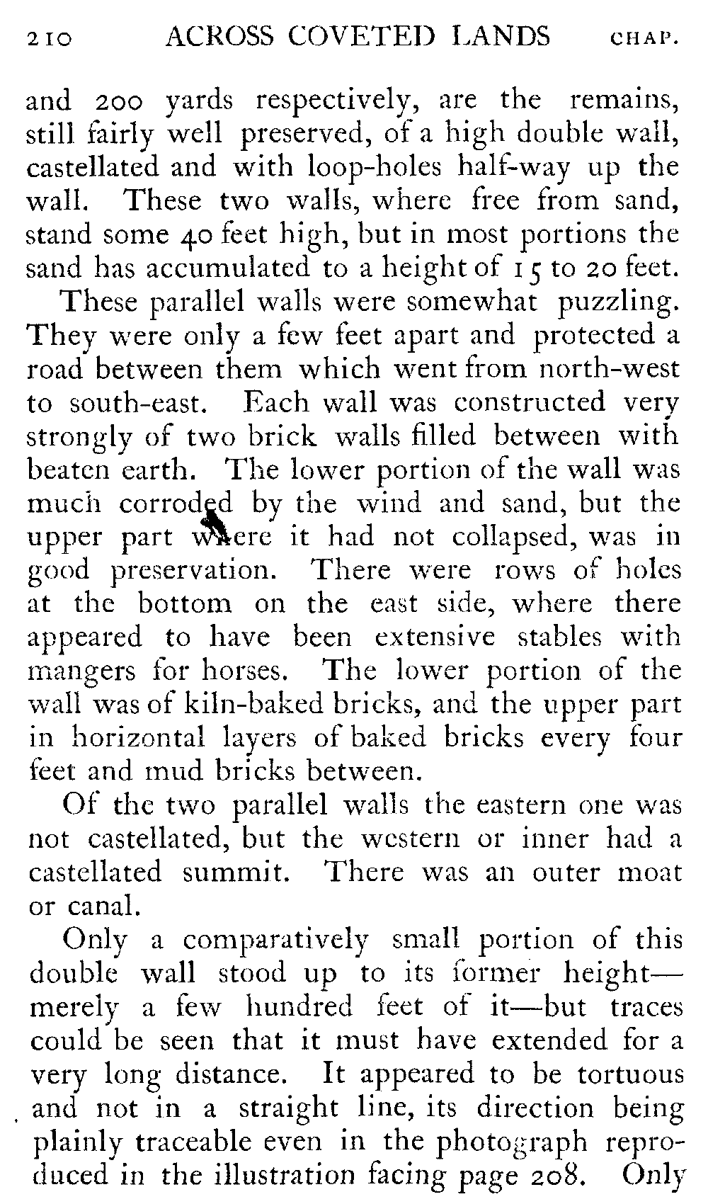
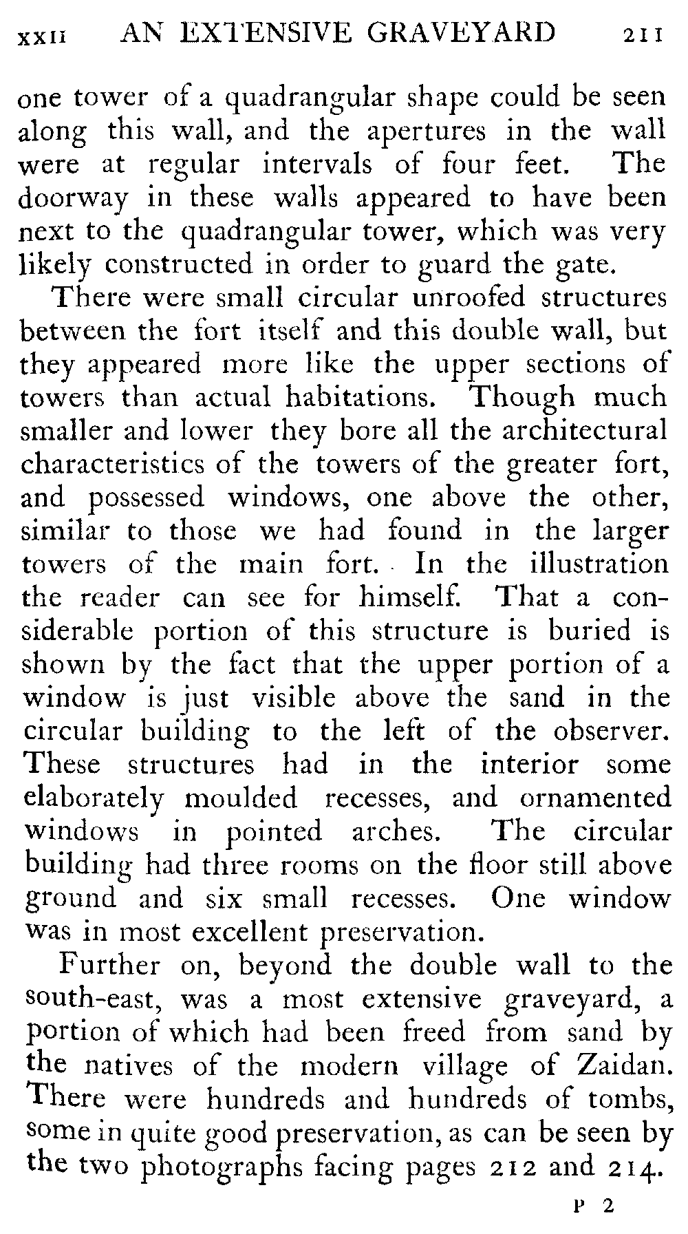
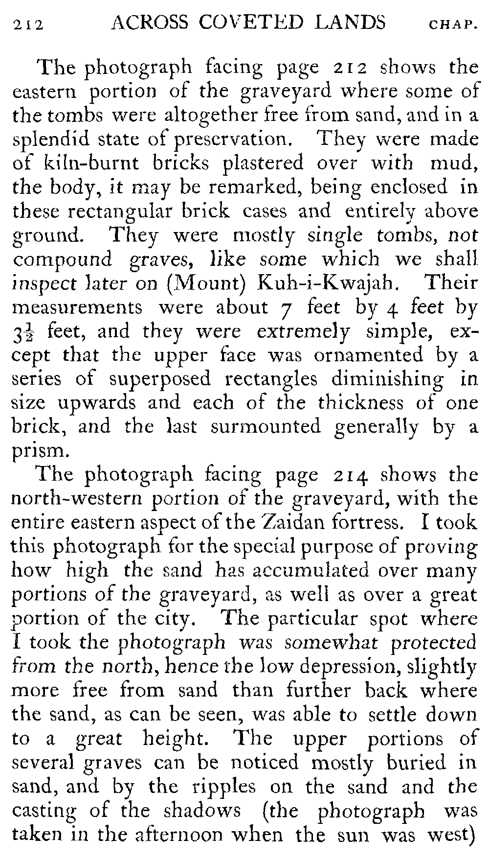
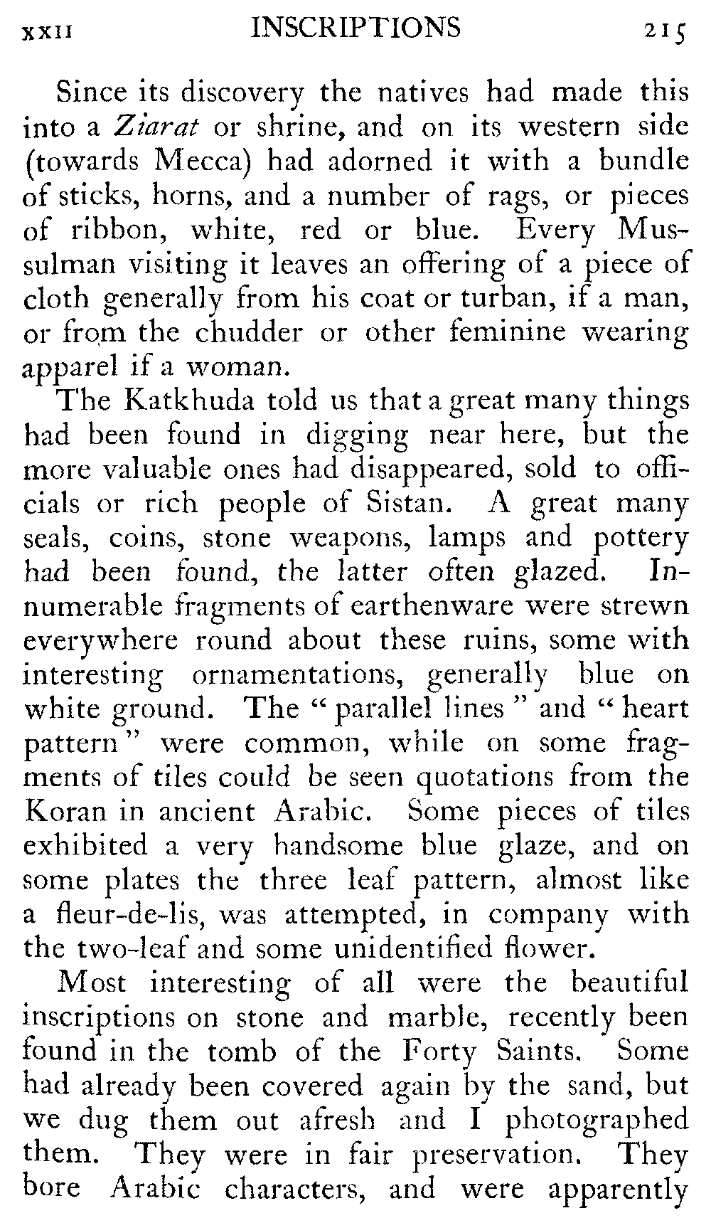
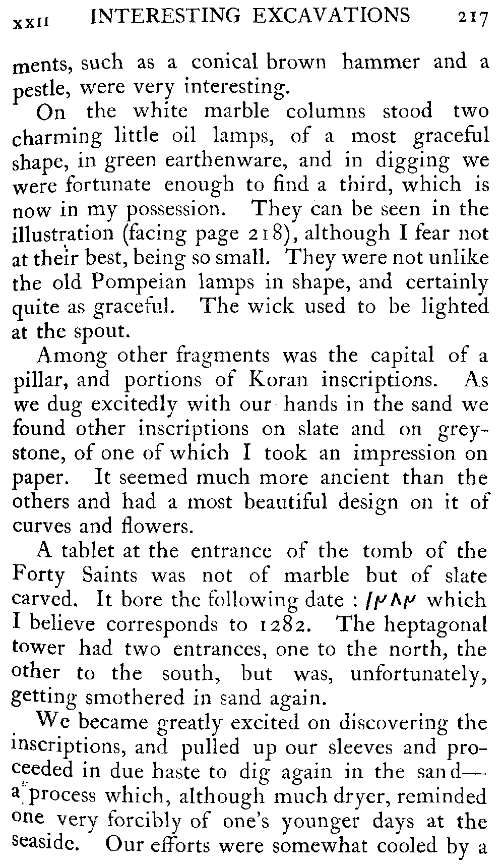
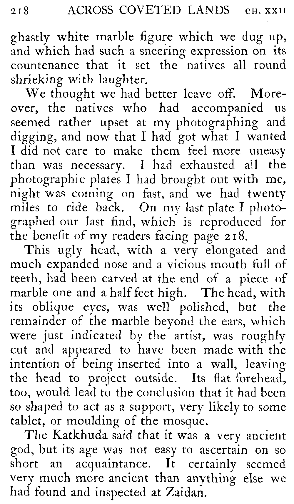
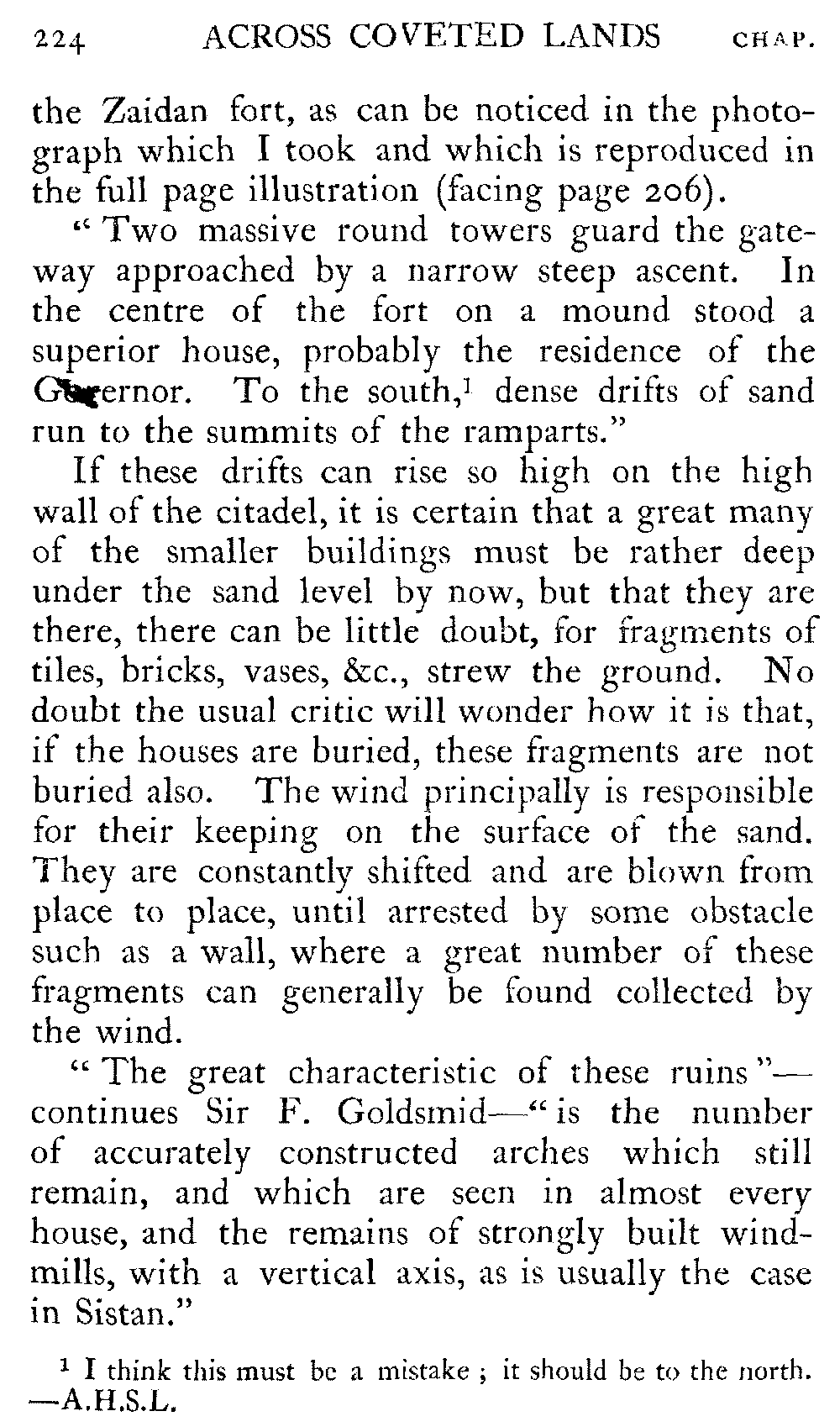
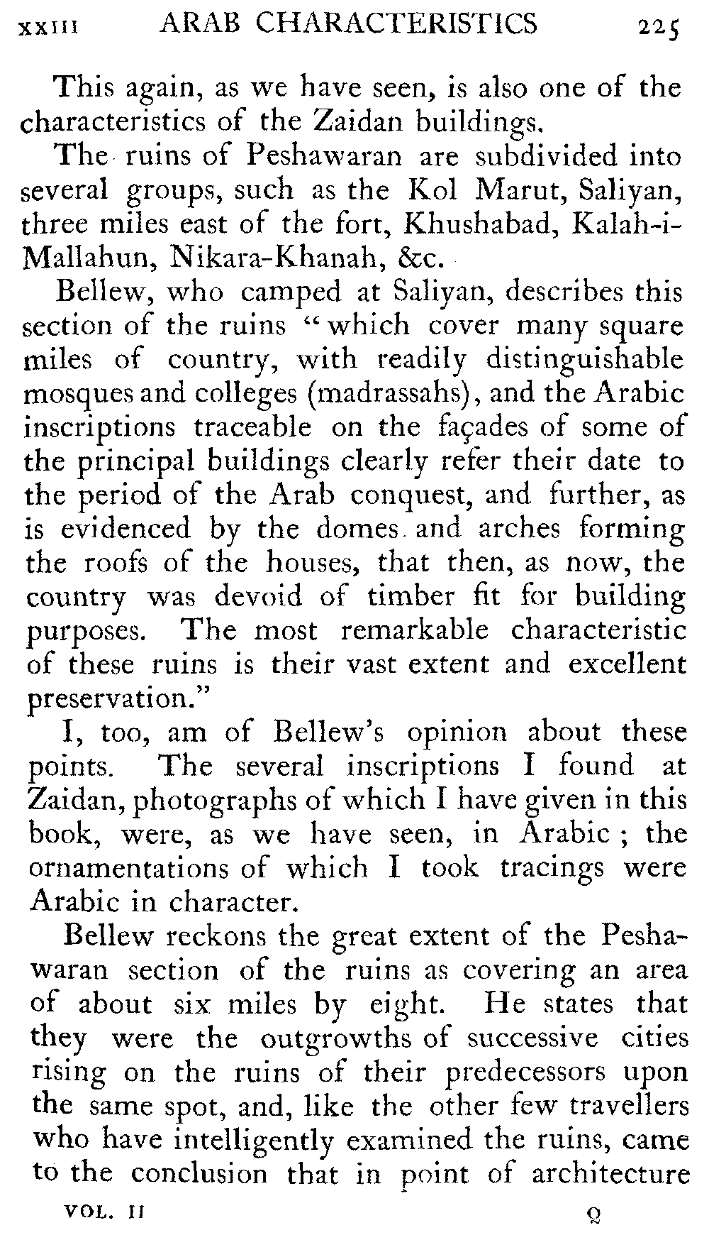
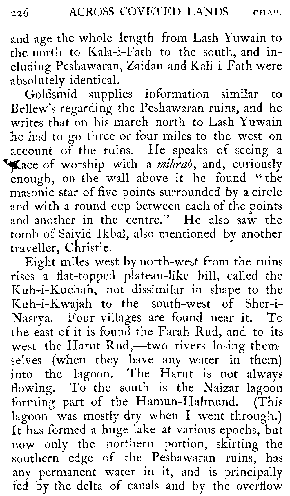
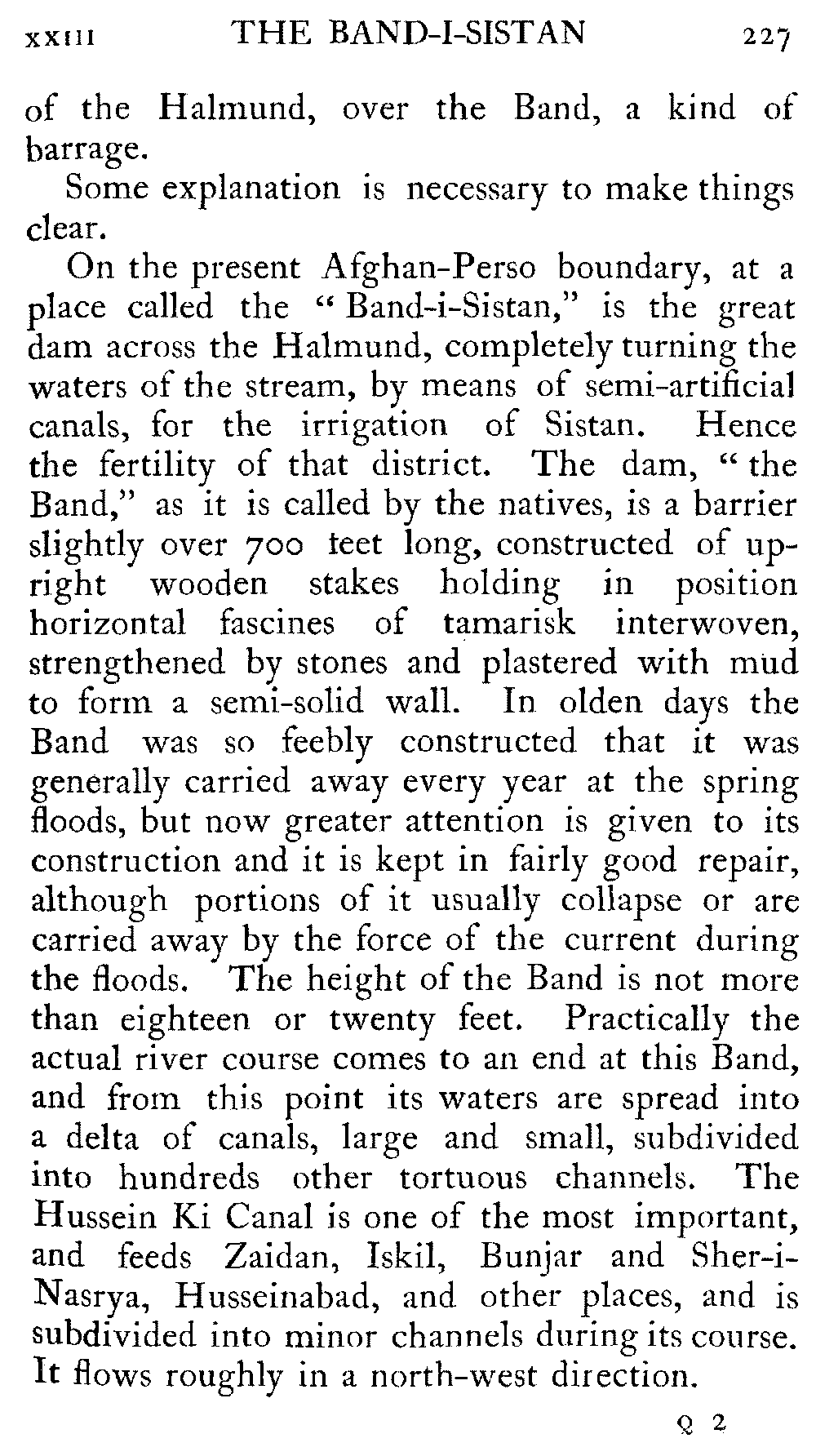
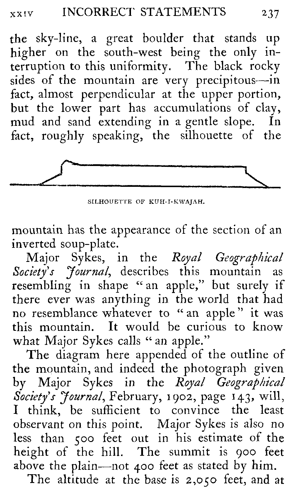
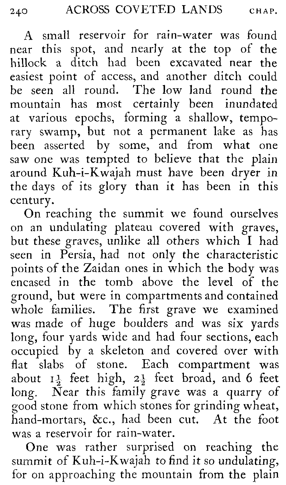
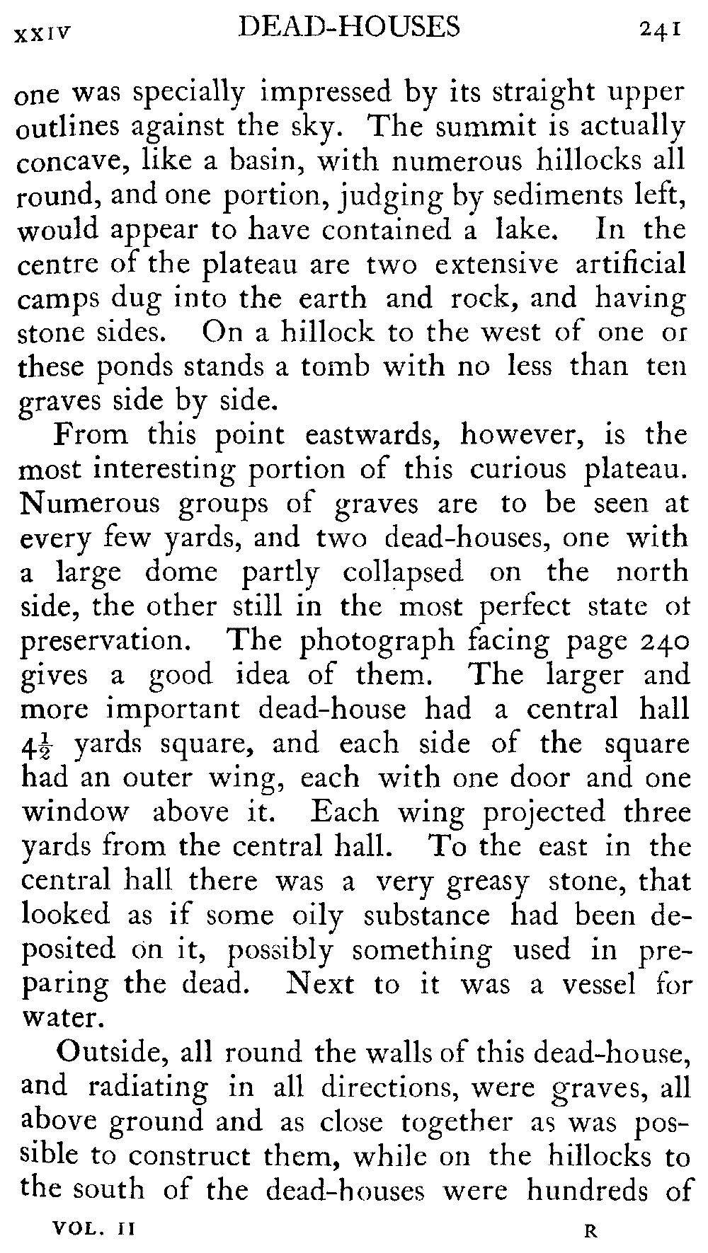
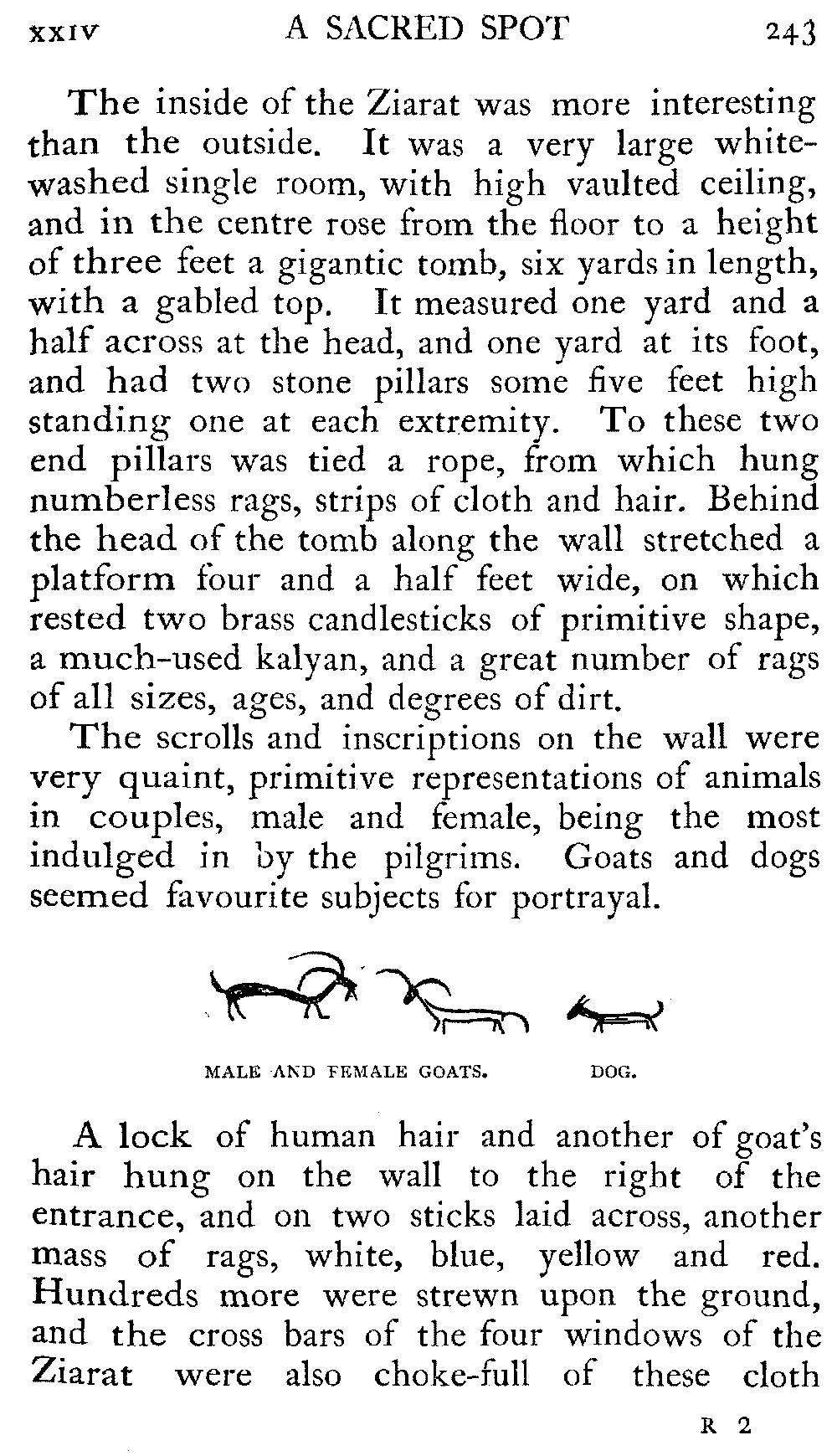
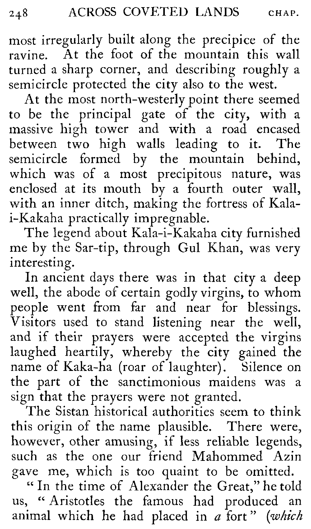
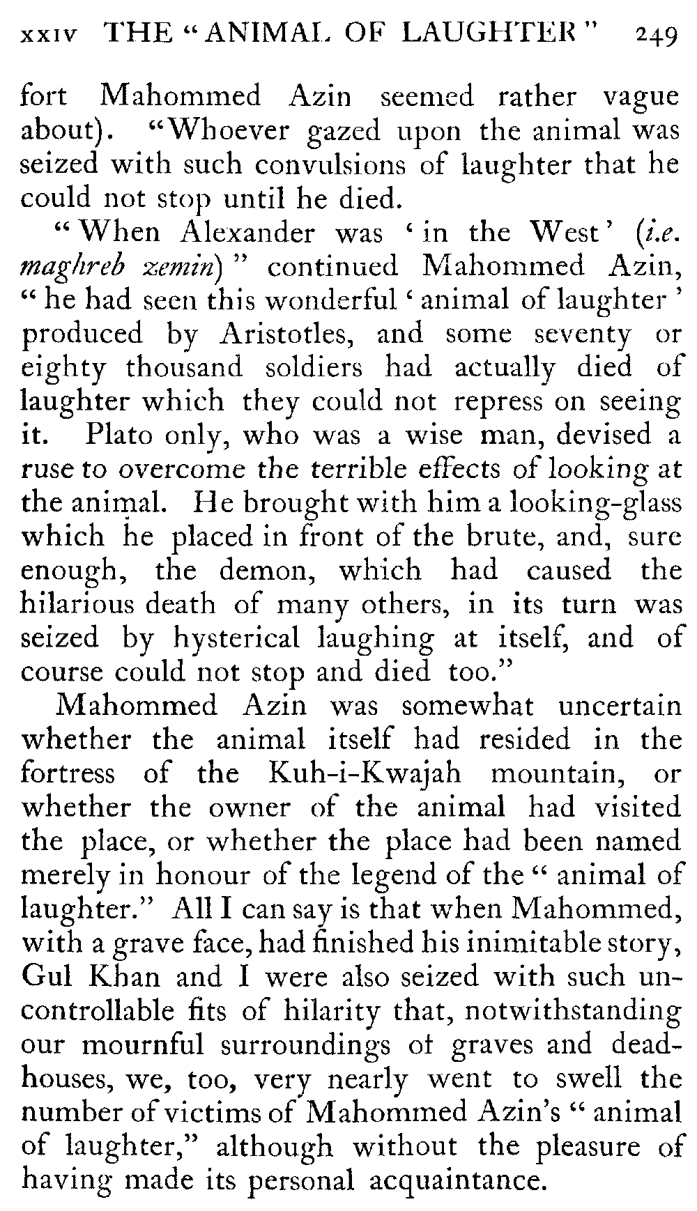
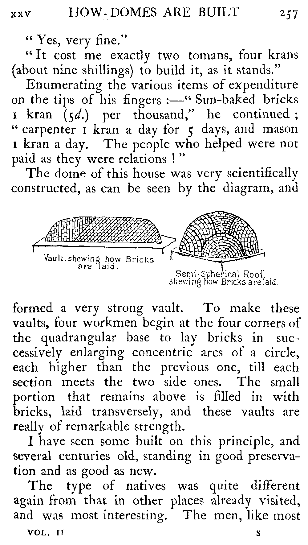
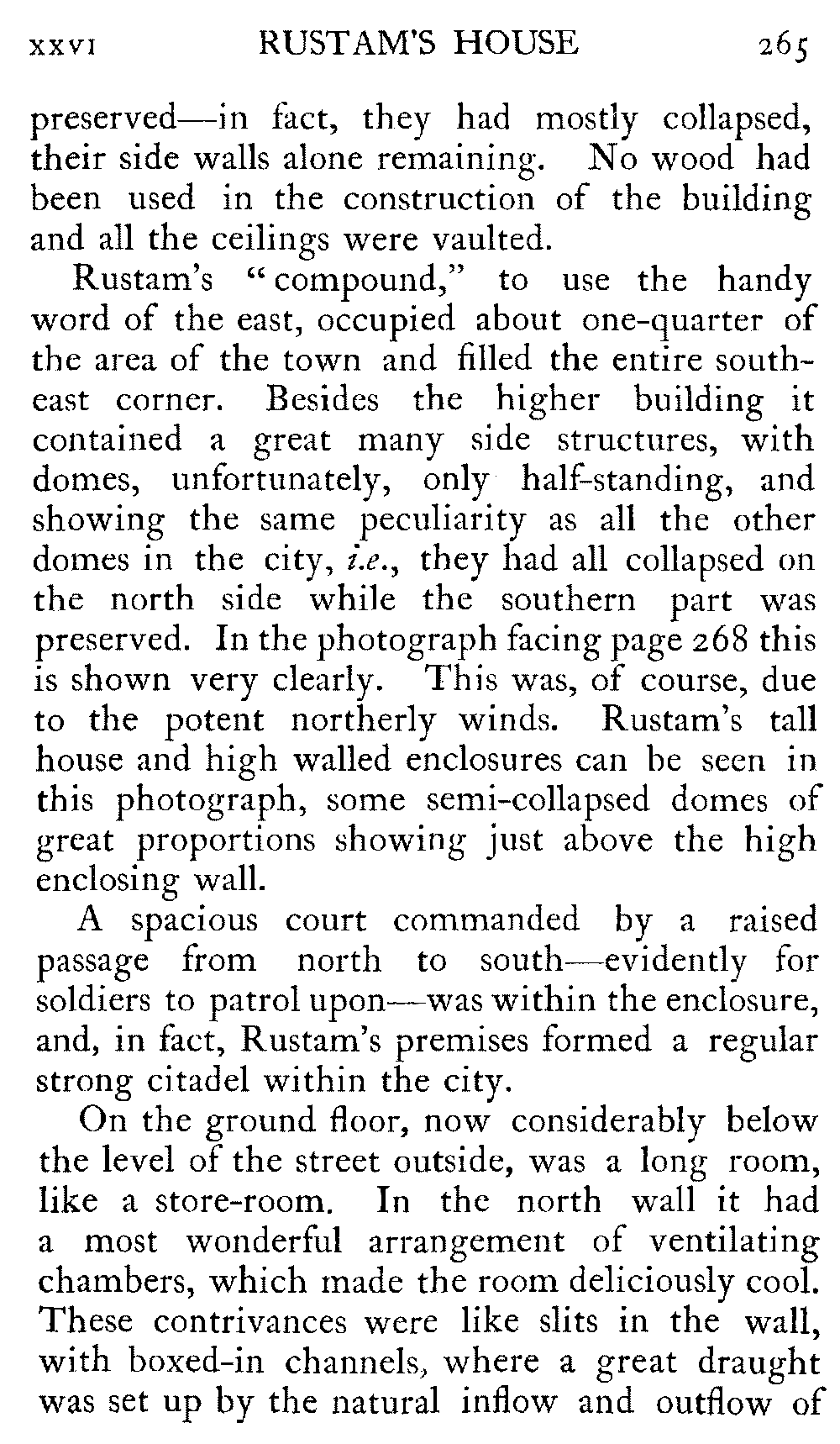
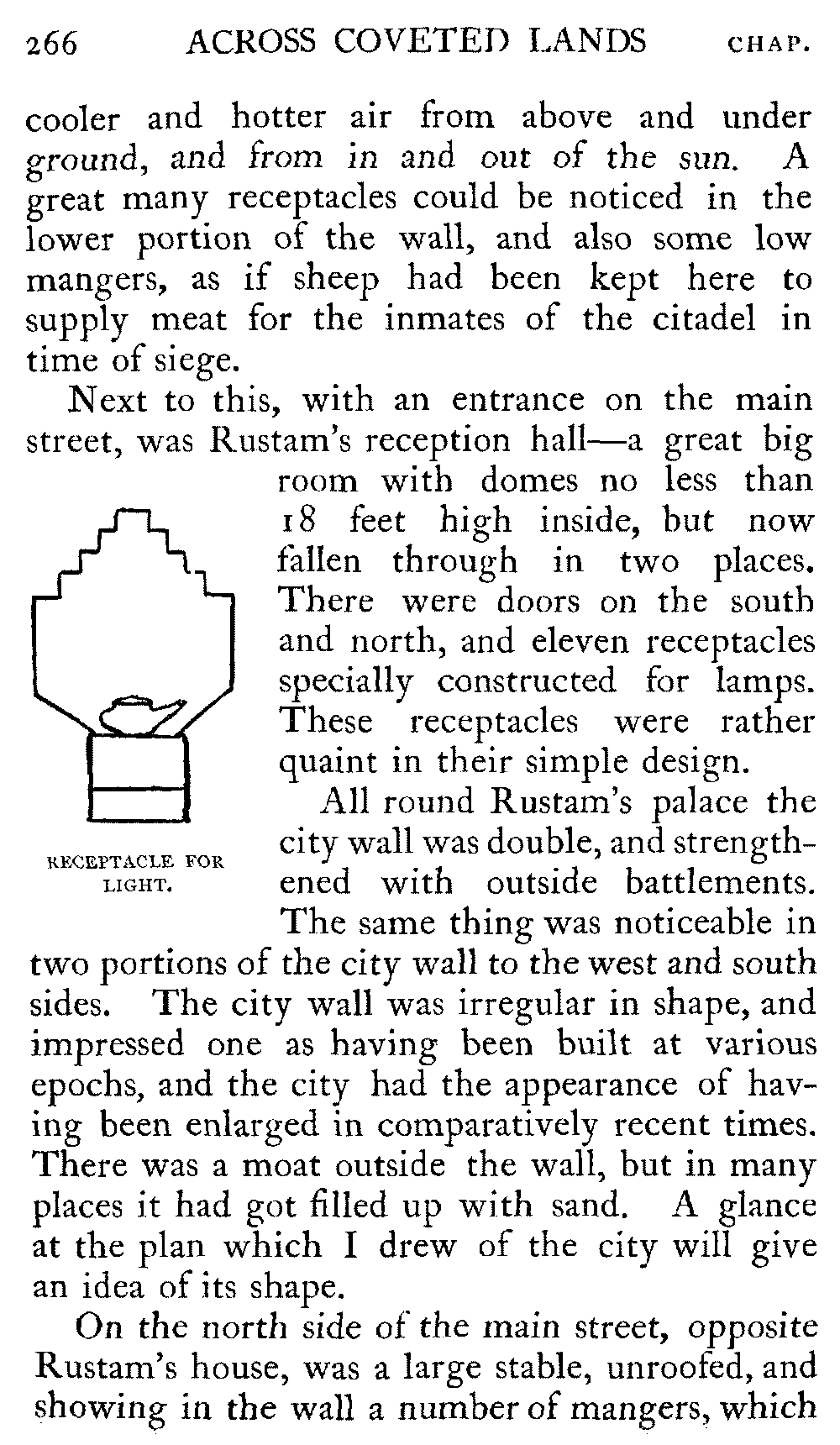
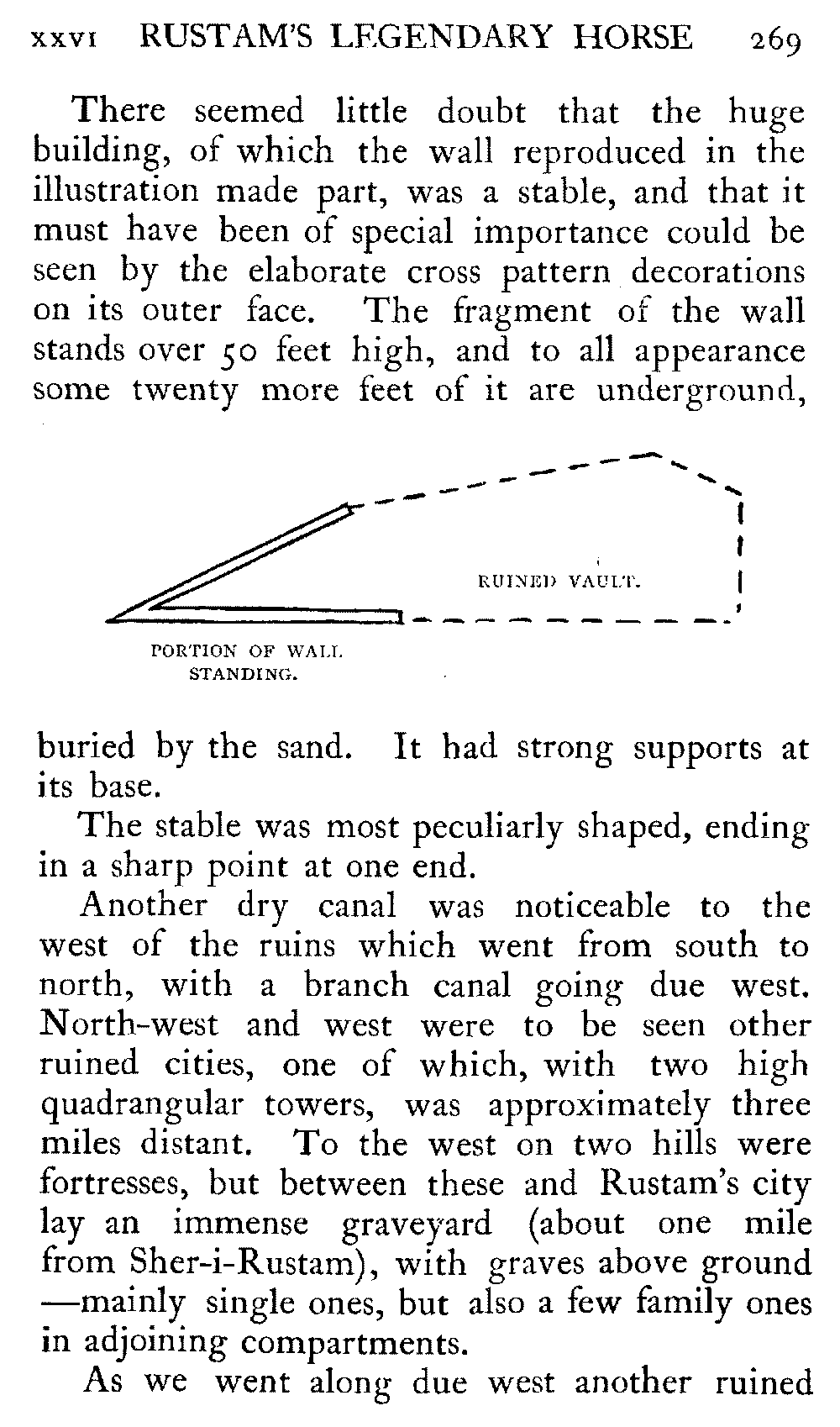
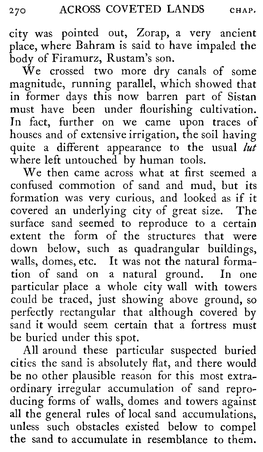
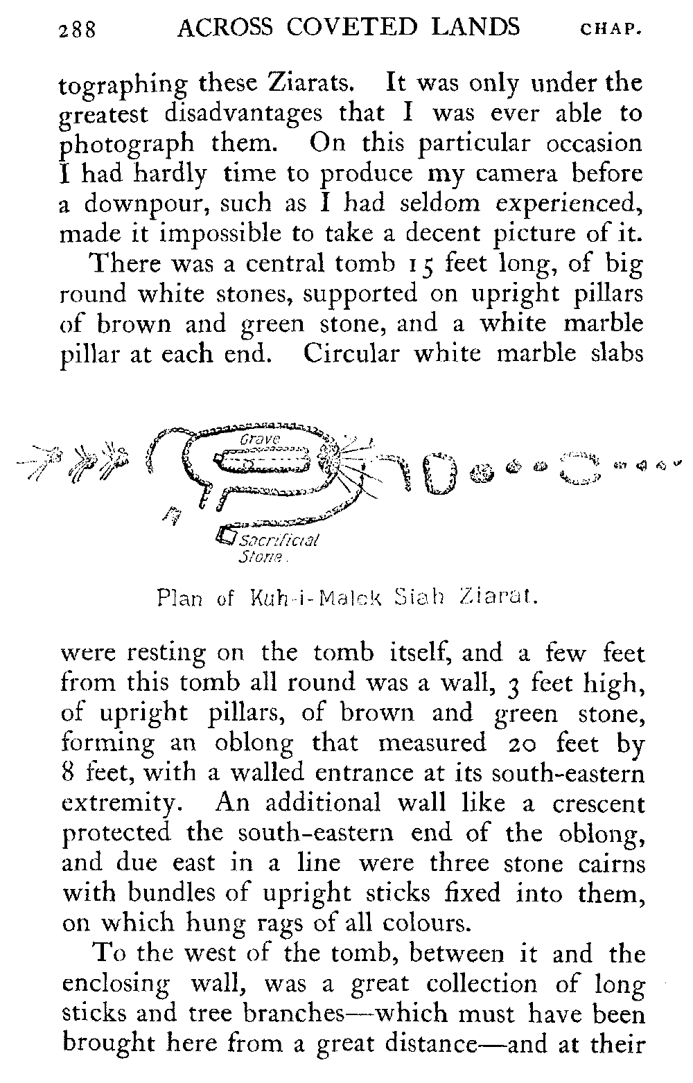
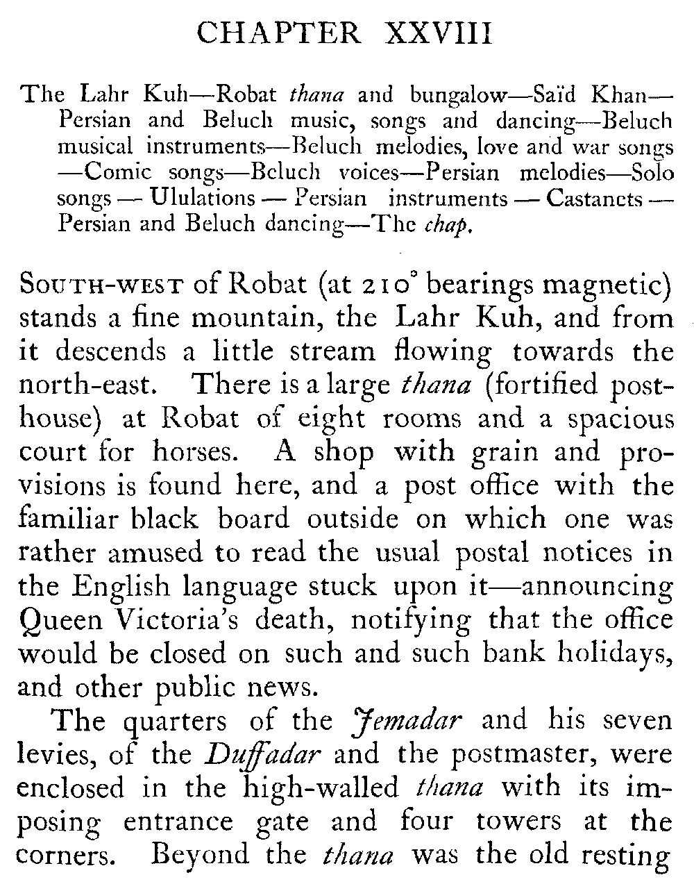
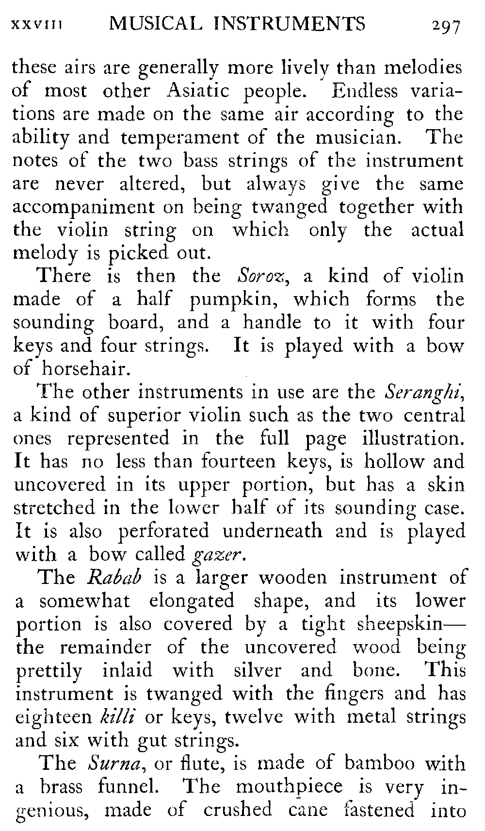
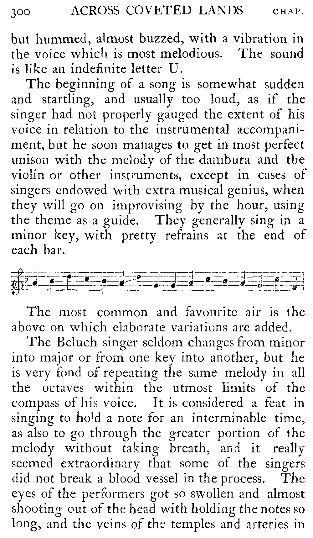
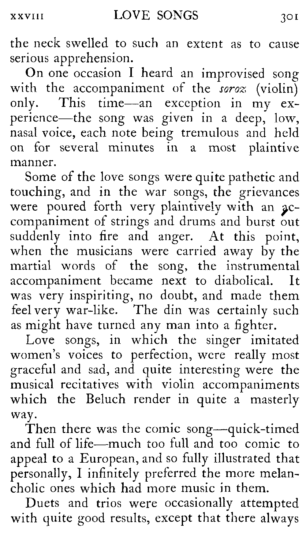
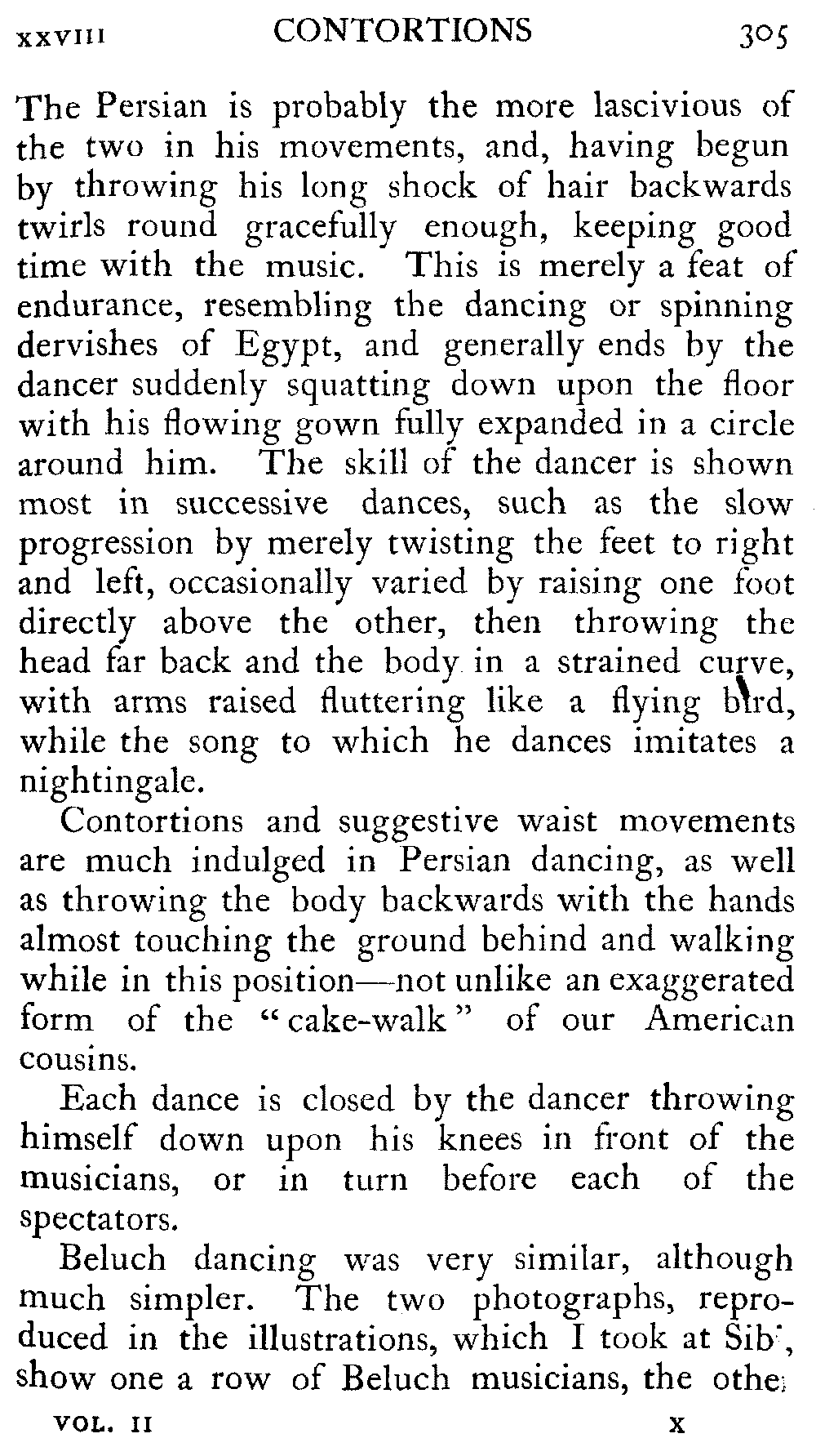
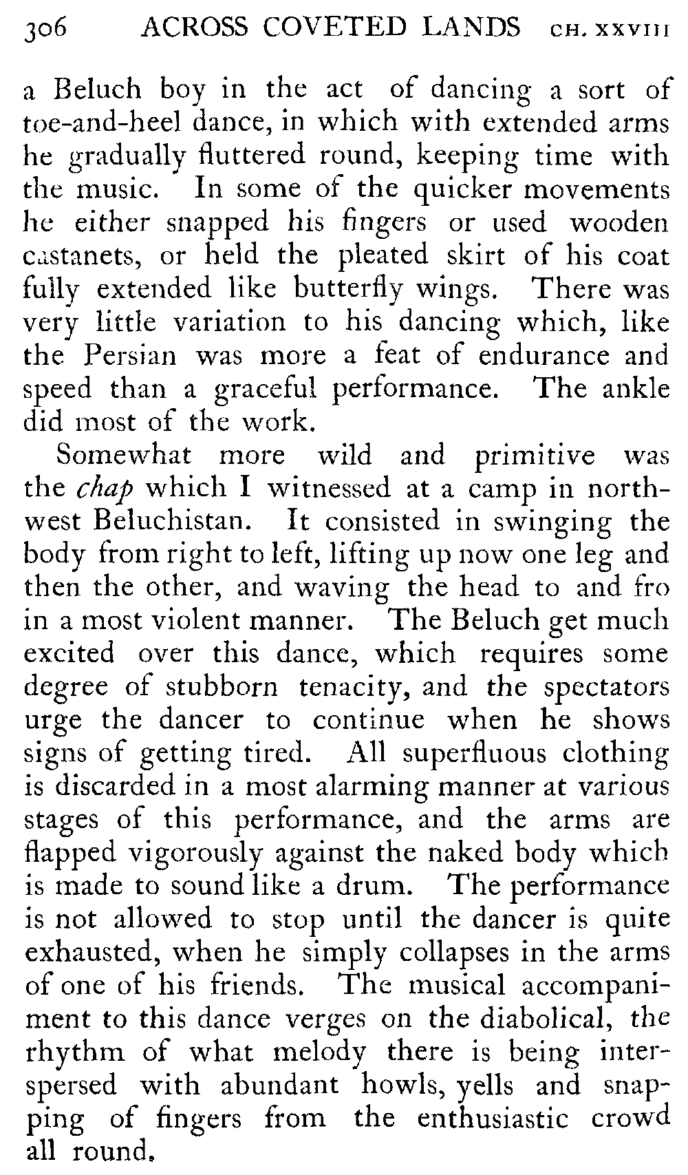
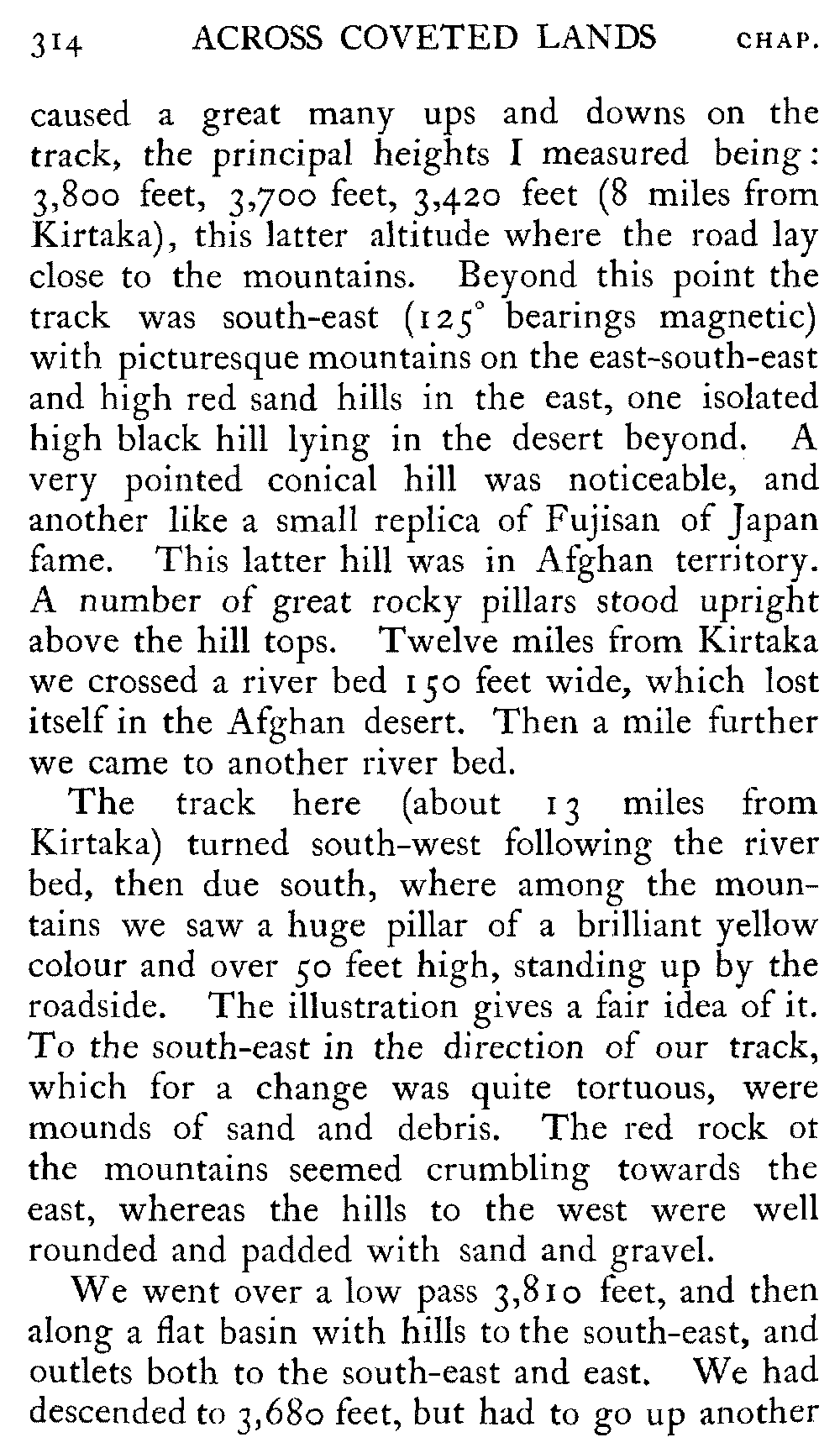
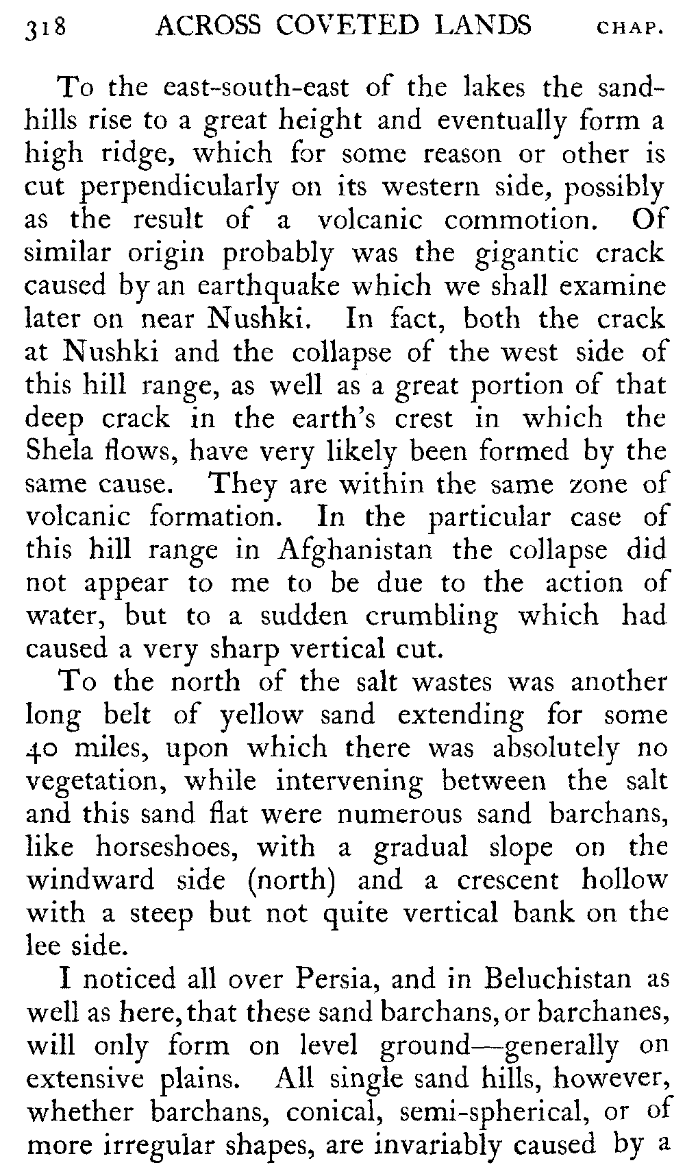
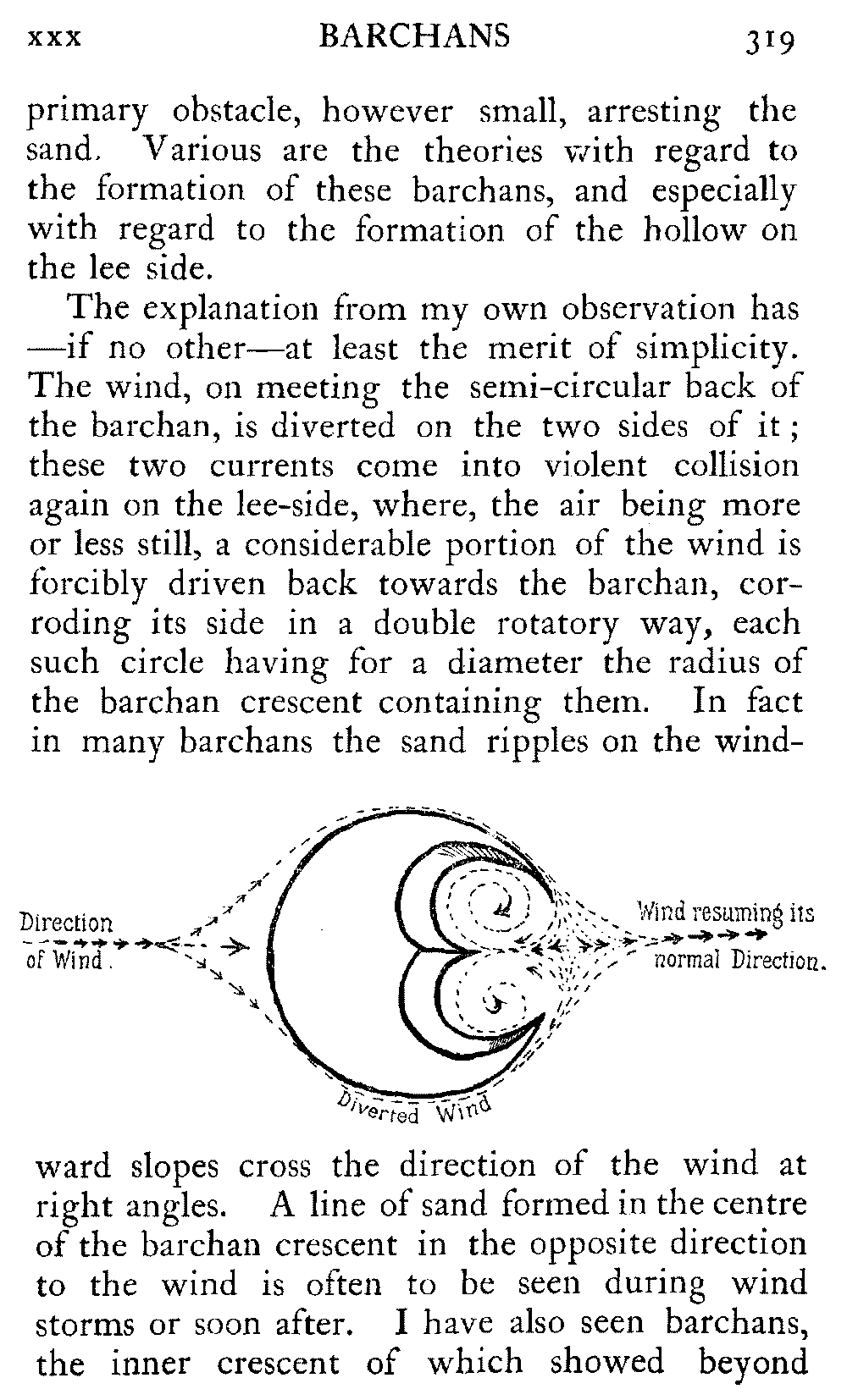
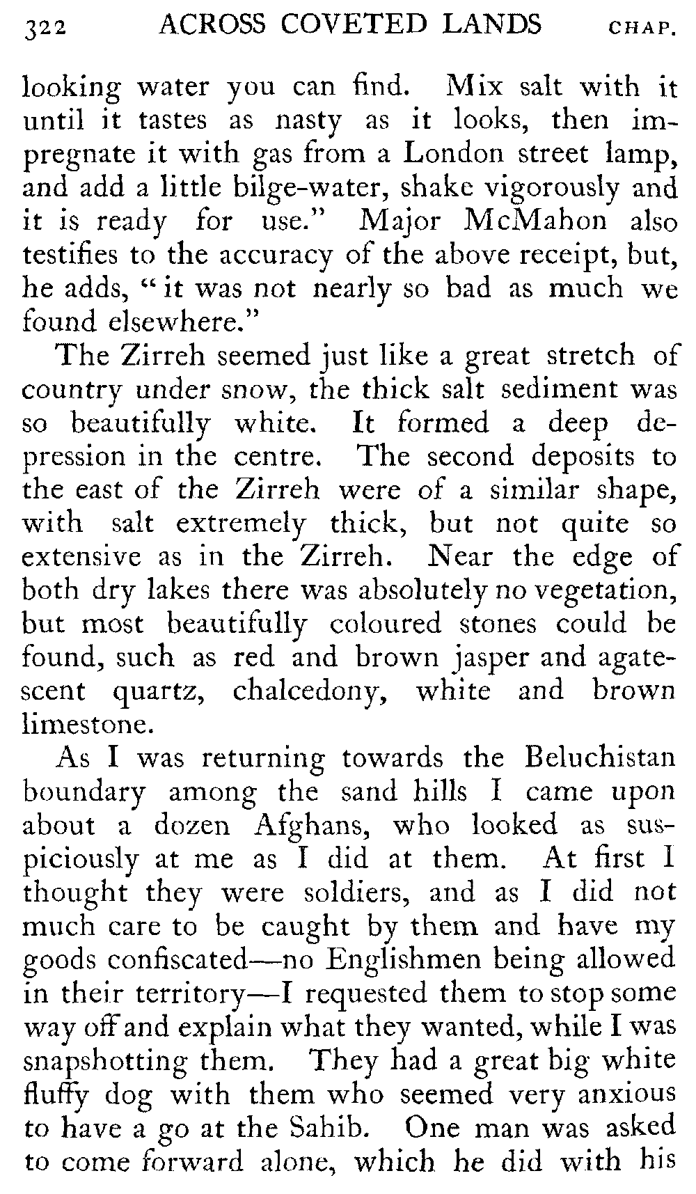
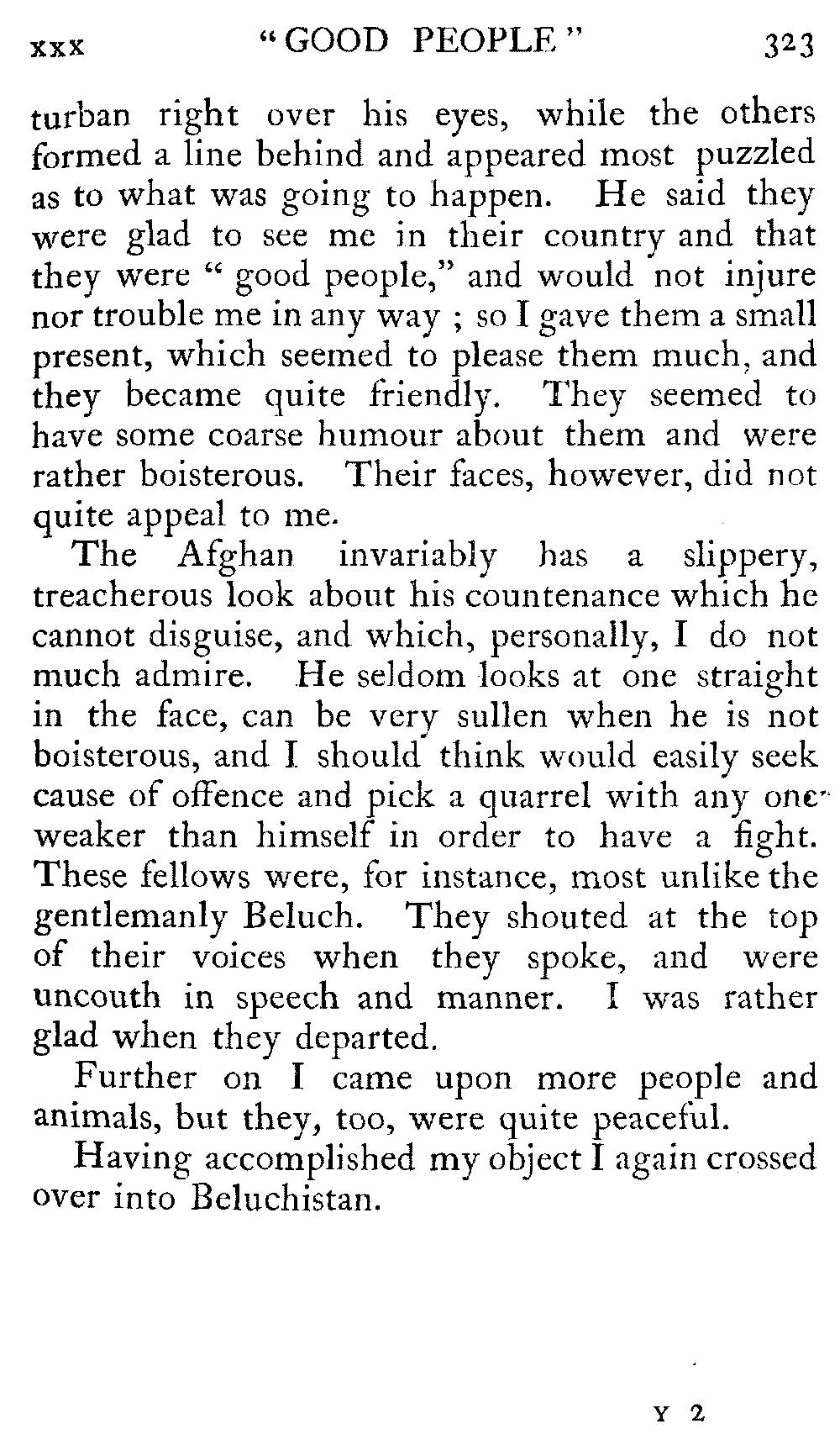
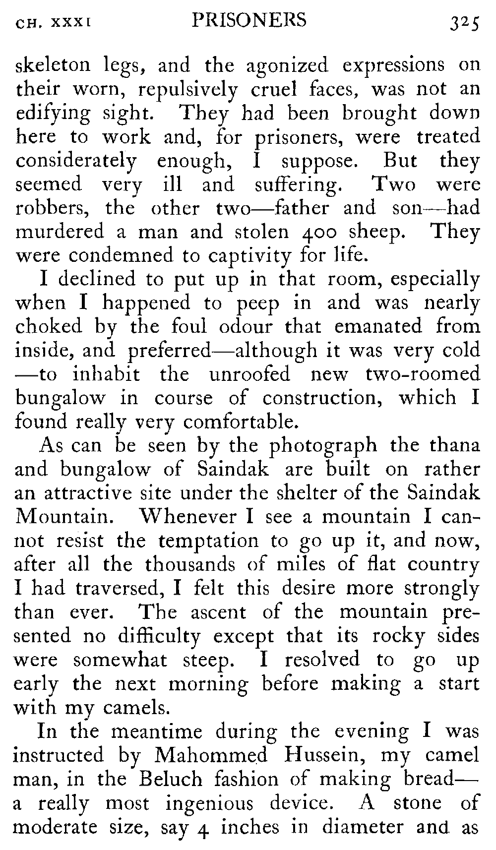
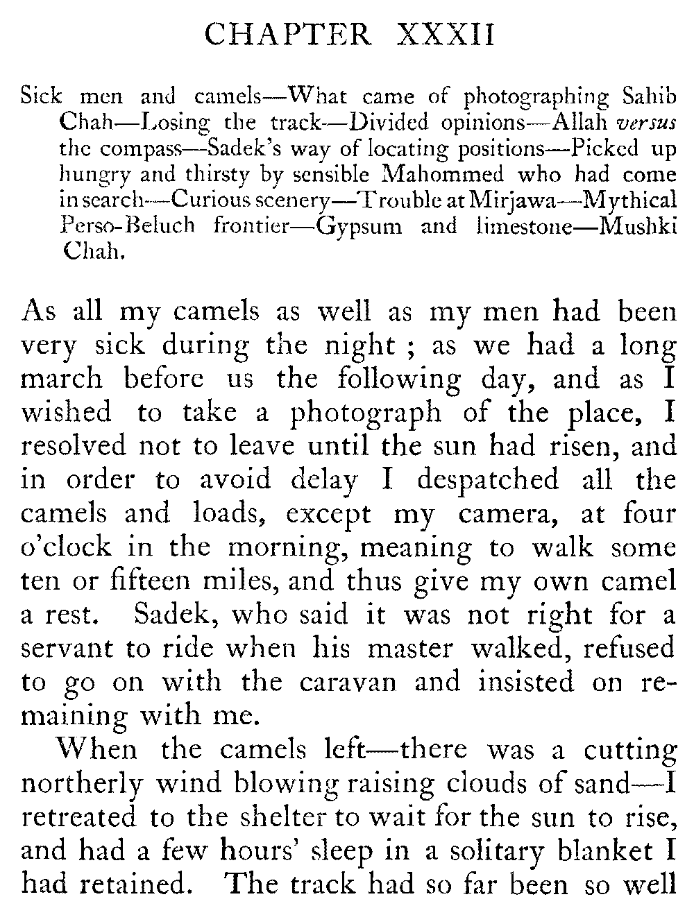
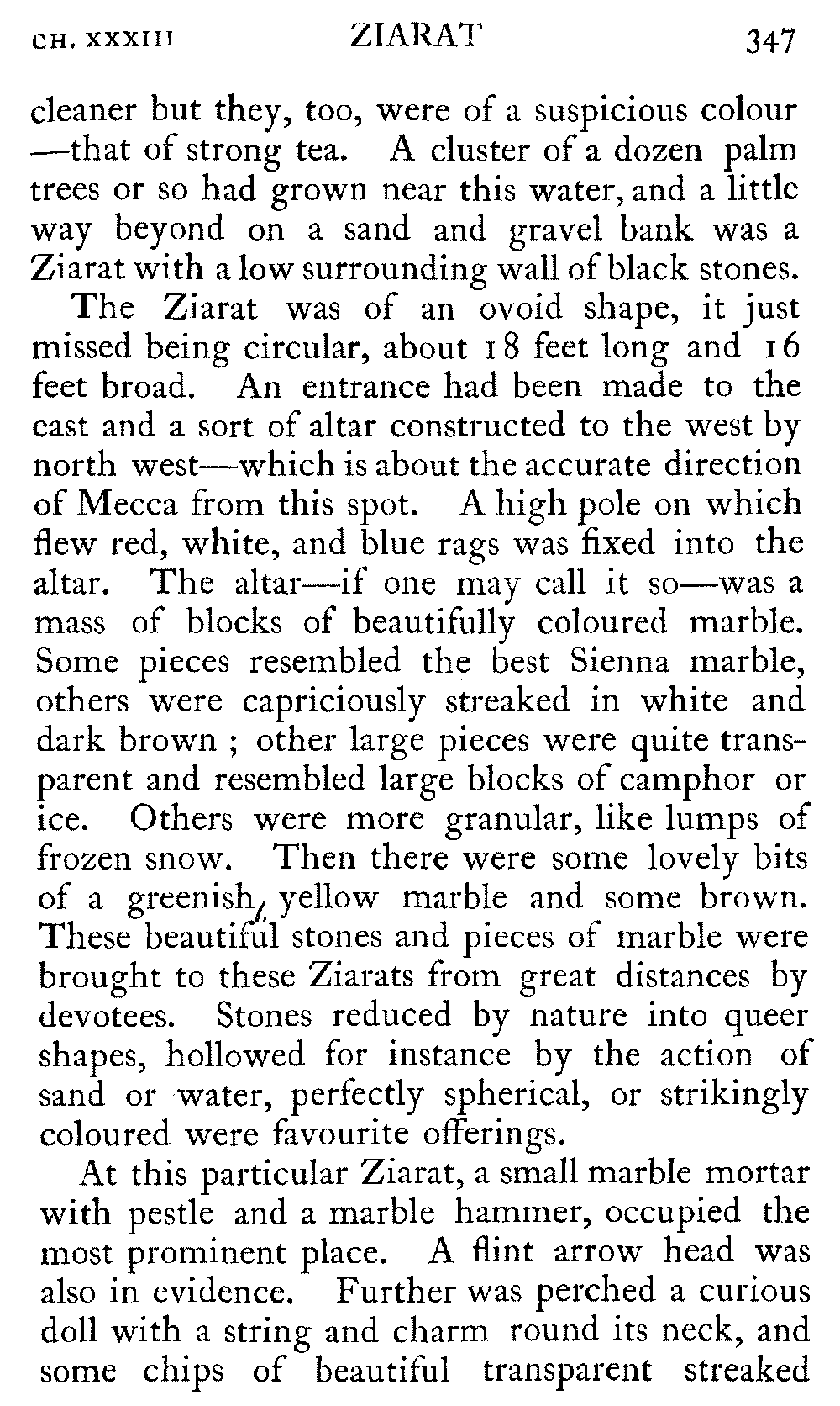
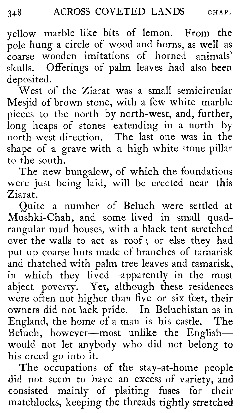
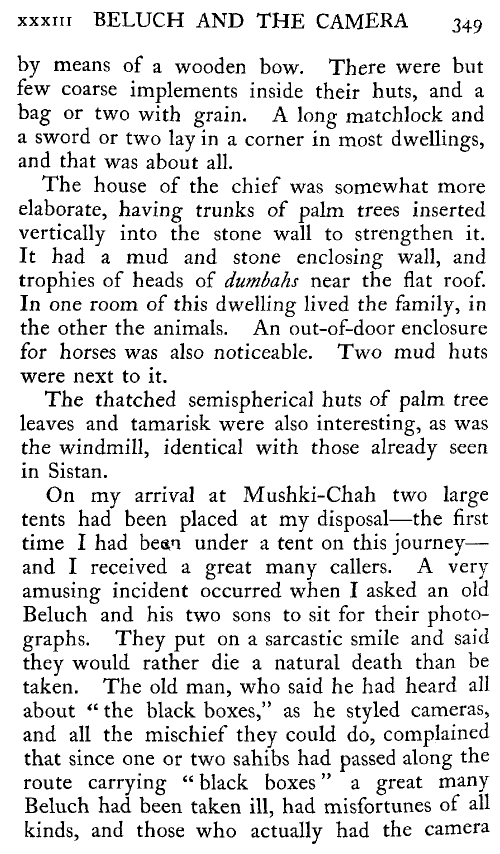
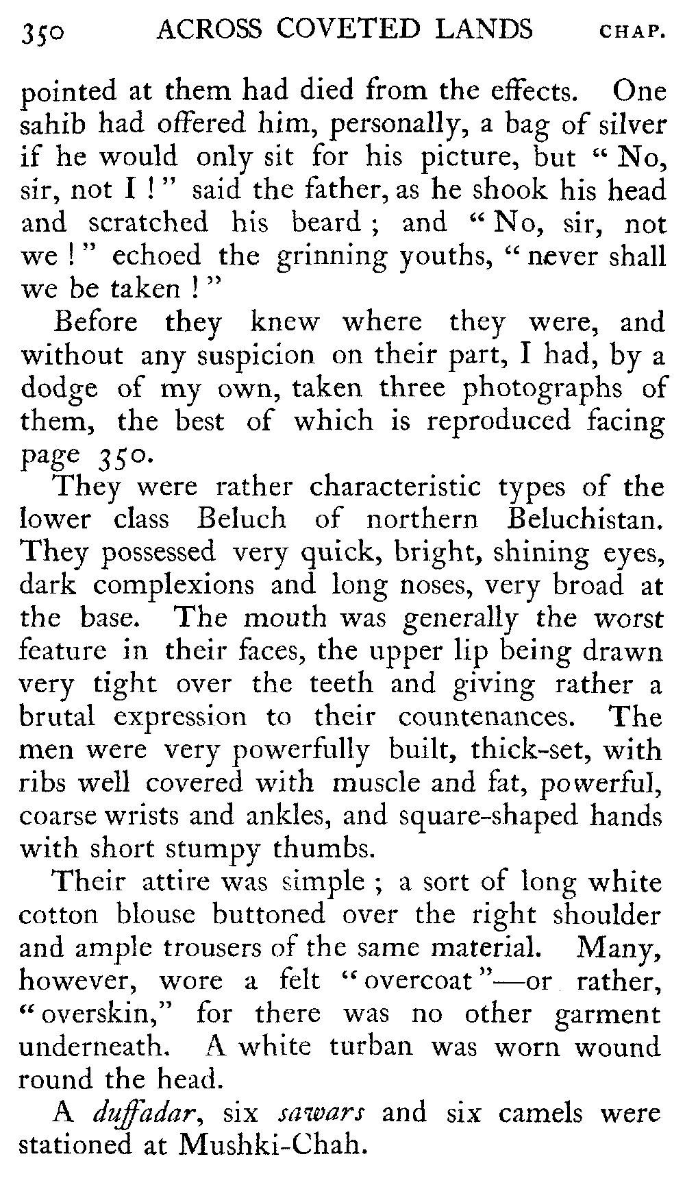
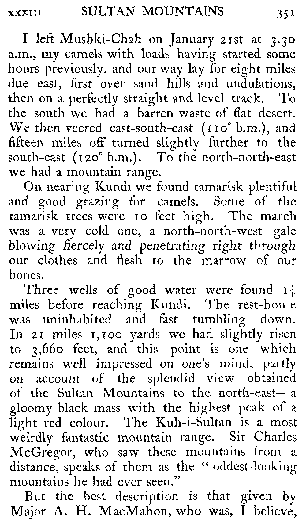
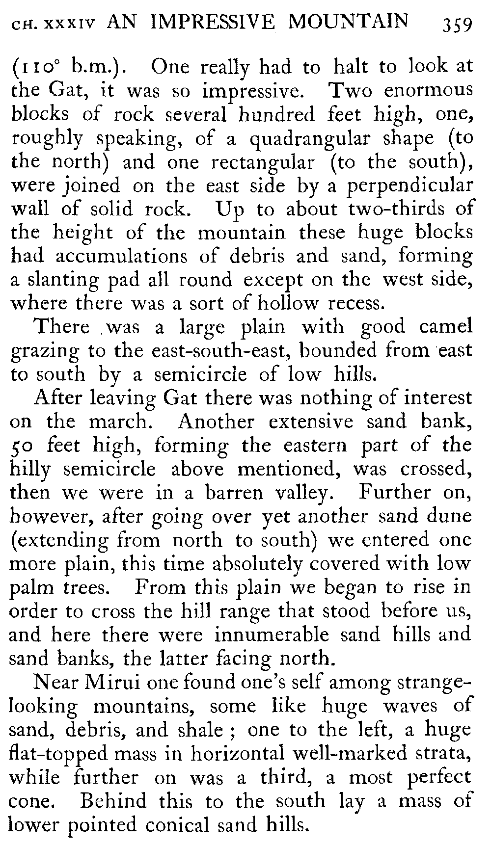
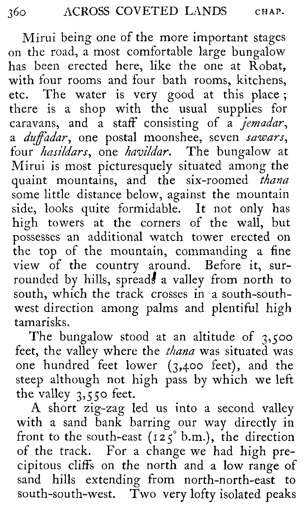
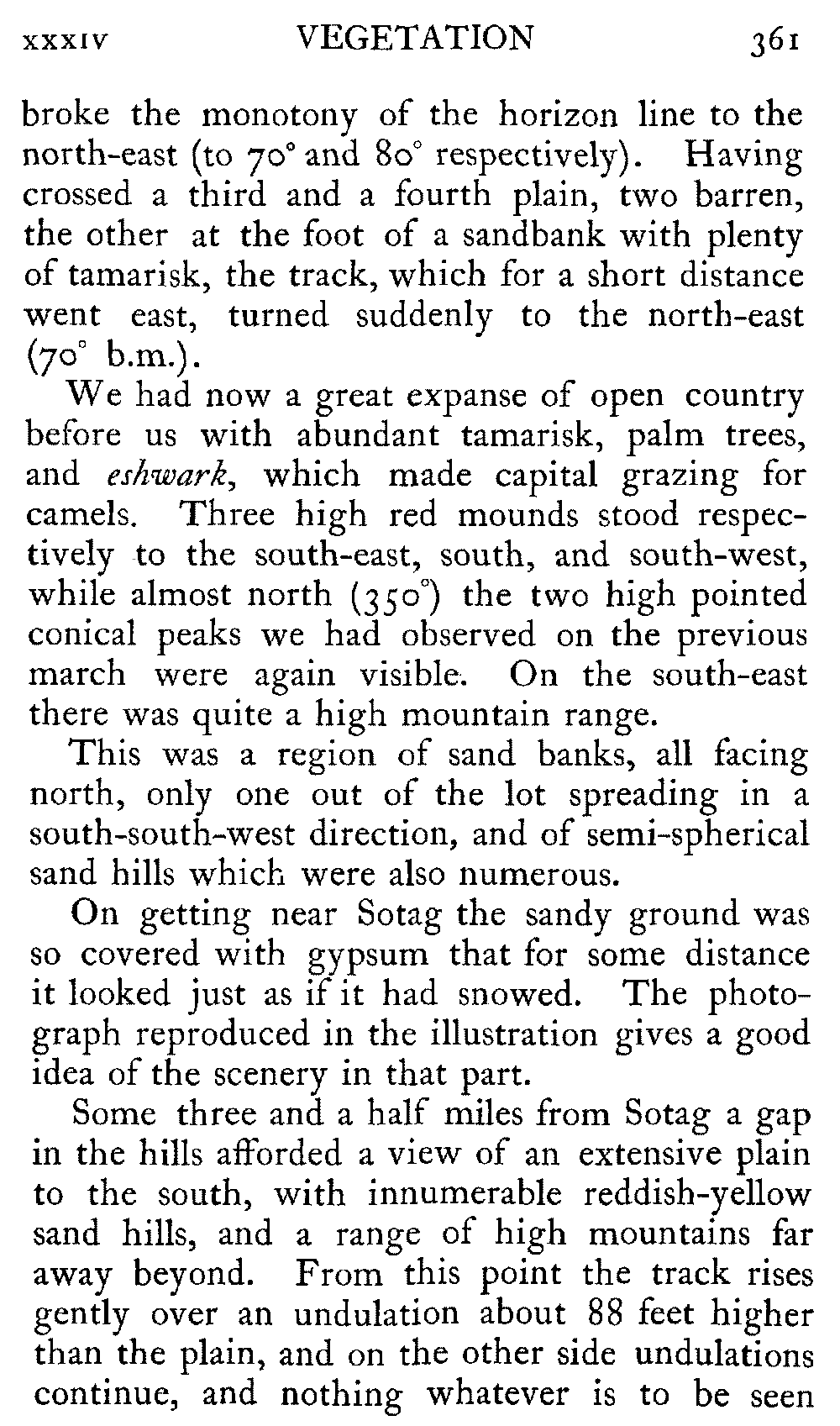
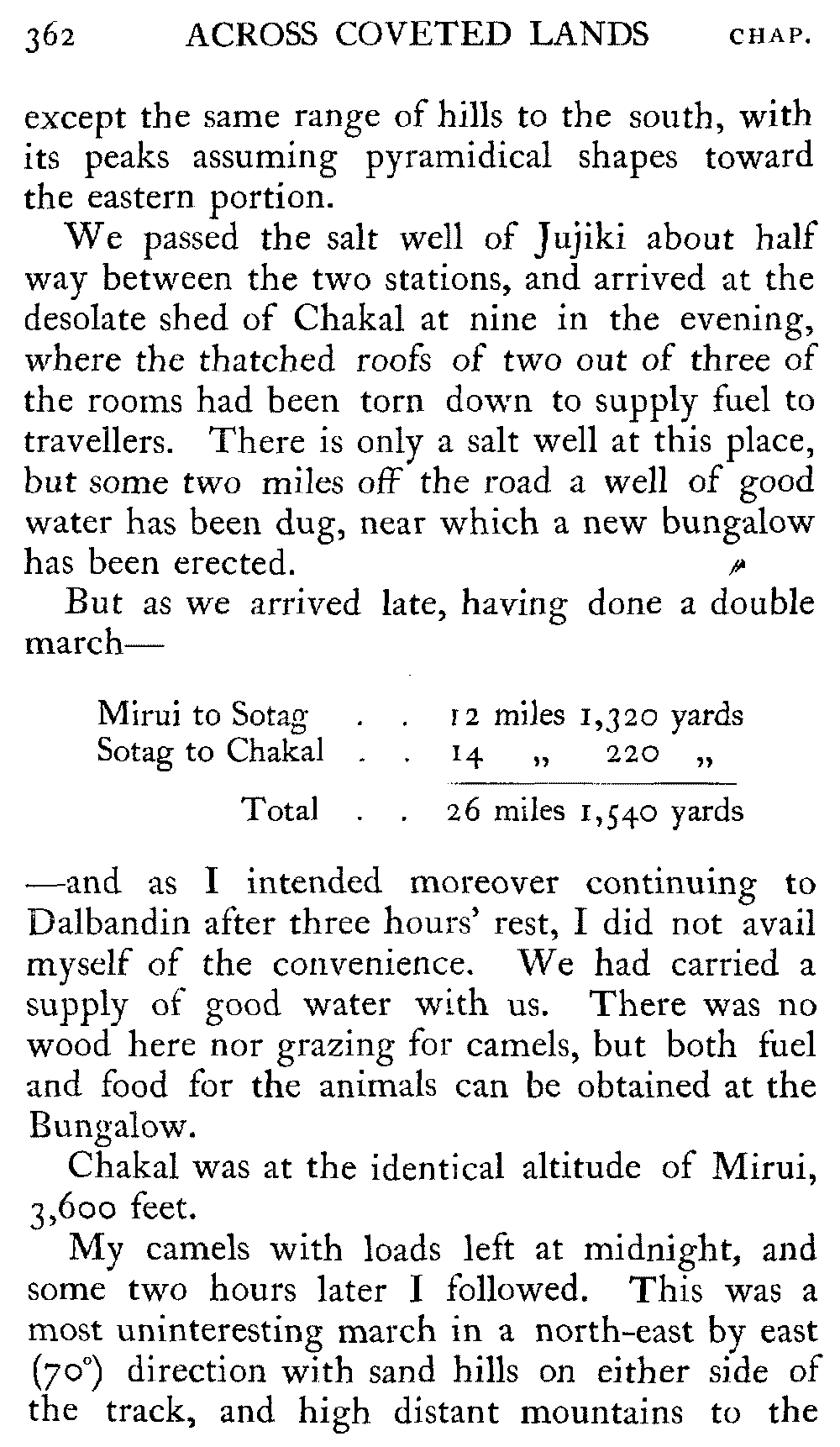
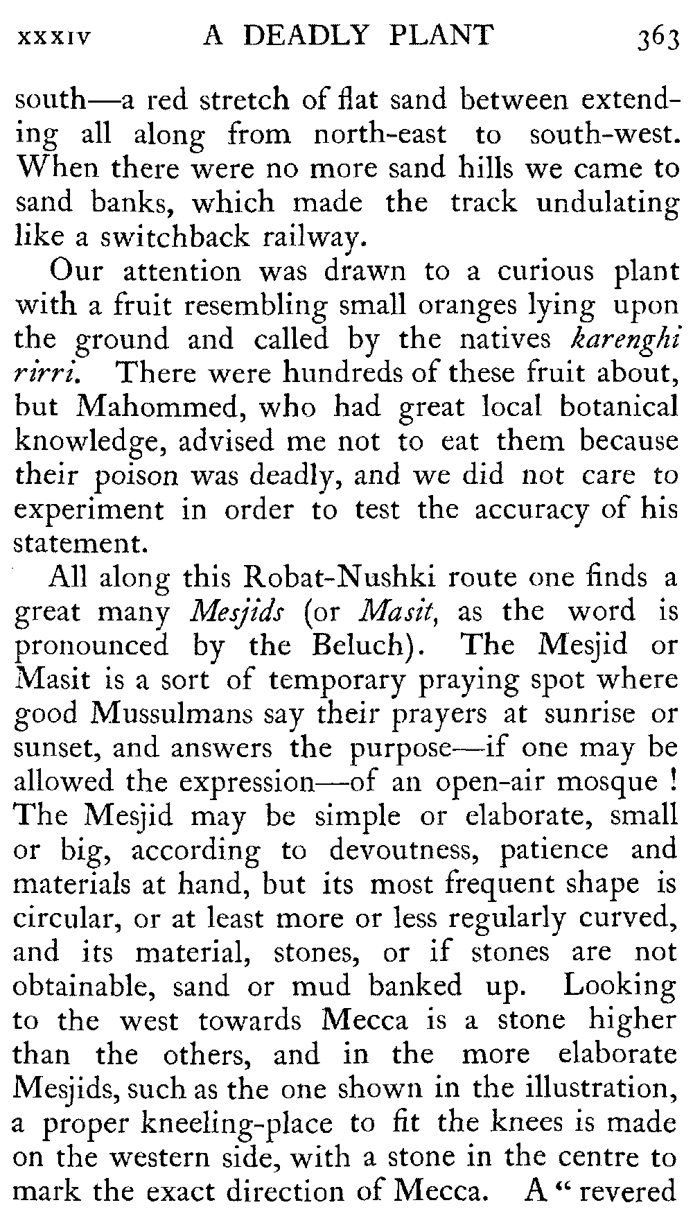
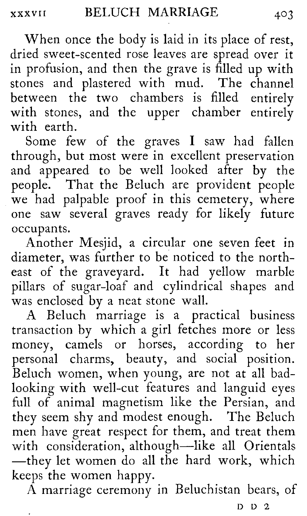
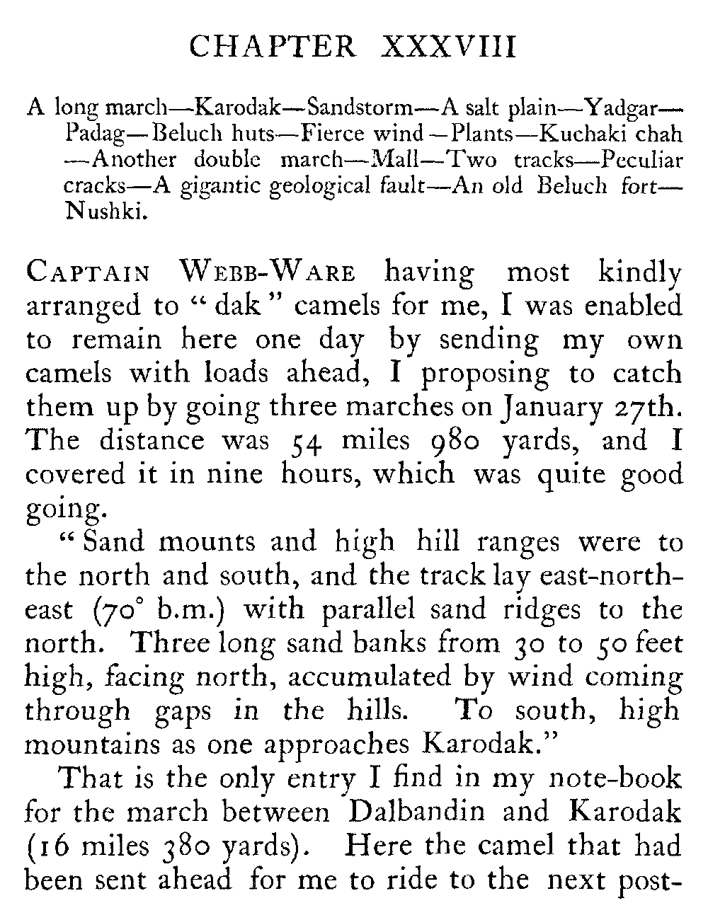
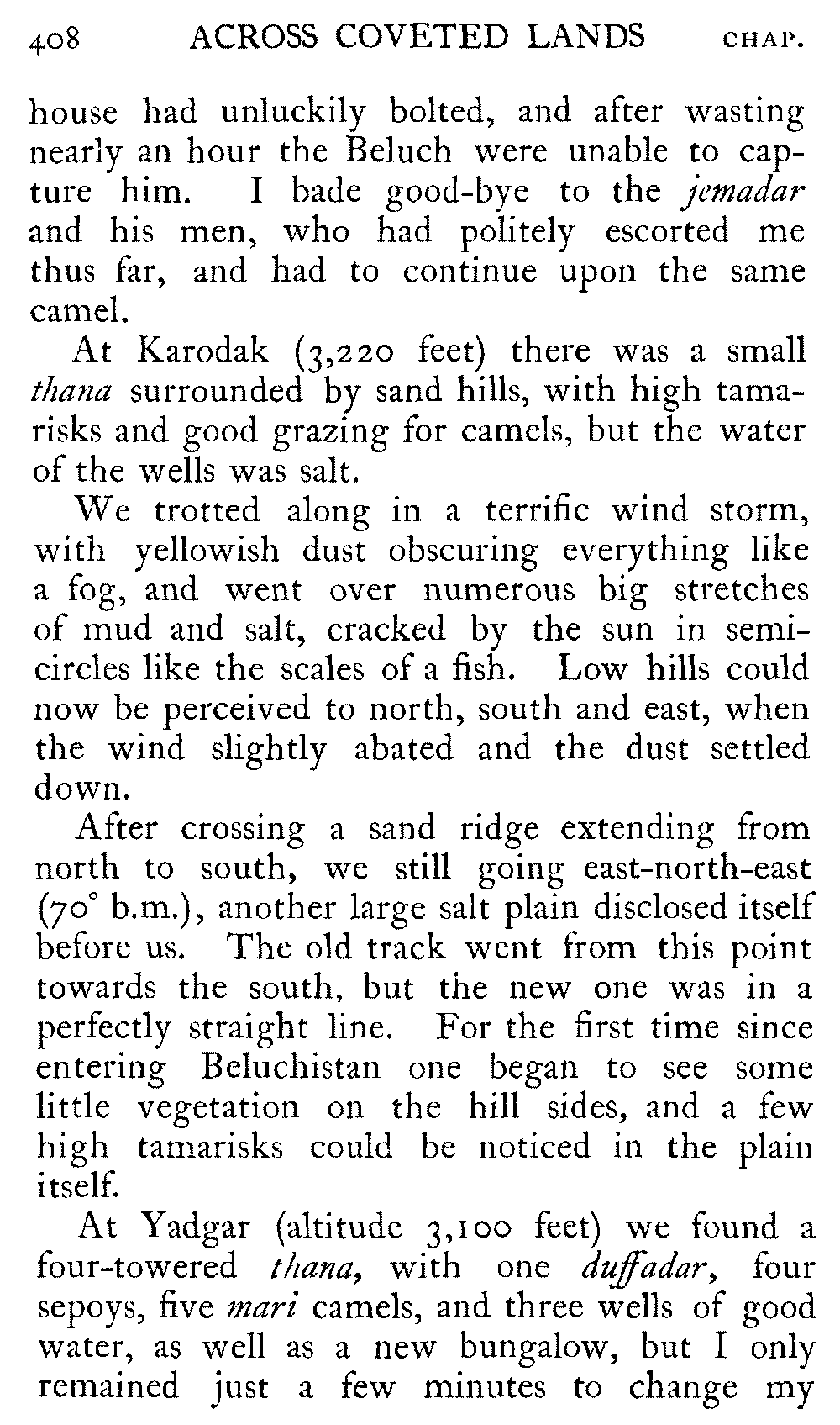
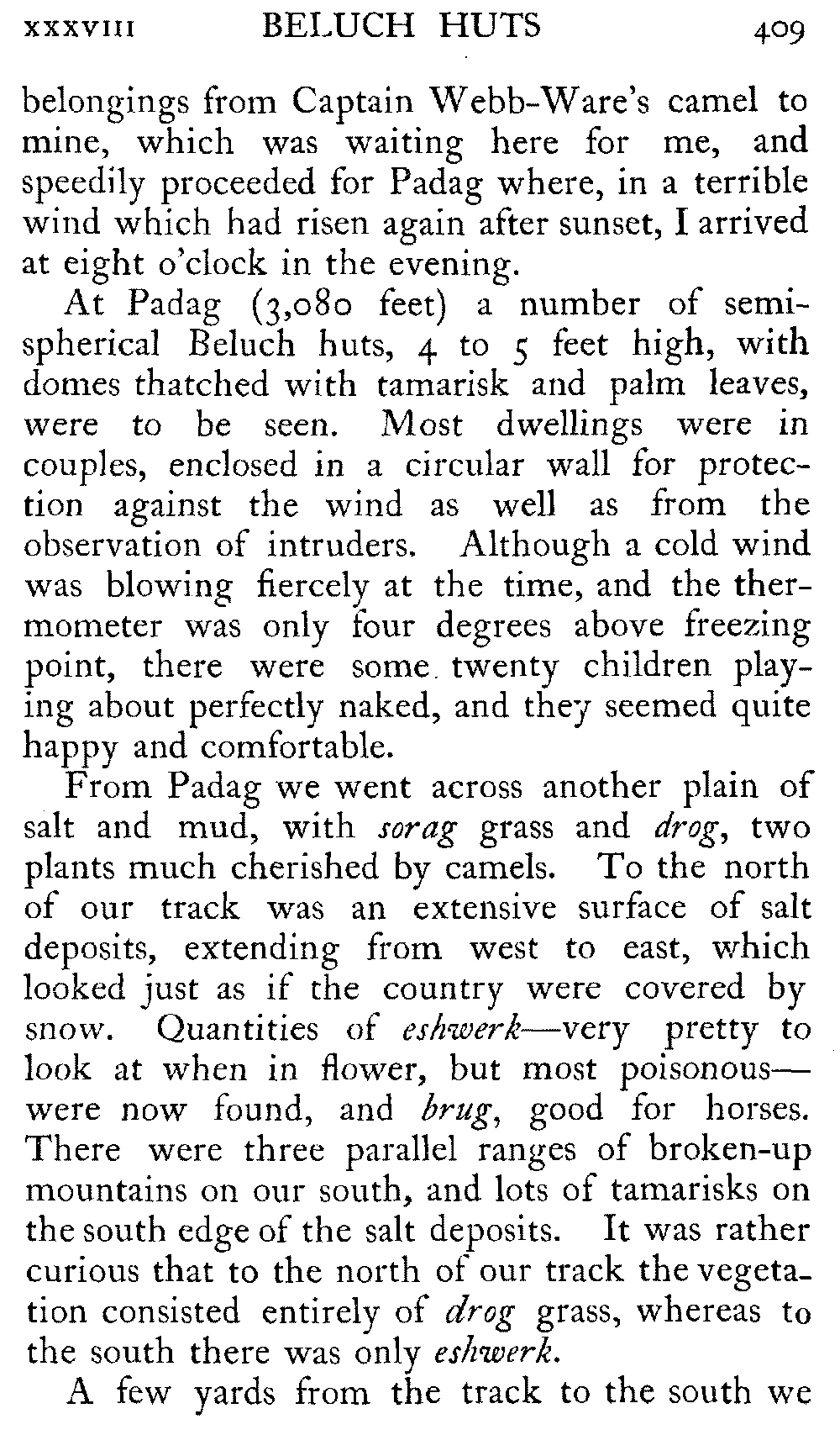
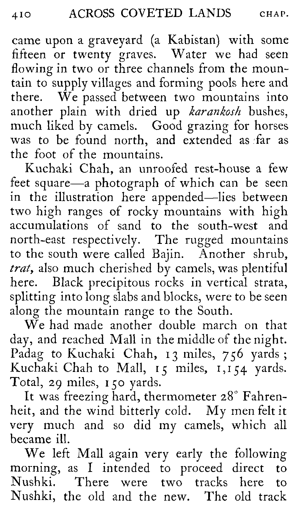
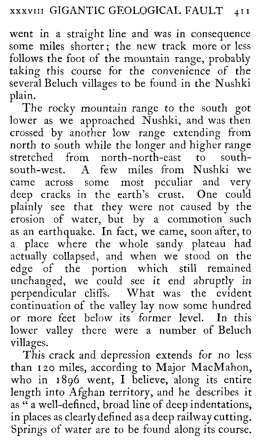
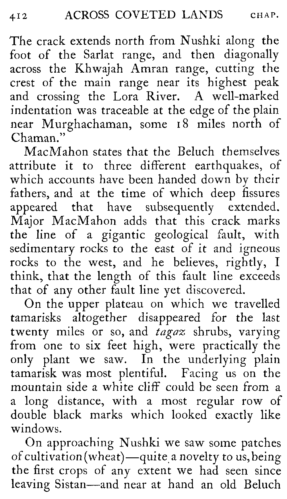
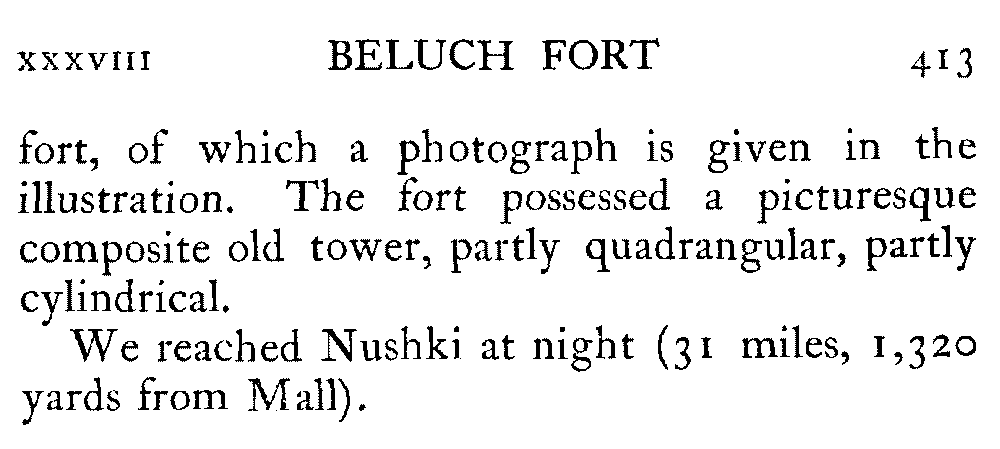
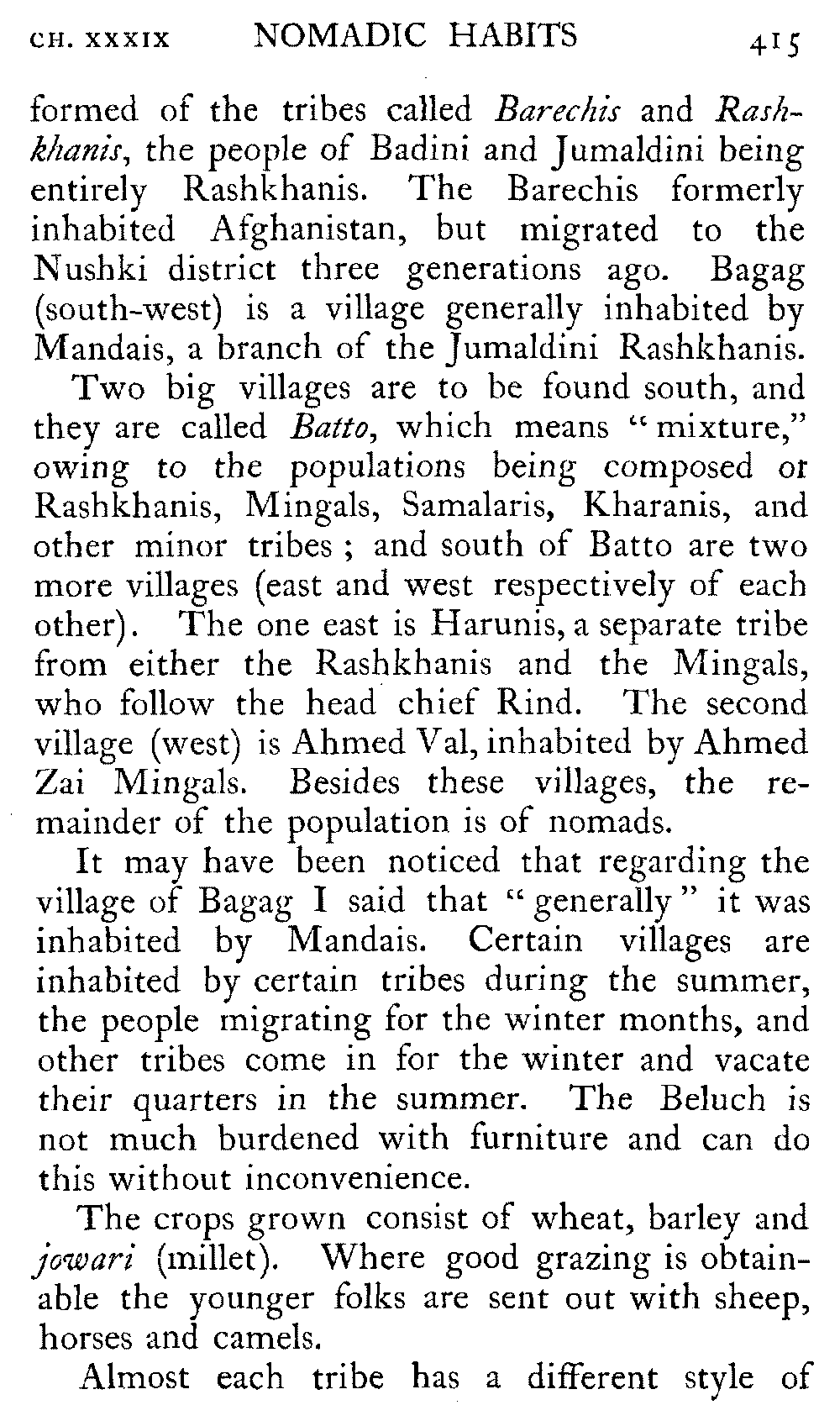
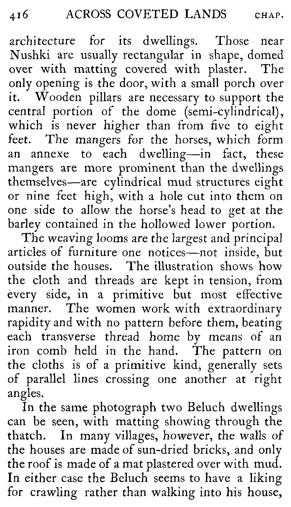
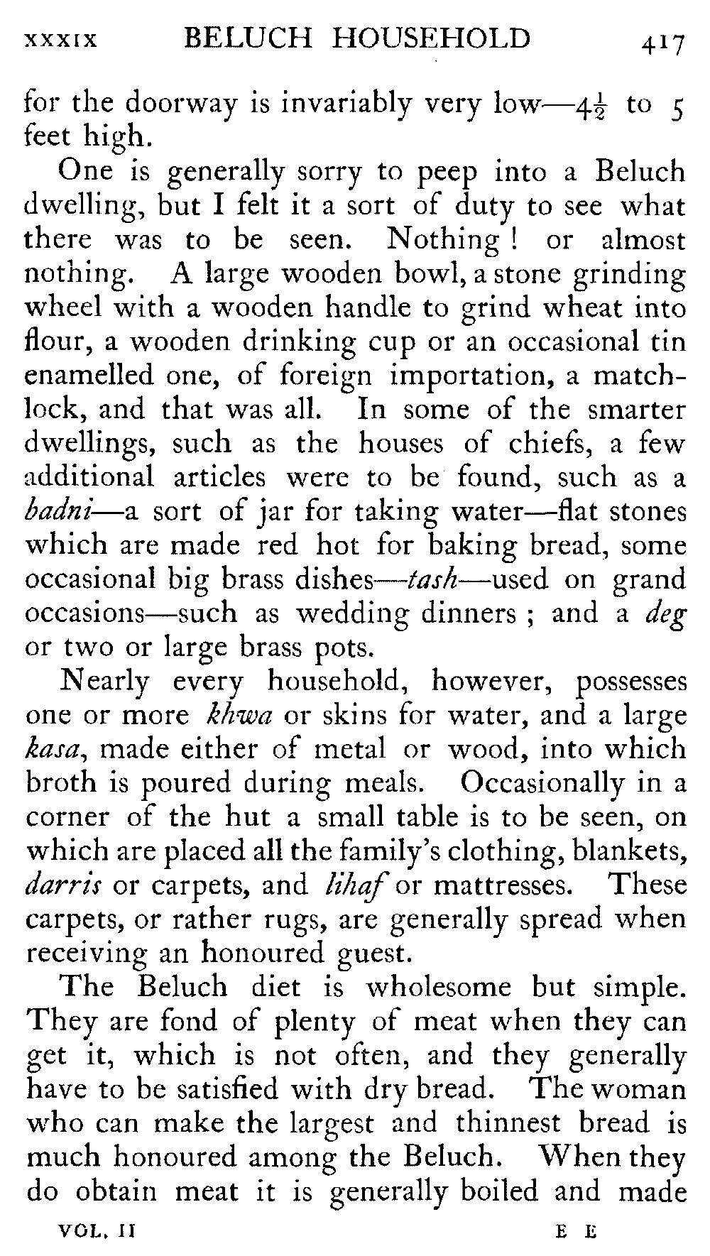
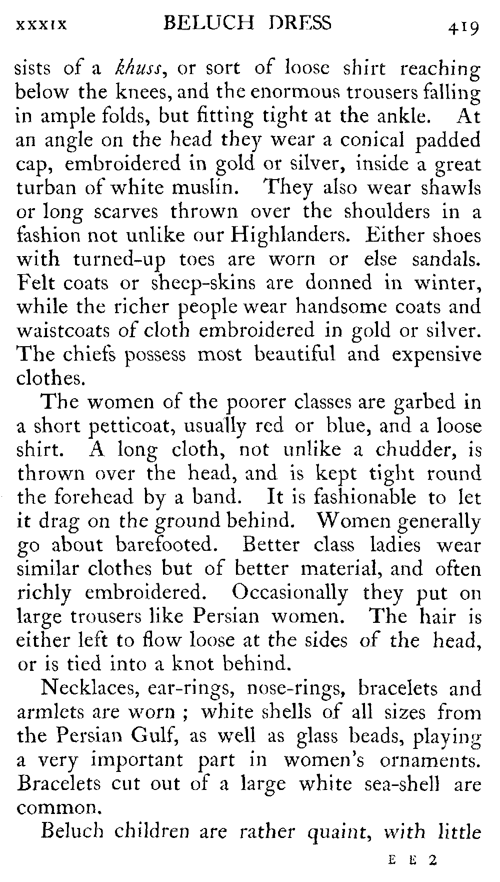
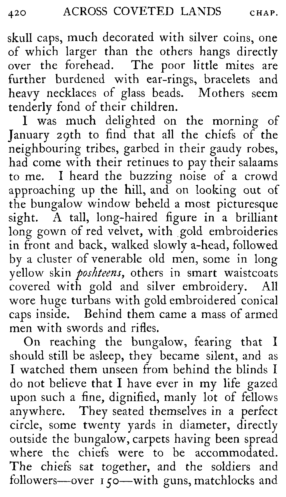
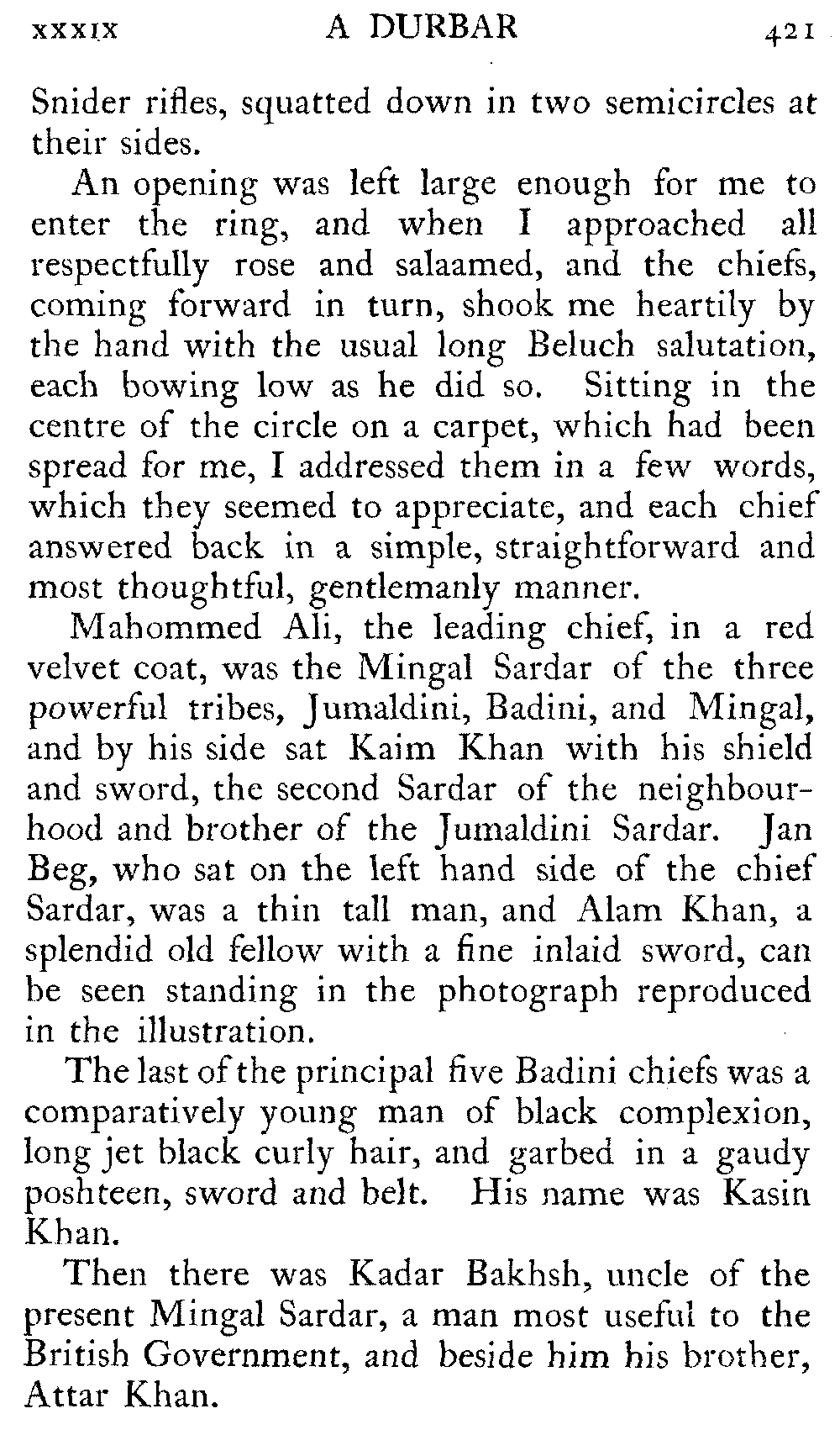
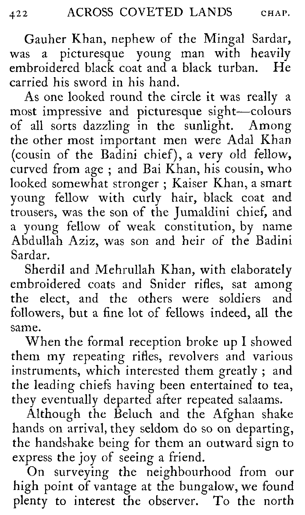
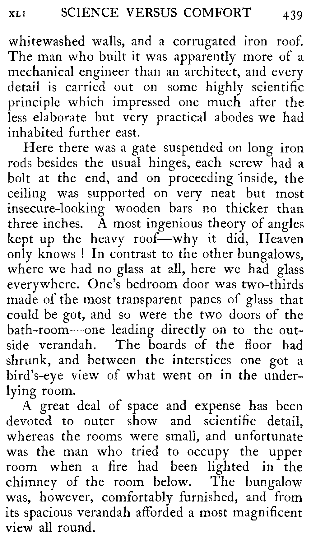
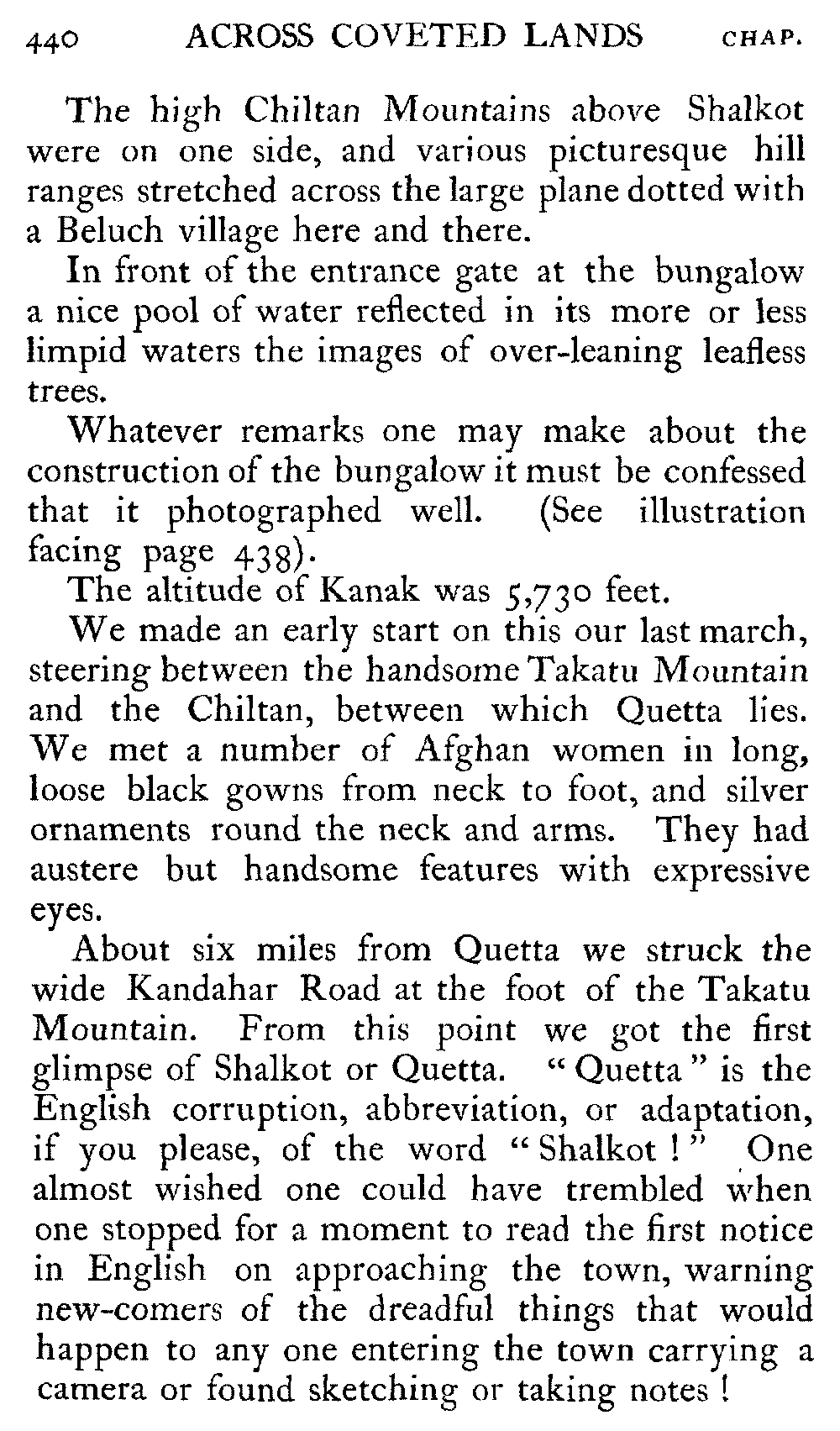
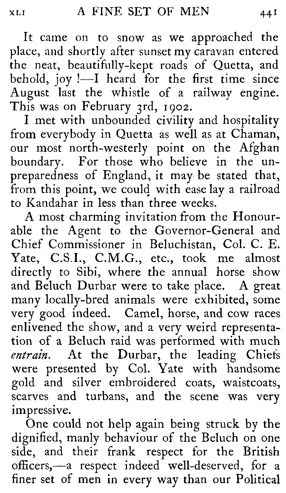
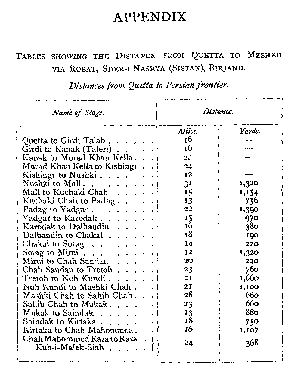
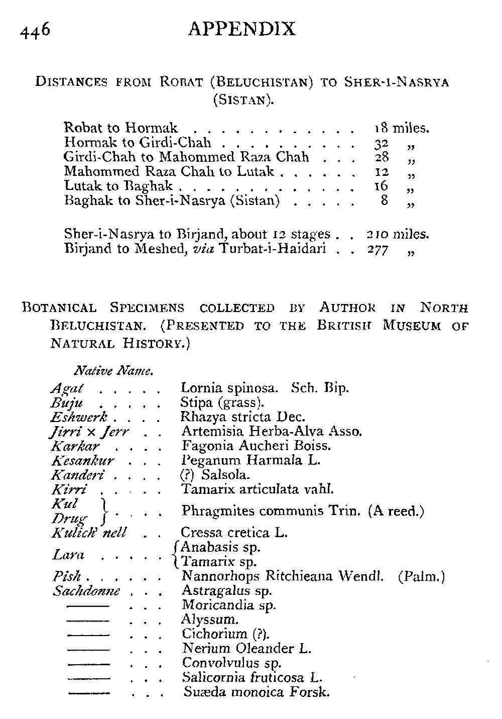