

.
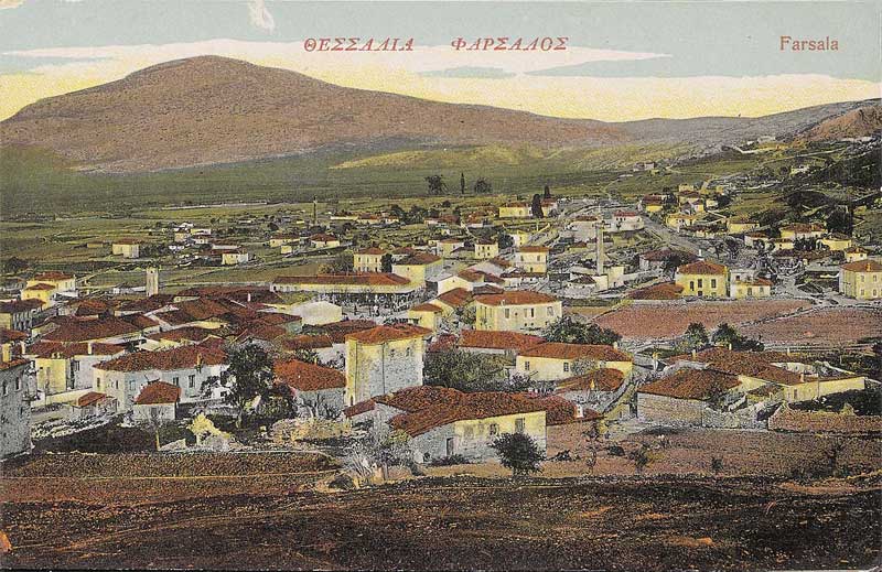
Farsala (Greek: Φάρσαλα), known in Antiquity as Φάρσαλος, Pharsalos or Pharsalus, is a city in southern Thessaly, in Greece. Farsala is located in the southern part of Larissa peripheral unit, and is one of its largest towns. The city is linked with GR-3, the old highway linking Larissa and Lamia and is also accessed by GR-30 linking Karditsa and Volos. The GR-1/E65 and E75 superhighway runs to the east of the city. Several mountain ranges lie to the South, while the Thessalian Plain lies to the North, some hills to the East and the Farsalian Fields in the central part. Farsala is located SE of Karditsa, S of Larissa, W of Volos and N of Lamia.
The area is an economic and agricultural centre of the province. The population are mainly rural especially with cotton production and breeding, one of the many are in local production units in agricultural production as well as clothing and textile industries. Farsala is famous for its distinctive halva.
History
Ancient Pharsalos
The Homeric Phthia of the Mycenaean period, capital of the Kingdom of the Myrmidons and of Peleus, father of Achilles, has sometimes been identified with the later city of Farsalos (Greek: Φάρσαλος), now Pharsala. A Cyclopean Wall which protected a city still exists today near modern Pharsala, as does a vaulted tomb from that period.
The Pharsalos of the historic era was built over a hillside of the Narthacius mountains at an elevation of some 160 m, where modern Pharsala stands. It was one of the main cities in Thessaly and was the capital of the Phthian tetrarch. In the Persian Wars it sided with the Athenians. A distinctive tribe of the city was that of Echecratidon. In the early 4th century BC, the city was a part of the Thessalian Commons. Later, it joined the Macedonian Kingdom under Philip II. The area became a theatre of war where the Aetolians and the Thessalians clashed with the Macedonians, especially during the Second and the Third Macedonian Wars. After the defeat of the Macedonian Kingdom, Pharsalos and the whole area became a part of the Roman Republic. The whole area suffered great destruction during the Roman Civil War. The Battle of Pharsalus took place in 48 BC in the fields of the Pharsalian Plain, where Julius Caesar defeated Pompey.
The Battle of Farsala by Georgios Roilos (1867–1928).
The geographer Strabo speaks of two towns, Old Pharsalos (Palaepharsalos) and Pharsalos, existing in historical times. His statement (9.5.6) that the Thetideion, the temple to Thetis south of Skotoussa, was “near both the Pharsaloi, the Old and the New”, seems to imply that Palaepharsalos was not itself close by Pharsalos. Although the battle of 48 BC is called after Pharsalos, four ancient writers - the author of the Bellum Alexandrinum (48.1), Frontinus (Strategemata 2.3.22), Eutropius (20), and Orosius (6.15.27) - place it specifically at Palaepharsalos. In 198 B.C. Philip V had sacked Palaepharsalos (Livy 32.13.9). If that town had been close to Pharsalos he would have sacked both, and Livy would have written “Pharsalus” instead of “Palaepharsalus”. The British scholar F. L. Lucas demonstrated (Annual of the British School at Athens, No. XXIV, 1919–21) that the battle of 48 BC must have been fought north of the Enipeus, near modern-day Krini; and John D. Morgan in “Palae-pharsalus – the Battle and the Town” (The American Journal of Archaeology, Vol. 87, No. 1, Jan. 1983), suggests that Krini is built on the site of Palaepharsalos, where the old road south from Larissa emerged from the hills on to the Pharsalian Plain.
Modern Farsala
Farsala was known as "Çatalca" during Ottoman rule.[1] Farsala was liberated from the Ottoman Empire in 1881 and together with the rest of Thessaly became part of the Hellenic Kingdom. During the first Greco-Turkish War (1897), a major battle took place in the vicinity of Farsala.
Municipality
The municipality Farsala was formed at the 2011 local government reform by the merger of the following 4 former municipalities, that became municipal units:[2]
Enippeas
Farsala
Narthaki
Polydamantas
Historical population
Year Town population Municipality population
1981 7,211 -
1991 8,457 9,464
2001 9,801 10,812
See also
List of communities of Larissa
References
^ http://dictionary.sensagent.com/farsala/en-en/ Farsala was known as Çatalca during Ottman rule
^ Kallikratis law Greece Ministry of Interior (Greek)
| Ancient Greece
Science, Technology , Medicine , Warfare, , Biographies , Life , Cities/Places/Maps , Arts , Literature , Philosophy ,Olympics, Mythology , History , Images Medieval Greece / Byzantine Empire Science, Technology, Arts, , Warfare , Literature, Biographies, Icons, History Modern Greece Cities, Islands, Regions, Fauna/Flora ,Biographies , History , Warfare, Science/Technology, Literature, Music , Arts , Film/Actors , Sport , Fashion --- |
Retrieved from "http://en.wikipedia.org/"
All text is available under the terms of the GNU Free Documentation License
