

.
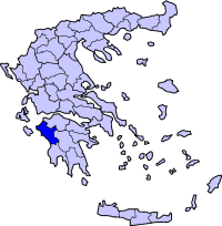
Periphery:West Greece
Prefecture : Ilia
|
 |
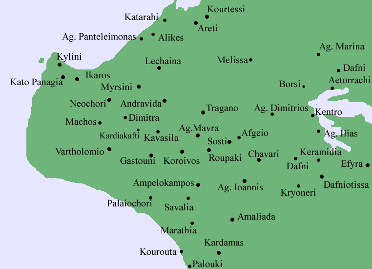
Borsi (Greek, Modern: Μπόρσι, Ancient/Katharevousa: -on), older forms: Borsio and Borsion, is a community lying in hilly area and is connected with a road to the Peneus Dam, Lechaina and Varda.
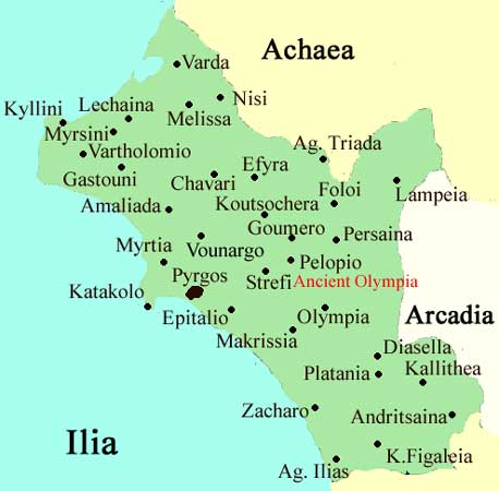
It was part of the former municipality of Lechaina. The prefecture of Achaia is located to the northeast. It is located about about 17 km E of Lechaina, about 15 km S of Varda, about 70 km WSW of Patras, about 4 km NE of the Peneus dam and about 50 km N of Pyrgos via roads. In the 19th century, the community was part of the old municipality of Kalotychias. It became a settlement of Melissa when it became a part of the present-day municipality. Later, it became a separate commune again in the same municipality.
Nearest places
- Nisi, north
- Aetorrachi, northeast
- Kentro, south
- Olga, southwest
- Agios Charalampos, northwest
Geography
Location:
- Longitude: 22.437 (22°26'16') E
- Latitude: 37.541 (37°55'38') N
Postal code: 270 52
Elevation: 170 m
Dialing code: +11+30-26230 (030-26230)-61
The hills are to the south and are covered with dry grass with a few forests. The hills also contains some forests. The curdy road do Kentro and Gastouni are to the south. Valleys are around the Borsi area and has some streams and creeks. Farmlands are to the southwest and to the southeast. Forests cover the southern and the eastern parts. Groves dominates the northern part. The junction with Lechaina and Aetorrachi is 1 km north and Tragano, Markopoulo and Olga are 1 km SW. The village length is about 400 m from north to south. The taller hills are to the northeast and mount Scollis lies about 10 km east. The panorama of the southern Ionian can rarely be seen.
Historical population
| Year | Population |
|---|---|
| 1981 | - |
| 1991 | 290 |
| 2001 | 381 |
Other
Borsi has a small kindergarten school, a school, a church and a square (plateia) which is next to the Kentro - Varda main road.
The entire population prior to the late-20th century were entirely rural and were also farmers. Today, it is still the majority of the population of the settlement.
| Municipal unit Lechaina |
|---|
| Municipal Community Lechaina |
| Agioi Theodoroi (Άγιοι Θεόδωροι, οι) |
| Agios Panteleimon (Άγιος Παντελεήμων, ο) |
| Καταρράχι, το |
| Lechaina (Λεχαινά, τα) |
| Community Agios Charalambos |
| Agios Charlambos (Άγιος Χαράλαμπος, ο) |
| Community Areti |
| Areti (Αρετή, η) |
| Community Melissa |
| Melissa (Μέλισσα, η) |
| Community Borsi |
| Borsi (Μπόρσι, το) |
| Community Myrsini |
| Myrsini (Μυρσίνη, η) |
Greece :
A - B - C - D - E - F - G - H - I - J - K - L - M -
N - O - P - Q - R - S - T - U - V - W - X - Y - Z
| Ancient Greece
Science, Technology , Medicine , Warfare, , Biographies , Life , Cities/Places/Maps , Arts , Literature , Philosophy ,Olympics, Mythology , History , Images Medieval Greece / Byzantine Empire Science, Technology, Arts, , Warfare , Literature, Biographies, Icons, History Modern Greece Cities, Islands, Regions, Fauna/Flora ,Biographies , History , Warfare, Science/Technology, Literature, Music , Arts , Film/Actors , Sport , Fashion --- |
Retrieved from "http://en.wikipedia.org/"
All text is available under the terms of the GNU Free Documentation License
